Extended Description of the Vector Map
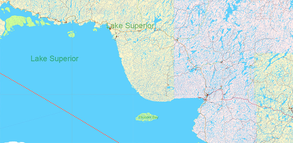
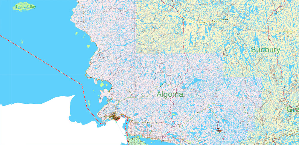
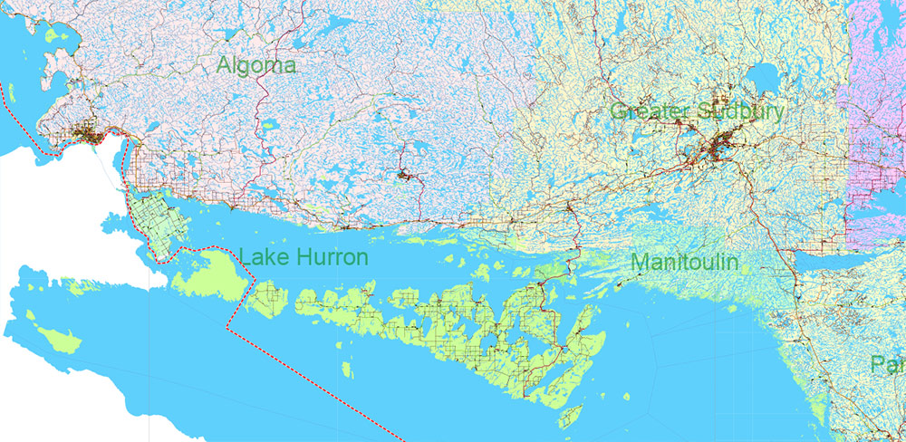
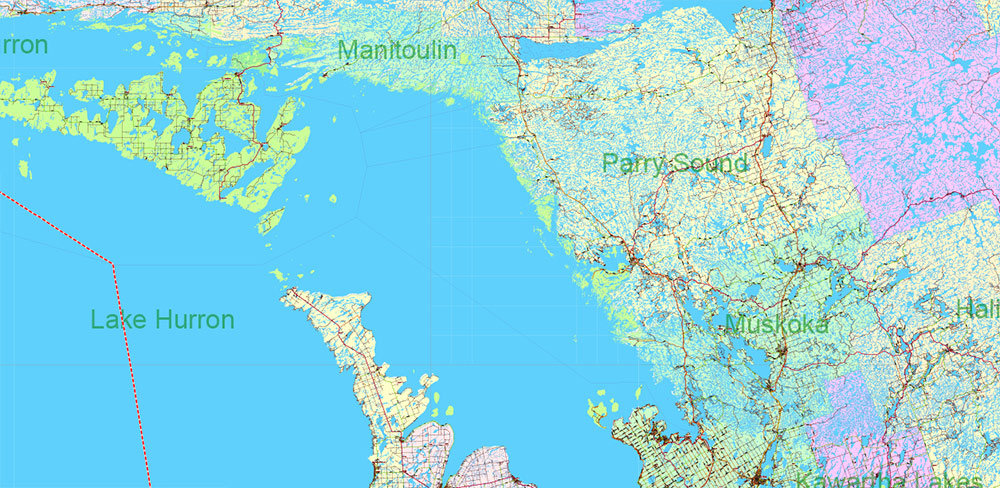
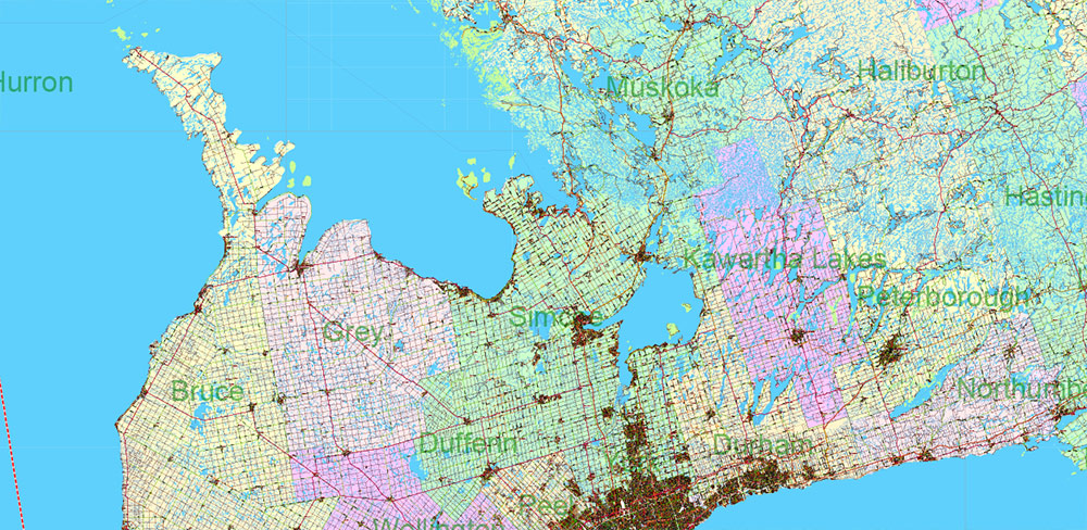
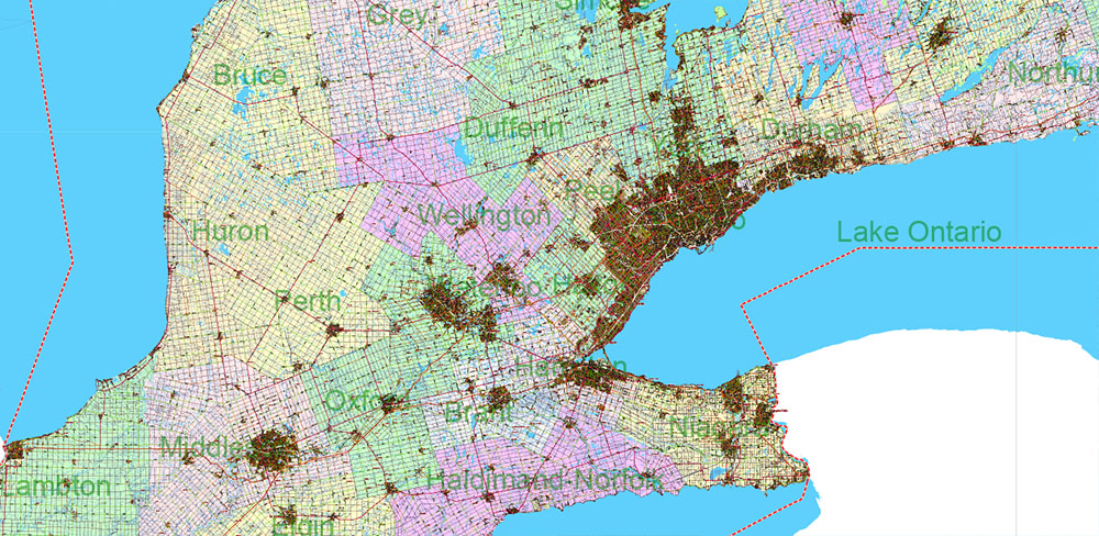
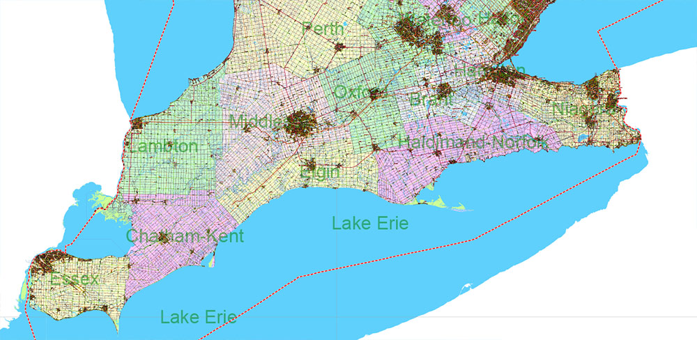
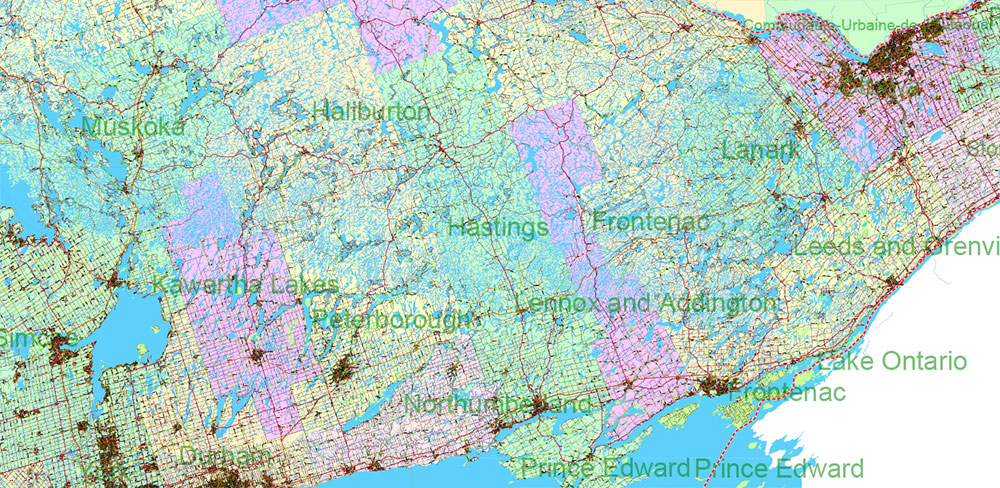
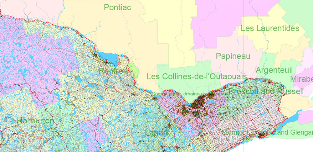
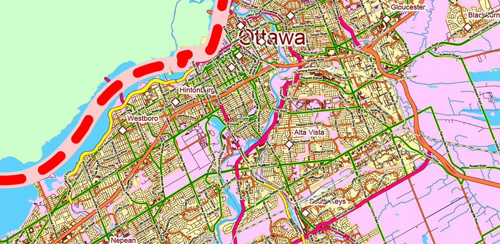
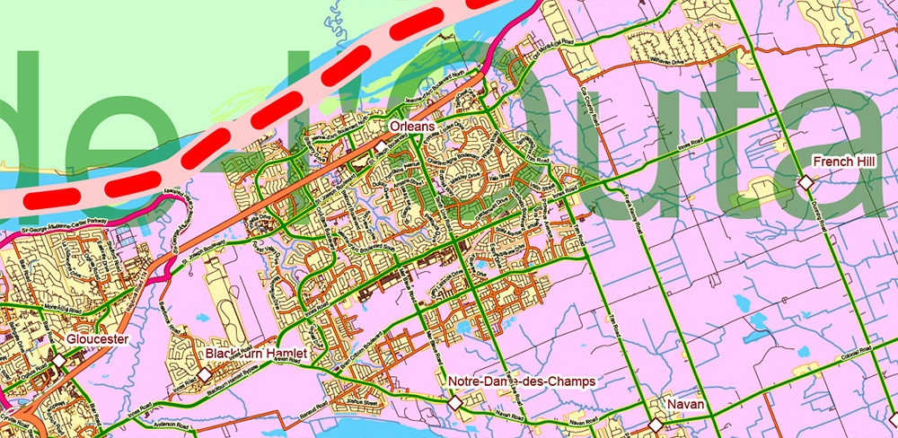
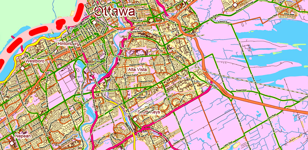
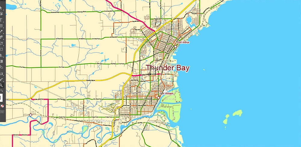
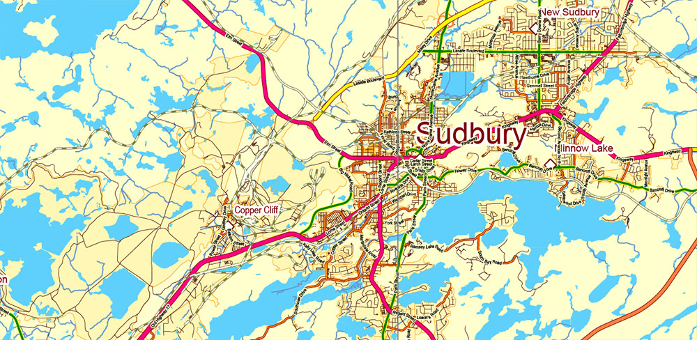
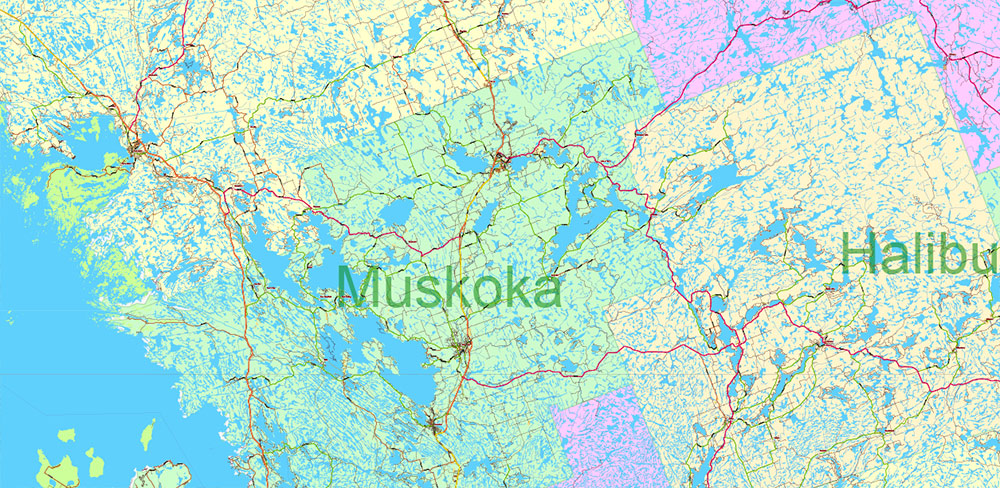
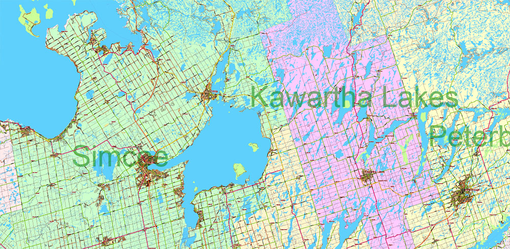
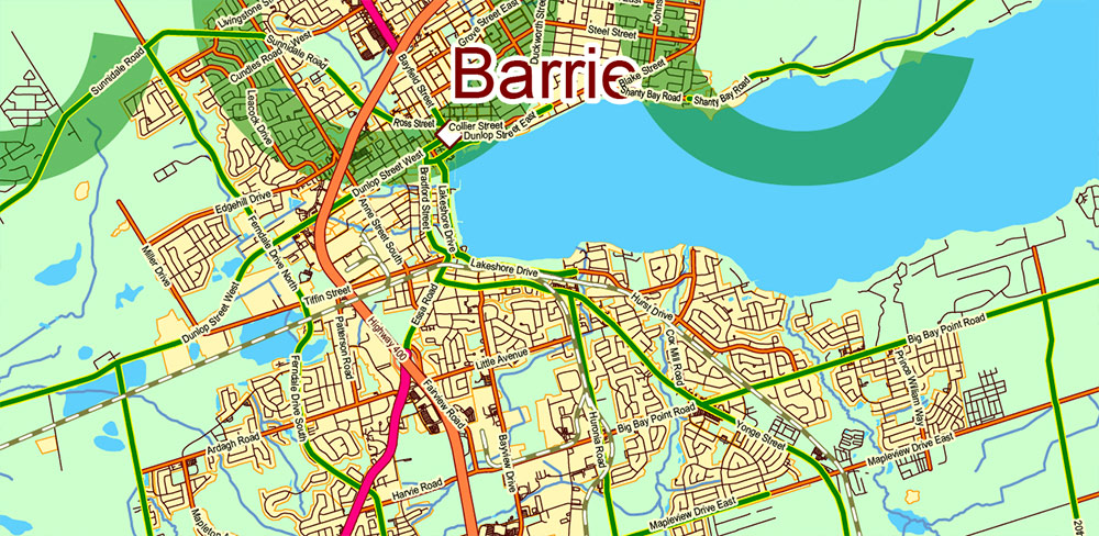
Printable Vector Map of the Southern Part of Ontario Canada high detailed All road and railroad map + admin areas + all cities and towns and water objects editable Layered Adobe PDF + EPS + DWG (in 1 archive), scalable, curves format of all names, 1.904 Mb (1.9 Gb !) ZIP
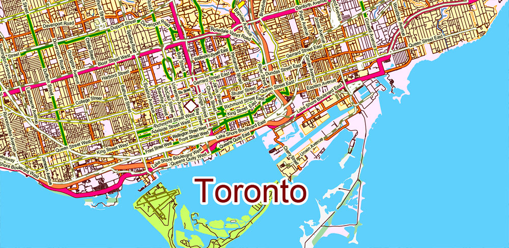
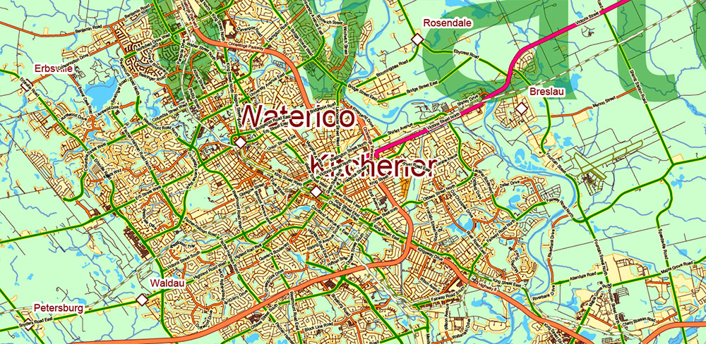
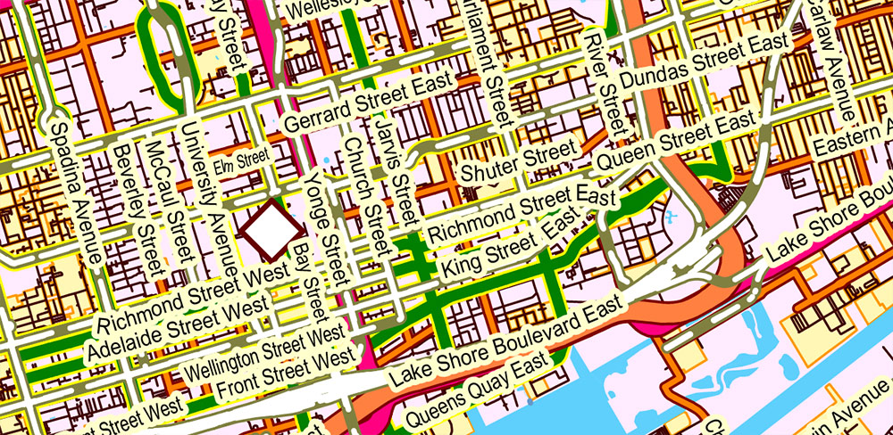
Principal streets and roads names.
NOTE!
The file size and number of objects on the map are CLOSE TO THE LIMIT of Adobe Illustrator’s software capabilities.
The exported DWG file is divided into 2 parts by layers, that is, it is actually 2 files.
To combine 2 files, both parts have the same GRIDS layer.
Also:
You can import EPS to AutoCAD (full map, all layers)
https://www.autocadhelp.net/importing-postscript-images/
You can import PDF to AutoCAD (full map, all layers)
https://help.autodesk.com/view/ACDLT/2024/ENU/
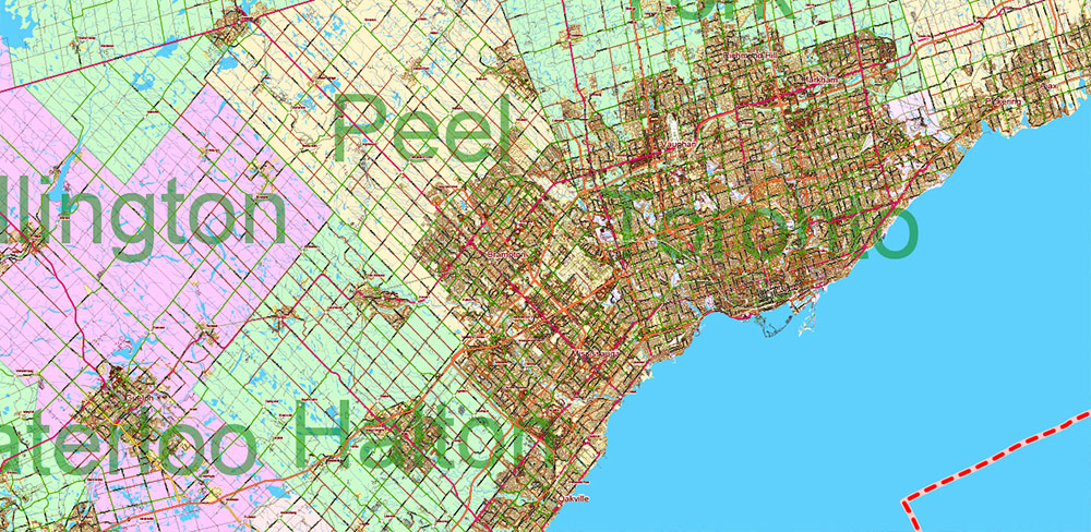
Layered exact editable map: Map for publishing, design, printing, publications, arts, projects, presentations, for architects, designers, and builders, business, logistics. The most exact and detailed map. GPS correct Mercator Projection.
For printing any format.
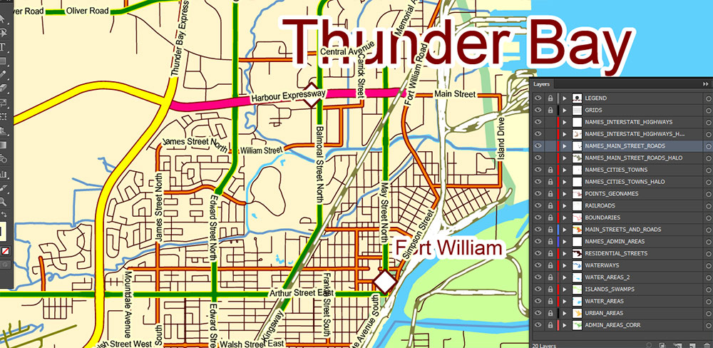
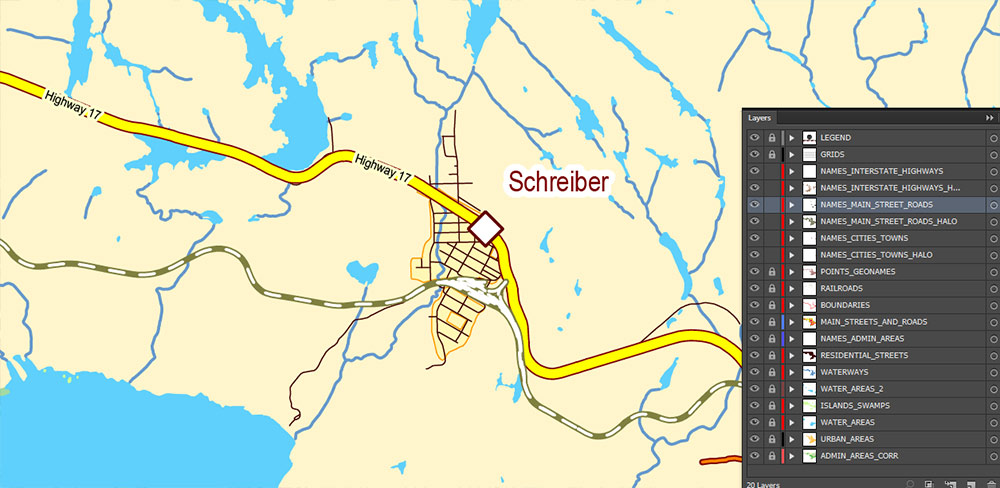
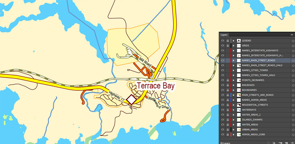
Please note: in the preview, ALL LAYERS are enabled and visible. Of course, you can easily turn off the layers you don’t need and the map will become much simpler.
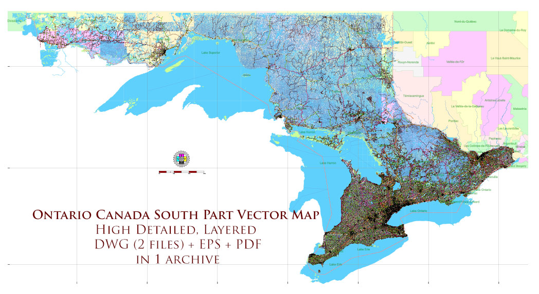
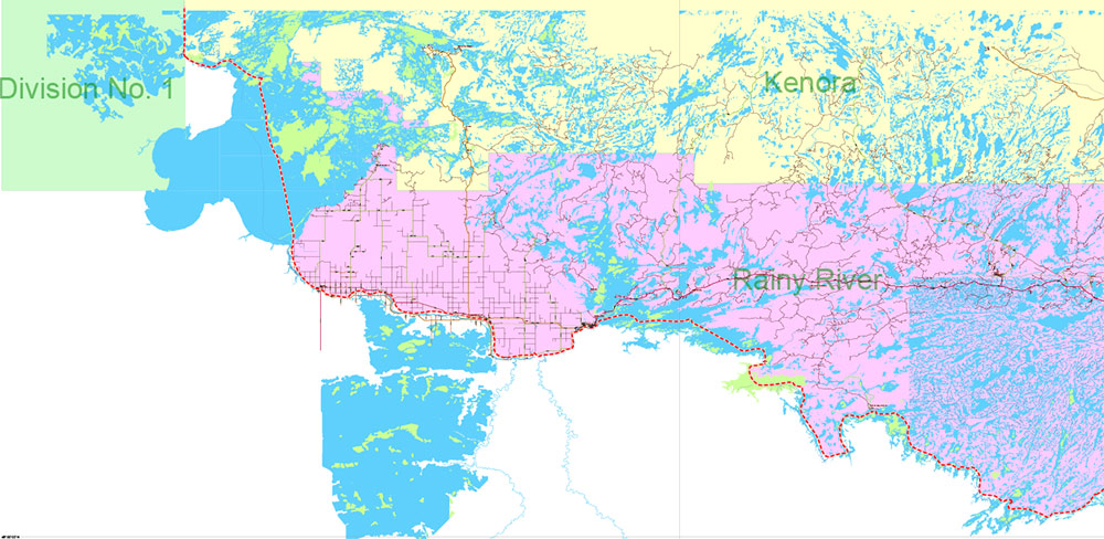
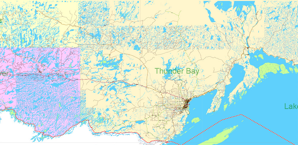
Ontario South Part Canada Vector Map High Detailed All Streets and Roads all Cities and Towns DWG+PDF+EPS
Separated layers:
- Legend
- Grids
- Names Cities and Towns (with halo)
- Points Geo (all cities and towns)
- Names Principal Streets and Roads
- Names Highways and Interstate Roads
- Names admin areas
- Urban areas
- Main roads and Streets
- Residential roads and streets
- Railroads
- Province boundaries
- Waterways
- Water areas 2 (lakes on the islands)
- Islands and swamp areas
- Water areas
- Admin areas (color polygons)
Ontario South Part Canada Vector Map High Detailed All Streets and Roads all Cities and Towns DWG+PDF+EPS
Ontario South Part Canada Vector Map High Detailed All Streets and Roads all Cities and Towns DWG+PDF+EPS
Ontario South Part Canada Vector Map High Detailed All Streets and Roads all Cities and Towns DWG+PDF+EPS
Ontario South Part Canada Vector Map High Detailed All Streets and Roads all Cities and Towns DWG+PDF+EPS
Ontario South Part Canada Vector Map High Detailed All Streets and Roads all Cities and Towns DWG+PDF+EPS
Ontario South Part Canada Vector Map High Detailed All Streets and Roads all Cities and Towns DWG+PDF+EPS
Ontario South Part Canada Vector Map High Detailed All Streets and Roads all Cities and Towns DWG+PDF+EPS
Ontario South Part Canada Vector Map High Detailed All Streets and Roads all Cities and Towns DWG+PDF+EPS
Ontario South Part Canada Vector Map High Detailed All Streets and Roads all Cities and Towns DWG+PDF+EPS
Ontario South Part Canada Vector Map High Detailed All Streets and Roads all Cities and Towns DWG+PDF+EPS
Ontario South Part Canada Vector Map High Detailed All Streets and Roads all Cities and Towns DWG+PDF+EPS
Ontario South Part Canada Vector Map High Detailed All Streets and Roads all Cities and Towns DWG+PDF+EPS
Ontario South Part Canada Vector Map High Detailed All Streets and Roads all Cities and Towns DWG+PDF+EPS
Ontario South Part Canada Vector Map High Detailed All Streets and Roads all Cities and Towns DWG+PDF+EPS
Ontario South Part Canada Vector Map High Detailed All Streets and Roads all Cities and Towns DWG+PDF+EPS
Ontario South Part Canada Vector Map High Detailed All Streets and Roads all Cities and Towns DWG+PDF+EPS
Ontario South Part Canada Vector Map High Detailed All Streets and Roads all Cities and Towns DWG+PDF+EPS
Ontario South Part Canada Vector Map High Detailed All Streets and Roads all Cities and Towns DWG+PDF+EPS
Ontario South Part Canada Vector Map High Detailed All Streets and Roads all Cities and Towns DWG+PDF+EPS
Ontario South Part Canada Vector Map High Detailed All Streets and Roads all Cities and Towns DWG+PDF+EPS
Ontario South Part Canada Vector Map High Detailed All Streets and Roads all Cities and Towns DWG+PDF+EPS
Ontario South Part Canada Vector Map High Detailed All Streets and Roads all Cities and Towns DWG+PDF+EPS
Ontario South Part Canada Vector Map High Detailed All Streets and Roads all Cities and Towns DWG+PDF+EPS
Ontario South Part Canada Vector Map High Detailed All Streets and Roads all Cities and Towns DWG+PDF+EPS
Ontario South Part Canada Vector Map High Detailed All Streets and Roads all Cities and Towns DWG+PDF+EPS
Ontario South Part Canada Vector Map High Detailed All Streets and Roads all Cities and Towns DWG+PDF+EPS

 Author: Kirill Shrayber, Ph.D. FRGS