Extended Description of the Vector Map
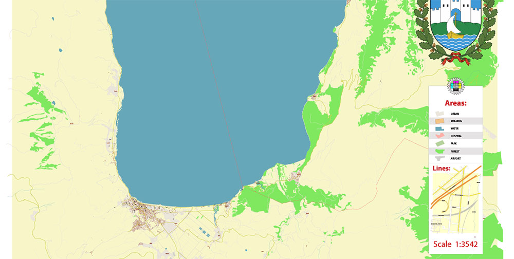
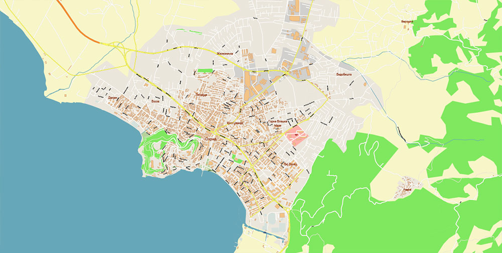
Printable PDF Vector Map of Ohrid North Macedonia + surrounds High detailed street map scale 1:3452 fully editable Layered Adobe PDF scalable, text format all names, 8 MB ZIP
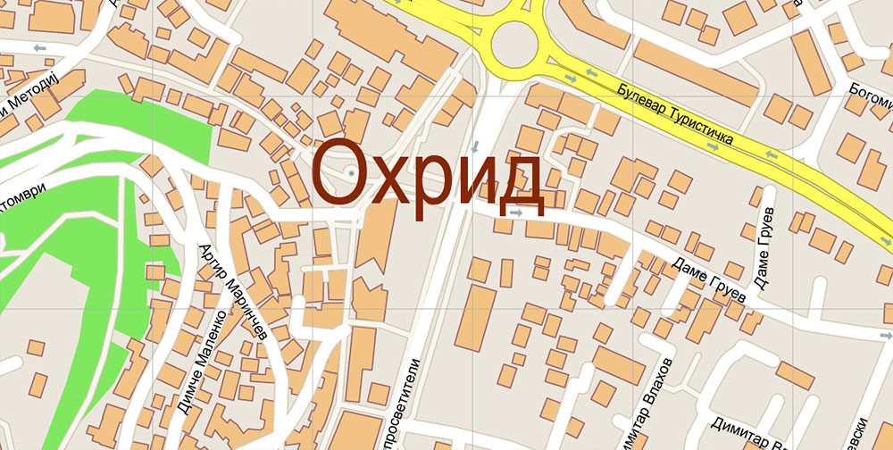
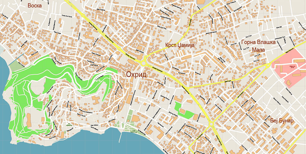
All street names, Main Objects, Buildings. Map for design, printing, arts, projects, presentations, for architects, designers, and builders, business, logistics.
Note: All layers in the preview are enabled and displayed, you may not need all layers – just disable the layers you don’t need.
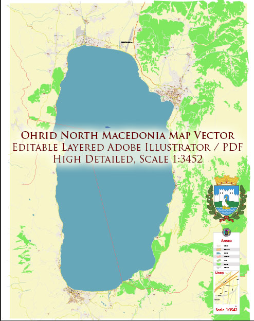
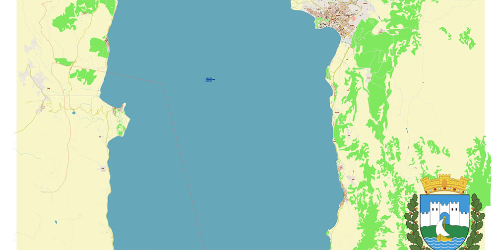
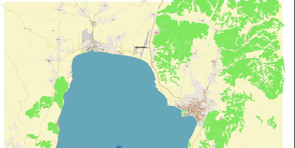
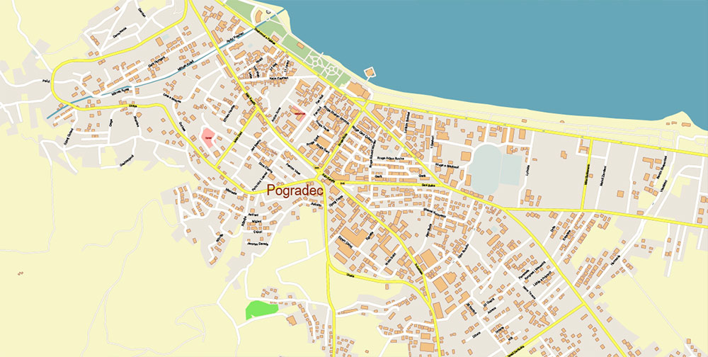
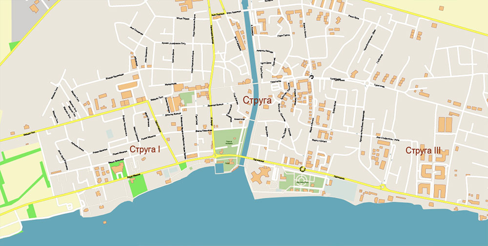
Ohrid North Macedonia PDF Vector Map high detailed All Roads Streets map editable Layered Adobe PDF
Layers list:
- Legend
- Labels of roads
- Names of places (city, hamlet, etc.)
- Names of objects (parks, hospitals, water)
- Names of main streets
- Names of civil streets
- Arrows of streets
- Main Streets, roads
- Residential streets
- Buildings
- Water objects (rivers, lakes, ponds)
- Waterways
- Color fills (parks, land use, etc.)
- Background
The most exact and detailed map of the city in scale.
For Editing and High-Quality Printing
OHRID, NORTH MACEDONIA
Overview
-
Lakeside city on the NE shore of Lake Ohrid, near the Albania border. Urban core wrapped around a steep peninsula below Samuel’s Fortress; suburbs stretch N toward Struga.
-
Elev ~695 m AMSL; lake max depth ~288 m. Surrounded by Galičica massif (E) and Jablanica (W).
-
UNESCO mixed site (natural + cultural). No railhead; city depends on road, lake craft, and a small airport.
Key Roads / Lines of Communication
-
A2 (E852): Primary E–W artery. West to Qafë Thanë border crossing (Albania) via Struga; east to Kičevo → Tetovo/Skopje. Chokepoints: lakeside bends, summer traffic, occasional rockfall sections.
-
A3: N–S spur. South along the lake foot to Sveti Naum/Tushemisht border crossing (Albania); east over the saddle via Resen → Bitola. Winter snow/ice above Prespa divide.
-
Ring/local: Narrow historic streets in Old Town (pedestrian priority). Lakeside road to Trpejca is single-lane in segments; expect congestion.
-
Air: Ohrid “St. Paul the Apostle” (OHD) ~9 km NW; seasonal international traffic.
-
Water: Small marina/piers; passenger craft and tourism boats. No heavy freight capability.
Terrain & Geography
-
Urban peninsula with terraced housing; steep gradients give commanding lines of sight.
-
Galičica National Park forms an immediate eastern wall (2,200+ m ridgeline); limited passes.
-
Lake shoreline is a mobility corridor but constrained by cliffs south of the city.
-
Outflow of Lake Ohrid forms the Black Drin at Struga—hydrologic choke.
Climate / Seasonality
-
Continental-Mediterranean mix. Summers hot/dry with afternoon lake breezes; winters cool with fog around the basin.
-
Peak tourist load June–September; traffic and accommodation strain.
-
Fire risk on mountain slopes in late summer; occasional downslope winds; convective storms can roughen lake surface.
Demography / Human Terrain
-
City ~40–45k; wider municipality ~50k+. Majority Macedonian (Orthodox); Albanian minority more visible toward Struga; smaller Turk, Roma, Vlach communities.
-
English widely workable in tourism zones; Albanian present along W corridor.
-
Civic pride anchored in medieval literacy tradition (St. Clement & Naum) and UNESCO status.
Economy
-
Tourism is the center of gravity (heritage sites, lake resorts, festivals).
-
Services/retail, small hospitality supply chains; light manufacturing and construction on the periphery.
-
Fishing regulated (Ohrid trout heritage); local crafts include Ohrid pearls.
-
Seasonal employment swings; cash economy active in waterfront zones.
History (Operationally Relevant)
-
Ancient Lychnidos on Via Egnatia (Roman E–W axis).
-
Capital under Tsar Samuel (10–11th c.); fortress dominates skyline and terrain.
-
Long Ottoman period preserved organic street plan; Yugoslav era added lakeside hotels and transport links.
-
Recent decades: stability; 2001 insurgency largely bypassed the city proper.
Key Sites / Compounds (Reference)
-
Samuel’s Fortress (overwatch point), St. John at Kaneo (promontory), St. Sophia, Ancient Theatre, St. Naum Monastery (border-adjacent), waterfront resort strip N/E of center.
-
Hospital/clinics in city; higher-tier care at Bitola/Skopje.
-
Police/municipal near center; seasonal tourist police presence.
Hazards / Threats
-
Mobility: narrow medieval grid; constrained parking; tourist buses create intermittent blockages.
-
Geophysical: seismicity typical of Western Balkans; rockfall on cut slopes; lake squalls.
-
Environmental: wildfire risk on Galičica; water-quality sensitivities—local restrictions possible.
-
Crowd: festival peaks and summer weekends increase density along the waterfront.
Logistics / Sustainment
-
Best ingress by A2 from Skopje/Kičevo; exfil west via Qafë Thanë or south via Sveti Naum/Tushemisht to Korçë.
-
Fuel and basic supplies readily available; specialty parts limited.
-
Power/water generally reliable; plan for summer brownouts and cell congestion on holiday peaks. 4G widely available; 5G spotty.
Command Takeaways
-
LOO dominance: Control/monitor A2 (east↔west) and A3 (south↔east) spurs; both border crossings are natural gates.
-
Terrain: Heights of Galičica and the Fortress provide ISR vantage; lakeside road is a single strand—protect against blockage.
-
Seasonality: Summer density hampers maneuver and comms; winter increases road risk over passes.
-
CIVMIL: Tourism-centric populace; maintain low-signature posture around heritage sites and waterfront commerce.
Ohrid North Macedonia PDF Vector Map high detailed All Roads Streets map editable Layered Adobe PDF
Ohrid North Macedonia PDF Vector Map high detailed All Roads Streets map editable Layered Adobe PDF
Ohrid North Macedonia PDF Vector Map high detailed All Roads Streets map editable Layered Adobe PDF
Ohrid North Macedonia PDF Vector Map high detailed All Roads Streets map editable Layered Adobe PDF
Ohrid North Macedonia PDF Vector Map high detailed All Roads Streets map editable Layered Adobe PDF
Ohrid North Macedonia PDF Vector Map high detailed All Roads Streets map editable Layered Adobe PDF
Ohrid North Macedonia PDF Vector Map high detailed All Roads Streets map editable Layered Adobe PDF
Ohrid North Macedonia PDF Vector Map high detailed All Roads Streets map editable Layered Adobe PDF

 Author: Kirill Shrayber, Ph.D. FRGS