Extended Description of the Vector Map
North Dakota, a state in the Midwest, is dominated by the Great Plains. The state is also famous for its picturesque Badlands area (which is a barren rock formation), farms, and ranches, as well as the history of the life of the Plains Indians and the settlements of the pioneers of the XIX century.
Home to several Great Plains Indian tribes, including the Dakota/Lakota (Sioux), Mandan, and Hidatsa peoples, North Dakota is a permanent venue for Pow-wow events that bring together not only tribal participants but also spectators. From April to October, you can see the rodeo.
The state has several museums dedicated to American Indian culture. The national historic landmark “Indian Villages on the Knife River ” tells about the rituals, cooking, and games of the Indians of the Northern Plains. And the Great Plains Museum of Art, located in Fargo, displays American Indian art.
Printable Vector Map of North Dakota Full State US: All Streets and Roads + counties areas + zip-codes areas, fully editable Adobe Illustrator Map in layers, scalable, 97 MB ZIP
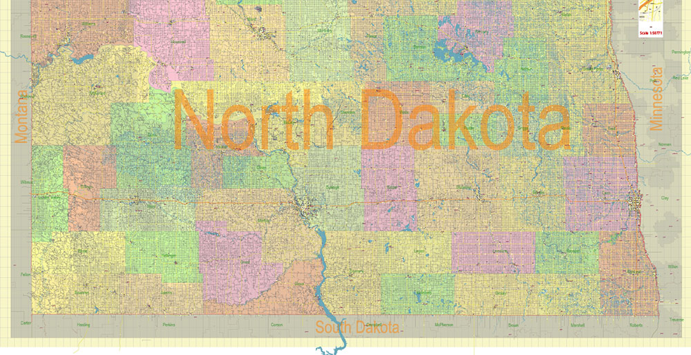
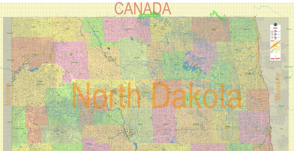
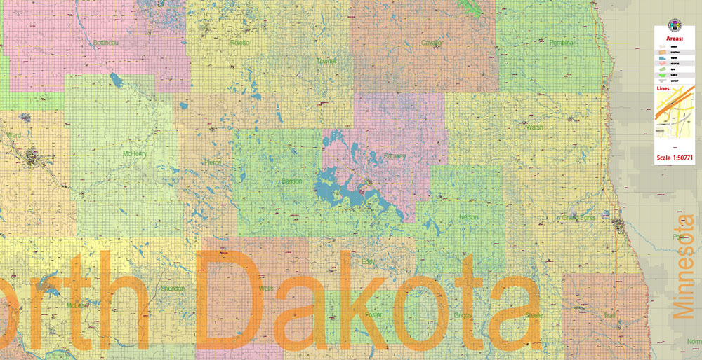
Scale: 1:50771
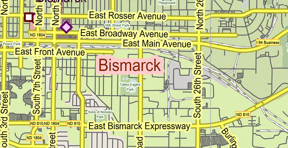
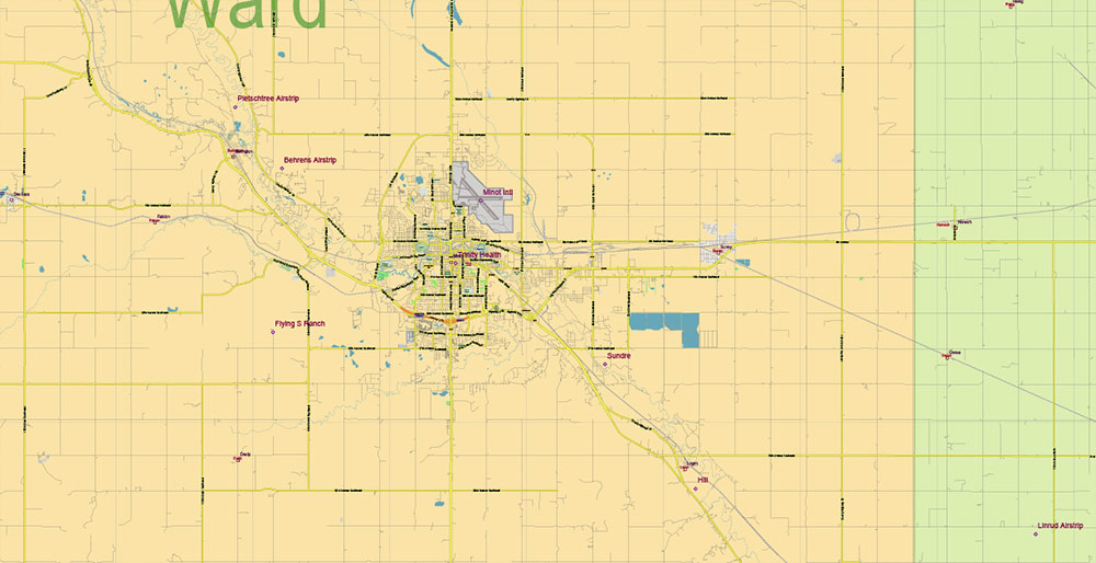
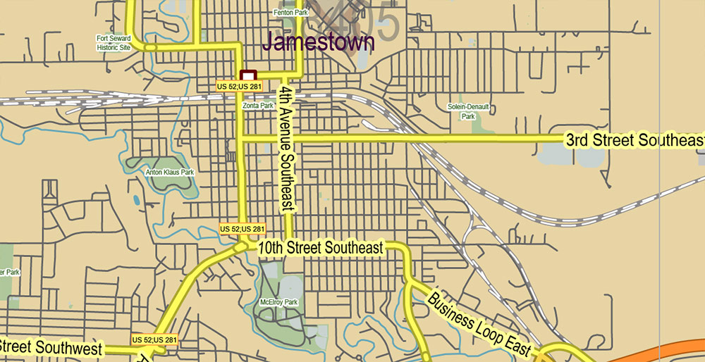
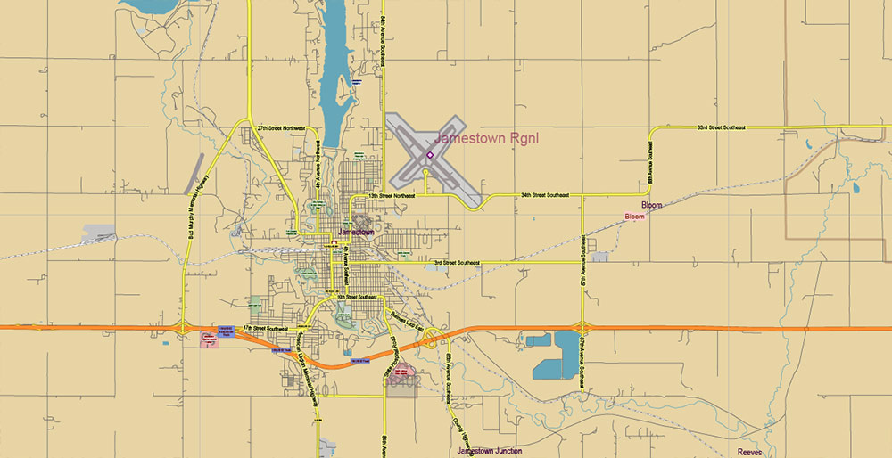
All streets and roads, Names of Principal streets, All Cities and Towns, Counties, All Geonames, airports, and heliports. Map for design, printing, arts, projects, presentations, for architects, designers, and builders, business, logistics.
NOTE! All objects are located on separate layers by type. The preview shows all layers together. When you work with this map, just turn off or delete those layers that are not needed for your project.
For Editing and High-Quality Printing, Royalty free
Need AutoCAD DWG / DXF, CDR, or any other format? Please, contact us!
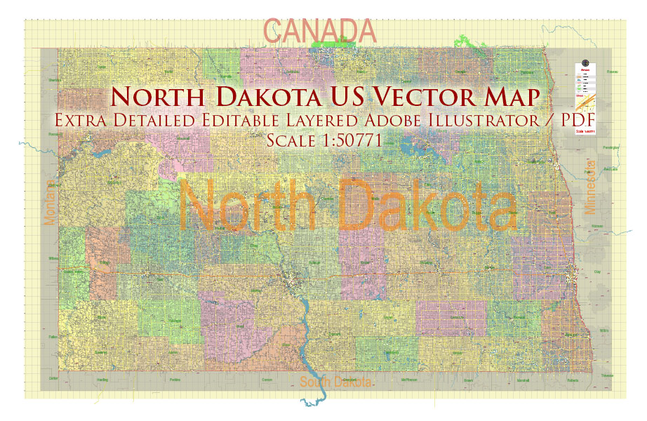
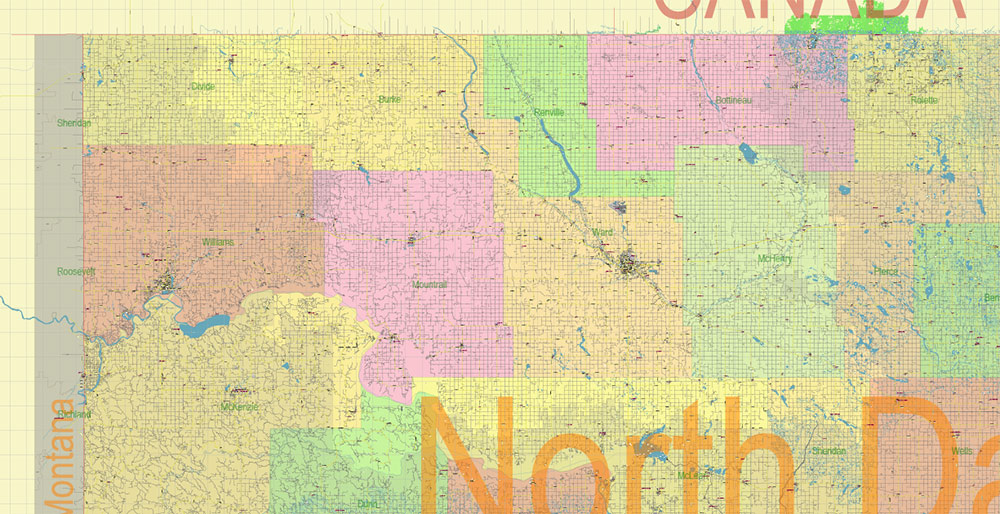
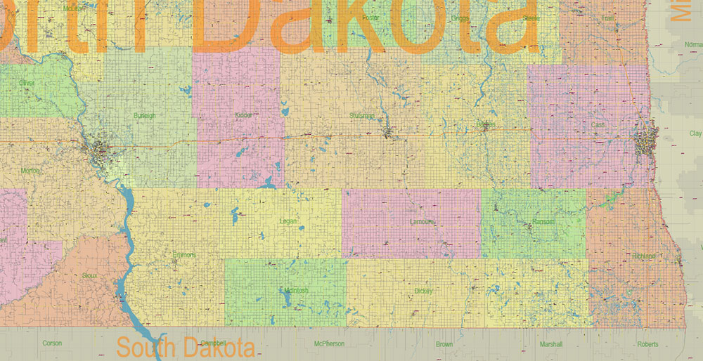
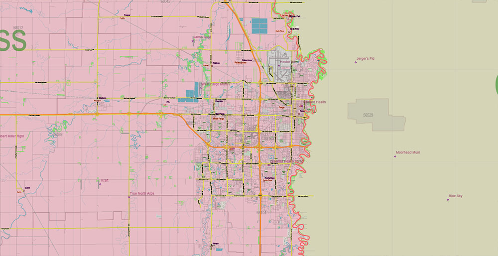
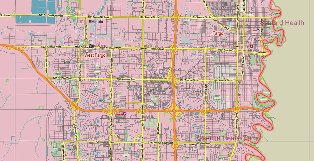
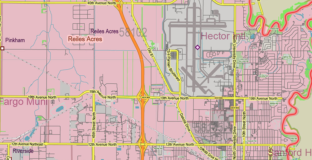
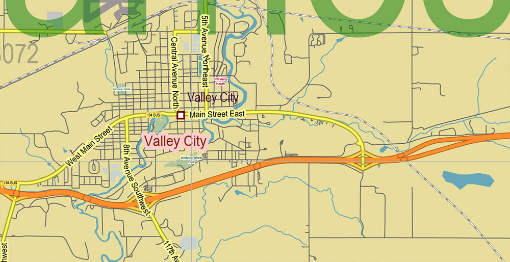
North Dakota US Map Vector Exact State Plan High Detailed Road Map + Counties + Zipcodes + Airports editable Adobe Illustrator in layers
Layers list:
- Legend
- Grids
- Labels of roads (numbers) – highways, interstate
- All Geonames (cities, towns, villages, hamlets, islands)
- Points of the Geonames (cities, towns, villages, hamlets, islands)
- Names places: Names of all Cities, towns, villages and hamlets
- Names of the Airports and Heliports
- Points of the Airports and Heliports
- Numbers of ZIP codes
- Names of objects (water, park, hospital)
- Names of States
- Names of Counties
- Names of the Main Streets
- Major Roads and Streets – Highways
- Minor Roads and residential streets
- Railroads
- State boundaries
- Water objects (rivers, lakes, ponds, swamps, reefs)
- Waterways
- Ground objects (urban areas, parks, hospitals, etc.)
- ZIP-codes areas
- Counties areas (colored)
- States areas
- Background
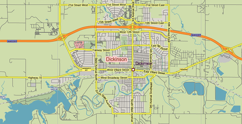
North Dakota US Map Vector Exact State Plan High Detailed Road Map + Counties + Zipcodes + Airports editable Adobe Illustrator in layers
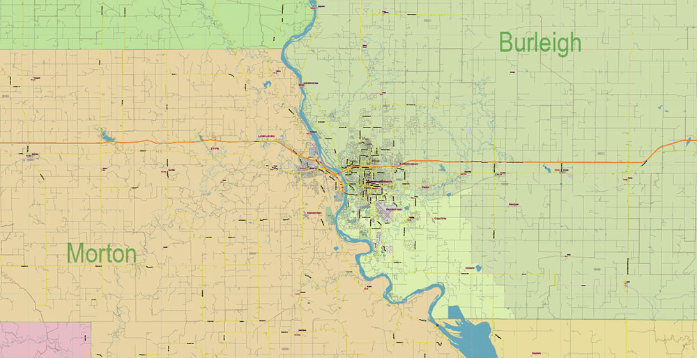
North Dakota US Map Vector Exact State Plan High Detailed Road Map + Counties + Zipcodes + Airports editable Adobe Illustrator in layers
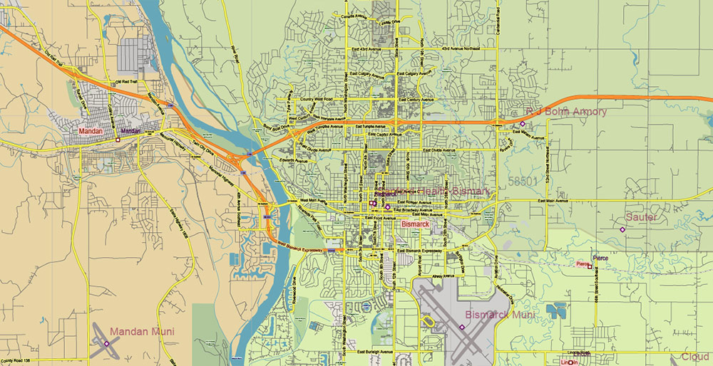
North Dakota US Map Vector Exact State Plan High Detailed Road Map + Counties + Zipcodes + Airports editable Adobe Illustrator in layers
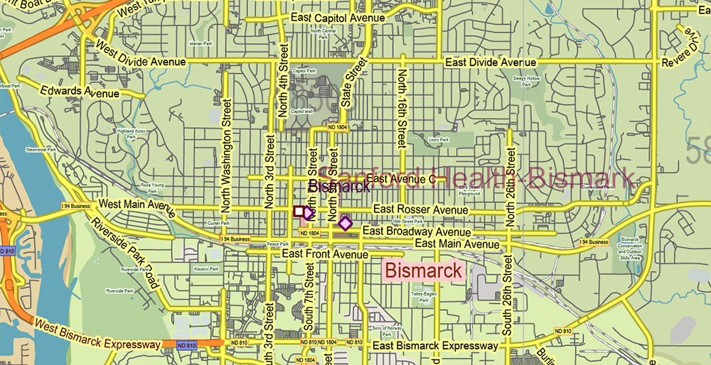
North Dakota US Map Vector Exact State Plan High Detailed Road Map + Counties + Zipcodes + Airports editable Adobe Illustrator in layers

North Dakota US Map Vector Exact State Plan High Detailed Road Map + Counties + Zipcodes + Airports editable Adobe Illustrator in layers
North Dakota US Map Vector Exact State Plan High Detailed Road Map + Counties + Zipcodes + Airports editable Adobe Illustrator in layers
North Dakota US Map Vector Exact State Plan High Detailed Road Map + Counties + Zipcodes + Airports editable Adobe Illustrator in layers
North Dakota US Map Vector Exact State Plan High Detailed Road Map + Counties + Zipcodes + Airports editable Adobe Illustrator in layers
North Dakota US Map Vector Exact State Plan High Detailed Road Map + Counties + Zipcodes + Airports editable Adobe Illustrator in layers
North Dakota US Map Vector Exact State Plan High Detailed Road Map + Counties + Zipcodes + Airports editable Adobe Illustrator in layers
North Dakota US Map Vector Exact State Plan High Detailed Road Map + Counties + Zipcodes + Airports editable Adobe Illustrator in layers
North Dakota US Map Vector Exact State Plan High Detailed Road Map + Counties + Zipcodes + Airports editable Adobe Illustrator in layers
North Dakota US Map Vector Exact State Plan High Detailed Road Map + Counties + Zipcodes + Airports editable Adobe Illustrator in layers
North Dakota US Map Vector Exact State Plan High Detailed Road Map + Counties + Zipcodes + Airports editable Adobe Illustrator in layers
North Dakota US Map Vector Exact State Plan High Detailed Road Map + Counties + Zipcodes + Airports editable Adobe Illustrator in layers
North Dakota US Map Vector Exact State Plan High Detailed Road Map + Counties + Zipcodes + Airports editable Adobe Illustrator in layers
North Dakota US Map Vector Exact State Plan High Detailed Road Map + Counties + Zipcodes + Airports editable Adobe Illustrator in layers
North Dakota US Map Vector Exact State Plan High Detailed Road Map + Counties + Zipcodes + Airports editable Adobe Illustrator in layers

 Author: Kirill Shrayber, Ph.D. FRGS

