The modern economy of the state of Nevada is focused on tourists, who are offered a rich selection of entertainment, primarily gambling.
Nevada has the most hotel rooms per capita in the United States (one hotel room per 14 residents of the state, compared to the United States average of one hotel room per 67 residents). More than two hundred and fifty casinos with an annual income of over a million dollars (and hundreds of smaller establishments) offer their services to tourists.
Along with gambling itself, all major hotels and casinos also attract visitors with a variety of shows, celebrity concerts, sports matches, and other equally interesting events.
The largest, most luxurious, most famous hotels and casinos in Nevada are located, of course, in the “world capital of entertainment”, in the famous “sin city” – Las Vegas.
The Greater Las Vegas metropolitan area is home to more than two-thirds of Nevada’s population. Here, on Fremont Street in the city center and on the world-famous Strip of Las Vegas in its suburb of Paradise, the largest casinos are concentrated, attracting millions of tourists. The Las Vegas Strip is the second most popular attraction in the United States (after Times Square in New York).
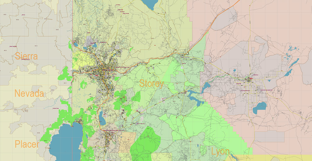
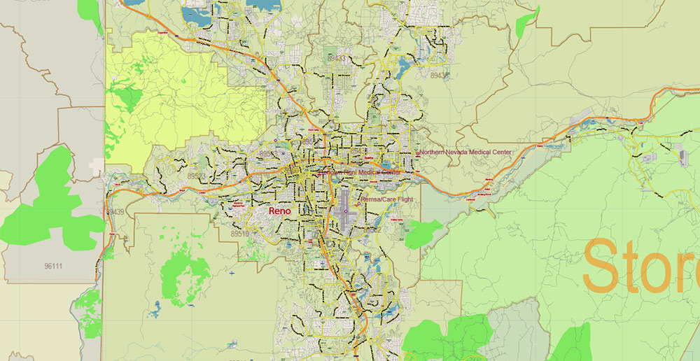
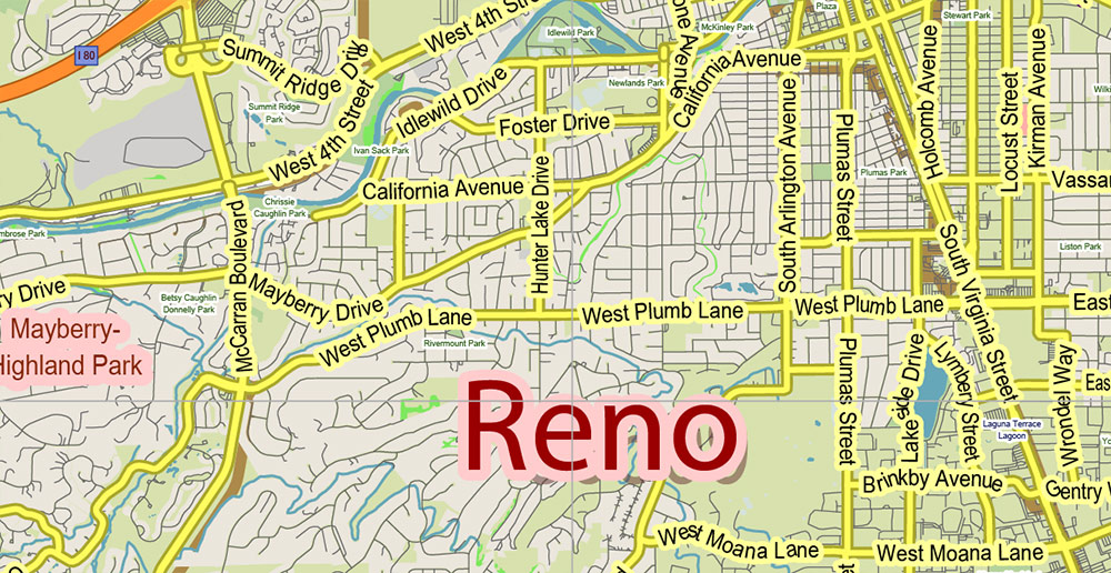
The second most popular gambling and entertainment center in Nevada after Las Vegas is the “largest small city in the world” Reno, located at the foot of the Sierra Nevada Mountains in the west of the state. Reno was the gambling capital of the United States until the late fifties when the rapid growth of Las Vegas began. And today, Reno casinos are very popular with tourists from northern California, in particular from San Francisco.
Several very popular casinos are also located in the city of Laughlin, which is located one hundred and fifty kilometers south of Las Vegas, on the Colorado River. Laughlin’s entertainment and activities are considered more family-friendly than those offered in Las Vegas or Reno. Laughlin also hosts the largest annual biker event in the Western United States, the Laughlin River Run.
Nevada is the only state in the United States that has legalized prostitution in some counties.
Nevada has one of the highest unemployment rates in the United States.
Outside of major tourist-focused gambling hubs like Las Vegas and Reno, Nevada’s main industries are agriculture and mining.
Nevada’s agriculture is primarily focused on raising cattle, producing milk, and growing vegetables. The state has more than 500,000 cattle and 70,000 sheep. More than 90% of Nevada’s arable land is used for forage crops.
The state produces a lot of minerals, primarily gold (about 9 % of the world’s production) and silver. The Nevada deposits are very rich, but they are also expensive to mine.
In addition, Nevada has a number of engineering companies, food products, and electrical equipment.
One of the largest employers in the state of Nevada is the US Federal Government. There are several military installations in Nevada, the largest and most famous of which is Nellis Air Force Base.
Located in North Las Vegas, just thirteen kilometers north of Las Vegas, the airbase trains American military pilots. Exercises, including international ones, are often held here.
It is believed that the highly classified “area 51” is located on the territory of the Nellis airbase.
Several other military facilities are located in Nevada, including a test site where nuclear weapons have been tested since 1951.
Fifty-seven hectares of land at Nellis Air Base is occupied by a 14-megawatt solar power plant. 70,000 solar panels generate more than 25 million kilowatt-hours of electricity per year, and the airbase itself consumes only a quarter of the energy produced. At the time of its completion, in 2007, it was the most powerful power plant in the world.
In general, Nevada, due to its sunny climate with little precipitation, is very well suited for creating a solar power plant. The largest of them is “Solar One” (Nevada Solar One) with a nominal capacity of 64 megawatts and “Cooper-Montaine Solar Plant” with a capacity of 48 megawatts. Both of these stations are located in southern Nevada, in the Mojave Desert near Boulder City.
Much attention is paid to the development of clean solar energy in Nevada, as in neighboring California. In the coming years, the state plans to build new, even more powerful solar power plants.
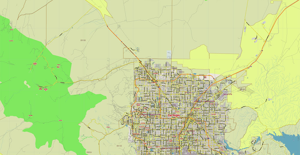
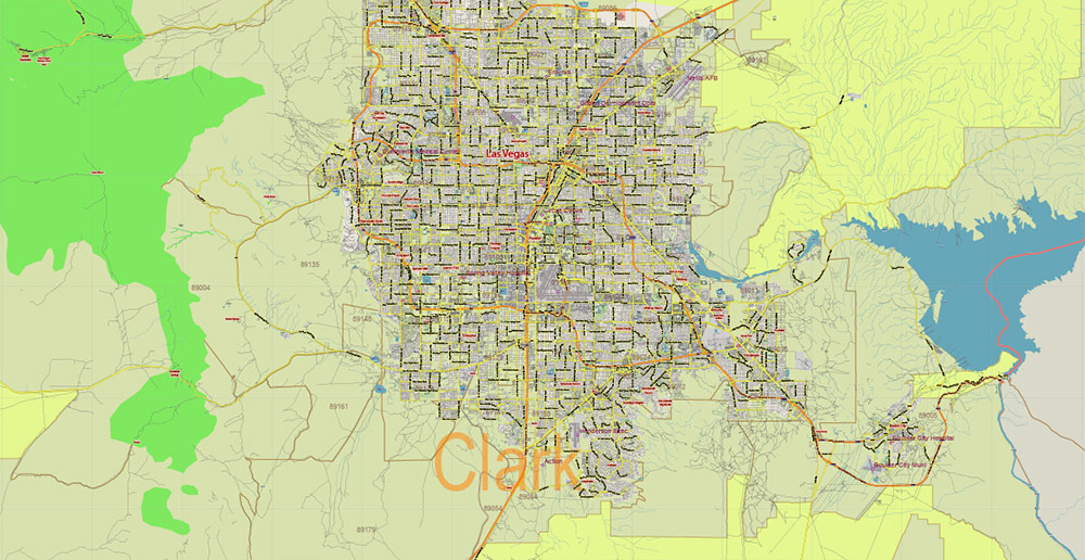
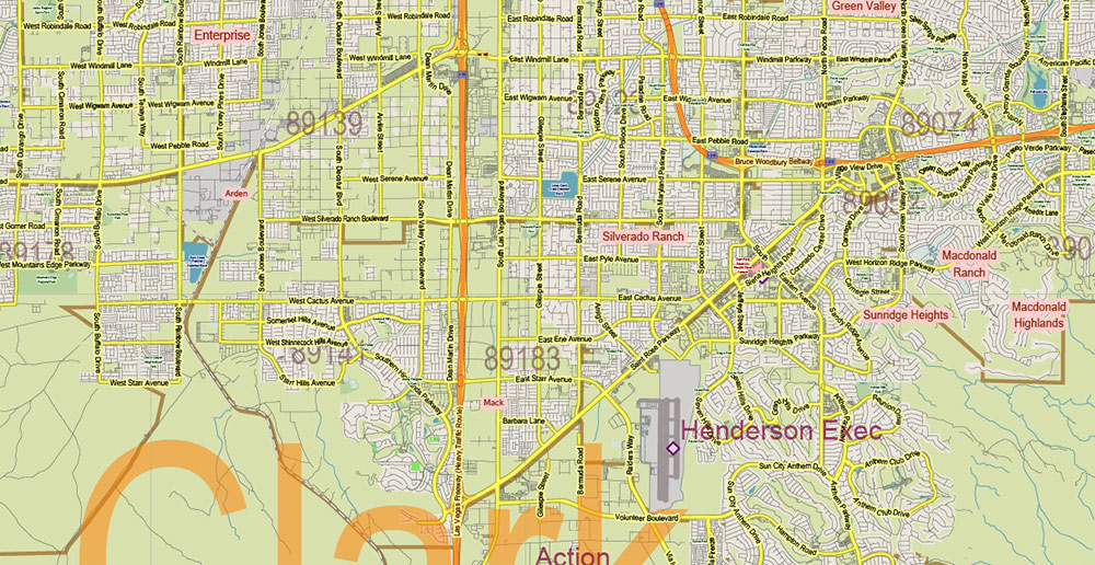
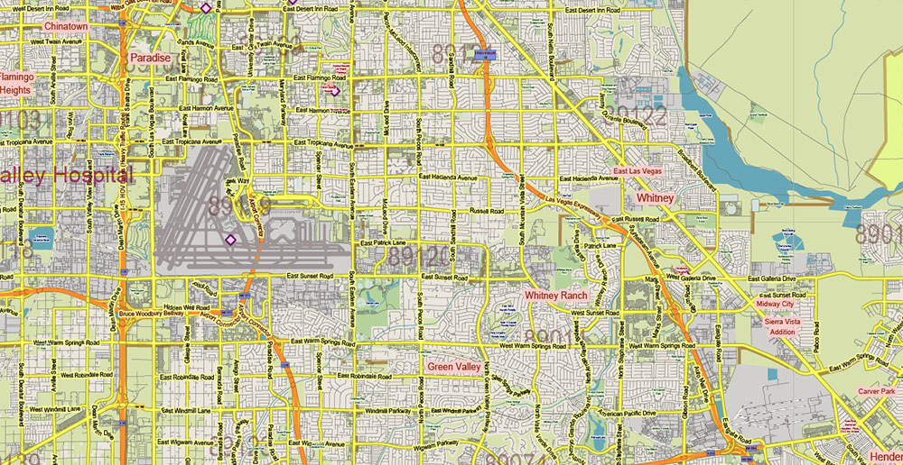
Printable Vector Map of Nevada Full State US: All Streets and Roads + counties areas + zip-codes areas, fully editable Adobe Illustrator Map in layers, scalable, 63 MB ZIP
Scale: 1:58721
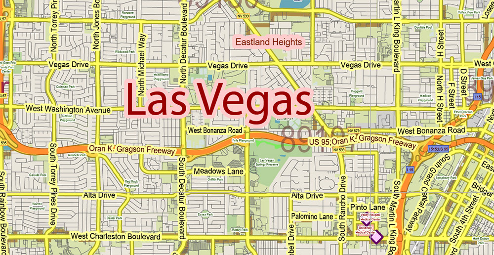
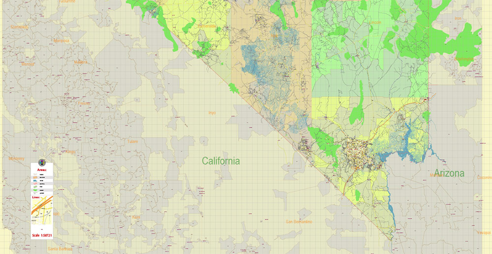
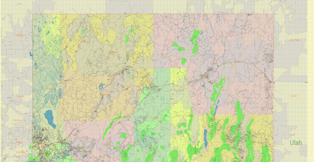
All streets and roads, Names of Principal streets, All Cities and Towns, Counties, All Geonames, airports and heliports. Map for design, printing, arts, projects, presentations, for architects, designers, and builders, business, logistics.
ATTN! All objects are located on separate layers by type. The preview shows them all together. When you work with this map, just turn off or delete those layers that are not needed for your project.
For Editing and High-Quality Printing, Royalty free
Need AutoCAD DWG / DXF, CDR, or any other format? Please, contact us!
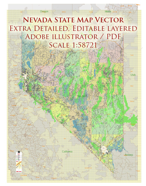
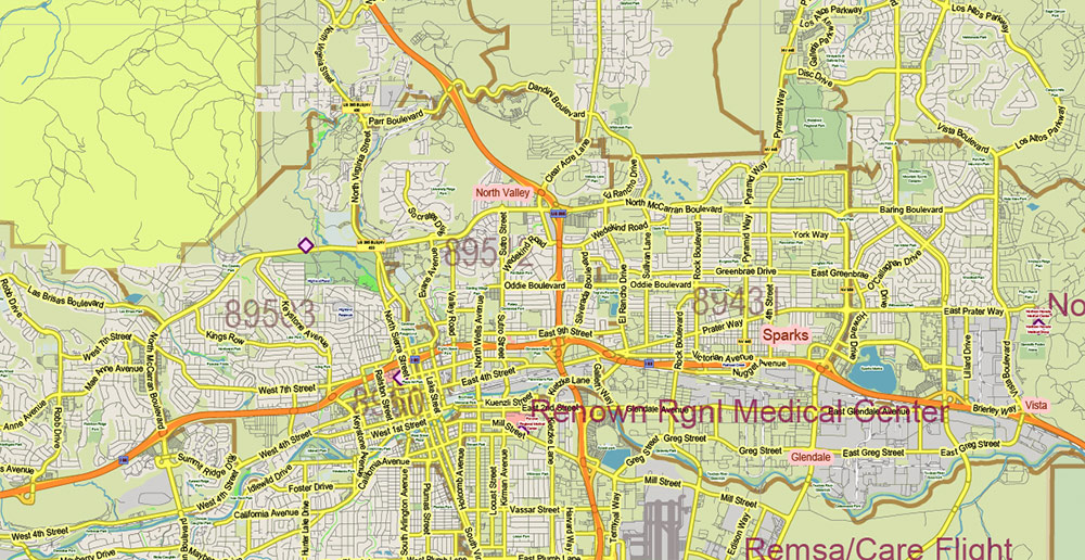
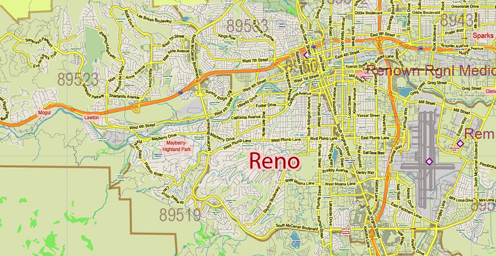
Nevada Full State US Vector Map: Full Extra High Detailed (all roads, zipcodes, airports) + Admin Areas editable Adobe Illustrator in layers
Layers list:
- Legend
- Grids
- Labels of roads (numbers) – highways, interstate
- All Geonames (cities, towns, villages, hamlets, islands)
- Points of the Geonames (cities, towns, villages, hamlets, islands)
- Names places: Names of all Cities, towns, villages and hamlets
- Names of the Airports and Heliports
- Points of the Airports and Heliports
- Numbers of ZIP codes
- Names of objects (water, park, hospital)
- Names of States
- Names of Counties
- Names of the Main Streets
- Major Roads and Streets – Highways
- Minor Roads and residential streets
- Railroads
- State boundaries
- Water objects (rivers, lakes, ponds, swamps, reefs)
- Waterways
- Ground objects (urban areas, parks, hospitals, etc.)
- ZIP-codes areas
- Counties areas (colored)
- States areas
- Background
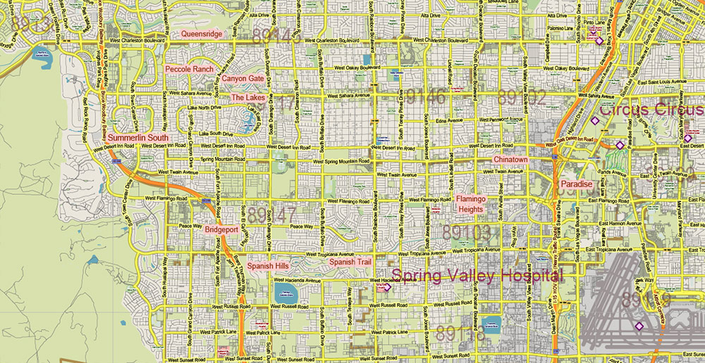
Nevada Full State US Vector Map: Full Extra High Detailed (all roads, zipcodes, airports) + Admin Areas editable Adobe Illustrator in layers
Nevada Full State US Vector Map: Full Extra High Detailed (all roads, zipcodes, airports) + Admin Areas editable Adobe Illustrator in layers

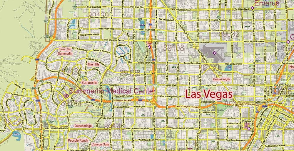
Nevada Full State US Vector Map: Full Extra High Detailed (all roads, zipcodes, airports) + Admin Areas editable Adobe Illustrator in layers
Nevada Full State US Vector Map: Full Extra High Detailed (all roads, zipcodes, airports) + Admin Areas editable Adobe Illustrator in layers
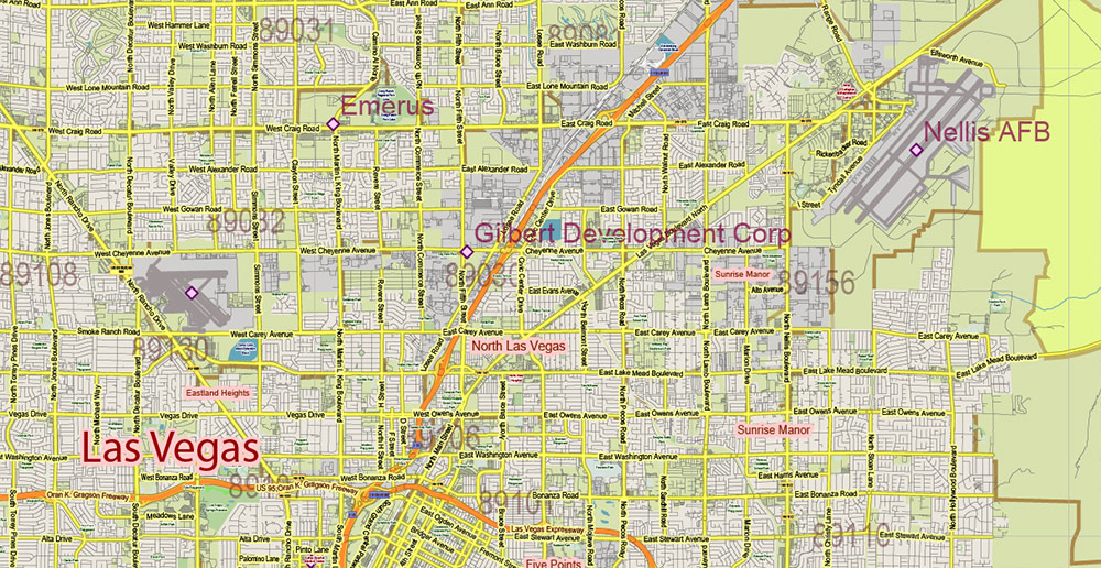
Nevada Full State US Vector Map: Full Extra High Detailed (all roads, zipcodes, airports) + Admin Areas editable Adobe Illustrator in layers
Nevada Full State US Vector Map: Full Extra High Detailed (all roads, zipcodes, airports) + Admin Areas editable Adobe Illustrator in layers
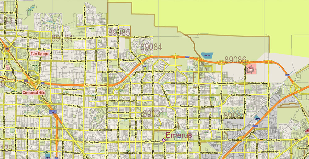
Nevada Full State US Vector Map: Full Extra High Detailed (all roads, zipcodes, airports) + Admin Areas editable Adobe Illustrator in layers
Nevada Full State US Vector Map: Full Extra High Detailed (all roads, zipcodes, airports) + Admin Areas editable Adobe Illustrator in layers
Nevada Full State US Vector Map: Full Extra High Detailed (all roads, zipcodes, airports) + Admin Areas editable Adobe Illustrator in layers
Nevada Full State US Vector Map: Full Extra High Detailed (all roads, zipcodes, airports) + Admin Areas editable Adobe Illustrator in layers
Nevada Full State US Vector Map: Full Extra High Detailed (all roads, zipcodes, airports) + Admin Areas editable Adobe Illustrator in layers
Nevada Full State US Vector Map: Full Extra High Detailed (all roads, zipcodes, airports) + Admin Areas editable Adobe Illustrator in layers
Nevada Full State US Vector Map: Full Extra High Detailed (all roads, zipcodes, airports) + Admin Areas editable Adobe Illustrator in layers
Nevada Full State US Vector Map: Full Extra High Detailed (all roads, zipcodes, airports) + Admin Areas editable Adobe Illustrator in layers
Nevada Full State US Vector Map: Full Extra High Detailed (all roads, zipcodes, airports) + Admin Areas editable Adobe Illustrator in layers
Nevada Full State US Vector Map: Full Extra High Detailed (all roads, zipcodes, airports) + Admin Areas editable Adobe Illustrator in layers
Nevada Full State US Vector Map: Full Extra High Detailed (all roads, zipcodes, airports) + Admin Areas editable Adobe Illustrator in layers
Nevada Full State US Vector Map: Full Extra High Detailed (all roads, zipcodes, airports) + Admin Areas editable Adobe Illustrator in layers
Nevada Full State US Vector Map: Full Extra High Detailed (all roads, zipcodes, airports) + Admin Areas editable Adobe Illustrator in layers
Nevada Full State US Vector Map: Full Extra High Detailed (all roads, zipcodes, airports) + Admin Areas editable Adobe Illustrator in layers

 Author: Kirill Shrayber, Ph.D. FRGS

