The area of the state of Nevada – 286,367 km2 (7th place in the United States)
The length of the state of Nevada:
from north to south-788 km
from east to west-519 km
Region of the state of the Nevada – Mountain States of the United States
The highest point of the state of Nevada – 4,005 meters above sea level
The lowest point of the state of Nevada – 146 meters above sea level
The abbreviation of the state of Nevada is NV
The capital of Nevada is Carson City
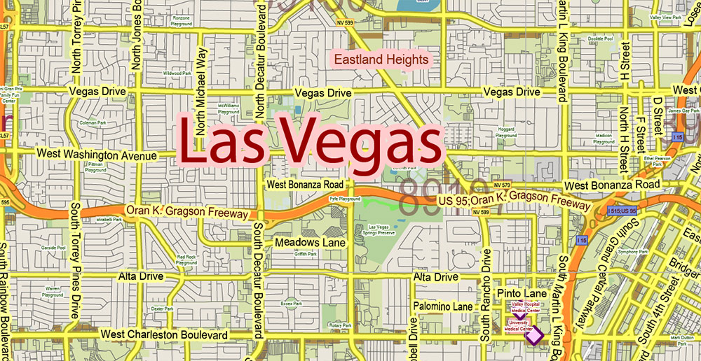
The largest city in the state of Nevada – Las Vegas
Date of formation of the state of Nevada – October 31, 1864 (36 in the United States)
The population of the state of Nevada is about 2,650,000 people (35th place in the United States)
The population density in the state of Nevada is 9 people per km2 (42nd place in the United States)
The motto of the State of Nevada is All For Our Country (“Everything for our country”)
The nickname of the state of Nevada – “Silver State”, ” The State born in battles”
The territory of the modern state of Nevada was part of the Spanish colony of New Spain in North America (as well as the US states of California, Arizona, Utah, and Wyoming).
Not surprisingly, the name of the state of Nevada comes from the Spanish word Nevada, which means “snow-covered” (as the Sierra Nevada Mountains – “snow-capped mountains”).
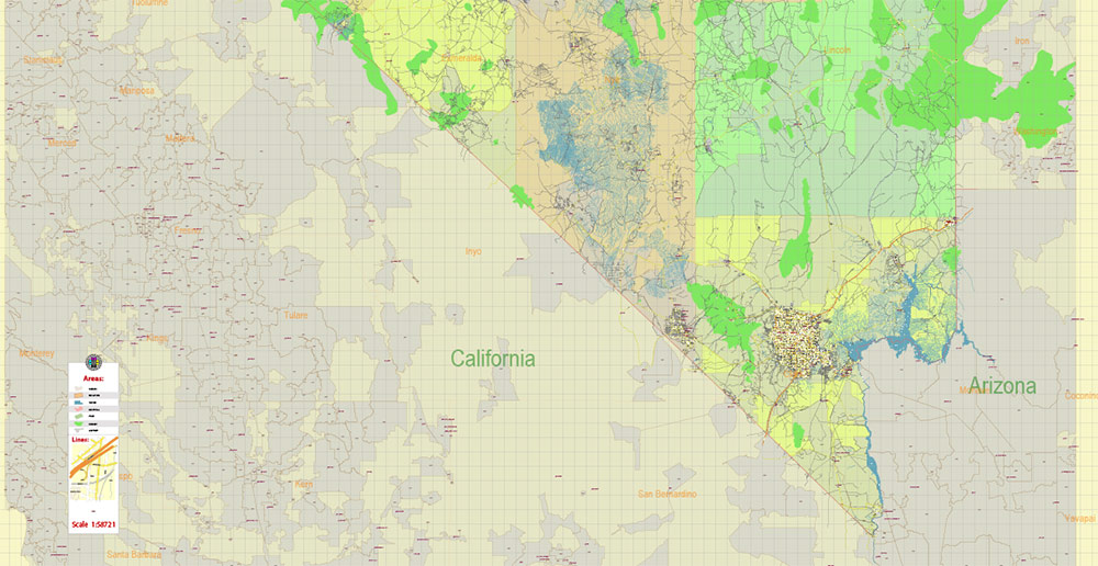
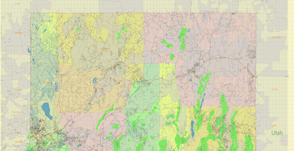
The state of Nevada is part of the Mountain States region of the United States and is bordered by the states of Oregon and Idaho to the north; Utah to the east; Arizona to the southeast; and California to the west and southwest.
The area of the state of Nevada is 286,367 km2 (7th place among the US states).
Most of the state of Nevada is located in the area of the Intermountain Plateaus, namely within the Great Basin, the largest rainless region of the United States. In the northern part of Nevada, there are many mountain ranges, the highest mountain in Nevada, Boundary Peak, rises 4007 meters above sea level.
The southern part of the state, where, among other things, the largest city in Nevada – Las Vegas is located in the Mojave Desert.
Several rivers flow through the state, most of which are relatively small and have no access to the oceans (such as the Humboldt River, which flows into the lake of the same name). Several rivers in the north of the state belong to the Pacific Ocean basin (tributaries of the Columbia River).
The Colorado River is the border between the states of Nevada and Arizona. It is also home to the famous Hoover Dam and the dam-formed Lake Mead.
On the border between the states of Nevada and California is the largest in the United States and extremely picturesque mountain lake – Tahoe.
Nevada is characterized by a dry (one of the driest in the United States), desert climate, with large seasonal and daily temperature fluctuations.
The daytime temperature in summer can reach 52°C, the night temperature in winter drops to -46°C.
The flora and fauna of Nevada are represented by typical desert and semi-desert species. Here you can see various types of cacti, shrubs, and herbaceous plants. The wildlife of Nevada is represented by black-tailed hares, coyotes, cougars, ground squirrels, foxes, mice, skunks, many species of birds, various reptiles, and, of course, one of the symbols of the state of Nevada – the desert bighorn.
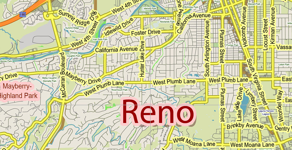
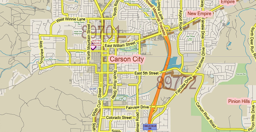
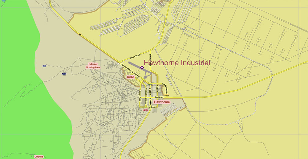
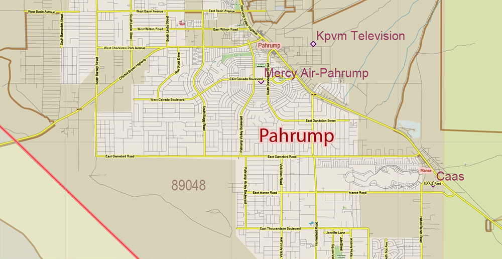
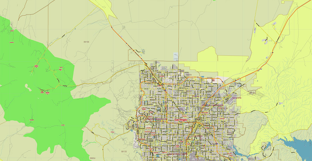
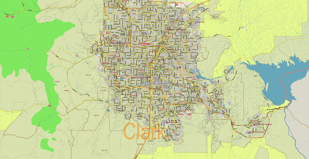
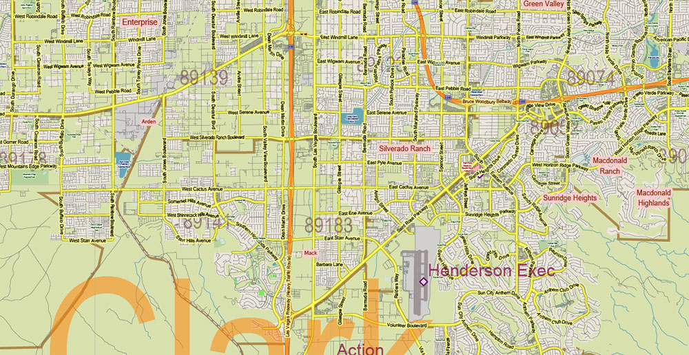
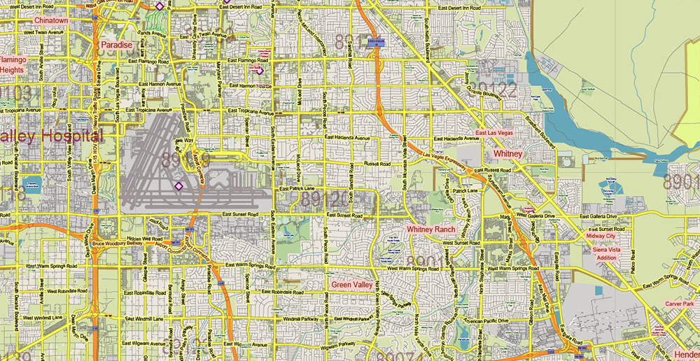
Printable PDF Vector Map of Nevada Full State US: All Streets and Roads + counties areas + zip-codes areas, fully editable Adobe PDF Map in layers, scalable, 139 MB ZIP
Scale: 1:58721
All streets and roads, Names of Principal streets, All Cities and Towns, Counties, All Geonames, airports and heliports. Map for design, printing, arts, projects, presentations, for architects, designers, and builders, business, logistics.
ATTN! All objects are located on separate layers by type. The preview shows them all together. When you work with this map, just turn off or delete those layers that are not needed for your project.
For Editing and High-Quality Printing, Royalty free
Need AutoCAD DWG / DXF, CDR, or any other format? Please, contact us!
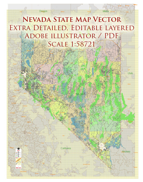
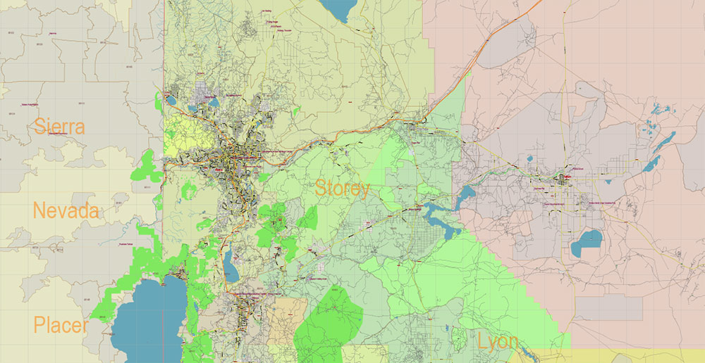
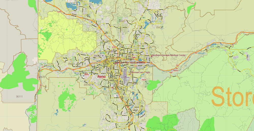
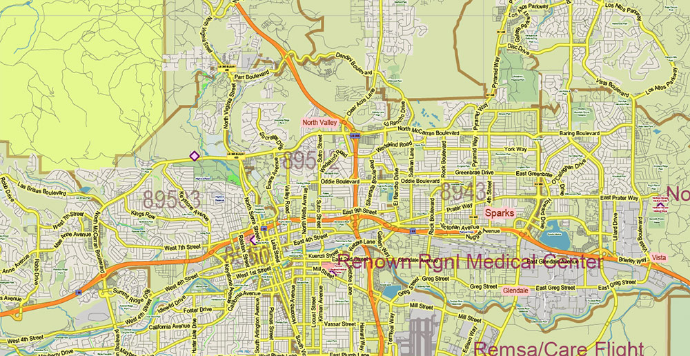
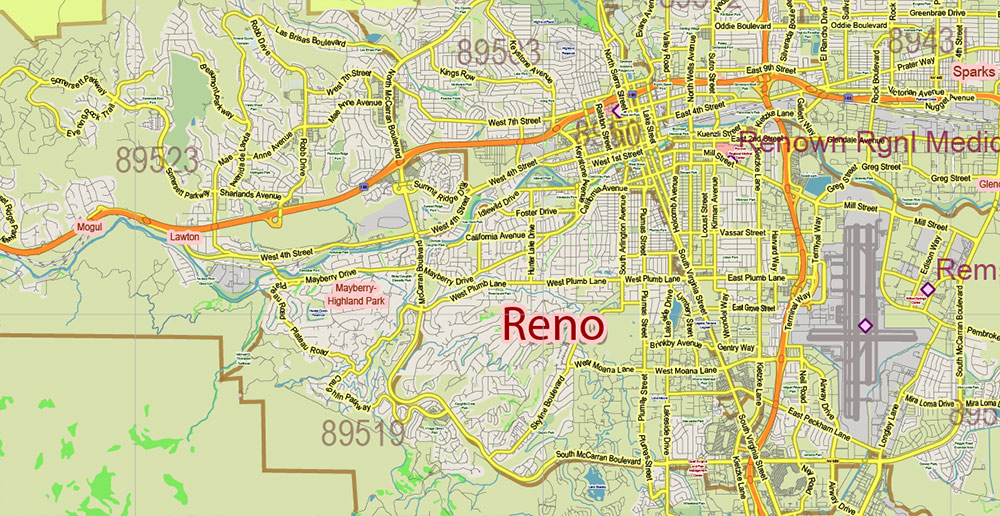
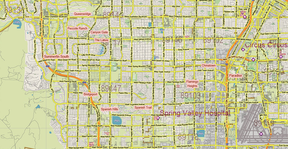
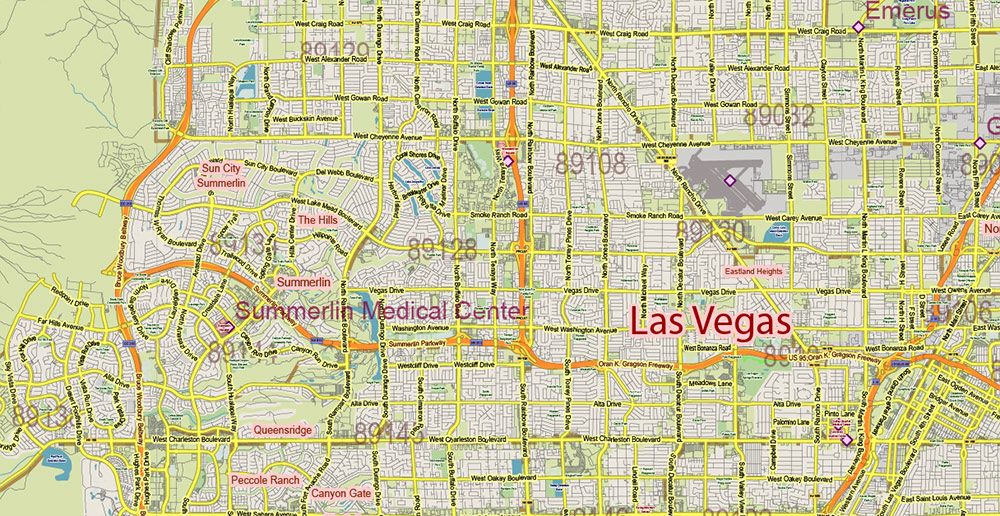
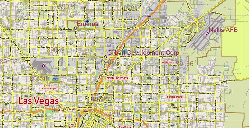
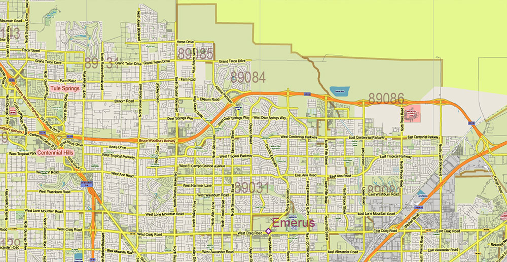
Nevada Full State US PDF Vector Map: Full Extra High Detailed (all roads, zipcodes, airports) + Admin Areas editable Adobe PDF in layers
Layers list:
- Legend
- Grids
- Labels of roads (numbers) – highways, interstate
- All Geonames (cities, towns, villages, hamlets, islands)
- Points of the Geonames (cities, towns, villages, hamlets, islands)
- Names places: Names of all Cities, towns, villages and hamlets
- Names of the Airports and Heliports
- Points of the Airports and Heliports
- Numbers of ZIP codes
- Names of objects (water, park, hospital)
- Names of States
- Names of Counties
- Names of the Main Streets
- Major Roads and Streets – Highways
- Minor Roads and residential streets
- Railroads
- State boundaries
- Water objects (rivers, lakes, ponds, swamps, reefs)
- Waterways
- Ground objects (urban areas, parks, hospitals, etc.)
- ZIP-codes areas
- Counties areas (colored)
- States areas
- Background
Nevada Full State US PDF Vector Map: Full Extra High Detailed (all roads, zipcodes, airports) + Admin Areas editable Adobe PDF in layers
Nevada Full State US PDF Vector Map: Full Extra High Detailed (all roads, zipcodes, airports) + Admin Areas editable Adobe PDF in layers

Nevada Full State US PDF Vector Map: Full Extra High Detailed (all roads, zipcodes, airports) + Admin Areas editable Adobe PDF in layers
Nevada Full State US PDF Vector Map: Full Extra High Detailed (all roads, zipcodes, airports) + Admin Areas editable Adobe PDF in layers
Nevada Full State US PDF Vector Map: Full Extra High Detailed (all roads, zipcodes, airports) + Admin Areas editable Adobe PDF in layers
Nevada Full State US PDF Vector Map: Full Extra High Detailed (all roads, zipcodes, airports) + Admin Areas editable Adobe PDF in layers
Nevada Full State US PDF Vector Map: Full Extra High Detailed (all roads, zipcodes, airports) + Admin Areas editable Adobe PDF in layers
Nevada Full State US PDF Vector Map: Full Extra High Detailed (all roads, zipcodes, airports) + Admin Areas editable Adobe PDF in layers
Nevada Full State US PDF Vector Map: Full Extra High Detailed (all roads, zipcodes, airports) + Admin Areas editable Adobe PDF in layers
Nevada Full State US PDF Vector Map: Full Extra High Detailed (all roads, zipcodes, airports) + Admin Areas editable Adobe PDF in layers
Nevada Full State US PDF Vector Map: Full Extra High Detailed (all roads, zipcodes, airports) + Admin Areas editable Adobe PDF in layers
Nevada Full State US PDF Vector Map: Full Extra High Detailed (all roads, zipcodes, airports) + Admin Areas editable Adobe PDF in layers
Nevada Full State US PDF Vector Map: Full Extra High Detailed (all roads, zipcodes, airports) + Admin Areas editable Adobe PDF in layers
Nevada Full State US PDF Vector Map: Full Extra High Detailed (all roads, zipcodes, airports) + Admin Areas editable Adobe PDF in layers
Nevada Full State US PDF Vector Map: Full Extra High Detailed (all roads, zipcodes, airports) + Admin Areas editable Adobe PDF in layers
Nevada Full State US PDF Vector Map: Full Extra High Detailed (all roads, zipcodes, airports) + Admin Areas editable Adobe PDF in layers
Nevada Full State US PDF Vector Map: Full Extra High Detailed (all roads, zipcodes, airports) + Admin Areas editable Adobe PDF in layers
Nevada Full State US PDF Vector Map: Full Extra High Detailed (all roads, zipcodes, airports) + Admin Areas editable Adobe PDF in layers
Nevada Full State US PDF Vector Map: Full Extra High Detailed (all roads, zipcodes, airports) + Admin Areas editable Adobe PDF in layers
Nevada Full State US PDF Vector Map: Full Extra High Detailed (all roads, zipcodes, airports) + Admin Areas editable Adobe PDF in layers

 Author: Kirill Shrayber, Ph.D. FRGS

