Nebraska’s economy is primarily based on agriculture. In addition, financial companies and industrial enterprises work in the state, cargo transportation is very well developed, and units of the US Armed Forces are based.
Nebraska is home to the headquarters of several major American companies, including Berkshire Hathaway (a holding company that invests in industry, transportation, publishing, and other industries. Its chairman, Warren Buffett, is one of the richest people in the world), ConAgra Foods (food production), Union Pacific (rail transportation), Valmont Industries (irrigation equipment manufacturing), and others.
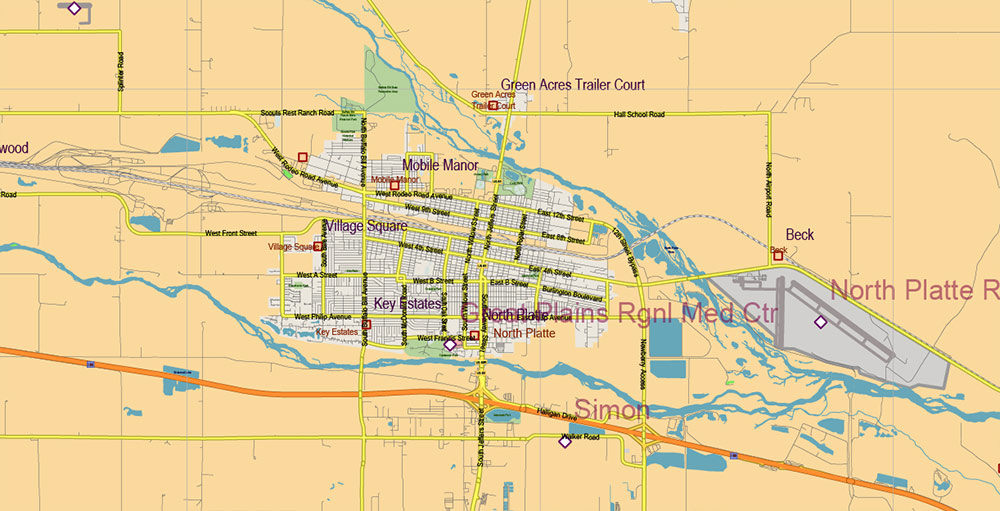
North Platte is home to the Union Pacific-owned Bailey Yard marshaling yard, which is considered the largest in the world.
Nebraska is part of the” grain belt of the United States“, the cultivation of cereals, primarily corn and wheat – the basis of the economy of the”corn cob state”. In addition, the fields of Nebraska grow sorghum, soybeans, sugar beets, and other crops. The state is also very well developed in animal husbandry (Nebraska farmers raise cattle and pigs) and meat processing.
For the population of Nebraska, as well as for other “agricultural” states of the Midwest of the United States (Iowa, Kansas, North Dakota, and South Dakota), the process of outflow of residents (primarily young people) from rural areas to large cities is characteristic.
Not far from Omaha, Nebraska, is Offutt Air Force Base, the headquarters of the Strategic Command of the United States Armed Forces, which directs space operations, missile defense, and strategic nuclear forces of the United States of America.
There are several tourist attractions in the state that are associated with both the nature of Nebraska and its history, primarily with the period of development of the Western United States. American pioneers Lewis and Clark traveled through Nebraska, and the famous Oregon Trail and the Pony Express horse courier route passed through here. Today, a number of sites in Nebraska have the status of National Monuments and are protected by the US government.
Nebraska is home to about 1,850,000 people (the thirty-eighth most populous state in the United States). The average population density in the “Corn Cob State” is about 9 people per km2 (forty-third place in the United States).
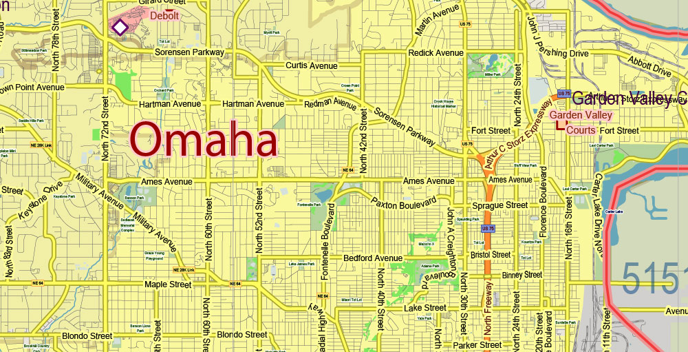
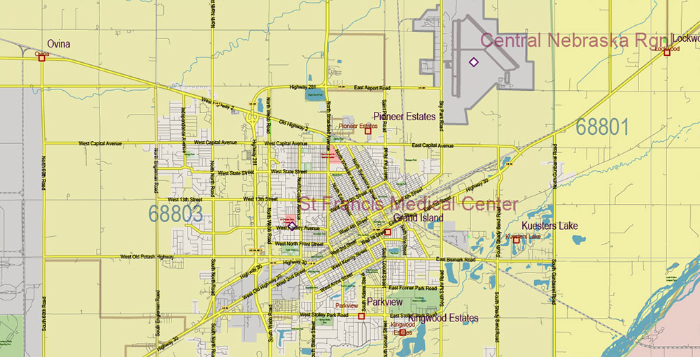
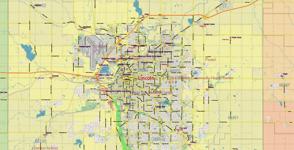
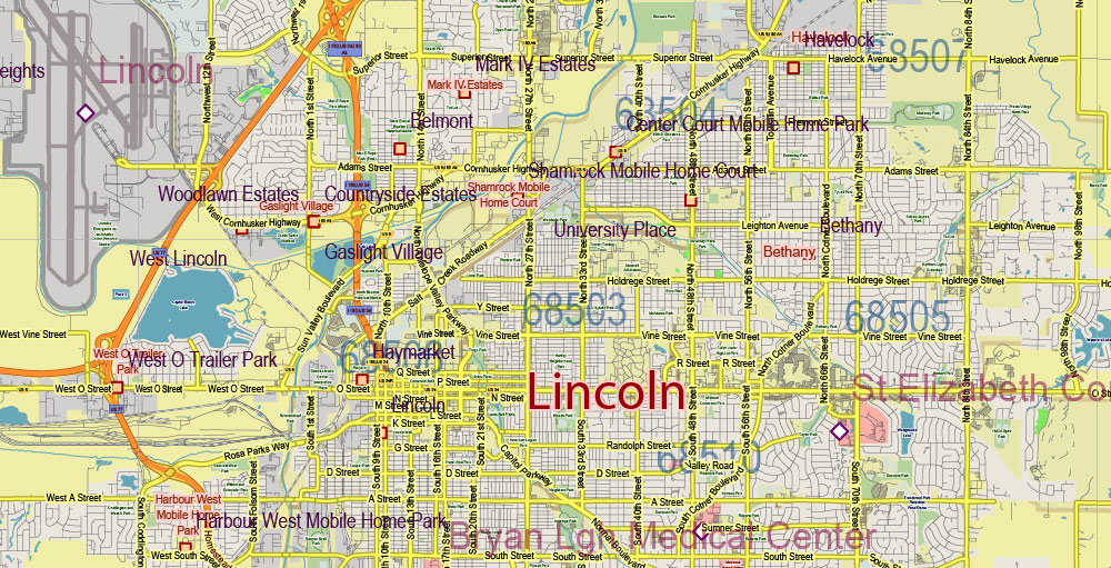
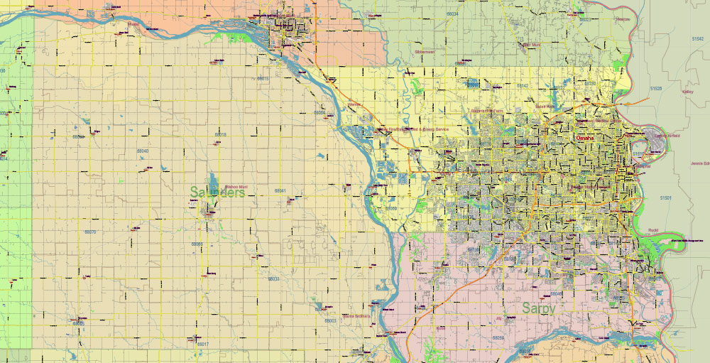
The largest cities in Nebraska are Omaha (about 410,000 residents, the forty-second largest city in the United States), the state capital of Lincoln (more than 260,000 residents), Bellevue (more than 50,000 residents), Grand Island (about 50,000 residents), and Carney (more than 30,000 residents).
The largest metropolitan area of the state was formed around Omaha, there are more than 730,000 people in Nebraska alone, and taking into account the residents of the settlements of neighboring Iowa that are part of the agglomeration, about 870,000 people (fifty-ninth place in the list of megacities in the United States).
The largest ethnic (national) groups among the population of the state of Nebraska:
Germans – 38.6%
Irish – 12.4%
English – 9.6%
Czechs – 5.5%
Swedes – 4.9%
Nebraska has a higher percentage of ethnic Czechs in the population than any other U.S. state.
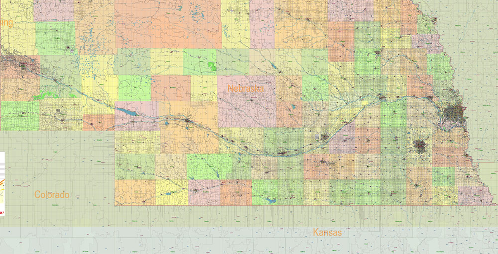
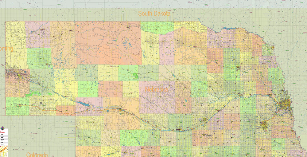
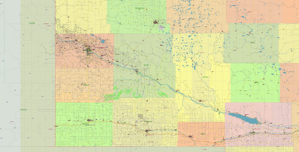
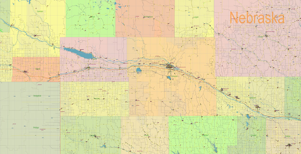
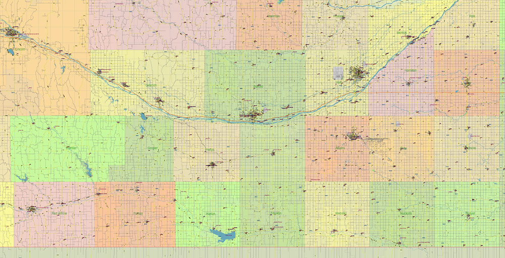
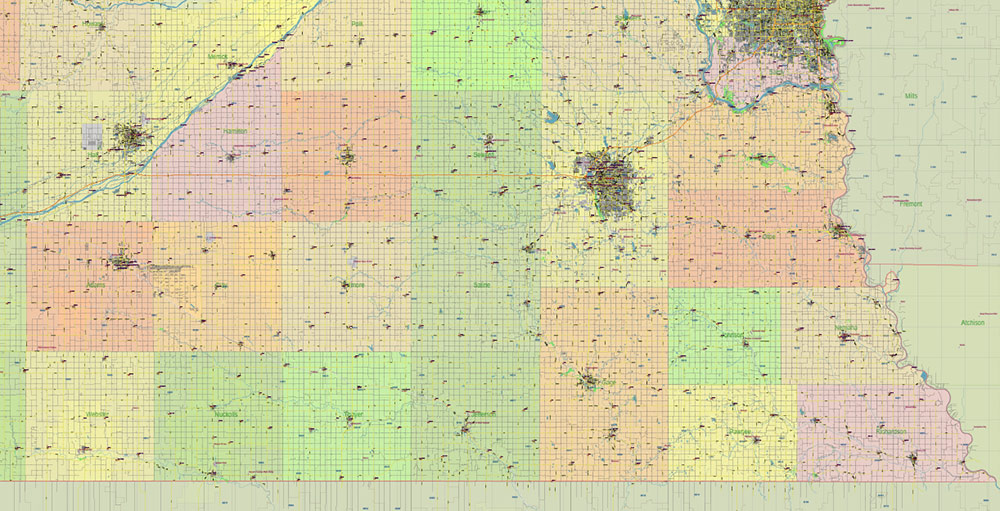
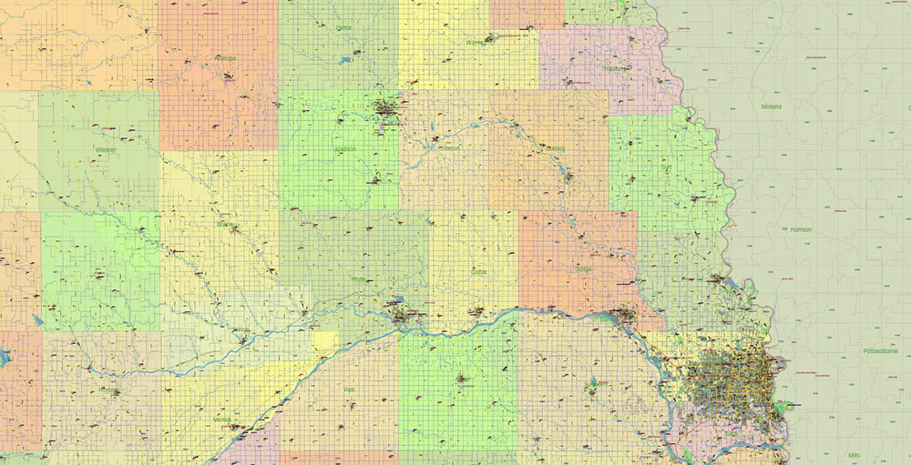
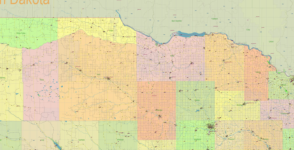
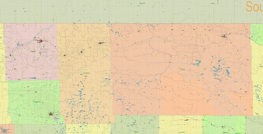
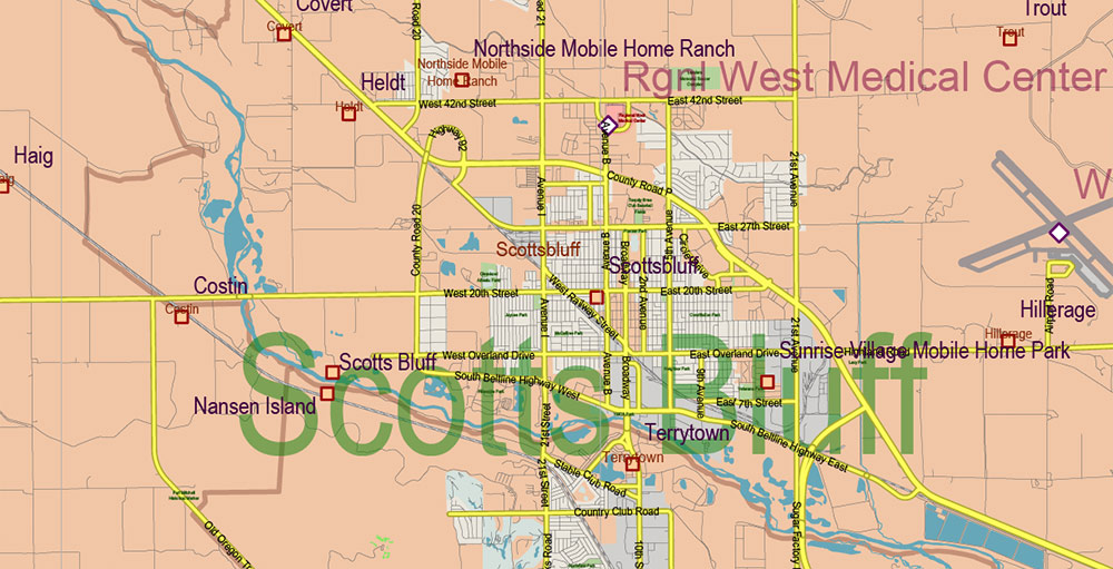
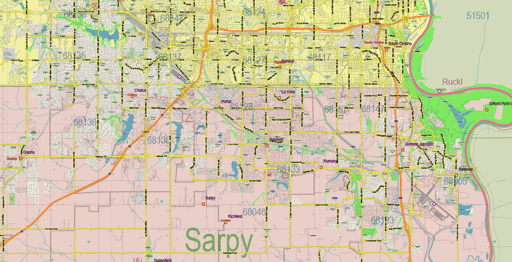
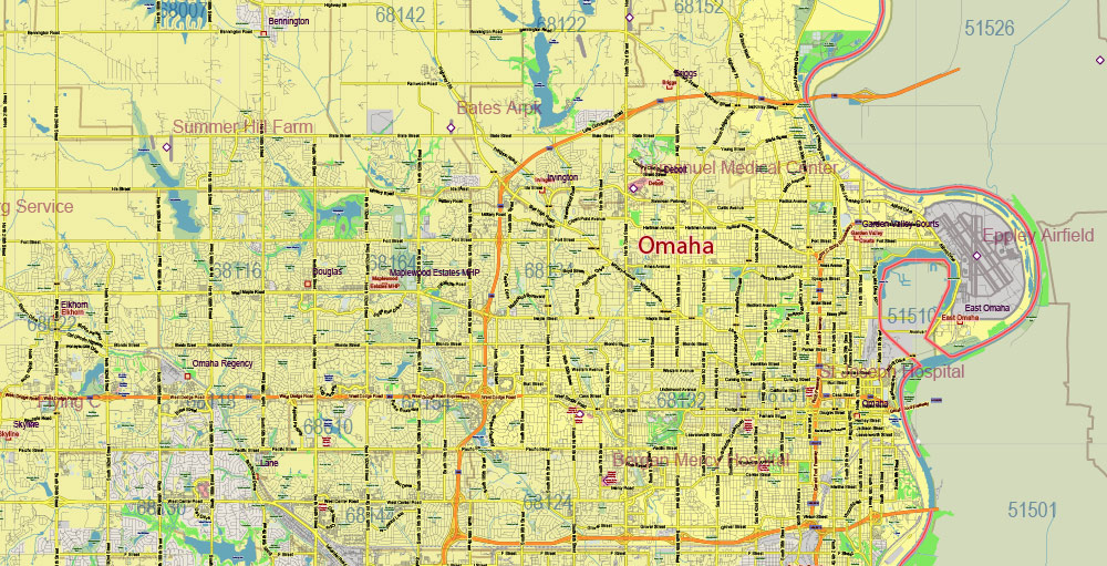
Printable Vector Map of Nebraska Full State US: All Streets and Roads + counties areas + zip-codes areas, fully editable Adobe Illustrator Map in layers, scalable, 80 MB ZIP
Scale: 1:56267
All streets and roads, Names of Principal streets, All Cities and Towns, Counties, All Geonames, airports and heliports. Map for design, printing, arts, projects, presentations, for architects, designers, and builders, business, logistics.
ATTN! All objects are located on separate layers by type. The preview shows them all together. When you work with this map, just turn off or delete those layers that are not needed for your project.
For Editing and High-Quality Printing, Royalty free
Need AutoCAD DWG / DXF, CDR, or any other format? Please, contact us!
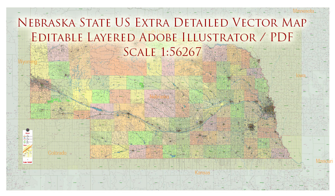
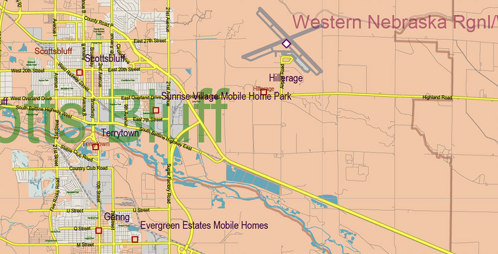
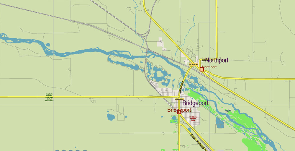
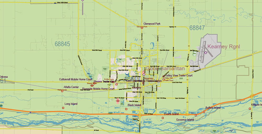
Nebraska Full State US Vector Map: Full Extra High Detailed (all roads, zipcodes, airports) + Admin Areas editable Adobe Illustrator in layers
Layers list:
- Legend
- Grids
- Labels of roads (numbers) – highways, interstate
- All Geonames (cities, towns, villages, hamlets, islands)
- Points of the Geonames (cities, towns, villages, hamlets, islands)
- Names places: Names of all Cities, towns, villages and hamlets
- Names of the Airports and Heliports
- Points of the Airports and Heliports
- Numbers of ZIP codes
- Names of objects (water, park, hospital)
- Names of States
- Names of Counties
- Names of the Main Streets
- Major Roads and Streets – Highways
- Minor Roads and residential streets
- Railroads
- State boundaries
- Water objects (rivers, lakes, ponds, swamps, reefs)
- Waterways
- Ground objects (urban areas, parks, hospitals, etc.)
- ZIP-codes areas
- Counties areas (colored)
- States areas
- Background
Nebraska Full State US Vector Map: Full Extra High Detailed (all roads, zipcodes, airports) + Admin Areas editable Adobe Illustrator in layers
Nebraska Full State US Vector Map: Full Extra High Detailed (all roads, zipcodes, airports) + Admin Areas editable Adobe Illustrator in layers
Nebraska Full State US Vector Map: Full Extra High Detailed (all roads, zipcodes, airports) + Admin Areas editable Adobe Illustrator in layers
Nebraska Full State US Vector Map: Full Extra High Detailed (all roads, zipcodes, airports) + Admin Areas editable Adobe Illustrator in layers
Nebraska Full State US Vector Map: Full Extra High Detailed (all roads, zipcodes, airports) + Admin Areas editable Adobe Illustrator in layers
Nebraska Full State US Vector Map: Full Extra High Detailed (all roads, zipcodes, airports) + Admin Areas editable Adobe Illustrator in layers
Nebraska Full State US Vector Map: Full Extra High Detailed (all roads, zipcodes, airports) + Admin Areas editable Adobe Illustrator in layers
Nebraska Full State US Vector Map: Full Extra High Detailed (all roads, zipcodes, airports) + Admin Areas editable Adobe Illustrator in layers
Nebraska Full State US Vector Map: Full Extra High Detailed (all roads, zipcodes, airports) + Admin Areas editable Adobe Illustrator in layers
Nebraska Full State US Vector Map: Full Extra High Detailed (all roads, zipcodes, airports) + Admin Areas editable Adobe Illustrator in layers
Nebraska Full State US Vector Map: Full Extra High Detailed (all roads, zipcodes, airports) + Admin Areas editable Adobe Illustrator in layers
Nebraska Full State US Vector Map: Full Extra High Detailed (all roads, zipcodes, airports) + Admin Areas editable Adobe Illustrator in layers
Nebraska Full State US Vector Map: Full Extra High Detailed (all roads, zipcodes, airports) + Admin Areas editable Adobe Illustrator in layers
Nebraska Full State US Vector Map: Full Extra High Detailed (all roads, zipcodes, airports) + Admin Areas editable Adobe Illustrator in layers
Nebraska Full State US Vector Map: Full Extra High Detailed (all roads, zipcodes, airports) + Admin Areas editable Adobe Illustrator in layers
Nebraska Full State US Vector Map: Full Extra High Detailed (all roads, zipcodes, airports) + Admin Areas editable Adobe Illustrator in layers
Nebraska Full State US Vector Map: Full Extra High Detailed (all roads, zipcodes, airports) + Admin Areas editable Adobe Illustrator in layers
Nebraska Full State US Vector Map: Full Extra High Detailed (all roads, zipcodes, airports) + Admin Areas editable Adobe Illustrator in layers
Nebraska Full State US Vector Map: Full Extra High Detailed (all roads, zipcodes, airports) + Admin Areas editable Adobe Illustrator in layers
Nebraska Full State US Vector Map: Full Extra High Detailed (all roads, zipcodes, airports) + Admin Areas editable Adobe Illustrator in layers
Nebraska Full State US Vector Map: Full Extra High Detailed (all roads, zipcodes, airports) + Admin Areas editable Adobe Illustrator in layers

 Author: Kirill Shrayber, Ph.D. FRGS


