Extended Description of the Vector Map
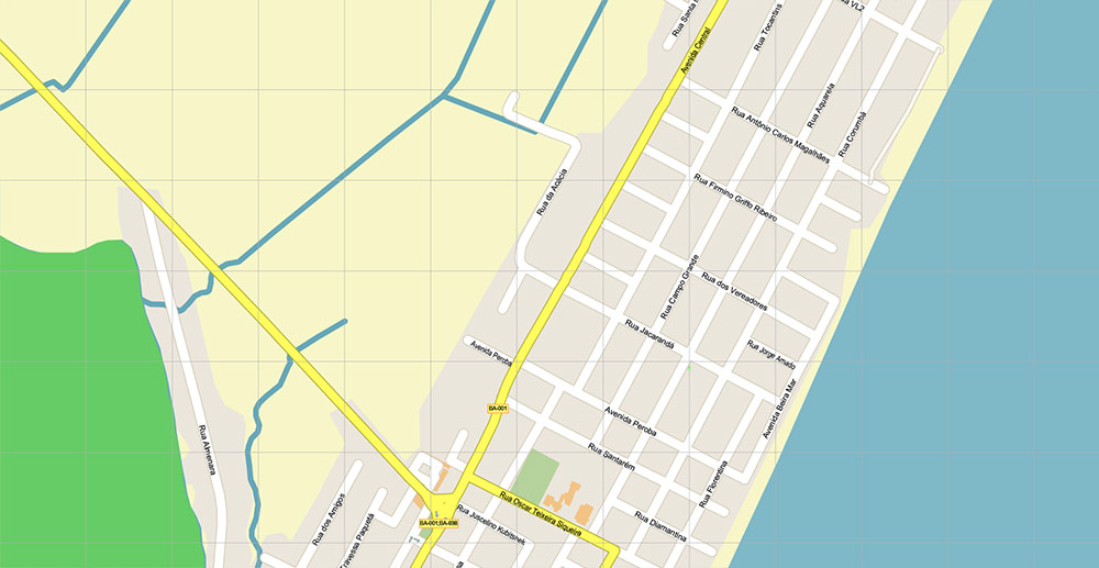
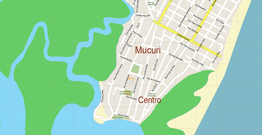
Printable PDF Vector Map of Mucuri Bahia Brazil High detailed street map scale 1:4465 fully editable Layered Adobe PDF scalable, text format all names, 2 MB ZIP
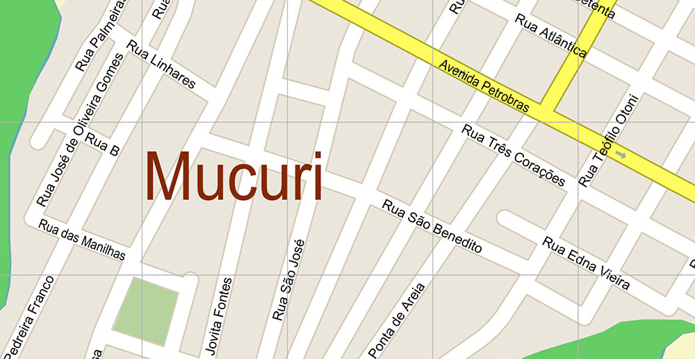
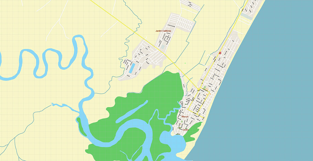
All street names, Main Objects, Buildings. Map for design, printing, arts, projects, presentations, for architects, designers, and builders, business, logistics.
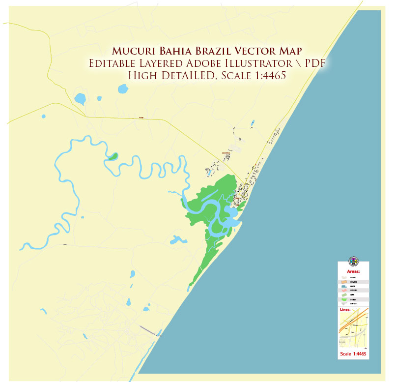
Mucuri Bahia Brazil PDF Map Vector Exact Plan High Detailed Street Map editable Adobe PDF in layers
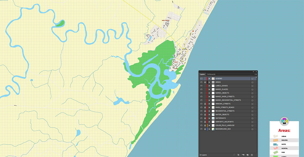
Layers list:
- Legend
- Names of places (city, hamlet, etc.)
- Names of objects (parks, hospital, water)
- Names of main streets
- Names of residential streets
- Main Streets, roads
- Residential streets
- Water objects (rivers, lakes, ponds)
- Waterways
- Airports Heliports
- Color fills (parks, land use, etc.)
- Background and Sea
The most exact and detailed map of the Mucuri Bahia Brazil in scale.
For Editing and High-Quality Printing
Mucuri Bahia Brazil PDF Map Vector Exact Plan High Detailed Street Map editable Adobe PDF in layers
AO BRIEF — Mucuri OVERVIEW
Small coastal town in the extreme south of Bahia, on the Atlantic shore near the Espírito Santo border. Low-rise urban fabric, fishing roots, seasonal tourism. Strategic value is coastal access, river mouth, and proximity to interstate corridors.
GEOGRAPHY & TERRAIN
-
Setting: Atlantic coast, mouth of the Mucuri River.
-
Relief: Flat to gently undulating coastal plain.
-
Biomes: Mangroves, restinga (coastal scrub), riverine wetlands.
-
Climate: Tropical humid; high temperatures year-round, heavy rains mainly Nov–Mar.
-
Hydrology: Estuarine environment; brackish zones affect mobility and infrastructure.
LINES OF COMMUNICATION (ROADS & ACCESS)
-
BR-101: Primary north–south artery linking Bahia ↔ Espírito Santo; main logistics spine.
-
Local connectors: Short urban roads linking river port areas, beaches, and residential quarters.
-
Sea access: Small craft, artisanal fishing; no deep-water port.
-
Air: Nearest regional airports outside AO (Teixeira de Freitas / Vitória corridor).
URBAN STRUCTURE
-
Compact town center near river/coast.
-
Low-density residential belts inland.
-
Informal shoreline activities (fishing, small tourism services).
-
Limited vertical development; visibility dominated by palms, low roofs.
HISTORY (CONDENSED)
-
Colonial era: River mouth used as minor anchorage and supply point.
-
19th–20th c.: Fishing, timber, cacao-related regional trade.
-
Late 20th c.: BR-101 integration increased mobility; gradual shift toward services and tourism.
-
Modern: Quiet peripheral town within Bahia’s southern coastal belt.
DEMOGRAPHY / HUMAN TERRAIN
-
Population: Small (tens of thousands).
-
Profile: Mixed Afro-Brazilian and coastal settler heritage.
-
Economy: Fishing, small commerce, services, seasonal tourism, public sector.
-
Social rhythm: Calm, slow-paced; influx during holidays.
-
Security: Generally low-intensity; standard urban caution.
KEY POINTS OF INTEREST
-
Beaches along Costa das Baleias.
-
Mangrove estuary zones (environmentally sensitive).
-
Riverfront fishing areas.
-
Small town squares and local markets.
HAZARDS & CONSTRAINTS
-
Flooding risk in estuarine lowlands during heavy rains.
-
Heat, humidity, insects year-round.
-
Limited medical and logistics capacity locally.
-
Soft ground in mangroves restricts heavy movement.
COMMAND TAKEAWAYS
-
Control BR-101 = control of regional access.
-
Estuary terrain favors light, mobile operations only.
-
Population is neutral–friendly; local knowledge matters.
-
Weather and hydrology are primary operational constraints.
-
Best suited for observation, coastal monitoring, or low-profile presence – not heavy staging.
Mucuri Bahia Brazil PDF Map Vector Exact Plan High Detailed Street Map editable Adobe PDF in layers
Mucuri Bahia Brazil PDF Map Vector Exact Plan High Detailed Street Map editable Adobe PDF in layers
Mucuri Bahia Brazil PDF Map Vector Exact Plan High Detailed Street Map editable Adobe PDF in layers
Mucuri Bahia Brazil PDF Map Vector Exact Plan High Detailed Street Map editable Adobe PDF in layers

 Author: Kirill Shrayber, Ph.D. FRGS