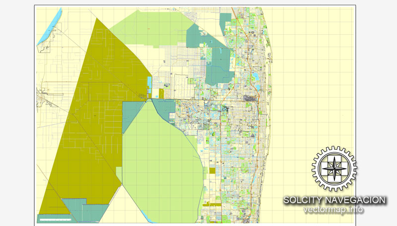
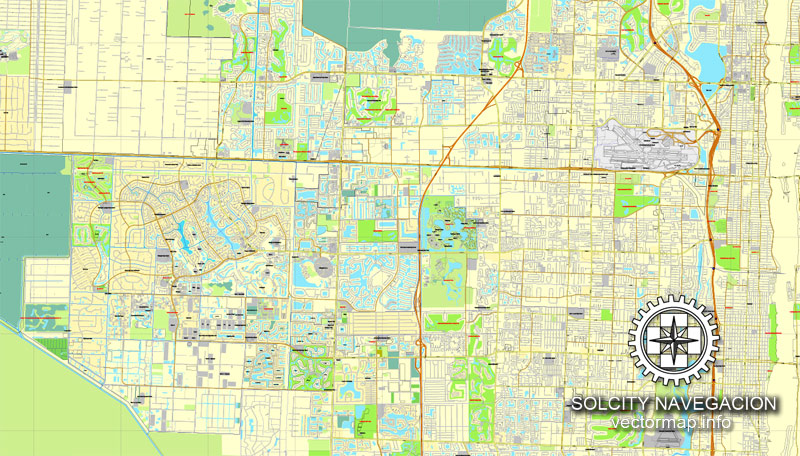
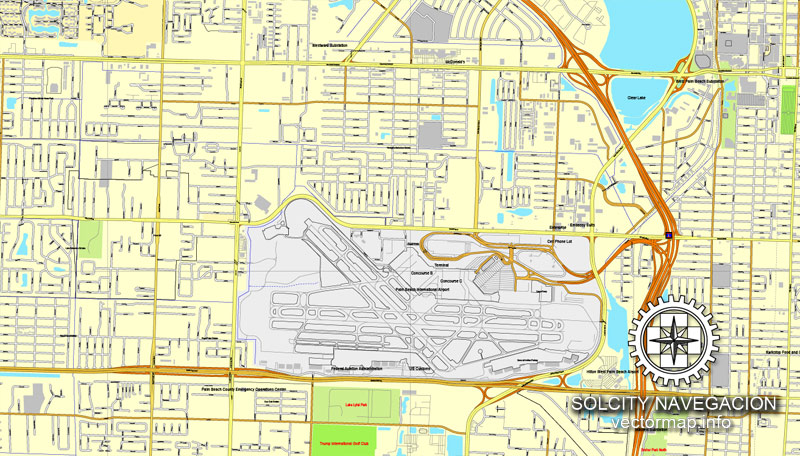
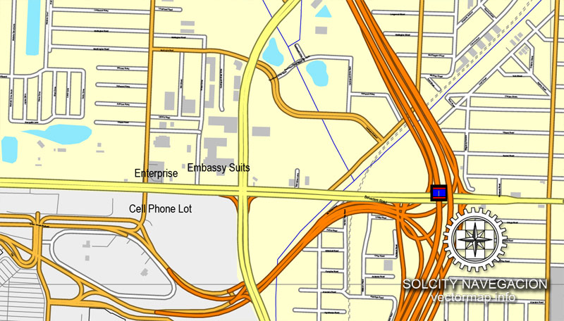
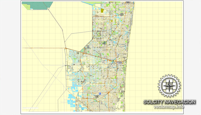
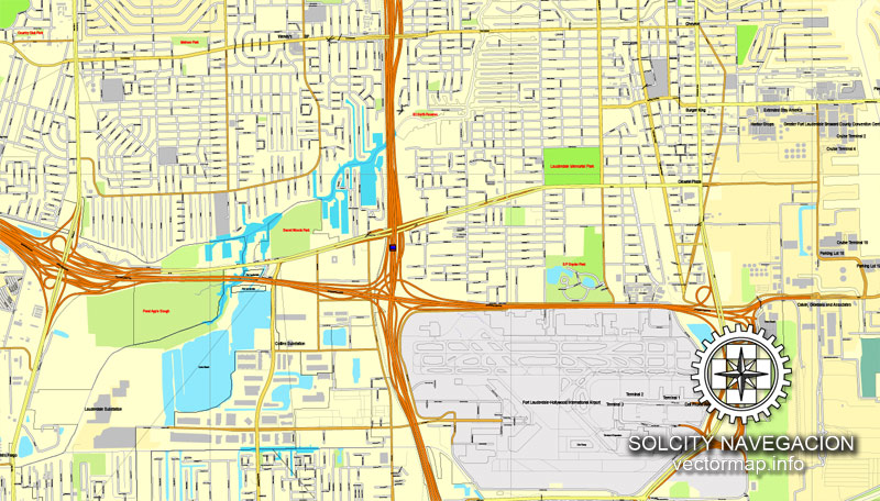
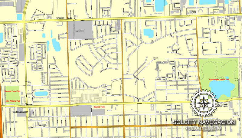
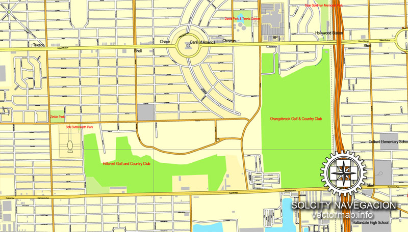
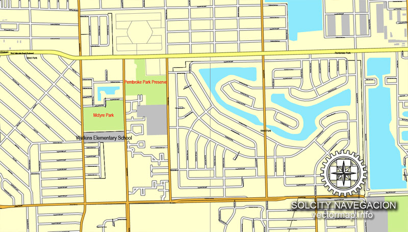
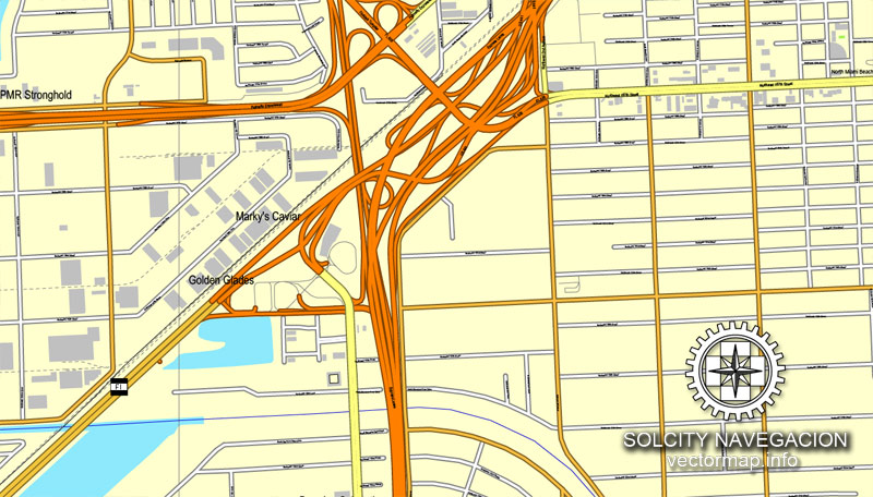
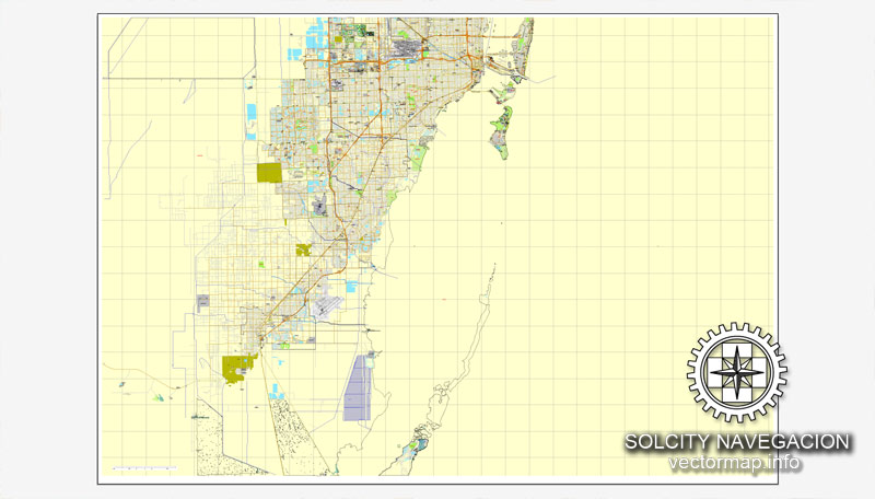
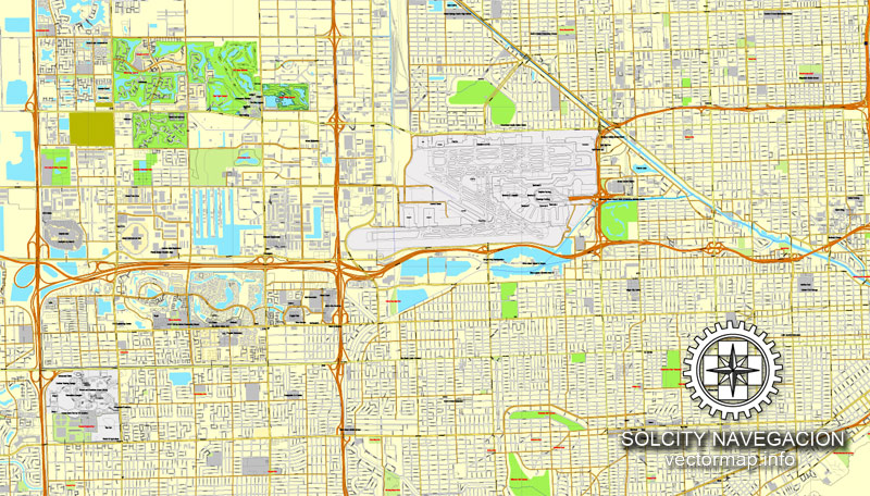
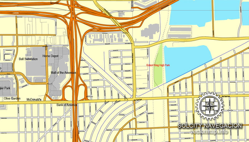
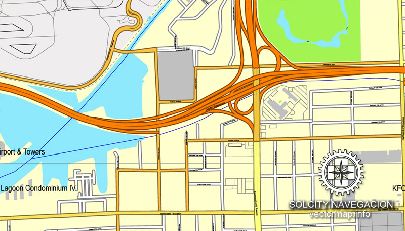
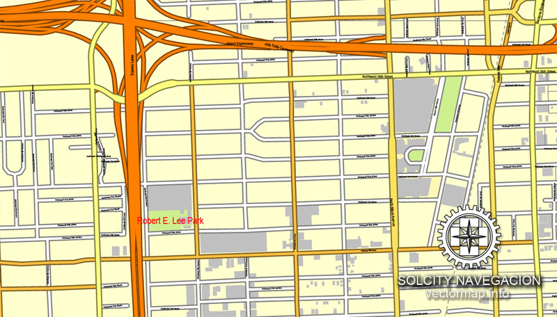
Miami, Florida, US printable vector street City Plan map 3 parts, full editable, Adobe Illustrator, full vector, scalable, editable, text format street names, 24,9 mb ZIP
All streets, All buildings. Map for design, print, arts, projects, presentations.
PDF, DXF, CDR and other formats – on request, same price, please, contact
Miami, Florida, USA.
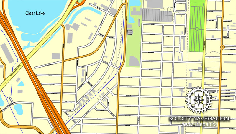
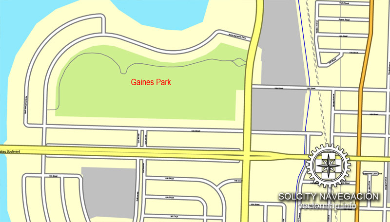
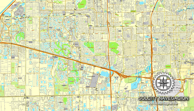
This vector map of Miami city is used as a basis for design, editing, and further printing.
This is the most detailed, exact map of Miami city for high-quality printing and polygraphy. You can always clarify the map development date by contacting us.
For your convenience, all objects on Miami vector city map are divided into layers. And the editing is very easy – colors, lines, etc.
You can easily add any objects needed (e.g. shops, salons, sale points, gas station or attraction) on any layer of Miami vector map.
Miami, officially the City of Miami, is the cultural, economic and financial center of South Florida. Miami is the seat of Miami-Dade County, the most populous county in Florida. The city covers an area of about 56.6 square miles (147 km2), between the Everglades to the west and Biscayne Bay on the east; it is also the sixth most densely populated major city in the United States. The Miami metropolitan area is home to 6.1 million people and the seventh-largest metropolitan area in the nation. Miami’s metro area is the second-most populous metropolis in the southeastern United States and fourth-largest urban area in the U.S.

One of the advantages of Miami city vector maps of our production is the relevance of cartographic data, we constantly update all our products.
This vector map of Miami city is used by:
designers, layout designers, printers, advertisers and architects. Our product – vector maps – is designed for further editing and printing in large formats – from @Wall format (a few meters) to A-0 and A-1, A-2, A-3.
Miami city map in vector format is used for design, urban planning, presentations and media visualizations.
Advertising and presentation map of Miami city (usually the final designer marks the routes, and puts the client’s objects (shops, saloons, gas stations etc.)
The undoubted advantage is that people will NEVER throw out this advertising product – the map. In fact, as an advertising medium, a city map is the most “long-playing” of the well-known polygraphic advertising media, with the longest lifespan, and the maximum number of interactions with the customer.
For travelers, maps are sold at the airports and gas stations around the world. Often the source is our vector maps.
Take a look, who purchases our vector maps of Miami city in “Our Clients and Friends” page – these are large and small companies, from super-brands like Volvo and Starbucks, to small design studios and printing houses.
It’s very easy to work with vector maps of Miami city, even for a not very experienced designer who can turn on and off the map layers, add new objects, change the colors of fill and lines according to customer requirements.
The undoubted advantage of Miami city vector maps in printing is an excellent and detailed visualization, when customer can expand a large paper map and instantly define his location, find a landmark, an object or address on map, unlike using the popular electronic formats of Google and Yandex maps for example.
Printable vector maps of Miami city are much more convenient and efficient than any electronic maps on your smartphone, because ALL DETAILS are displayed in the entire space of Miami city map.
Useful tips on working with vector maps of cities and countries in Adobe Illustrator.
«V» – launches the Selection tool (cursor, black arrow), which makes active any vector line.
«А» – launches the Direct Selection tool (white cursor), allows you to select curve elements and drag them to the desired place.
«R» – activates the Rotate tool, which helps you rotating selected objects around the center point by 360 degrees.
«E» – gives you the opportunity to use the Eraser tool and erase unnecessary parts.
«X» – switches between Fill and Stroke in the Tools section. Try to get used to this hot key and
you will quickly understand that you can’t live and work without it.
Guides are not limited to vertical and horizontal in Adobe Illustrator. You can also create a diagonal guide for example. Moreover, you can turn any contours into guides. Select the outline and go to View > Guides > Make Guides (Create Guides), or simply press Cmd/Ctrl + 5. You can also turn the guides back into an editable object. Go to menu, View > Guides > Unlock Guides (Release Guides), select the guide you want to edit and select View > Guides > Release Guides (Reset Guides), or just press Cmd/Ctrl + Option / Alt + 5).
You will probably want to change the color scheme used on our Miami vector city map.
To quickly and effectively play with colors.
Of course, you can do it manually, all objects in our Miami city vector map are divided according to types and layers, and you can easily change the color gamma of vector objects in groups and layers.
But there is more effective way of working with the whole VECTOR MAP of Miami city and all layers:
The overview dialog «Edit colors»/«Repaint Graphic Object» (this dialog box name can change depending on the context):
If you have selected a part or a layer of Miami city vector map and open the dialog box by clicking the icon in the Control panel, on the Samples palette or the Color Catalog, or if you choose Edit > Edit Colors> Repaint Graphic Object, then the «Repaint Graphic Object» dialog box appears, and you get access to «Assign» and «Edit» tabs.
If a picture or a map fragment is not selected, and you open the dialog box by clicking the icon in the Control panel, on the Samples palette or in the Color Catalog, the «Edit Colors» dialog box appears and you can only access the «Edit» tab.
Regardless of the name at the top of the dialog box, the right-hand side always displays the color group of the current document, as well as two default color groups: Print Color and Grayscale. These color groups can be selected and used any time.
Create and edit color groups of Miami city vector map, and also assign colors using the «Edit Colors»/ а «Repaint Graphic Object» dialog box.
A. Creating and editing of a color group on the «Edit» tab
B. Assigning colors on the «Assign» tab
C. Select a group of colors from the «Color groups» list
The option «Repaint a graphic object» in the lower part of the dialog box allows you to preview the colors on a selected layer of Vector map, or a group of elements, and specify whether its colors will be redefined when the dialog box is closed.
The main areas of the dialog box are:
«Edit»
The «Edit» tab is designed to create a new or edit the existing color groups.
The harmony rules Menu and the Color Wheel are used to conduct experiments with color harmonies. The color wheel shows how colors are related in color harmony, and the color bars allow you to view and manipulate an individual color values. In addition, you can adjust the brightness, add and remove colors, save color groups and view colors on the selected Vector Map of Miami city or a separated layers.
«Assign»
The «Assign» tab is used to view and control on how the original colors are replaced with colors from the color group like your corporate colors in the Vector Map of Miami city.
The assign color ability is provided only if the entire map, layer or fragment is selected in the document. You can specify which of new colors replace the current colors, whether the spot colors should be preserved and how colors are replaced (for example, you can replace colors completely or changing the color tone while maintaining the brightness). The «Assign» tab allows you to redefine colors in the Vector Map of Miami city, or in separate layers and fragments using the current color group or reducing the number of colors in the current Vector Map.
Color groups
Is a list of all saved color groups for current document (the same groups appear in the «Samples» palette). You can edit and delete the existing color groups, as well as creating a new ones using the list of “Color Groups” in the dialog box. All changes appear in the «Samples» palette.
The highlighted color group shows, which color group is currently edited.
Any color group can be selected and edited, or used to redefine the colors in the selected vector map of Miami city, its fragments or elements.
Saving a color group adds this group to the specified list.
Opening the «Edit Colors»/«Repaint Graphic Object» dialog box.
Open the «Edit Colors»/«Repaint Graphic Object» dialog box using one of the following methods:
«Edit»> «Edit Colors»> «Repaint Graphic object» or «Repaint With Style».
Use these commands if you need to edit the colors in the selected vector map of Miami city.
«Repaint Graphic object» button on the «Control» panel.
Use this button if you need to adjust colors of Miami city vector map using the а «Repaint graphic object» dialog box.
The specified button is available if the selected vector map or its fragment contains two or more colors.
Note. This color editing method is convenient for global color adjustment in a vector map, if global colors were not used when creating a City Map of Miami.
Miami is a major center, and a leader in finance, commerce, culture, media, entertainment, the arts, and international trade. The Miami Metropolitan Area is by far the largest urban economy in Florida and the 12th largest in the United States with a GDP of $344.9 billion as of 2017. In 2012, Miami was classified as an “Alpha−” level world city in the World Cities Study Group’s inventory. In 2010, Miami ranked seventh in the United States and 33rd among global cities in terms of business activity, human capital, information exchange, cultural experience, and political engagement. In 2008, Forbes magazine ranked Miami “America’s Cleanest City”, for its year-round good air quality, vast green spaces, clean drinking water, clean streets, and citywide recycling programs. According to a 2009 UBS study of 73 world cities, Miami was ranked as the richest city in the United States, and the world’s seventh-richest city in terms of purchasing power. Miami is nicknamed the “Capital of Latin America” and is the largest city with a Cuban-American plurality.
The «Edit colors» button or «Edit or apply colors» on the «Color Catalog» palette
Click this button if you need to edit colors on the «Color Catalog» palette or edit and then apply them to the selected Vector Map of Miami city or its fragment.
The «Edit color group» button or «Edit or apply color group» on the «Samples» palette.
Click this button if you need to edit the colors in the specific color group or edit and apply them to the selected Vector Map of Miami city or a group of its elements, for example, the whole layer “Streets and lines”. You can also double-click the color group in the Samples panel to open the dialog box.
If the map file is too large and your computer freezes or even can’t open it quickly:
1. Try to reduce the color resolution of the video card (display) to 256 colors while working with a large map.
2. Using Windows Task Manager, select all the application you don’t need, while working with map, just turn them off.
3. Launch Adobe Illustrator. (DO NOT OPEN the vector map file)
4. Start the Windows Task Manager using administrator rights > Find the “Illustrator” process > set the «real time» priority,
5. Open the file. When you see the LEGACY FONT popup window – click “OK” (do not update). You can restore the TEXT later.
6. Can also be useful: When file is opened – Edit > Settings > Basic Settings > disable smoothing. /// It looks scary, but works quickly)))
We recommend saving the file in Adobe Illustrator 10 version. It’s much more stable when working with VERY BIG size files.
Greater Downtown Miami has one of the largest concentrations of international banks in the United States, and is home to many large national and international companies. The Civic Center is a major center for hospitals, research institutes, medical centers, and biotechnology industries. For more than two decades, the Port of Miami, known as the “Cruise Capital of the World”, has been the number one cruise passenger port in the world. It accommodates some of the world’s largest cruise ships and operations, and is the busiest port in both passenger traffic and cruise lines. Metropolitan Miami is also a major tourism hub in the southeastern U.S. for international visitors, ranking number two in the country after New York City.
Geography
Miami and its suburbs are located on a broad plain between the Florida Everglades to the west and Biscayne Bay to the east, which also extends from Florida Bay north to Lake Okeechobee. The elevation of the area never rises above 40 ft (12 m) and averages at around 6 ft (1.8 m) above mean sea level in most neighborhoods, especially near the coast. The highest undulations are found along the coastal Miami Rock Ridge, whose substrate underlies most of the eastern Miami metropolitan region. The main portion of the city lies on the shores of Biscayne Bay which contains several hundred natural and artificially created barrier islands, the largest of which contains Miami Beach and South Beach. The Gulf Stream, a warm ocean current, runs northward just 15 miles (24 km) off the coast, allowing the city’s climate to stay warm and mild all year.
Miami is split into many different sections, roughly into North, South, West and Downtown. The heart of the city is Downtown Miami and is technically on the eastern side of the city. This area includes Brickell, Virginia Key, Watson Island, and PortMiami. Downtown is South Florida’s central business district, and Florida’s largest and most influential central business district. Downtown has the largest concentration of international banks in the U.S. along Brickell Avenue. Downtown is home to many major banks, courthouses, financial headquarters, cultural and tourist attractions, schools, parks and a large residential population. East of Downtown, across Biscayne Bay is South Beach. Just northwest of Downtown, is the Civic Center, which is Miami’s center for hospitals, research institutes and biotechnology with hospitals such as Jackson Memorial Hospital, Miami VA Hospital, and the University of Miami’s Leonard M. Miller School of Medicine.
The southern side of Miami includes Coral Way, The Roads and Coconut Grove. Coral Way is a historic residential neighborhood built in 1922 connecting Downtown with Coral Gables, and is home to many old homes and tree-lined streets. Coconut Grove was established in 1825 and is the location of Miami’s City Hall in Dinner Key, the Coconut Grove Playhouse, CocoWalk, many nightclubs, bars, restaurants and bohemian shops, and as such, is very popular with local college students. It is a historic neighborhood with narrow, winding roads, and a heavy tree canopy. Coconut Grove has many parks and gardens such as Villa Vizcaya, The Kampong, The Barnacle Historic State Park, and is the home of the Coconut Grove Convention Center and numerous historic homes and estates.
The western side of Miami includes Little Havana, West Flagler, and Flagami, and is home to many of the city’s traditionally immigrant neighborhoods. Although at one time a mostly Jewish neighborhood, today western Miami is home to immigrants from mostly Central America and Cuba, while the west central neighborhood of Allapattah is a multicultural community of many ethnicities.
The northern side of Miami includes Midtown, a district with a great mix of diversity with many West Indians, Hispanics, European Americans, bohemians, and artists. Edgewater, and Wynwood, are neighborhoods of Midtown and are made up mostly of high-rise residential towers and are home to the Adrienne Arsht Center for the Performing Arts. The wealthier residents usually live in the northeastern part, in Midtown, the Design District, and the Upper East Side, with many sought after 1920s homes and home of the MiMo Historic District, a style of architecture originated in Miami in the 1950s. The northern side of Miami also has notable African American and Caribbean immigrant communities such as Little Haiti, Overtown (home of the Lyric Theater), and Liberty City.
Small guide: How to work with the vector map?
You can: Mass select objects by type and color – for example, the objects type “building” (they are usually dark gray) – and remove them from the map, if you do not need them in your print or design project. You can also easily change the thickness of lines (streets), just bulk selection the road by the line color.
The streets are separated by type, for example, type “residential road” are usually white with a gray stroke. Highway usually orange with a brown or dark gray stroke.
It is easy to change the font of inscriptions, all or each individually. Also, just can be make and any other manipulation of objects on the vector map in Adobe illustrator format.
Important: All the proportions on the map are true, that is, the relative sizes of the objects are true, because Map is based on an accurate GPS projection, and It transated into the (usual for all) the Mercator projection.
You can easily change the color, stroke and fill of any object on the map, zoom without loss of quality Image Verification.
Select object

Bulk selection the same objects on the vector map

See the bulk selected objects on the vector map

Bulk delete buildungs from the vector map

Select residencial road (small street) on the vector map

Bulk selection the same lines (streets, roads) on the full map

Create fat lines of the streets on the vector maps (bulk action) 1

Create fat lines of the streets on the vector maps (bulk action) 2

Create fat lines of the streets on the vector maps (bulk action) 3

You can easily change the color, stroke and fill of any object on the map, zoom without loss of quality Image Verification.

 Author: Kirill Shrayber, Ph.D. FRGS


