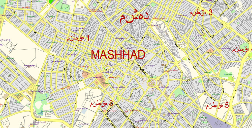
Printable PDF Vector Map of Mashhad Iran Farci / Ehglish Low detailed City Plan scale 1:60573 full editable Adobe PDF Street Map in layers for small print size, scalable, editable text format all names, 7 mb ZIP
English / Farci Principal streets names, Main Objects, Buildings. Map for design, printing, arts, projects, presentations, for architects, designers and builders, business, logistics.
Layers: color_fills, streets_roads, labels_roads, names_objects, names_streets, names_places, grids, legend.
The most exact and detailed map of the city in scale.
For High Quality Printing small size
DWG, DXF and other formats – on request, same price, please, contact.

Mashhad is the second most populous city in Iran and the capital of Razavi Khorasan Province. It is located in the northeast of the country, near the borders with Turkmenistan and Afghanistan.
One of the advantages of Mashhad city vector maps of our production is the relevance of cartographic data, we constantly update all our products.
This vector map of Mashhad city is used by:
designers, layout designers, printers, advertisers and architects. Our product – vector maps – is designed for further editing and printing in large formats – from @Wall format (a few meters) to A-0 and A-1, A-2, A-3.
The Mashhad city map in vector format is used for design, urban planning, presentations and media visualizations.
It has a population of 3,001,184 inhabitants (2016 census), which includes the areas of Mashhad Taman and Torqabeh. It was a major oasis along the ancient Silk Road connecting with Merv to the east.
The specified button is available if the selected vector map or its fragment contains two or more colors.
Note. This color editing method is convenient for global color adjustment in a vector map, if global colors were not used when creating a City Map of Mashhad.
The «Edit colors» button or «Edit or apply colors» on the «Color Catalog» palette
Click this button if you need to edit colors on the «Color Catalog» palette or edit and then apply them to the selected Vector Map of Mashhad city or its fragment.
The «Edit color group» button or «Edit or apply color group» on the «Samples» palette.
Click this button if you need to edit the colors in the specific color group or edit and apply them to the selected Vector Map of Mashhad city or a group of its elements, for example, the whole layer “Streets and lines”. You can also double-click the color group in the Samples panel to open the dialog box.
If the map file is too large and your computer freezes or even can’t open it quickly:
1. Try to reduce the color resolution of the video card (display) to 256 colors while working with a large map.
2. Using Windows Task Manager, select all the application you don’t need, while working with map, just turn them off.
3. Launch Adobe Illustrator. (DO NOT OPEN the vector map file)
4. Start the Windows Task Manager using administrator rights > Find the “Illustrator” process > set the «real time» priority,
5. Open the file. When you see the LEGACY FONT popup window – click “OK” (do not update). You can restore the TEXT later.
6. Can also be useful: When file is opened – Edit > Settings > Basic Settings > disable smoothing. /// It looks scary, but works quickly)))
We recommend saving the file in Adobe Illustrator 10 version. It’s much more stable when working with VERY BIG size files.
The city is named after the “shrine” of Imam Reza, the eighth Shia Imam. The Imam was buried in a village in Khorasan, which afterwards gained the name Mashhad, meaning the place of martyrdom.
Useful tips on working with vector maps of cities and countries in Adobe Illustrator.
«V» – launches the Selection tool (cursor, black arrow), which makes active any vector line.
«А» – launches the Direct Selection tool (white cursor), allows you to select curve elements and drag them to the desired place.
«R» – activates the Rotate tool, which helps you rotating selected objects around the center point by 360 degrees.
«E» – gives you the opportunity to use the Eraser tool and erase unnecessary parts.
«X» – switches between Fill and Stroke in the Tools section. Try to get used to this hot key and
you will quickly understand that you can’t live and work without it.
Guides are not limited to vertical and horizontal in Adobe Illustrator. You can also create a diagonal guide for example. Moreover, you can turn any contours into guides. Select the outline and go to View > Guides > Make Guides (Create Guides), or simply press Cmd/Ctrl + 5. You can also turn the guides back into an editable object. Go to menu, View > Guides > Unlock Guides (Release Guides), select the guide you want to edit and select View > Guides > Release Guides (Reset Guides), or just press Cmd/Ctrl + Option / Alt + 5).
Every year, millions of pilgrims visit the Imam Reza shrine. The Abbasid caliph Harun al-Rashid is also buried within the shrine.
Color groups
Is a list of all saved color groups for current document (the same groups appear in the «Samples» palette). You can edit and delete the existing color groups, as well as creating a new ones using the list of “Color Groups” in the dialog box. All changes appear in the «Samples» palette.
The highlighted color group shows, which color group is currently edited. Any color group can be selected and edited, or used to redefine the colors in the selected vector map of Mashhad city, its fragments or elements.
Saving a color group adds this group to the specified list.
Opening the «Edit Colors»/«Repaint Graphic Object» dialog box.
Open the «Edit Colors»/«Repaint Graphic Object» dialog box using one of the following methods:
«Edit»> «Edit Colors»> «Repaint Graphic object» or «Repaint With Style».
Use these commands if you need to edit the colors in the selected vector map of Mashhad city.
«Repaint Graphic object» button on the «Control» panel.
Use this button if you need to adjust colors of Mashhad city vector map using the а «Repaint graphic object» dialog box.
Mashhad has been governed by different ethnic groups over the course of its history. The city enjoyed relative prosperity in the Mongol period.
If a picture or a map fragment is not selected, and you open the dialog box by clicking the icon in the Control panel, on the Samples palette or in the Color Catalog, the «Edit Colors» dialog box appears and you can only access the «Edit» tab.
Regardless of the name at the top of the dialog box, the right-hand side always displays the color group of the current document, as well as two default color groups: Print Color and Grayscale. These color groups can be selected and used any time.
Create and edit color groups of Mashhad city vector map, and also assign colors using the «Edit Colors»/ а «Repaint Graphic Object» dialog box.
A. Creating and editing of a color group on the «Edit» tab
B. Assigning colors on the «Assign» tab
C. Select a group of colors from the «Color groups» list
The option «Repaint a graphic object» in the lower part of the dialog box allows you to preview the colors on a selected layer of Vector map, or a group of elements, and specify whether its colors will be redefined when the dialog box is closed.
Mashhad is also known colloquially as the city of Ferdowsi, after the Iranian poet who composed the Shahnameh. The city is the hometown of some of the most significant Iranian literary figures and artists, such as the poet Mehdi Akhavan-Sales, and Mohammad-Reza Shajarian, the traditional Iranian singer and composer. Ferdowsi and Akhavan Sales are both buried in Tus, an ancient city that is considered to be the main origin of the current city of Mashhad.
On 30 October 2009 (the anniversary of the death of Imam Reza), Iran’s then-President Mahmoud Ahmadinejad declared Mashhad to be “Iran’s spiritual capital”.
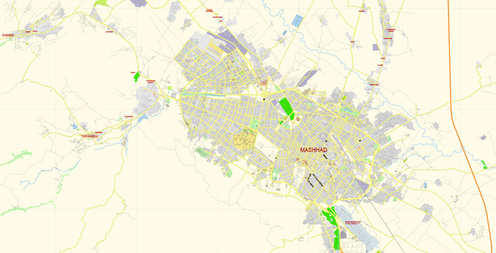
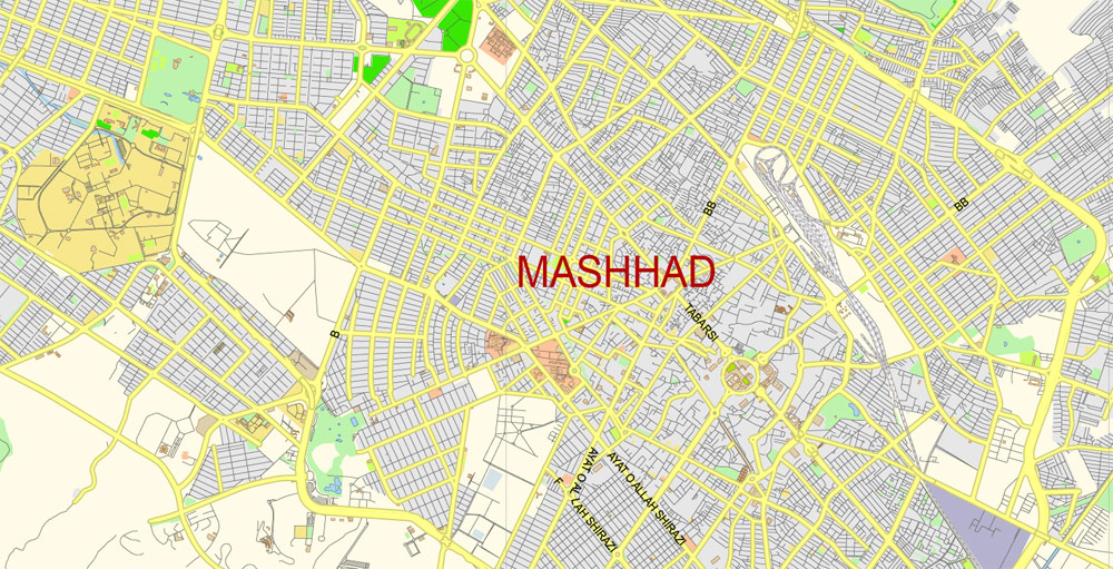
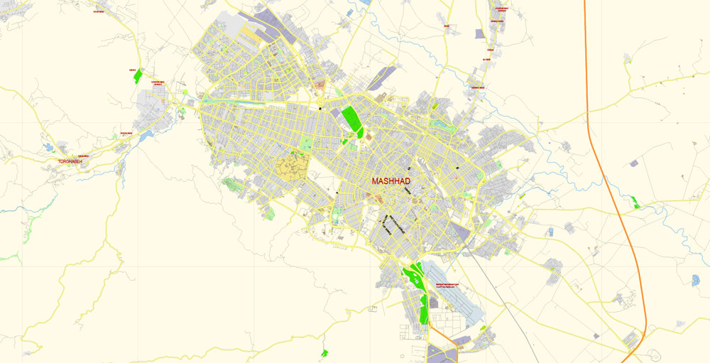
This vector map of Mashhad city is used as a basis for design, editing, and further printing.
This is the most detailed, exact map of Mashhad city for high-quality printing and polygraphy. You can always clarify the map development date by contacting us.
For your convenience, all objects on Mashhad vector city map are divided into layers, and the editing is very easy – colors, lines, etc.
You can easily add any objects needed (e.g. shops, salons, sale points, gas station or attraction) on any layer of Mashhad vector map.
Geography
The city is located at 36.20º North latitude and 59.35º East longitude, in the valley of the Kashafrud River near Turkmenistan, between the two mountain ranges of Binalood and Hezar Masjed Mountains.
The advertising and presentation map of Mashhad city (usually the final designer marks the routes, and puts the client’s objects (shops, saloons, gas stations etc.)
The undoubted advantage is that people will NEVER throw out this advertising product – the map. In fact, as an advertising medium, a city map is the most “long-playing” of the well-known polygraphic advertising media, with the longest lifespan, and the maximum number of interactions with the customer.
For travelers, maps are sold at the airports and gas stations around the world. Often the source is our vector maps.
Take a look, who purchases our vector maps of Mashhad city in “Our Clients and Friends” page – these are large and small companies, from super-brands like Volvo and Starbucks, to small design studios and printing houses.
It’s very easy to work with vector maps of Mashhad city, even for a not very experienced designer who can turn on and off the map layers, add new objects, change the colors of fill and lines according to customer requirements.
The city benefits from the proximity of the mountains, having cool winters, pleasant springs, mild summers, and beautiful autumns. It is only about 250 km (160 mi) from Ashgabat, Turkmenistan.
The city is the administrative center of Mashhad County (or the Shahrestan of Mashhad) as well as the somewhat smaller district (Bakhsh) of Mashhad.
The undoubted advantage of Mashhad city vector maps in printing is an excellent and detailed visualization, when customer can expand a large paper map and instantly define his location, find a landmark, an object or address on map, unlike using the popular electronic formats of Google and Yandex maps for example.
Printable vector maps of Mashhad city is much more convenient and efficient than any electronic maps on your smartphone, because ALL DETAILS are displayed in the entire space of Mashhad city map.
The city itself, excluding parts of the surrounding Bakhsh and Shahrestan, is divided into 13 smaller administrative units, with a total population of more than 3 million.
You will probably want to change the color scheme used on our Mashhad vector city map.
To quickly and effectively play with colors.
Of course, you can do it manually, all objects in our Mashhad city vector map are divided according to types and layers, and you can easily change the color gamma of vector objects in groups and layers.
But there is more effective way of working with the whole VECTOR MAP of Mashhad city and all layers:
The overview dialog «Edit colors»/«Repaint Graphic Object» (this dialog box name can change depending on the context):
If you have selected a part or a layer of Mashhad city vector map and open the dialog box by clicking the icon in the Control panel, on the Samples palette or the Color Catalog, or if you choose Edit > Edit Colors> Repaint Graphic Object, then the «Repaint Graphic Object» dialog box appears, and you get access to «Assign» and «Edit» tabs.
The main areas of the dialog box are:
«Edit»
The «Edit» tab is designed to create a new or edit the existing color groups.
The harmony rules Menu and the Color Wheel are used to conduct experiments with color harmonies. The color wheel shows how colors are related in color harmony, and the color bars allow you to view and manipulate an individual color values. In addition, you can adjust the brightness, add and remove colors, save color groups and view colors on the selected Vector Map of Mashhad city or a separated layers.
Assign
The «Assign» tab is used to view and control on how the original colors are replaced with colors from the color group like your corporate colors in the Vector Map of Mashhad city.
The assign color ability is provided only if the entire map, layer or fragment is selected in the document. You can specify which of new colors replace the current colors, whether the spot colors should be preserved and how colors are replaced (for example, you can replace colors completely or changing the color tone while maintaining the brightness). The «Assign» tab allows you to redefine colors in the Vector Map of Mashhad city, or in separate layers and fragments using the current color group or reducing the number of colors in the current Vector Map.
Mashhad
City in Iran
Mashhad is a city in northeast Iran, known as a place of religious pilgrimage. It’s centered on the vast Holy Shrine of Imam Reza, with golden domes and minarets that are floodlit at night. The circular complex also contains the tomb of Lebanese scholar Sheikh Bahai, plus the 15th-century, tile-fronted Goharshad Mosque, with a turquoise dome. Museums within the shrine include the Carpet Museum, with many rare pieces.
Area
• City 328 km2 (127 sq mi)
Elevation 995 m (3,264 ft)
Population
• Urban 3,114,688
• Metro 3,372,660
• Population Rank in Iran 2nd
Over 25 million pilgrims and tourists per year
Free vector map World, Adobe Illustrator, download now maps vector clipart
Map for design, projects, presentation free to use as you like.
See also: TERMS & CONDITIONS: SOFTWARE LICENSE AGREEMENT FOR DIGITAL CARTOGRAPHIC DATA.

 Author: Kirill Shrayber, Ph.D. FRGS