Extended Description of the Vector Map
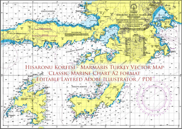
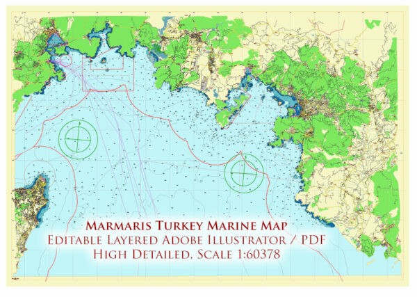
Printable Marmaris Turkey area West Part Marine Chart PDF Vector Map, exact high detailed editable layered for print 420×594 mm, Adobe PDF scalable, editable, curves format all names, Mercator projection, 5 MB ZIP
Correct shorelines, depth points
Map for Marine Navigation, design, printing, arts, projects, presentations, for architects, designers, and builders, business, logistics.
The most exact and detailed Marine Map Marmaris West area Turkey
Map for editing and High-Quality Printing

Marmaris area Marine chart West Part Turkey PDF Vector Map high detailed editable layered Adobe PDF
Layers list:
- Legend
- Grids
- Names Objects
- Names Places
- Lighthouses and Marinas
- Main Streets and Roads
- Residential roads and streets
- Course lines
- Isobaths
- Depth points (meters)
- Marine restricted areas
- Marine objects (areas)
- Waterways
- Main Land area
- Islands areas
- Rocks
- Sea
- Background

Marmaris area Marine chart West Part Turkey PDF Vector Map high detailed editable layered Adobe PDF
Marmaris, located in southwestern Turkey, is a stunning coastal area renowned for its turquoise seas, dramatic coastline, and natural beauty. Here’s a detailed description of the Marmaris region’s marine features:
1. Bays
The Marmaris coastline is dotted with picturesque bays, offering secluded spots and beautiful vistas:
- Turunç Bay: A tranquil bay surrounded by pine forests and clear blue waters, perfect for swimming and snorkeling.
- Kumlubük Bay: Famous for its sandy beaches and calm waters, ideal for relaxation and water sports.
- Hisarönü Bay: Known for its unspoiled beauty, this bay offers opportunities for sailing and enjoying pristine nature.
- Bozburun Bay: Popular for its crystal-clear waters and traditional boat-building culture.
2. Islands
The Marmaris region has several small islands, each with unique charm:
- Sedir Island (Cleopatra Island): Famous for its historical ruins and unique golden sands, said to have been imported by Cleopatra herself.
- Bedir Island: A serene destination for boat trips, offering quiet beaches and scenic views.
- Yassica Islands: A group of small, uninhabited islands with shallow waters, ideal for swimming and picnicking.
3. Harbors
Marmaris is a hub for maritime activities, with well-developed harbors:
- Marmaris Marina: One of the largest and most modern marinas in Turkey, accommodating luxury yachts and providing excellent facilities for sailors.
- Netsel Marina: Centrally located, this marina is a bustling spot with shops, restaurants, and easy access to the town.
- Bozburun Harbor: Known for its peaceful atmosphere and local boat-building tradition.
4. Sea Characteristics
- Turquoise Coastline: The waters around Marmaris are famously clear, with shades of blue and green reflecting the surrounding forests and hills.
- Calm Waters: Especially during summer, the sea is calm, making it perfect for boating and water sports.
- Underwater World: The area is popular for diving and snorkeling, with vibrant marine life, underwater caves, and shipwrecks.
5. Boating and Yacht Tourism
The Marmaris area is a sailing paradise, with countless routes and stops:
- Blue Cruises: Popular multi-day tours take travelers around the bays and islands, offering a mix of adventure and relaxation.
- Gulets: Traditional wooden boats often used for these cruises, providing an authentic experience.
- International Connections: Marmaris’s location makes it a gateway to nearby Greek islands like Rhodes, easily accessible by ferry.
6. Notable Attractions
- Ekincik Bay: A favorite among sailors for its quiet coves and access to the Dalyan River, which leads to ancient ruins and famous Iztuzu Beach.
- Serçe Limanı: A natural harbor with historical shipwrecks and unspoiled nature.
- Knidos: Located on the Datça Peninsula, this ancient site combines historical ruins with spectacular sea views.
Marmaris’s diverse marine environment makes it a perfect destination for travelers seeking adventure, tranquility, and natural beauty by the sea.

Marmaris area Marine chart West Part Turkey PDF Vector Map high detailed editable layered Adobe PDF

Marmaris area Marine chart West Part Turkey PDF Vector Map high detailed editable layered Adobe PDF

Marmaris area Marine chart West Part Turkey PDF Vector Map high detailed editable layered Adobe PDF

Marmaris area Marine chart West Part Turkey PDF Vector Map high detailed editable layered Adobe PDF

Marmaris area Marine chart West Part Turkey PDF Vector Map high detailed editable layered Adobe PDF

Marmaris area Marine chart West Part Turkey PDF Vector Map high detailed editable layered Adobe PDF

Marmaris area Marine chart West Part Turkey PDF Vector Map high detailed editable layered Adobe PDF

Marmaris area Marine chart West Part Turkey PDF Vector Map high detailed editable layered Adobe PDF

Marmaris area Marine chart West Part Turkey PDF Vector Map high detailed editable layered Adobe PDF

Marmaris area Marine chart West Part Turkey PDF Vector Map high detailed editable layered Adobe PDF

Marmaris area Marine chart West Part Turkey PDF Vector Map high detailed editable layered Adobe PDF

Marmaris area Marine chart West Part Turkey PDF Vector Map high detailed editable layered Adobe PDF


 Author: Kirill Shrayber, Ph.D. FRGS
