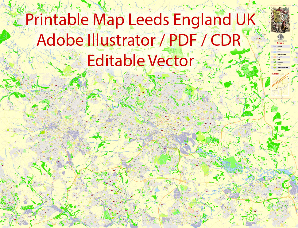
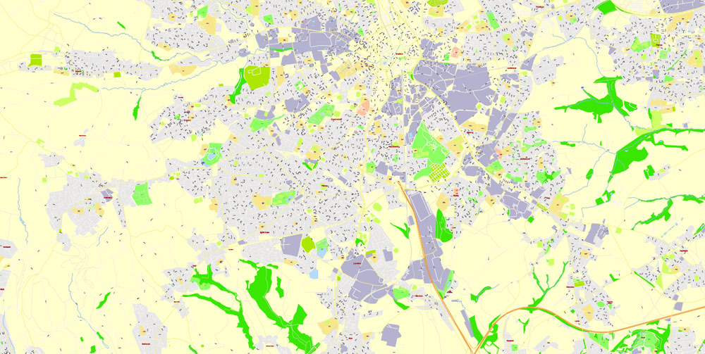
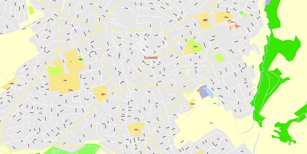
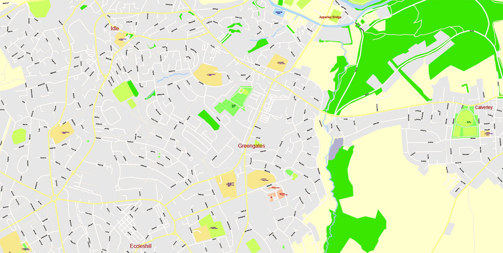
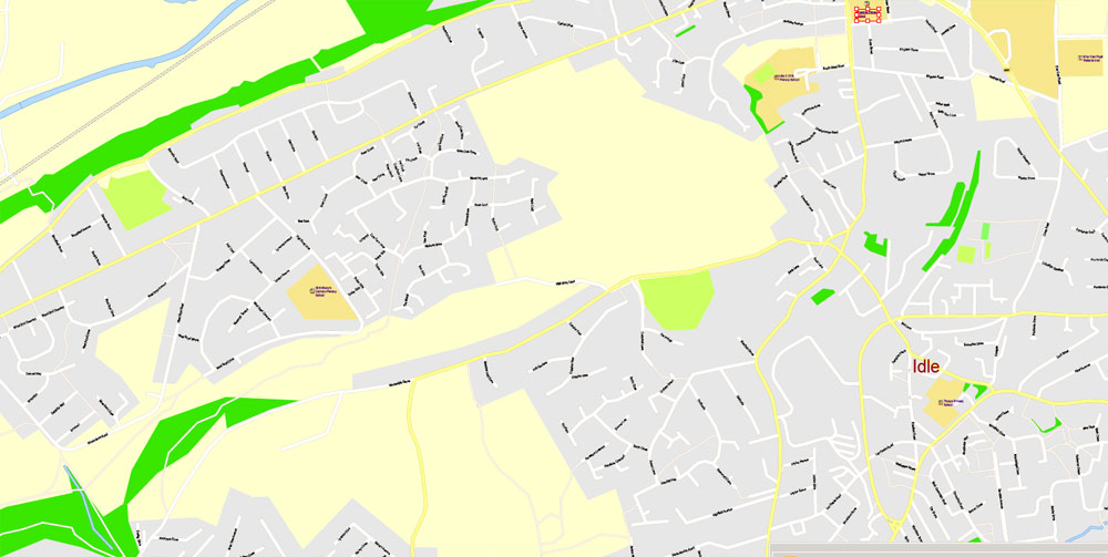
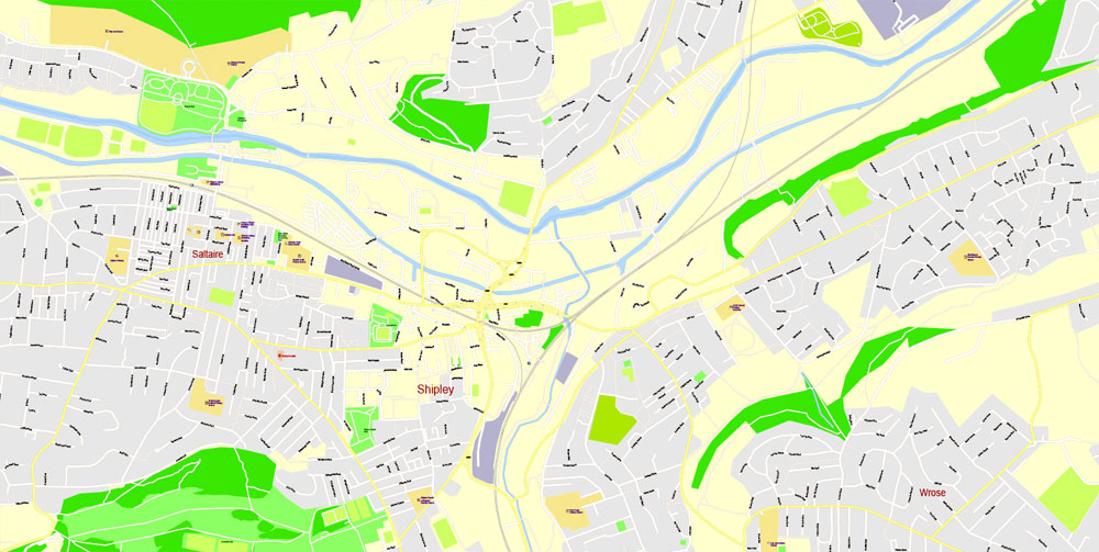
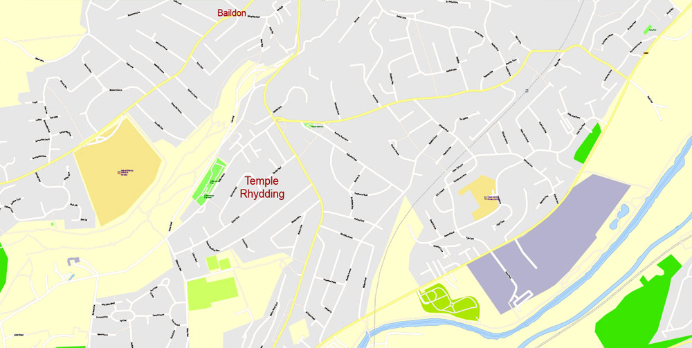
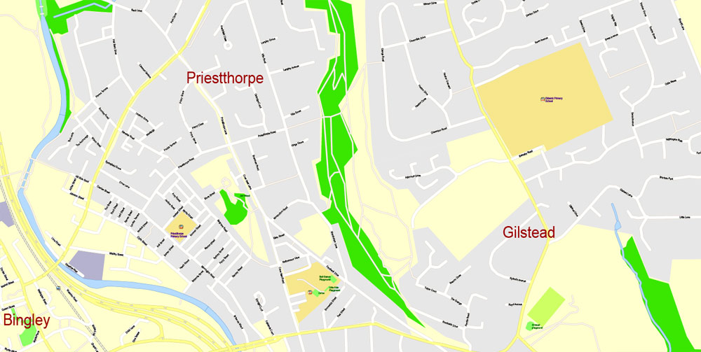
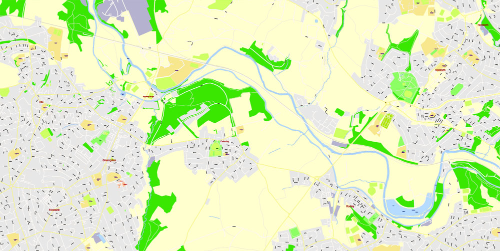
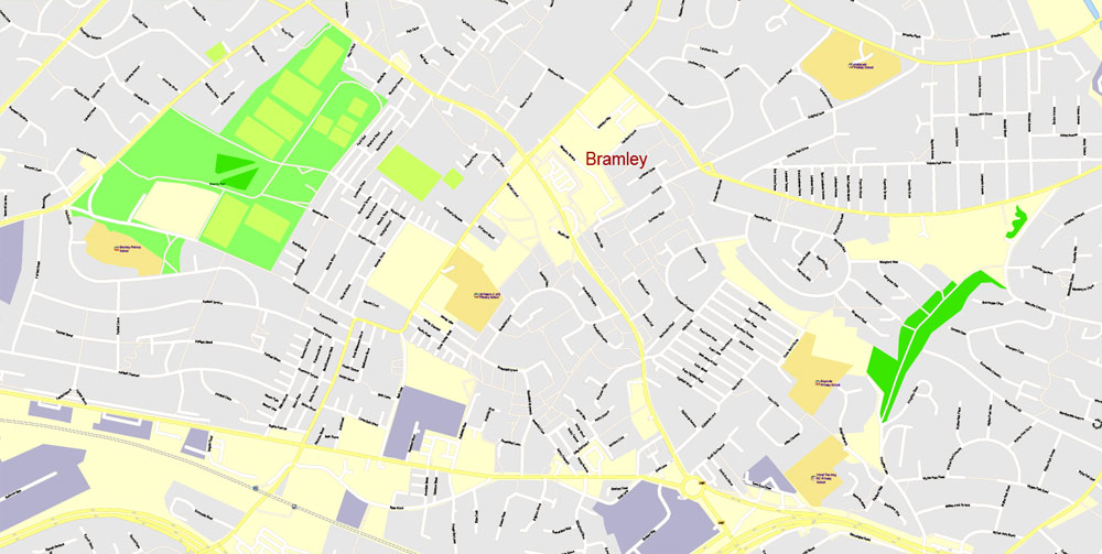
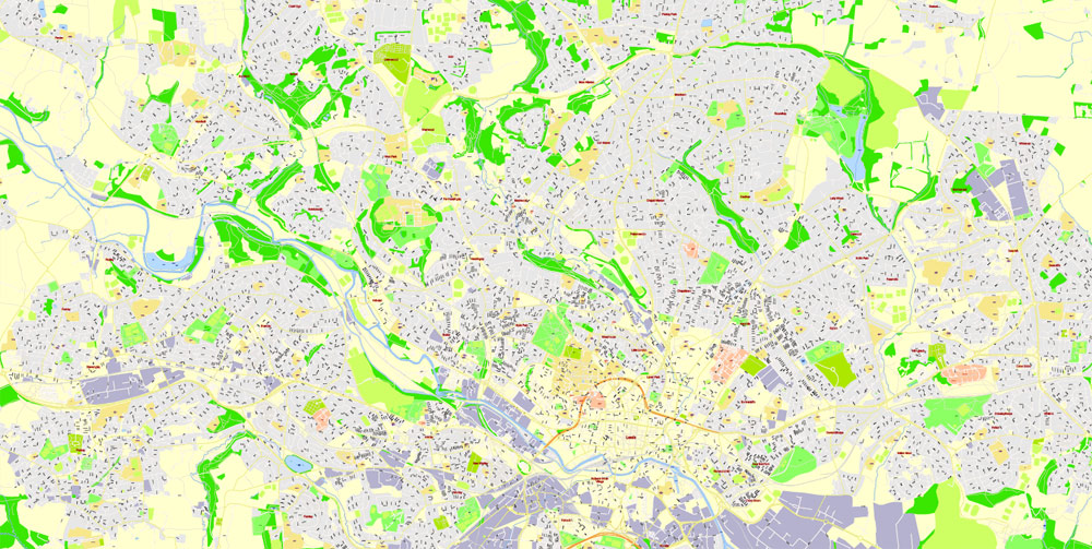
Printable PDF Vector Map Leeds + Bradford, England UK, exact detailed City Plan, editable Layered Adobe PDF, 23 Mb ZIP.
All streets named, main objects. Map for publishing, design, printing, publications, arts, projects, presentations, for architects, designers and builders, business, logistics. The most exact and detailed map of the city.
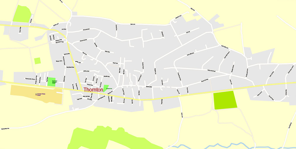
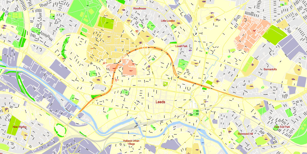
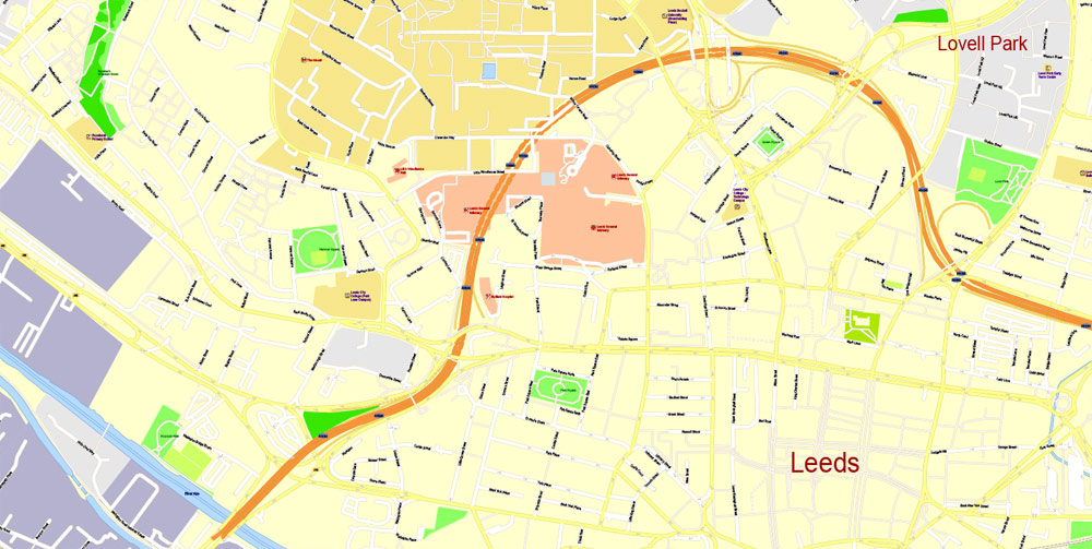
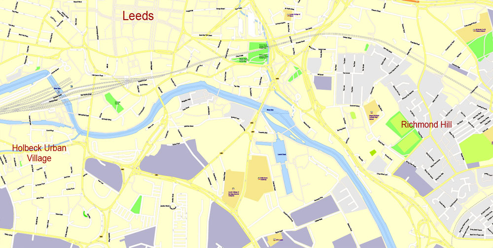
Layers: legend, grids, labels_roads, names_places, names_streets, names_objects, objects, arrows_streets, streets_roads, color_fills.
Text format street names
DWG, DXF, CDR, ESRI Shapes, and other formats – by request, same price, please contact.
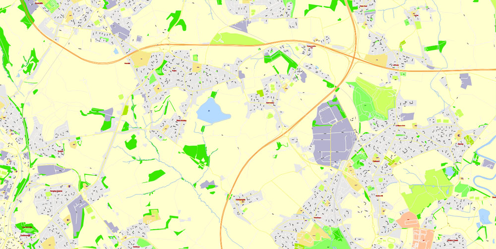
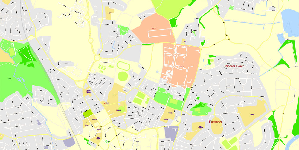
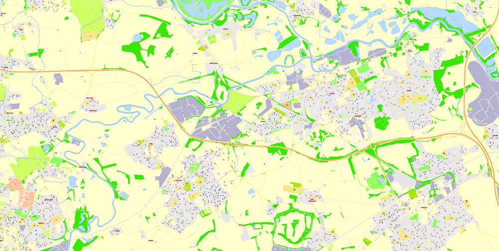
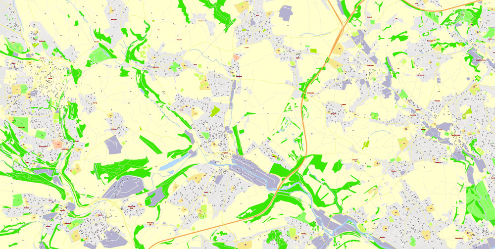
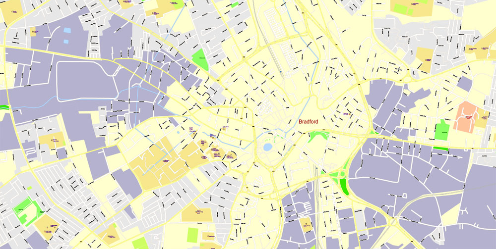
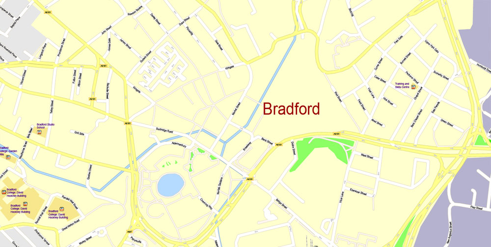
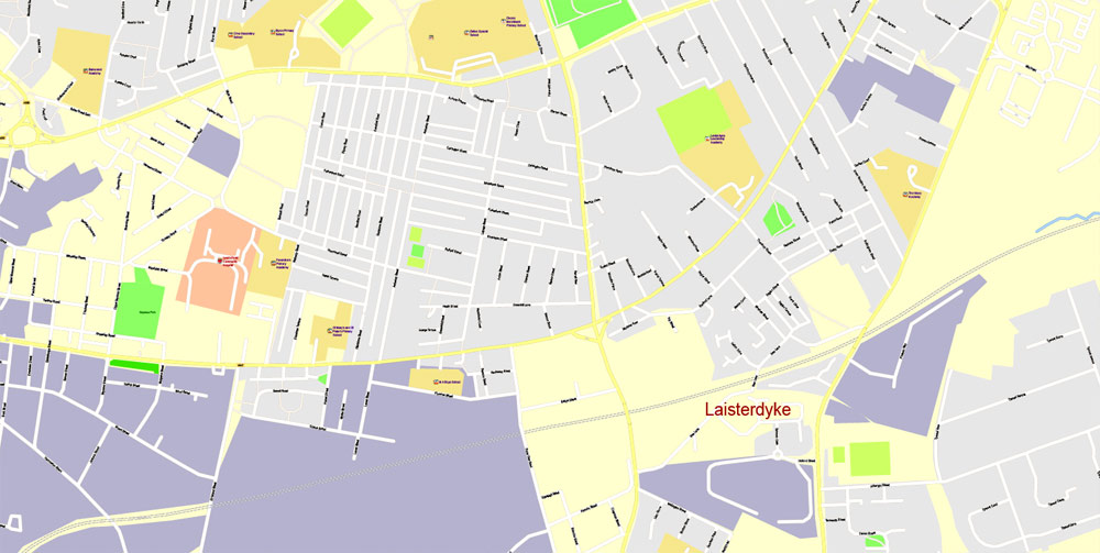
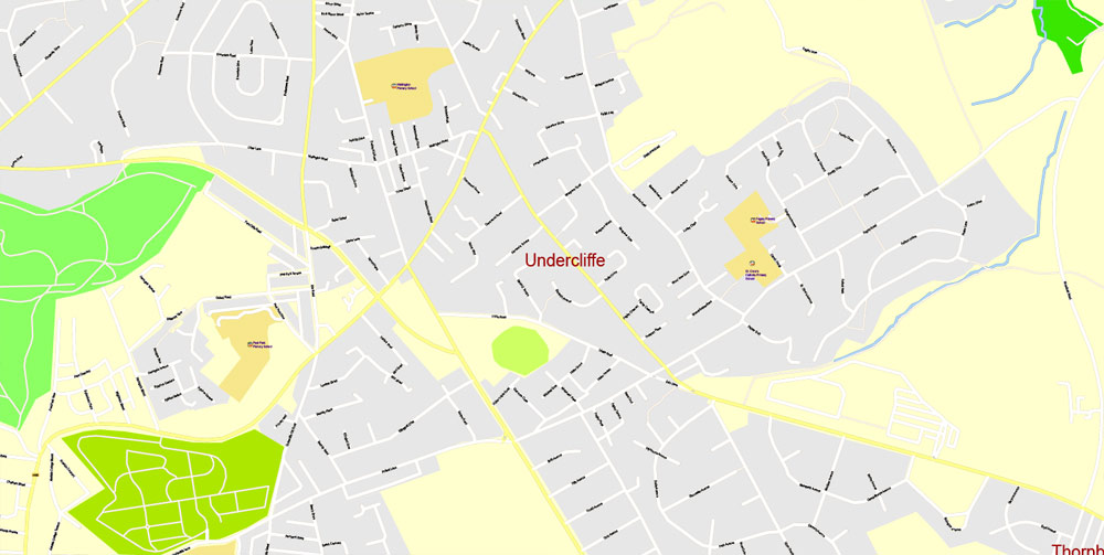
Leeds + Bradford, England, UK.
This vector map of Leeds city is used as a basis for design, editing, and further printing.
This is the most detailed, exact map of Leeds city for high-quality printing and polygraphy. You can always clarify the map development date by contacting us.
For your convenience, all objects on Leeds vector city map are divided into layers. And the editing is very easy – colors, lines, etc.
You can easily add any objects needed (e.g. shops, salons, sale points, gas station or attraction) on any layer of Leeds vector map.
Leeds is a city in West Yorkshire, England, the principal settlement in the administrative district known as the City of Leeds. The Leeds urban subdivision defined in the last census constitutes 112 square kilometres (43 sq mi) of the 552 square kilometres (213 sq mi) of the City of Leeds, which also includes a number of towns and rural areas around Leeds.
One of the advantages of Leeds city vector maps of our production is the relevance of cartographic data, we constantly update all our products.
This vector map of Leeds city is used by:
designers, layout designers, printers, advertisers and architects. Our product – vector maps – is designed for further editing and printing in large formats – from @Wall format (a few meters) to A-0 and A-1, A-2, A-3.
The Leeds city map in vector format is used for design, urban planning, presentations and media visualizations.
The advertising and presentation map of Leeds city (usually the final designer marks the routes, and puts the client’s objects (shops, saloons, gas stations etc.)
The undoubted advantage is that people will NEVER throw out this advertising product – the map. In fact, as an advertising medium, a city map is the most “long-playing” of the well-known polygraphic advertising media, with the longest lifespan, and the maximum number of interactions with the customer.
For travelers, maps are sold at the airports and gas stations around the world. Often the source is our vector maps.
Take a look, who purchases our vector maps of Leeds city in “Our Clients and Friends” page – these are large and small companies, from super-brands like Volvo and Starbucks, to small design studios and printing houses.
Leeds was a small manorial borough in the 13th century, and in the 17th and 18th centuries it became a major centre for the production and trading of wool, and in the Industrial Revolution a major mill town; wool was still the dominant industry, but flax, engineering, iron foundries, printing, and other industries were also important. From being a market town in the valley of the River Aire in the 16th century, Leeds expanded and absorbed the surrounding villages to become a populous urban centre by the mid-20th century. It now lies within the West Yorkshire Urban Area, the United Kingdom’s fourth-most populous urban area, with a population of 2.6 million.
It’s very easy to work with vector maps of Leeds city, even for a not very experienced designer who can turn on and off the map layers, add new objects, change the colors of fill and lines according to customer requirements.
The undoubted advantage of Leeds city vector maps in printing is an excellent and detailed visualization, when customer can expand a large paper map and instantly define his location, find a landmark, an object or address on map, unlike using the popular electronic formats of Google and Yandex maps for example.
Printable vector maps of Leeds city are much more convenient and efficient than any electronic maps on your smartphone, because ALL DETAILS are displayed in the entire space of Leeds city map.
Leeds has one of the most diverse economies of all the UK’s main employment centres and has seen the fastest rate of private-sector jobs growth of any UK city. It also has the highest ratio of private to public sector jobs of all the UK’s Core Cities, with 77% of its workforce working in the private sector. Leeds has the third-largest jobs total by local authority area, with 480,000 in employment and self-employment at the beginning of 2015.
Useful tips on working with vector maps of cities and countries in Adobe Illustrator.
«V» – launches the Selection tool (cursor, black arrow), which makes active any vector line.
«А» – launches the Direct Selection tool (white cursor), allows you to select curve elements and drag them to the desired place.
«R» – activates the Rotate tool, which helps you rotating selected objects around the center point by 360 degrees.
«E» – gives you the opportunity to use the Eraser tool and erase unnecessary parts.
«X» – switches between Fill and Stroke in the Tools section. Try to get used to this hot key and
you will quickly understand that you can’t live and work without it.
Guides are not limited to vertical and horizontal in Adobe Illustrator. You can also create a diagonal guide for example. Moreover, you can turn any contours into guides. Select the outline and go to View > Guides > Make Guides (Create Guides), or simply press Cmd/Ctrl + 5. You can also turn the guides back into an editable object. Go to menu, View > Guides > Unlock Guides (Release Guides), select the guide you want to edit and select View > Guides > Release Guides (Reset Guides), or just press Cmd/Ctrl + Option / Alt + 5).
You will probably want to change the color scheme used on our Leeds vector city map.
To quickly and effectively play with colors.
Of course, you can do it manually, all objects in our Leeds city vector map are divided according to types and layers, and you can easily change the color gamma of vector objects in groups and layers.
But there is more effective way of working with the whole VECTOR MAP of Leeds city and all layers:
The overview dialog «Edit colors»/«Repaint Graphic Object» (this dialog box name can change depending on the context):
If you have selected a part or a layer of Leeds city vector map and open the dialog box by clicking the icon in the Control panel, on the Samples palette or the Color Catalog, or if you choose Edit > Edit Colors> Repaint Graphic Object, then the «Repaint Graphic Object» dialog box appears, and you get access to «Assign» and «Edit» tabs.
If a picture or a map fragment is not selected, and you open the dialog box by clicking the icon in the Control panel, on the Samples palette or in the Color Catalog, the «Edit Colors» dialog box appears and you can only access the «Edit» tab.
Leeds is ranked as a gamma world city by the Globalization and World Cities Research Network. Leeds is the cultural, financial and commercial heart of the West Yorkshire Urban Area. Leeds is served by four universities, and has the fourth largest student population in the country and the country’s fourth largest urban economy.
Regardless of the name at the top of the dialog box, the right-hand side always displays the color group of the current document, as well as two default color groups: Print Color and Grayscale. These color groups can be selected and used any time.
Create and edit color groups of Leeds city vector map, and also assign colors using the «Edit Colors»/ а «Repaint Graphic Object» dialog box.
A. Creating and editing of a color group on the «Edit» tab
B. Assigning colors on the «Assign» tab
C. Select a group of colors from the «Color groups» list
The option «Repaint a graphic object» in the lower part of the dialog box allows you to preview the colors on a selected layer of Vector map, or a group of elements, and specify whether its colors will be redefined when the dialog box is closed.
The main areas of the dialog box are:
«Edit»
The «Edit» tab is designed to create a new or edit the existing color groups.
The harmony rules Menu and the Color Wheel are used to conduct experiments with color harmonies. The color wheel shows how colors are related in color harmony, and the color bars allow you to view and manipulate an individual color values. In addition, you can adjust the brightness, add and remove colors, save color groups and view colors on the selected Vector Map of Leeds city or a separated layers.
Today, Leeds has become the largest legal and financial centre, outside London with the financial and insurance services industry worth £13 billion to the city’s economy. The finance and business service sector account for 38% of total output with more than 30 national and international banks located in the city, including an office of the Bank of England.
«Assign»
The «Assign» tab is used to view and control on how the original colors are replaced with colors from the color group like your corporate colors in the Vector Map of Leeds city.
The assign color ability is provided only if the entire map, layer or fragment is selected in the document. You can specify which of new colors replace the current colors, whether the spot colors should be preserved and how colors are replaced (for example, you can replace colors completely or changing the color tone while maintaining the brightness). The «Assign» tab allows you to redefine colors in the Vector Map of Leeds city, or in separate layers and fragments using the current color group or reducing the number of colors in the current Vector Map.
Color groups
Is a list of all saved color groups for current document (the same groups appear in the «Samples» palette). You can edit and delete the existing color groups, as well as creating a new ones using the list of “Color Groups” in the dialog box. All changes appear in the «Samples» palette.
The highlighted color group shows, which color group is currently edited.
Leeds is also the UK’s third-largest manufacturing centre with around 1,800 firms and 39,000 employees, Leeds manufacturing firms account for 8.8% of total employment in the city and is worth over £7 billion to the local economy. The largest sub-sectors are engineering, printing and publishing, food and drink, chemicals and medical technology. Other key sectors include retail, leisure and the visitor economy, construction, and the creative and digital industries. The city saw several firsts, including the oldest-surviving film in existence, Roundhay Garden Scene (1888), and the 1767 invention of soda water.
Any color group can be selected and edited, or used to redefine the colors in the selected vector map of Leeds city, its fragments or elements.
Saving a color group adds this group to the specified list.
Opening the «Edit Colors»/«Repaint Graphic Object» dialog box.
Open the «Edit Colors»/«Repaint Graphic Object» dialog box using one of the following methods:
«Edit»> «Edit Colors»> «Repaint Graphic object» or «Repaint With Style».
Use these commands if you need to edit the colors in the selected vector map of Leeds city.
«Repaint Graphic object» button on the «Control» panel.
Use this button if you need to adjust colors of Leeds city vector map using the а «Repaint graphic object» dialog box.
The specified button is available if the selected vector map or its fragment contains two or more colors.
Note. This color editing method is convenient for global color adjustment in a vector map, if global colors were not used when creating a City Map of Leeds.
The «Edit colors» button or «Edit or apply colors» on the «Color Catalog» palette
Click this button if you need to edit colors on the «Color Catalog» palette or edit and then apply them to the selected Vector Map of Leeds city or its fragment.
The «Edit color group» button or «Edit or apply color group» on the «Samples» palette.
Click this button if you need to edit the colors in the specific color group or edit and apply them to the selected Vector Map of Leeds city or a group of its elements, for example, the whole layer “Streets and lines”. You can also double-click the color group in the Samples panel to open the dialog box.
If the map file is too large and your computer freezes or even can’t open it quickly:
1. Try to reduce the color resolution of the video card (display) to 256 colors while working with a large map.
2. Using Windows Task Manager, select all the application you don’t need, while working with map, just turn them off.
3. Launch Adobe Illustrator. (DO NOT OPEN the vector map file)
4. Start the Windows Task Manager using administrator rights > Find the “Illustrator” process > set the «real time» priority,
5. Open the file. When you see the LEGACY FONT popup window – click “OK” (do not update). You can restore the TEXT later.
6. Can also be useful: When file is opened – Edit > Settings > Basic Settings > disable smoothing. /// It looks scary, but works quickly)))
We recommend saving the file in Adobe Illustrator 10 version. It’s much more stable when working with VERY BIG size files.
Public transport, rail and road communications networks in the region are focused on Leeds, and the second phase of High Speed 2 will connect it to London via East Midlands Hub and Sheffield Meadowhall. Leeds currently has the third busiest train station and the tenth busiest airport outside London.
Geography
This map shows the locations of Leeds (coloured pink) and the other four metropolitan boroughs of West Yorkshire (clockwise from Leeds: Wakefield, Kirklees, Calderdale and Bradford). County and borough boundaries are black, urban areas grey, motorways blue with white stripe, rivers and bodies of water light blue. An inset shows a map of Great Britain with the location of West Yorkshire highlighted.
The canalised River Aire flows from the Dark Arches under Leeds’s main railway station towards the bottom of the picture. To the left of the river is the lock which links the river with the Leeds and Liverpool Canal. To the right is a riverside walk beneath modern buildings, and in the distance, beyond the railway viaduct and station, are more high-rise modern buildings located on the west side of the city centre.
Leeds is located 190 miles (310 km) north-northwest of London, on the valley of the River Aire in the eastern foothills of the Pennines. The city centre lies in a narrow section of the Aire Valley at about 206 feet (63 m) above sea level; while the district ranges from 1,115 feet (340 m) in the far west on the slopes of Ilkley Moor to about 33 feet (10 m) where the rivers Aire and Wharfe cross the eastern boundary. The centre of Leeds is part of a continuously built-up area extending to Pudsey, Bramley, Horsforth, Alwoodley, Seacroft, Middleton and Morley.
Leeds has the second-highest population of any local authority district in the UK (after Birmingham), and the second-greatest area of any English metropolitan district (after Doncaster), extending 15 miles (24 km) from east to west, and 13 miles (21 km) from north to south. The northern boundary follows the River Wharfe for several miles, but it crosses the river to include the part of Otley which lies north of the river.
The city centre is less than twenty miles (32 km) from the Yorkshire Dales National Park, which has some of the most spectacular scenery and countryside in the UK. Inner and southern areas of Leeds lie on a layer of coal measure sandstones forming the Yorkshire Coalfield. To the north parts are built on older sandstone and gritstones and to the east it extends into the magnesian limestone belt. The land use in the central areas of Leeds is overwhelmingly urban.
Attempts to define the exact geographic meaning of Leeds lead to a variety of concepts of its extent, varying by context include the area of the city centre, the urban sprawl, the administrative boundaries, and the functional region.
Leeds is much more a generalised concept place name in inverted commas, it is the city, but it is also the commuter villages and the region as well.
—Brian Thompson, A History of Modern Leeds
Leeds city centre is contained within the Leeds Inner Ring Road, formed from parts of the A58 road, A61 road, A64 road, A643 road and the M621 motorway. Briggate, the principal north-south shopping street, is pedestrianised and Queen Victoria Street, a part of the Victoria Quarter, is enclosed under a glass roof. Millennium Square is a significant urban focal point. The Leeds postcode area covers most of the City of Leeds and is almost entirely made up of the Leeds post town. Otley, Wetherby, Tadcaster, Pudsey and Ilkley are separate post towns within the postcode area. Aside from the built up area of Leeds itself, there are a number of suburbs and exurbs within the district.
Urban subdivision
At the time of the United Kingdom Census 2001, the Leeds urban subdivision occupied an area of 109 square kilometres (42 sq mi) and had a population of 443,247; making it the fourth-most populous urban subdivision within England and the fifth largest within the United Kingdom. The population density was 4,066 inhabitants per square kilometre (10,530/sq mi), slightly higher than the rest of the West Yorkshire Urban Area. It accounts for 20% of the area and 62% of the population of the City of Leeds. The population of the urban subdivision had a 100 to 93.1 female–male ratio. Of those over 16 years old, 39.4% were single (never married) and 35.4% married for the first time. The urban subdivision’s 188,890 households included 35% one-person, 27.9% married couples living together, 8.8% were co-habiting couples, and 5.7% single parents with their children. Leeds is the largest component of the West Yorkshire Urban Area and is counted by Eurostat as part of the Leeds-Bradford larger urban zone. The Leeds travel to work area in 2001 included all of the City of Leeds, a northern strip of the City of Bradford, the eastern part of Kirklees, and a section of southern North Yorkshire; it occupies 751 square kilometres (290 sq mi).
In 2011, the Leeds USD had a population of 474,632 and had an area of 112 square kilometres (70 square miles) with a population density of 4,238 people per square kilometre and 6,780 per square mile. It is bounded by, and physically attached to, the other towns of Garforth to the east, Morley to the southwest and Pudsey to the west, all being within the wider borough. 63% of the borough’s population of 751,485 live in the USD, while it takes up only 21% of its area.
The City of Bradford is a local government district of West Yorkshire, England, with the status of a city and metropolitan borough. It is named after its largest settlement, Bradford, but covers a far larger area which includes the towns of Keighley, Shipley, Bingley, Ilkley, Haworth, Silsden and Denholme. Bradford has a population of 528,155, making it the fourth-most populous metropolitan district and the sixth-most populous local authority district in England. It forms part of the West Yorkshire Urban Area conurbation which in 2001 had a population of 1.5 million and the city is part of the Leeds-Bradford Larger Urban Zone (LUZ), which, with a population of 2,393,300, is the fourth largest in the United Kingdom after London, Birmingham and Manchester.
The city is situated on the edge of the Pennines, and is bounded to the east by the City of Leeds, the south east by the Metropolitan Borough of Kirklees and the south west by the Metropolitan Borough of Calderdale. The Pendle borough of Lancashire lies to the west, whilst the Craven and Harrogate boroughs of North Yorkshire lie to the north west and north east of the city. Bradford is the 4th largest metropolitan district in the country, and the contiguous urban area to the north which includes the towns of Shipley and Bingley is heavily populated. The spa town of Ilkley lies further north, whilst the town of Keighley lies to the west. Roughly two thirds of the district is rural, with an environment varying from moorlands in the north and west, to valleys and floodplains formed by the river systems that flow throughout the district. More than half of Bradford’s land is green open space, stretching over part of the Airedale and Wharfedale Valleys, across the hills and the Pennine moorland between. The Yorkshire Dales and the Peak District are both in close proximity.
The City of Bradford has architecture designated as being of special or historic importance, most of which were constructed with local stone, with 5,800 listed buildings and 59 conservation areas. The model village of Saltaire has been listed as a UNESCO World Heritage Site. Central Bradford rose to prominence during the 19th century as an international centre of textile manufacture, particularly wool. The area’s access to a supply of coal, iron ore and soft water facilitated the growth of Bradford’s manufacturing base, which, as textile manufacture grew, led to an explosion in population and was a stimulus to civic investment.
However, Bradford has faced similar challenges to the rest of the post-industrial area of northern England, including deindustrialisation, housing problems, and economic deprivation. Wool and textiles still play an important part in the city’s economy, but today’s fastest-growing sectors include information technology, financial services, digital industries, environmental technologies, cultural industries, tourism and retail headquarters and distribution. Bradford’s reputation as a base for high technology, scientific and computer-based industries is growing, building on a long tradition of innovation, high skill levels and quality products.
Bradford has experienced significant levels of immigration throughout the 19th and 20th centuries. In the 1840s Bradford’s population was significantly increased by migrants from Ireland, particularly rural Mayo and Sligo, and by 1851 around 18,000 people of Irish origin resided in the town, representing around 10% of the population, the largest proportion in Yorkshire. Around the same time there was also an influx of German Jewish migrants to the town, and by 1910 around 1,500 people of German origin resided in the city. In the 1950s there was large scale immigration from South Asia and to a lesser extent from Poland. Bradford has the second highest proportion in England and Wales outside London, in terms of population (behind Birmingham) and 26.83% in percentage (behind Slough, Leicester, Luton and Blackburn with Darwen). An estimated 352,317 of all White ethnic groups reside in the city, representing around 67.44% of the city’s population.
Geography
The City of Bradford is situated on the edge of the Pennines, and is bounded to the east by the City of Leeds, the south east by the Metropolitan Borough of Kirklees and the south west by the Metropolitan Borough of Calderdale. The Lancashire borough of Pendle lies to the west, whilst North Yorkshire boroughs of Craven and Harrogate lie to the north west and north east respectively. Bradford district has 3636 hectares of upland heathland, including Ilkley Moor where the peat bogs rise to 402 m (1,319 ft) above sea level.
Less than 5% of the Bradford district is woodland. Greenspace accounts for 73.8% of the City of Bradford’s total area, domestic buildings and gardens comprise 12.1%, and the rest is made up of roads and non-domestic buildings. Three river systems serve the City of Bradford, along with 23 km of canal. The Airedale towns of Keighley, Bingley and Shipley lie on the River Aire. The River Wharfe runs through Ilkley and Burley in Wharfedale, and tributaries of the River Calder run through the district. Unusually for a major settlement, Bradford is not built on any substantial body of water. The ford from which it takes its name (Broad-Ford) was a crossing of the stream called Bradford Beck.
Leeds
City in England
Leeds is a city in the northern English county of Yorkshire. On the south bank of the River Aire, the Royal Armouries houses the national collection of arms and artillery. Across the river, the redeveloped industrial area around Call Lane is famed for bars and live music venues under converted railway arches. Leeds Kirkgate Market features hundreds of indoor and outdoor stalls.
Area
• City 213.0 sq mi (551.7 km2)
• Urban 188.3 sq mi (487.8 km2)
Area rank 84th
Highest elevation 1,115 ft (340 m)
Lowest elevation 33 ft (10 m)
Population
• City 781,700
• Rank 2nd
• Density 3,670/sq mi (1,416/km2)
• Urban 1,901,934 (4th)
• Urban density 9,440/sq mi (3,645/km2)
• Metro 2,454,000 (4th)
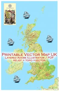
See also: Full map UK
Free vector maps:

Free download printable map Europe vector Adobe Illustrator >>>
Free download printable PDF map Europe vector Adobe PDF >>>

 Author: Kirill Shrayber, Ph.D. FRGS

