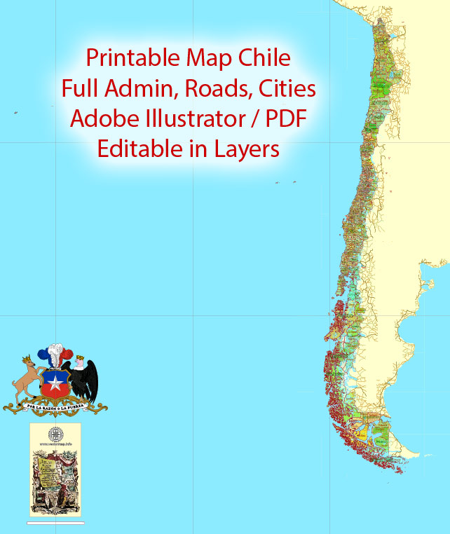
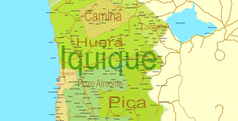
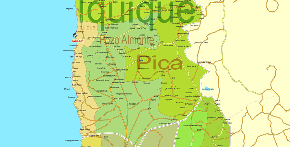
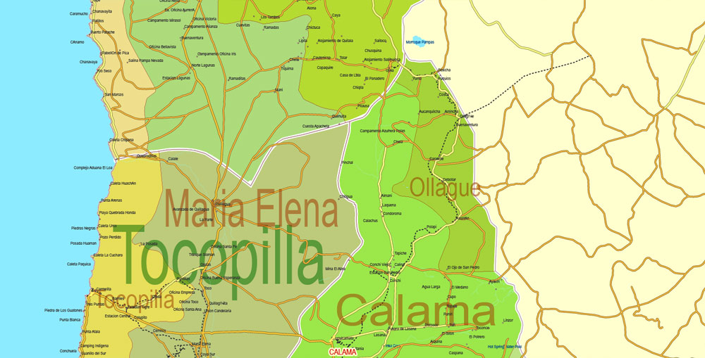
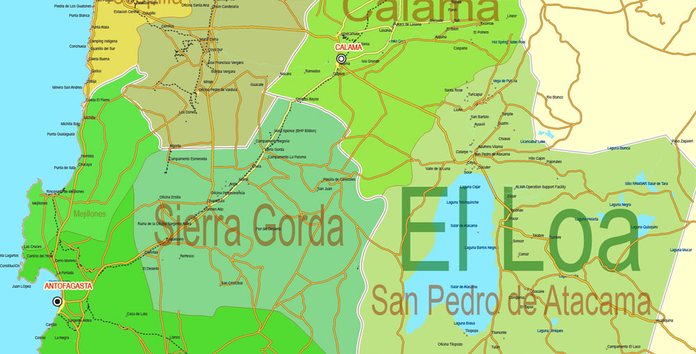
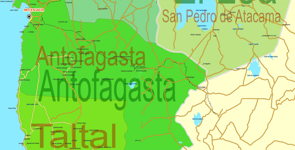
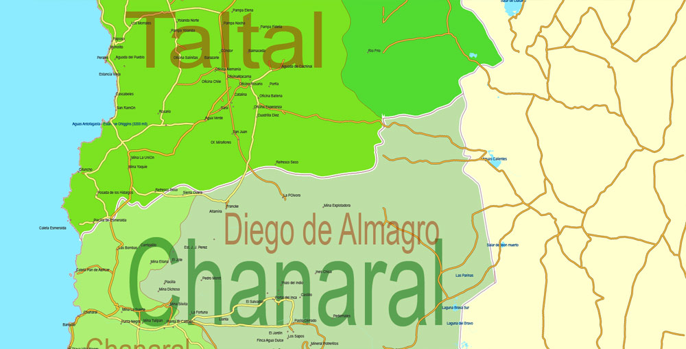
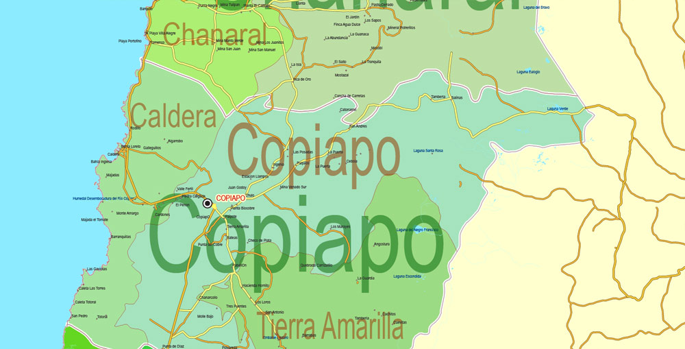
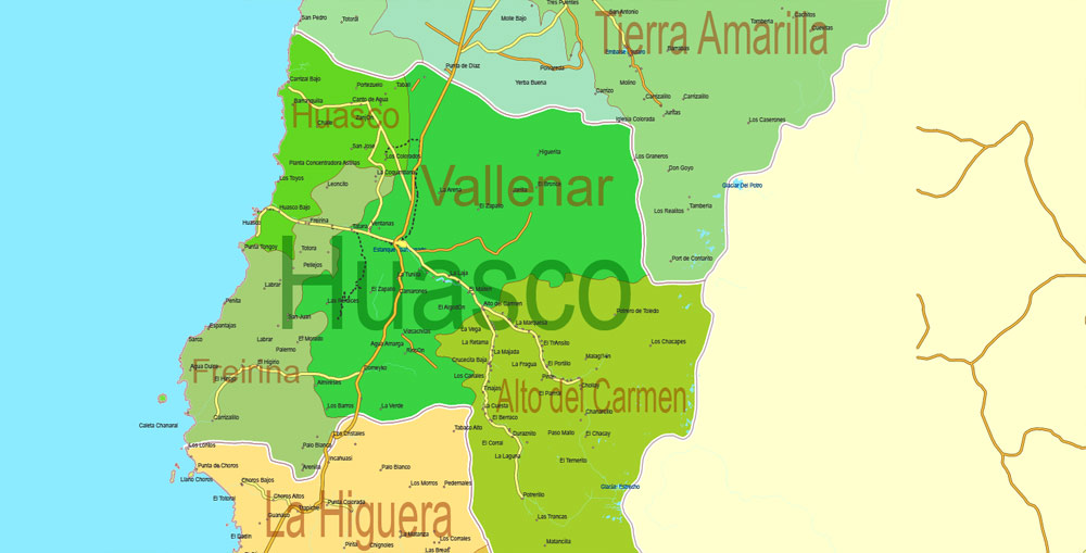
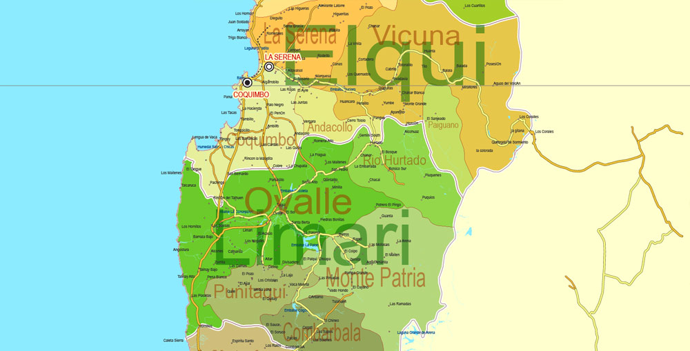
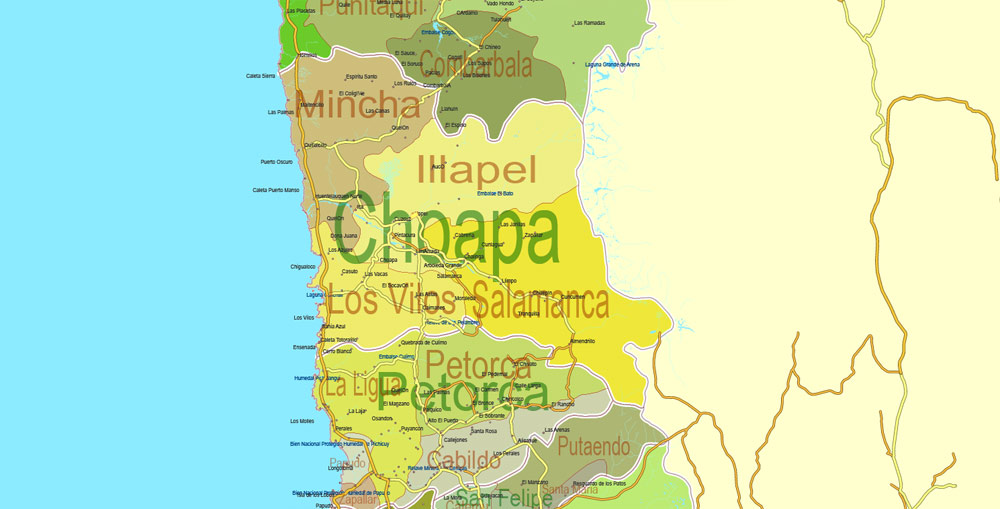
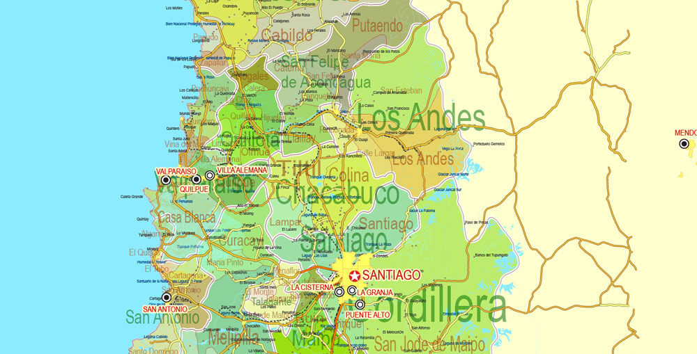
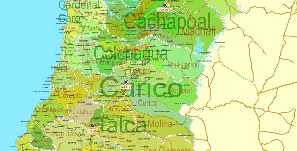
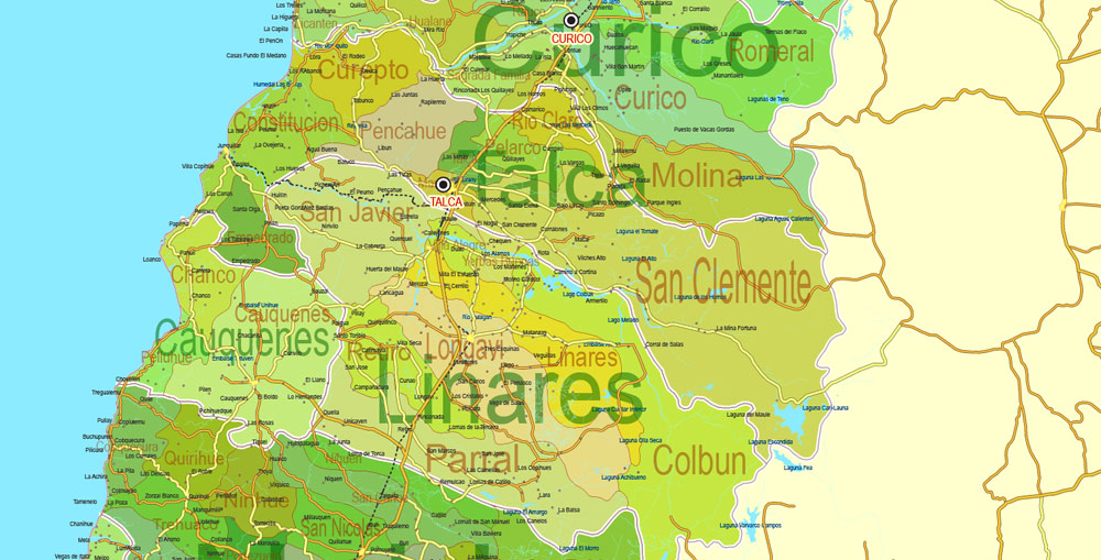
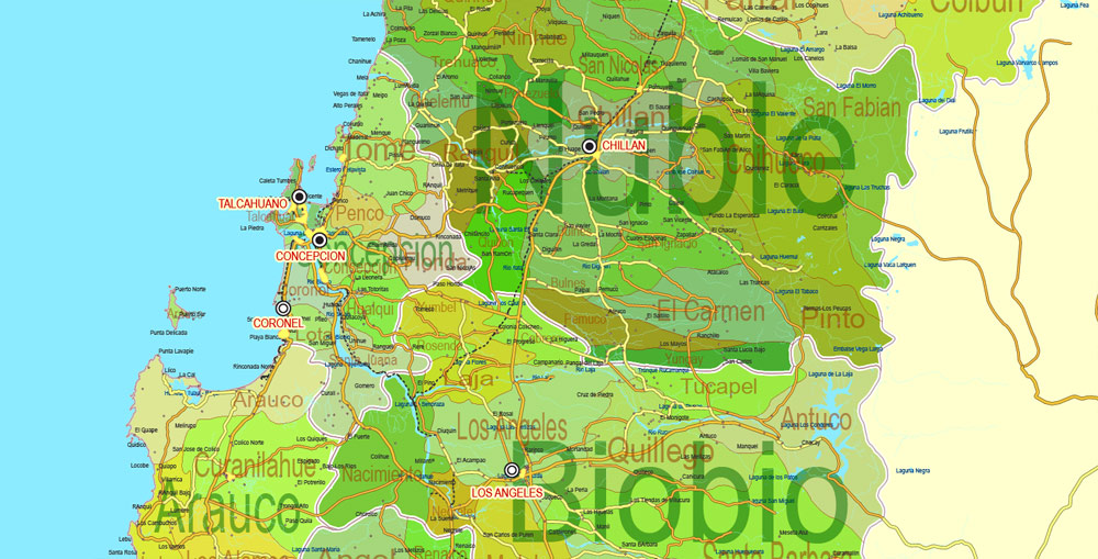
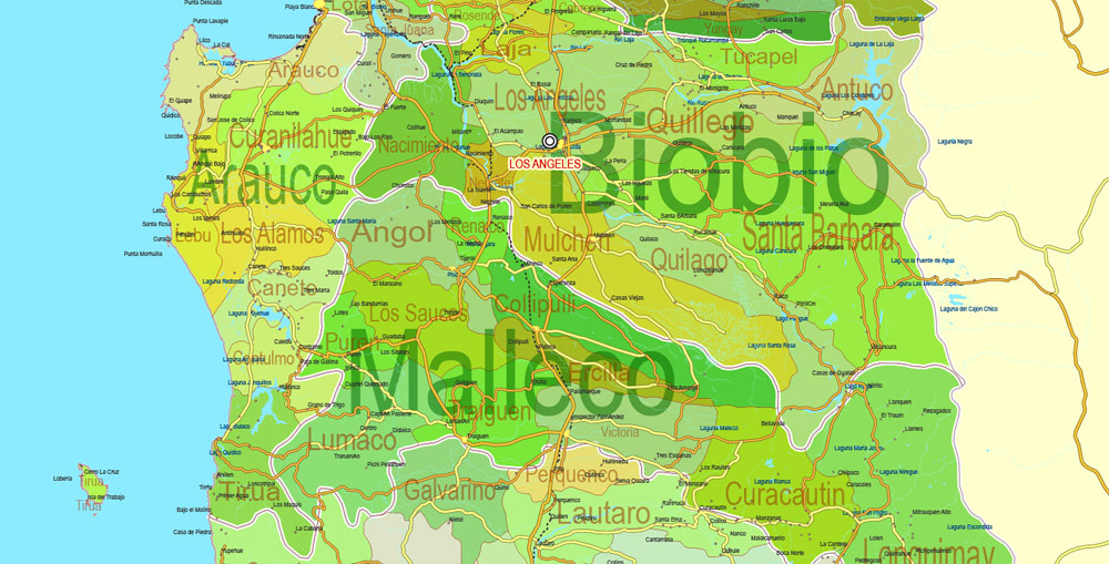
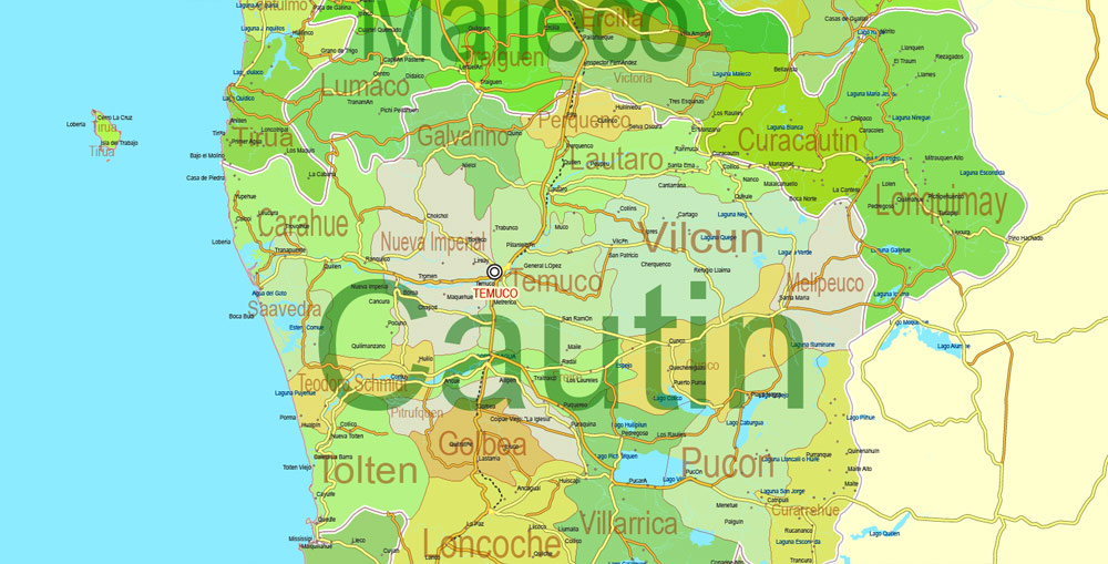
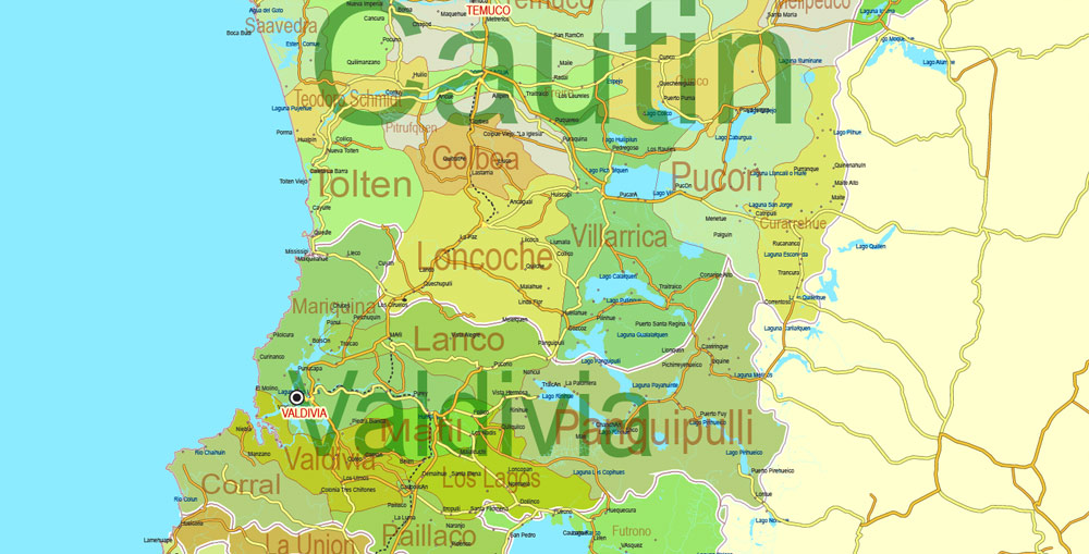
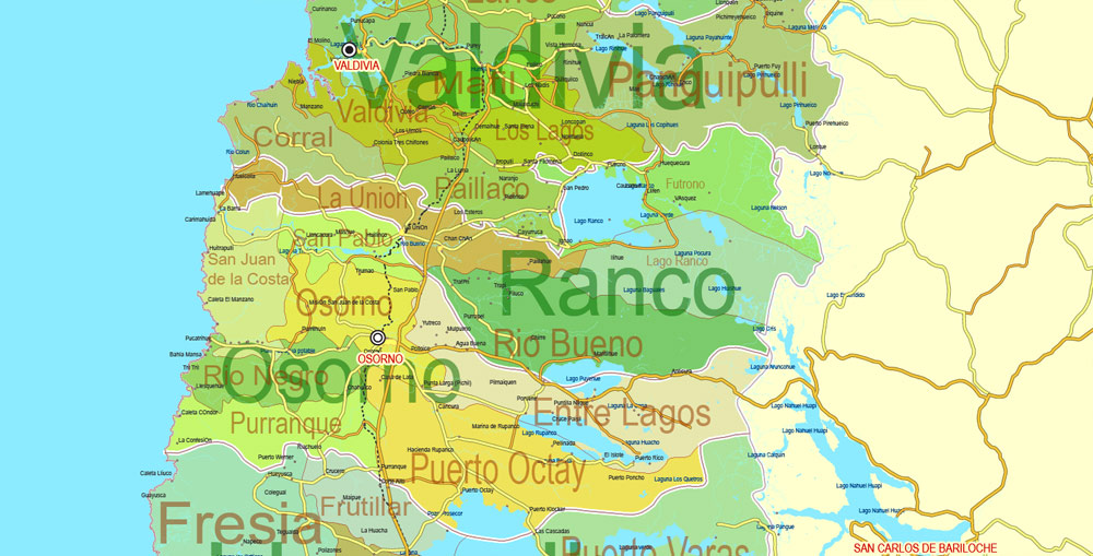
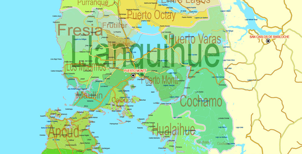
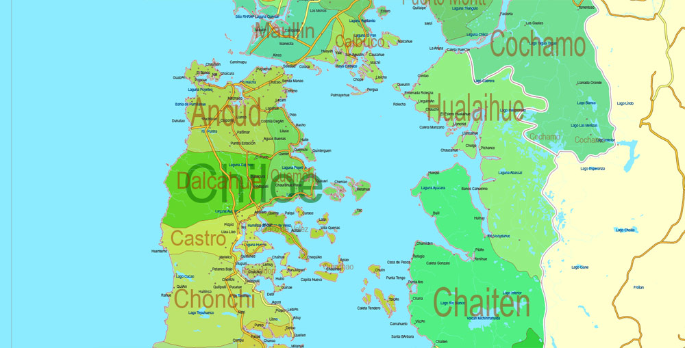
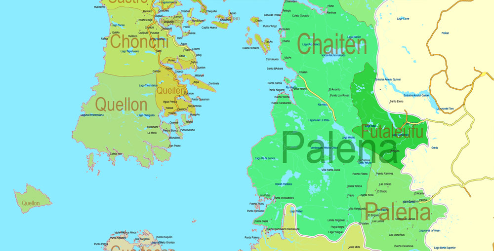
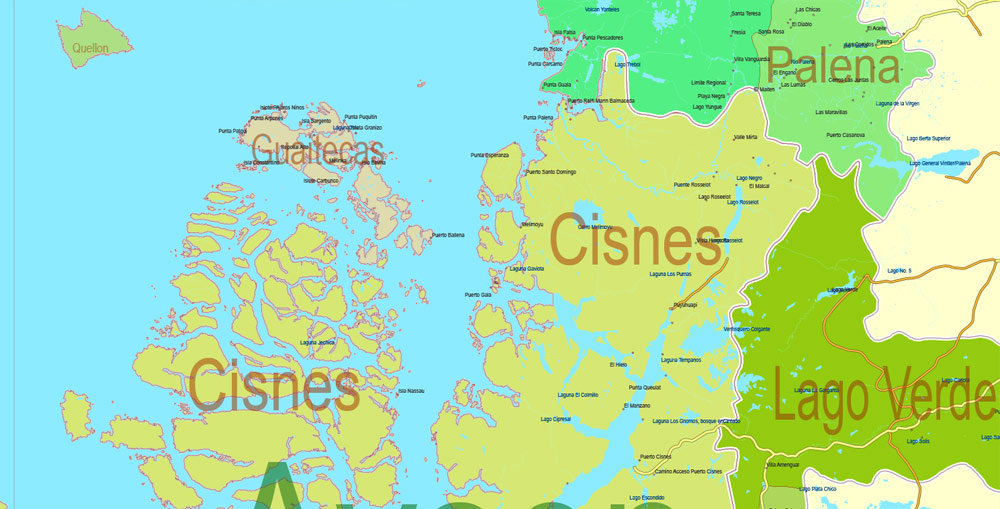
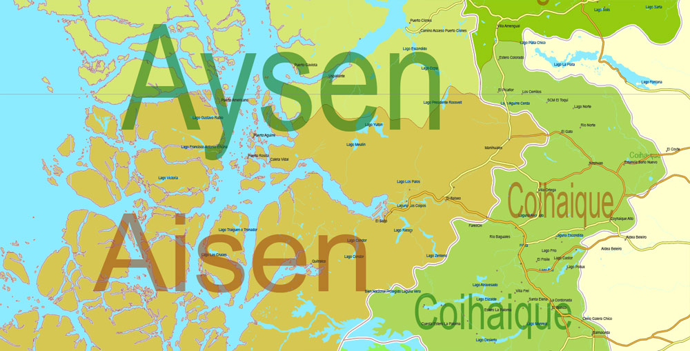
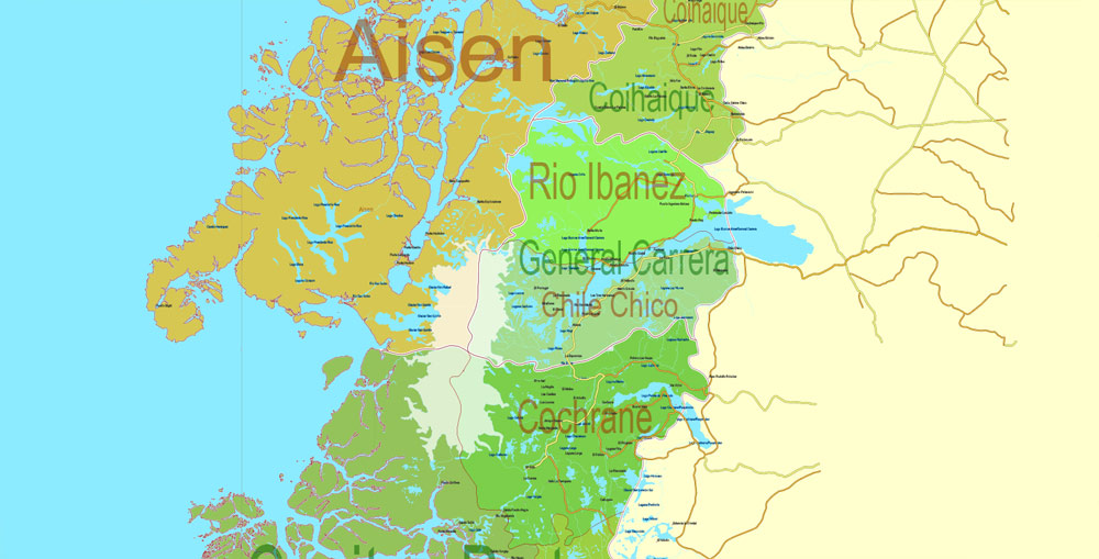
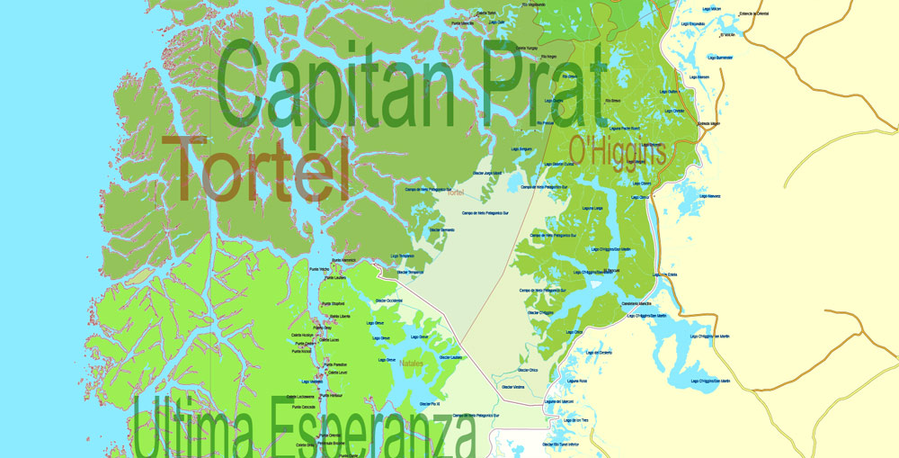
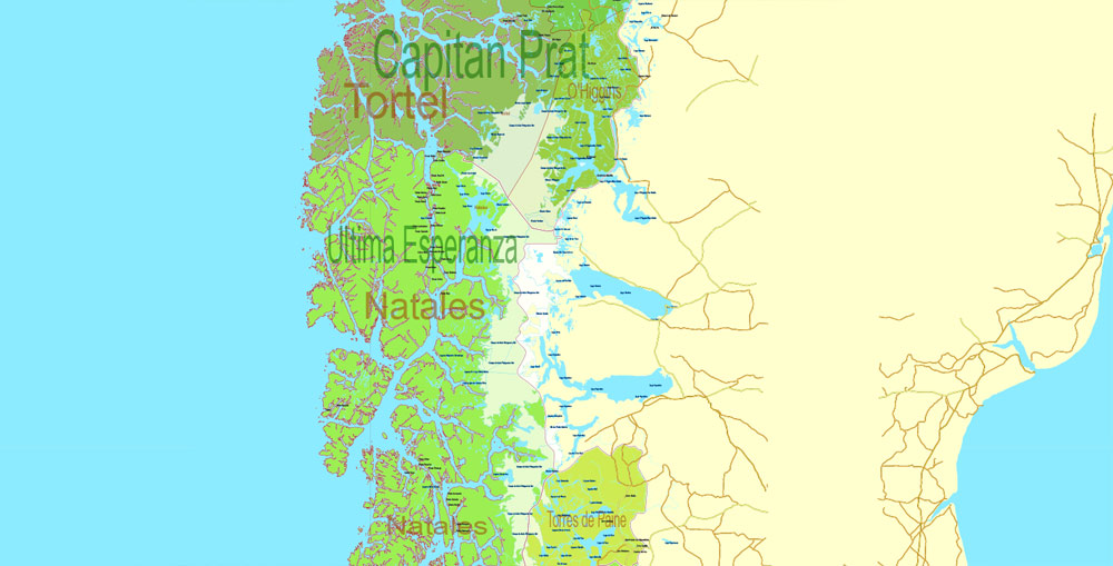
PDF Admin Road Map Chile Extra Detailed, Mercator Projection, – Provinces, Admin Districts, Roads, Water, Cities, full editable, Adobe PDF, scalable, editable text format names, 138 Mb ZIP.
All provinces and counties named. Map for publishing, design, printing, publications, arts, projects, presentations, for architects, designers and builders, business, logistics. The most exact and detailed map of the Chile Admin Territories.
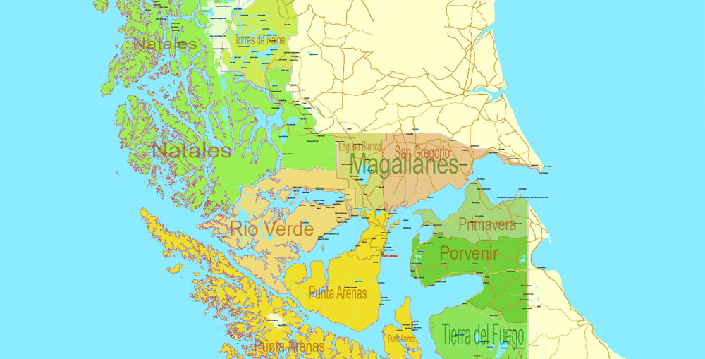
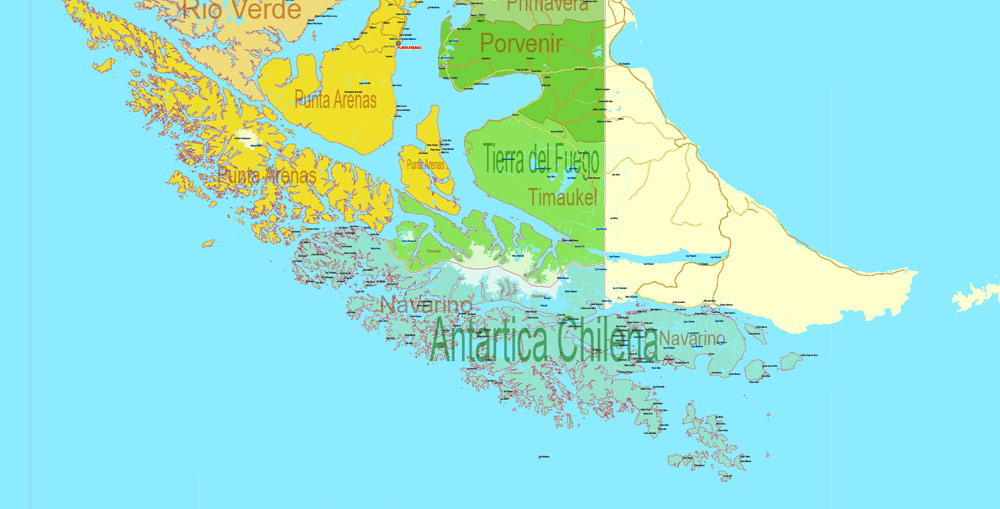
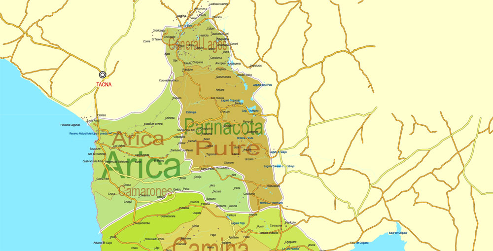
Separated layers: provinces, borders provinces, admin areas, names_admin, water objects, names_water, names provinces, urban_areas, grids, roads. railroads, Cities, Main Cities, Cities_names, etc.
You can edit this file by Adobe Illustrator, Adobe Acrobat, Corel Draw.
DWG, DXF, CDR and other formats – by request, same price, please contact.
Chile.
This vector map of Chile is used as a basis for design, editing, and further printing.
This is the most detailed, exact map of Chile for high-quality printing and polygraphy. You can always clarify the map development date by contacting us.
For your convenience, all objects on Chile vector map are divided into layers. And the editing is very easy – colors, lines, etc.
You can easily add any objects needed (e.g. shops, salons, sale points, gas station or attraction) on any layer of Chile vector map.
Chile is a South American country occupying a long, narrow strip of land between the Andes to the east and the Pacific Ocean to the west. It borders Peru to the north, Bolivia to the northeast, Argentina to the east, and the Drake Passage in the far south. Chilean territory includes the Pacific islands of Juan Fernández, Salas y Gómez, Desventuradas, and Easter Island in Oceania. Chile also claims about 1,250,000 square kilometres (480,000 sq mi) of Antarctica, although all claims are suspended under the Antarctic Treaty.
One of the advantages of Chile vector maps of our production is the relevance of cartographic data, we constantly update all our products.
This vector map of Chile is used by:
designers, layout designers, printers, advertisers and architects. Our product – vector maps – is designed for further editing and printing in large formats – from @Wall format (a few meters) to A-0 and A-1, A-2, A-3.
The Chile map in vector format is used for design, urban planning, presentations and media visualizations.
The advertising and presentation map of Chile (usually the final designer marks the routes, and puts the client’s objects (shops, saloons, gas stations etc.)
The undoubted advantage is that people will NEVER throw out this advertising product – the map. In fact, as an advertising medium, a map is the most “long-playing” of the well-known polygraphic advertising media, with the longest lifespan, and the maximum number of interactions with the customer.
For travelers, maps are sold at the airports and gas stations around the world. Often the source is our vector maps.
Take a look, who purchases our vector maps of Chile in “Our Clients and Friends” page – these are large and small companies, from super-brands like Volvo and Starbucks, to small design studios and printing houses.
It’s very easy to work with vector maps of Chile city, even for a not very experienced designer who can turn on and off the map layers, add new objects, change the colors of fill and lines according to customer requirements.
The undoubted advantage of Chile vector maps in printing is an excellent and detailed visualization, when customer can expand a large paper map and instantly define his location, find a landmark, an object or address on map, unlike using the popular electronic formats of Google and Yandex maps for example.
Printable vector maps of Chile are much more convenient and efficient than any electronic maps on your smartphone, because ALL DETAILS are displayed in the entire space of Chile map.
The arid Atacama Desert in northern Chile contains great mineral wealth, principally copper. The relatively small central area dominates in terms of population and agricultural resources, and is the cultural and political center from which Chile expanded in the late 19th century when it incorporated its northern and southern regions. Southern Chile is rich in forests and grazing lands, and features a string of volcanoes and lakes. The southern coast is a labyrinth of fjords, inlets, canals, twisting peninsulas, and islands.
Useful tips on working with vector maps of cities and countries in Adobe Illustrator.
«V» – launches the Selection tool (cursor, black arrow), which makes active any vector line.
«А» – launches the Direct Selection tool (white cursor), allows you to select curve elements and drag them to the desired place.
«R» – activates the Rotate tool, which helps you rotating selected objects around the center point by 360 degrees.
«E» – gives you the opportunity to use the Eraser tool and erase unnecessary parts.
«X» – switches between Fill and Stroke in the Tools section. Try to get used to this hot key and
you will quickly understand that you can’t live and work without it.
Guides are not limited to vertical and horizontal in Adobe Illustrator. You can also create a diagonal guide for example. Moreover, you can turn any contours into guides. Select the outline and go to View > Guides > Make Guides (Create Guides), or simply press Cmd/Ctrl + 5. You can also turn the guides back into an editable object. Go to menu, View > Guides > Unlock Guides (Release Guides), select the guide you want to edit and select View > Guides > Release Guides (Reset Guides), or just press Cmd/Ctrl + Option / Alt + 5).
Spain conquered and colonized the region in the mid-16th century, replacing Inca rule in the north and centre, but failing to conquer the independent Mapuche who inhabited what is now south-central Chile. After declaring its independence from Spain in 1818, Chile emerged in the 1830s as a relatively stable authoritarian republic. In the 19th century, Chile saw significant economic and territorial growth, ending Mapuche resistance in the 1880s and gaining its current northern territory in the War of the Pacific (1879–83) after defeating Peru and Bolivia.
You will probably want to change the color scheme used on our Chile vector map.
To quickly and effectively play with colors.
Of course, you can do it manually, all objects in our Chile vector map are divided according to types and layers, and you can easily change the color gamma of vector objects in groups and layers.
But there is more effective way of working with the whole VECTOR MAP of Chile and all layers:
The overview dialog «Edit colors»/«Repaint Graphic Object» (this dialog box name can change depending on the context):
If you have selected a part or a layer of Chile vector map and open the dialog box by clicking the icon in the Control panel, on the Samples palette or the Color Catalog, or if you choose Edit > Edit Colors> Repaint Graphic Object, then the «Repaint Graphic Object» dialog box appears, and you get access to «Assign» and «Edit» tabs.
If a picture or a map fragment is not selected, and you open the dialog box by clicking the icon in the Control panel, on the Samples palette or in the Color Catalog, the «Edit Colors» dialog box appears and you can only access the «Edit» tab.
Regardless of the name at the top of the dialog box, the right-hand side always displays the color group of the current document, as well as two default color groups: Print Color and Grayscale. These color groups can be selected and used any time.
Create and edit color groups of Chile vector map, and also assign colors using the «Edit Colors»/ а «Repaint Graphic Object» dialog box.
A. Creating and editing of a color group on the «Edit» tab
B. Assigning colors on the «Assign» tab
C. Select a group of colors from the «Color groups» list
The option «Repaint a graphic object» in the lower part of the dialog box allows you to preview the colors on a selected layer of Vector map, or a group of elements, and specify whether its colors will be redefined when the dialog box is closed.
In the 1960s and 1970s, the country experienced severe left-right political polarization and turmoil. This development culminated with the 1973 Chilean coup d’état that overthrew Salvador Allende’s democratically elected left-wing government and instituted a 16-year-long right-wing military dictatorship that left more than 3,000 people dead or missing. The regime, headed by Augusto Pinochet, ended in 1990 after it lost a referendum in 1988 and was succeeded by a center-left coalition which ruled through four presidencies until 2010.
The main areas of the dialog box are:
«Edit»
The «Edit» tab is designed to create a new or edit the existing color groups.
The harmony rules Menu and the Color Wheel are used to conduct experiments with color harmonies. The color wheel shows how colors are related in color harmony, and the color bars allow you to view and manipulate an individual color values. In addition, you can adjust the brightness, add and remove colors, save color groups and view colors on the selected Vector Map of Chile or a separated layers.
«Assign»
The «Assign» tab is used to view and control on how the original colors are replaced with colors from the color group like your corporate colors in the Vector Map of Chile city.
The assign color ability is provided only if the entire map, layer or fragment is selected in the document. You can specify which of new colors replace the current colors, whether the spot colors should be preserved and how colors are replaced (for example, you can replace colors completely or changing the color tone while maintaining the brightness). The «Assign» tab allows you to redefine colors in the Vector Map of Chile city, or in separate layers and fragments using the current color group or reducing the number of colors in the current Vector Map.
Color groups
Is a list of all saved color groups for current document (the same groups appear in the «Samples» palette). You can edit and delete the existing color groups, as well as creating a new ones using the list of “Color Groups” in the dialog box. All changes appear in the «Samples» palette.
The highlighted color group shows, which color group is currently edited.
Any color group can be selected and edited, or used to redefine the colors in the selected vector map of Chile city, its fragments or elements.
Saving a color group adds this group to the specified list.
Opening the «Edit Colors»/«Repaint Graphic Object» dialog box.
Open the «Edit Colors»/«Repaint Graphic Object» dialog box using one of the following methods:
«Edit»> «Edit Colors»> «Repaint Graphic object» or «Repaint With Style».
Use these commands if you need to edit the colors in the selected vector map of Chile city.
«Repaint Graphic object» button on the «Control» panel.
Use this button if you need to adjust colors of Chile vector map using the а «Repaint graphic object» dialog box.
The specified button is available if the selected vector map or its fragment contains two or more colors.
Note. This color editing method is convenient for global color adjustment in a vector map, if global colors were not used when creating a Map of Chile.
The «Edit colors» button or «Edit or apply colors» on the «Color Catalog» palette
Click this button if you need to edit colors on the «Color Catalog» palette or edit and then apply them to the selected Vector Map of Chile or its fragment.
The «Edit color group» button or «Edit or apply color group» on the «Samples» palette.
Click this button if you need to edit the colors in the specific color group or edit and apply them to the selected Vector Map of Chile or a group of its elements, for example, the whole layer “Streets and lines”. You can also double-click the color group in the Samples panel to open the dialog box.
If the map file is too large and your computer freezes or even can’t open it quickly:
1. Try to reduce the color resolution of the video card (display) to 256 colors while working with a large map.
2. Using Windows Task Manager, select all the application you don’t need, while working with map, just turn them off.
3. Launch Adobe Illustrator. (DO NOT OPEN the vector map file)
4. Start the Windows Task Manager using administrator rights > Find the “Illustrator” process > set the «real time» priority,
5. Open the file. When you see the LEGACY FONT popup window – click “OK” (do not update). You can restore the TEXT later.
6. Can also be useful: When file is opened – Edit > Settings > Basic Settings > disable smoothing. /// It looks scary, but works quickly)))
We recommend saving the file in Adobe Illustrator 10 version. It’s much more stable when working with VERY BIG size files.
The modern sovereign state of Chile is among South America’s most economically and socially stable and prosperous nations, with a high-income economy and high living standards. It leads Latin American nations in rankings of human development, competitiveness, income per capita, globalization, state of peace, economic freedom, and low perception of corruption. It also ranks high regionally in sustainability of the state, and democratic development. Chile is a member of the Organisation for Economic Co-operation and Development (OECD), joining in 2010. Currently it also has the lowest homicide rate in South America. Chile is a founding member of the United Nations, the Union of South American Nations (UNASUR) and the Community of Latin American and Caribbean States (CELAC).
Geography, climate, and environment
A long and narrow coastal Southern Cone country on the west side of the Andes Mountains, Chile stretches over 4,300 km (2,670 mi) north to south, but only 350 km (217 mi) at its widest point east to west. This encompasses a remarkable variety of climates and landscapes. It contains 756,950 square kilometres (292,260 sq mi) of land area. It is situated within the Pacific Ring of Fire. Excluding its Pacific islands and Antarctic claim, Chile lies between latitudes 17° and 56°S, and longitudes 66° and 75°W.
Chile is among the longest north-south countries in the world. If one considers only mainland territory, Chile is unique within this group in its narrowness from east to west, with the other long north-south countries (including Brazil, Russia, Canada, and the United States, among others) all being wider from east to west by a factor of more than 10. Chile also claims 1,250,000 km2 (480,000 sq mi) of Antarctica as part of its territory (Chilean Antarctic Territory). However, this latter claim is suspended under the terms of the Antarctic Treaty, of which Chile is a signatory. It is the world’s southernmost country that is geographically on the mainland.
Chile controls Easter Island and Sala y Gómez Island, the easternmost islands of Polynesia, which it incorporated to its territory in 1888, and Robinson Crusoe Island, more than 600 km (370 mi) from the mainland, in the Juan Fernández Islands. Also controlled but only temporarily inhabited (by some local fishermen) are the small islands of San Ambrosio and San Felix. These islands are notable because they extend Chile’s claim to territorial waters out from its coast into the Pacific Ocean.
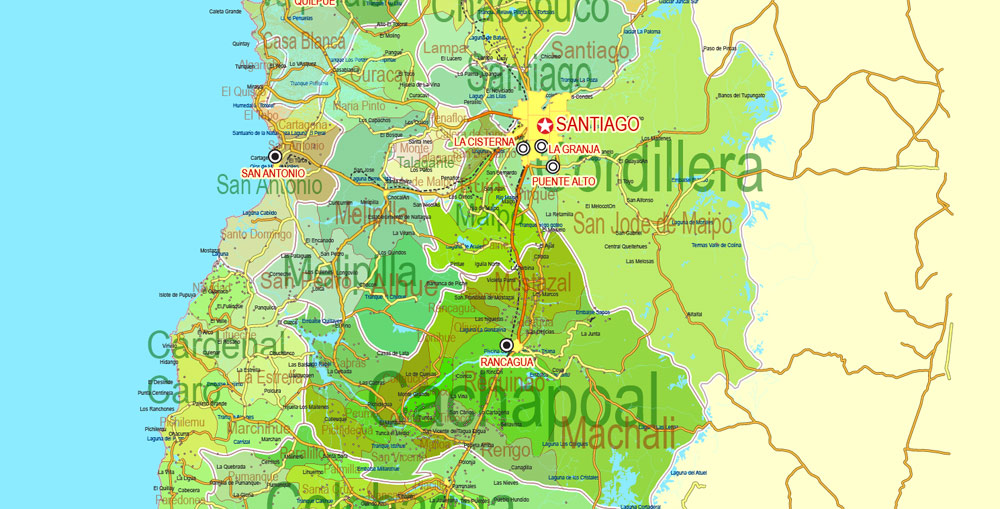
The northern Atacama Desert contains great mineral wealth, primarily copper and nitrates. The relatively small Central Valley, which includes Santiago, dominates the country in terms of population and agricultural resources. This area is also the historical center from which Chile expanded in the late 19th century, when it integrated the northern and southern regions. Southern Chile is rich in forests, grazing lands, and features a string of volcanoes and lakes. The southern coast is a labyrinth of fjords, inlets, canals, twisting peninsulas, and islands. The Andes Mountains are located on the eastern border.
The geography of Chile is extremely diverse as the country extends from a latitude of 17° South to Cape Horn at 56° (if Chilean claims on Antarctica are included Chile would extend to the South Pole) and from the ocean on the west to Andes on the east. Chile is situated in southern South America, bordering the South Pacific Ocean and a small part of the South Atlantic Ocean. Chile’s territorial shape is among the world’s most unusual. From north to south, Chile extends 4,270 km (2,653 mi), and yet it only averages 177 km (110 mi) east to west. Chile reaches from the middle of South America’s west coast straight down to the southern tip of the continent, where it curves slightly eastward. Diego Ramírez Islands and Cape Horn, the southernmost points in the Americas, where the Pacific and Atlantic oceans meet, are Chilean territory. Chile’s northern neighbors are Peru and Bolivia, and its border with Argentina to the east, at 5,150 km (3,200 mi), is the world’s third longest.
The northern two-thirds of Chile lie on top of the telluric Nazca Plate, which, moving eastward about ten centimeters a year, is forcing its way under the continental plate of South America. This movement has resulted in the formation of the Peru–Chile Trench, which lies beyond a narrow band of coastal waters off the northern two-thirds of the country. The trench is about 150 km (93 mi) wide and averages about 5,000 m (16,404 ft) in depth. At its deepest point, just north of the port of Antofagasta, it plunges to 8,066 m (26,463 ft). Although the ocean’s surface obscures this fact, most of Chile lies at the edge of a profound precipice.
The same telluric displacements that created the Peru-Chile Trench make the country highly prone to earthquakes. During the twentieth century, Chile has been struck by twenty-eight major earthquakes, all with a force greater than 6.9 on the Richter scale. The strongest of these occurred in 2010 (registering an estimated 8.8 on the Richter scale) and in Valdivia 1960 (reaching 9.5). This latter earthquake occurred on May 22, the day after another major quake measuring 7.25 on the Richter scale, and covered an extensive section of south-central Chile. It caused a tsunami that decimated several fishing villages in the south and raised or lowered sections of the coast as much as two meters. The clash between the Earth’s surface plates has also generated the Andes, a geologically young mountain range that, in Chilean territory alone, includes about 620 volcanoes, many of them active. Almost sixty of these had erupted in the twentieth century by the early 1990s. More than half of Chile’s land surface is volcanic in origin.
About 80 percent of the land in Chile is made up of mountains of some form or other. Most Chileans live near or on these mountains. The majestically snowcapped Andes and their precordillera elevations provide an ever-present backdrop to much of the scenery, but there are other, albeit less formidable, mountains as well. Although they seemingly can appear anywhere, the non-Andean mountains usually form part of transverse and coastal ranges. The former, located most characteristically in the near north and the far north natural regions, extend with various shapes from the Andes to the ocean, creating valleys with an east-west direction. The latter are evident mainly in the center of the country and create what is commonly called the Central Valley (Valle Central) between them and the Andes. In the far south, the Central Valley runs into the ocean’s waters. At this location, the higher elevations of the coastal range facing the Andes become a multiplicity of islands, forming an intricate labyrinth of channels and fjords that have been an enduring challenge to maritime navigators.
Much of Chile’s coastline is rugged, with surf that seems to explode against the rocks lying at the feet of high bluffs. This collision of land and sea gives way every so often to lovely beaches of various lengths, some of them encased by the bluffs. The Humboldt Current, which originates northwest of the Antarctic Peninsula (which juts into the Bellingshausen Sea) and runs the full length of the Chilean coast, makes the water frigid. Swimming at Chile’s popular beaches in the central part of the country, where the water gets no warmer than 15 °C (59 °F) in the summer, requires more than a bit of fortitude.
Chilean territory extends as far west as Polynesia. The best known of Chile’s Pacific Islands is Easter Island (Isla de Pascua, also known by its Polynesian name of Rapa Nui), with a population of 2,800 people. Located 3,600 km (2,237 mi) west of Chile’s mainland port of Caldera, just below the Tropic of Capricorn, Easter Island provides Chile a gateway to the Pacific. It is noted for its 867 monoliths (moais), which are huge (up to twenty meters high) and mysterious, expressionless faces sculpted of volcanic stone. The Juan Fernández Islands, located 587 km (365 mi) west of Valparaíso, are the locale of a small fishing settlement. They are famous for their lobster and the fact that one of the islands, Robinson Crusoe Island, is where Alexander Selkirk, the inspiration for Daniel Defoe’s novel, was marooned for about four years.
Chile
Country in South America
Chile is a long, narrow country stretching along South America’s western edge, with more than 6,000km of Pacific Ocean coastline. Santiago, its capital, sits in a valley surrounded by the Andes and Chilean Coast Range mountains. The city’s palm-lined Plaza de Armas contains the neoclassical cathedral and the National History Museum. The massive Parque Metropolitano offers swimming pools, a botanical garden and zoo.
Area
• Total
756,096.3 km2 (291,930.4 sq mi) (37th)
• Water (%) 1.07b
Population
• 2015 estimate 18,006,407 (62nd)
• 2012 census 16,341,929
• Density 24/km2 (62.2/sq mi) (194th)
Free vector maps:
Free download Vector Map US Interstate roads, Adobe PDF, V.2 Free_Map_US_Interstates_Roads_2.pdf
Free download Vector Map US Interstate roads, Adobe Illustrator, V.2 Free_Map_US_Interstates_Roads_2.ai
Free Download Vector Map US County and State Adobe Illustrator
Free_Vector_Map_US_States_County_Map.ai
Free Download Vector Map US County and State Adobe PDF
Free_Vector_Map_US_States_County_Map.pdf
Free Vector Map US Census Data Top US Ancestries by County Adobe Illustrator
Free_Vector_Map_US_Census-Data-Top-US-Ancestries-by-County.ai
Free Vector Map US Census Data Top US Ancestries by County Adobe PDF
Free_Vector_Map_US_Census-Data-Top-US-Ancestries-by-County.pdf

 Author: Kirill Shrayber, Ph.D. FRGS