Maine’s modern economy is based on agriculture, fishing, shipbuilding, forestry, and the pulp and paper industry. In recent decades, the state has been rapidly and successfully developing tourism, as well as high-tech, knowledge-intensive industries.
The main agricultural crops of the state of Maine are potatoes (especially famous for their potato harvests in the northernmost district of the state – Aroostook), cereals (mainly feed corn and oats), legumes. Fruits and berries (apples, cranberries, raspberries, strawberries) are grown in the state. Maine ranks first among all US states in terms of blueberry production, with a quarter of this extremely popular berry grown in the US. Maine is one of the largest producers of traditional New England maple syrup and maple sugar.
Maine farmers raise cattle, pigs, and poultry. It produces a lot of dairy products and eggs. The breeding of valuable fish species (salmon, trout) is also widespread.
An important role in the economy of Maine is played by commercial fishing, cod, flounder, haddock, and herring are caught in coastal waters. Maine is the leader in the United States in the production of lobsters and is also famous for its other seafood (mussels, crabs, sea urchins).
In Maine, granite, sand, crushed stone, and other building materials are mined, as well as semiprecious stones (amethysts, topazes, tourmalines).
Maine is one of the largest producers of lumber, paper, and wood products in the United States. The state’s factories also produce electronic equipment, leather goods, and food.
The state of Maine is home to the headquarters of several well-known companies in the United States: the manufacturer of semiconductor products Fairchild Semiconductor, the chain of retail supermarkets Hannaford Bros. Co., which produces clothing Cole Haan and LLBean, one of the largest manufacturers of GPS devices DeLorme.
Bar Harbor is home to several biotech companies, including one of the world’s leading genetic research and development companies, Jackson Laboratory.
The port of Portland is one of the largest in the Northeastern United States.
Shipbuilding has traditionally been one of the most important sectors of the economy. Maine’s two largest shipyards, Bath Iron Works in Bath and Portsmouth Naval Shipyard in Kittery, have been building ships for the U.S. Navy for centuries.
The picturesque and diverse nature of Maine attracts many tourists, thereby giving the opportunity to develop another very important branch of the state’s economy.
The Appalachian Trail is a very well-known and popular hiking trail in the United States. Lovers of rafting (rafting) and rowing with pleasure come to the rivers of Maine. Maine is very popular among hunters (including bear, elk, deer) and fishermen.
One of the main tourist attractions in Maine (and one of the most popular attractions in the United States) is the Acadia National Park. Each year, the park, located near the coast of Maine on Mount Desert Island, is visited by more than two million tourists.
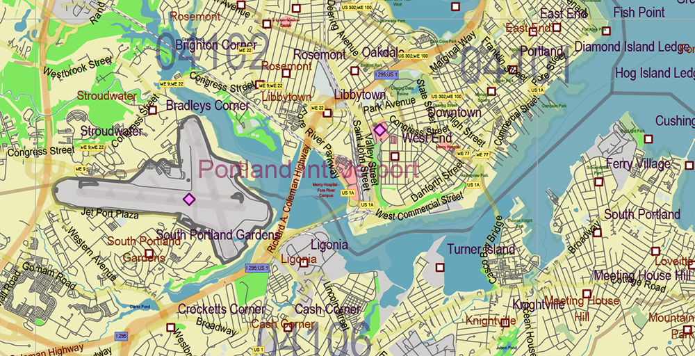
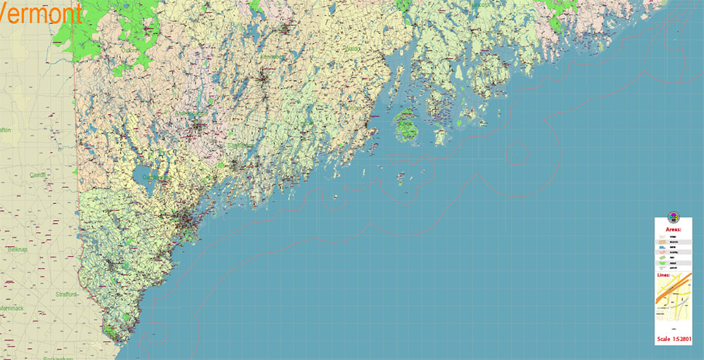
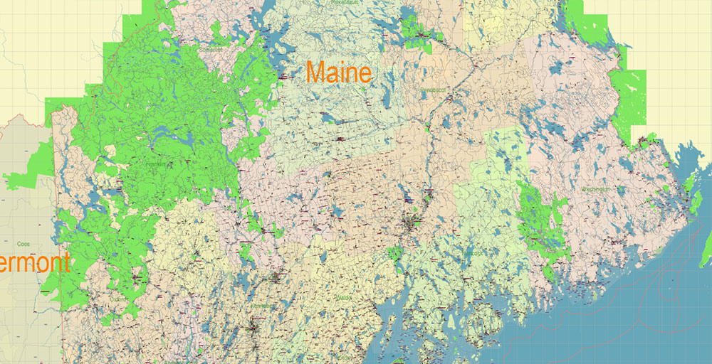
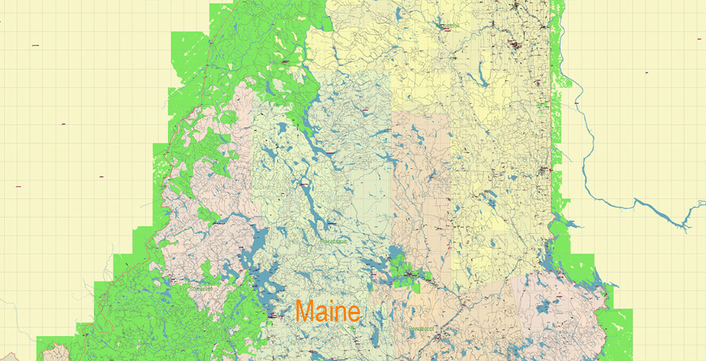
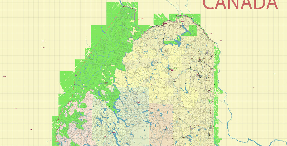
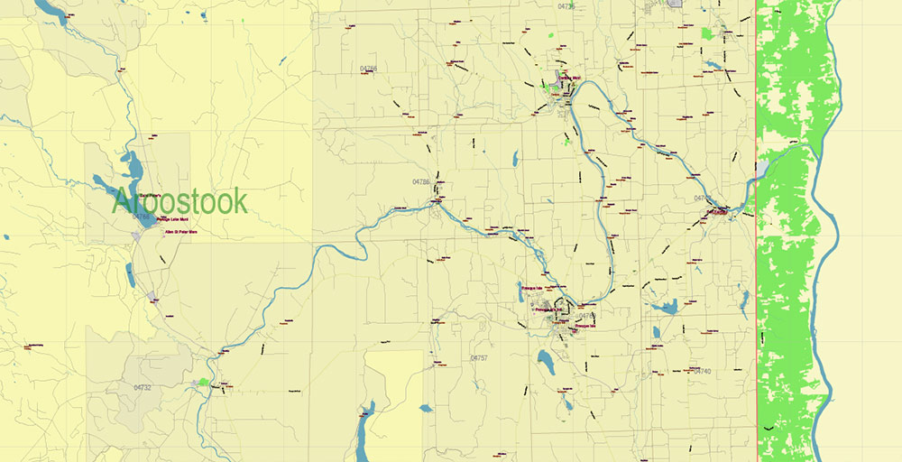
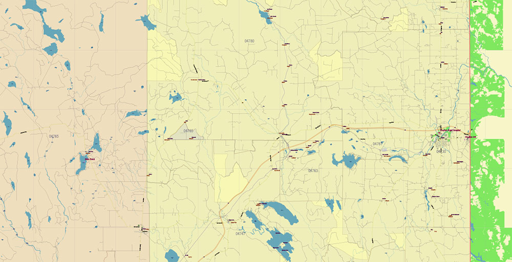
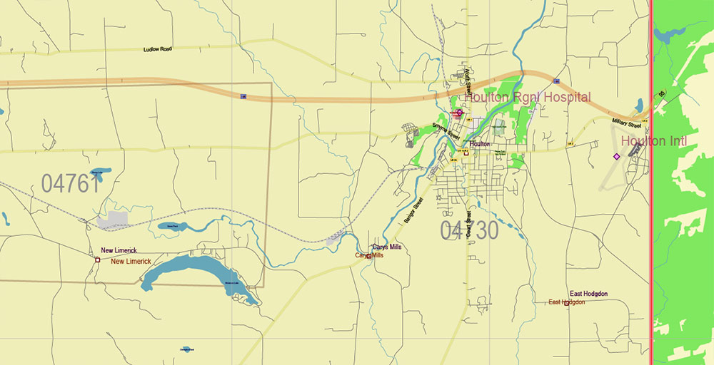
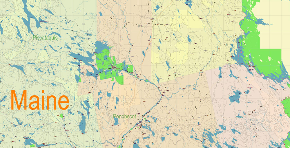
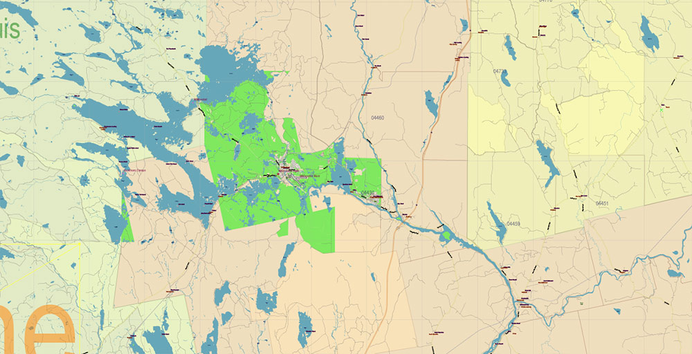
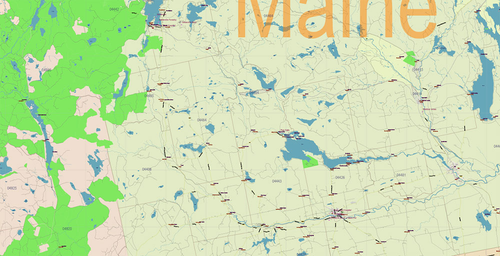
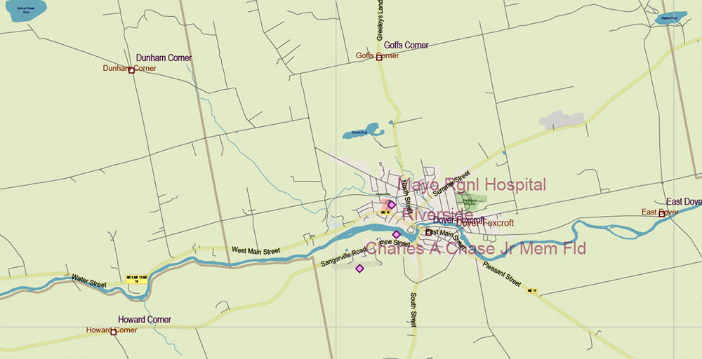
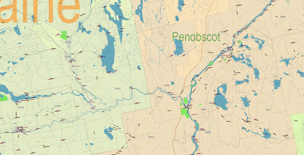
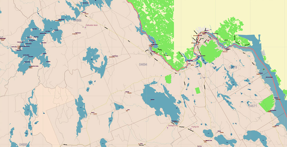
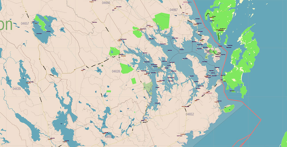
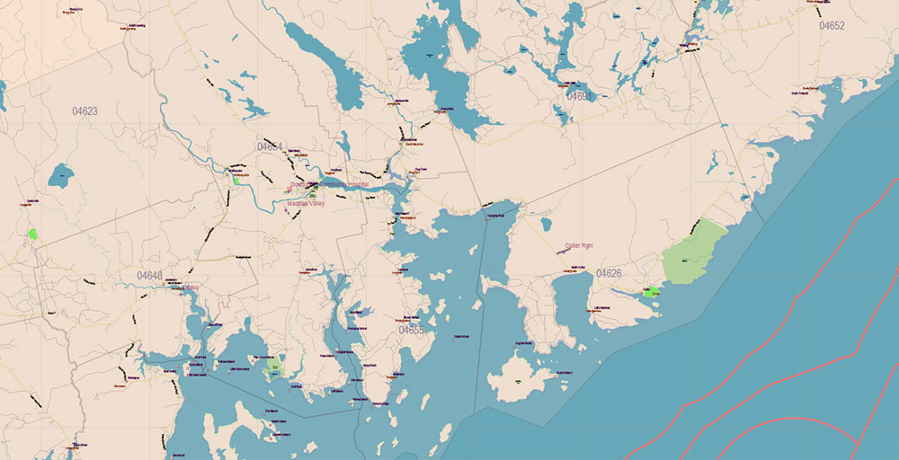
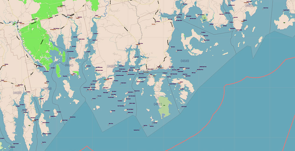
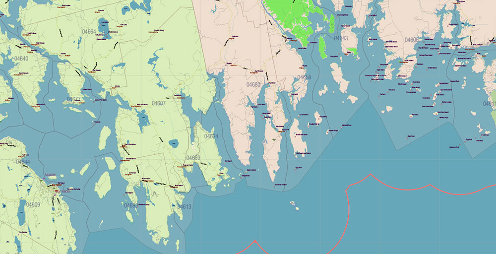
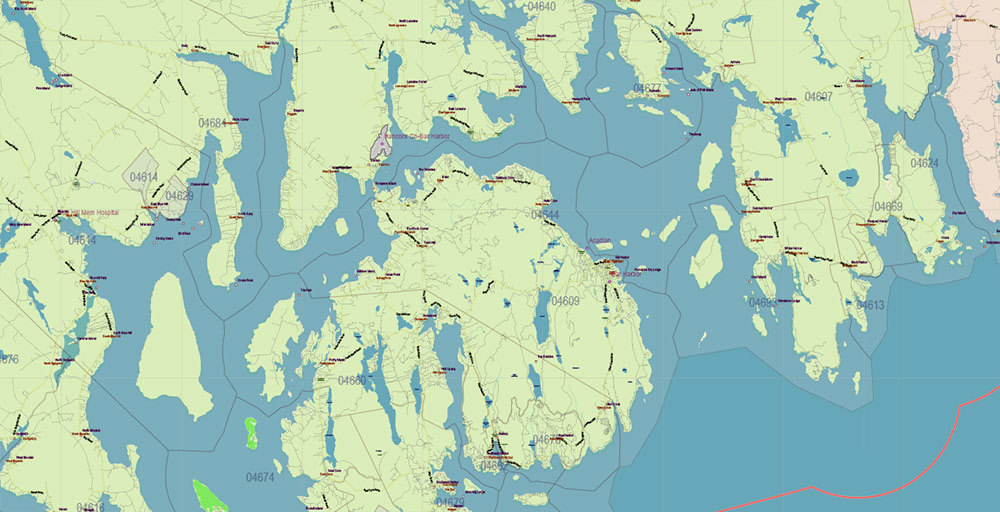
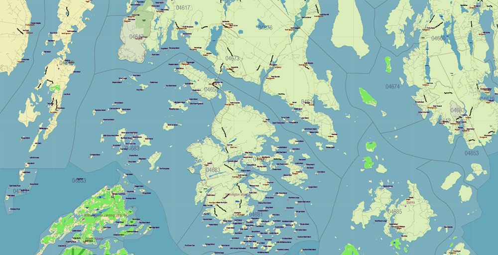
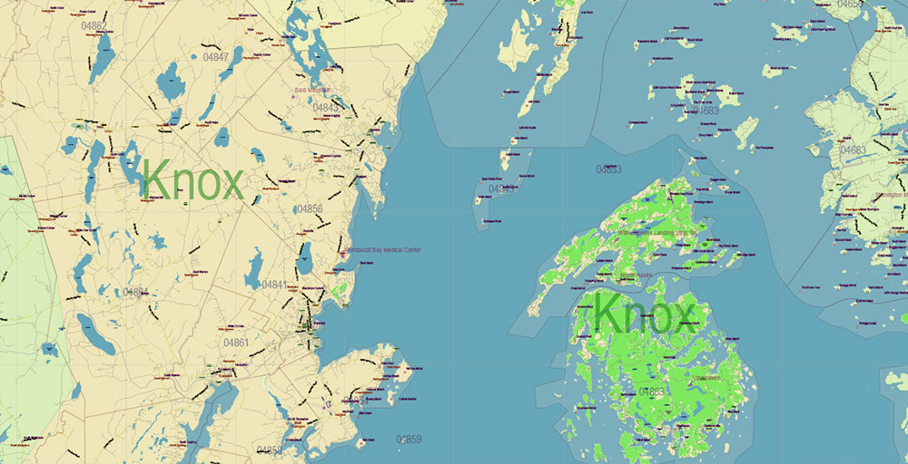
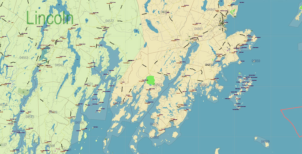
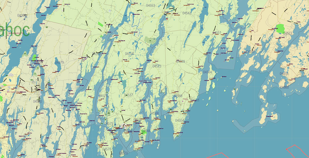
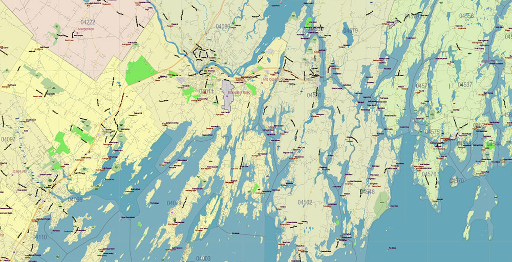
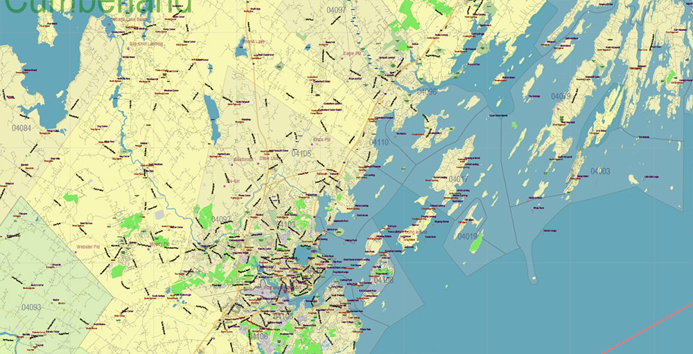
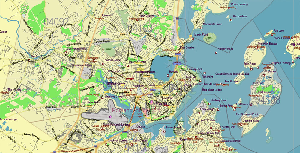
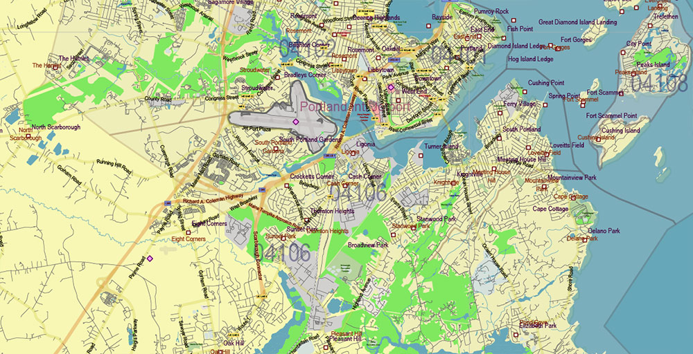
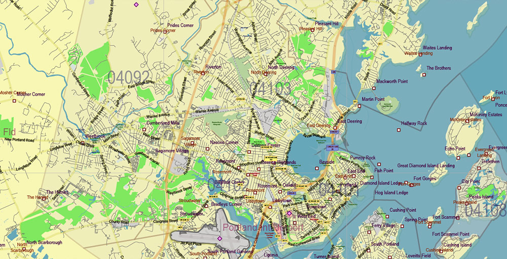
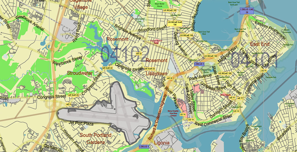
Printable Vector Map of Maine Full State US: All Streets and Roads + counties areas + zipcodes areas, full editable Adobe Illustrator Map in layers, scalable, 53 MB ZIP
Scale: 1:52801
All streets and roads, Names of Principal streets, All Cities and Towns, Counties, All Geonames, airports and heliports. Map for design, printing, arts, projects, presentations, for architects, designers, and builders, business, logistics.
ATTN! All objects are located on separate layers by type. The preview shows them all together. When you work with this map, just turn off or delete those layers that are not needed for your project.
For Editing and High-Quality Printing, Royalty free
Need AutoCAD DWG / DXF, CDR or any other format? Please, contact us!

Maine Full State US Vector Map: Full Extra High Detailed (all roads, zipcodes, airports) + Admin Areas editable Adobe Illustrator in layers
Layers list:
- Legend
- Grids
- Labels of roads (numbers) – highways, interstate
- All Geonames (cities, towns, villages, hamlets, islands)
- Points of the Geonames (cities, towns, villages, hamlets, islands)
- Names places: Names of all Cities, towns, villages and hamlets
- Names of the Airports and Heliports
- Points of the Airports and Heliports
- Numbers of ZIPcodes
- Names of objects (water, park, hospital)
- Names of States
- Names of Counties
- Names of the Main Streets
- Major Roads and Streets – Highways
- Minor Roads and residential streets
- Railroads
- State boundaries
- Water objects (rivers, lakes, ponds, swamps, reefs)
- Waterways
- Ground objects (urban areas, parks, hospitals, etc.)
- ZIP-codes areas
- Counties areas (colored)
- States areas
- Islands
- Sea
- Background
Maine Full State US Vector Map: Full Extra High Detailed (all roads, zipcodes, airports) + Admin Areas editable Adobe Illustrator in layers
Maine Full State US Vector Map: Full Extra High Detailed (all roads, zipcodes, airports) + Admin Areas editable Adobe Illustrator in layers
Maine Full State US Vector Map: Full Extra High Detailed (all roads, zipcodes, airports) + Admin Areas editable Adobe Illustrator in layers
Maine Full State US Vector Map: Full Extra High Detailed (all roads, zipcodes, airports) + Admin Areas editable Adobe Illustrator in layers
Maine Full State US Vector Map: Full Extra High Detailed (all roads, zipcodes, airports) + Admin Areas editable Adobe Illustrator in layers
Maine Full State US Vector Map: Full Extra High Detailed (all roads, zipcodes, airports) + Admin Areas editable Adobe Illustrator in layers
Maine Full State US Vector Map: Full Extra High Detailed (all roads, zipcodes, airports) + Admin Areas editable Adobe Illustrator in layers
Maine Full State US Vector Map: Full Extra High Detailed (all roads, zipcodes, airports) + Admin Areas editable Adobe Illustrator in layers
Maine Full State US Vector Map: Full Extra High Detailed (all roads, zipcodes, airports) + Admin Areas editable Adobe Illustrator in layers
Maine Full State US Vector Map: Full Extra High Detailed (all roads, zipcodes, airports) + Admin Areas editable Adobe Illustrator in layers
Maine Full State US Vector Map: Full Extra High Detailed (all roads, zipcodes, airports) + Admin Areas editable Adobe Illustrator in layers
Maine Full State US Vector Map: Full Extra High Detailed (all roads, zipcodes, airports) + Admin Areas editable Adobe Illustrator in layers
Maine Full State US Vector Map: Full Extra High Detailed (all roads, zipcodes, airports) + Admin Areas editable Adobe Illustrator in layers
Maine Full State US Vector Map: Full Extra High Detailed (all roads, zipcodes, airports) + Admin Areas editable Adobe Illustrator in layers
Maine Full State US Vector Map: Full Extra High Detailed (all roads, zipcodes, airports) + Admin Areas editable Adobe Illustrator in layers
Maine Full State US Vector Map: Full Extra High Detailed (all roads, zipcodes, airports) + Admin Areas editable Adobe Illustrator in layers
Maine Full State US Vector Map: Full Extra High Detailed (all roads, zipcodes, airports) + Admin Areas editable Adobe Illustrator in layers
Maine Full State US Vector Map: Full Extra High Detailed (all roads, zipcodes, airports) + Admin Areas editable Adobe Illustrator in layers
Maine Full State US Vector Map: Full Extra High Detailed (all roads, zipcodes, airports) + Admin Areas editable Adobe Illustrator in layers
Maine Full State US Vector Map: Full Extra High Detailed (all roads, zipcodes, airports) + Admin Areas editable Adobe Illustrator in layers
Maine Full State US Vector Map: Full Extra High Detailed (all roads, zipcodes, airports) + Admin Areas editable Adobe Illustrator in layers
Maine Full State US Vector Map: Full Extra High Detailed (all roads, zipcodes, airports) + Admin Areas editable Adobe Illustrator in layers
Maine Full State US Vector Map: Full Extra High Detailed (all roads, zipcodes, airports) + Admin Areas editable Adobe Illustrator in layers
Maine Full State US Vector Map: Full Extra High Detailed (all roads, zipcodes, airports) + Admin Areas editable Adobe Illustrator in layers
Maine Full State US Vector Map: Full Extra High Detailed (all roads, zipcodes, airports) + Admin Areas editable Adobe Illustrator in layers
Maine Full State US Vector Map: Full Extra High Detailed (all roads, zipcodes, airports) + Admin Areas editable Adobe Illustrator in layers
Maine Full State US Vector Map: Full Extra High Detailed (all roads, zipcodes, airports) + Admin Areas editable Adobe Illustrator in layers
Maine Full State US Vector Map: Full Extra High Detailed (all roads, zipcodes, airports) + Admin Areas editable Adobe Illustrator in layers
Maine Full State US Vector Map: Full Extra High Detailed (all roads, zipcodes, airports) + Admin Areas editable Adobe Illustrator in layers

 Author: Kirill Shrayber, Ph.D. FRGS

