Official state name — State of Maine
State region – New England, Northeastern United States
State area – 91,644 km2 (including land – 79,930 km2 and water surface – 11,714 km2), 39th place among the US states
State length:
from north to south-515 km
from west to east-330 km
State elevation above sea level:
maximum — 1,606 m
minimum-0 m
State Time Zone — Eastern United States Time Zone
The state was founded on March 15, 1820 (the 23rd state in the United States)
The state capital is Augusta
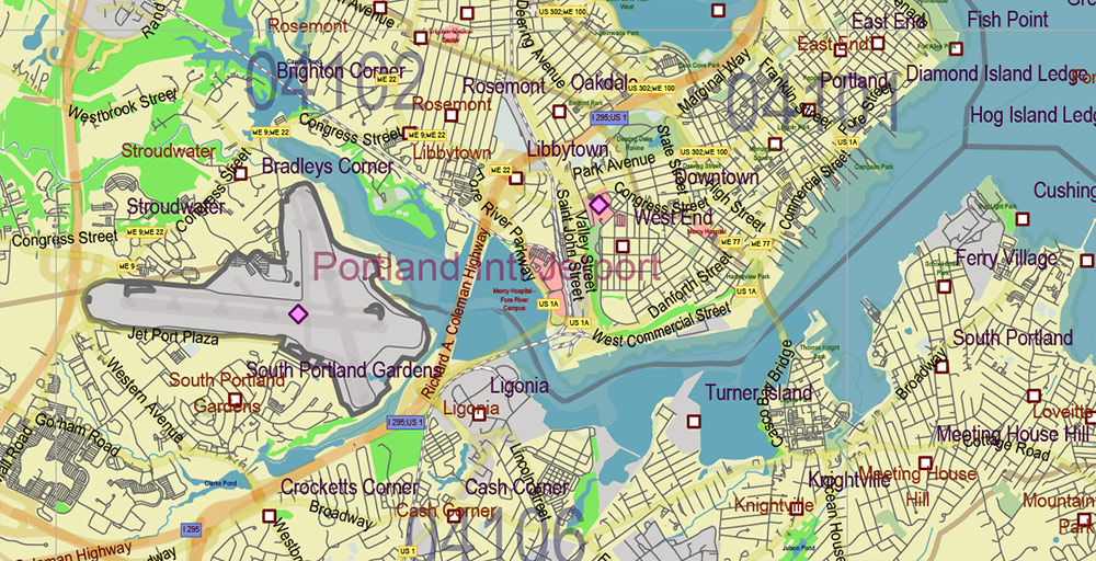
The largest city in the state is Portland
The state has a population of about 1,345,000 (42nd among US states)
The population density in the state is about 16.9 people/km2 (38th place among US states) The average household income in the state is about $56,280 (32nd place among US states)
State motto – Dirigo (“I lead”)
State nicknames — “Pine State“, “Vacation Country”
State abbreviation – ME
The state of Maine is located in New England in the northeastern United States. Maine is bordered by the state of New Hampshire to the west, as well as by Canada (with the provinces of Quebec to the northwest and New Brunswick to the northeast). From the south, the coast of the state is washed by the waters of the Atlantic Ocean. The easternmost point of the continental United States, the West Quaddie Lighthouse, is located in Maine.
There is no consensus about the origin of the name of the state of Maine, according to one of the popular versions, it comes from the English word “mainland”. However, in 2001, the Maine Legislature passed a resolution stating that the state was named after the French province of the same name. It is this version of the origin of the name that is now considered official.
Much of Maine is occupied by the Appalachian spurs: to the west are the ranges of the White Mountains, to the north are the Longfellow Mountains. South and southeast Maine is part of the Atlantic Lowlands. The coastline of the state is cut by bays, along the coast, there are hundreds of islands. A significant part of the territory of the “Pine State” is covered with coniferous forests.
Maine has a humid continental climate, with warm, humid summers and cold (especially in the north of the state), snowy winters.
The first European explorer of the territory of the modern state of Maine was the famous French pioneer Samuel de Champlain in 1604. At the beginning of the 17th century, the French established several Catholic missions and a trading post here. Soon the British claimed these lands, and from the seventies of the XVII century and for a century, the territory of Maine was the cause of constant disputes, conflicts, and wars. Only with the end of the Franco-Indian War in 1763 did England establish full control over the region.
Residents of Maine (which was then part of Massachusetts) actively participated in the War of Independence. The history of the United States includes the “Burning of Falmouth” in 1775 when British ships set fire to the port of Falmouth (modern Portland), and the landing troops completed the destruction of the city.
Maine was granted state status in 1820, becoming part of the”Missouri Compromise“. Then, to maintain the balance in the US Congress, two new states were simultaneously included in the US – the slave-owning Missouri and Maine, in which slavery was prohibited.
Maine is a sparsely populated state, with about 70,000 residents in its largest city, Portland, and about 20,000 in the state capital, Augusta.
In Maine, there are a lot of ethnic French and French-speaking residents (of all the US states, only New Hampshire has more). This is due to the state’s history, as well as its proximity to the French-speaking Canadian province of Quebec.
Maine’s modern economy is based on agriculture, fishing, shipbuilding, forestry, and the pulp and paper industry. In recent decades, tourism has been developing rapidly and successfully in the state (it is not by chance that one of the state’s nicknames is “Vacation Country“).
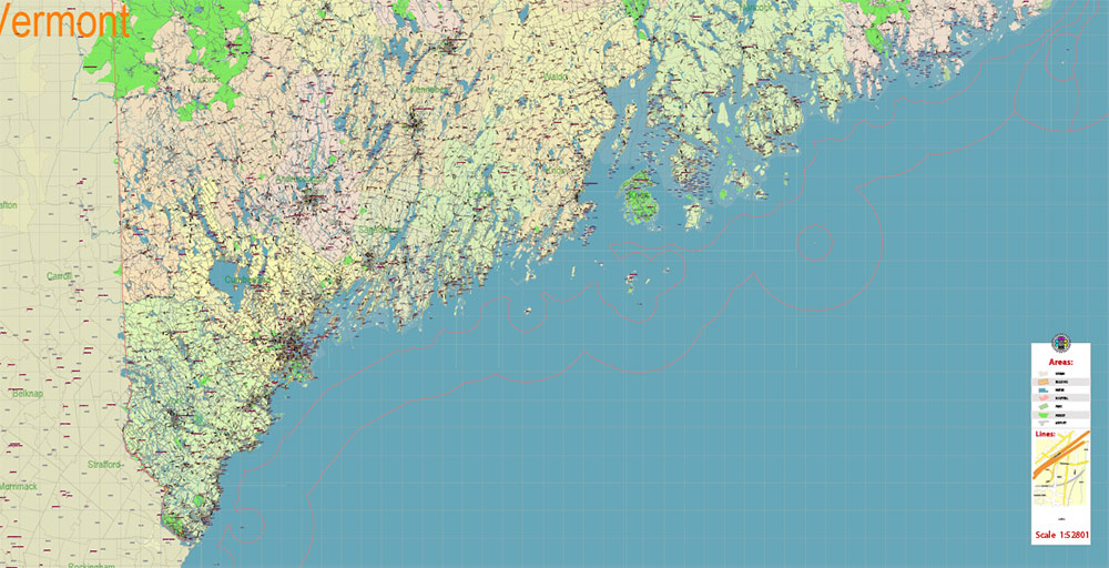
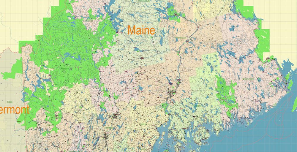
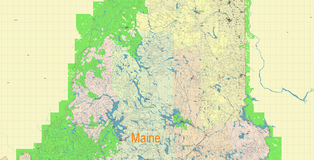
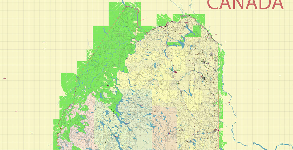
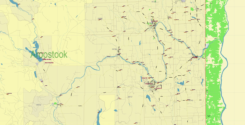
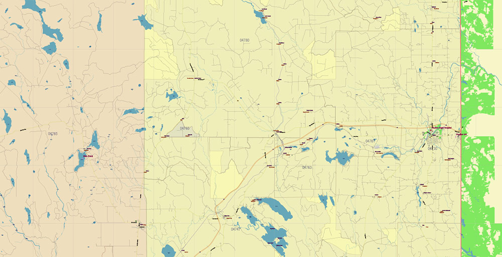
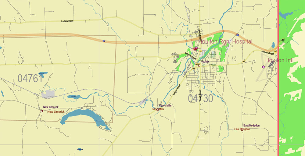
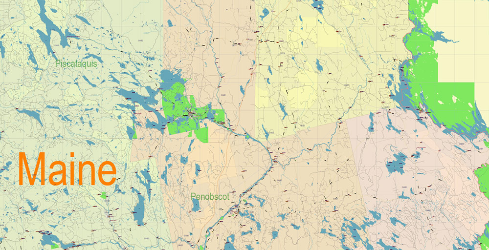
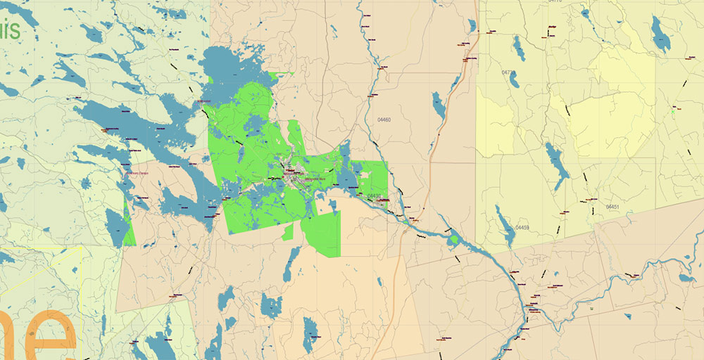
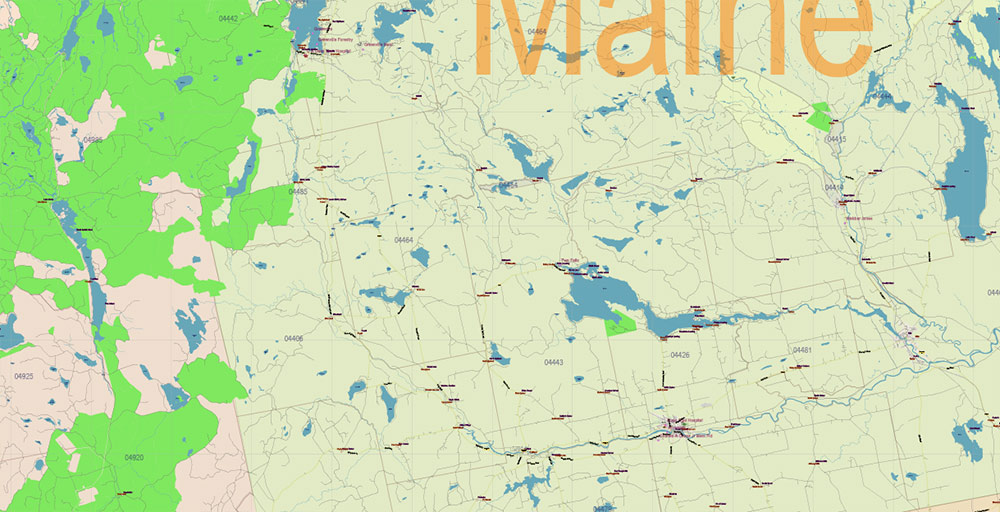
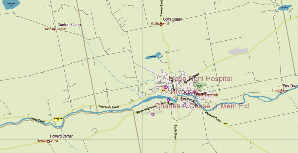
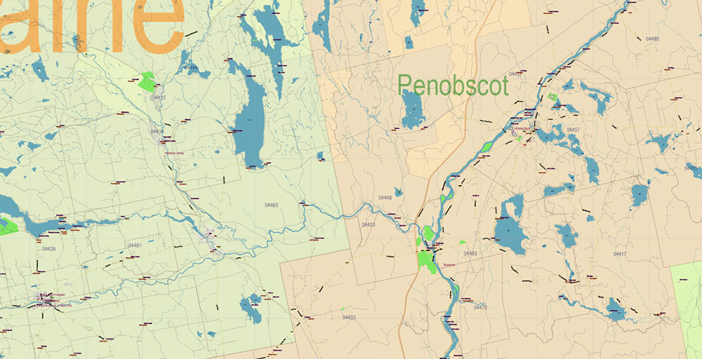
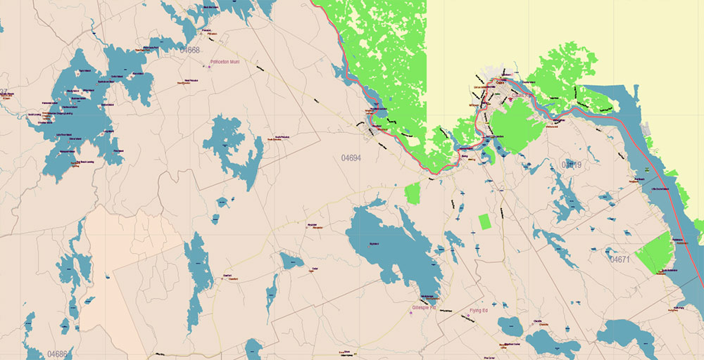
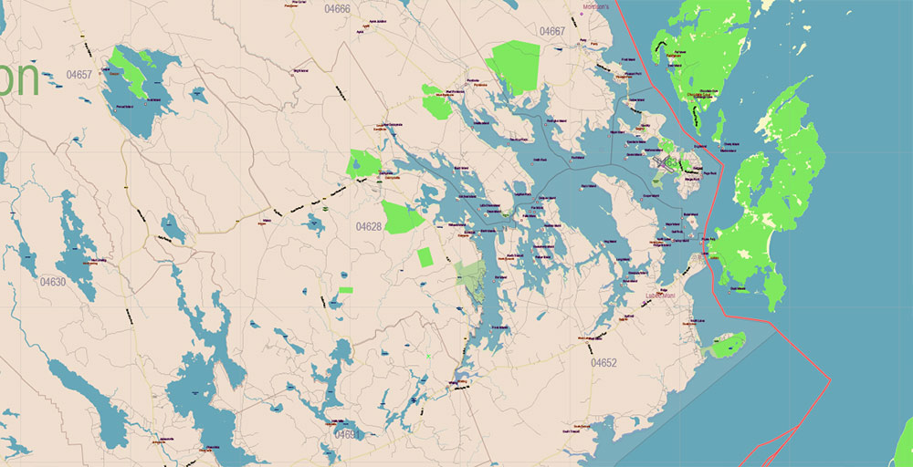
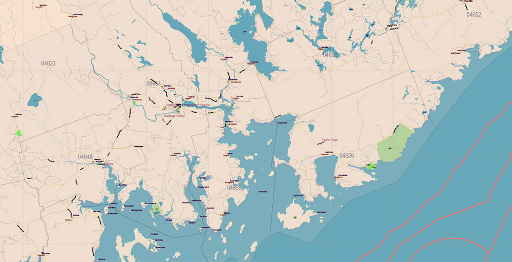
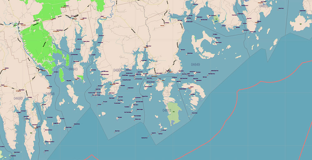
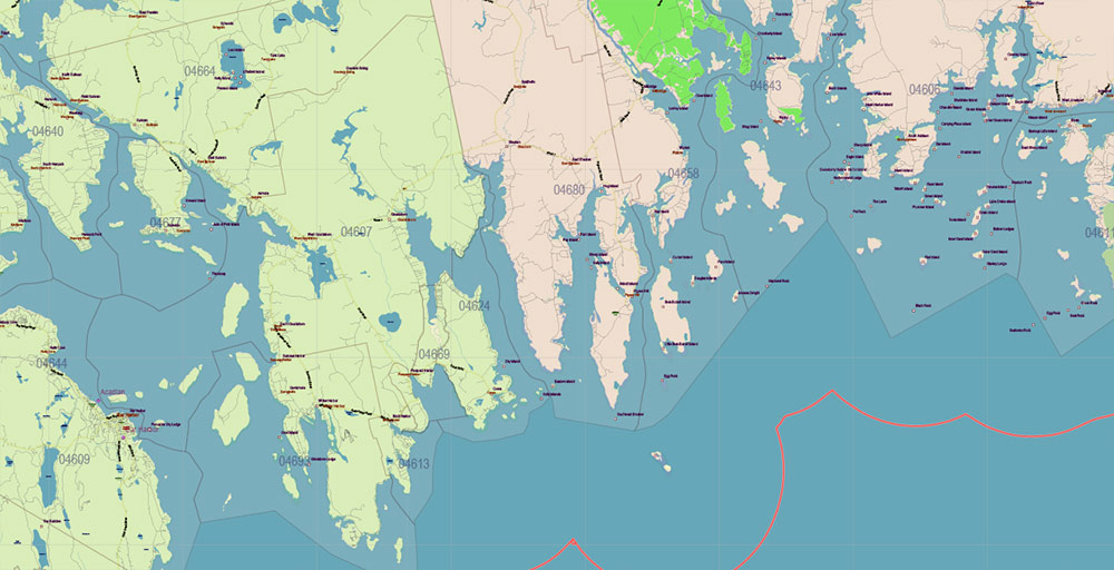
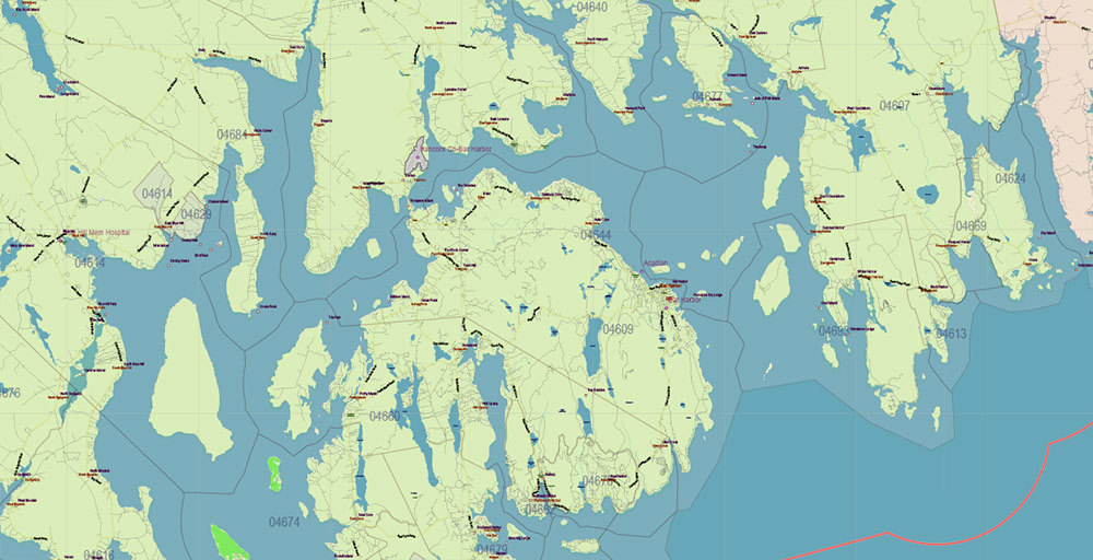
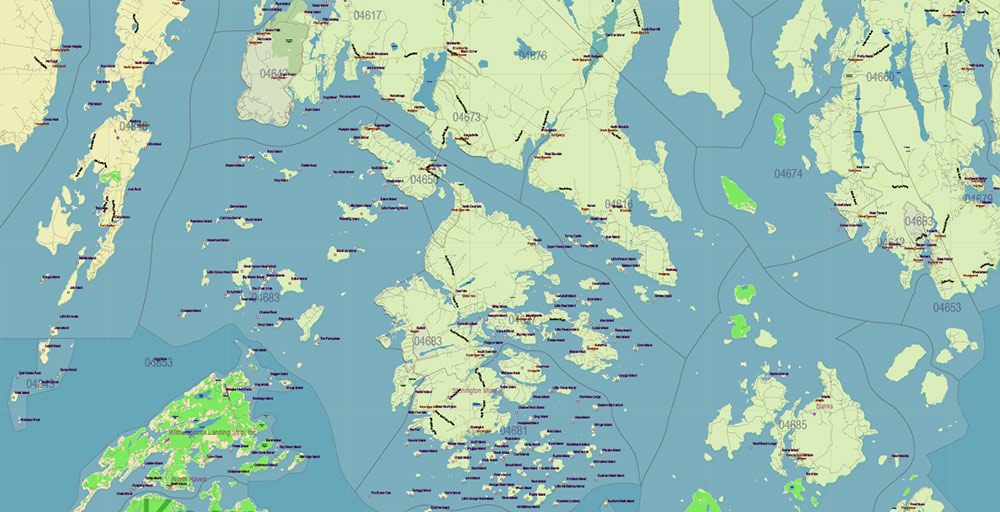
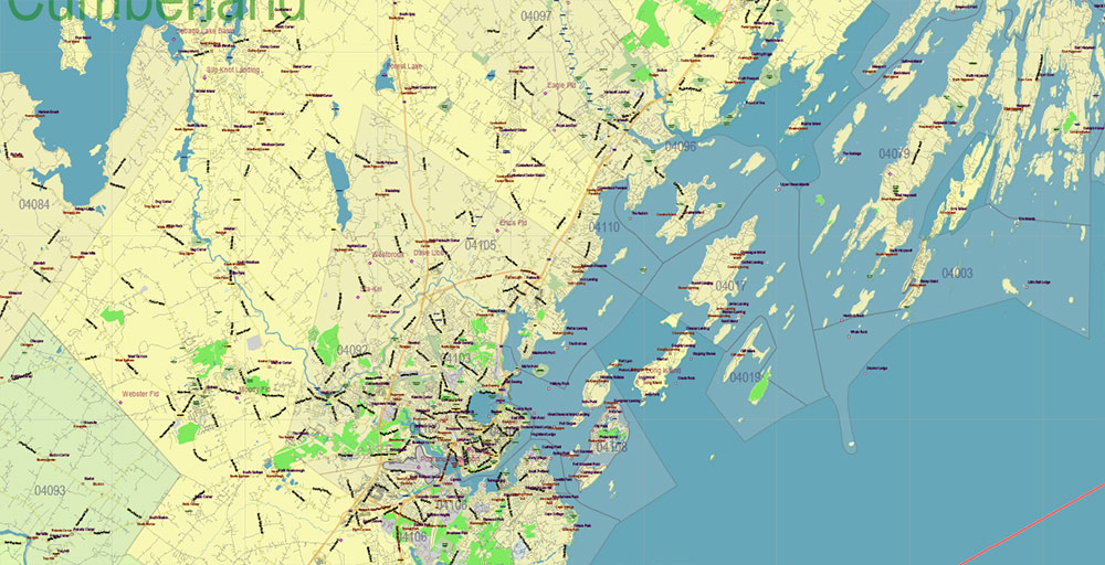
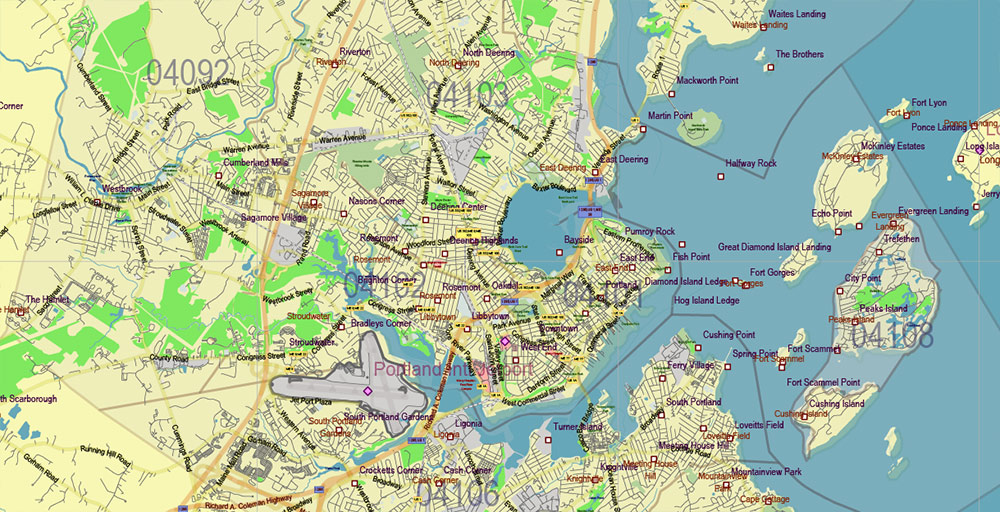
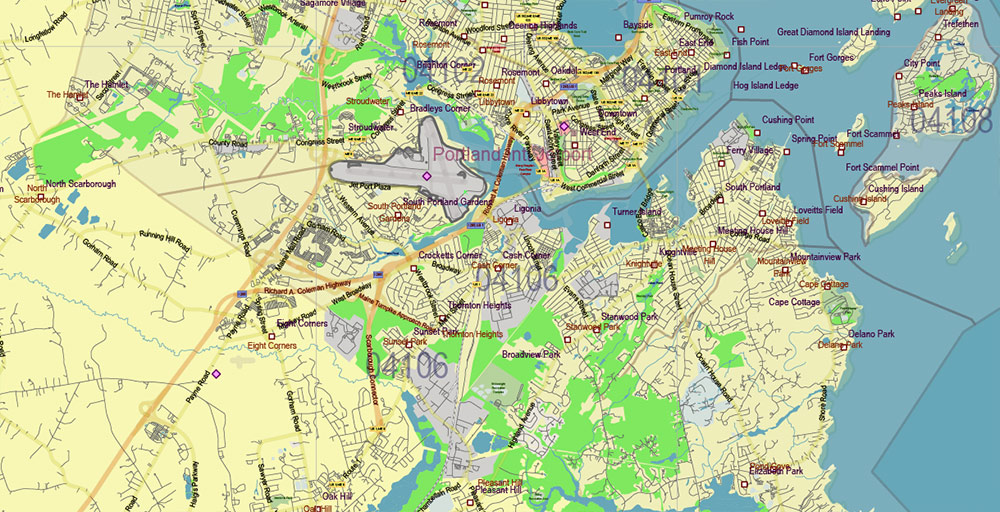
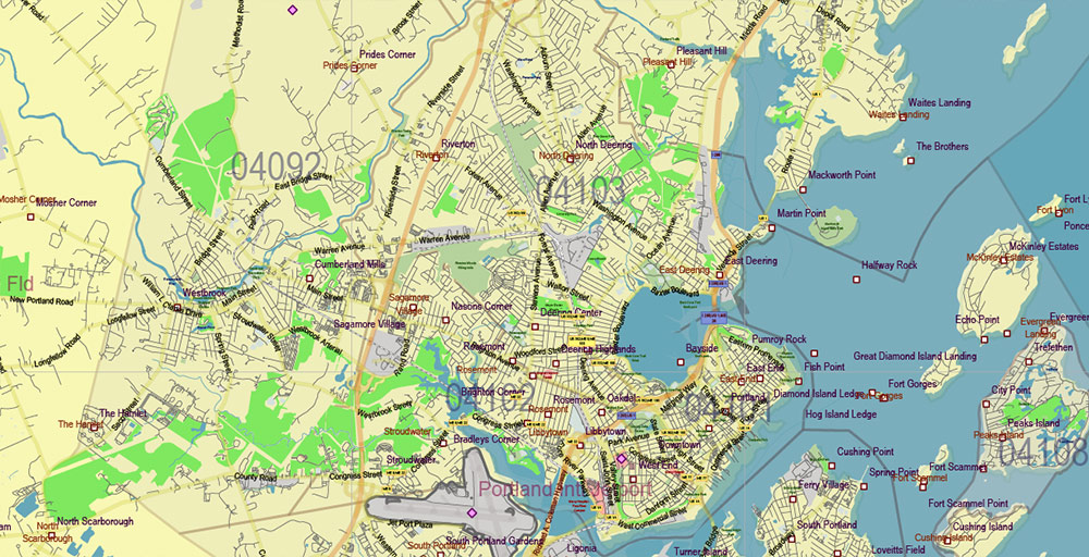
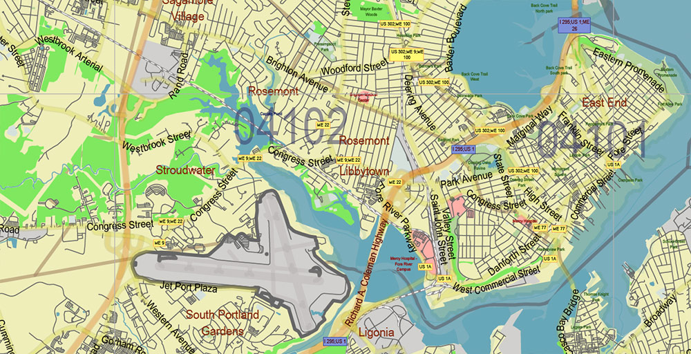
Printable PDF Vector Map of Maine Full State US: All Streets and Roads + counties areas + zip codes areas, fully editable Adobe PDF Map in layers, scalable, 126 MB ZIP
Scale: 1:52801
All streets and roads, Names of Principal streets, All Cities and Towns, Counties, All Geonames, airports and heliports. Map for design, printing, arts, projects, presentations, for architects, designers, and builders, business, logistics.
ATTN! All objects are located on separate layers by type. The preview shows them all together. When you work with this map, just turn off or delete those layers that are not needed for your project.
For Editing and High-Quality Printing, Royalty free
Need AutoCAD DWG / DXF, CDR, or any other format? Please, contact us!

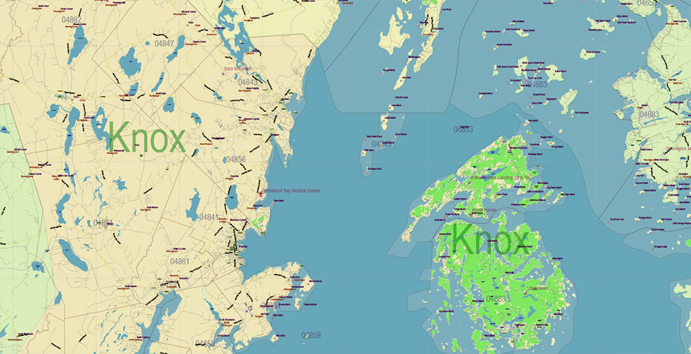
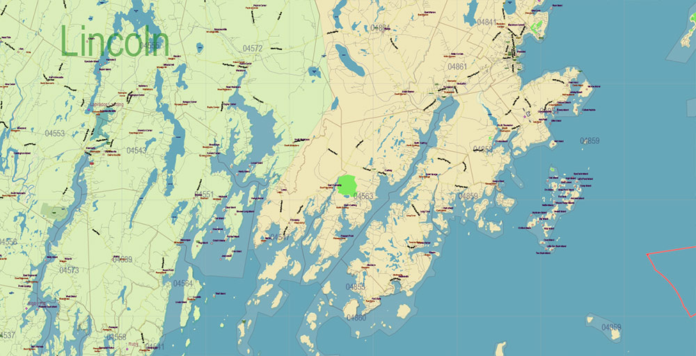
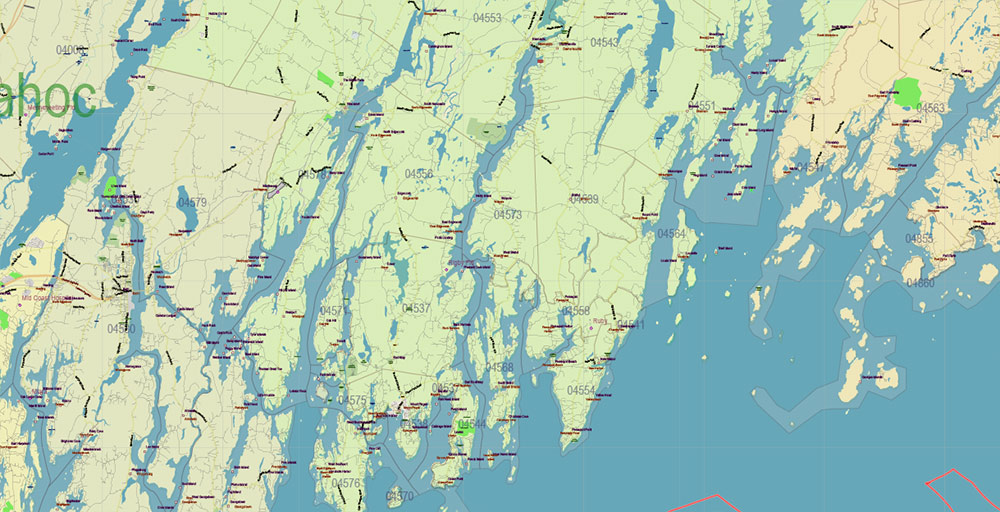
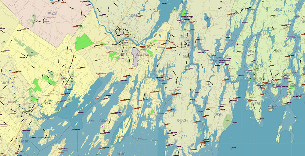
Maine Full State US PDF Vector Map: Full Extra High Detailed (all roads, zipcodes, airports) + Admin Areas editable Adobe PDF in layers
Layers list:
- Legend
- Grids
- Labels of roads (numbers) – highways, interstate
- All Geonames (cities, towns, villages, hamlets, islands)
- Points of the Geonames (cities, towns, villages, hamlets, islands)
- Names places: Names of all Cities, towns, villages and hamlets
- Names of the Airports and Heliports
- Points of the Airports and Heliports
- Numbers of ZIPcodes
- Names of objects (water, park, hospital)
- Names of States
- Names of Counties
- Names of the Main Streets
- Major Roads and Streets – Highways
- Minor Roads and residential streets
- Railroads
- State boundaries
- Water objects (rivers, lakes, ponds, swamps, reefs)
- Waterways
- Ground objects (urban areas, parks, hospitals, etc.)
- ZIP-codes areas
- Counties areas (colored)
- States areas
- Islands
- Sea
- Background
Maine Full State US PDF Vector Map: Full Extra High Detailed (all roads, zipcodes, airports) + Admin Areas editable Adobe PDF in layers
Maine Full State US PDF Vector Map: Full Extra High Detailed (all roads, zipcodes, airports) + Admin Areas editable Adobe PDF in layers
Maine Full State US PDF Vector Map: Full Extra High Detailed (all roads, zipcodes, airports) + Admin Areas editable Adobe PDF in layers
Maine Full State US PDF Vector Map: Full Extra High Detailed (all roads, zipcodes, airports) + Admin Areas editable Adobe PDF in layers
Maine Full State US PDF Vector Map: Full Extra High Detailed (all roads, zipcodes, airports) + Admin Areas editable Adobe PDF in layers
Maine Full State US PDF Vector Map: Full Extra High Detailed (all roads, zipcodes, airports) + Admin Areas editable Adobe PDF in layers
Maine Full State US PDF Vector Map: Full Extra High Detailed (all roads, zipcodes, airports) + Admin Areas editable Adobe PDF in layers
Maine Full State US PDF Vector Map: Full Extra High Detailed (all roads, zipcodes, airports) + Admin Areas editable Adobe PDF in layers
Maine Full State US PDF Vector Map: Full Extra High Detailed (all roads, zipcodes, airports) + Admin Areas editable Adobe PDF in layers
Maine Full State US PDF Vector Map: Full Extra High Detailed (all roads, zipcodes, airports) + Admin Areas editable Adobe PDF in layers
Maine Full State US PDF Vector Map: Full Extra High Detailed (all roads, zipcodes, airports) + Admin Areas editable Adobe PDF in layers
Maine Full State US PDF Vector Map: Full Extra High Detailed (all roads, zipcodes, airports) + Admin Areas editable Adobe PDF in layers
Maine Full State US PDF Vector Map: Full Extra High Detailed (all roads, zipcodes, airports) + Admin Areas editable Adobe PDF in layers
Maine Full State US PDF Vector Map: Full Extra High Detailed (all roads, zipcodes, airports) + Admin Areas editable Adobe PDF in layers
Maine Full State US PDF Vector Map: Full Extra High Detailed (all roads, zipcodes, airports) + Admin Areas editable Adobe PDF in layers
Maine Full State US PDF Vector Map: Full Extra High Detailed (all roads, zipcodes, airports) + Admin Areas editable Adobe PDF in layers
Maine Full State US PDF Vector Map: Full Extra High Detailed (all roads, zipcodes, airports) + Admin Areas editable Adobe PDF in layers
Maine Full State US PDF Vector Map: Full Extra High Detailed (all roads, zipcodes, airports) + Admin Areas editable Adobe PDF in layers
Maine Full State US PDF Vector Map: Full Extra High Detailed (all roads, zipcodes, airports) + Admin Areas editable Adobe PDF in layers
Maine Full State US PDF Vector Map: Full Extra High Detailed (all roads, zipcodes, airports) + Admin Areas editable Adobe PDF in layers
Maine Full State US PDF Vector Map: Full Extra High Detailed (all roads, zipcodes, airports) + Admin Areas editable Adobe PDF in layers
Maine Full State US PDF Vector Map: Full Extra High Detailed (all roads, zipcodes, airports) + Admin Areas editable Adobe PDF in layers
Maine Full State US PDF Vector Map: Full Extra High Detailed (all roads, zipcodes, airports) + Admin Areas editable Adobe PDF in layers
Maine Full State US PDF Vector Map: Full Extra High Detailed (all roads, zipcodes, airports) + Admin Areas editable Adobe PDF in layers
Maine Full State US PDF Vector Map: Full Extra High Detailed (all roads, zipcodes, airports) + Admin Areas editable Adobe PDF in layers
Maine Full State US PDF Vector Map: Full Extra High Detailed (all roads, zipcodes, airports) + Admin Areas editable Adobe PDF in layers
Maine Full State US PDF Vector Map: Full Extra High Detailed (all roads, zipcodes, airports) + Admin Areas editable Adobe PDF in layers
Maine Full State US PDF Vector Map: Full Extra High Detailed (all roads, zipcodes, airports) + Admin Areas editable Adobe PDF in layers
Maine Full State US PDF Vector Map: Full Extra High Detailed (all roads, zipcodes, airports) + Admin Areas editable Adobe PDF in layers

 Author: Kirill Shrayber, Ph.D. FRGS

