Extended Description of the Vector Map
Printable PDF Vector Map of Izmir Turkey detailed street map scale 1:3681 fully editable Layered Adobe PDF scalable, text/curves format all names, 83 MB ZIP
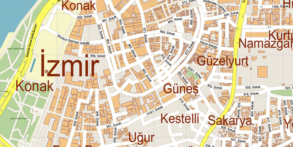
All street names, Main Objects, Buildings. Map for design, printing, arts, projects, presentations, for architects, designers, and builders, business, logistics.
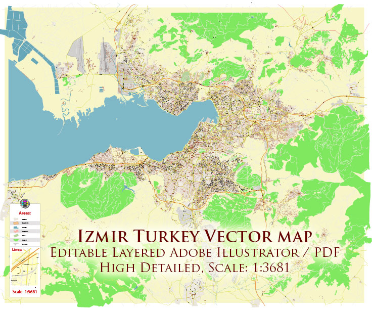
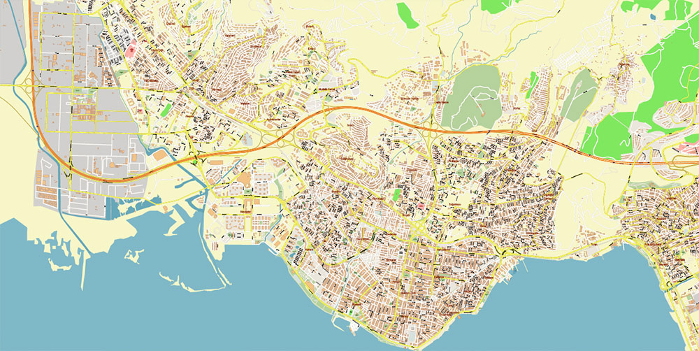
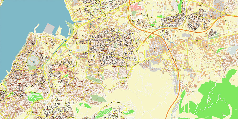
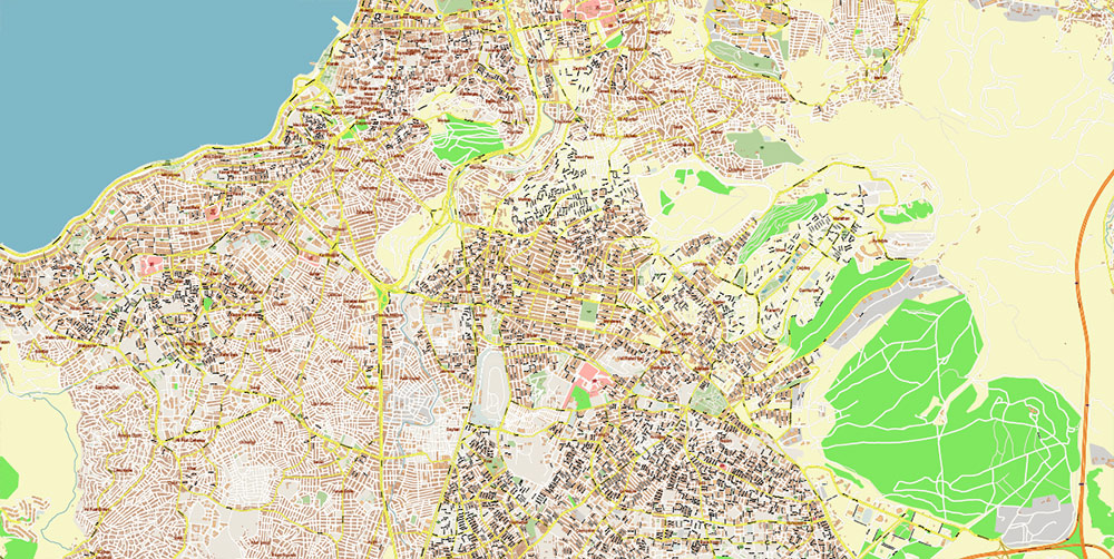
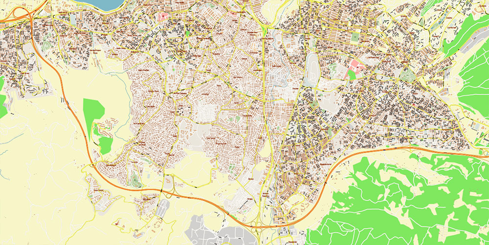
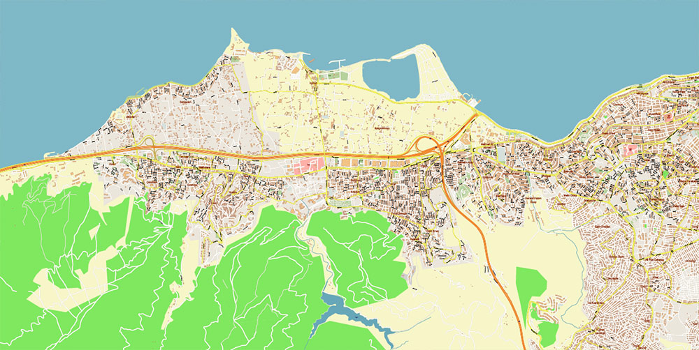
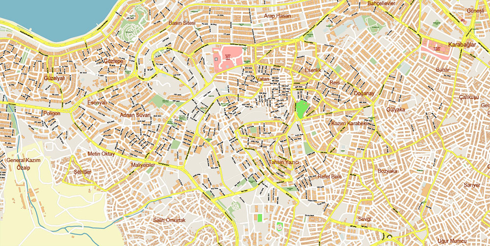
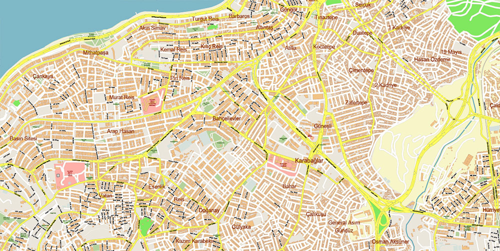
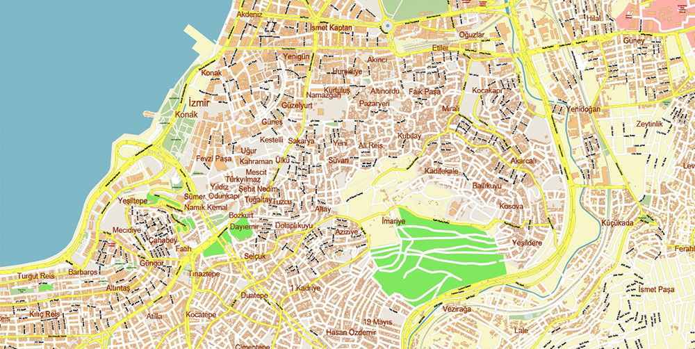
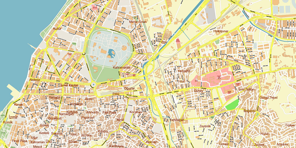
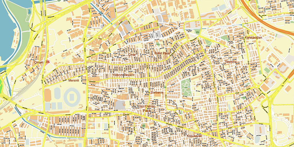
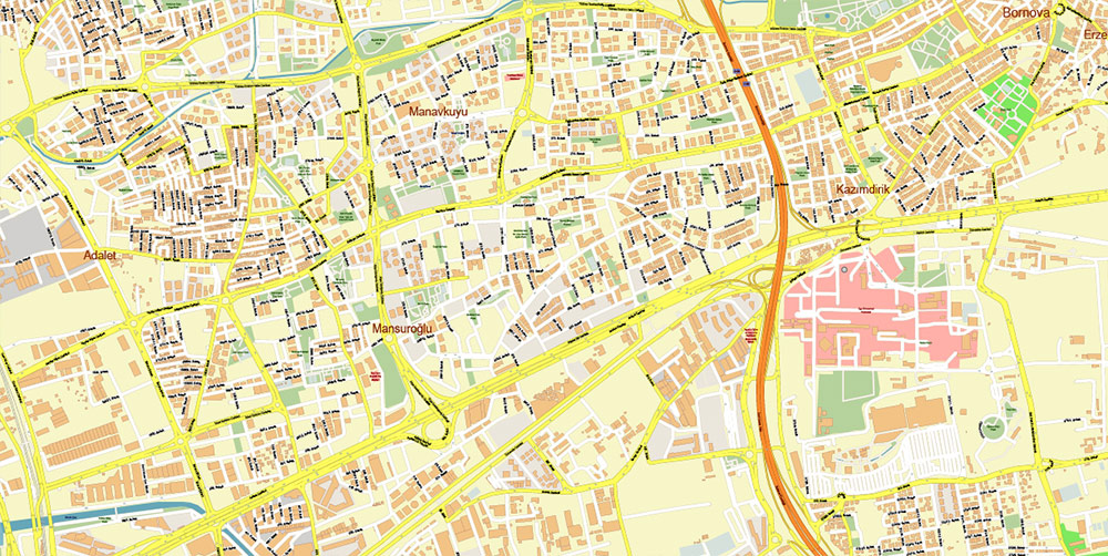
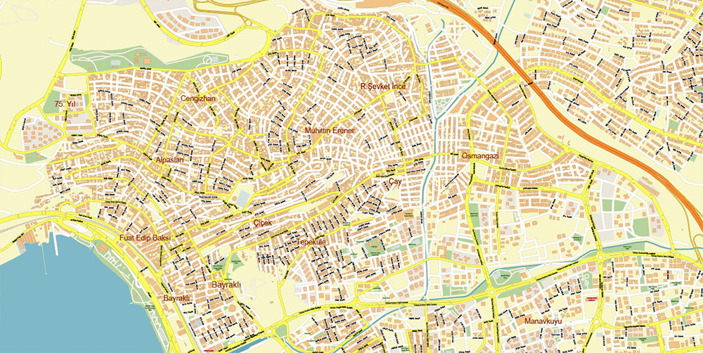
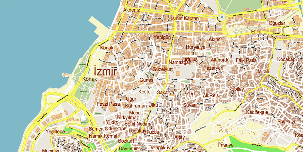
Izmir Turkey PDF Map Vector Exact City Plan High Detailed Street Map editable Adobe PDF in layers
Layers list:
- Legend
- Labels of roads
- Names of places (city, hamlet, etc.)
- Names of objects (parks, water)
- Names of main streets
- Names of civil streets
- Arrows of streets
- Main Streets, roads
- Residential streets
- Railroads
- Buildings
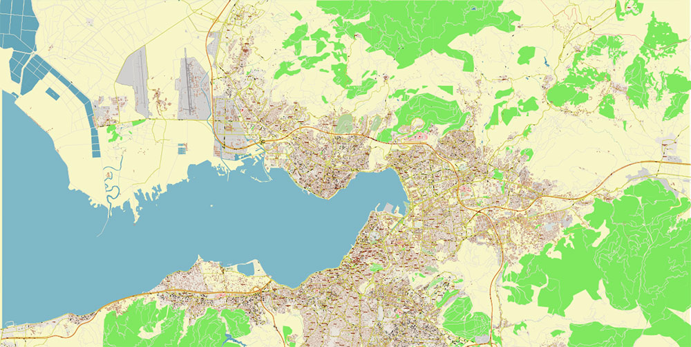
- Water objects (rivers, lakes, ponds)
- Waterways
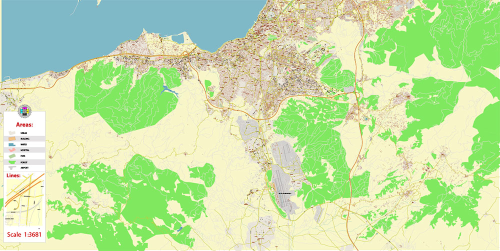
- Color fills (parks, land use, etc.)
- Islands
- Background and Sea
The most exact and detailed map of the city in scale.
For Editing and High-Quality Printing
Tactical Geo Brief — İzmir, Turkey
Overview & Terrain
Population & Demography
-
Province / metro: ~4.49M (2024).
-
Urban core (11 central districts): ~2.94M (2024).
-
Highest densities: Konak–Alsancak–Bayraklı–Karşıyaka. Large student population (Ege, Dokuz Eylül). Turkish is dominant; notable internal migration from Aegean/Anatolian regions.
Urban Layout & Key Districts
-
South shore: Konak (historic core: Kemeraltı bazaar, Konak Sq./Clock Tower), Alsancak (port/rail), Balçova (residential/commercial).
-
North shore: Karşıyaka–Çiğli (commercial/industrial belts).
-
East: Bornova–Bayraklı (business and residential corridors); Buca (dense residential, major arterials).
Roads & Main Arteries
-
Ring & Motorways (Otoyol):
-
O-30 İzmir Beltway — circumferential bypass tying all radials.
-
O-31 İzmir–Aydın–Denizli — southeast axis; airport access via D550.
-
O-32 İzmir–Çeşme — west to Urla–Alaçatı–Çeşme resort corridor.
-
O-33 Northern Aegean — north to Menemen–Aliağa–Bergama (heavy industry/ports).
-
National routes: D550/E87 north–south spine; D300/D200 (Ankara Cd.) east–west through Bornova/Altındağ, feeding O-31/O-32.
-
Urban arterials: Mustafa Kemal Coastal Boulevard (Konak–Balçova) along the south waterfront; Altınyol for Karşıyaka–Bayraklı on the north shore.
Rail & Urban Transit
-
Commuter rail (İZBAN): North–south electric network linking Çiğli–Menemen–Aliağa and south/east via Adnan Menderes Airport to Torbalı–Selçuk; interchange with national rail at Halkapınar/Alsancak.
-
Metro İzmir (M1): Fahrettin Altay ↔ Evka-3 via Konak–Halkapınar–Bornova. (M2 Buca line under construction.)
-
Trams: Konak Tram (Halkapınar–F.Altay) on the south shore; Karşıyaka Tram on the north shore.
-
Urban ferries (İZDENİZ): Frequent cross-gulf services between Konak, Karşıyaka, Alsancak, Bostanlı, and other piers; integrated ticketing.
Air
Ports & Maritime
-
Port of İzmir (Alsancak): Multi-purpose port near Alsancak station; containers, breakbulk, cruise calls (container role partly shifted to Aliağa/Nemrut Bay).
-
Northern industrial ports: Aliağa cluster (Petkim/STAR refinery terminals) for petroleum, chemicals, and bulk; served by O-33 and rail spurs.
Tourism & Sites
-
City: Kemeraltı Bazaar, Konak Clock Tower, Agora of Smyrna, Kadifekale, Asansör, Kültürpark.
-
Region: Ephesus (via D550/O-31 toward Selçuk), Çeşme/Alaçatı beaches (O-32), Pergamon (Bergama) to the north (D550/O-33).
Practical Notes (Operations)
-
Chokepoints: Coastal corridor through Konak; O-30 interchanges with O-31/O-32/O-33 saturate at peaks.
-
Cross-gulf movement: No bridge; ferries are the quickest cross-shore option.
-
Terrain constraints: Hills south/east of Konak/Buca limit grid options; long east–west plain favors D200/D300 corridors.
-
Weather: Aegean climate; summer heat, occasional strong northerlies (meltemi) across the gulf; winter rainfall can impact low-lying arterials.
Quick Reference
-
Province/metro population: ~4.49M
-
Urban core (central districts): ~2.94M
-
Airport: Adnan Menderes (ADB), south on D550
-
Motorways: O-30 ring; O-31 (Aydın/Denizli), O-32 (Çeşme), O-33 (Northern Aegean)
-
Sea links: İZDENİZ ferries across the gulf; Alsancak multi-purpose port; Aliağa heavy-industry terminals
Izmir Turkey PDF Map Vector Exact City Plan High Detailed Street Map editable Adobe PDF in layers
Izmir Turkey PDF Map Vector Exact City Plan High Detailed Street Map editable Adobe PDF in layers
Izmir Turkey PDF Map Vector Exact City Plan High Detailed Street Map editable Adobe PDF in layers
Izmir Turkey PDF Map Vector Exact City Plan High Detailed Street Map editable Adobe PDF in layers
Izmir Turkey PDF Map Vector Exact City Plan High Detailed Street Map editable Adobe PDF in layers
Izmir Turkey PDF Map Vector Exact City Plan High Detailed Street Map editable Adobe PDF in layers
Izmir Turkey PDF Map Vector Exact City Plan High Detailed Street Map editable Adobe PDF in layers
Izmir Turkey PDF Map Vector Exact City Plan High Detailed Street Map editable Adobe PDF in layers
Izmir Turkey PDF Map Vector Exact City Plan High Detailed Street Map editable Adobe PDF in layers
Izmir Turkey PDF Map Vector Exact City Plan High Detailed Street Map editable Adobe PDF in layers
Izmir Turkey PDF Map Vector Exact City Plan High Detailed Street Map editable Adobe PDF in layers
Izmir Turkey PDF Map Vector Exact City Plan High Detailed Street Map editable Adobe PDF in layers
Izmir Turkey PDF Map Vector Exact City Plan High Detailed Street Map editable Adobe PDF in layers
Izmir Turkey PDF Map Vector Exact City Plan High Detailed Street Map editable Adobe PDF in layers
Izmir Turkey PDF Map Vector Exact City Plan High Detailed Street Map editable Adobe PDF in layers
Izmir Turkey PDF Map Vector Exact City Plan High Detailed Street Map editable Adobe PDF in layers
Izmir Turkey PDF Map Vector Exact City Plan High Detailed Street Map editable Adobe PDF in layers

 Author: Kirill Shrayber, Ph.D. FRGS
