Extended Description of the Vector Map
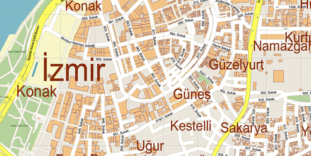
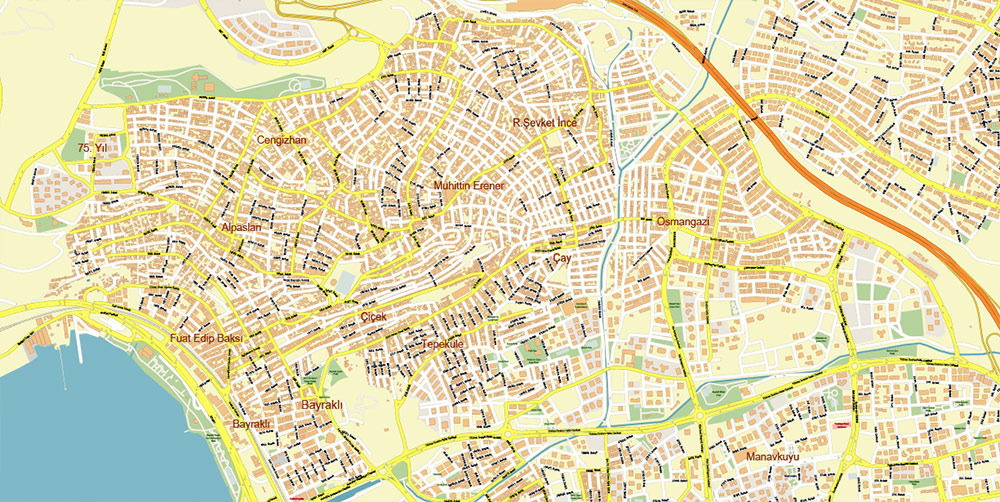
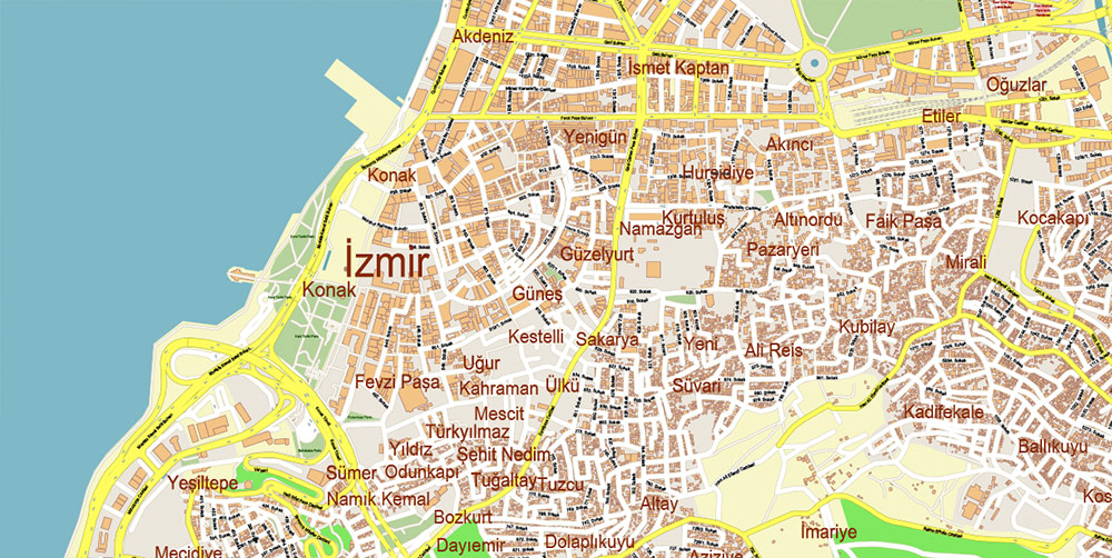
Printable Vector Map of Izmir Turkey detailed street map scale 1:3681 fully editable Layered Adobe Illustrator scalable, text format all names, 29 MB ZIP
All street names, Main Objects, Buildings. Map for design, printing, arts, projects, presentations, for architects, designers, and builders, business, logistics.
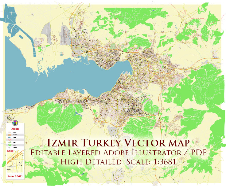
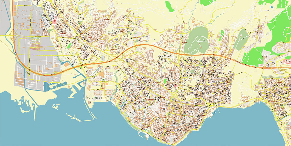
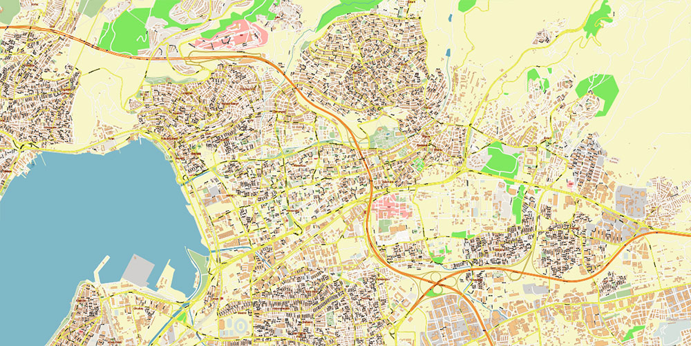
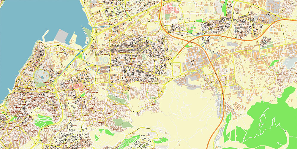
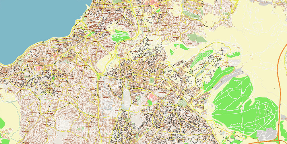
Izmir Turkey Map Vector Exact City Plan High Detailed Street Map editable Adobe Illustrator in layers
Layers list:
- Legend
- Labels of roads
- Names of places (city, hamlet, etc.)
- Names of objects (parks, water)
- Names of main streets
- Names of civil streets
- Arrows of streets
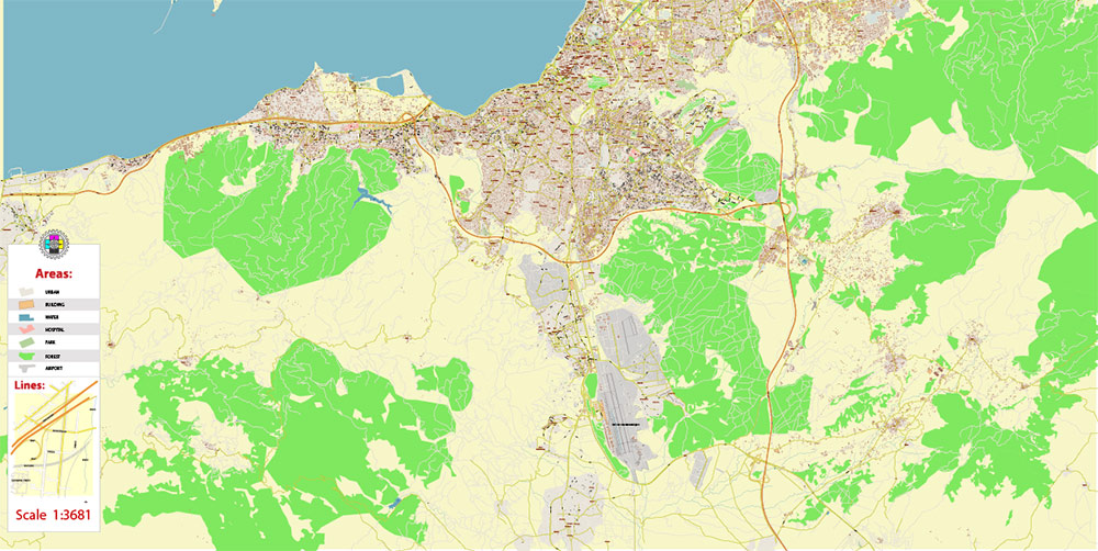
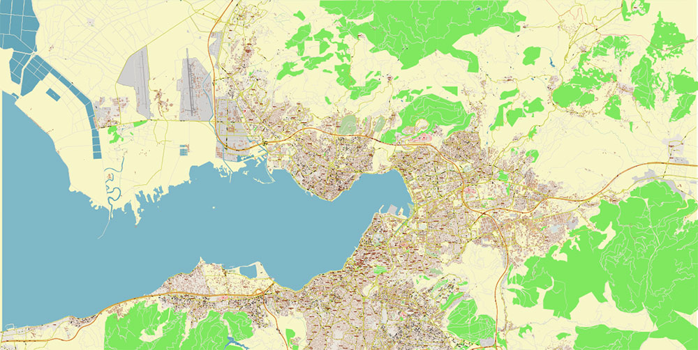
- Main Streets, roads
- Residential streets
- Railroads
- Buildings
- Water objects (rivers, lakes, ponds)
- Waterways
- Color fills (parks, land use, etc.)
- Islands
- Background and Sea
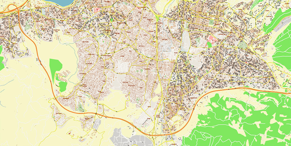
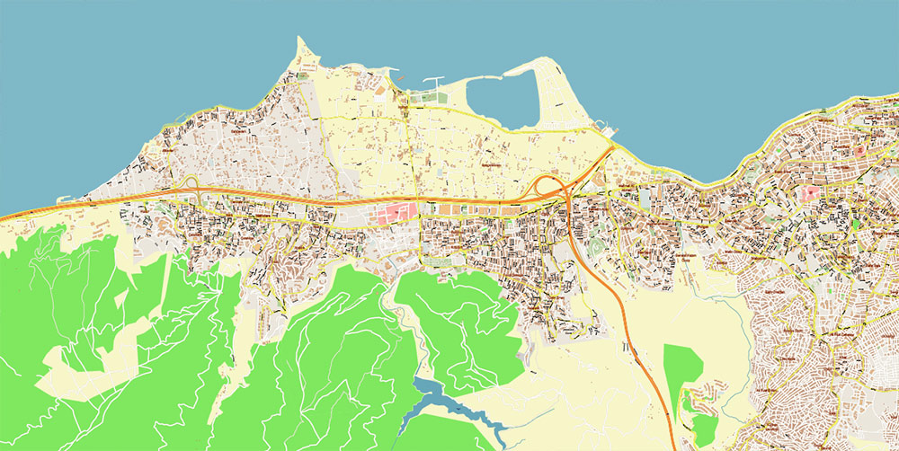
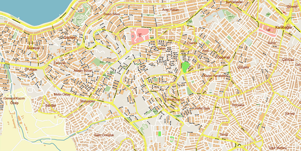
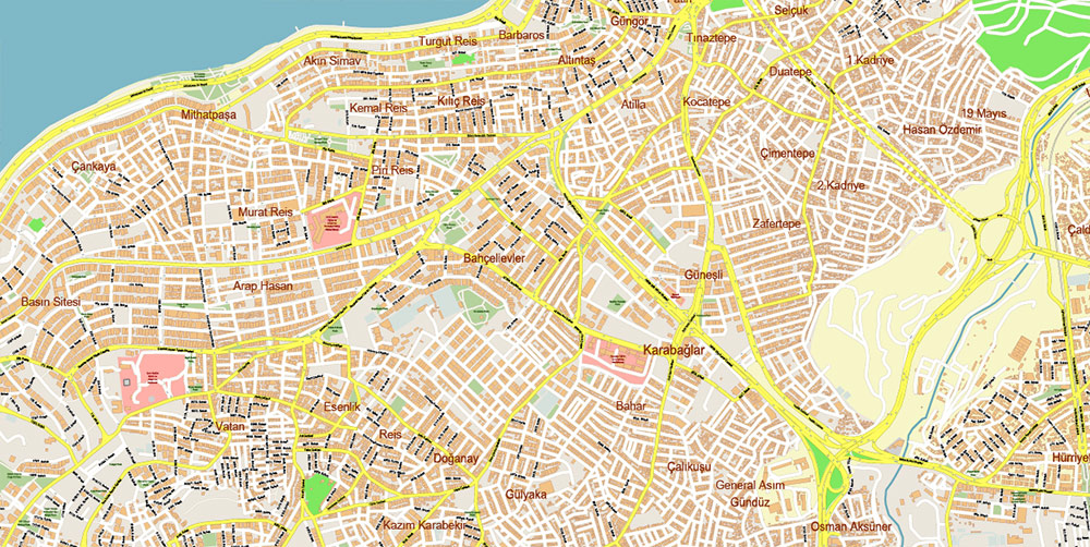
The most exact and detailed map of the city in scale.
For Editing and High-Quality Printing
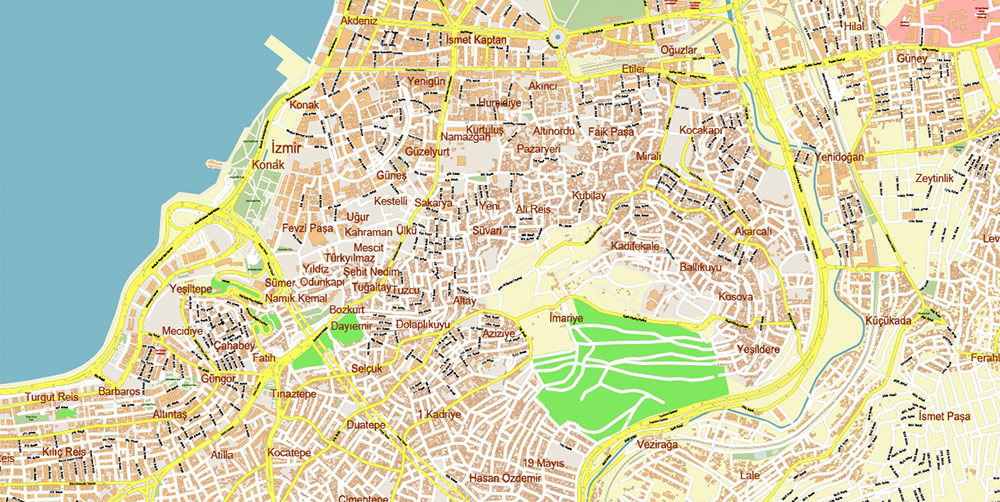
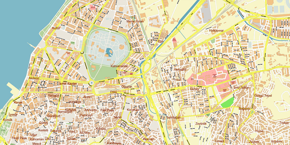
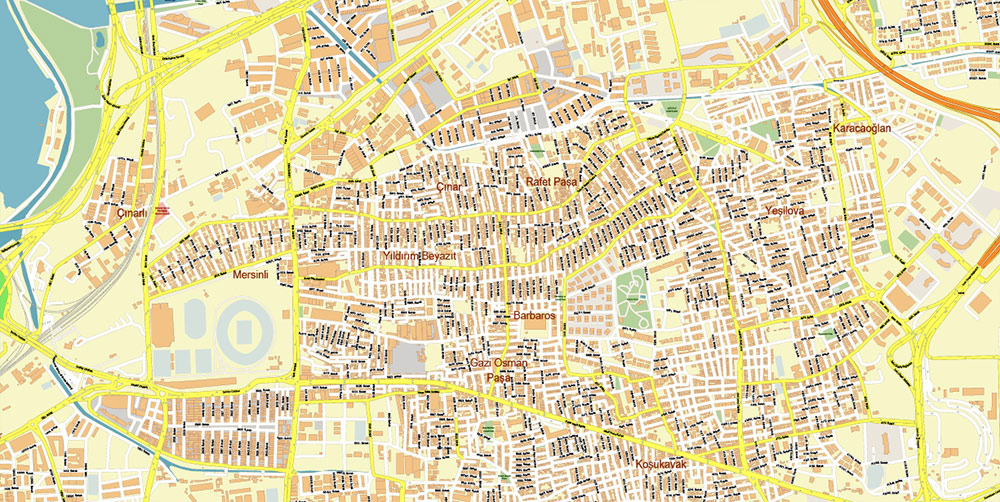
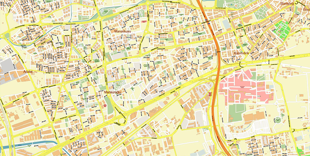
Izmir Turkey Map Vector Exact City Plan High Detailed Street Map editable Adobe Illustrator in layers
Izmir Turkey Map Vector Exact City Plan High Detailed Street Map editable Adobe Illustrator in layers
Izmir Turkey Map Vector Exact City Plan High Detailed Street Map editable Adobe Illustrator in layers
Izmir Turkey Map Vector Exact City Plan High Detailed Street Map editable Adobe Illustrator in layers
Izmir Turkey Map Vector Exact City Plan High Detailed Street Map editable Adobe Illustrator in layers
Izmir Turkey Map Vector Exact City Plan High Detailed Street Map editable Adobe Illustrator in layers
Izmir Turkey Map Vector Exact City Plan High Detailed Street Map editable Adobe Illustrator in layers
Izmir Turkey Map Vector Exact City Plan High Detailed Street Map editable Adobe Illustrator in layers
Izmir Turkey Map Vector Exact City Plan High Detailed Street Map editable Adobe Illustrator in layers
Izmir Turkey Map Vector Exact City Plan High Detailed Street Map editable Adobe Illustrator in layers
Izmir Turkey Map Vector Exact City Plan High Detailed Street Map editable Adobe Illustrator in layers
Izmir Turkey Map Vector Exact City Plan High Detailed Street Map editable Adobe Illustrator in layers
Izmir Turkey Map Vector Exact City Plan High Detailed Street Map editable Adobe Illustrator in layers
Izmir Turkey Map Vector Exact City Plan High Detailed Street Map editable Adobe Illustrator in layers
Izmir Turkey Map Vector Exact City Plan High Detailed Street Map editable Adobe Illustrator in layers
Izmir Turkey Map Vector Exact City Plan High Detailed Street Map editable Adobe Illustrator in layers
Izmir Turkey Map Vector Exact City Plan High Detailed Street Map editable Adobe Illustrator in layers

 Author: Kirill Shrayber, Ph.D. FRGS
