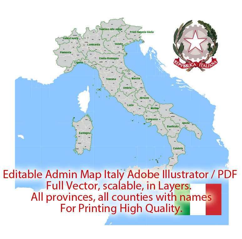
Italy Map Administrative Vector Adobe Illustrator Editable PDF Provinces Counties for publishing, design, media, projects, presentations, for High Quality Printing
Layers: Provinces, Counties, Borders_provinces, Borders_counties, Names_provinces, Names_counties, Flag, sea.
Text format all names
Italy.
This vector map of Italy is used as a basis for design, editing, and further printing.
This is the most detailed, exact map of Italy for high-quality printing and polygraphy. You can always clarify the map development date by contacting us.
For your convenience, all objects on Italy vector map are divided into layers. And the editing is very easy – colors, lines, etc.
You can easily add any objects needed (e.g. shops, salons, sale points, gas station or attraction) on any layer of Italy vector map.
Italy is a country in Europe. Located in the heart of the Mediterranean Sea, Italy shares open land borders with France, Switzerland, Austria, Slovenia, San Marino, and Vatican City. Italy covers an area of 301,340 km2 (116,350 sq mi) and has a largely temperate seasonal and Mediterranean climate. With around 61 million inhabitants, it is the fourth-most populous EU member state and the most populous country in southern Europe.
One of the advantages of Italy vector maps of our production is the relevance of cartographic data, we constantly update all our products.
This vector map of Italy is used by:
designers, layout designers, printers, advertisers and architects. Our product – vector maps – is designed for further editing and printing in large formats – from @Wall format (a few meters) to A-0 and A-1, A-2, A-3.
The Italy map in vector format is used for design, urban planning, presentations and media visualizations.
The advertising and presentation map of Italy (usually the final designer marks the routes, and puts the client’s objects (shops, saloons, gas stations etc.)
The undoubted advantage is that people will NEVER throw out this advertising product – the map. In fact, as an advertising medium, a map is the most “long-playing” of the well-known polygraphic advertising media, with the longest lifespan, and the maximum number of interactions with the customer.
For travelers, maps are sold at the airports and gas stations around the world. Often the source is our vector maps.
Take a look, who purchases our vector maps of Italy in “Our Clients and Friends” page – these are large and small companies, from super-brands like Volvo and Starbucks, to small design studios and printing houses.
It’s very easy to work with vector maps of Italy city, even for a not very experienced designer who can turn on and off the map layers, add new objects, change the colors of fill and lines according to customer requirements.
The undoubted advantage of Italy vector maps in printing is an excellent and detailed visualization, when customer can expand a large paper map and instantly define his location, find a landmark, an object or address on map, unlike using the popular electronic formats of Google and Yandex maps for example.
Printable vector maps of Italy are much more convenient and efficient than any electronic maps on your smartphone, because ALL DETAILS are displayed in the entire space of Italy map.
Useful tips on working with vector maps of cities and countries in Adobe Illustrator.
«V» – launches the Selection tool (cursor, black arrow), which makes active any vector line.
«А» – launches the Direct Selection tool (white cursor), allows you to select curve elements and drag them to the desired place.
«R» – activates the Rotate tool, which helps you rotating selected objects around the center point by 360 degrees.
«E» – gives you the opportunity to use the Eraser tool and erase unnecessary parts.
«X» – switches between Fill and Stroke in the Tools section. Try to get used to this hot key and
you will quickly understand that you can’t live and work without it.
Guides are not limited to vertical and horizontal in Adobe Illustrator. You can also create a diagonal guide for example. Moreover, you can turn any contours into guides. Select the outline and go to View > Guides > Make Guides (Create Guides), or simply press Cmd/Ctrl + 5. You can also turn the guides back into an editable object. Go to menu, View > Guides > Unlock Guides (Release Guides), select the guide you want to edit and select View > Guides > Release Guides (Reset Guides), or just press Cmd/Ctrl + Option / Alt + 5).
You will probably want to change the color scheme used on our Italy vector map.
To quickly and effectively play with colors.
Of course, you can do it manually, all objects in our Italy vector map are divided according to types and layers, and you can easily change the color gamma of vector objects in groups and layers.
But there is more effective way of working with the whole VECTOR MAP of Italy and all layers:
The overview dialog «Edit colors»/«Repaint Graphic Object» (this dialog box name can change depending on the context):
If you have selected a part or a layer of Italy vector map and open the dialog box by clicking the icon in the Control panel, on the Samples palette or the Color Catalog, or if you choose Edit > Edit Colors> Repaint Graphic Object, then the «Repaint Graphic Object» dialog box appears, and you get access to «Assign» and «Edit» tabs.
If a picture or a map fragment is not selected, and you open the dialog box by clicking the icon in the Control panel, on the Samples palette or in the Color Catalog, the «Edit Colors» dialog box appears and you can only access the «Edit» tab.
Regardless of the name at the top of the dialog box, the right-hand side always displays the color group of the current document, as well as two default color groups: Print Color and Grayscale. These color groups can be selected and used any time.
Create and edit color groups of Italy vector map, and also assign colors using the «Edit Colors»/ а «Repaint Graphic Object» dialog box.
A. Creating and editing of a color group on the «Edit» tab
B. Assigning colors on the «Assign» tab
C. Select a group of colors from the «Color groups» list
The option «Repaint a graphic object» in the lower part of the dialog box allows you to preview the colors on a selected layer of Vector map, or a group of elements, and specify whether its colors will be redefined when the dialog box is closed.
The main areas of the dialog box are:
«Edit»
The «Edit» tab is designed to create a new or edit the existing color groups.
The harmony rules Menu and the Color Wheel are used to conduct experiments with color harmonies. The color wheel shows how colors are related in color harmony, and the color bars allow you to view and manipulate an individual color values. In addition, you can adjust the brightness, add and remove colors, save color groups and view colors on the selected Vector Map of Italy or a separated layers.
«Assign»
The «Assign» tab is used to view and control on how the original colors are replaced with colors from the color group like your corporate colors in the Vector Map of Italy city.
The assign color ability is provided only if the entire map, layer or fragment is selected in the document. You can specify which of new colors replace the current colors, whether the spot colors should be preserved and how colors are replaced (for example, you can replace colors completely or changing the color tone while maintaining the brightness). The «Assign» tab allows you to redefine colors in the Vector Map of Italy city, or in separate layers and fragments using the current color group or reducing the number of colors in the current Vector Map.
Color groups
Is a list of all saved color groups for current document (the same groups appear in the «Samples» palette). You can edit and delete the existing color groups, as well as creating a new ones using the list of “Color Groups” in the dialog box. All changes appear in the «Samples» palette.
The highlighted color group shows, which color group is currently edited.
Any color group can be selected and edited, or used to redefine the colors in the selected vector map of Italy city, its fragments or elements.
Saving a color group adds this group to the specified list.
Opening the «Edit Colors»/«Repaint Graphic Object» dialog box.
Open the «Edit Colors»/«Repaint Graphic Object» dialog box using one of the following methods:
«Edit»> «Edit Colors»> «Repaint Graphic object» or «Repaint With Style».
Use these commands if you need to edit the colors in the selected vector map of Italy city.
«Repaint Graphic object» button on the «Control» panel.
Use this button if you need to adjust colors of Italy vector map using the а «Repaint graphic object» dialog box.
The specified button is available if the selected vector map or its fragment contains two or more colors.
Note. This color editing method is convenient for global color adjustment in a vector map, if global colors were not used when creating a Map of Italy.
The «Edit colors» button or «Edit or apply colors» on the «Color Catalog» palette
Click this button if you need to edit colors on the «Color Catalog» palette or edit and then apply them to the selected Vector Map of Italy or its fragment.
The «Edit color group» button or «Edit or apply color group» on the «Samples» palette.
Click this button if you need to edit the colors in the specific color group or edit and apply them to the selected Vector Map of Italy or a group of its elements, for example, the whole layer “Streets and lines”. You can also double-click the color group in the Samples panel to open the dialog box.
If the map file is too large and your computer freezes or even can’t open it quickly:
1. Try to reduce the color resolution of the video card (display) to 256 colors while working with a large map.
2. Using Windows Task Manager, select all the application you don’t need, while working with map, just turn them off.
3. Launch Adobe Illustrator. (DO NOT OPEN the vector map file)
4. Start the Windows Task Manager using administrator rights > Find the “Illustrator” process > set the «real time» priority,
5. Open the file. When you see the LEGACY FONT popup window – click “OK” (do not update). You can restore the TEXT later.
6. Can also be useful: When file is opened – Edit > Settings > Basic Settings > disable smoothing. /// It looks scary, but works quickly)))
We recommend saving the file in Adobe Illustrator 10 version. It’s much more stable when working with VERY BIG size files.
Due to its central geographic location in Europe and the Mediterranean, Italy has historically been home to a myriad of peoples and cultures. In addition to the various ancient Italian tribes and Italic peoples dispersed throughout the Italian Peninsula and insular Italy, beginning from the classical era, Phoenicians, Carthaginians and Greeks established settlements in the south of Italy, with Etruscans and Celts inhabiting the centre and the north of Italy respectively. The Italic tribe known as the Latins formed the Roman Kingdom in the 8th century BC, which eventually became a republic that conquered and assimilated its neighbours. In the first century BC, the Roman Empire emerged as the dominant power in the Mediterranean Basin and became the leading cultural, political and religious centre of Western civilisation. The legacy of the Roman Empire is widespread and can be observed in the global distribution of civilian law, republican governments, Christianity and the Latin script.
During the Early Middle Ages, Italy endured sociopolitical collapse and barbarian invasions, but by the 11th century, numerous rival city-states and maritime republics, mainly in the northern and central regions of Italy, rose to great prosperity through shipping, commerce and banking, laying the groundwork for modern capitalism. These mostly independent statelets served as Europe’s main trading hubs with Asia and the Near East, often enjoying a greater degree of democracy than the larger feudal monarchies that were consolidating throughout Europe; however, part of central Italy was under the control of the theocratic Papal States, while Southern Italy remained largely feudal until the 19th century, partially as a result of a succession of Byzantine, Arab, Norman, Angevin and Spanish conquests of the region.
The Renaissance began in Italy and spread to the rest of Europe, bringing a renewed interest in humanism, science, exploration and art. Italian culture flourished, producing famous scholars, artists and polymaths such as Michelangelo, Leonardo da Vinci, Raphael, Galileo and Machiavelli. During the Middle Ages, Italian explorers such as Marco Polo, Christopher Columbus, Amerigo Vespucci, John Cabot and Giovanni da Verrazzano discovered new routes to the Far East and the New World, helping to usher in the European Age of Discovery. Nevertheless, Italy’s commercial and political power significantly waned with the opening of trade routes that bypassed the Mediterranean. Centuries of infighting between the Italian city-states, such the Italian Wars of the 15th and 16th centuries, left the region fragmented, and it was subsequently conquered by European powers such as France, Spain and Austria.
By the mid-19th century, rising Italian nationalism and calls for independence from foreign control led to a period of revolutionary political upheaval. After centuries of foreign domination and political division, Italy was almost entirely unified in 1871, establishing the Kingdom of Italy as a great power. From the late 19th century to the early 20th century, Italy rapidly industrialised, namely in the north, and acquired a colonial empire, while the south remained largely impoverished and excluded from industrialisation, fuelling a large and influential diaspora. Despite being one of the main victors in World War I, Italy entered a period of economic crisis and social turmoil, leading to the rise of a fascist dictatorship in 1922. Participation in World War II on the Axis side ended in military defeat, economic destruction and the Italian Civil War. Following the liberation of Italy and the rise of the resistance, the country abolished the monarchy, reinstated democracy, enjoyed a prolonged economic boom and, despite periods of sociopolitical turmoil (e.g. the anni di piombo, the Maxi Trial, and mani pulite) became a major advanced country.
Today, Italy is considered to be one of the world’s most culturally and economically developed countries, with its economy ranking eighth largest in the world and third in the Eurozone. As an advanced economy, it has the sixth-largest worldwide national wealth, and is ranked third for its central bank gold reserve. Italy has a very high level of human development, and it stands among the top countries for life expectancy. The country plays a prominent role in regional and global economic, military, cultural and diplomatic affairs, and it is both a regional power and a great power. Italy is a founding and leading member of the European Union and a member of numerous international institutions, including the UN, NATO, the OECD, the OSCE, the WTO, the G7, the G20, the Union for the Mediterranean, the Council of Europe, Uniting for Consensus, the Schengen Area and many more.
As a reflection of its cultural wealth, Italy is home to 54 World Heritage Sites, the most in the world, and is the fifth-most visited country.
Geography
Italy is located in Southern Europe, between latitudes 35° and 47° N, and longitudes 6° and 19° E. To the north, Italy borders France, Switzerland, Austria and Slovenia, and is roughly delimited by the Alpine watershed, enclosing the Po Valley and the Venetian Plain. To the south, it consists of the entirety of the Italian Peninsula and the two Mediterranean islands of Sicily and Sardinia, in addition to many smaller islands. The sovereign states of San Marino and the Vatican City are enclaves within Italy, while Campione d’Italia is an Italian exclave in Switzerland.
The country’s total area is 301,230 square kilometres (116,306 sq mi), of which 294,020 km2 (113,522 sq mi) is land and 7,210 km2 (2,784 sq mi) is water. Including the islands, Italy has a coastline and border of 7,600 kilometres (4,722 miles) on the Adriatic, Ionian, Tyrrhenian seas (740 km (460 mi)), and borders shared with France (488 km (303 mi)), Austria (430 km (267 mi)), Slovenia (232 km (144 mi)) and Switzerland (740 km (460 mi)). San Marino (39 km (24 mi)) and Vatican City (3.2 km (2.0 mi)), both enclaves, account for the remainder.
The Apennine Mountains form the peninsula’s backbone and the Alps form most of its northern boundary, where Italy’s highest point is located on Monte Bianco (4,810 m or 15,780 ft). The Po, Italy’s longest river (652 kilometres or 405 miles), flows from the Alps on the western border with France and crosses the Padan plain on its way to the Adriatic Sea. The five largest lakes are, in order of diminishing size: Garda (367.94 km2 or 142 sq mi), Maggiore (212.51 km2 or 82 sq mi, whose minor northern part is Switzerland), Como (145.9 km2 or 56 sq mi), Trasimeno (124.29 km2 or 48 sq mi) and Bolsena (113.55 km2 or 44 sq mi).
Although the country includes the Italian peninsula, adjacent islands and most of the southern Alpine basin, some of Italy’s territory extends beyond the Alpine basin and some islands are located outside the Eurasian continental shelf. These territories are the comuni of: Livigno, Sexten, Innichen, Toblach (in part), Chiusaforte, Tarvisio, Graun im Vinschgau (in part), which are all part of the Danube’s drainage basin, while the Val di Lei constitutes part of the Rhine’s basin and the islands of Lampedusa and Lampione are on the African continental shelf.
Almost 40% of the Italian territory is mountainous, with the Alps as the northern boundary and the Apennine Mountains forming the backbone of the peninsula and extending for 1,350 km (840 mi). In between the two lies a large plain in the valley of the Po, the largest river in Italy, which flows 652 km (405 mi) eastward from the Cottian Alps to the Adriatic. The Po Valley is the largest plain in Italy, with 46,000 km2 (18,000 sq mi), and it represents over 70% of the total plain area in the country.
The Alpine mountain range is linked with the Apennines with the Colle di Cadibona pass in the Ligurian Alps.
Worldwide-known mountains in Italy are Monte Cervino (Matterhorn), Monte Rosa, Gran Paradiso in the West Alps, and Bernina, Stelvio and Dolomites along the eastern side of the Alps. The highest peak in Italy is Mont Blanc, at 4,810 meters (15,780 ft) above sea level.
Volcanoes
Many elements of the Italian territory are of volcanic origin. Most of the small islands and archipelagos in the south, like Capraia, Ponza, Ischia, Eolie, Ustica and Pantelleria are volcanic islands. There are also active volcanoes: Etna, in Sicily, the largest active volcano in Europe; Vulcano, Stromboli, and Vesuvius, near Naples, the only active volcano on mainland Europe.
Rivers and seas
Most of Italy’s rivers drain either into the Adriatic Sea (like Po, Piave, Adige, Brenta, Tagliamento, Reno) or into the Tyrrhenian (like Arno, Tiber and Volturno), though the waters from some border municipalities (Livigno in Lombardy, Innichen and Sexten in Trentino-Alto Adige/Südtirol) drain into the Black Sea through the basin of the Drava, a tributary of the Danube, and the waters from the Lago di Lei in Lombardy drain into the North Sea through the basin of the Rhine.
Maritime claims
Territorial sea: 12 nmi (22.2 km; 13.8 mi)
Continental shelf: 200-metre depth (660 ft) or to the depth of exploitation
Lakes
Lake Garda is the largest of the Italian lakes.
In the north of the country are a number of subalpine moraine-dammed lakes, the largest of which is Garda (370 km2 or 143 sq mi). Other well known of these subalpine lakes are Lake Maggiore (212.5 km2 or 82 sq mi), whose most northerly section is part of Switzerland, Como (146 km2 or 56 sq mi), Orta, Lugano, Iseo, Idro.
Other notable lakes in the Italian peninsula are Trasimeno, Bolsena, Bracciano, Vico, Varano and Lesina in Gargano and Omodeo in Sardinia.
Islands
Italy includes several islands. The largest are Sicily 25,708 km2 (9,926 sq mi) and Sardinia 24,090 km2 (9,300 sq mi). The third largest island is Elba, the largest island of the Tuscan Archipelago (224 km2 or 86 sq mi).
Italy
Country in Europe
Italy, a European country with a long Mediterranean coastline, has left a powerful mark on Western culture and cuisine. Its capital, Rome, is home to the Vatican as well as landmark art and ancient ruins. Other major cities include Florence, with Renaissance masterpieces such as Michelangelo’s “David” and Brunelleschi’s Duomo; Venice, the city of canals; and Milan, Italy’s fashion capital.
Capital: Rome
Dialing code: +39
Area
• Total 301,338 km2 (116,347 sq mi)
• Water (%) 2.4
Population
• 2016 estimate 60,589,445
• Density 201.3/km2 (521.4/sq mi)

 Author: Kirill Shrayber, Ph.D. FRGS

