Extended Description of the Vector Map
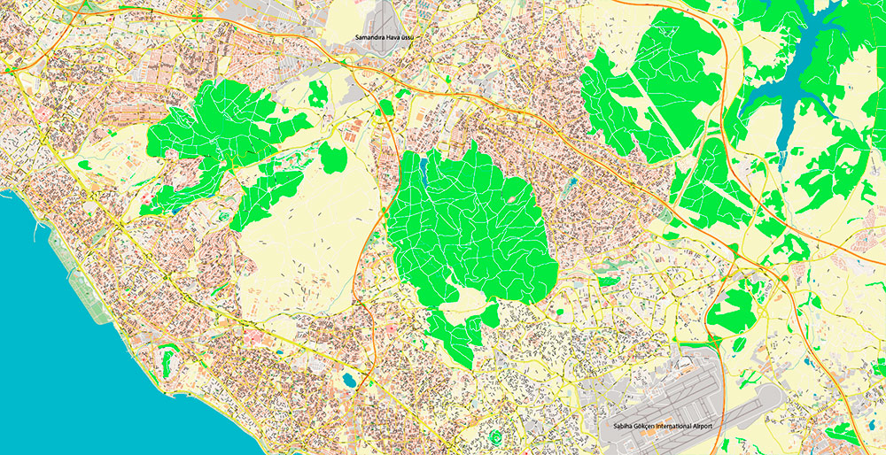
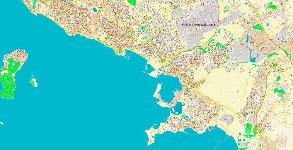
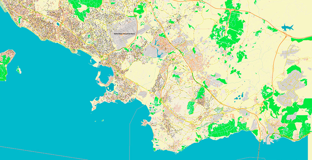
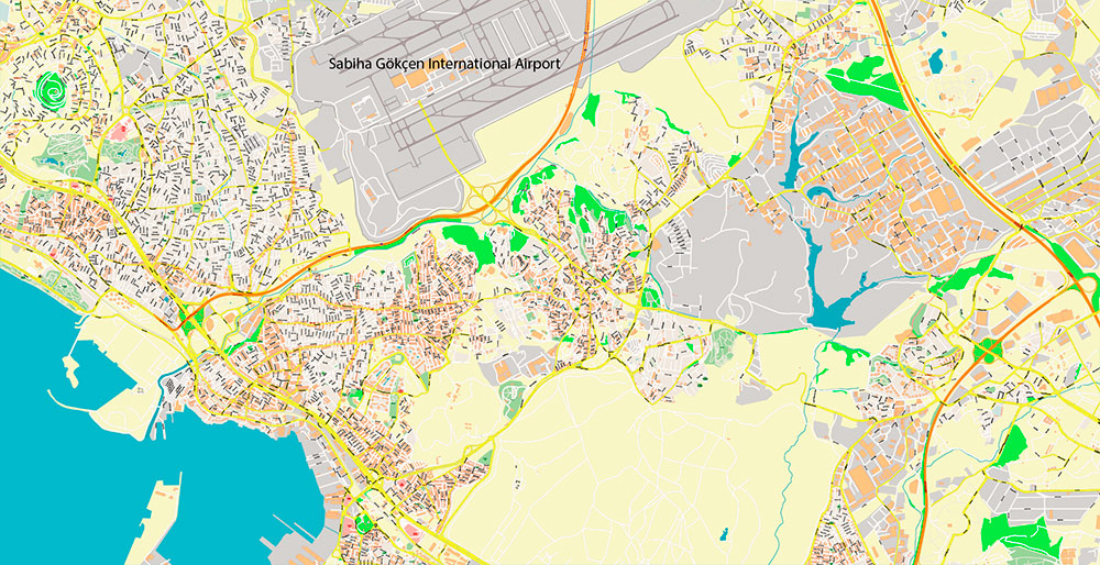
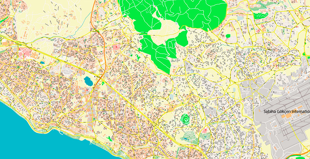
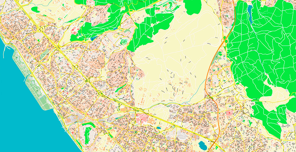
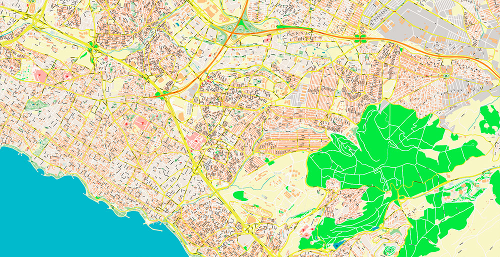
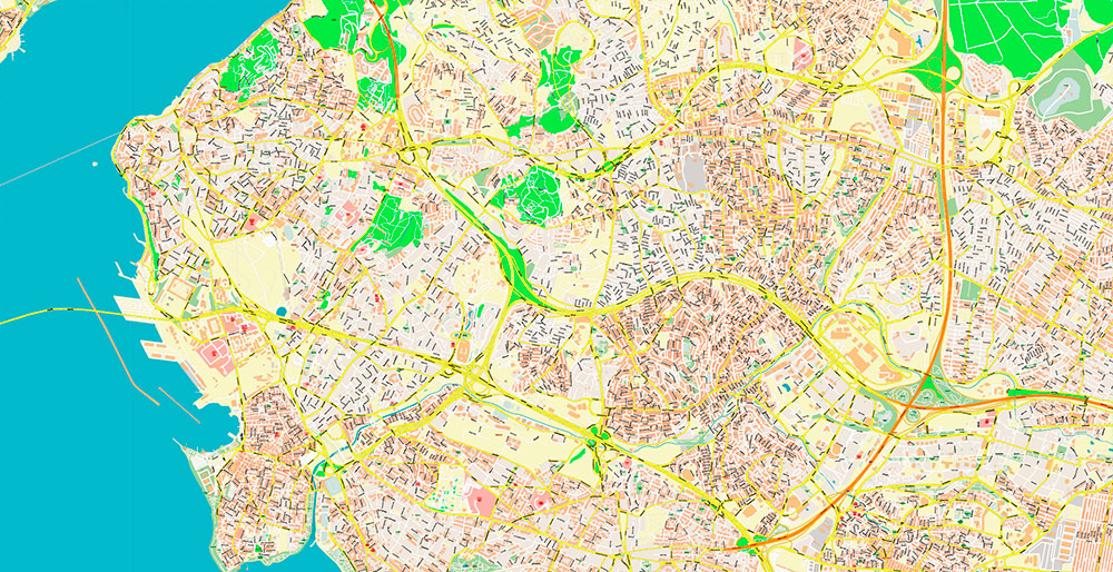
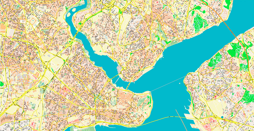
Printable PDF Vector Map of Istanbul Turkey Metro Area High Detailed street map scale 1:3547 fully editable Layered Adobe PDF scalable, text/curves format all names, 406 MB ZIP
All street names, Main Objects, Buildings. Map for design, printing, arts, projects, presentations, for architects, designers, and builders, business, logistics.
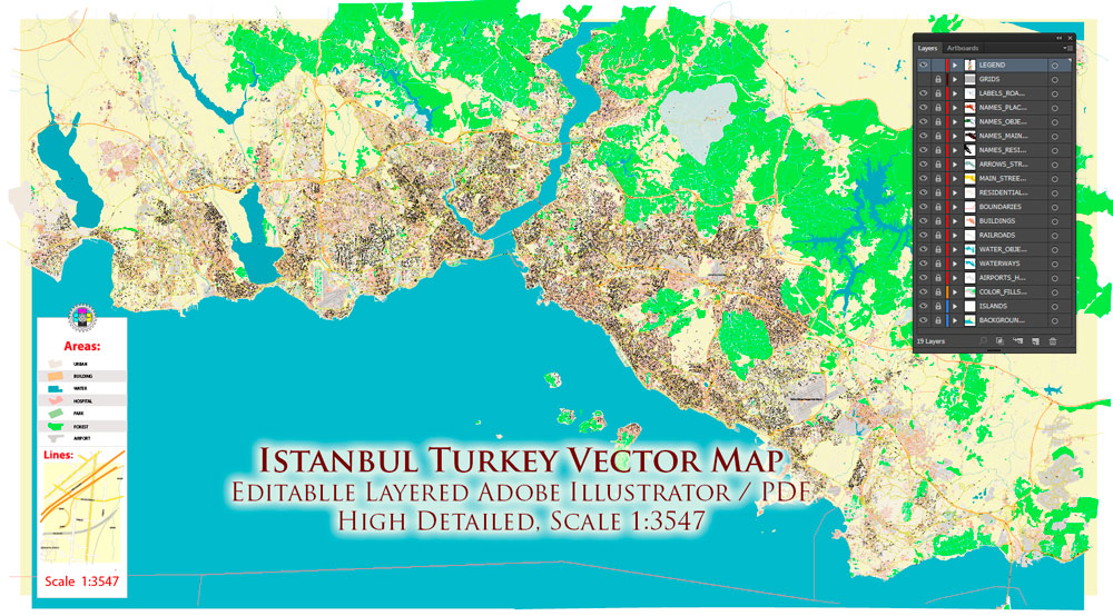
Istanbul Turkey Metro Area PDF Map Vector Exact High Detailed Street Map editable Adobe PDF in layers
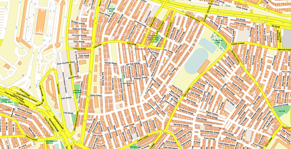
Layers list:
- Legend
- Names of places (city, hamlet, etc.)
- Names of objects (parks, hospital, water)
- Names of main streets
- Names of residential streets
- Main Streets, roads
- Residential streets
- Railroads
- Boundaries
- Buildings
- Water objects (rivers, lakes, ponds)
- Waterways
- Color fills (parks, land use, etc.)
- Islands
- Background and sea
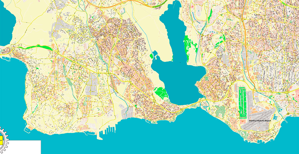
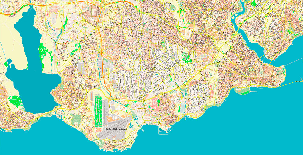
The most exact and detailed map of the Istanbul Turkey Metro Area in scale.
For Editing and High-Quality Printing
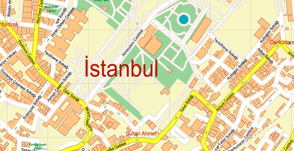
Istanbul Turkey Metro Area PDF Map Vector Exact High Detailed Street Map editable Adobe PDF in layers
AO BRIEF
Istanbul – Turkey
Metro Area | Exact High-Detail Street Vector Map (PDF)
OVERVIEW
-
Megacity at the junction of Europe and Asia, divided by the Bosphorus Strait
-
One of the world’s most complex urban fabrics: historical core + massive modern sprawl
-
Continuous urbanization with dense, irregular street geometry
-
Strategic maritime, commercial, and logistics hub
KEY ROADS / LINES OF COMMUNICATION
-
E-5 (D100) – primary east–west arterial through the urban core
-
TEM / O-2 (E80) – northern high-capacity motorway bypass
-
July 15 Martyrs Bridge, Fatih Sultan Mehmet Bridge, Yavuz Sultan Selim Bridge – Bosphorus crossings
-
Dense hierarchy of collectors, local streets, and historic narrow lanes
-
Major ferry routes and port access corridors integrated into urban traffic flow
URBAN STRUCTURE & STREET PATTERN
-
Highly heterogeneous street network
-
Historic districts: organic, irregular, narrow streets
-
Modern districts: grid-like and radial planning, wide arterials
-
Industrial and logistics zones with large-scale road geometry
-
Extensive highway interchanges and layered transport corridors
DEMOGRAPHY / HUMAN TERRAIN
-
Population: ~16+ million (metro)
-
Extremely high density in central and inner districts
-
Mixed residential, commercial, and informal development
-
Strong daily commuting flows across continental boundaries
TRANSPORT & INFRASTRUCTURE
-
Multi-layer transport system: roads, metro, tram, bus, ferries
-
Underground and surface rail integrated with street network
-
Major airports located on both European and Asian sides
-
Heavy reliance on road transport despite public transit expansion
TOURISM / KEY COMPOUNDS
-
Historic peninsula (Sultanahmet area) with dense pedestrian streets
-
Central business and cultural corridors along Bosphorus shoreline
-
High concentration of hotels, embassies, cultural institutions
-
Complex access patterns due to protected heritage zones
HAZARDS / CONSTRAINTS
-
Extremely dense traffic congestion
-
Seismic risk zone affecting infrastructure planning
-
Limited space for road expansion in historic areas
-
Complex elevation changes and waterfront constraints
LOGISTICS / SUSTAINMENT
-
Critical gateway between Europe, Middle East, and Asia
-
Major ports, logistics hubs, and industrial corridors
-
Road network supports heavy freight and long-haul transport
-
Strategic choke points at bridges and highway interchanges
MAP SPECIFICATION – OPERATIONAL VALUE
-
Exact high-detail street coverage across entire metro area
-
All roads and streets classified and layered
-
Fully editable Adobe PDF with structured layers
-
Suitable for large-format printing, design, planning, analytics
-
Optimized for architects, urban planners, logistics, and publishers
COMMAND TAKEAWAYS
-
Istanbul is a multi-layered megacity with extreme street complexity
-
High-resolution vector mapping is essential for clarity and usability
-
Precise road hierarchy and full coverage provide decisive advantage
-
Map supports professional design, infrastructure analysis, and large-scale print
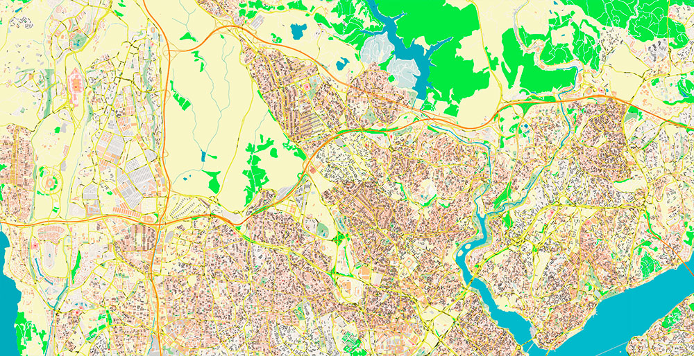
Istanbul Turkey Metro Area PDF Map Vector Exact High Detailed Street Map editable Adobe PDF in layers
Istanbul Turkey Metro Area PDF Map Vector Exact High Detailed Street Map editable Adobe PDF in layers
Istanbul Turkey Metro Area PDF Map Vector Exact High Detailed Street Map editable Adobe PDF in layers
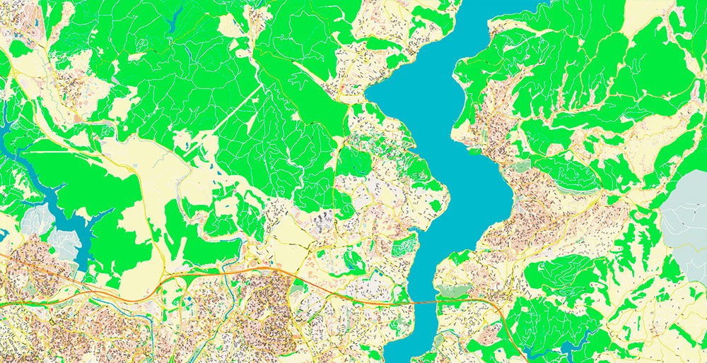
Istanbul Turkey Metro Area PDF Map Vector Exact High Detailed Street Map editable Adobe PDF in layers
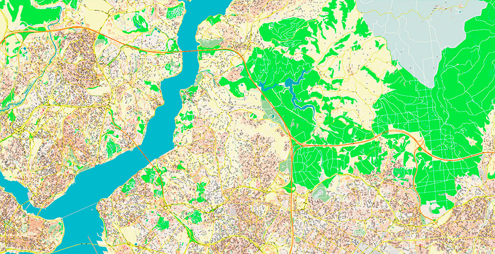
Istanbul Turkey Metro Area PDF Map Vector Exact High Detailed Street Map editable Adobe PDF in layers
Istanbul Turkey Metro Area PDF Map Vector Exact High Detailed Street Map editable Adobe PDF in layers
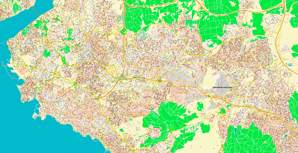
Istanbul Turkey Metro Area PDF Map Vector Exact High Detailed Street Map editable Adobe PDF in layers
Istanbul Turkey Metro Area PDF Map Vector Exact High Detailed Street Map editable Adobe PDF in layers
Istanbul Turkey Metro Area PDF Map Vector Exact High Detailed Street Map editable Adobe PDF in layers
Istanbul Turkey Metro Area PDF Map Vector Exact High Detailed Street Map editable Adobe PDF in layers
Istanbul Turkey Metro Area PDF Map Vector Exact High Detailed Street Map editable Adobe PDF in layers
Istanbul Turkey Metro Area PDF Map Vector Exact High Detailed Street Map editable Adobe PDF in layers
Istanbul Turkey Metro Area PDF Map Vector Exact High Detailed Street Map editable Adobe PDF in layers
Istanbul Turkey Metro Area PDF Map Vector Exact High Detailed Street Map editable Adobe PDF in layers
Istanbul Turkey Metro Area PDF Map Vector Exact High Detailed Street Map editable Adobe PDF in layers

Istanbul Turkey Metro Area PDF Map Vector Exact High Detailed Street Map editable Adobe PDF in layers
Istanbul Turkey Metro Area PDF Map Vector Exact High Detailed Street Map editable Adobe PDF in layers
Istanbul Turkey Metro Area PDF Map Vector Exact High Detailed Street Map editable Adobe PDF in layers

Istanbul Turkey Metro Area PDF Map Vector Exact High Detailed Street Map editable Adobe PDF in layers

Istanbul Turkey Metro Area PDF Map Vector Exact High Detailed Street Map editable Adobe PDF in layers

Istanbul Turkey Metro Area PDF Map Vector Exact High Detailed Street Map editable Adobe PDF in layers

 Author: Kirill Shrayber, Ph.D. FRGS

