PDF Vector Map Israel English names, exact extra detailed Country City Plan scale 1:4009 full editable Adobe PDF Road Street Admin Map, scalable, 25 mb ZIP
All street names (English), Main Objects. Map for design, printing, arts, projects, presentations, for architects, designers and builders, business, logistics.
Layers: color_fills, provinces, streets_roads, names_streets, names_places, grids, legend, etc.
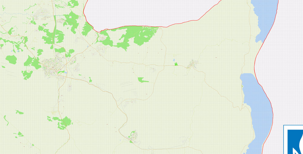
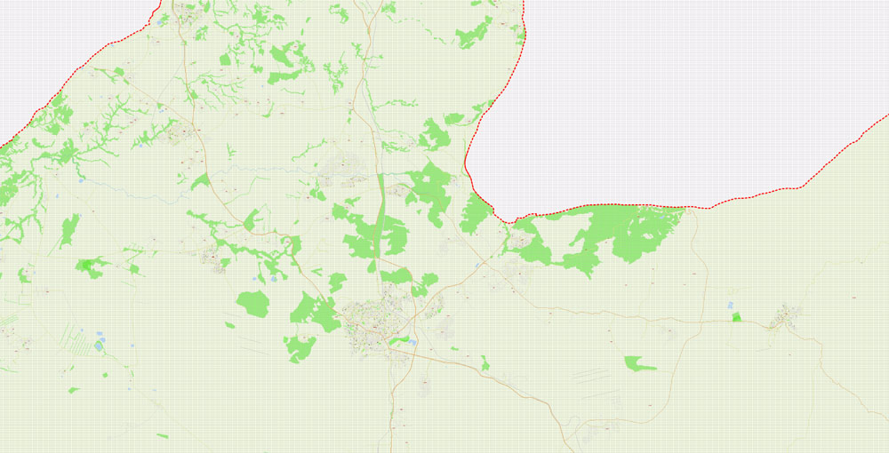
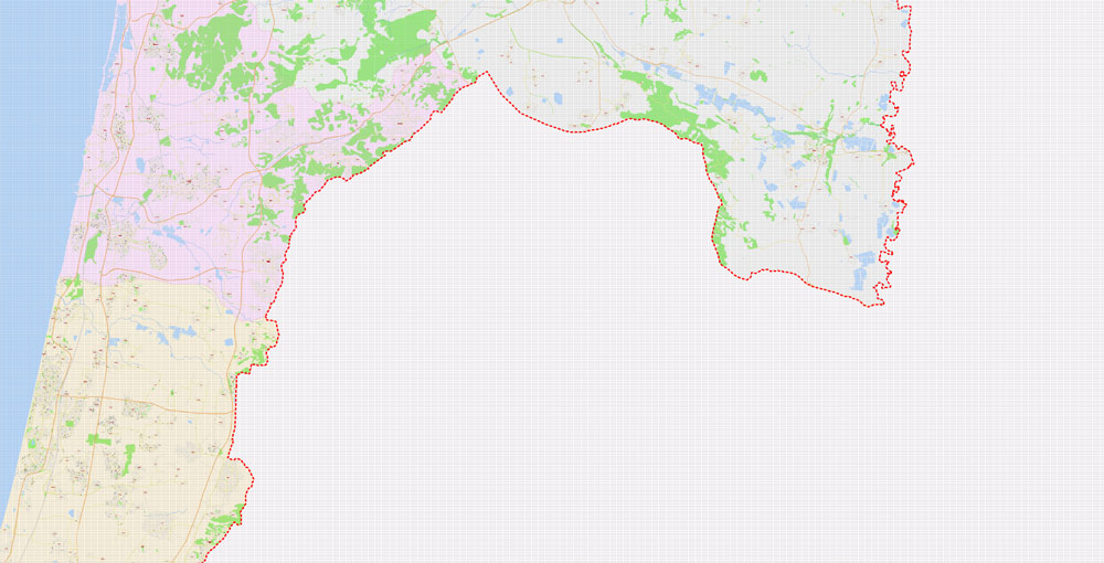
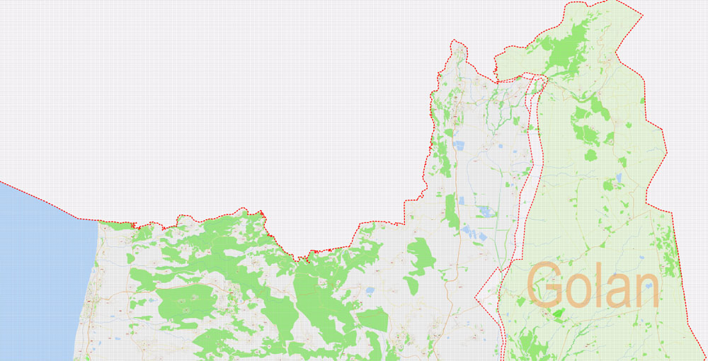
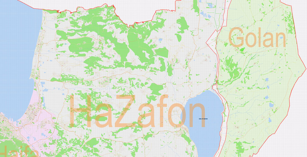
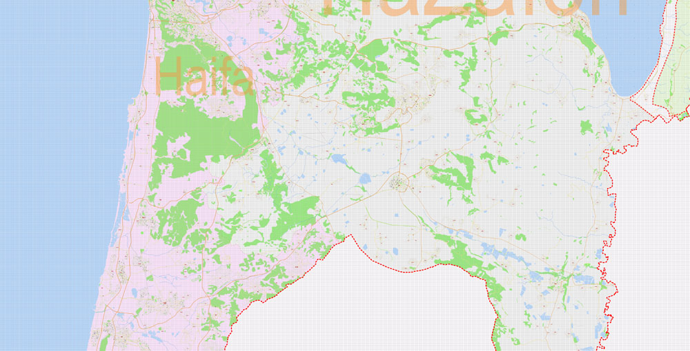
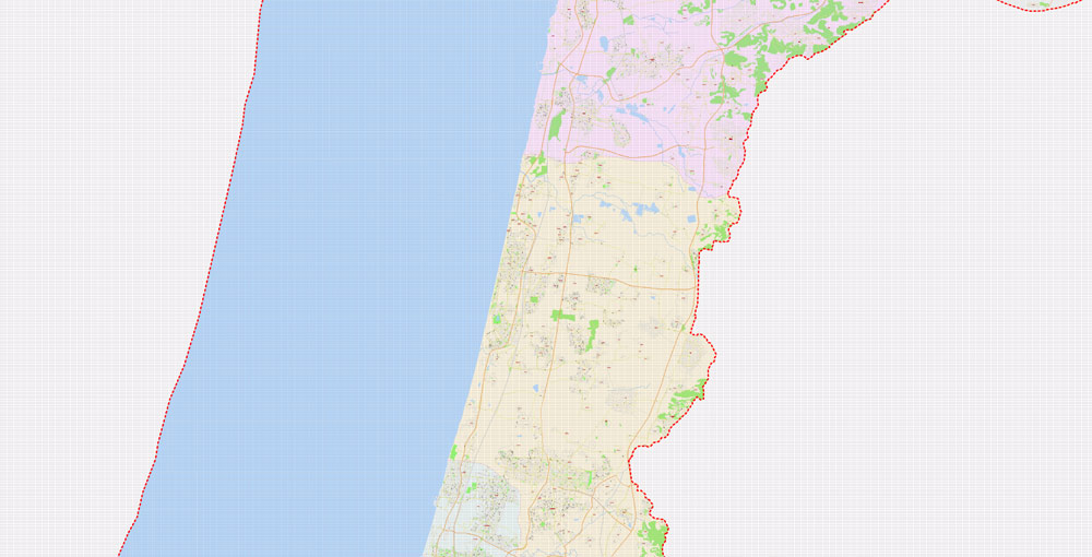
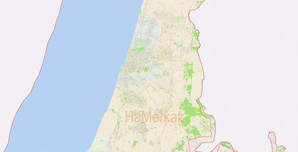
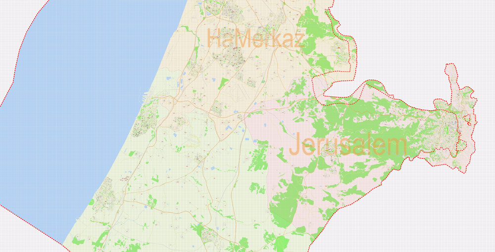
The most exact and detailed map of Israel.
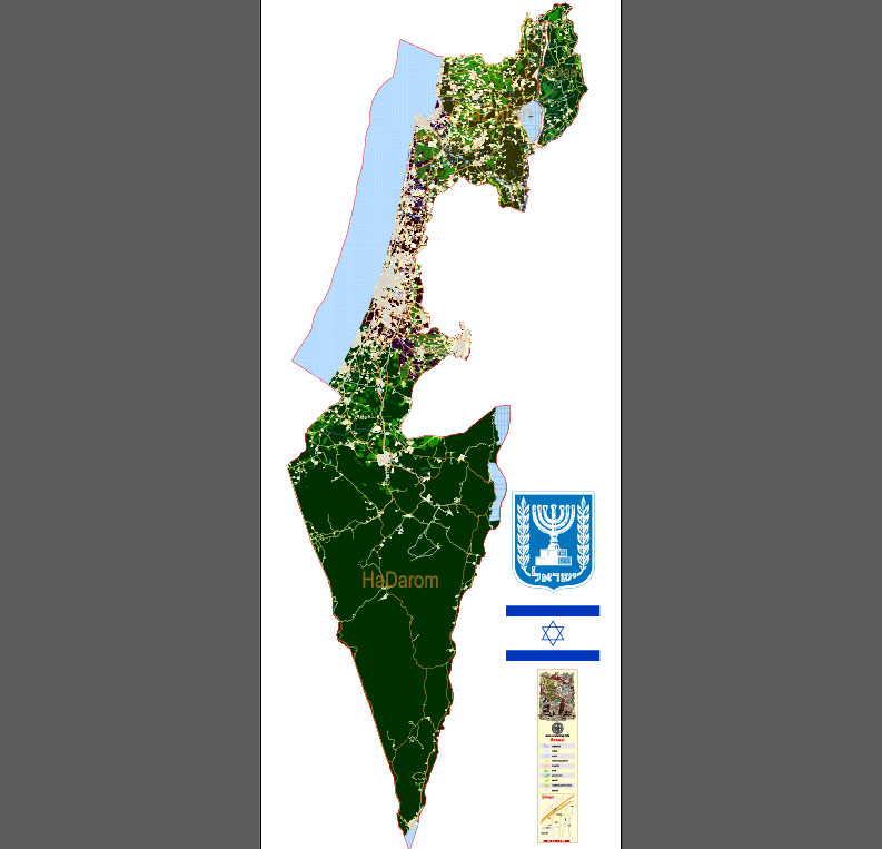
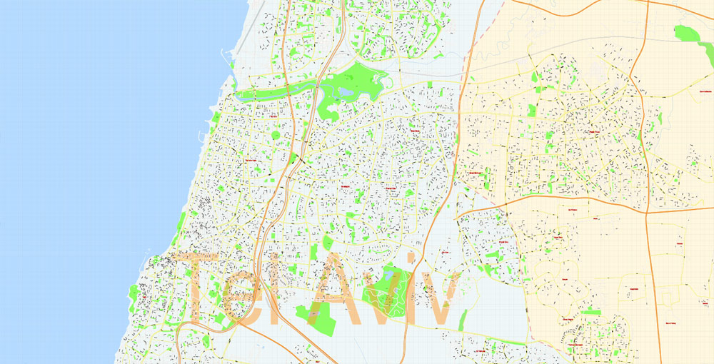
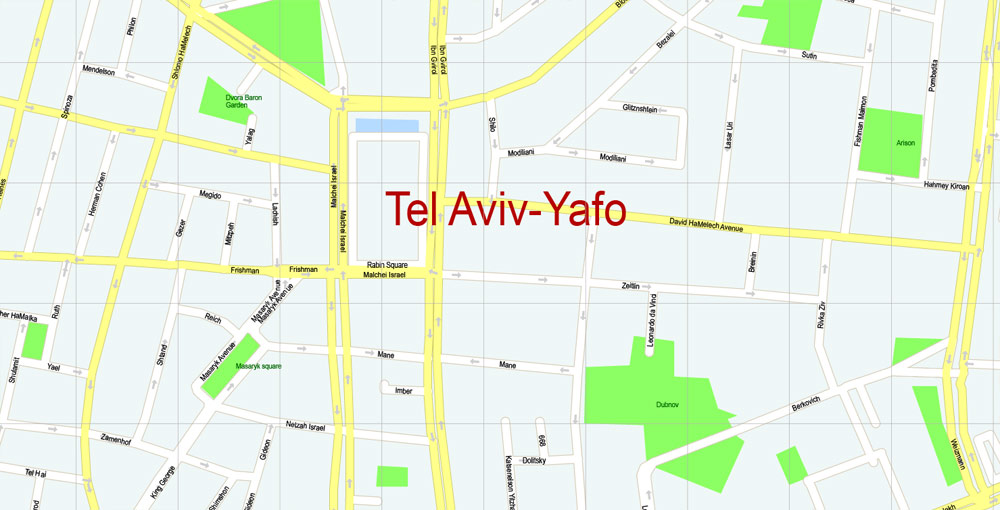
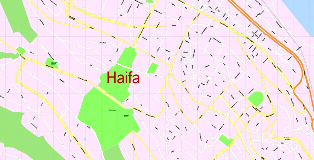
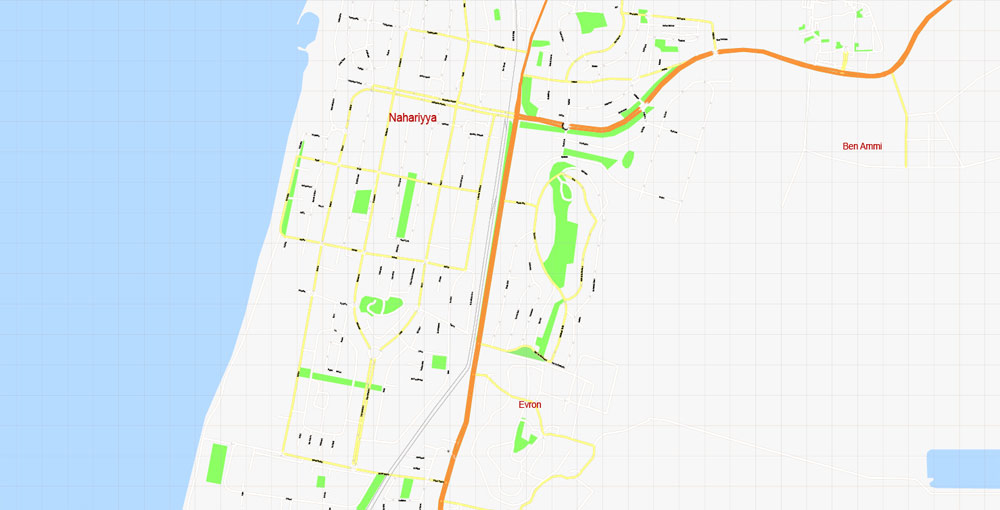
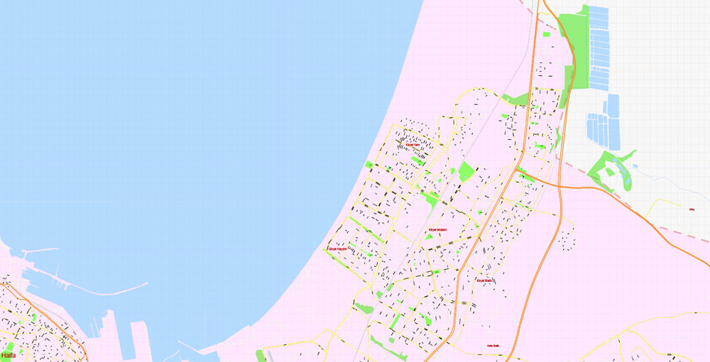
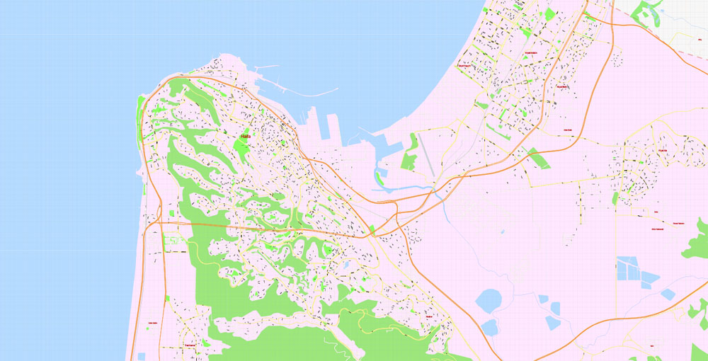
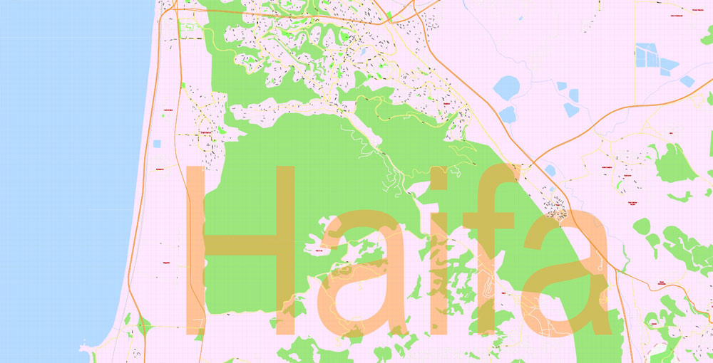
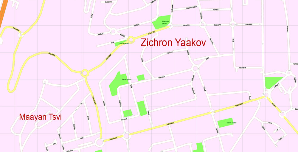
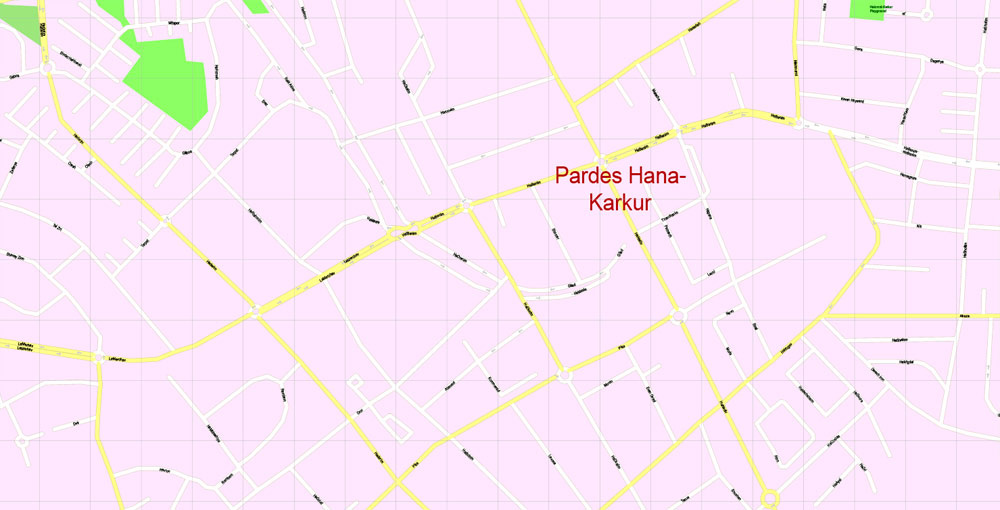
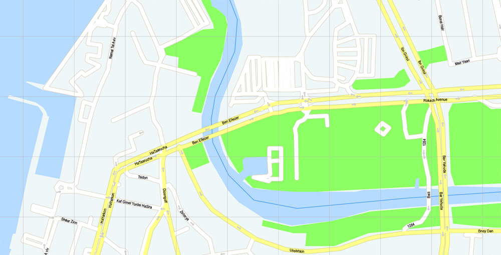
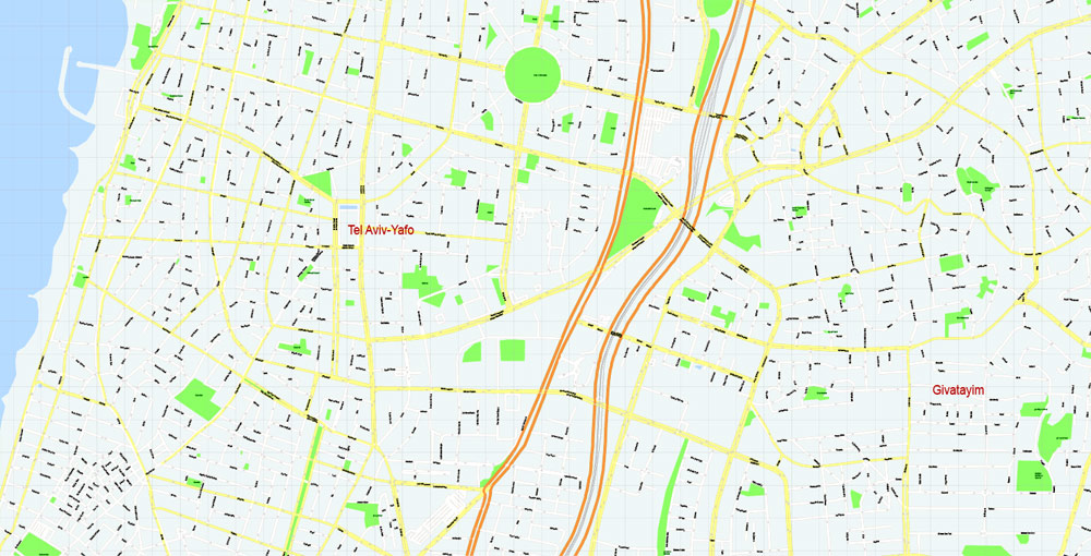
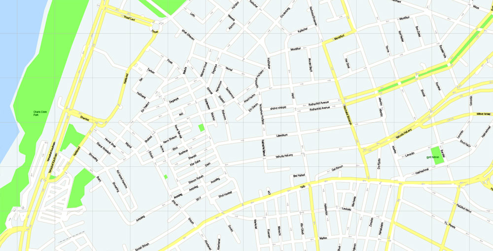
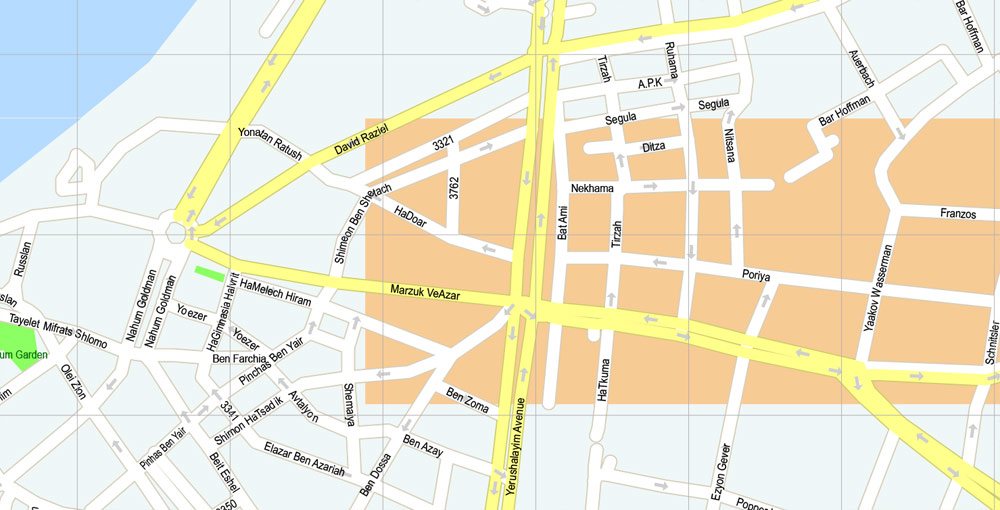
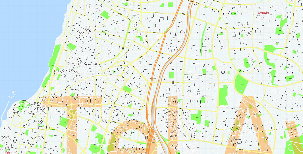
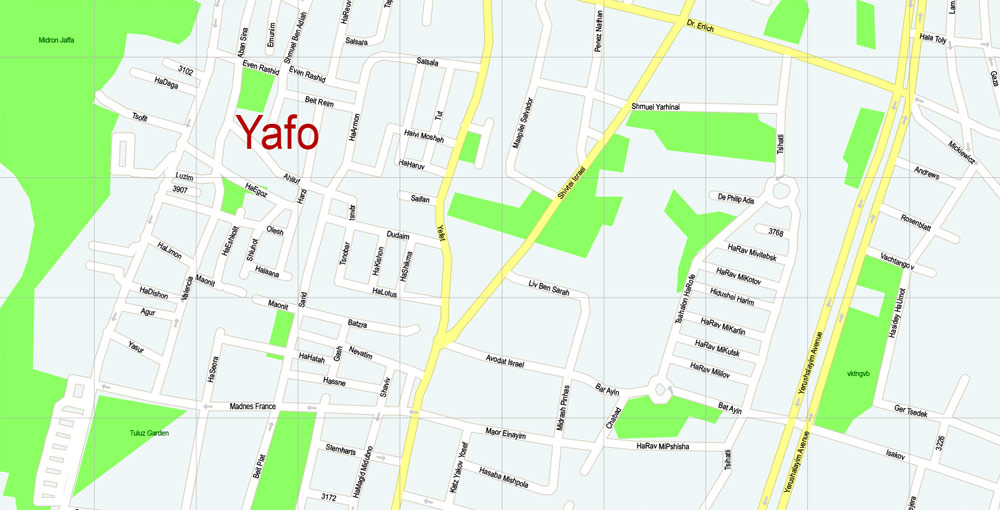
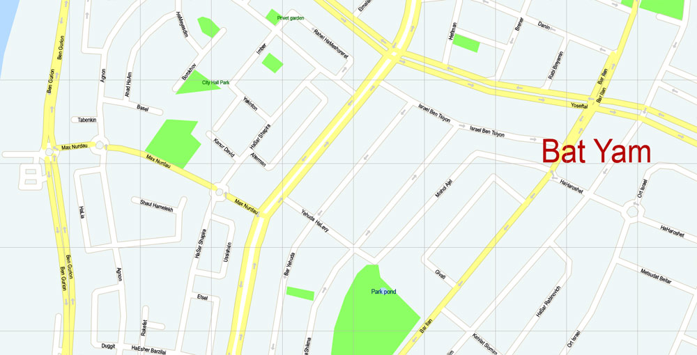
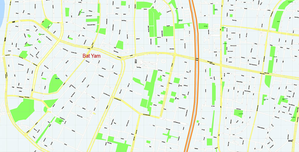
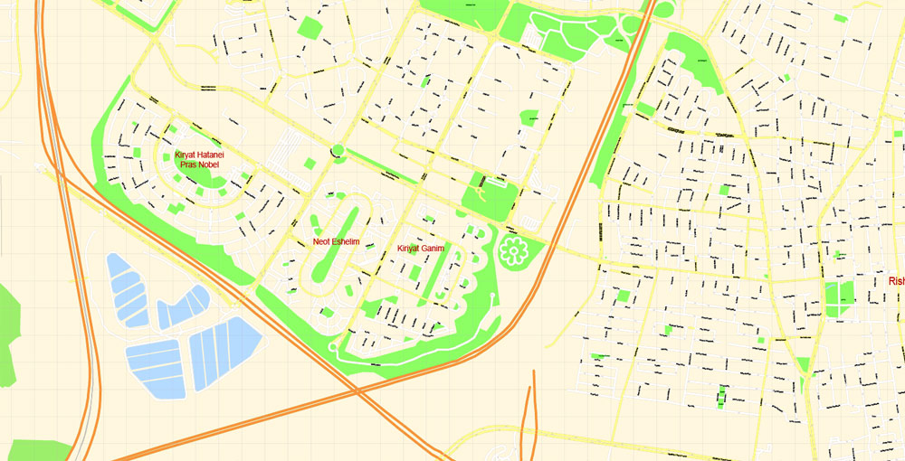
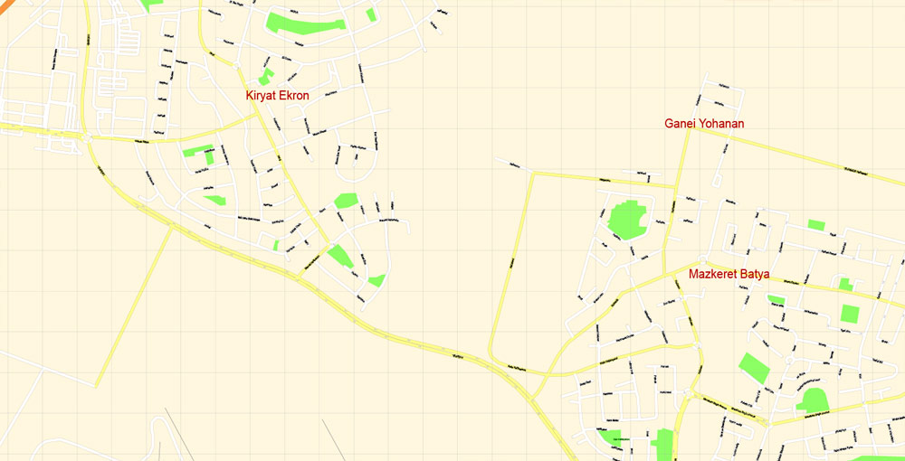
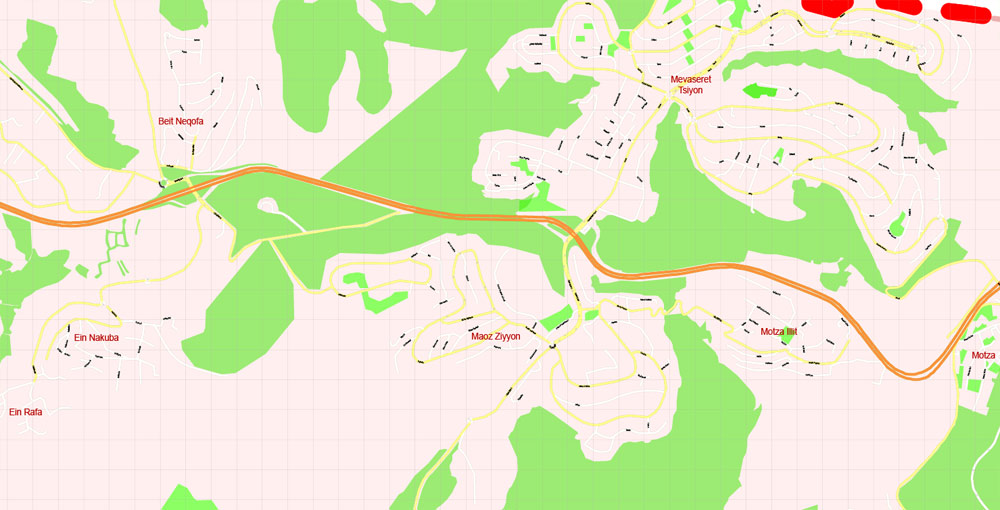
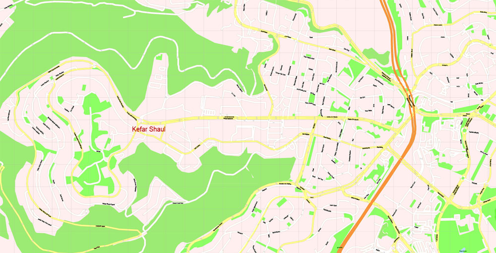
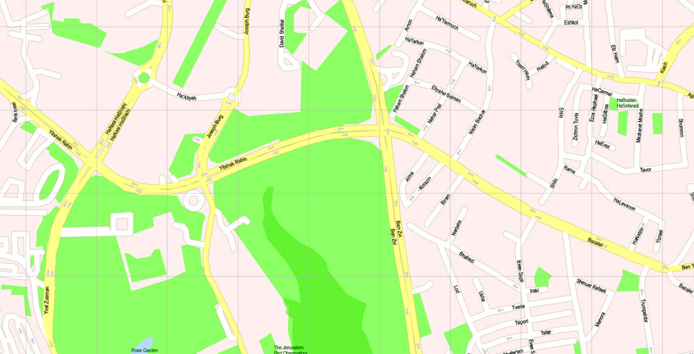
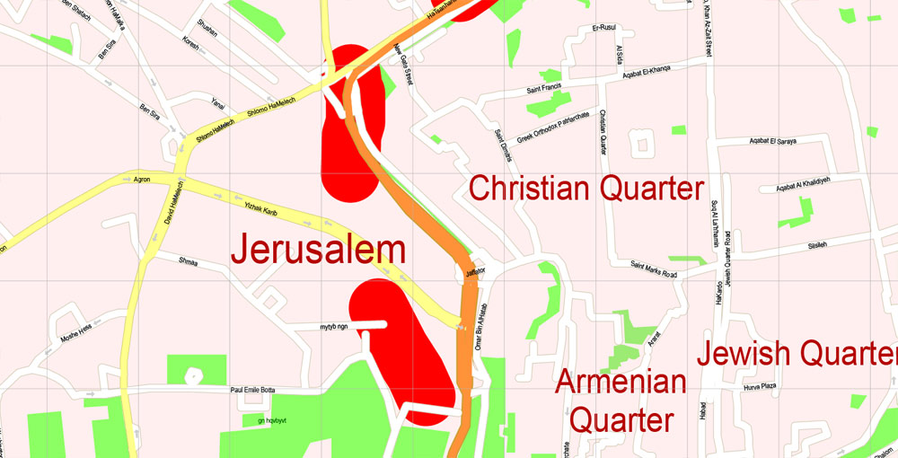
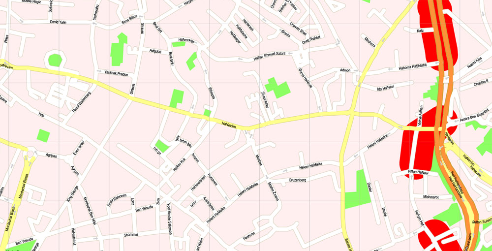
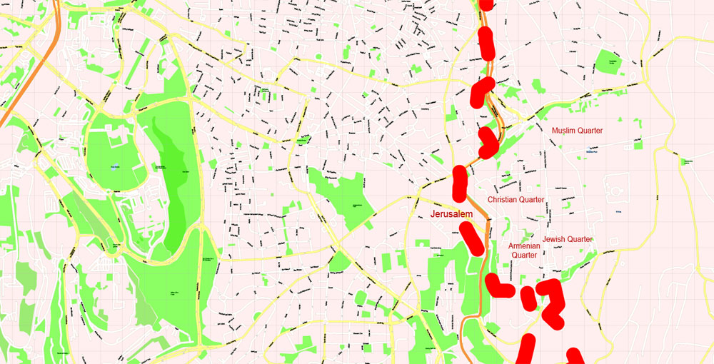
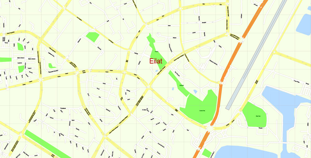
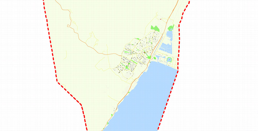
Included detailed maps of all cities and towns (all streets): Jerusalem, Tel Aviv – Yafo, Haifa, Rishon LeZion, Petah Tikva, Ashdod, Netanya, Beersheba, Holon, Bnei Brak, Ramat Gan, Rehovot, Ashkelon, Bat Yam, Beit Shemesh, Kfar Saba, Herzliya, Hadera, Modi’in, Nazareth, Ramla, Lod, Ra’anana, Rahat, Hod HaSharon, Givatayim, Kiryat Ata, Nahariya, Umm al-Fahm, Kiryat Gat, Eilat, etc. (ALL)
For High Quality Printing.
Israel.
This vector map of Israel is used as a basis for design, editing, and further printing.
This is the most detailed, exact map of Israel for high-quality printing and polygraphy. You can always clarify the map development date by contacting us.
For your convenience, all objects on Israel vector map are divided into layers. And the editing is very easy – colors, lines, etc.
You can easily add any objects needed (e.g. shops, salons, sale points, gas station or attraction) on any layer of Israel vector map.
One of the advantages of Israel vector maps of our production is the relevance of cartographic data, we constantly update all our products.
It’s very easy to work with vector maps of Israel city, even for a not very experienced designer who can turn on and off the map layers, add new objects, change the colors of fill and lines according to customer requirements.
The undoubted advantage of Israel vector maps in printing is an excellent and detailed visualization, when customer can expand a large paper map and instantly define his location, find a landmark, an object or address on map, unlike using the popular electronic formats of Google and Yandex maps for example.
Printable vector maps of Israel are much more convenient and efficient than any electronic maps on your smartphone, because ALL DETAILS are displayed in the entire space of Israel map.
Useful tips on working with vector maps of cities and countries in Adobe Illustrator.
«V» – launches the Selection tool (cursor, black arrow), which makes active any vector line.
«А» – launches the Direct Selection tool (white cursor), allows you to select curve elements and drag them to the desired place.
«R» – activates the Rotate tool, which helps you rotating selected objects around the center point by 360 degrees.
«E» – gives you the opportunity to use the Eraser tool and erase unnecessary parts.
«X» – switches between Fill and Stroke in the Tools section. Try to get used to this hot key and
you will quickly understand that you can’t live and work without it.
This vector map of Israel is used by:
designers, layout designers, printers, advertisers and architects. Our product – vector maps – is designed for further editing and printing in large formats – from @Wall format (a few meters) to A-0 and A-1, A-2, A-3.
The Israel map in vector format is used for design, urban planning, presentations and media visualizations.
The advertising and presentation map of Israel (usually the final designer marks the routes, and puts the client’s objects (shops, saloons, gas stations etc.)
The undoubted advantage is that people will NEVER throw out this advertising product – the map. In fact, as an advertising medium, a map is the most “long-playing” of the well-known polygraphic advertising media, with the longest lifespan, and the maximum number of interactions with the customer.
For travelers, maps are sold at the airports and gas stations around the world. Often the source is our vector maps.
Take a look, who purchases our vector maps of Israel in “Our Clients and Friends” page – these are large and small companies, from super-brands like Volvo and Starbucks, to small design studios and printing houses.
Israel, officially the State of Israel, is a country in the Middle East, located on the southeastern shore of the Mediterranean Sea and the northern shore of the Red Sea. It has land borders with Lebanon to the north, Syria to the northeast, Jordan on the east, the Palestinian territories of the West Bank and Gaza Strip to the east and west, respectively, and Egypt to the southwest. The country contains geographically diverse features within its relatively small area. Israel’s economic and technological center is Tel Aviv, while its seat of government and proclaimed capital is Jerusalem, although the state’s sovereignty over Jerusalem has only partial recognition.
Guides are not limited to vertical and horizontal in Adobe Illustrator. You can also create a diagonal guide for example. Moreover, you can turn any contours into guides. Select the outline and go to View > Guides > Make Guides (Create Guides), or simply press Cmd/Ctrl + 5. You can also turn the guides back into an editable object. Go to menu, View > Guides > Unlock Guides (Release Guides), select the guide you want to edit and select View > Guides > Release Guides (Reset Guides), or just press Cmd/Ctrl + Option / Alt + 5).
You will probably want to change the color scheme used on our Israel vector map.
To quickly and effectively play with colors.
Of course, you can do it manually, all objects in our Israel vector map are divided according to types and layers, and you can easily change the color gamma of vector objects in groups and layers.
Israel has evidence of the earliest migration of hominids out of Africa. Canaanite tribes are archaeologically attested since the Middle Bronze Age, while the Kingdoms of Israel and Judah emerged during the Iron Age. The Neo-Assyrian Empire destroyed Israel around 720 BCE. Judah was later conquered by the Babylonian, Persian and Hellenistic empires and had existed as Jewish autonomous provinces. The successful Maccabean Revolt led to an independent Hasmonean kingdom by 110 BCE, which in 63 BCE however became a client state of the Roman Republic that subsequently installed the Herodian dynasty in 37 BCE, and in 6 CE created the Roman province of Judea.
But there is more effective way of working with the whole VECTOR MAP of Israel and all layers:
The overview dialog «Edit colors»/«Repaint Graphic Object» (this dialog box name can change depending on the context):
If you have selected a part or a layer of Israel vector map and open the dialog box by clicking the icon in the Control panel, on the Samples palette or the Color Catalog, or if you choose Edit > Edit Colors> Repaint Graphic Object, then the «Repaint Graphic Object» dialog box appears, and you get access to «Assign» and «Edit» tabs.
If a picture or a map fragment is not selected, and you open the dialog box by clicking the icon in the Control panel, on the Samples palette or in the Color Catalog, the «Edit Colors» dialog box appears and you can only access the «Edit» tab.
Regardless of the name at the top of the dialog box, the right-hand side always displays the color group of the current document, as well as two default color groups: Print Color and Grayscale. These color groups can be selected and used any time.
Judea lasted as a Roman province until the failed Jewish revolts resulted in widespread destruction, expulsion of Jewish population and the renaming of the region from Iudaea to Syria Palaestina. Jewish presence in the region has persisted to a certain extent over the centuries. In the 7th century CE, the Levant was taken from the Byzantine Empire by the Arabs and remained in Muslim control until the First Crusade of 1099, followed by the Ayyubid conquest of 1187. The Mamluk Sultanate of Egypt extended its control over the Levant in the 13th century until its defeat by the Ottoman Empire in 1517. During the 19th century, national awakening among Jews led to the establishment of the Zionist movement in the diaspora followed by waves of immigration to Ottoman Syria and later British Mandate Palestine.
Create and edit color groups of Israel vector map, and also assign colors using the «Edit Colors»/ а «Repaint Graphic Object» dialog box.
A. Creating and editing of a color group on the «Edit» tab
B. Assigning colors on the «Assign» tab
C. Select a group of colors from the «Color groups» list
The option «Repaint a graphic object» in the lower part of the dialog box allows you to preview the colors on a selected layer of Vector map, or a group of elements, and specify whether its colors will be redefined when the dialog box is closed.
The main areas of the dialog box are:
«Edit»
The «Edit» tab is designed to create a new or edit the existing color groups.
The harmony rules Menu and the Color Wheel are used to conduct experiments with color harmonies. The color wheel shows how colors are related in color harmony, and the color bars allow you to view and manipulate an individual color values. In addition, you can adjust the brightness, add and remove colors, save color groups and view colors on the selected Vector Map of Israel or a separated layers.
«Assign»
The «Assign» tab is used to view and control on how the original colors are replaced with colors from the color group like your corporate colors in the Vector Map of Israel city.
The assign color ability is provided only if the entire map, layer or fragment is selected in the document. You can specify which of new colors replace the current colors, whether the spot colors should be preserved and how colors are replaced (for example, you can replace colors completely or changing the color tone while maintaining the brightness). The «Assign» tab allows you to redefine colors in the Vector Map of Israel city, or in separate layers and fragments using the current color group or reducing the number of colors in the current Vector Map.
Color groups
Is a list of all saved color groups for current document (the same groups appear in the «Samples» palette). You can edit and delete the existing color groups, as well as creating a new ones using the list of “Color Groups” in the dialog box. All changes appear in the «Samples» palette.
The highlighted color group shows, which color group is currently edited.
In 1947, the United Nations (UN) adopted a Partition Plan for Palestine recommending the creation of independent Arab and Jewish states and an internationalized Jerusalem. The plan was accepted by the Jewish Agency, and rejected by Arab leaders. The following year, the Jewish Agency declared the independence of the State of Israel, and the subsequent 1948 Arab–Israeli War saw Israel’s establishment over most of the former Mandate territory, while the West Bank and Gaza were held by neighboring Arab states.
Any color group can be selected and edited, or used to redefine the colors in the selected vector map of Israel city, its fragments or elements.
Saving a color group adds this group to the specified list.
Opening the «Edit Colors»/«Repaint Graphic Object» dialog box.
Open the «Edit Colors»/«Repaint Graphic Object» dialog box using one of the following methods:
«Edit»> «Edit Colors»> «Repaint Graphic object» or «Repaint With Style».
Use these commands if you need to edit the colors in the selected vector map of Israel city.
«Repaint Graphic object» button on the «Control» panel.
Use this button if you need to adjust colors of Israel vector map using the а «Repaint graphic object» dialog box.
The specified button is available if the selected vector map or its fragment contains two or more colors.
Note. This color editing method is convenient for global color adjustment in a vector map, if global colors were not used when creating a Map of Israel.
The «Edit colors» button or «Edit or apply colors» on the «Color Catalog» palette
Click this button if you need to edit colors on the «Color Catalog» palette or edit and then apply them to the selected Vector Map of Israel or its fragment.
The «Edit color group» button or «Edit or apply color group» on the «Samples» palette.
Click this button if you need to edit the colors in the specific color group or edit and apply them to the selected Vector Map of Israel or a group of its elements, for example, the whole layer “Streets and lines”. You can also double-click the color group in the Samples panel to open the dialog box.
If the map file is too large and your computer freezes or even can’t open it quickly:
1. Try to reduce the color resolution of the video card (display) to 256 colors while working with a large map.
2. Using Windows Task Manager, select all the application you don’t need, while working with map, just turn them off.
3. Launch Adobe Illustrator. (DO NOT OPEN the vector map file)
4. Start the Windows Task Manager using administrator rights > Find the “Illustrator” process > set the «real time» priority,
5. Open the file. When you see the LEGACY FONT popup window – click “OK” (do not update). You can restore the TEXT later.
6. Can also be useful: When file is opened – Edit > Settings > Basic Settings > disable smoothing. /// It looks scary, but works quickly)))
We recommend saving the file in Adobe Illustrator 10 version. It’s much more stable when working with VERY BIG size files.
Israel has since fought several wars with Arab countries, and since the Six-Day War in 1967 held occupied territories including the West Bank, Golan Heights and the Gaza Strip (still considered occupied after the 2005 disengagement, although some legal experts dispute this claim). It extended its laws to the Golan Heights and East Jerusalem, but not the West Bank. Israel’s occupation of the Palestinian territories is the world’s longest military occupation in modern times. Efforts to resolve the Israeli–Palestinian conflict have not resulted in a final peace agreement. However, peace treaties between Israel and both Egypt and Jordan have been signed.
In its Basic Laws, Israel defines itself as a Jewish and democratic state. The country has a liberal democracy, with a parliamentary system, proportional representation, and universal suffrage. The prime minister is head of government and the Knesset is the legislature. Israel is a developed country and an Organisation for Economic Co-operation and Development (OECD) member, with the 32nd-largest economy in the world by nominal gross domestic product (GDP) as of 2017.
The country benefits from a highly skilled workforce and is among the most educated countries in the world with one of the highest percentages of its citizens holding a tertiary education degree. Israel has the highest standard of living in the Middle East, and has one of the highest life expectancies in the world.
Geography and environment
Geography of Israel
Israel is located in the Levant area of the Fertile Crescent region. The country is at the eastern end of the Mediterranean Sea, bounded by Lebanon to the north, Syria to the northeast, Jordan and the West Bank to the east, and Egypt and the Gaza Strip to the southwest. It lies between latitudes 29° and 34° N, and longitudes 34° and 36° E.
The sovereign territory of Israel (according to the demarcation lines of the 1949 Armistice Agreements and excluding all territories captured by Israel during the 1967 Six-Day War) is approximately 20,770 square kilometers (8,019 sq mi) in area, of which two percent is water. However Israel is so narrow that the exclusive economic zone in the Mediterranean is double the land area of the country. The total area under Israeli law, including East Jerusalem and the Golan Heights, is 22,072 square kilometers (8,522 sq mi), and the total area under Israeli control, including the military-controlled and partially Palestinian-governed territory of the West Bank, is 27,799 square kilometers (10,733 sq mi).
Despite its small size, Israel is home to a variety of geographic features, from the Negev desert in the south to the inland fertile Jezreel Valley, mountain ranges of the Galilee, Carmel and toward the Golan in the north. The Israeli coastal plain on the shores of the Mediterranean is home to most of the nation’s population. East of the central highlands lies the Jordan Rift Valley, which forms a small part of the 6,500-kilometer (4,039 mi) Great Rift Valley.
The Jordan River runs along the Jordan Rift Valley, from Mount Hermon through the Hulah Valley and the Sea of Galilee to the Dead Sea, the lowest point on the surface of the Earth. Further south is the Arabah, ending with the Gulf of Eilat, part of the Red Sea. Unique to Israel and the Sinai Peninsula are makhteshim, or erosion cirques. The largest makhtesh in the world is Ramon Crater in the Negev, which measures 40 by 8 kilometers (25 by 5 mi). A report on the environmental status of the Mediterranean Basin states that Israel has the largest number of plant species per square meter of all the countries in the basin.
Location and boundaries
Israel lies to the north of the equator around 31°30′ north latitude and 34°45′ east longitude. It measures 424 km (263 mi) from north to south and, at its widest point 114 km (71 mi), from east to west. At its narrowest point, however, this is reduced to just 15 km (9 mi). It has a land frontier of 1,017 km (632 mi) and a coastline of 273 km (170 mi). It is ranked 153 on the List of countries and outlying territories by total area.
Prior to the establishment of the British Mandate for Palestine, there was no clear-cut definition of the geographical and territorial limits of the area known as “Palestine.” On the eve of World War I it was described by Encyclopædia Britannica as a “nebulous geographical concept.” The Sykes-Picot Treaty in 1916 divided the region that later became Palestine into four political units.
Under the British Mandate for Palestine, the first geo-political framework was created that distinguished the area from the larger countries that surrounded it. The boundary demarcation at this time did not introduce geographical changes near the frontiers and both sides of the border were controlled by the British administration.

Modern Israel is bounded to the north by Lebanon, the northeast by Syria, the east by Jordan and the West Bank, and to the southwest by Egypt. To the west of Israel is the Mediterranean Sea, which makes up the majority of Israel’s 273 km (170 mi) coastline and the Gaza Strip. Israel has a small coastline on the Red Sea in the south. The southernmost settlement in Israel is the city of Eilat whilst the northernmost is the town of Metula. The territorial waters of Israel extend into the sea to a distance of twelve nautical miles measured from the appropriate baseline.
The statistics provided by the Israel Central Bureau of Statistics include the annexed East Jerusalem and Golan Heights, but exclude the West Bank and Gaza Strip. The population of Israel includes Israeli settlers in the West Bank. The route of the Israeli West Bank barrier incorporates some parts of the West Bank.
Israel
Country in the Middle East
Israel, a Middle Eastern country on the Mediterranean Sea, is regarded by Jews, Christians and Muslims as the biblical Holy Land. Its most sacred sites are in Jerusalem. Within its Old City, the Temple Mount complex includes the Dome of the Rock shrine, the historic Western Wall, Al-Aqsa Mosque and the Church of the Holy Sepulchre. Israel’s financial hub, Tel Aviv, is known for its Bauhaus architecture and beaches.
Capital and largest city: Jerusalem (limited recognition); 31°47′N 35°13′E / 31.783°N 35.217°E
Area
• Total 20,770–22,072 km2 (8,019–8,522 sq mi)
• Water (%) 2.1
Population
• 2018 estimate 8,855,400
• Density 401/km2 (1,038.6/sq mi)
Israel, officially the State of Israel, is a country in the Middle East, on the southeastern shore of the Mediterranean Sea and the northern shore of the Red Sea. It has land borders with Lebanon to the north, Syria to the northeast, Jordan on the east, the Palestinian territories of the West Bank and Gaza Strip to the east and west, respectively, and Egypt to the southwest. The country contains geographically diverse features within its relatively small area. Israel’s economy and technology center is Tel Aviv, while its seat of government and proclaimed capital is Jerusalem, although the state’s sovereignty over Jerusalem is not recognised internationally.
The Kingdoms of Israel and Judah emerged during the Iron Age. The Neo-Assyrian Empire destroyed Israel around 720 BCE. Judah was later conquered by the Babylonian, Persian and Hellenistic empires and had existed as Jewish autonomous provinces. The successful Maccabean Revolt led to an independent Hasmonean kingdom by 110 BCE, which in 63 BCE however became a client state of the Roman Republic that subsequently installed the Herodian dynasty in 37 BCE, and in 6 CE created the Roman province of Judea. Judea lasted as a Roman province until the failed Jewish revolts resulted in widespread destruction, expulsion of Jewish population and the renaming of the region from Iudaea to Syria Palaestina.Jewish
presence in the region has persisted to a certain extent over the centuries. In the 7th century the Levant was taken from the Byzantine Empire by the Arabs and remained in Muslim control until the First Crusade of 1099, followed by the Ayyubid conquest of 1187. The Mamluk Sultanate of Egypt extended its control over the Levant in the 13th century until its defeat by the Ottoman Empire in 1517. During the 19th century, national awakening among Jews led to the establishment of the Zionist movement in the diaspora followed by waves of immigration to Ottoman and later British Palestine.
In 1947, the United Nations adopted a Partition Plan for Palestine recommending the creation of independent Arab and Jewish states and an internationalized Jerusalem. The plan was accepted by the Jewish Agency, and rejected by Arab leaders. The following year, the Jewish Agency declared the independence of the State of Israel, and the subsequent 1948 Arab–Israeli War saw Israel’s establishment over most of the former Mandate territory, while the West Bank and Gaza were held by neighboring Arab states. Israel has since fought several wars with Arab countries, and it has since 1967 occupied territories including the West Bank, Golan Heights and the Gaza Strip (still considered occupied after 2005 disengagement,
although some legal experts dispute this claim). It extended its laws to the Golan Heights and East Jerusalem, but not the West Bank. Israel’s occupation of the Palestinian territories is the world’s longest military occupation in modern times. Efforts to resolve the Israeli–Palestinian conflict have not resulted in final peace agreement. However, peace treaties between Israel and both Egypt and Jordan have been signed.
In its Basic Laws, Israel defines itself as a Jewish and democratic state. Israel is a representative democracy with a parliamentary system, proportional representation and universal suffrage. The prime minister is head of government and the Knesset is the legislature. Israel is a developed country and an OECD member, with the 33rd-largest economy in the world by nominal gross domestic product as of 2017. The country benefits from a highly skilled workforce and is among the most educated countries in the world with one of the highest percentages of its citizens holding a tertiary education degree. Israel has the highest standard of living in the Middle East, and has one of the highest life expectancies in the world.


 Author: Kirill Shrayber, Ph.D. FRGS


