Extended Description of the Vector Map
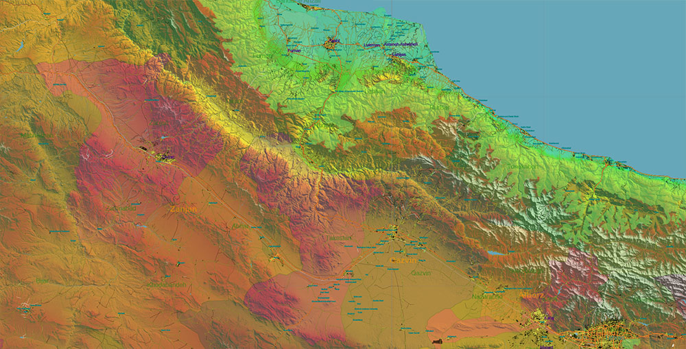
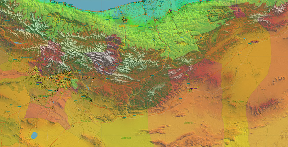
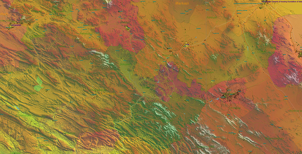
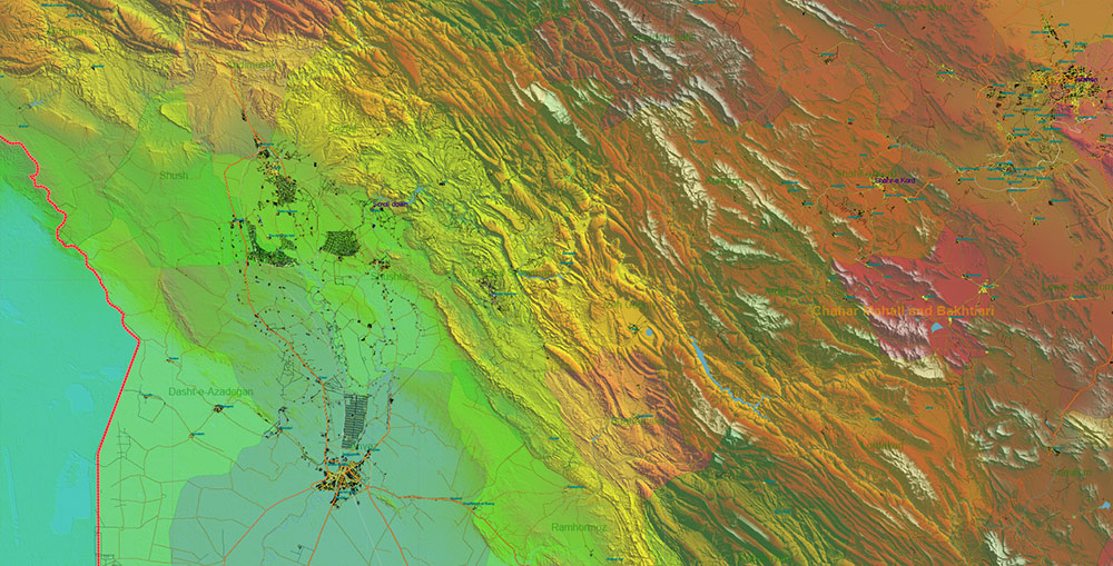
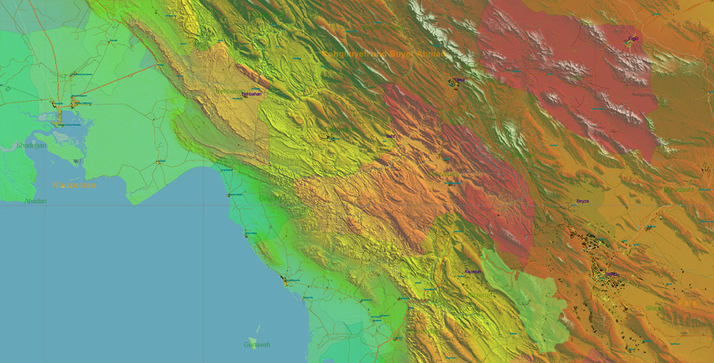
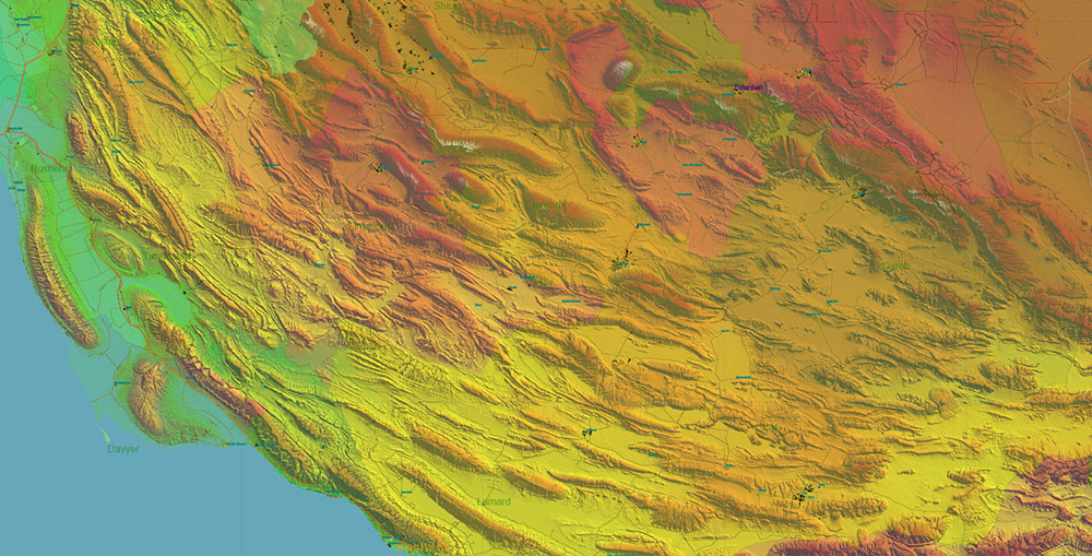
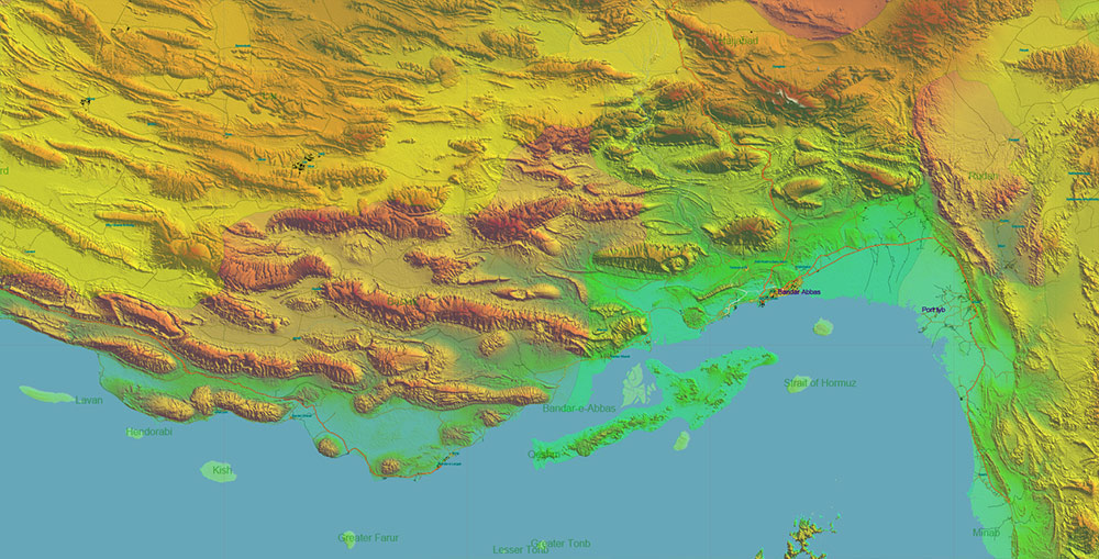
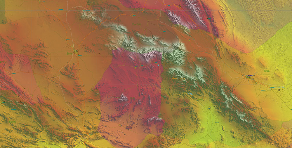
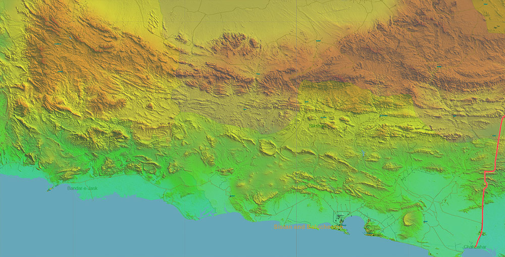
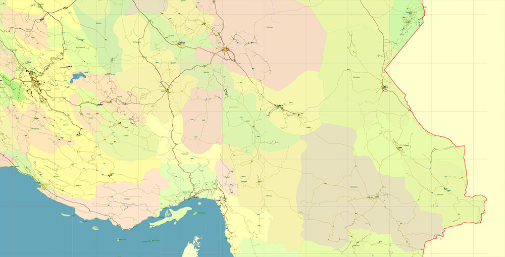
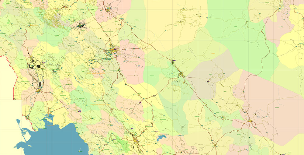
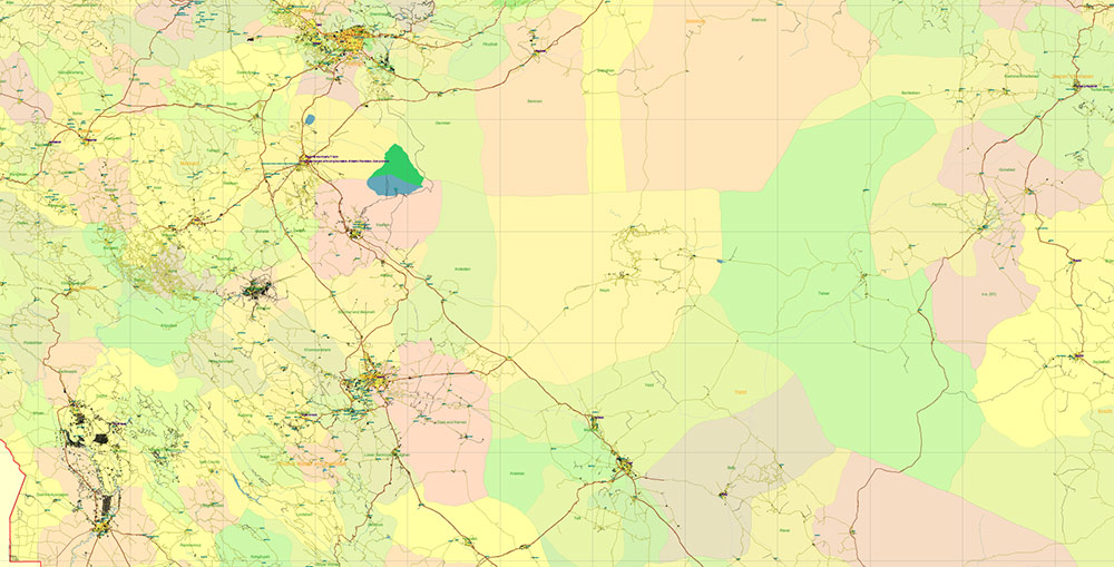
Printable Shaded Relief PDF Vector Map of Iran, High Detailed Plan full editable Adobe PDF Road Admin Map in layers, scalable, text format all names, 941 MB ZIP
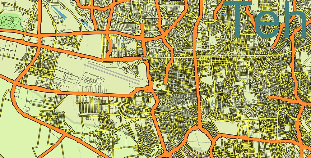
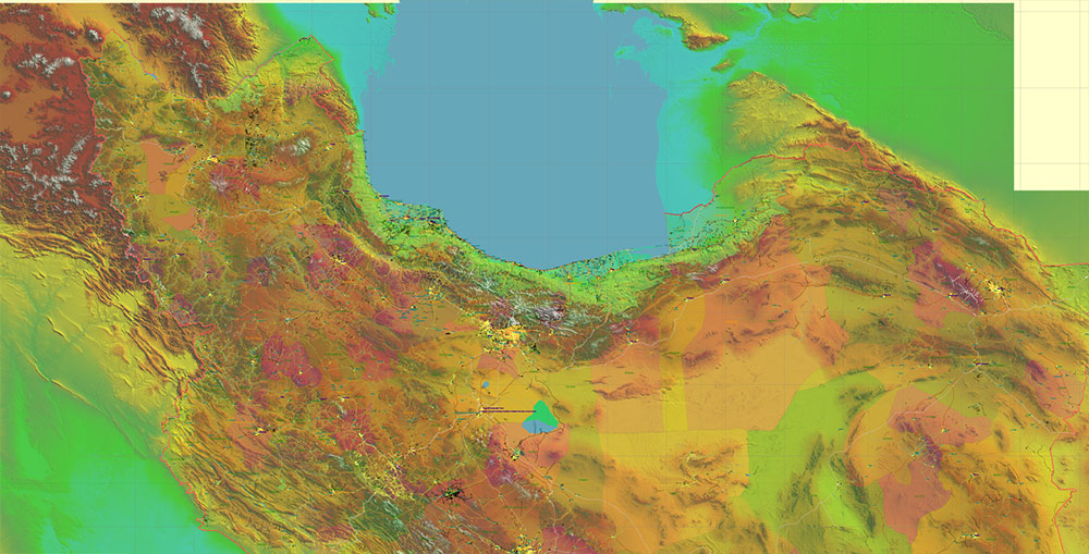
All streets and roads, Principal Roads and Main Streets, Main Cities and Towns, Main Objects, Admin areas 1, Admin areas 2, raster Shaded Relief HD. Map for design, printing, arts, projects, presentations, for architects, designers, and builders, business, logistics.
The most exact and detailed map of the state in scale.
For Editing and High-Quality Printing, Royalty free
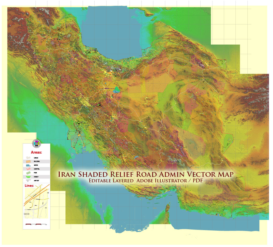
Iran PDF Map Vector Exact Shaded Relief and Roads High Detailed Map Admin areas levels 1,2, editable Adobe PDF in layers
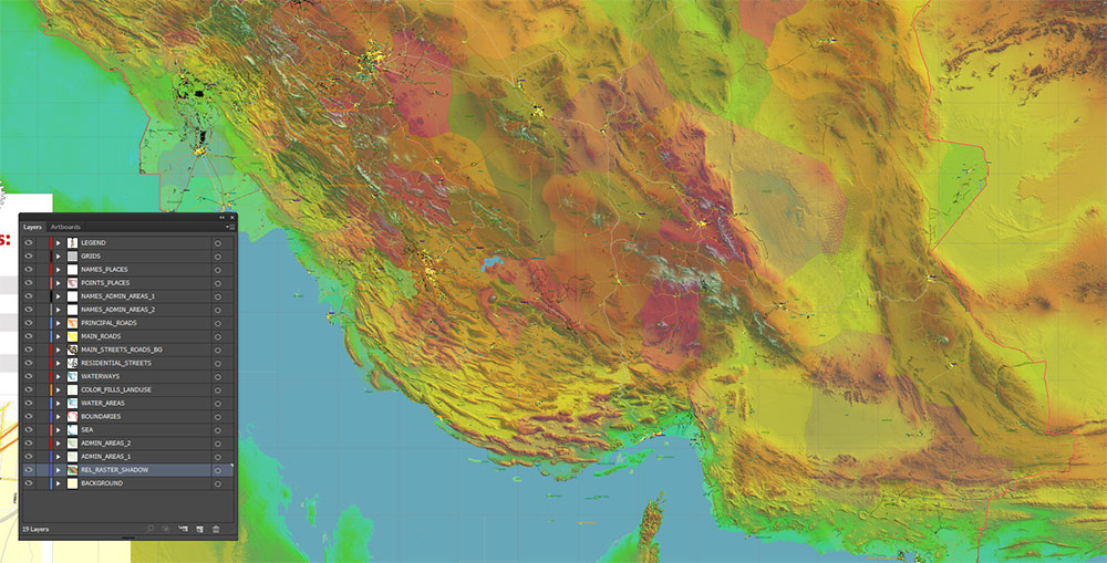
Layers list:
- Legend
- Grids
- Names of places (city, town, etc.)
- Points of the Cities and Towns
- Names of Admin areas level 1
- Names of Admin areas level 2
- Principal Streets and Main Roads 2
- Residential streets and roads
- Water objects (rivers, lakes, ponds)
- Waterways
- Color fills (parks, hospital areas, school areas, land use, etc.)
- Admin Areas level 2
- Admin Areas level 1
- Shaded Relief Raster PNG HD Tiles
- Background
IRAN — TRANSPORT, PORTS, OIL INDUSTRY & ECONOMIC INFRASTRUCTURE BRIEF
1) National Economic Geography Overview
Iran’s economic structure is built around:
-
Energy production (oil & gas)
-
Industrial manufacturing centers
-
Transport corridors linking the plateau to maritime export points
-
A large domestic consumer market
Economic activity is spatially concentrated in:
-
Southern hydrocarbon zones
-
Tehran metropolitan industrial belt
-
Major intercity transport corridors
2) Oil & Gas Geography
| Indicator |
Data (approx.) |
| Proven oil reserves |
Among the world’s top tier |
| Proven natural gas reserves |
Among the world’s largest |
| Main production zone |
Southwest (Khuzestan Province) |
| Offshore production |
Persian Gulf fields |
| Major oil terminals |
Along Persian Gulf coast |
Key Oil-Producing Regions
| Region |
Characteristics |
| Khuzestan |
Core oil basin; flat terrain; dense infrastructure |
| Persian Gulf offshore |
Platforms and coastal terminals |
| Central plateau |
Limited production |
Infrastructure Elements
Energy sector forms the backbone of export revenue and heavy industry.
3) Ports & Maritime Economy
| Port |
Location |
Function |
| Bandar Abbas |
Strait of Hormuz |
Main container and oil export hub |
| Bushehr |
Persian Gulf |
Energy and cargo port |
| Khorramshahr |
Shatt al-Arab region |
Inland Gulf trade |
| Chabahar |
Gulf of Oman |
Ocean-access port outside Hormuz chokepoint |
Maritime Role:
4) Transportation Network & Trade Flow
Roads
| Metric |
Data |
| Road network |
~220,000 km |
| Major freight corridors |
Tehran–Isfahan–Shiraz–Gulf; Tehran–Ahvaz; Tehran–Tabriz; Tehran–Mashhad |
Rail
| Metric |
Data |
| Rail network |
~14,000 km |
| Major freight lines |
Tehran → Bandar Abbas; Tehran → Tabriz; Tehran → Mashhad |
Rail links interior industry to ports.
Air
Major economic aviation nodes:
-
Tehran
-
Mashhad
-
Shiraz
-
Isfahan
5) Industrial Centers
| City/Region |
Industrial Role |
| Tehran–Karaj corridor |
Manufacturing, automotive, heavy industry |
| Isfahan |
Steel, metallurgy, engineering |
| Ahvaz |
Oil-field support, heavy industry |
| Shiraz |
Manufacturing and services |
| Tabriz |
Machinery, regional trade |
Industrial geography follows major transport axes.
6) Economic Structure
| Sector |
Weight |
| Oil & gas |
Core export driver |
| Manufacturing |
Large domestic sector |
| Agriculture |
Regional importance |
| Services |
Growing urban sector |
GDP structure is influenced by:
-
Energy exports
-
Industrial output
-
Domestic consumption
7) Spatial Economic Patterns
| Zone |
Economic Character |
| Southwest (Khuzestan) |
Energy production core |
| Central plateau |
Industry + population |
| Southern coast |
Ports + petrochemicals |
| Northwest |
Manufacturing + trade corridors |
| Deserts |
Sparse economic activity |
8) Logistics Flow Summary
Primary Flow Pattern:
Oil/Gas Fields → Refineries → Southern Ports → Maritime Export
Interior Industry → Rail/Highway Corridors → Ports
Urban Consumption → Central Distribution Hubs
9) Map Interpretation Summary
Iran’s economy maps as:
An energy-centered plateau economy whose transport corridors connect inland industrial zones to strategically vital southern ports.
Key spatial traits:
-
Southern hydrocarbon belt
-
Tehran-centered industrial network
-
Strong north–south freight corridors
-
Maritime export dependency
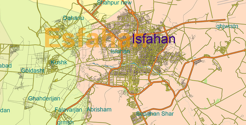
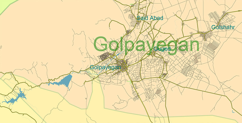
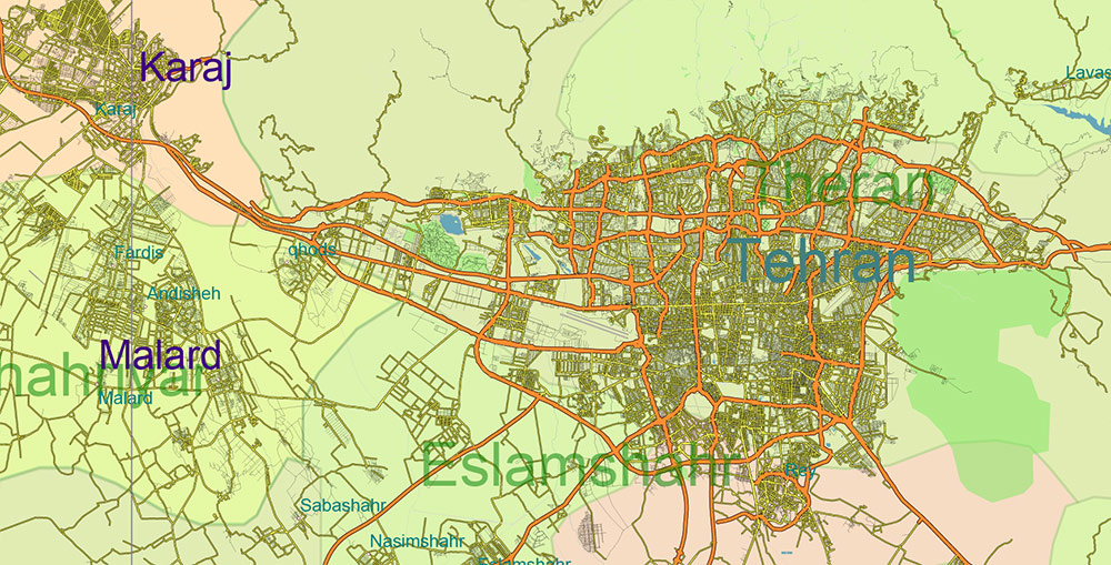
Iran PDF Map Vector Exact Shaded Relief and Roads High Detailed Map Admin areas levels 1,2, editable Adobe PDF in layers
Iran PDF Map Vector Exact Shaded Relief and Roads High Detailed Map Admin areas levels 1,2, editable Adobe PDF in layers
Iran PDF Map Vector Exact Shaded Relief and Roads High Detailed Map Admin areas levels 1,2, editable Adobe PDF in layers
Iran PDF Map Vector Exact Shaded Relief and Roads High Detailed Map Admin areas levels 1,2, editable Adobe PDF in layers
Iran PDF Map Vector Exact Shaded Relief and Roads High Detailed Map Admin areas levels 1,2, editable Adobe PDF in layers
Iran PDF Map Vector Exact Shaded Relief and Roads High Detailed Map Admin areas levels 1,2, editable Adobe PDF in layers
Iran PDF Map Vector Exact Shaded Relief and Roads High Detailed Map Admin areas levels 1,2, editable Adobe PDF in layers
Iran PDF Map Vector Exact Shaded Relief and Roads High Detailed Map Admin areas levels 1,2, editable Adobe PDF in layers
Iran PDF Map Vector Exact Shaded Relief and Roads High Detailed Map Admin areas levels 1,2, editable Adobe PDF in layers
Iran PDF Map Vector Exact Shaded Relief and Roads High Detailed Map Admin areas levels 1,2, editable Adobe PDF in layers
Iran PDF Map Vector Exact Shaded Relief and Roads High Detailed Map Admin areas levels 1,2, editable Adobe PDF in layers
Iran PDF Map Vector Exact Shaded Relief and Roads High Detailed Map Admin areas levels 1,2, editable Adobe PDF in layers
Iran PDF Map Vector Exact Shaded Relief and Roads High Detailed Map Admin areas levels 1,2, editable Adobe PDF in layers
Iran PDF Map Vector Exact Shaded Relief and Roads High Detailed Map Admin areas levels 1,2, editable Adobe PDF in layers
Iran PDF Map Vector Exact Shaded Relief and Roads High Detailed Map Admin areas levels 1,2, editable Adobe PDF in layers
Iran PDF Map Vector Exact Shaded Relief and Roads High Detailed Map Admin areas levels 1,2, editable Adobe PDF in layers
Iran PDF Map Vector Exact Shaded Relief and Roads High Detailed Map Admin areas levels 1,2, editable Adobe PDF in layers
Iran PDF Map Vector Exact Shaded Relief and Roads High Detailed Map Admin areas levels 1,2, editable Adobe PDF in layers

 Author: Kirill Shrayber, Ph.D. FRGS
