Extended Description of the Vector Map
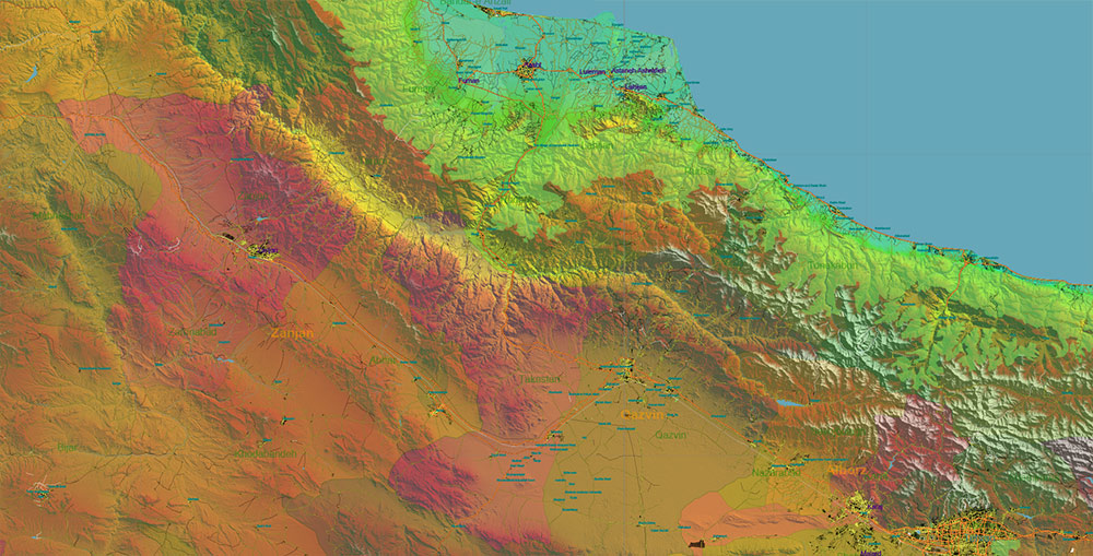
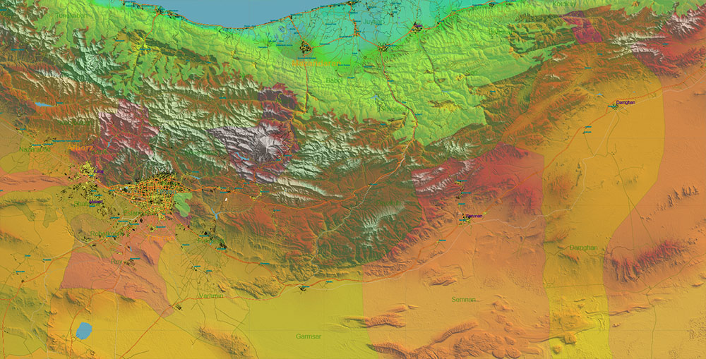
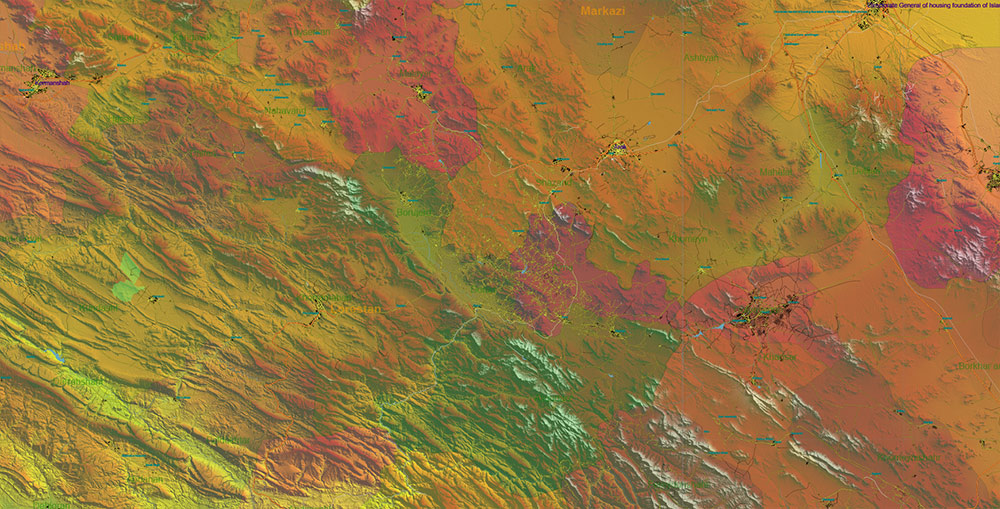
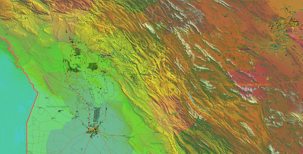
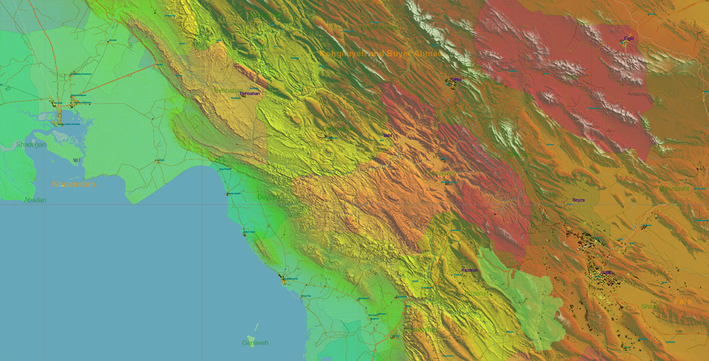
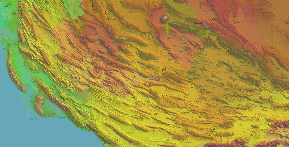
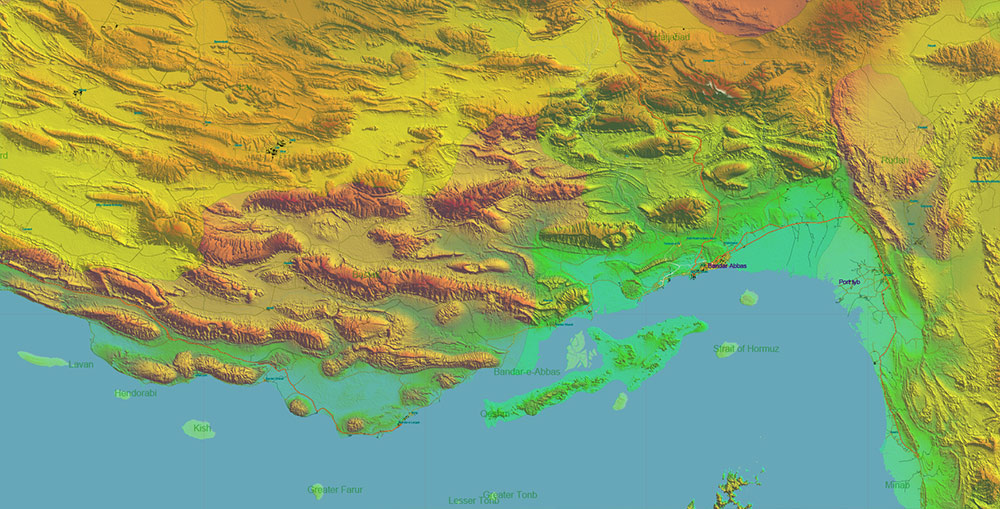
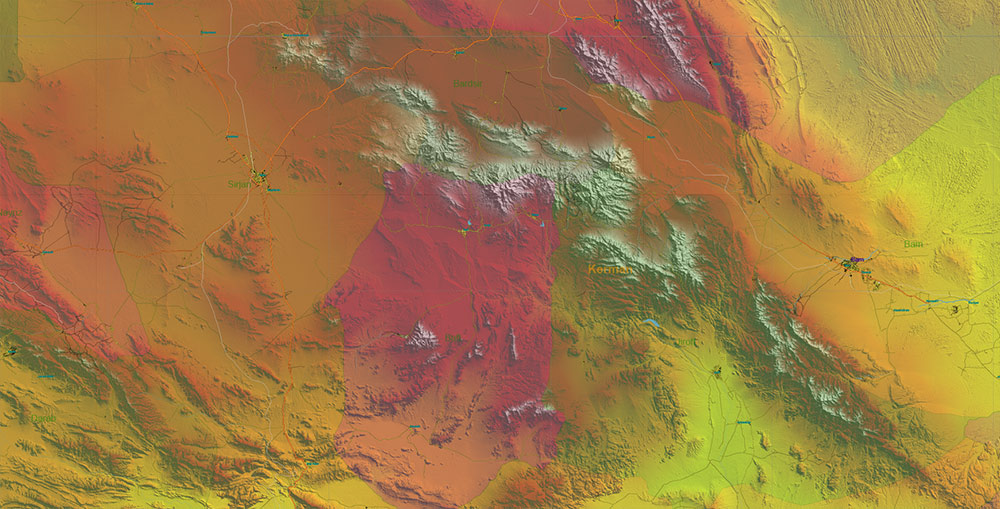
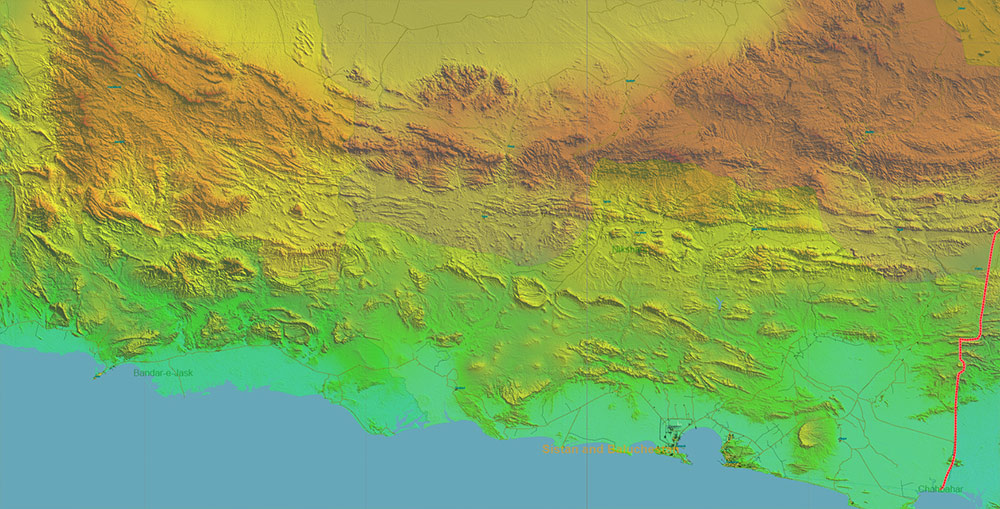
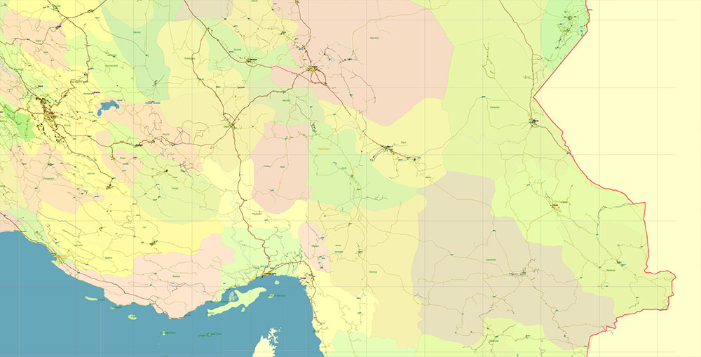
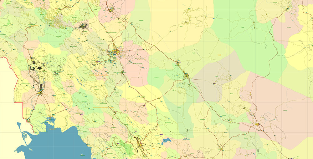
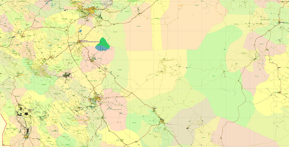
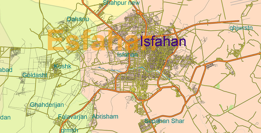
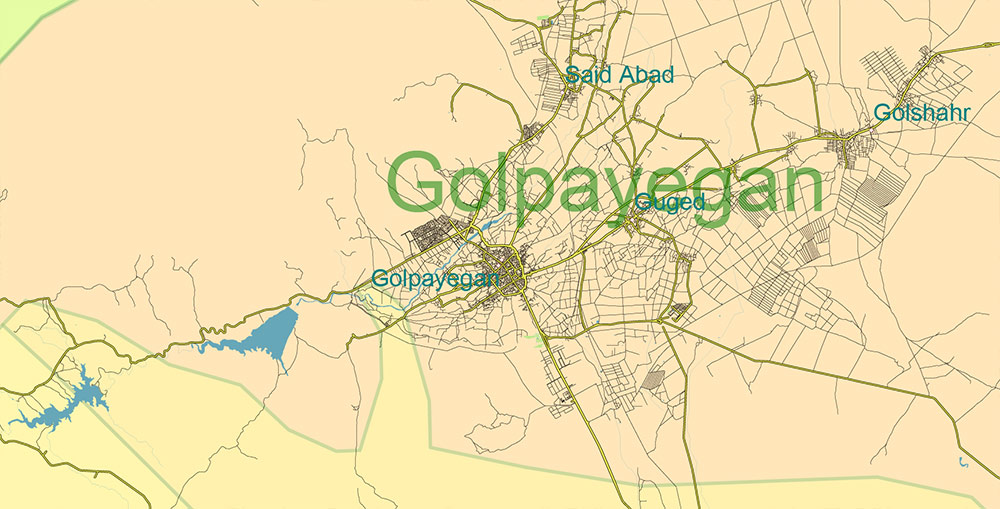
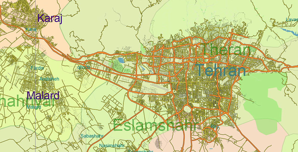
Printable Shaded Relief Vector Map of Iran, High Detailed Plan full editable Adobe Illustrator Road Admin Map in layers, scalable, text format all names, 453 MB ZIP
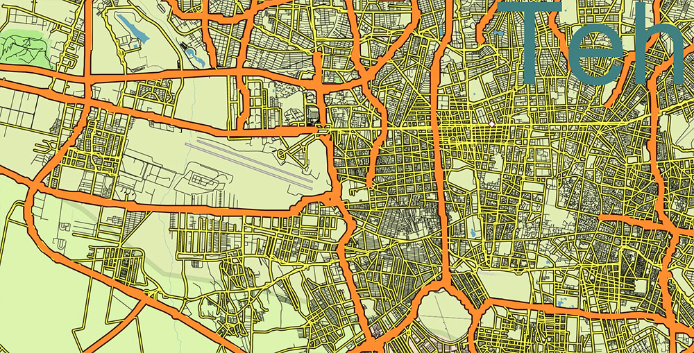
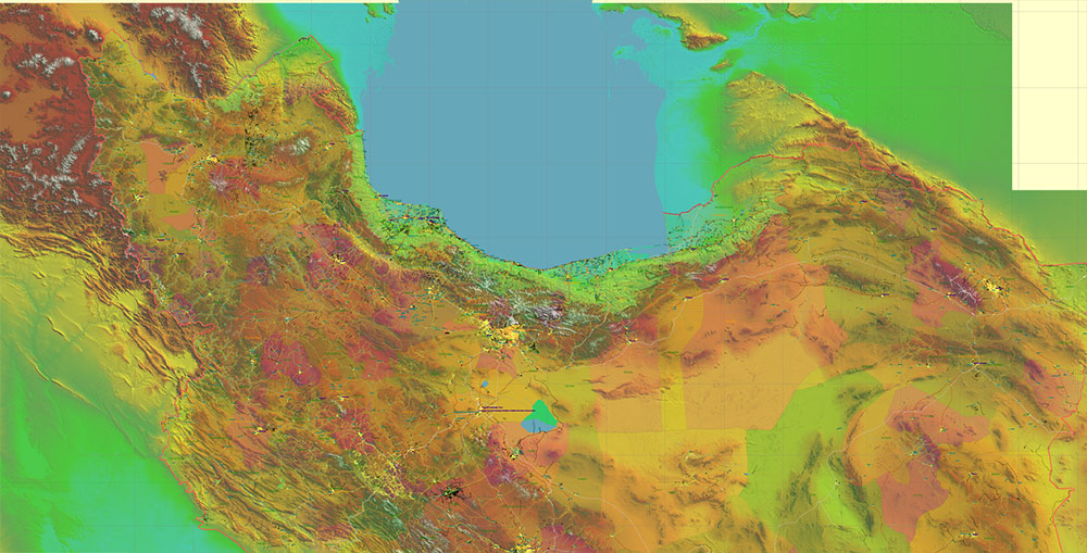
All streets and roads, Principal Roads and Main Streets, Main Cities and Towns, Main Objects, Admin areas 1, Admin areas 2, raster Shaded Relief HD. Map for design, printing, arts, projects, presentations, for architects, designers, and builders, business, logistics.
The most exact and detailed map of the state in scale.
For Editing and High-Quality Printing, Royalty free
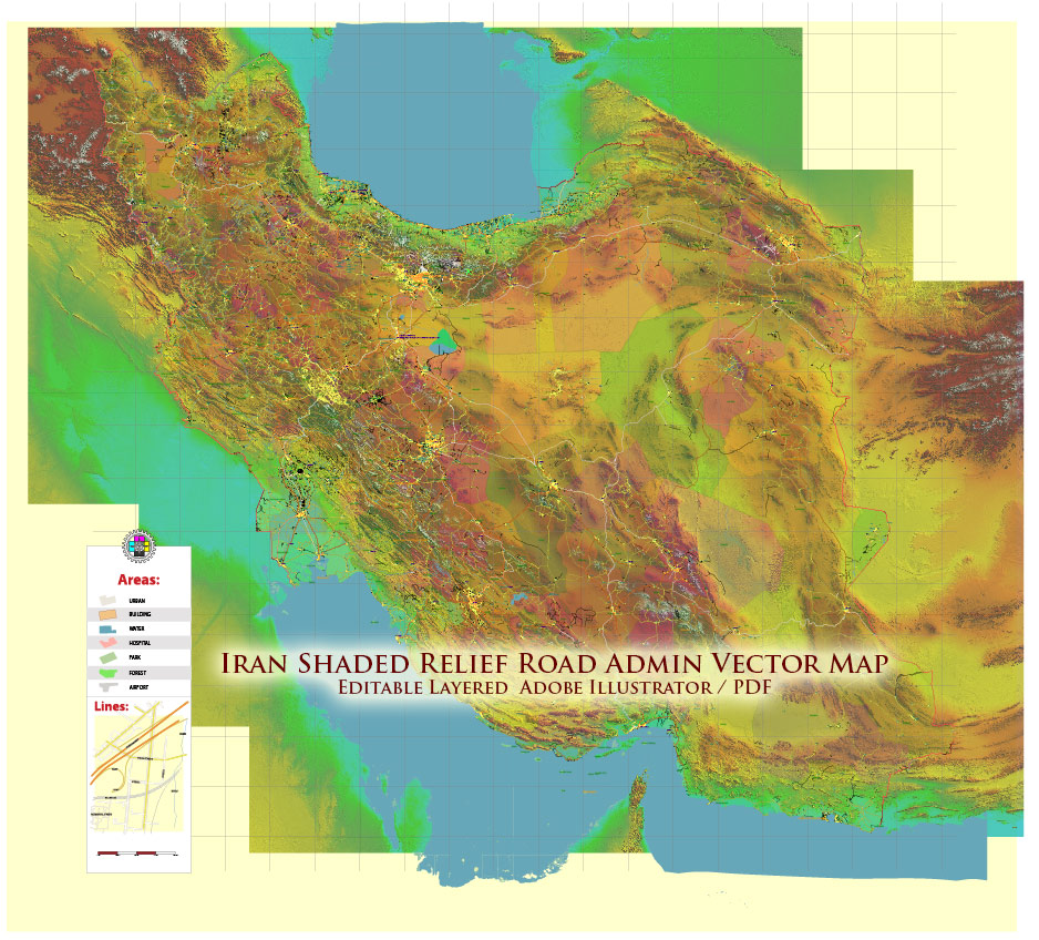
Iran Map Vector Exact Shaded Relief and Roads High Detailed Map Admin areas levels 1,2, editable Adobe Illustrator in layers
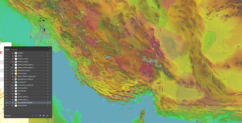
Layers list:
- Legend
- Grids
- Names of places (city, town, etc.)
- Points of the Cities and Towns
- Names of Admin areas level 1
- Names of Admin areas level 2
- Principal Streets and Main Roads 2
- Residential streets and roads
- Water objects (rivers, lakes, ponds)
- Waterways
- Color fills (parks, hospital areas, school areas, land use, etc.)
- Admin Areas level 2
- Admin Areas level 1
- Shaded Relief Raster PNG HD Tiles
- Background
IRAN — PURE TRANSPORTATION CORRIDOR MAP BRIEF
1) National Transport Structure Overview
Iran’s transport system forms a hub-and-spoke + corridor network centered on Tehran, constrained by mountain belts and deserts. Movement is channeled along plateau valleys, mountain passes, and coastal plains.
Network Type: Radial core with peripheral coastal and border corridors
Primary Control Node: Tehran metropolitan transport hub
2) Primary National Axes (Backbone Corridors)
| Corridor |
Orientation |
Connects |
Function |
| Tehran – Isfahan – Shiraz – Persian Gulf |
N–S |
Central plateau to southern coast |
Main interior–coastal artery |
| Tehran – Tabriz – Turkey border |
NW |
Capital to Anatolia |
Western international land route |
| Tehran – Mashhad – Turkmenistan |
NE |
Capital to northeast frontier |
Major eastbound corridor |
| Tehran – Ahvaz – Khorramshahr/Abadan |
SW |
Capital to oil region |
Energy/logistics axis |
| Tehran – Qom – Bandar Abbas |
N–S |
Plateau to Strait of Hormuz |
Strategic port connection |
These corridors carry the majority of national freight and passenger flow.
3) Secondary Strategic Routes
| Route |
Region |
Role |
| Tabriz – Urmia corridor |
NW |
Lateral border movement |
| Mashhad – Zahedan |
East |
Sparse but long-distance desert link |
| Shiraz – Bushehr |
South |
Coastal access |
| Isfahan – Yazd – Kerman |
Central plateau |
Interior desert corridor |
Secondary routes fill gaps between primary spines but often cross arid or mountainous terrain.
4) Rail Transport Corridors
Rail follows similar geometry to highways.
| Rail Axis |
Function |
| Tehran – Mashhad |
High-volume passenger/freight |
| Tehran – Tabriz |
International westward connection |
| Tehran – Bandar Abbas |
Key freight to major port |
| Tehran – Isfahan – Shiraz |
Central industrial link |
Rail network length ~14,000 km; major nodes align with urban-industrial centers.
5) Maritime Access Corridors
| Corridor |
Port |
Role |
| Interior → Bandar Abbas |
Strait of Hormuz |
Primary maritime outlet |
| Interior → Bushehr |
Persian Gulf |
Secondary port corridor |
| Interior → Chabahar |
Gulf of Oman |
Ocean access bypassing Hormuz |
Southern corridors are essential for international trade flow.
6) Air Transport Nodes
| Node |
Function |
| Tehran (IKA) |
National aviation hub |
| Mashhad |
Northeast hub |
| Shiraz |
Southern regional hub |
| Isfahan |
Central hub |
| Tabriz |
Northwest hub |
Air corridors largely follow urban population centers.
7) Terrain Influence on Corridors
| Terrain |
Effect on Network |
| Zagros Mountains |
Forces SW routes into valleys/passes |
| Alborz Mountains |
Restricts northbound movement from Tehran |
| Central deserts |
Limits route density; corridors sparse |
| Coastal plains |
Enable dense southern road networks |
Transport lines are terrain-dictated, not grid-based.
8) Chokepoint Locations (Infrastructure Sense)
| Location |
Corridor Type |
| Tehran ring |
National convergence node |
| Zagros passes (west/southwest) |
Mountain bottlenecks |
| Hormuz coast access roads |
Maritime funnel points |
| Alborz passes north of Tehran |
Limited northbound routes |
9) Network Density Pattern
| Region |
Density |
| Tehran region |
Very high |
| Western plateau |
Moderate |
| Southern coast |
Moderate |
| Central deserts |
Low |
| Southeast |
Very low |
10) Map Interpretation Summary
Iran’s transportation network is best understood as:
A terrain-controlled radial system centered on Tehran, with longitudinal corridors linking the plateau interior to coastal ports and international borders.
Key mapping characteristics:
Iran Map Vector Exact Shaded Relief and Roads High Detailed Map Admin areas levels 1,2, editable Adobe Illustrator in layers
Iran Map Vector Exact Shaded Relief and Roads High Detailed Map Admin areas levels 1,2, editable Adobe Illustrator in layers
Iran Map Vector Exact Shaded Relief and Roads High Detailed Map Admin areas levels 1,2, editable Adobe Illustrator in layers
Iran Map Vector Exact Shaded Relief and Roads High Detailed Map Admin areas levels 1,2, editable Adobe Illustrator in layers
Iran Map Vector Exact Shaded Relief and Roads High Detailed Map Admin areas levels 1,2, editable Adobe Illustrator in layers
Iran Map Vector Exact Shaded Relief and Roads High Detailed Map Admin areas levels 1,2, editable Adobe Illustrator in layers
Iran Map Vector Exact Shaded Relief and Roads High Detailed Map Admin areas levels 1,2, editable Adobe Illustrator in layers
Iran Map Vector Exact Shaded Relief and Roads High Detailed Map Admin areas levels 1,2, editable Adobe Illustrator in layers
Iran Map Vector Exact Shaded Relief and Roads High Detailed Map Admin areas levels 1,2, editable Adobe Illustrator in layers
Iran Map Vector Exact Shaded Relief and Roads High Detailed Map Admin areas levels 1,2, editable Adobe Illustrator in layers
Iran Map Vector Exact Shaded Relief and Roads High Detailed Map Admin areas levels 1,2, editable Adobe Illustrator in layers
Iran Map Vector Exact Shaded Relief and Roads High Detailed Map Admin areas levels 1,2, editable Adobe Illustrator in layers
Iran Map Vector Exact Shaded Relief and Roads High Detailed Map Admin areas levels 1,2, editable Adobe Illustrator in layers
Iran Map Vector Exact Shaded Relief and Roads High Detailed Map Admin areas levels 1,2, editable Adobe Illustrator in layers
Iran Map Vector Exact Shaded Relief and Roads High Detailed Map Admin areas levels 1,2, editable Adobe Illustrator in layers
Iran Map Vector Exact Shaded Relief and Roads High Detailed Map Admin areas levels 1,2, editable Adobe Illustrator in layers
Iran Map Vector Exact Shaded Relief and Roads High Detailed Map Admin areas levels 1,2, editable Adobe Illustrator in layers
Iran Map Vector Exact Shaded Relief and Roads High Detailed Map Admin areas levels 1,2, editable Adobe Illustrator in layers

 Author: Kirill Shrayber, Ph.D. FRGS
