Relief, drainage, and soils
Indiana forms part of the east-central lowlands that slope downward from the Appalachian Mountains to the Mississippi River. Most of the state’s surface was modified by glacial action, leaving a vast quantity of excellent soil material and extensive deposits of sand, gravel, glacial till, and loess. The more-eroded southern part of the state gives way to the central plain, an extremely fertile agricultural belt with large farms, and then to the mostly flat glacial lake basin and moraine (rocky glacial debris) region of northern Indiana. The highest elevation is near the Ohio border, at about 1,250 feet (380 meters) above sea level, while the lowest point, at roughly 330 feet (100 meters), is in the southwest where the Wabash River enters the Ohio River. About 90 percent of the land lies between 500 and 1,000 feet (150 and 300 meters).
The general slope and drainage pattern is toward the south and southwest, though an almost imperceptible groundswell in the northeast forms a watershed between the St. Lawrence and Mississippi basins. The Wabash, the Ohio, and the east and west forks of the White River form part of the Mississippi basin. In the north, the St. Joseph River meanders into Lake Michigan, while in the east the Maumee flows northeastward into Lake Erie. The northern half of the state is dotted with many small glacial lakes, including several of the state’s largest.
A high percentage of forested land is privately owned, primarily by farmers. Among the dramatic features of the landscape are the Indiana Dunes—sand dunes along Lake Michigan—most of which have been removed from the public domain by industry and private homes. This situation was remedied somewhat with the dedication in 1972 of Indiana Dunes National Lakeshore. One of the most scenic parts of the state is the hilly south-central region around Brown County.
Climate
Indiana has four distinct seasons and a temperate climate, usually escaping extremes of cold and heat. In January, daily temperatures in Jeffersonville, on the Ohio River in the south, usually rise from the low 20s F (about –6 °C) into the low 40s F (about 4 °C), while in South Bend, near Lake Michigan in the north, temperatures typically range from the mid-10s F (about −9 °C) to the low 30s F (about −1 °C). In July, temperatures in both the north and the south normally drop into the mid-60s F (about 17 °C) and rise into the mid- to upper 80s F (28–32 °C) daily.
Annual precipitation varies from about 45 inches (1,150 mm) in the south-central region to about 37 inches (940 mm) in the north. Snow may fall over a six-month period and averages more than 20 inches (510 mm) annually, with the cities along the northern border often reporting more than 100 inches (2,540 mm). The climate of northwestern Indiana is modified greatly by its presence in the lee of Lake Michigan. Cold air passing over the warmer lake water in fall (October through December) and winter (January through March) induces heavy precipitation, and winter snowfall especially is several times greater than in other parts of the state. In addition, average daily temperatures are warmer in the fall and cooler in the spring (April through June) as a result of this “lake effect.” Indiana is part of a belt of Midwestern states with an unusually high frequency of severe storms. Spring, with its generally erratic and unstable weather, is the season with the greatest number of tornadoes. www.britannica.com
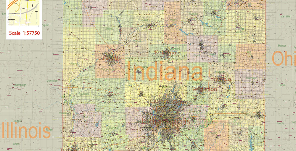
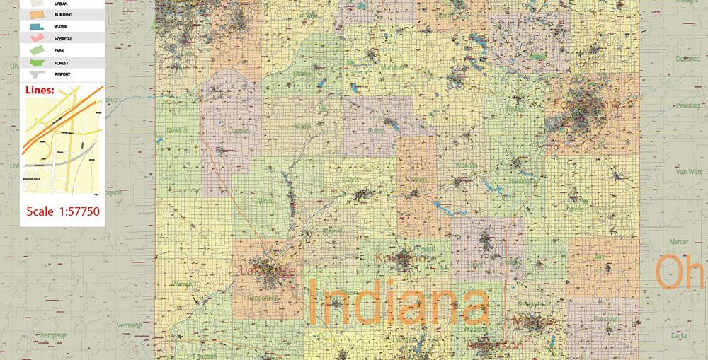
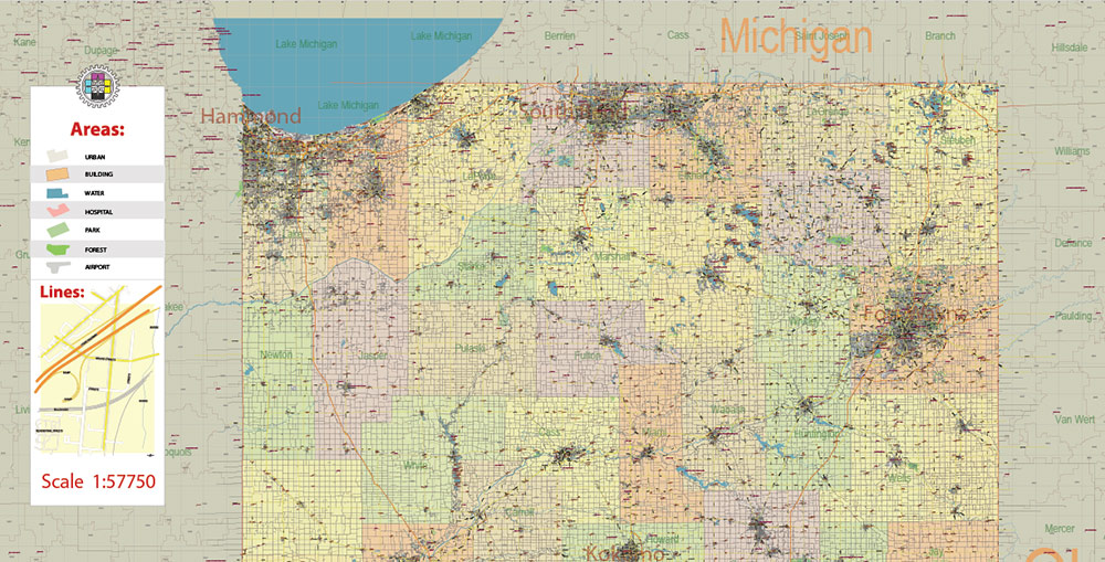
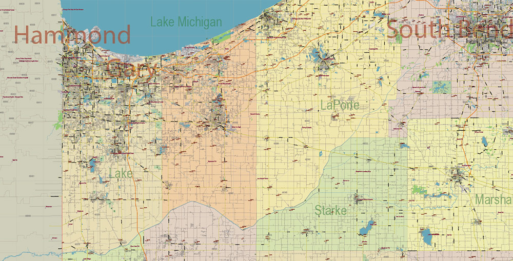
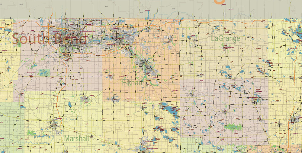
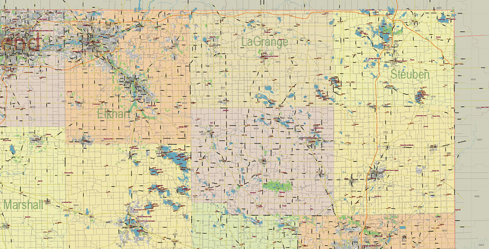
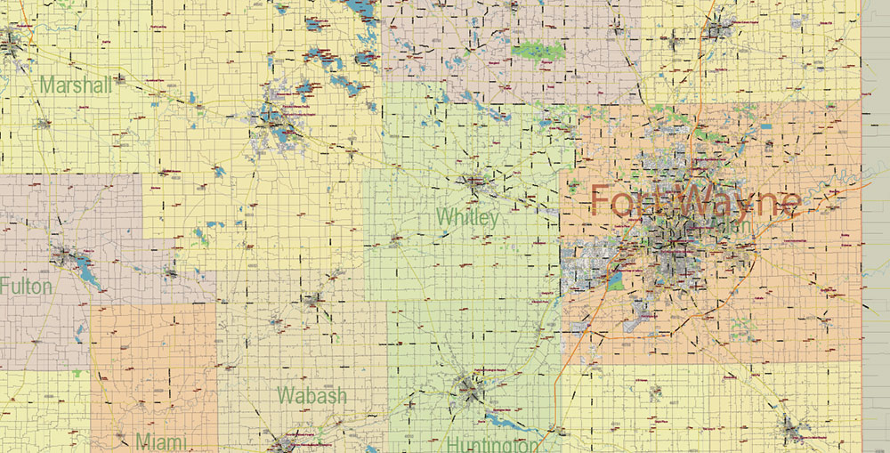
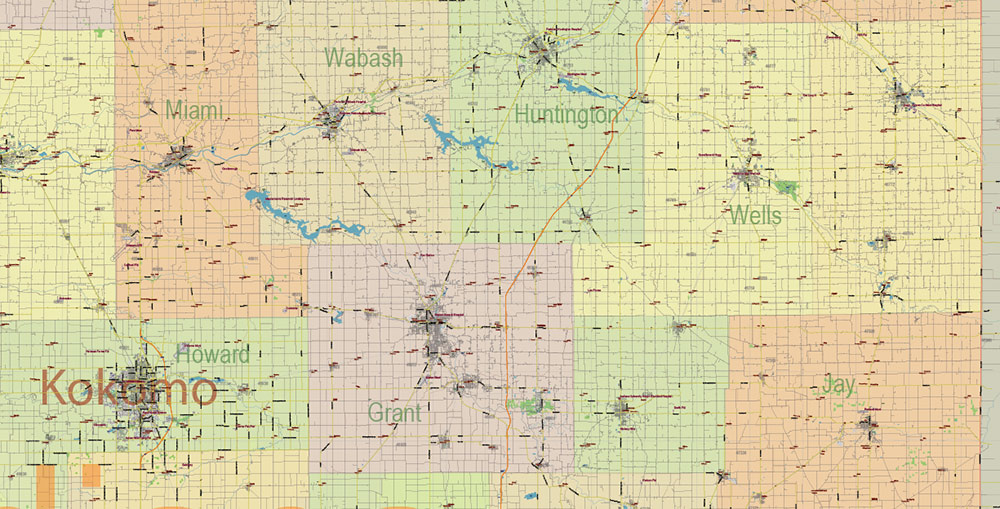
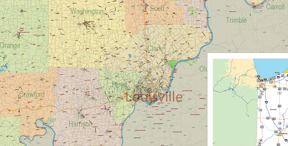
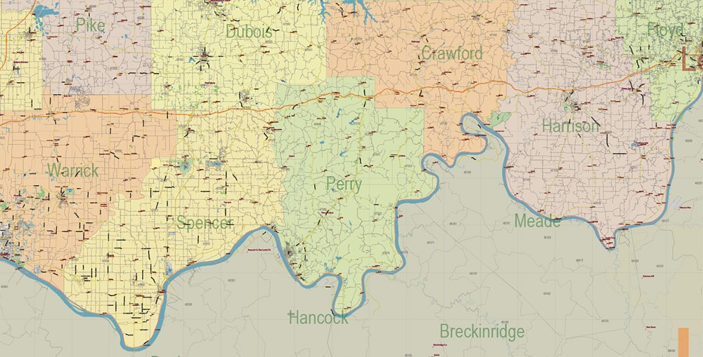
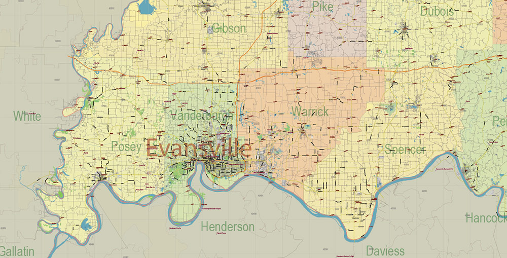
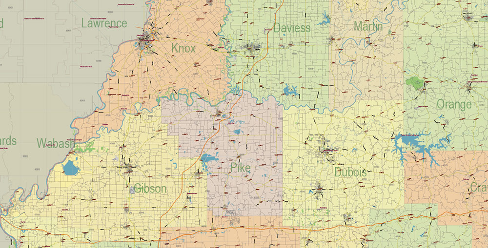
Printable PDF Vector Map of Indiana Full State US: All Streets and Roads + counties areas + zip-codes areas, fully editable Adobe PDF Map in layers, scalable, 173 MB ZIP
Scale: 1:57750
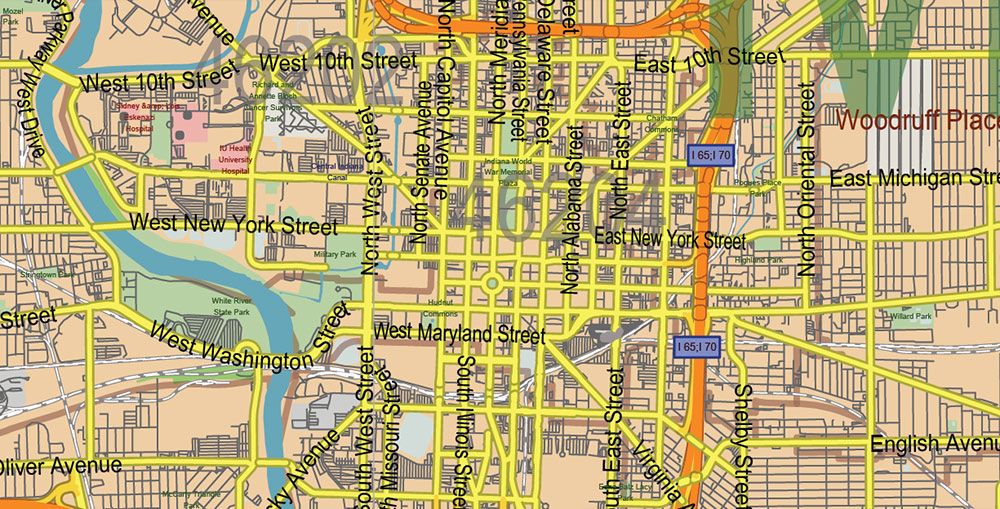
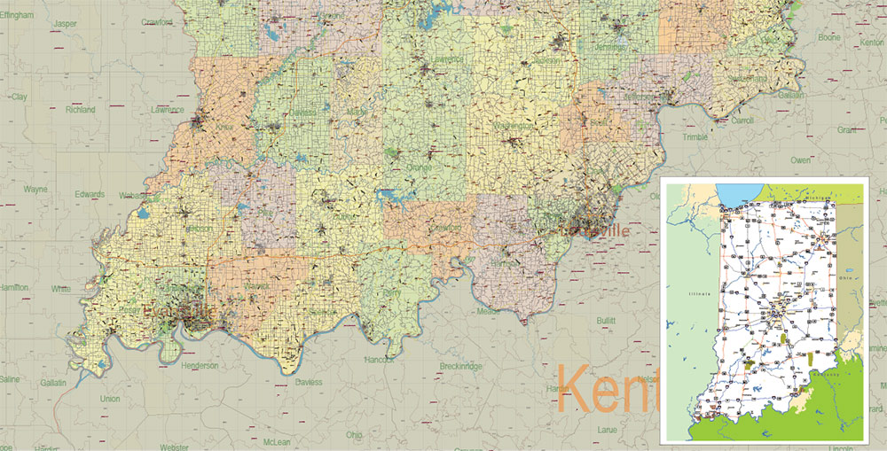
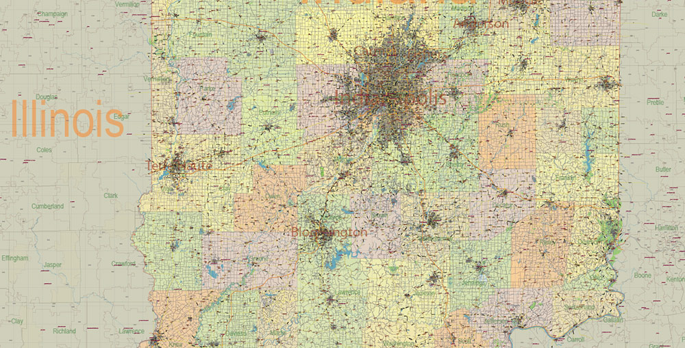
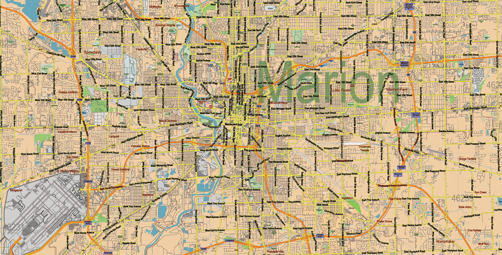
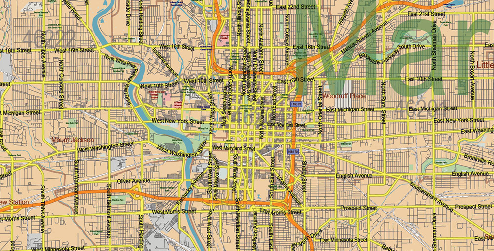
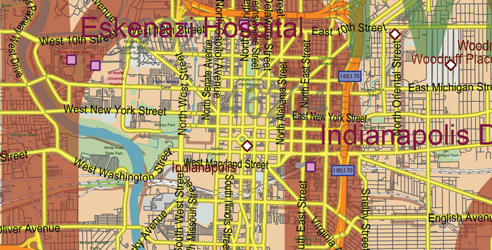
All streets and roads, Names of Principal streets, All Cities and Towns, Counties, All Geonames, airports, and heliports. Map for design, printing, arts, projects, presentations, for architects, designers, and builders, business, logistics.
NOTE! All objects are located on separate layers by type. The preview shows all layers together. When you work with this map, just turn off or delete those layers that are not needed for your project.
For Editing and High-Quality Printing, Royalty free
Need AutoCAD DWG / DXF, CDR, or any other format? Please, contact us!
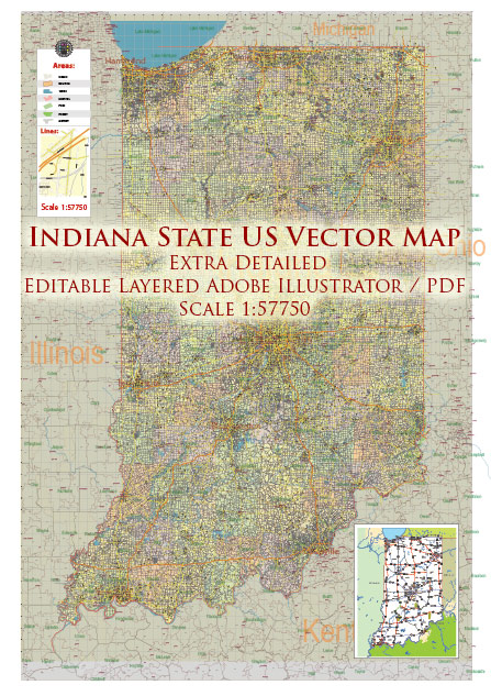
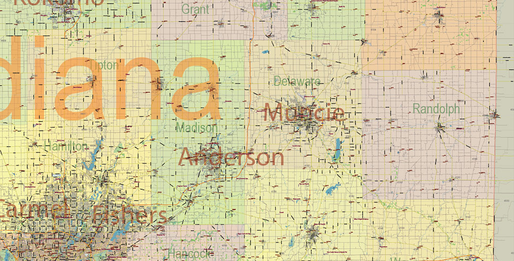
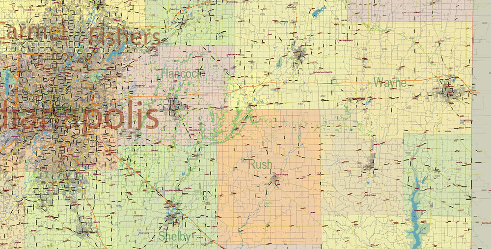
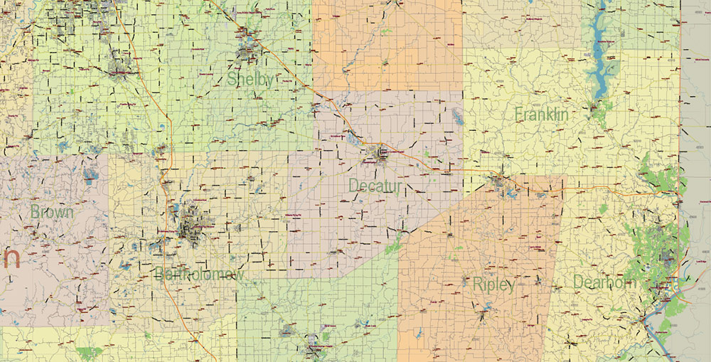
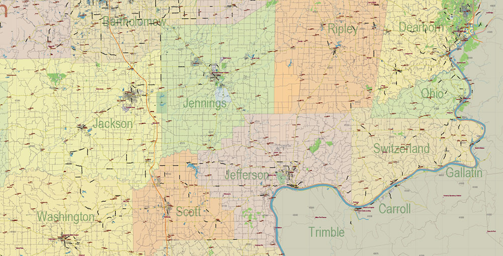
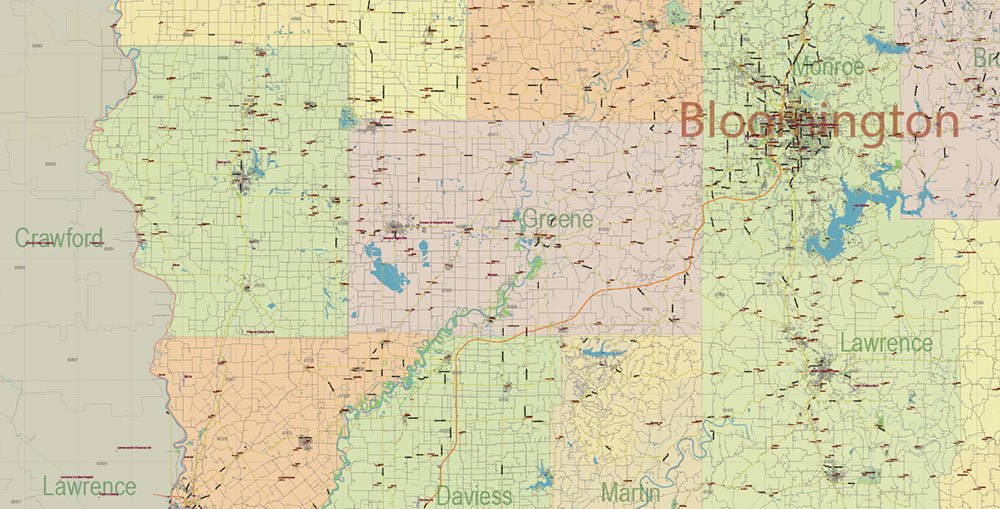
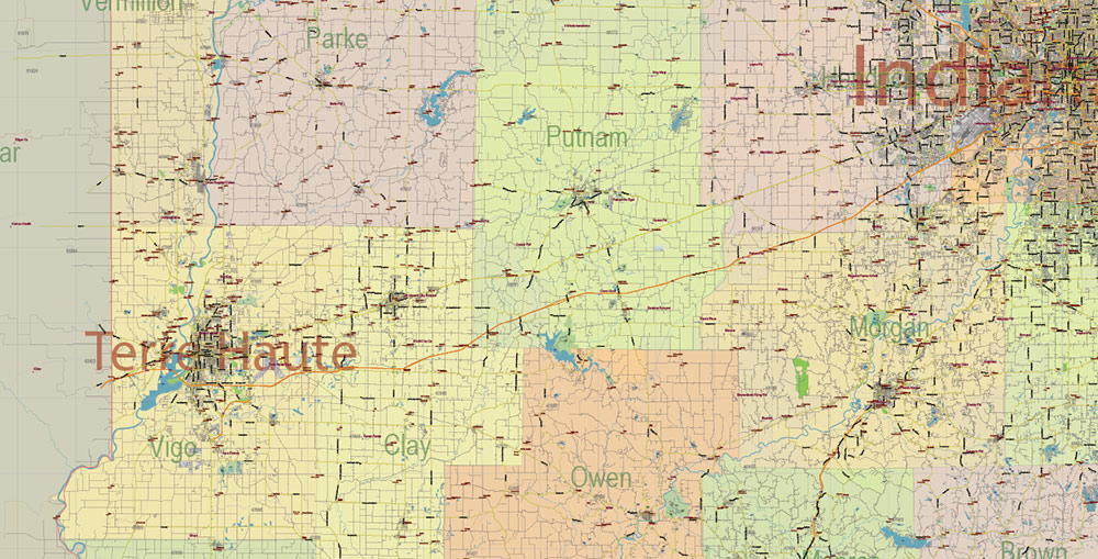
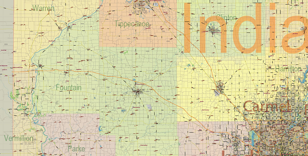
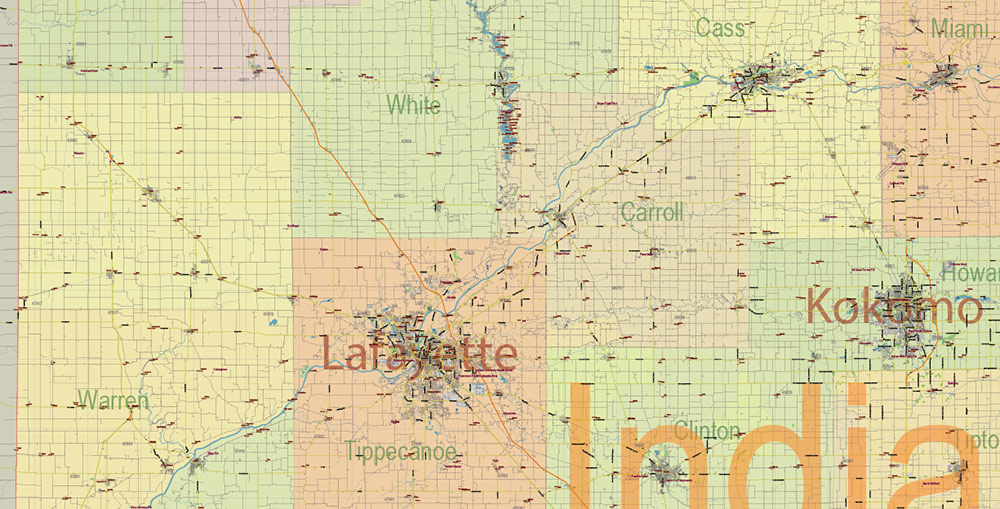
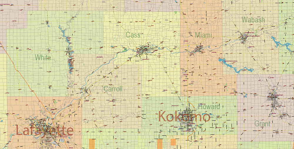
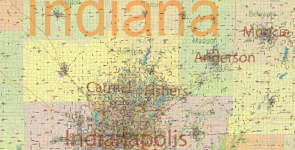
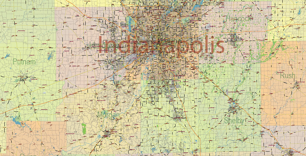
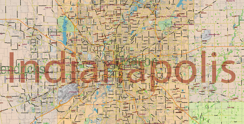
Indiana US PDF Vector Map: Exact State Plan High Detailed Road Map + Counties + Zipcodes + Airports editable Adobe PDF in layers
Layers list:
- Legend
- Grids
- Labels of roads (numbers) – highways, interstate
- All Geonames (cities, towns, villages, hamlets, islands)
- Points of the Geonames (cities, towns, villages, hamlets, islands)
- Names places: Names of all Cities, towns, villages and hamlets
- Names of the Airports and Heliports
- Points of the Airports and Heliports
- Numbers of ZIP codes
- Names of objects (water, park, hospital)
- Names of States
- Names of Counties
- Names of the Main Streets
- Major Roads and Streets – Highways
- Minor Roads and residential streets
- Railroads
- State boundaries
- Water objects (rivers, lakes, ponds, swamps, reefs)
- Waterways
- Ground objects (urban areas, parks, hospitals, etc.)
- ZIP-codes areas
- Counties areas (colored)
- States areas
- Background
Indiana US PDF Vector Map: Exact State Plan High Detailed Road Map + Counties + Zipcodes + Airports editable Adobe PDF in layers
Indiana US PDF Vector Map: Exact State Plan High Detailed Road Map + Counties + Zipcodes + Airports editable Adobe PDF in layers
Indiana US PDF Vector Map: Exact State Plan High Detailed Road Map + Counties + Zipcodes + Airports editable Adobe PDF in layers
Indiana US PDF Vector Map: Exact State Plan High Detailed Road Map + Counties + Zipcodes + Airports editable Adobe PDF in layers
Indiana US PDF Vector Map: Exact State Plan High Detailed Road Map + Counties + Zipcodes + Airports editable Adobe PDF in layers
Indiana US PDF Vector Map: Exact State Plan High Detailed Road Map + Counties + Zipcodes + Airports editable Adobe PDF in layers
Indiana US PDF Vector Map: Exact State Plan High Detailed Road Map + Counties + Zipcodes + Airports editable Adobe PDF in layers
Indiana US PDF Vector Map: Exact State Plan High Detailed Road Map + Counties + Zipcodes + Airports editable Adobe PDF in layers
Indiana US PDF Vector Map: Exact State Plan High Detailed Road Map + Counties + Zipcodes + Airports editable Adobe PDF in layers
Indiana US PDF Vector Map: Exact State Plan High Detailed Road Map + Counties + Zipcodes + Airports editable Adobe PDF in layers
Indiana US PDF Vector Map: Exact State Plan High Detailed Road Map + Counties + Zipcodes + Airports editable Adobe PDF in layers
Indiana US PDF Vector Map: Exact State Plan High Detailed Road Map + Counties + Zipcodes + Airports editable Adobe PDF in layers
Indiana US PDF Vector Map: Exact State Plan High Detailed Road Map + Counties + Zipcodes + Airports editable Adobe PDF in layers
Indiana US PDF Vector Map: Exact State Plan High Detailed Road Map + Counties + Zipcodes + Airports editable Adobe PDF in layers
Indiana US PDF Vector Map: Exact State Plan High Detailed Road Map + Counties + Zipcodes + Airports editable Adobe PDF in layers
Indiana US PDF Vector Map: Exact State Plan High Detailed Road Map + Counties + Zipcodes + Airports editable Adobe PDF in layers
Indiana US PDF Vector Map: Exact State Plan High Detailed Road Map + Counties + Zipcodes + Airports editable Adobe PDF in layers
Indiana US PDF Vector Map: Exact State Plan High Detailed Road Map + Counties + Zipcodes + Airports editable Adobe PDF in layers
Indiana US PDF Vector Map: Exact State Plan High Detailed Road Map + Counties + Zipcodes + Airports editable Adobe PDF in layers
Indiana US PDF Vector Map: Exact State Plan High Detailed Road Map + Counties + Zipcodes + Airports editable Adobe PDF in layers
Indiana US PDF Vector Map: Exact State Plan High Detailed Road Map + Counties + Zipcodes + Airports editable Adobe PDF in layers
Indiana US PDF Vector Map: Exact State Plan High Detailed Road Map + Counties + Zipcodes + Airports editable Adobe PDF in layers
Indiana US PDF Vector Map: Exact State Plan High Detailed Road Map + Counties + Zipcodes + Airports editable Adobe PDF in layers
Indiana US PDF Vector Map: Exact State Plan High Detailed Road Map + Counties + Zipcodes + Airports editable Adobe PDF in layers
Indiana US PDF Vector Map: Exact State Plan High Detailed Road Map + Counties + Zipcodes + Airports editable Adobe PDF in layers
Indiana US PDF Vector Map: Exact State Plan High Detailed Road Map + Counties + Zipcodes + Airports editable Adobe PDF in layers
Indiana US PDF Vector Map: Exact State Plan High Detailed Road Map + Counties + Zipcodes + Airports editable Adobe PDF in layers
Indiana US PDF Vector Map: Exact State Plan High Detailed Road Map + Counties + Zipcodes + Airports editable Adobe PDF in layers
Indiana US PDF Vector Map: Exact State Plan High Detailed Road Map + Counties + Zipcodes + Airports editable Adobe PDF in layers
Indiana US PDF Vector Map: Exact State Plan High Detailed Road Map + Counties + Zipcodes + Airports editable Adobe PDF in layers

 Author: Kirill Shrayber, Ph.D. FRGS
 Indiana US Map Vector City Plan High Detailed Street Map editable Adobe Illustrator in layers")

