Extended Description of the Vector Map
Population
Resident population: 6,666,818 (17th Largest State, 2016)
10 largest cities (2010): Indianapolis, 834,852; Fort Wayne, 254,555; Evansville, 120,235; South Bend, 100,800; Carmel, 83,565; Bloomington, 81,963; Fishers, 81,833; Hammond, 79,686; Gary, 79,170; Muncie, 70,087
Race/Ethnicity: White (84.3%); Black (9.1%); American Indian (0.3%); Asian (1.6%); Other race (2.4%); Two or more races (2.0%); Hispanic/Latino(6.0%).
Religion: Protestant (52%);No religion/Unaffiliated (26%);Catholic (18%); Mormon (1%); Jewish(1%); Other (2%).
Sex: Male (49.2%); Female (50.8%).
Age: Under 18 (24.8%); 18-64 (62.4%); 65 and over (12.8%). Median Age: 37
Economy
GDP: 359 billion dollars (16th in U.S., 2017)
Unemployment: 3.4% (2015)
Overview: Indiana has remained one of America’s strongest manufacturing states. The state has the highest percentage of laborers employed in manufacturing; it is a leading producer of steel, heavy machinery, and automotive parts. It also has notable mining and energy sectors, though like the rest of the country it has seen a large growth in service industries in the last two decades.
Geography
Land area: 35,867 sq mi. (92,896 km2)
Geographic center: In Boone Co., 14 mi. NNW of Indianapolis
Number of counties: 92
Largest county by population and area: Marion, 918,887 (2014); Allen, 657 sq mi.
State historic sites: 17 (2,007 ac.)
State parks/recreation areas: 23 (56,409 ac.)
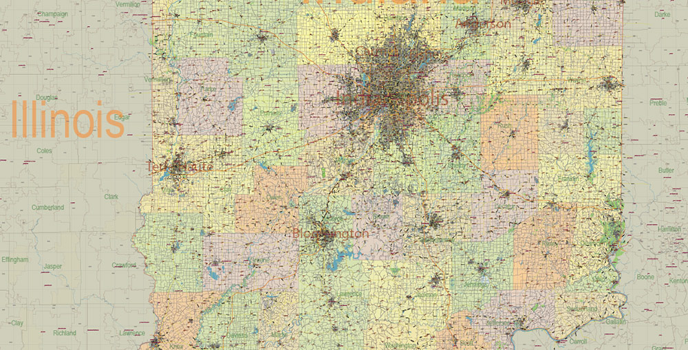
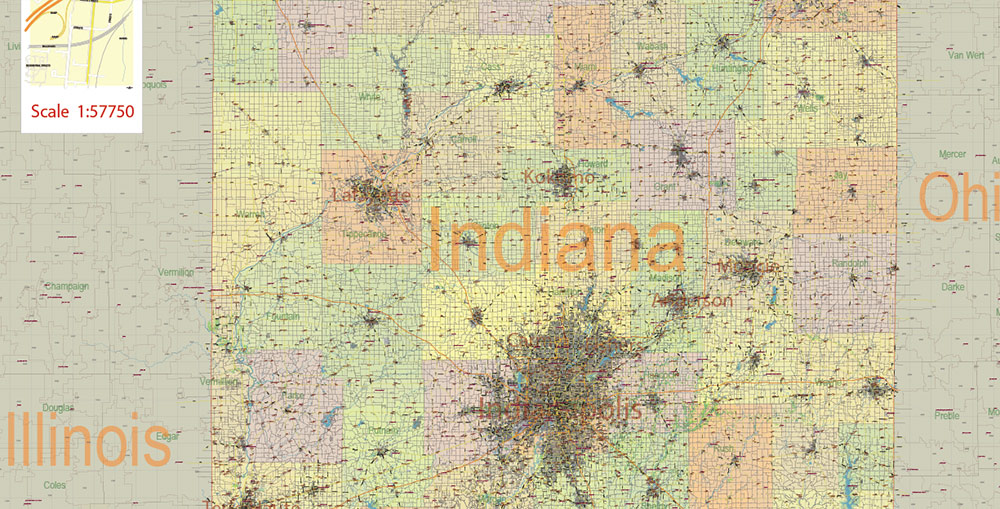
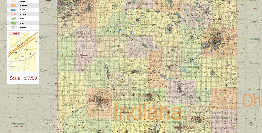
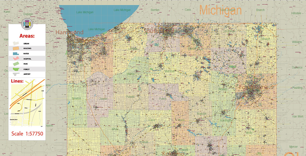
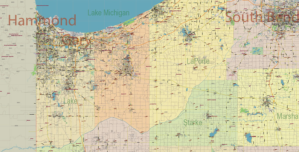
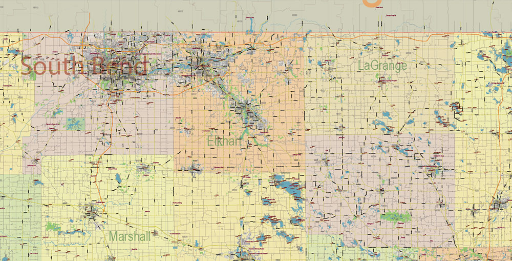
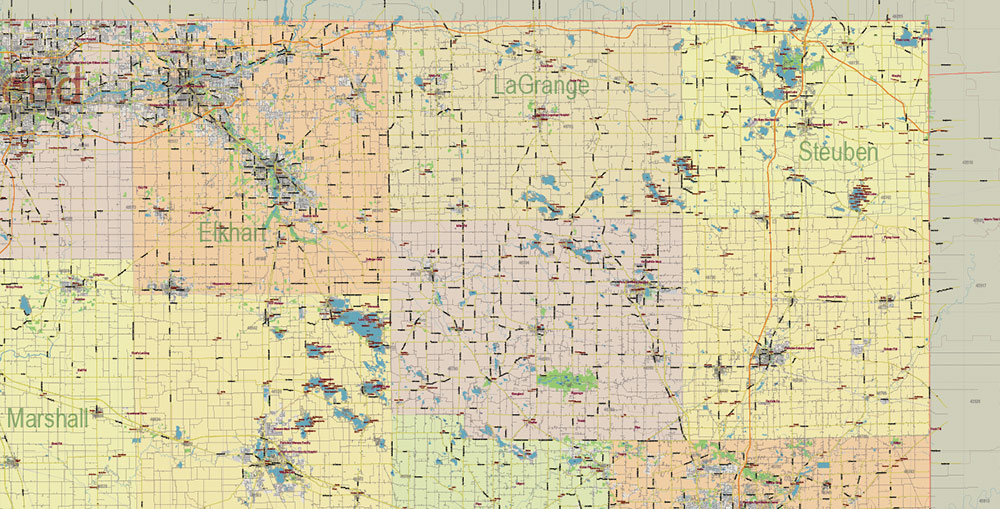
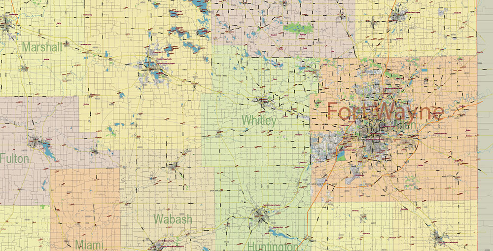
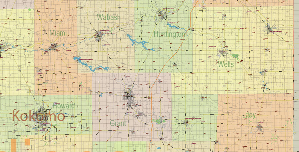
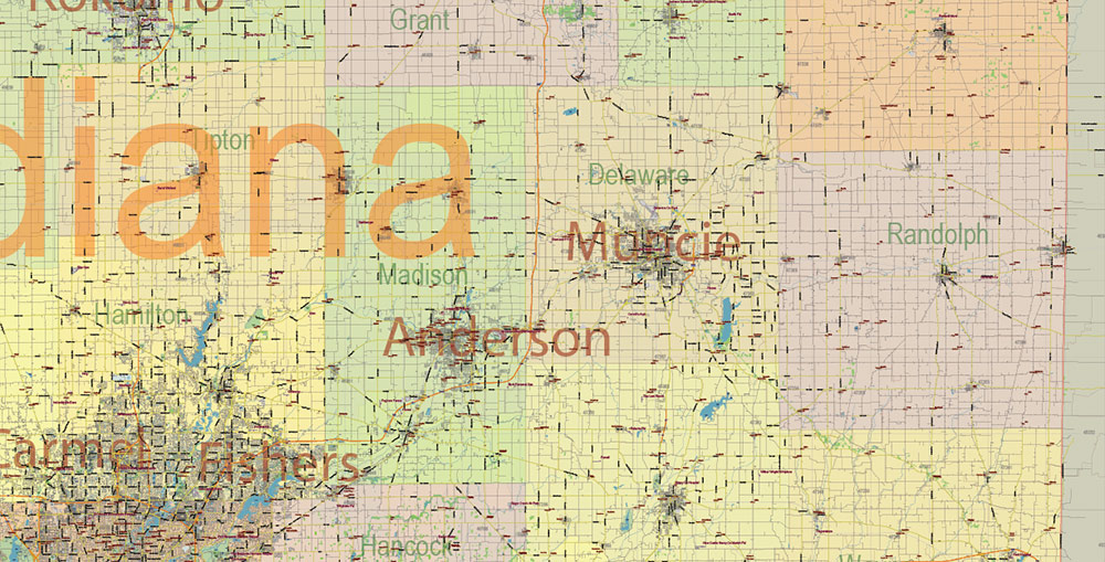
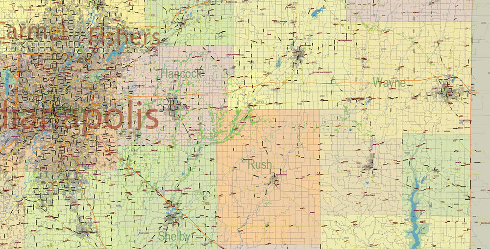
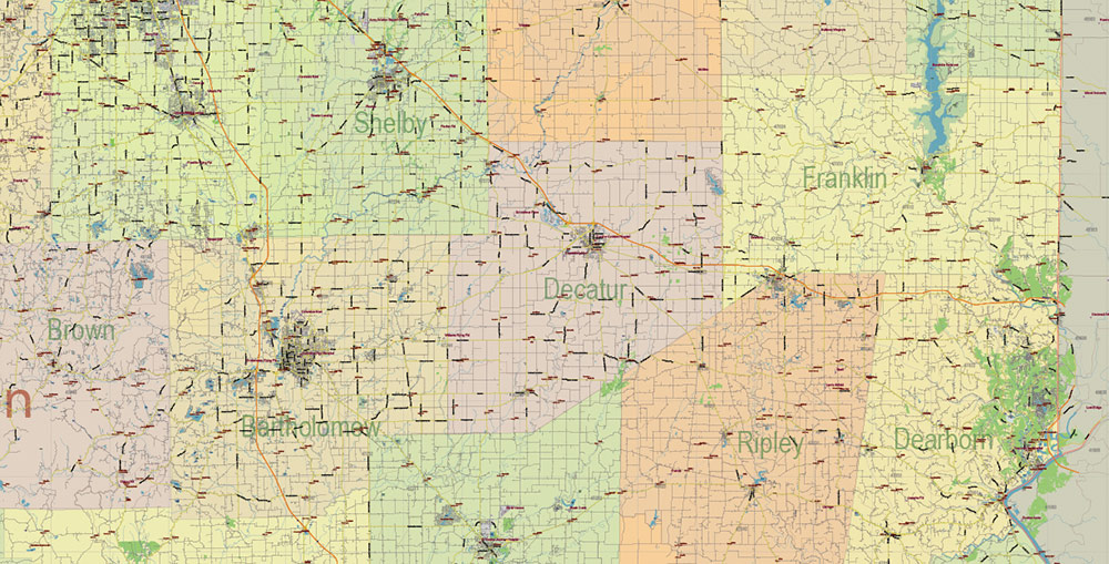
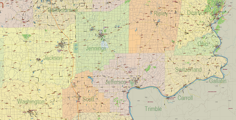
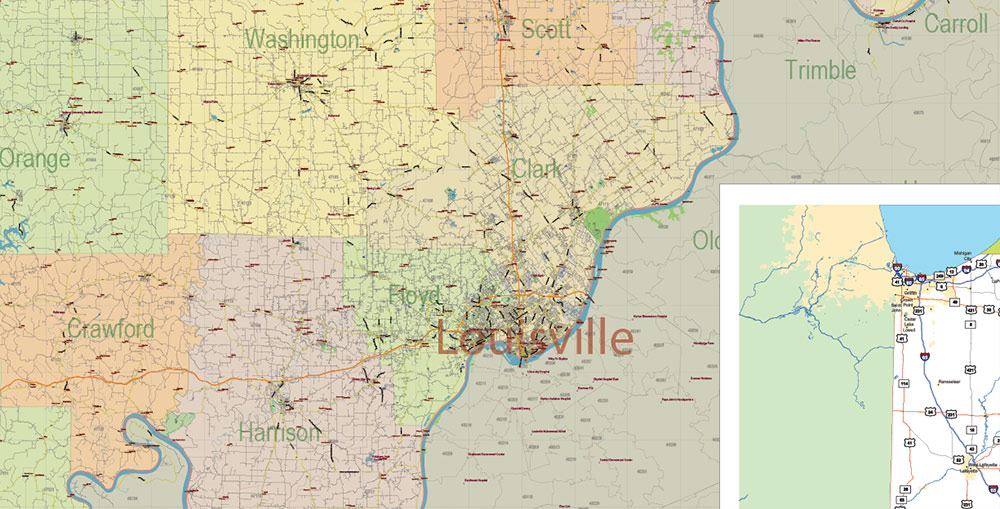
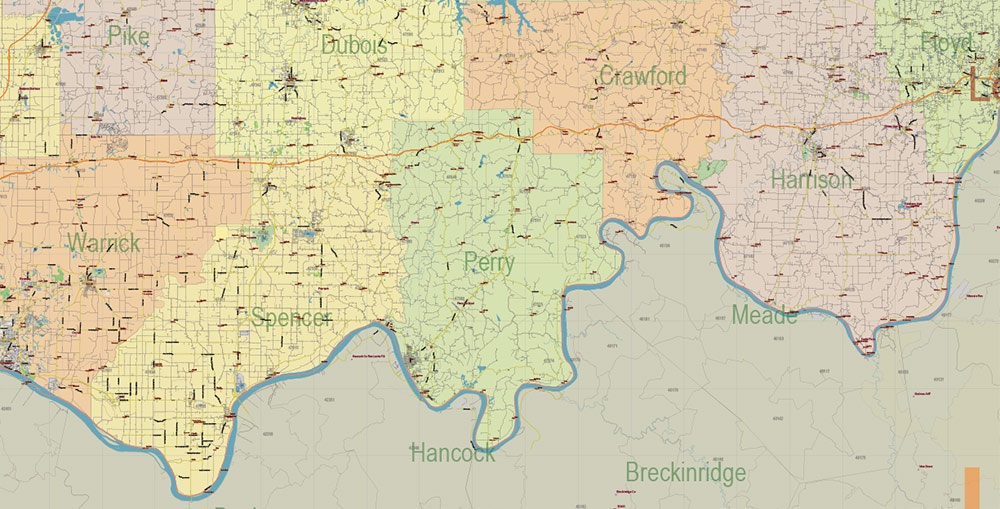
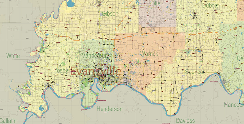
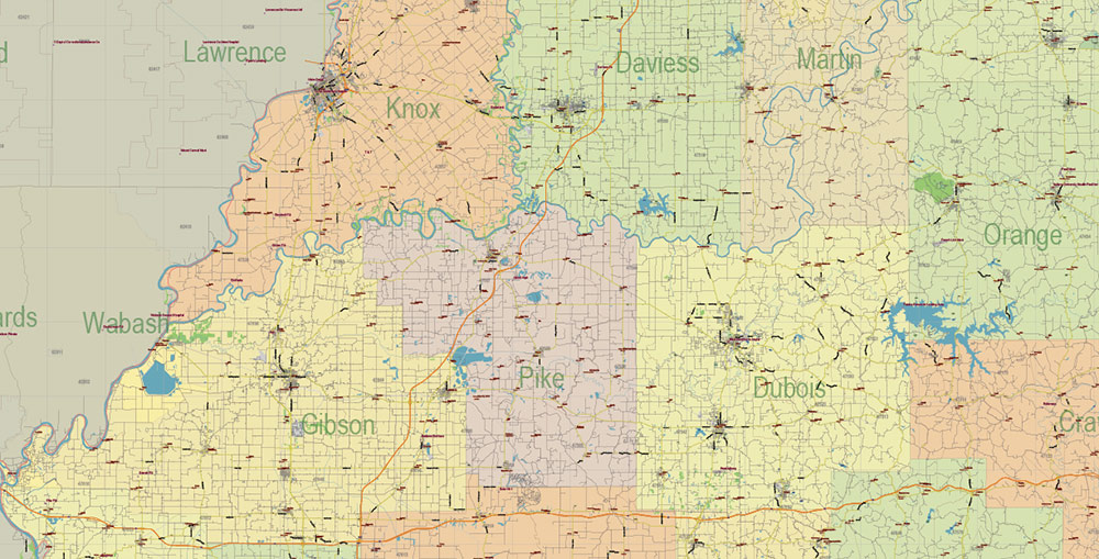
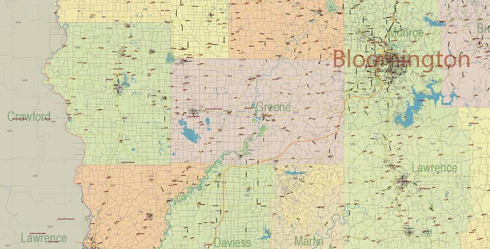
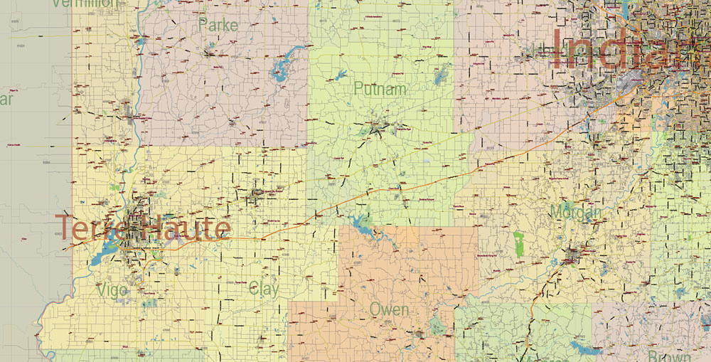
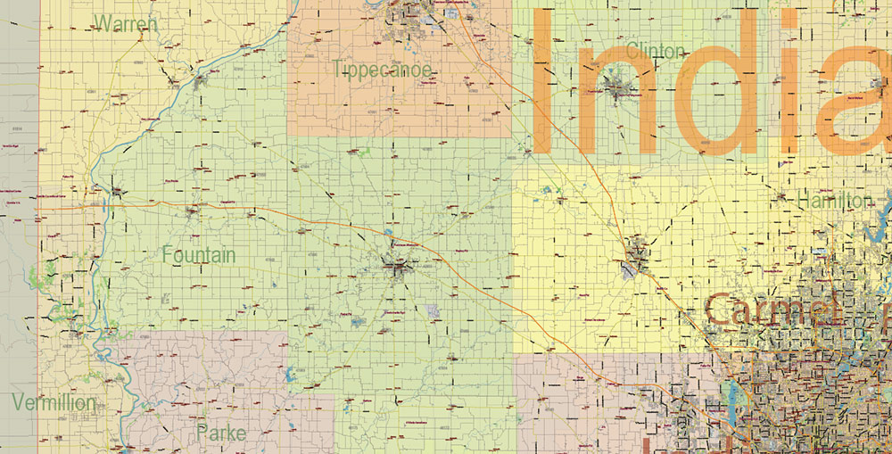
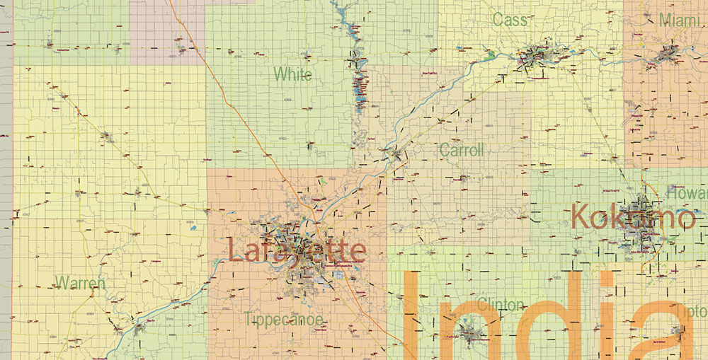
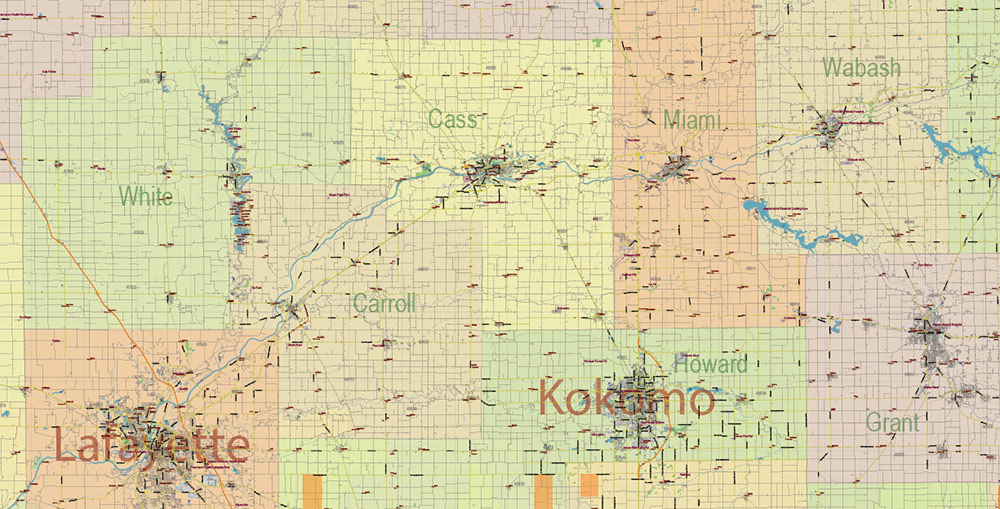
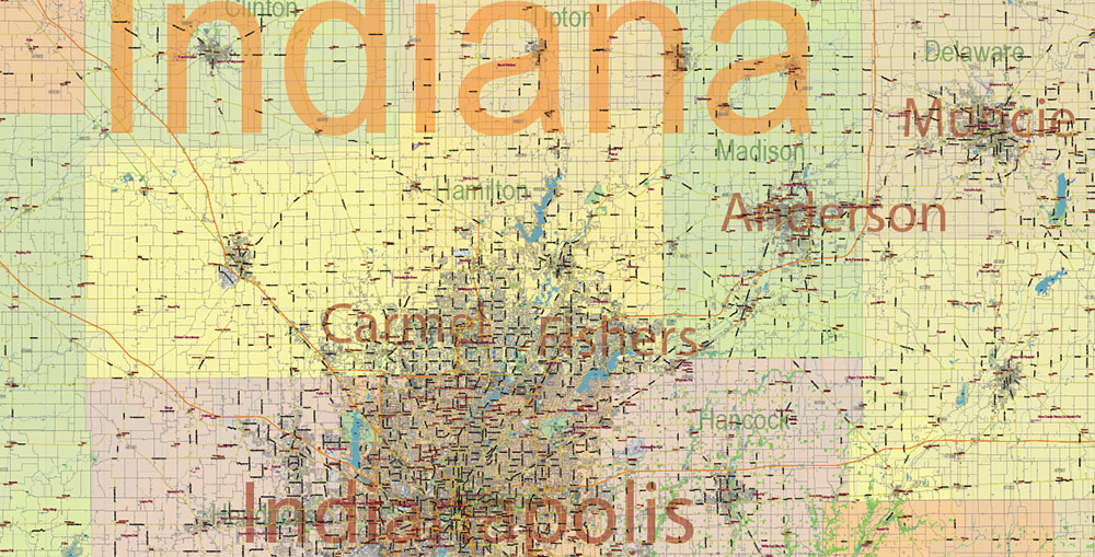
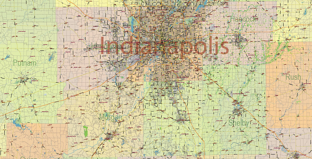
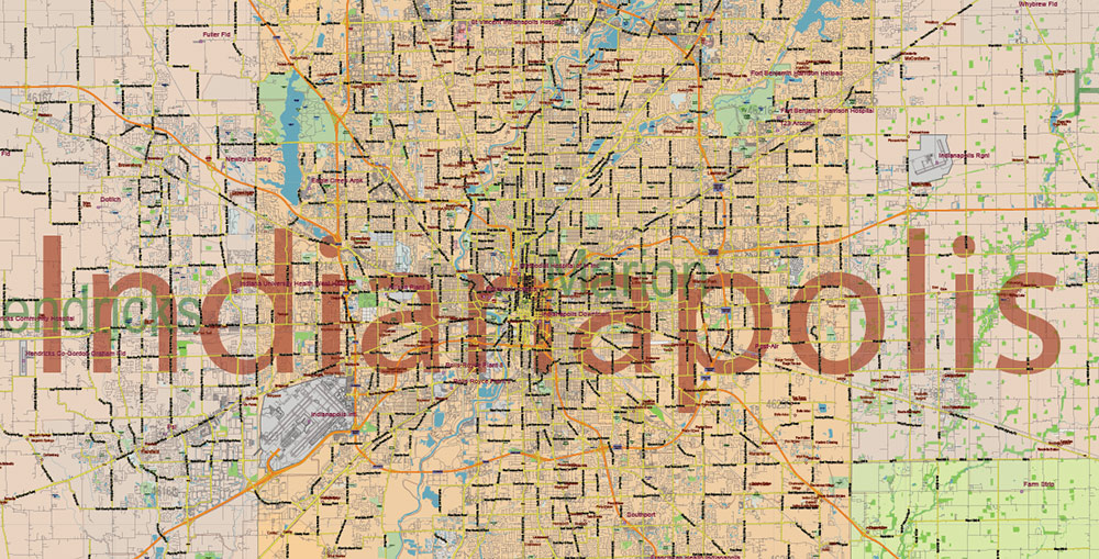
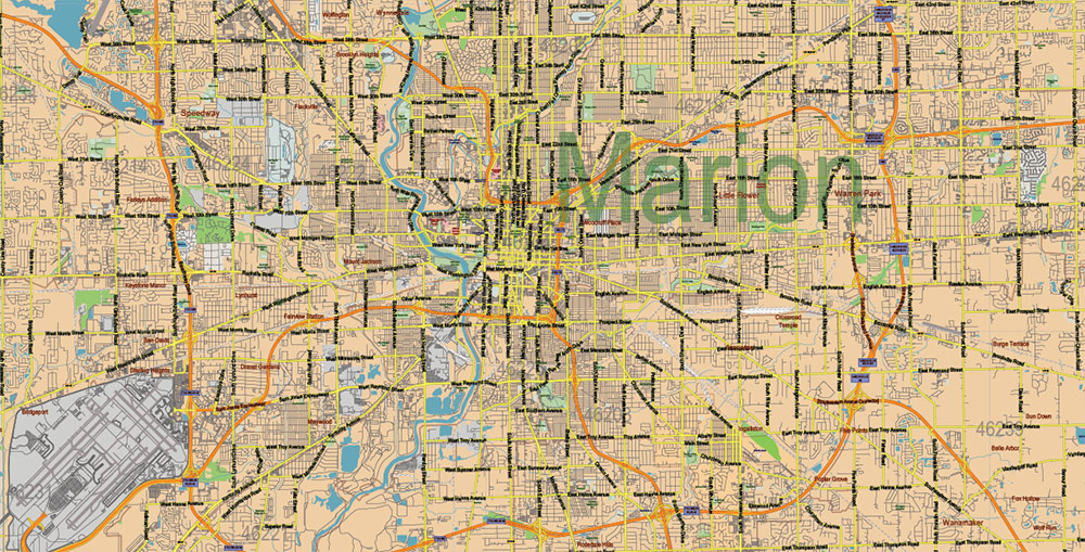
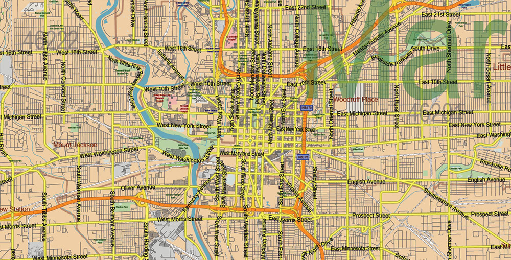
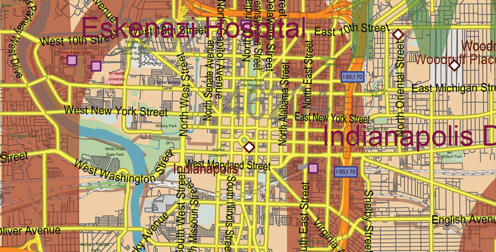
Printable Vector Map of Indiana Full State US: All Streets and Roads + counties areas + zip-codes areas, fully editable Adobe Illustrator Map in layers, scalable, 67 MB ZIP
Scale: 1:57750
All streets and roads, Names of Principal streets, All Cities and Towns, Counties, All Geonames, airports, and heliports. Map for design, printing, arts, projects, presentations, for architects, designers, and builders, business, logistics.
NOTE! All objects are located on separate layers by type. The preview shows all layers together. When you work with this map, just turn off or delete those layers that are not needed for your project.
For Editing and High-Quality Printing, Royalty free
Need AutoCAD DWG / DXF, CDR, or any other format? Please, contact us!
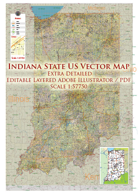
Indiana US Map Vector Exact State Plan High Detailed Road Map + Counties + Zipcodes + Airports editable Adobe Illustrator in layers
Layers list:
- Legend
- Grids
- Labels of roads (numbers) – highways, interstate
- All Geonames (cities, towns, villages, hamlets, islands)
- Points of the Geonames (cities, towns, villages, hamlets, islands)
- Names places: Names of all Cities, towns, villages and hamlets
- Names of the Airports and Heliports
- Points of the Airports and Heliports
- Numbers of ZIP codes
- Names of objects (water, park, hospital)
- Names of States
- Names of Counties
- Names of the Main Streets
- Major Roads and Streets – Highways
- Minor Roads and residential streets
- Railroads
- State boundaries
- Water objects (rivers, lakes, ponds, swamps, reefs)
- Waterways
- Ground objects (urban areas, parks, hospitals, etc.)
- ZIP-codes areas
- Counties areas (colored)
- States areas
- Background
Indiana US Map Vector Exact State Plan High Detailed Road Map + Counties + Zipcodes + Airports editable Adobe Illustrator in layers
Indiana US Map Vector Exact State Plan High Detailed Road Map + Counties + Zipcodes + Airports editable Adobe Illustrator in layers
Indiana US Map Vector Exact State Plan High Detailed Road Map + Counties + Zipcodes + Airports editable Adobe Illustrator in layers
Indiana US Map Vector Exact State Plan High Detailed Road Map + Counties + Zipcodes + Airports editable Adobe Illustrator in layers
Indiana US Map Vector Exact State Plan High Detailed Road Map + Counties + Zipcodes + Airports editable Adobe Illustrator in layers
Indiana US Map Vector Exact State Plan High Detailed Road Map + Counties + Zipcodes + Airports editable Adobe Illustrator in layers
Indiana US Map Vector Exact State Plan High Detailed Road Map + Counties + Zipcodes + Airports editable Adobe Illustrator in layers
Indiana US Map Vector Exact State Plan High Detailed Road Map + Counties + Zipcodes + Airports editable Adobe Illustrator in layers
Indiana US Map Vector Exact State Plan High Detailed Road Map + Counties + Zipcodes + Airports editable Adobe Illustrator in layers
Indiana US Map Vector Exact State Plan High Detailed Road Map + Counties + Zipcodes + Airports editable Adobe Illustrator in layers
Indiana US Map Vector Exact State Plan High Detailed Road Map + Counties + Zipcodes + Airports editable Adobe Illustrator in layers
Indiana US Map Vector Exact State Plan High Detailed Road Map + Counties + Zipcodes + Airports editable Adobe Illustrator in layers
Indiana US Map Vector Exact State Plan High Detailed Road Map + Counties + Zipcodes + Airports editable Adobe Illustrator in layers
Indiana US Map Vector Exact State Plan High Detailed Road Map + Counties + Zipcodes + Airports editable Adobe Illustrator in layers
Indiana US Map Vector Exact State Plan High Detailed Road Map + Counties + Zipcodes + Airports editable Adobe Illustrator in layers
Indiana US Map Vector Exact State Plan High Detailed Road Map + Counties + Zipcodes + Airports editable Adobe Illustrator in layers
Indiana US Map Vector Exact State Plan High Detailed Road Map + Counties + Zipcodes + Airports editable Adobe Illustrator in layers
Indiana US Map Vector Exact State Plan High Detailed Road Map + Counties + Zipcodes + Airports editable Adobe Illustrator in layers
Indiana US Map Vector Exact State Plan High Detailed Road Map + Counties + Zipcodes + Airports editable Adobe Illustrator in layers
Indiana US Map Vector Exact State Plan High Detailed Road Map + Counties + Zipcodes + Airports editable Adobe Illustrator in layers
Indiana US Map Vector Exact State Plan High Detailed Road Map + Counties + Zipcodes + Airports editable Adobe Illustrator in layers
Indiana US Map Vector Exact State Plan High Detailed Road Map + Counties + Zipcodes + Airports editable Adobe Illustrator in layers
Indiana US Map Vector Exact State Plan High Detailed Road Map + Counties + Zipcodes + Airports editable Adobe Illustrator in layers
Indiana US Map Vector Exact State Plan High Detailed Road Map + Counties + Zipcodes + Airports editable Adobe Illustrator in layers
Indiana US Map Vector Exact State Plan High Detailed Road Map + Counties + Zipcodes + Airports editable Adobe Illustrator in layers
Indiana US Map Vector Exact State Plan High Detailed Road Map + Counties + Zipcodes + Airports editable Adobe Illustrator in layers
Indiana US Map Vector Exact State Plan High Detailed Road Map + Counties + Zipcodes + Airports editable Adobe Illustrator in layers
Indiana US Map Vector Exact State Plan High Detailed Road Map + Counties + Zipcodes + Airports editable Adobe Illustrator in layers
Indiana US Map Vector Exact State Plan High Detailed Road Map + Counties + Zipcodes + Airports editable Adobe Illustrator in layers
Indiana US Map Vector Exact State Plan High Detailed Road Map + Counties + Zipcodes + Airports editable Adobe Illustrator in layers

 Author: Kirill Shrayber, Ph.D. FRGS
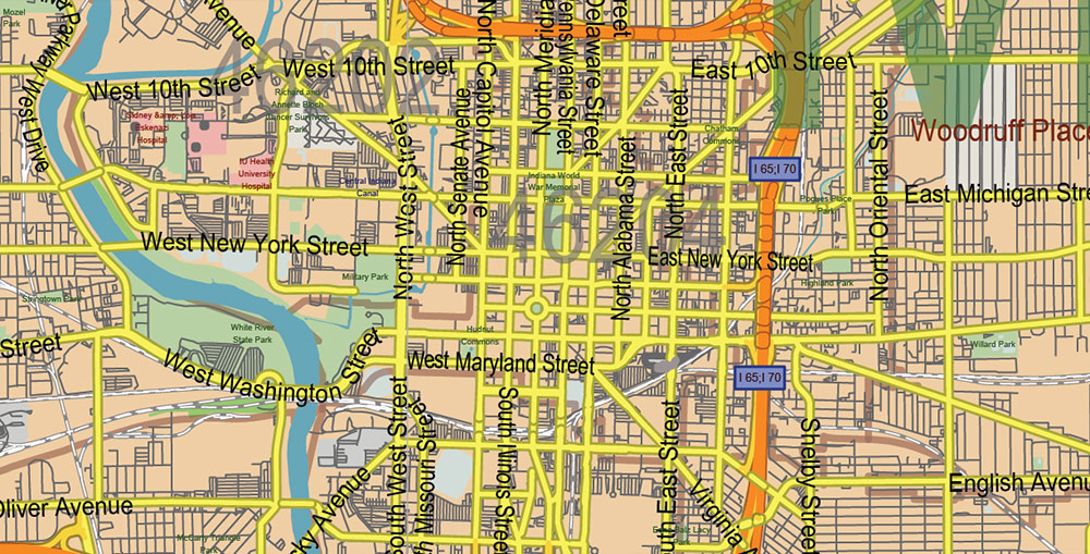
 Indiana US Map Vector City Plan High Detailed Street Map editable Adobe Illustrator in layers")

