Extended Description of the Vector Map
Printable PDF Vector Map of Groningen Netherlands Area High detailed road map fully editable Layered Adobe PDF scalable, curvestext format all names, 101 MB ZIP
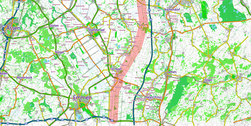
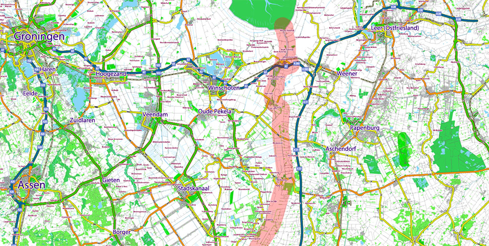
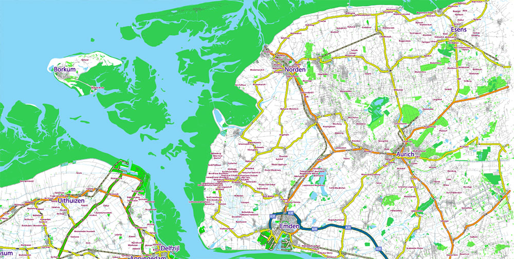
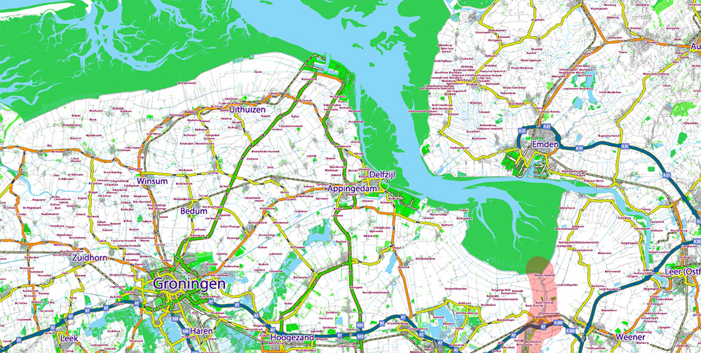
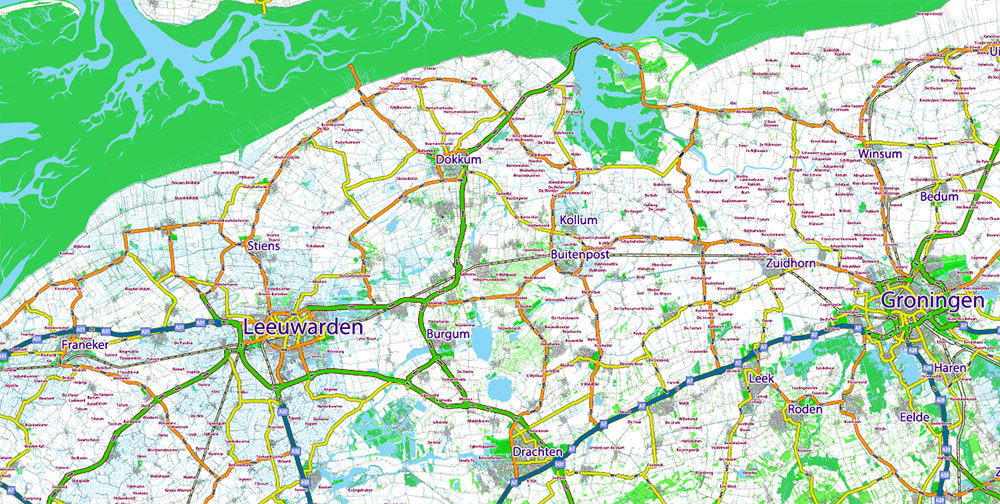
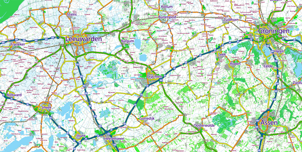
Large Area: Includes Northern part of Netherlands and the North-West part of Germany. Road shields and numbers.
All street and roads, Water Objects, Railroads, Urban areas, Green zones, Main cities and towns. Map for design, printing, arts, projects, presentations, for architects, designers, and builders, business, logistics.
Printing size: 1 meter
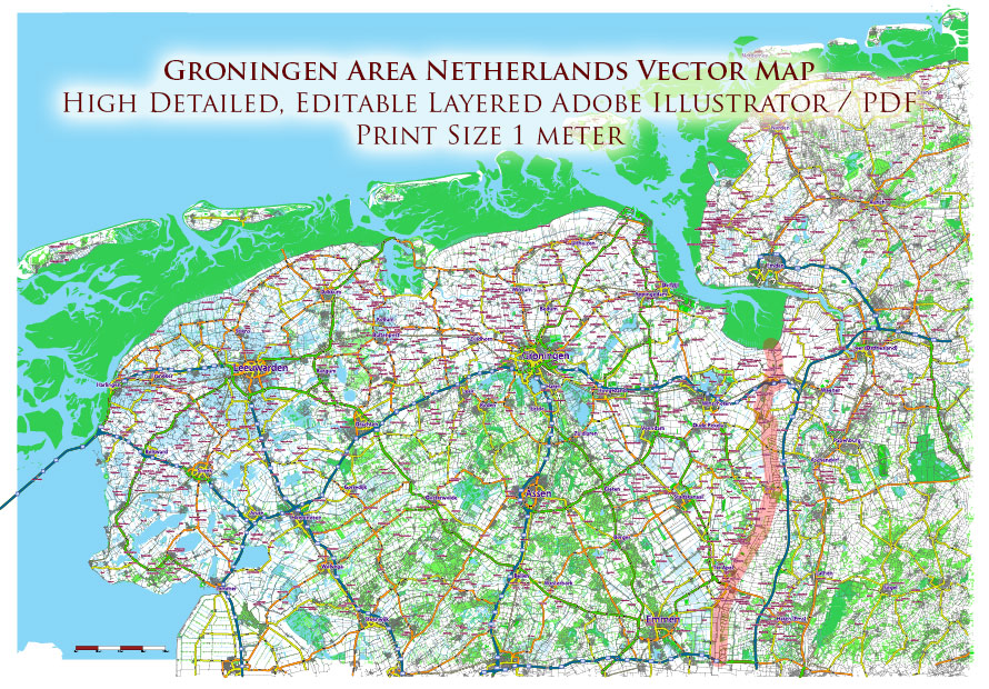
Groningen Netherlands Area Large PDF Map Vector Exact City Plan High Detailed Road Map editable Adobe PDF in layers
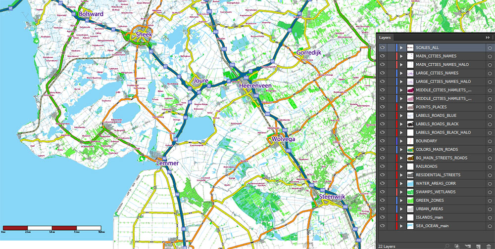
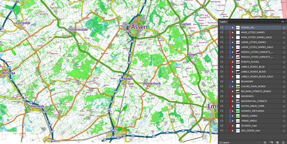
Layers list:
- Scale.
- Names of places (city, town, etc.)
- Numbers of roads
- Main Streets, roads
- Residential streets
- Railroads
- Green zones (forest, park)
- Urban areas
- Water objects (rivers, lakes, ponds, channels)
- Wetlands and swamps
- Islands
- Background and Sea
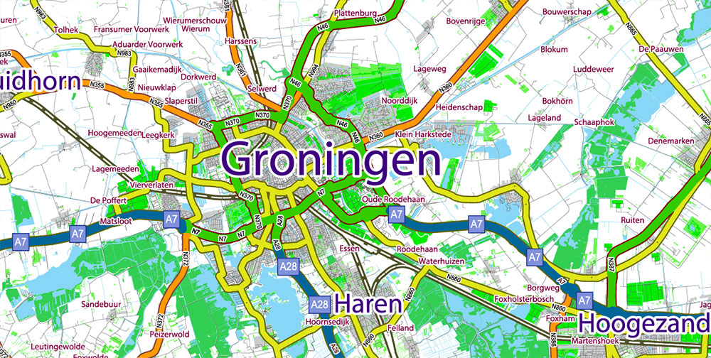
The most exact and detailed map of the city in scale.
For Editing and High-Quality Printing
Groningen Netherlands Area Large PDF Map Vector Exact City Plan High Detailed Road Map editable Adobe PDF in layers
AO BRIEF — GRONINGEN REGION (North Netherlands + NW Germany)
Overview
-
Area: Core AO is Groningen Province (Netherlands), extending east into north-west Germany (Lower Saxony coastal belt: East Frisia / Ostfriesland, Emsland fringe).
-
Terrain: Predominantly low-lying coastal plain, reclaimed polders, peatlands, and river deltas. Very flat relief with extensive canal networks, dikes, and wind exposure. Inland transitions to agricultural plains with scattered raised settlements (terps).
-
Key natural lines: Wadden Sea coastline (tidal flats and barrier islands), Ems River estuary, dense canal system (Winschoterdiep, Eemskanaal), and controlled water infrastructure (sluices, pumping stations).
Demography / Human Terrain
-
Population density: Low to moderate compared to Randstad; concentrated in Groningen city and medium towns; rural areas sparsely populated.
-
Urban centers (NL): Groningen (regional capital, university city), Delfzijl, Appingedam, Winschoten, Veendam, Stadskanaal.
-
Urban centers (DE): Emden, Leer, Aurich, Papenburg; Oldenburg slightly southeast as a larger regional hub.
-
Socio-economic profile: Strong agriculture, energy (gas fields, offshore wind, Eemshaven energy hub), ports/logistics, shipbuilding (Papenburg), and education/research (Groningen).
-
Cultural notes: Bilingual/bi-cultural border zone (Dutch/German); calm, decentralized settlement pattern; high bicycle usage in urban cores.
Key Roads / Lines of Communication (LOC)
Primary highways (Netherlands)
-
A7 (E22): Main east–west spine Amsterdam – Groningen – German border – Bremen/Hamburg; decisive for cross-border logistics.
-
A28: Groningen – Assen – Zwolle – Randstad axis; primary southbound connection.
-
N33: Groningen – Veendam – Assen industrial connector (energy/logistics).
-
N46: Groningen – Eemshaven port and energy corridor.
Primary highways (Germany)
-
A31: Emden – Ruhrgebiet north–south freight corridor; vital for port-to-industrial movement.
-
A28 (DE): Leer – Oldenburg – Bremen regional connector.
-
A1 (fringe AO): Major Bremen – Hamburg – Ruhr artery influencing wider sustainment routes.
Secondary network
Ports / Maritime Access
-
Eemshaven (NL): Strategic deep-water energy and logistics port; offshore wind support, data cables, power infrastructure.
-
Delfzijl (NL): Chemical/industrial port; regional shipping.
-
Emden (DE): Major automobile export port, shipyard facilities, and logistics node.
-
Papenburg (DE): River shipbuilding center on the Ems (large vessel transit events impact river traffic).
-
Wadden Sea access: Highly regulated; tidal constraints; environmentally sensitive—movement off marked channels is restricted.
Rail, Air, and Intermodal
-
Rail (NL): Groningen as northern rail hub; lines south to Zwolle and east toward Germany (regional freight/passenger).
-
Rail (DE): Emden–Leer–Oldenburg lines connect to national network.
-
Air: Groningen Airport Eelde (regional); larger hubs Bremen and Hamburg outside core AO.
-
Intermodal nodes: Eemshaven, Emden, and inland logistics parks near A7/A31 junctions.
Climate / Seasonality
-
Maritime temperate climate: Cool summers, mild winters; strong winds, frequent cloud cover.
-
Operational factors: Rain and wind are persistent; winter icing rare but possible; fog in coastal and canal zones.
Hazards / Constraints
-
Flood risk: Reliance on dikes, pumps, and storm-surge barriers; low elevation makes water control infrastructure mission-critical.
-
Soil stability: Peat and soft sediments limit heavy loads off paved routes.
-
Seismic micro-risk: Localized induced seismicity near gas fields (minor but infrastructure-relevant).
-
Environmental regulation: Strict protections in Wadden Sea and coastal zones constrain movement and construction.
Logistics / Sustainment
-
Best movement posture: Use A7 / A28 (NL) and A31 / A28 (DE) for high-capacity flow; ports for heavy/energy cargo.
-
Redundancy: Limited—few true high-capacity alternates; canal bridges and river crossings are key vulnerabilities.
-
Energy significance: Power generation, offshore wind staging, and gas infrastructure elevate the region’s strategic value beyond population size.
Command Takeaways
-
Flat, open, wind-exposed AO: Excellent visibility; minimal natural cover outside urban cores.
-
Infrastructure beats terrain: Control of ports, highways, dikes, and pumping stations defines operational control.
-
Cross-border continuity: Dutch–German road and logistics systems integrate seamlessly; planning must be binational.
-
Low density, high value: Sparse population but outsized strategic importance due to energy and maritime assets.
Groningen Netherlands Area Large PDF Map Vector Exact City Plan High Detailed Road Map editable Adobe PDF in layers
Groningen Netherlands Area Large PDF Map Vector Exact City Plan High Detailed Road Map editable Adobe PDF in layers
Groningen Netherlands Area Large PDF Map Vector Exact City Plan High Detailed Road Map editable Adobe PDF in layers
Groningen Netherlands Area Large PDF Map Vector Exact City Plan High Detailed Road Map editable Adobe PDF in layers
Groningen Netherlands Area Large PDF Map Vector Exact City Plan High Detailed Road Map editable Adobe PDF in layers
Groningen Netherlands Area Large PDF Map Vector Exact City Plan High Detailed Road Map editable Adobe PDF in layers
Groningen Netherlands Area Large PDF Map Vector Exact City Plan High Detailed Road Map editable Adobe PDF in layers
Groningen Netherlands Area Large PDF Map Vector Exact City Plan High Detailed Road Map editable Adobe PDF in layers

 Author: Kirill Shrayber, Ph.D. FRGS