


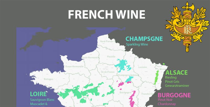
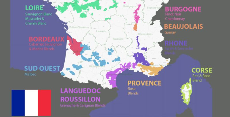
Printable Vector Map of French Wines country plane full editable Adobe Illustrator + Admin (counties and provinces) + Wine Areas Map in layers, scalable, text format all names, 3 MB ZIP
Layers list French Wines + Admin map:
- Flag and COA
- Names of Wines
- Sea
- Names of Provinces
- Names of Counties
- Borders of Provinces
- Borders of Counties
- Provinces areas
- Wine areas
ALSO: DWG, DXF, CDR and other formats: free convert for our customers.
For Editing and High-Quality Printing

 Author: Kirill Shrayber, Ph.D. FRGS


