Extended Description of the Vector Map
Printable PDF Vector Map of Freiburg im Breisgau Germany detailed City Plan scale 1:3143 full editable Adobe PDF scalable, text / curves format all names, 58 MB ZIP
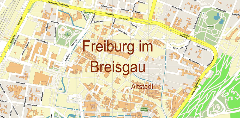
All street names, Main Objects, Buildings. Map for design, printing, arts, projects, presentations, for architects, designers, and builders, business, logistics.

Freiburg im Breisgau Germany PDF Map Vector Exact City Plan High Detailed Street Map editable Adobe PDF in layers
Layers list:
- Legend
- Grids
- Labels of roads
- Names of places (city, hamlet, etc.)
- Names of objects (hospitals, parks, water)
- Names of main streets
- Names of civil streets
- Arrows of streets
- Main Streets, roads
- Civil streets
- Railroads
- Buildings
- Airports and heliports
- Water objects (rivers, lakes, ponds)
- Waterways
- Color fills (parks, hospital areas, land use, etc.)
- Islands
- Background
The most exact and detailed map of the city in scale.
For Editing and High-Quality Printing
Freiburg im Breisgau is a picturesque city located in the southwest of Germany, in the federal state of Baden-Württemberg. Known for its medieval old town, eco-conscious lifestyle, and proximity to the Black Forest, Freiburg is often considered one of Germany’s most livable cities. Here’s a detailed geographical description of the city:
1. Location
-
Latitude/Longitude: Approximately 48.0° N, 7.85° E
-
Elevation: The city center lies at around 278 meters (912 feet) above sea level.
-
Region: Freiburg is part of the Breisgau region in the Upper Rhine Plain, near the borders of France and Switzerland.
-
It is located about:
-
70 km north of Basel (Switzerland)
-
50 km west of Donaueschingen (Black Forest source of the Danube)
-
90 km south of Strasbourg (France)
2. Topography
Freiburg lies at the junction of three distinct geographical zones:
a. Rhine Rift Valley (Upper Rhine Plain)
-
Flat, fertile plains to the west and north, formed by tectonic rift activity.
-
The land here is used intensively for agriculture, particularly vineyards and orchards.
b. Black Forest (Schwarzwald)
-
To the east and south, Freiburg is flanked by the foothills of the Southern Black Forest, a forested low mountain range.
-
Notable peaks near Freiburg:
-
Schauinsland (1,284 m): A prominent mountain southeast of the city with panoramic views.
-
Rosskopf (737 m): A forested hill with a wind turbine, popular for hiking and cycling.
-
The terrain becomes steep and rugged moving into the forested hills.
c. Kaiserstuhl Range
-
To the northwest of Freiburg, the Kaiserstuhl is a small volcanic hill range known for wine production.
-
It’s geologically distinct, with rich volcanic soils that support unique flora and fauna.
3. Hydrology
-
Dreisam River: Flows through the city from east to west. While small, it plays an important role in city planning and flood management.
-
The city has a network of small streams and Bächle, shallow water channels that run through the streets of the old town—part of a historic water management system.
-
Freiburg sits on permeable gravel and sandstone soils, helping natural drainage.
4. Climate
-
Type: Warm-summer oceanic climate (Köppen: Cfb), bordering on a humid subtropical climate.
-
Freiburg is one of Germany’s warmest and sunniest cities.
-
Microclimate effects from the surrounding hills create localized variations, especially on south-facing slopes used for vineyards.
5. Urban Geography
-
The city is spread in a semi-circular pattern, opening westward onto the Rhine Plain.
-
Districts/Subdivisions:
-
Altstadt (Old Town): Historic center with cobbled streets, the Gothic Freiburg Minster, and medieval architecture.
-
Vauban: A famous sustainable district with car-free zones and energy-efficient buildings.
-
Wiehre, Herdern, Stühlinger, Zähringen: Residential areas with a mix of traditional and modern housing.
-
Littenweiler, Günterstal, Kappel: Suburban districts extending into forested valleys.
-
Transportation: Connected by autobahn A5 (Karlsruhe–Basel) and a major rail corridor (Mannheim–Basel).
6. Land Use
-
Urban area: Densely built in the central and western parts.
-
Agricultural land: Surrounding plains are dominated by vineyards, orchards, and cereal crops.
-
Forested area: Over 40% of Freiburg’s territory is forested, primarily in the east and southeast (Black Forest).
-
Green spaces and nature reserves: Include Schlossberg, Mooswald forest, and parts of the Black Forest National Park to the east.
7. Environmental Features
-
Freiburg is known for sustainable urban planning, with extensive bike paths, green roofs, and eco-housing projects.
-
Renewable energy (especially solar) plays a key role; the city has earned the nickname “Green City”.
-
The city actively integrates nature conservation with urban development.
Freiburg im Breisgau Germany PDF Map Vector Exact City Plan High Detailed Street Map editable Adobe PDF in layers

Freiburg im Breisgau Germany PDF Map Vector Exact City Plan High Detailed Street Map editable Adobe PDF in layers

Freiburg im Breisgau Germany PDF Map Vector Exact City Plan High Detailed Street Map editable Adobe PDF in layers

Freiburg im Breisgau Germany PDF Map Vector Exact City Plan High Detailed Street Map editable Adobe PDF in layers

Freiburg im Breisgau Germany PDF Map Vector Exact City Plan High Detailed Street Map editable Adobe PDF in layers

Freiburg im Breisgau Germany PDF Map Vector Exact City Plan High Detailed Street Map editable Adobe PDF in layers

Freiburg im Breisgau Germany PDF Map Vector Exact City Plan High Detailed Street Map editable Adobe PDF in layers

 Author: Kirill Shrayber, Ph.D. FRGS