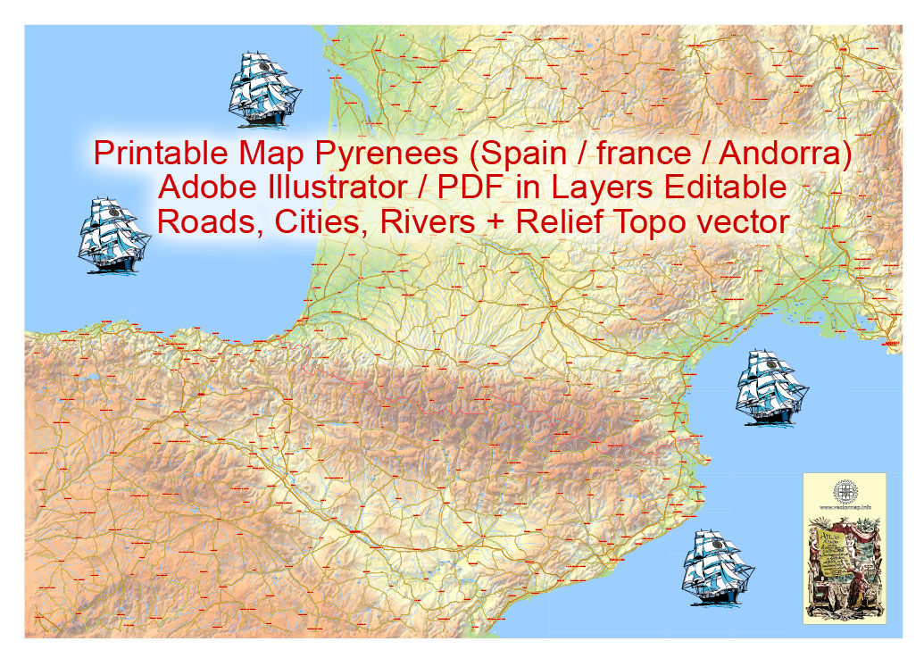
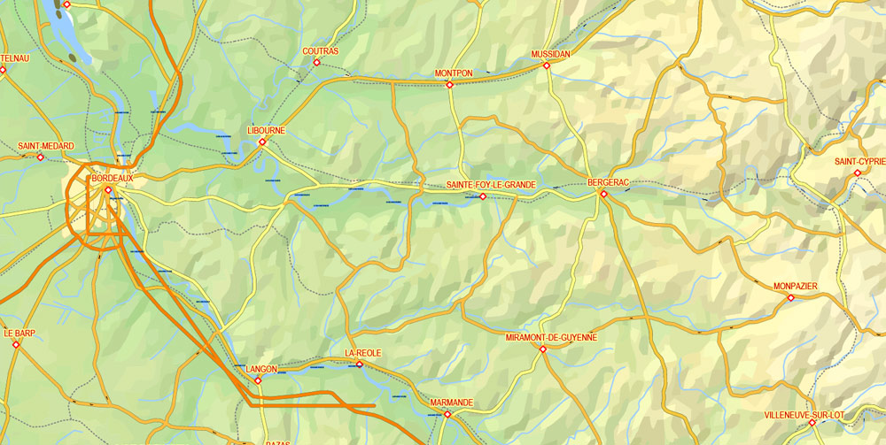
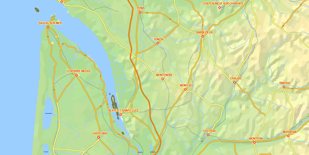
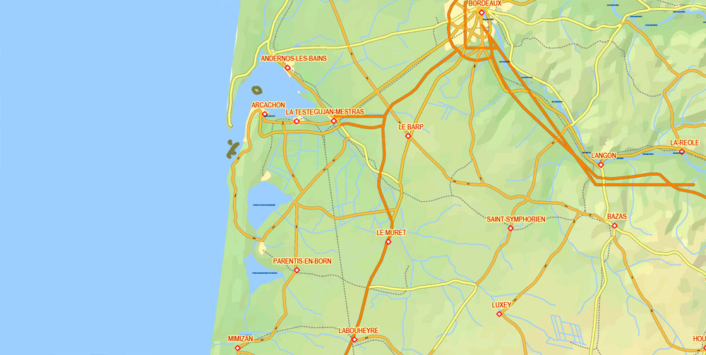
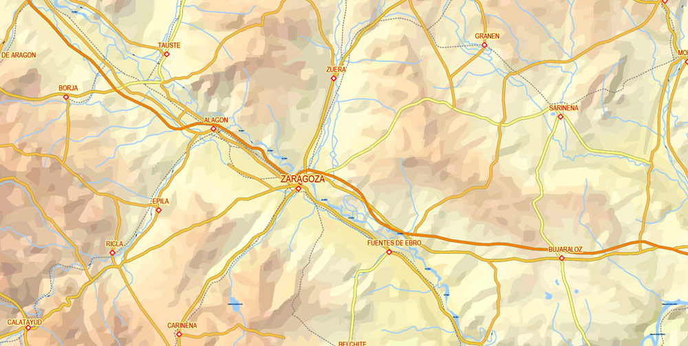
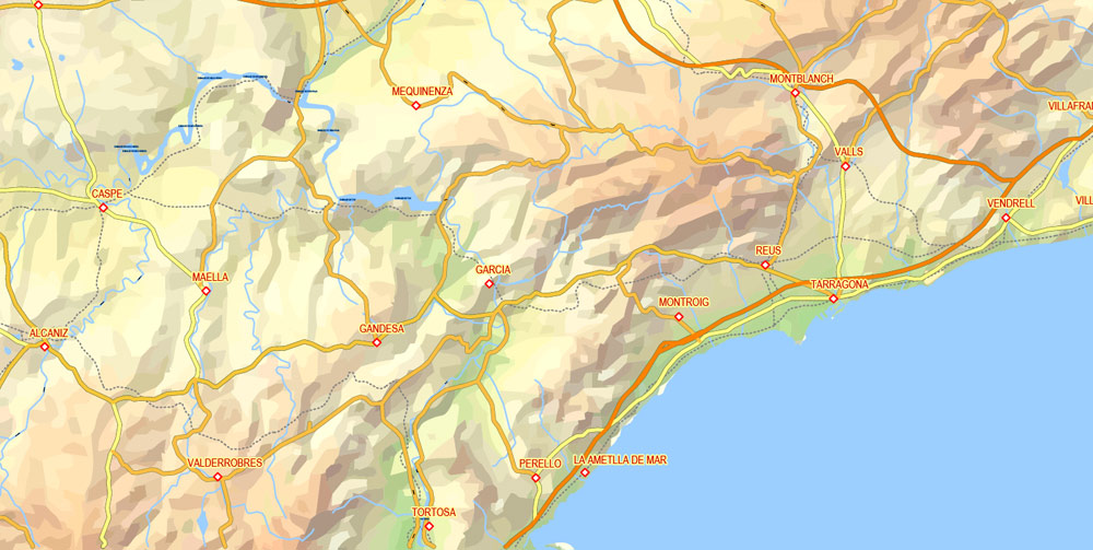
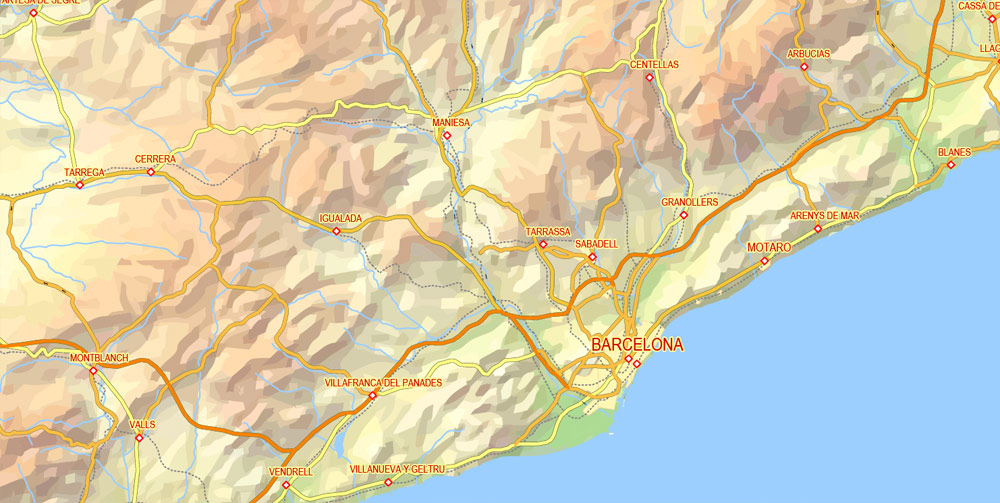
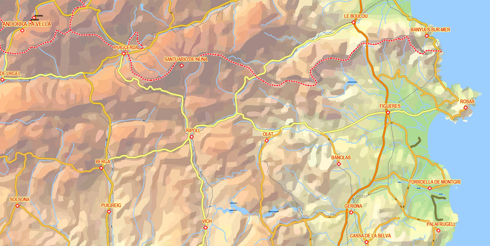
Editable Vector Map Pyrenees Area, Relief, Roads and Waterways map Printable Adobe Illustrator, scalable, editable text format of names, 18 Mb ZIP.
Relief Road Map for publishing, design, printing, publications, arts, projects, presentations, for architects, designers and builders, business, logistics. The most exact and detailed map of the Region.
Separated layers: names, relief, roads by type, urban areas, cities, waterways, railways, etc.
DWG, DXF, CDR, ESRI Shapes, and other formats – by request, same price, please contact.
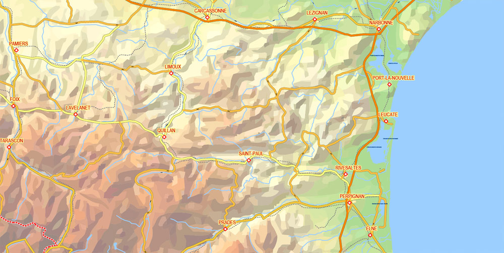
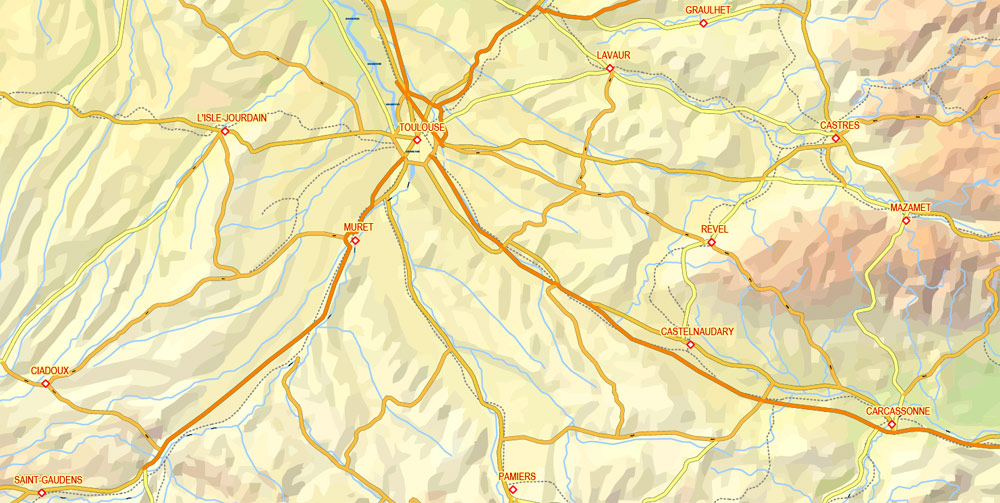
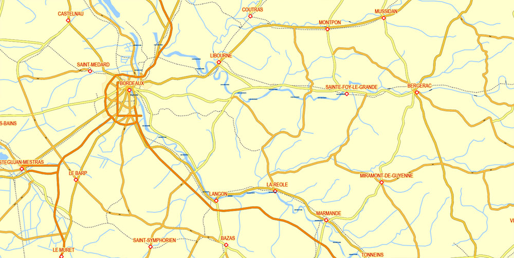
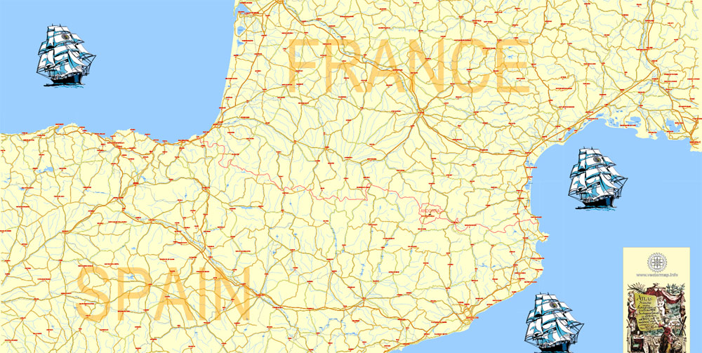
Pyrenees Mountains.
This vector map of Pyrenees is used as a basis for design, editing, and further printing.
This is the most detailed, exact map of Pyrenees for high-quality printing and polygraphy. You can always clarify the map development date by contacting us.
For your convenience, all objects on Pyrenees vector map are divided into layers. And the editing is very easy – colors, lines, etc.
You can easily add any objects needed (e.g. shops, salons, sale points, gas station or attraction) on any layer of Pyrenees vector map.
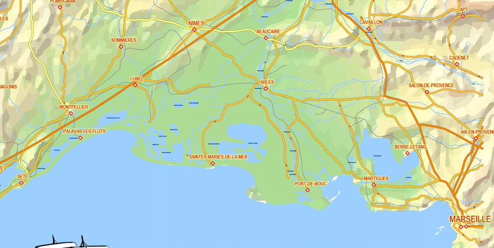
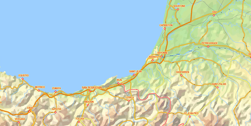
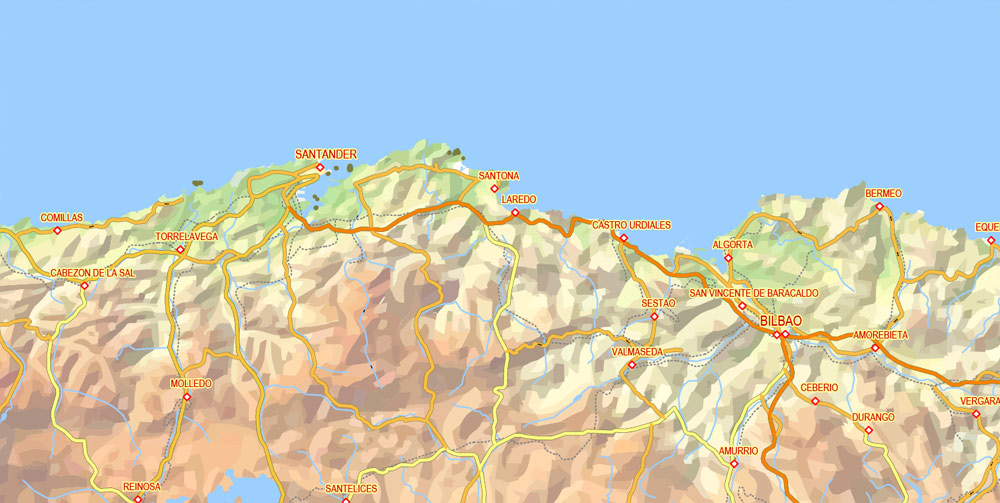
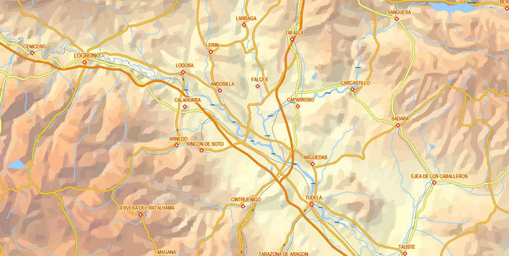
The Pyrenees is a range of mountains in southwest Europe that forms a natural border between Spain and France. Reaching a height of 3,404 metres (11,168 ft) altitude at the peak of Aneto, the range separates the Iberian Peninsula from the rest of continental Europe, and extends for about 491 km (305 mi) from the Bay of Biscay (Cap Higuer) to the Mediterranean Sea (Cap de Creus).
One of the advantages of Pyrenees vector maps of our production is the relevance of cartographic data, we constantly update all our products.
This vector map of Pyrenees is used by:
designers, layout designers, printers, advertisers and architects. Our product – vector maps – is designed for further editing and printing in large formats – from @Wall format (a few meters) to A-0 and A-1, A-2, A-3.
The Pyrenees map in vector format is used for design, urban planning, presentations and media visualizations.
The advertising and presentation map of Pyrenees (usually the final designer marks the routes, and puts the client’s objects (shops, saloons, gas stations etc.)
The undoubted advantage is that people will NEVER throw out this advertising product – the map. In fact, as an advertising medium, a map is the most “long-playing” of the well-known polygraphic advertising media, with the longest lifespan, and the maximum number of interactions with the customer.
For travelers, maps are sold at the airports and gas stations around the world. Often the source is our vector maps.
Take a look, who purchases our vector maps of Pyrenees in “Our Clients and Friends” page – these are large and small companies, from super-brands like Volvo and Starbucks, to small design studios and printing houses.
It’s very easy to work with vector maps of Pyrenees city, even for a not very experienced designer who can turn on and off the map layers, add new objects, change the colors of fill and lines according to customer requirements.
The undoubted advantage of Pyrenees vector maps in printing is an excellent and detailed visualization, when customer can expand a large paper map and instantly define his location, find a landmark, an object or address on map, unlike using the popular electronic formats of Google and Yandex maps for example.
Printable vector maps of Pyrenees are much more convenient and efficient than any electronic maps on your smartphone, because ALL DETAILS are displayed in the entire space of Pyrenees map.
Useful tips on working with vector maps of cities and countries in Adobe Illustrator.
«V» – launches the Selection tool (cursor, black arrow), which makes active any vector line.
«А» – launches the Direct Selection tool (white cursor), allows you to select curve elements and drag them to the desired place.
«R» – activates the Rotate tool, which helps you rotating selected objects around the center point by 360 degrees.
«E» – gives you the opportunity to use the Eraser tool and erase unnecessary parts.
«X» – switches between Fill and Stroke in the Tools section. Try to get used to this hot key and
you will quickly understand that you can’t live and work without it.
Guides are not limited to vertical and horizontal in Adobe Illustrator. You can also create a diagonal guide for example. Moreover, you can turn any contours into guides. Select the outline and go to View > Guides > Make Guides (Create Guides), or simply press Cmd/Ctrl + 5. You can also turn the guides back into an editable object. Go to menu, View > Guides > Unlock Guides (Release Guides), select the guide you want to edit and select View > Guides > Release Guides (Reset Guides), or just press Cmd/Ctrl + Option / Alt + 5).
You will probably want to change the color scheme used on our Pyrenees vector map.
To quickly and effectively play with colors.
Of course, you can do it manually, all objects in our Pyrenees vector map are divided according to types and layers, and you can easily change the color gamma of vector objects in groups and layers.
But there is more effective way of working with the whole VECTOR MAP of Pyrenees and all layers:
The overview dialog «Edit colors»/«Repaint Graphic Object» (this dialog box name can change depending on the context):
If you have selected a part or a layer of Pyrenees vector map and open the dialog box by clicking the icon in the Control panel, on the Samples palette or the Color Catalog, or if you choose Edit > Edit Colors> Repaint Graphic Object, then the «Repaint Graphic Object» dialog box appears, and you get access to «Assign» and «Edit» tabs.
For the most part, the main crest forms a divide between Spain and France, with the microstate of Andorra sandwiched in between. The Principality of Catalonia alongside with the Kingdom of Aragon in the Crown of Aragon, Occitania and the Kingdom of Navarre have historically extended on both sides of the mountain range, with smaller northern portions now in France and larger southern parts now in Spain.
The demonym for the noun “Pyrenees” in English is Pyrenean.
If a picture or a map fragment is not selected, and you open the dialog box by clicking the icon in the Control panel, on the Samples palette or in the Color Catalog, the «Edit Colors» dialog box appears and you can only access the «Edit» tab.
Regardless of the name at the top of the dialog box, the right-hand side always displays the color group of the current document, as well as two default color groups: Print Color and Grayscale. These color groups can be selected and used any time.
Create and edit color groups of Pyrenees vector map, and also assign colors using the «Edit Colors»/ а «Repaint Graphic Object» dialog box.
A. Creating and editing of a color group on the «Edit» tab
B. Assigning colors on the «Assign» tab
C. Select a group of colors from the «Color groups» list
The option «Repaint a graphic object» in the lower part of the dialog box allows you to preview the colors on a selected layer of Vector map, or a group of elements, and specify whether its colors will be redefined when the dialog box is closed.
Geography
Political divisions
The Spanish Pyrenees are part of the following provinces, from east to west: Girona, Barcelona, Lleida (all in Catalonia), Huesca (in Aragon), Navarra (in Navarre) and Gipuzkoa (in the Basque Country).
The French Pyrenees are part of the following départements, from east to west: Pyrénées-Orientales (North Catalonia and Fenolheda), Aude, Ariège, Haute-Garonne, Hautes-Pyrénées, and Pyrénées-Atlantiques (the latter two of which include the Pyrenees National Park).
The main areas of the dialog box are:
«Edit»
The «Edit» tab is designed to create a new or edit the existing color groups.
The harmony rules Menu and the Color Wheel are used to conduct experiments with color harmonies. The color wheel shows how colors are related in color harmony, and the color bars allow you to view and manipulate an individual color values. In addition, you can adjust the brightness, add and remove colors, save color groups and view colors on the selected Vector Map of Pyrenees or a separated layers.
«Assign»
The «Assign» tab is used to view and control on how the original colors are replaced with colors from the color group like your corporate colors in the Vector Map of Pyrenees city.
The assign color ability is provided only if the entire map, layer or fragment is selected in the document. You can specify which of new colors replace the current colors, whether the spot colors should be preserved and how colors are replaced (for example, you can replace colors completely or changing the color tone while maintaining the brightness). The «Assign» tab allows you to redefine colors in the Vector Map of Pyrenees city, or in separate layers and fragments using the current color group or reducing the number of colors in the current Vector Map.
Color groups
Is a list of all saved color groups for current document (the same groups appear in the «Samples» palette). You can edit and delete the existing color groups, as well as creating a new ones using the list of “Color Groups” in the dialog box. All changes appear in the «Samples» palette.
The highlighted color group shows, which color group is currently edited.
Any color group can be selected and edited, or used to redefine the colors in the selected vector map of Pyrenees city, its fragments or elements.
Saving a color group adds this group to the specified list.
Opening the «Edit Colors»/«Repaint Graphic Object» dialog box.
Open the «Edit Colors»/«Repaint Graphic Object» dialog box using one of the following methods:
«Edit»> «Edit Colors»> «Repaint Graphic object» or «Repaint With Style».
Use these commands if you need to edit the colors in the selected vector map of Pyrenees city.
«Repaint Graphic object» button on the «Control» panel.
Use this button if you need to adjust colors of Pyrenees vector map using the а «Repaint graphic object» dialog box.
The specified button is available if the selected vector map or its fragment contains two or more colors.
Note. This color editing method is convenient for global color adjustment in a vector map, if global colors were not used when creating a Map of Pyrenees.
The «Edit colors» button or «Edit or apply colors» on the «Color Catalog» palette
Click this button if you need to edit colors on the «Color Catalog» palette or edit and then apply them to the selected Vector Map of Pyrenees or its fragment.
The «Edit color group» button or «Edit or apply color group» on the «Samples» palette.
Click this button if you need to edit the colors in the specific color group or edit and apply them to the selected Vector Map of Pyrenees or a group of its elements, for example, the whole layer “Streets and lines”. You can also double-click the color group in the Samples panel to open the dialog box.
If the map file is too large and your computer freezes or even can’t open it quickly:
1. Try to reduce the color resolution of the video card (display) to 256 colors while working with a large map.
2. Using Windows Task Manager, select all the application you don’t need, while working with map, just turn them off.
3. Launch Adobe Illustrator. (DO NOT OPEN the vector map file)
4. Start the Windows Task Manager using administrator rights > Find the “Illustrator” process > set the «real time» priority,
5. Open the file. When you see the LEGACY FONT popup window – click “OK” (do not update). You can restore the TEXT later.
6. Can also be useful: When file is opened – Edit > Settings > Basic Settings > disable smoothing. /// It looks scary, but works quickly)))
We recommend saving the file in Adobe Illustrator 10 version. It’s much more stable when working with VERY BIG size files.
The independent principality of Andorra is sandwiched in the eastern portion of the mountain range between the Spanish Pyrenees and French Pyrenees.
Landscape
Conspicuous features of Pyrenean scenery are:
the absence of great lakes, such as those that fill the lateral valleys of the Alps
the rarity and relative high elevation of usable passes
the large number of the mountain torrents locally called gaves, which often form lofty waterfalls, surpassed in Europe only by those of Scandinavia
the frequency with which the upper end of a valley assumes the form of a semicircle of precipitous cliffs, called a cirque.
The highest waterfall is Gavarnie (462 m or 1,515 ft), at the head of the Gave de Pau; the Cirque de Gavarnie, in the same valley, together with the nearby Cirque de Troumouse and Cirque d’Estaubé, are notable examples of the cirque formation.
Low passes are lacking, and the principal roads and the railroads between France and Spain run only in the lowlands at the western and eastern ends of the Pyrenees, near sea level. The main passes of note are:
the Col de la Perche (1581m), towards the east, between the valley of the Têt and the valley of the Segre,
the Pas de la Casa or Port d’Envalira, the highest road pass in the Pyrenees at 2408m, and one of the highest points of the European road network, which provides the route from France to Andorra,
the nearby Col de Puymorens (1920m), on European route E09 between France and Spain.
the Port de la Bonaigua (2070m), in the middle of the range at the head of the Aran Valley, although the nearly col at Plan de Beret (1870m) is the lowest point in the main ridge between the Col de la Perche, almost 100km to the east and the Col du Pourtalet (1794m), over 100km to the west.
the Col de Somport or Port de Canfranc (1632m), where there were old Roman roads.
Because of the lack of low passes a number of tunnels have been created, beneath the passes at Somport, Envalira, and Puymorens and new routes in the center of the range at Bielsa and Vielha.
A notable visual feature of this mountain range is La Brèche de Roland, a gap in the ridge line, which – according to legend – was created by Roland.
Pyrenees
Mountain range in Europe
The Pyrenees mountain range separates the Iberian Peninsula from the rest of Europe, stretching more than 430km between Spain and France and rising higher than 3,400m in elevation. Hiking trails traverse the entire length of the range and national parks offer shorter trails, while dozens of ski resorts can be found on both sides of the Pyrenees. Andorra is a tiny sovereign state in the heart of the chain.
Elevation: 3,404 m
Highest point: Aneto
Etymology: Named for Pyrene
Length: 491 km (305 mi)
Free vector maps:

Free download printable map Europe vector Adobe Illustrator >>>
Free download printable PDF map Europe vector Adobe PDF >>>


 Author: Kirill Shrayber, Ph.D. FRGS