Extended Description of the Vector Map
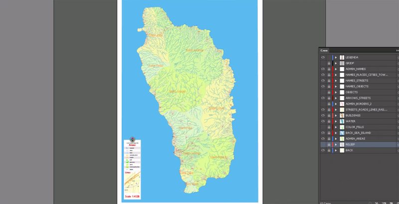
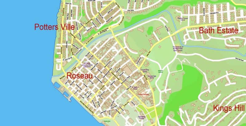
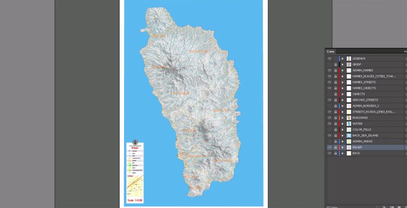
Printable Vector PDF Map of Dominica Extra detailed Plan scale 1:4528 full editable Adobe PDF Admin Shaded Relief Street Map in layers , scalable, editable text format all names, 19 mb ZIP
Streets names, Main Objects, Relief, Admin areas, Buildings. Map for design, printing, arts, projects, presentations, for architects, designers and builders, business, logistics.
Layers: color_fills, relief, admin, streets_roads, labels_roads, Water, names_objects, names_streets, names_places, water, buildings, grids, legend, etc.
The most exact and detailed map in scale.
For Editing and High Quality Printing
Other formats – on request, same price, please, contact
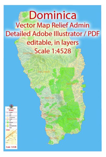
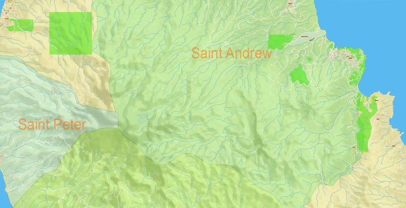
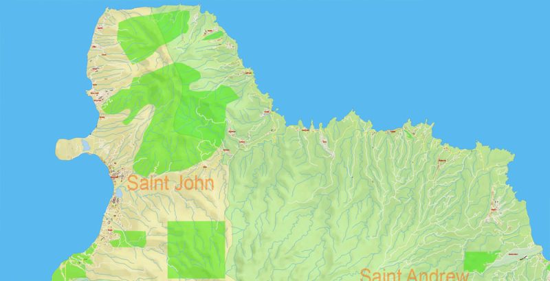
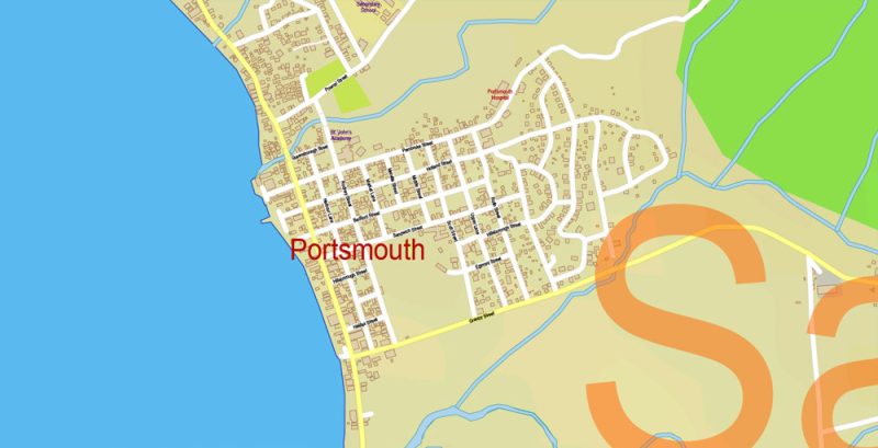
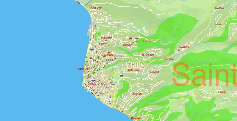
Printable Vector PDF Map of Dominica Extra detailed Plan editable Admin Shaded Relief and roads overview
FREE DOWNLOAD: Hypsometric contours in 1 archive 55 MB ZIP, elevation levels (topography, 2 files *.DWG, at intervals of 5 meters and 5 feet, + original file *.hgt + polish format file *.mp) DOWNLOAD NOW FREE >>>
Dominica
Country in the Caribbean
Dominica is a mountainous Caribbean island nation with natural hot springs and tropical rainforests. Morne Trois Pitons National Park is home to the volcanically heated, steam-covered Boiling Lake. The park also encompasses sulphur vents, the 65m-tall Trafalgar Falls and narrow Titou Gorge. To the west is Dominica’s capital, Roseau, with colorful timber houses and botanic gardens.
Capital: Roseau
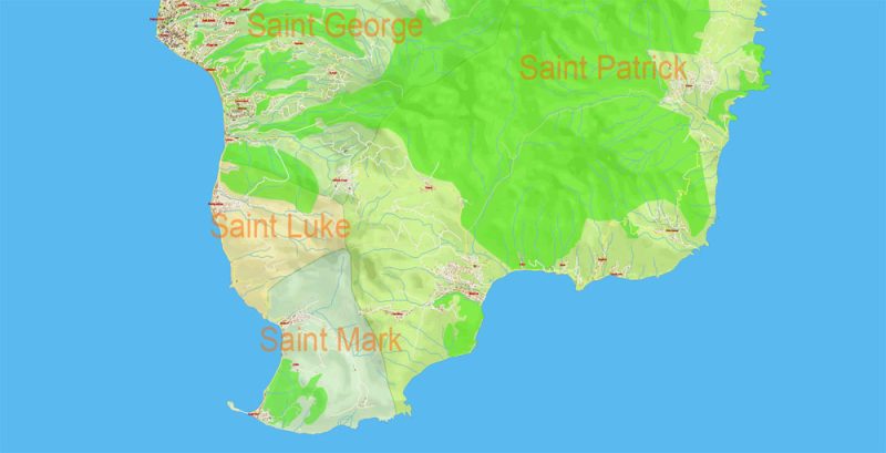
Dominica Vector PDF Map Extra detailed Plan editable Admin Shaded Relief and roads preview 1
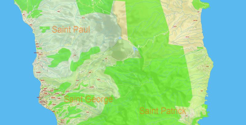
Dominica Vector PDF Map Extra detailed Plan editable Admin Shaded Relief and roads preview 2
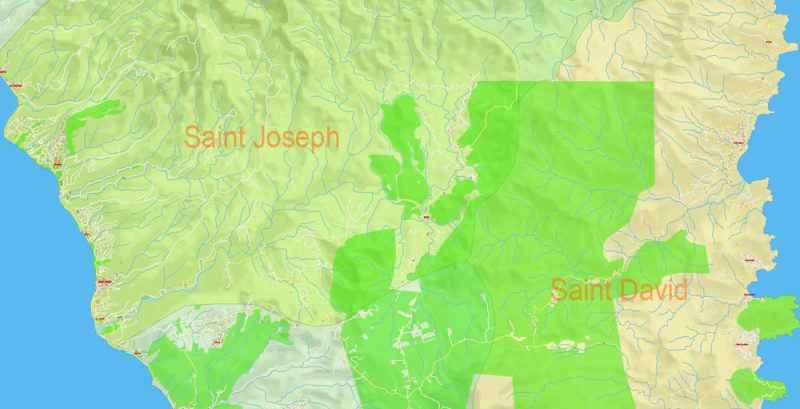
Dominica Vector PDF Map Extra detailed Plan editable Admin Shaded Relief and roads preview 3
Dominica Vector PDF Map Extra detailed Plan editable Admin Shaded Relief and roads preview 4
Dominica Vector PDF Map Extra detailed Plan editable Admin Shaded Relief and roads preview 5
Dominica Vector PDF Map Extra detailed Plan editable Admin Shaded Relief and roads preview 6
Dominica Vector PDF Map Extra detailed Plan editable Admin Shaded Relief and roads preview 7
Dominica Vector PDF Map Extra detailed Plan editable Admin Shaded Relief and roads preview 8
Dominica Vector PDF Map Extra detailed Plan editable Admin Shaded Relief and roads preview 9
Free vector map World, Adobe Illustrator, download now maps vector clipart
Map for design, projects, presentation free to use as you like.
See also: TERMS & CONDITIONS: SOFTWARE LICENSE AGREEMENT FOR DIGITAL CARTOGRAPHIC DATA.
Need more USA Vector Maps, printable and editable?


 Author: Kirill Shrayber, Ph.D. FRGS