Extended Description of the Vector Map
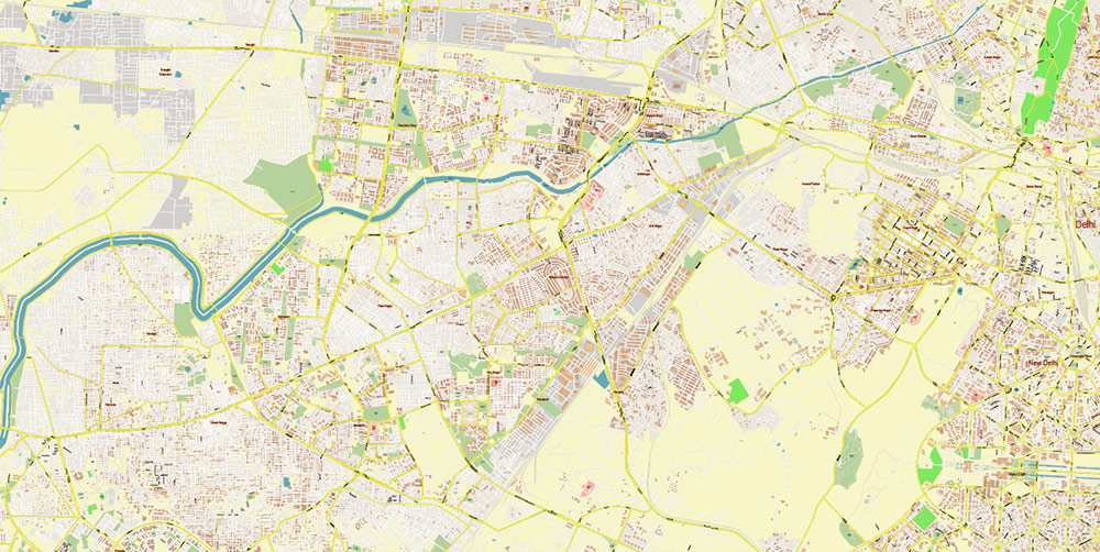
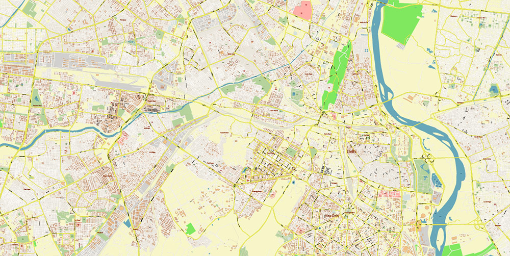
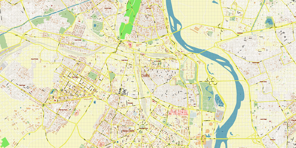
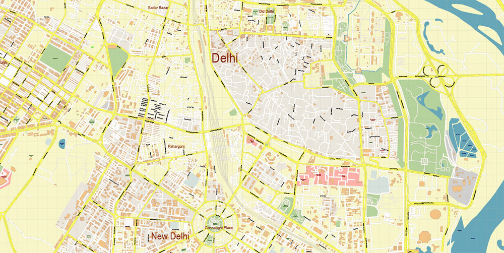
Printable PDF Vector Map of Delhi and New Delhi India (metro area) detailed City Plan scale 1:4123 full editable Adobe PDF Street Map in layers, scalable, text format all names, 128 MB ZIP
All street names, Main Objects, Buildings. Map for design, printing, arts, projects, presentations, for architects, designers, and builders, business, logistics.
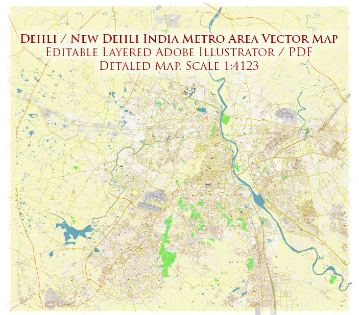
Delhi and New Delhi India Map PDF Vector Exact City Plan High Detailed Street Map editable Adobe PDF in layers
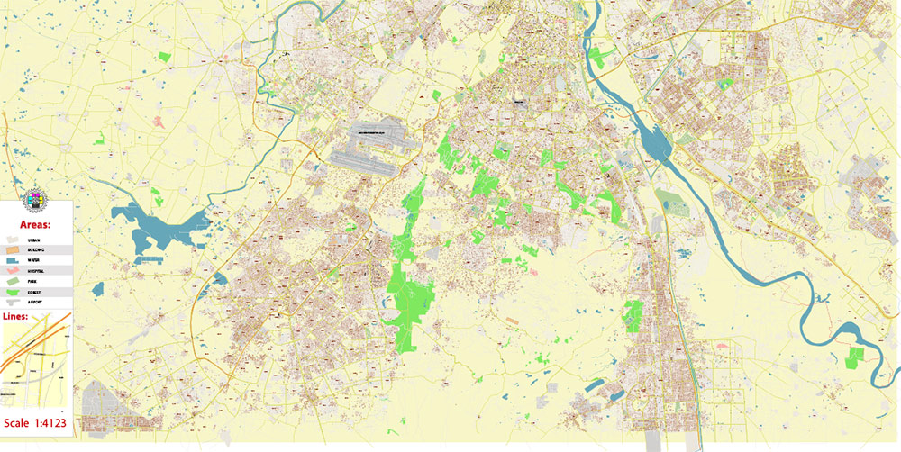
Layers list:
- Legend
- Grids
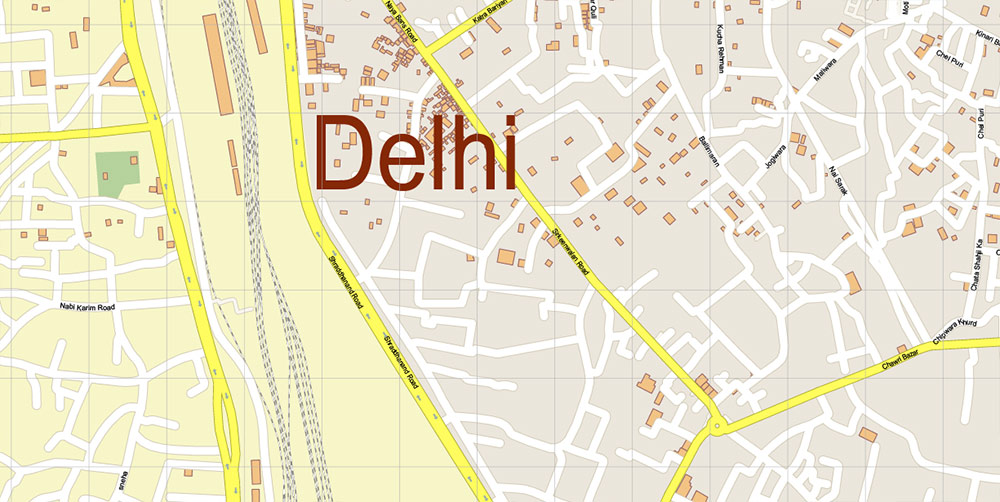
- Labels of roads
- Names of places (city, hamlet, etc.)
- Names of objects (hospitals, schools, parks, water)
- Names of main streets
- Names of civil streets
- Arrows of streets
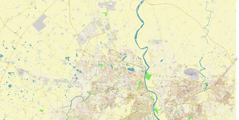
- Main Streets, roads, railroads, lines
- Civil streets
- Railroads
- Buildings
- Airports and heliports
- Water objects (rivers, lakes, ponds)
- Waterways
- Color fills (parks, hospital areas, school areas, land use, etc.)
- Background
IF YOU NEED: We can add the layers with admin areas (counties) and zip codes areas and numbers to this map. It’s free for our customers.
Galactic Commander Geobrief: Delhi & New Delhi, India
General Coordinates & Setting
-
Region: Northern India, Indo-Gangetic Plain.
-
Coordinates: Approx. 28.6°N, 77.2°E.
-
Elevation: ~200–250 m above sea level.
-
Terrain: Flat alluvial plain, cut by the Yamuna River (tributary of the Ganges).
-
Strategic Position: Core of India’s political, administrative, and transport networks.
Political / Urban Structure
-
Delhi (National Capital Territory, NCT): ~1,484 km². Population ~29–30 million metro area (2023 est).
-
New Delhi: Planned capital district (≈42 km²) within Delhi, seat of national government, embassies, and high command.
-
Division: 11 administrative districts; dense mixed-use urban core with sprawling suburbs.
Population & Density
-
Metro Population: ~30 million — one of the world’s largest agglomerations.
-
Density: >11,000/km² in central zones.
-
Demographics: Highly mixed — Hindi and English widely used; major religions include Hinduism, Islam, Sikhism, Christianity.
Climate & Environmental Conditions
-
Type: Humid subtropical with semi-arid edge.
-
Summer (Apr–Jun): Extreme heat, often 40–45 °C; dust storms common.
-
Monsoon (Jul–Sep): Heavy rainfall, flooding risk.
-
Winter (Dec–Jan): Mild days, cold nights, 7–15 °C; dense fog and pollution inversions frequent.
-
Operational Hazard: Air quality among the worst globally; visibility and respiratory issues likely.
Urban Layout & Key Axes
-
Ring Roads: Inner and Outer Ring Road encircle the core.
-
Arteries:
-
National Highway 44 (North–South spine).
-
NH 48 (Delhi–Gurgaon–Jaipur corridor).
-
Mathura Road, Ring Road connectors.
-
New Delhi Grid: Wide ceremonial boulevards (Rajpath/Kartavya Path, Janpath) radiating from India Gate and Rashtrapati Bhavan.
-
Old Delhi: Dense medieval pattern centered on Chandni Chowk, Red Fort, Jama Masjid.
Transport & Access
-
Air: Indira Gandhi International Airport (IGI) — one of South Asia’s busiest.
-
Rail: New Delhi Railway Station (NDLS) major hub of Indian Railways.
-
Metro: Delhi Metro network >390 km, crucial urban mobility backbone.
-
Roads: Severe congestion; infiltration best planned at night or via metro corridors.
Strategic / Symbolic Targets
-
Red Fort (Lal Qila): Historic Mughal fortress, UNESCO site; symbolic core of Indian sovereignty.
-
Parliament House & Rashtrapati Bhavan: Government control centers, New Delhi.
-
India Gate & Rajpath Axis: Ceremonial grounds, high-visibility landmark.
Surrounding Urban Zones
-
Gurgaon (Gurugram): South-west, modern corporate/tech hub.
-
Noida: South-east, planned city, IT parks, media.
-
Ghaziabad: East, industrial & residential density.
-
Faridabad: South, industrial base.
-
Together these form the NCR (National Capital Region) — integrated mega-urban battlefield.
Tactical Notes for Galactic Deployment
-
Advantages: Flat terrain, high population density = concealment among masses; metro tunnels = subterranean mobility.
-
Risks: Pollution, heat stress, and chaotic traffic = logistical slowdown.
-
Key Control Points: Airports, ring-road interchanges, metro command centers.
-
Psychological Factor: Capture of New Delhi = symbolic domination of entire Indian Union.
📌 Summary:
Delhi–New Delhi is not just a city, but a 30-million-strong megapolis with political command at its heart. For any Galactic operation, New Delhi’s ceremonial core = nerve center, Old Delhi = chaos zone, NCR satellites = supply and tech corridors. Control of IGI Airport, the Metro grid, and Parliament zone ensures immediate dominance.
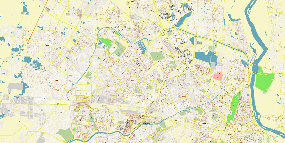
Delhi and New Delhi India Map PDF Vector Exact City Plan High Detailed Street Map editable Adobe PDF in layers
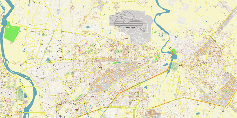
Delhi and New Delhi India Map PDF Vector Exact City Plan High Detailed Street Map editable Adobe PDF in layers
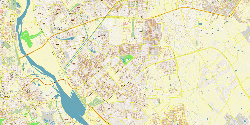
Delhi and New Delhi India Map PDF Vector Exact City Plan High Detailed Street Map editable Adobe PDF in layers
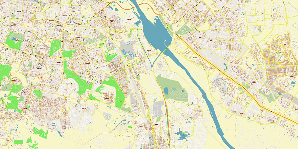
Delhi and New Delhi India Map PDF Vector Exact City Plan High Detailed Street Map editable Adobe PDF in layers
Delhi and New Delhi India Map PDF Vector Exact City Plan High Detailed Street Map editable Adobe PDF in layers
Delhi and New Delhi India Map PDF Vector Exact City Plan High Detailed Street Map editable Adobe PDF in layers
Delhi and New Delhi India Map PDF Vector Exact City Plan High Detailed Street Map editable Adobe PDF in layers
Delhi and New Delhi India Map PDF Vector Exact City Plan High Detailed Street Map editable Adobe PDF in layers
Delhi and New Delhi India Map PDF Vector Exact City Plan High Detailed Street Map editable Adobe PDF in layers
Delhi and New Delhi India Map PDF Vector Exact City Plan High Detailed Street Map editable Adobe PDF in layers
Delhi and New Delhi India Map PDF Vector Exact City Plan High Detailed Street Map editable Adobe PDF in layers

 Author: Kirill Shrayber, Ph.D. FRGS
