Extended Description of the Vector Map
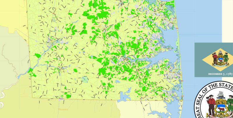
Printable PDF Vector Map of Delaware State US detailed Plan scale 1:58279 full editable Adobe PDF Road Admin Map in layers, scalable, text format all names, 27 MB ZIP
Principal street names, All Cities and Towns, Main Objects, Counties. Map for design, printing, arts, projects, presentations, for architects, designers, and builders, business, logistics.
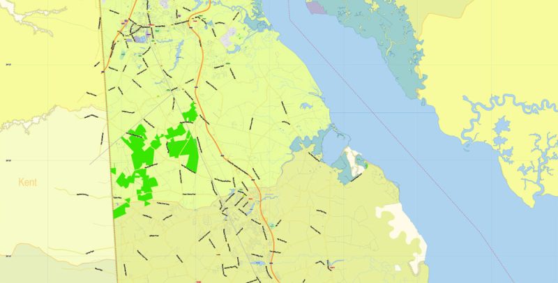
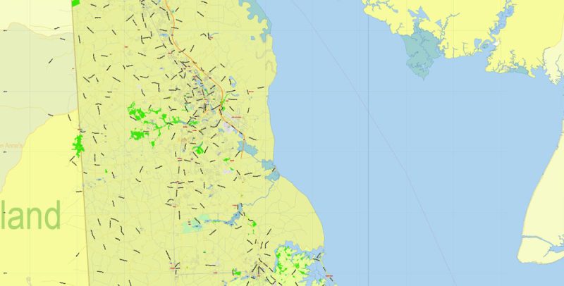
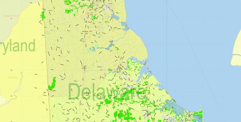
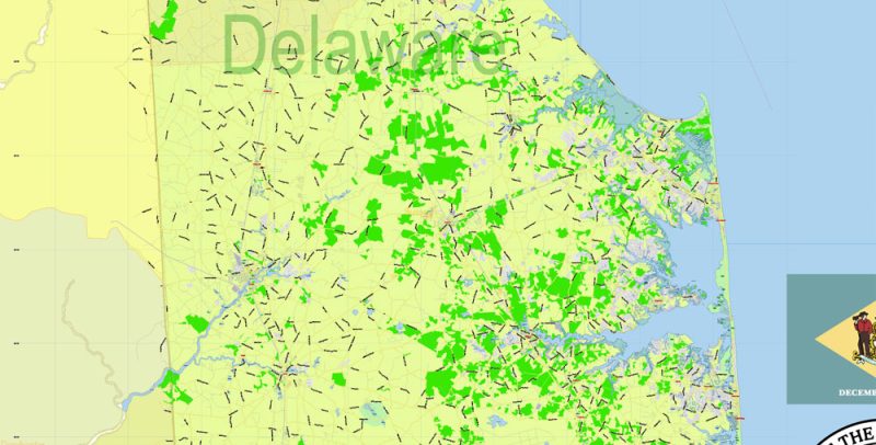
Layers: color_fills, water, streets_roads, labels_roads, counties_areas, state_areas, names_objects, names_streets, names_places, grids, legend, etc.
If you need: we can add postal codes (zip codes areas with numbers) to the map as a separated layer.
The most exact and detailed map of the state in scale.
For Editing and High-Quality Printing
Delaware
Delaware is a small but proud state. It is one of the smallest States in the United States and has a population of less than a million, but Delaware was the first of the thirteen British colonies to sign the US Constitution. Moreover, he took such an active part in the creation of its text that this document became known as the “Constitution of the state of Delaware”. The state itself is also called the “First”.
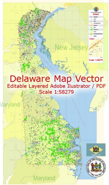
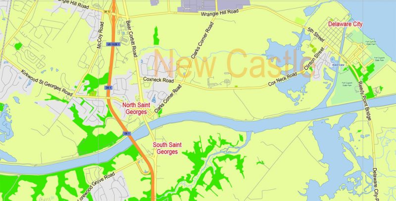
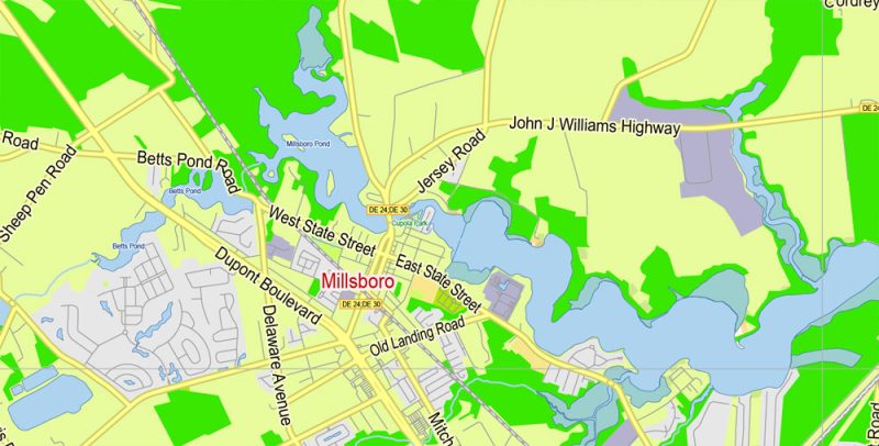
Delaware State Map Vector Exact Plan detailed Road Admin Map editable Adobe Illustrator in layers
Delaware is in a group of so-called Mid-Atlantic States, between Pennsylvania and Maryland. To the East, Delaware is bordered by New Jersey, and the state’s Western border is the Delaware Bay coast, washed by the Atlantic ocean. Part of the border between Delaware and Maryland runs right through the residential streets, and its application was preceded by a lawsuit that lasted about a hundred years. And part of the border with Pennsylvania seemed to be laid on a compass – it was also carried out by a court decision, and the point from which the countdown was on the roof of the courthouse in a New Castle.
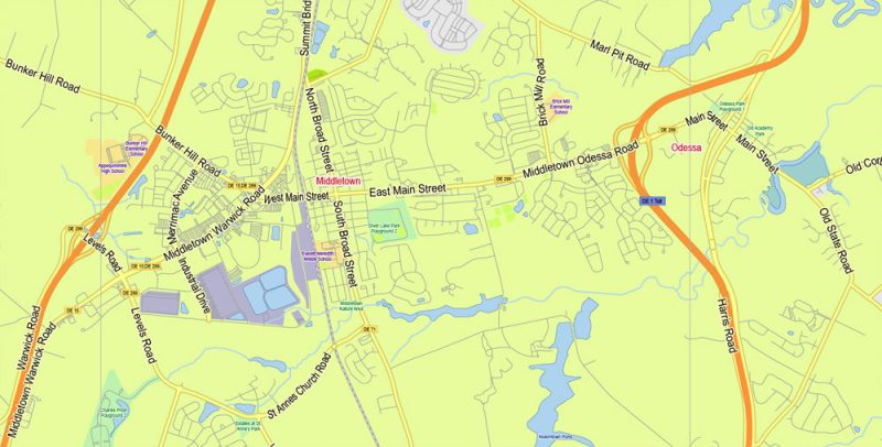
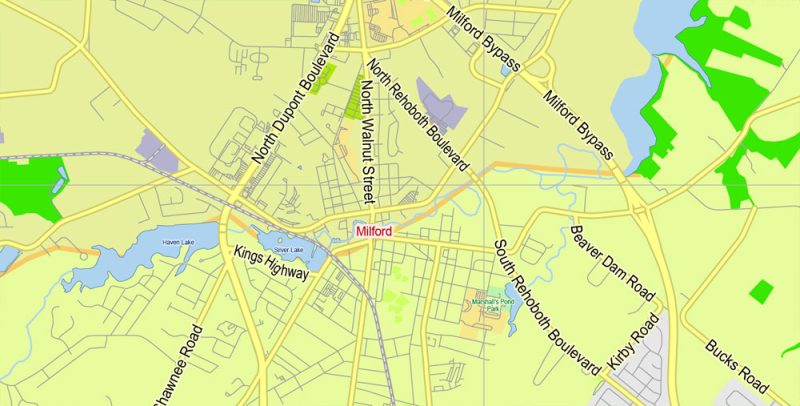
Delaware State Map Vector Exact Plan detailed Road Admin Map editable Adobe Illustrator in layers
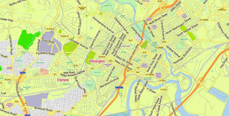
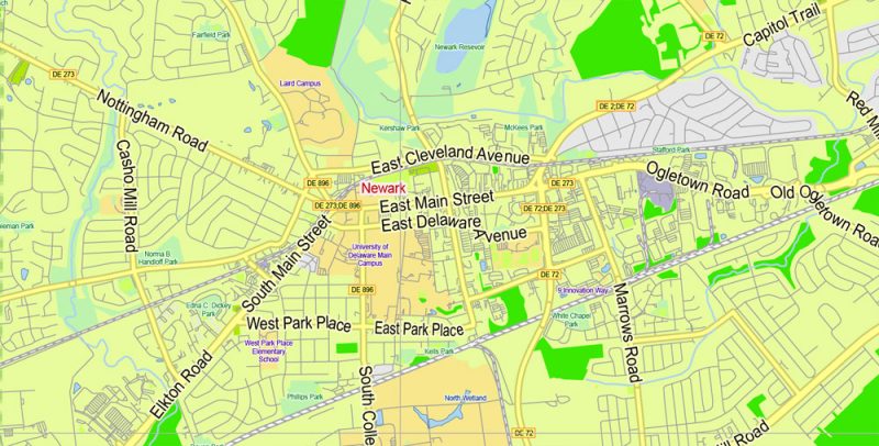
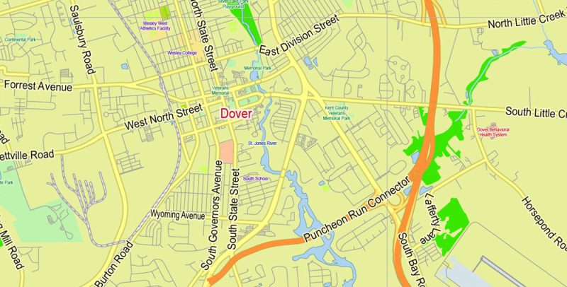
The name of the state comes from the Delaware Indian tribe. The capital city is Dover, but the largest in the state recognized by the city of Wilmington. The largest include Newark, Middletown, Milford and a couple of other cities.
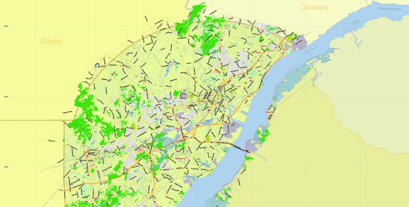
Delaware State Map Vector Exact Plan detailed Road Admin Map editable Adobe Illustrator in layers
In search of the historical landmarks of the state of Delaware is to visit New Castle, standing on the shore of the Bay, and the Delaware city historic Park “Fort Delaware”. The first Fort in New Castle was founded in the middle of the XVII century by the Dutch. Many buildings in the city have retained their historical appearance, this was due to the economic downturn in the early twentieth century when residents did not have the means to rebuild their homes. In May, the inhabitants of New Castle dressed in costumes of the era of the colonists and organize a procession. Delaware city is also located in New Castle County. The historic district of the city, which has about two hundred old buildings, is included in the national register of historical places. Fort Delaware Park is located on the island of PI Patch, a kilometer from the city. The fortress was built around the middle of the XIX century to protect the coast, during the Civil war served as a prison for the Confederates.
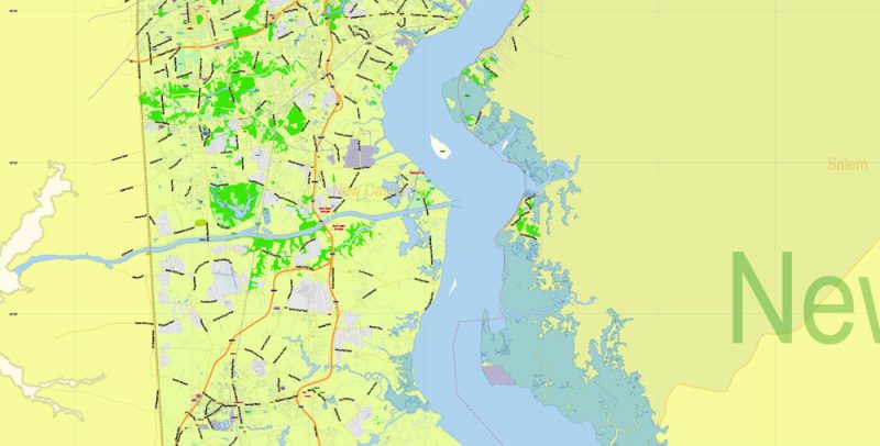
Delaware State Map Vector Exact Plan detailed Road Admin Map editable Adobe Illustrator in layers
Another fortress – Fort Christine, one of the first buildings built by Europeans in Delaware. The Swedes built the Fort in 1638. Another famous building of the XVII century is the Church of the Holy Trinity in Wilmington, also built by Swedish colonists.
Delaware State Map Vector Exact Plan detailed Road Admin Map editable Adobe Illustrator in layers
In Delaware, there is a network of beach resorts, the most famous of which is Rehoboth beach. The network also includes beaches in Dewey Beach, Bethany Beach, South Bethany, Dewey, and Fenwick Island. Rehoboth – sandy, it is considered the most beautiful and offers a large selection of outdoor activities on the water.
Delaware State Map Vector Exact Plan detailed Road Admin Map editable Adobe Illustrator in layers
Delaware State Map Vector Exact Plan detailed Road Admin Map editable Adobe Illustrator in layers
Delaware State Map Vector Exact Plan detailed Road Admin Map editable Adobe Illustrator in layers
Delaware State Map Vector Exact Plan detailed Road Admin Map editable Adobe Illustrator in layers
Delaware State Map Vector Exact Plan detailed Road Admin Map editable Adobe Illustrator in layers
Delaware State Map Vector Exact Plan detailed Road Admin Map editable Adobe Illustrator in layers
Delaware State Map Vector Exact Plan detailed Road Admin Map editable Adobe Illustrator in layers
Delaware State Map Vector Exact Plan detailed Road Admin Map editable Adobe Illustrator in layers
Delaware State Map Vector Exact Plan detailed Road Admin Map editable Adobe Illustrator in layers
Delaware State Map Vector Exact Plan detailed Road Admin Map editable Adobe Illustrator in layers
Delaware State Map Vector Exact Plan detailed Road Admin Map editable Adobe Illustrator in layers


 Author: Kirill Shrayber, Ph.D. FRGS

