Extended Description of the Vector Map
Printable Vector Map Congo Democratic Republic high detailed road map + admin areas + cities and water objects editable Layered Adobe Illustrator, scalable, editable text format of all names, 151 Mb ZIP.
Layered exact editable map: Map for publishing, design, printing, publications, arts, projects, presentations, for architects, designers, and builders, business, logistics. The most exact and detailed map. GPS correct Mercator Projection.
For printing any format.
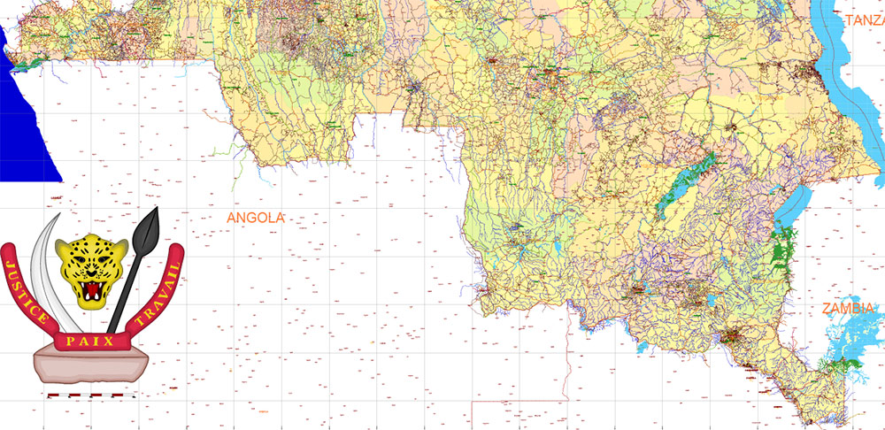
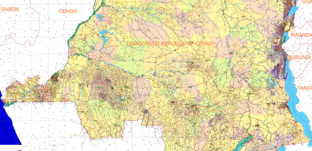
Please note:This country map is compiled from multiple, unrelated geodata sources. The state border line (according to the UN data) DOES NOT COINCIDE with the boundaries of the administrative territories of the country (according to the national geo-statistical bureau).
Please note: in the preview, ALL LAYERS are enabled and visible. Of course, you can easily turn off the layers you don’t need and the map will become much simpler.
DWG, DXF, CDR, ESRI Shapes, and other formats – by request, the same price, please contact.
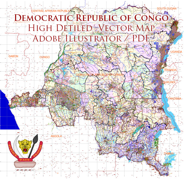
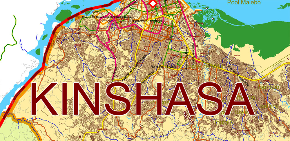
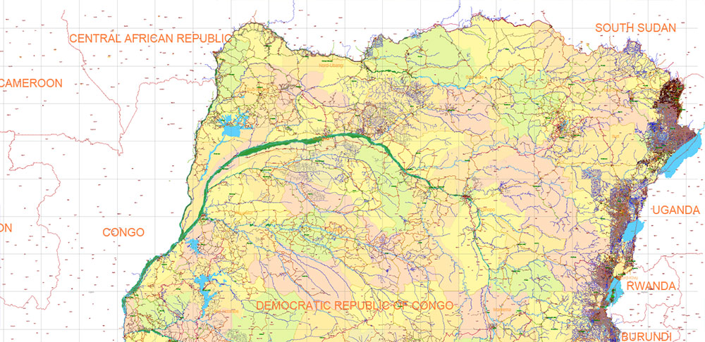
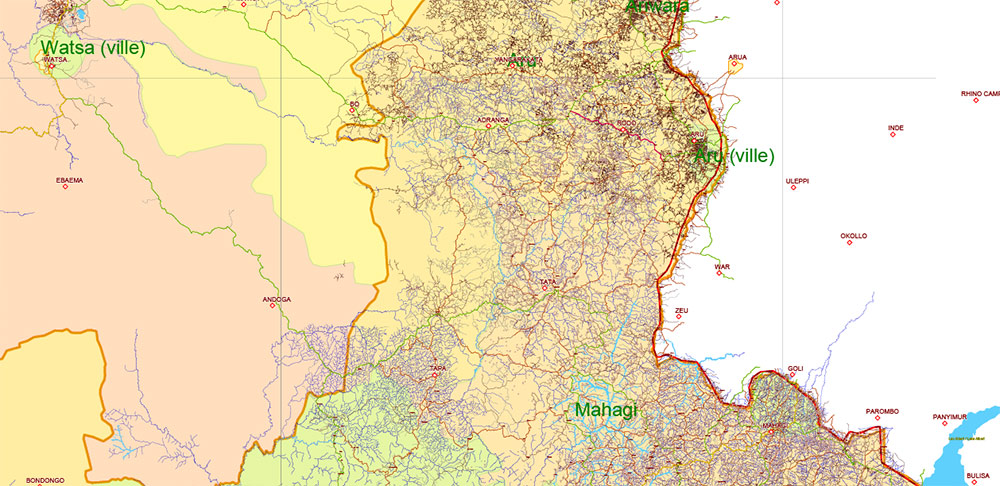
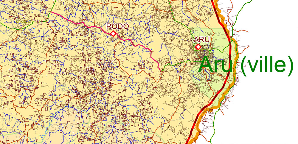
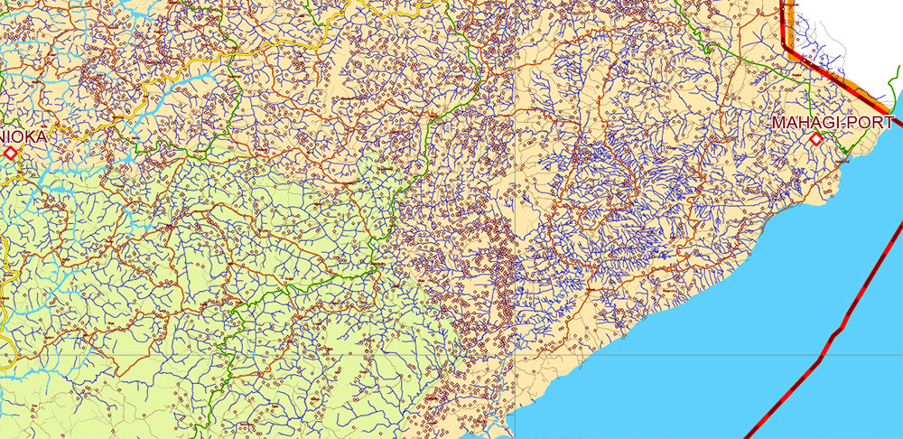
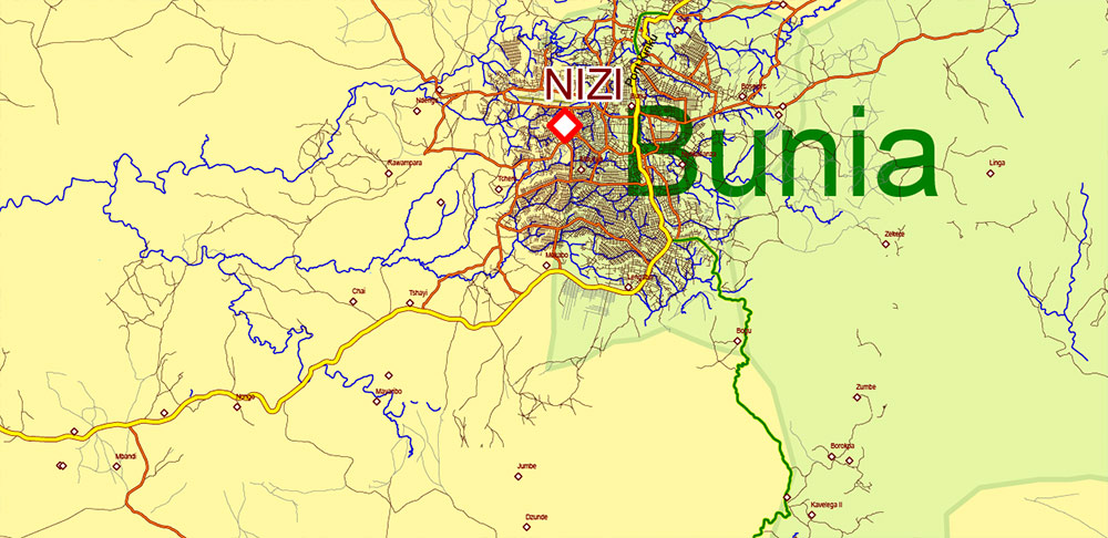
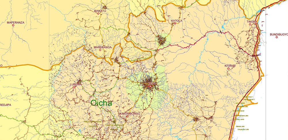
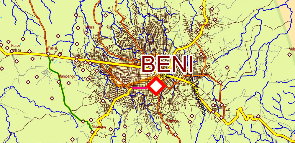
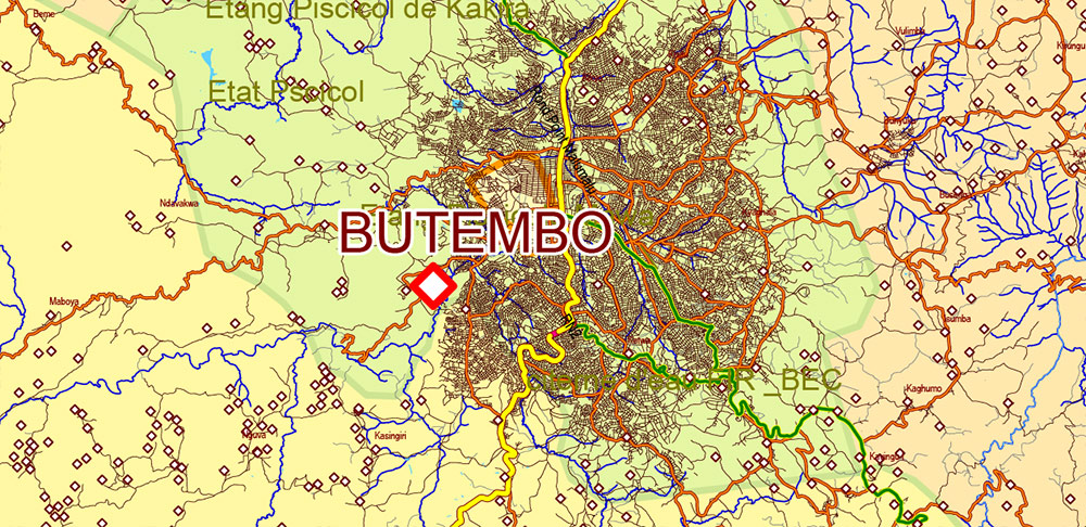
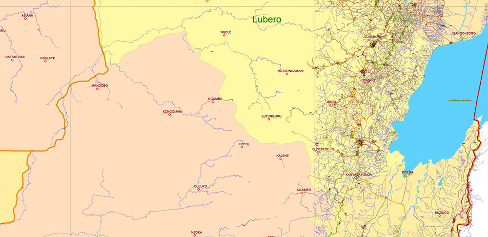
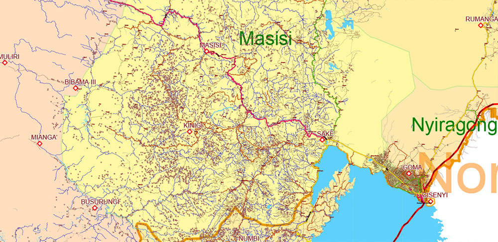
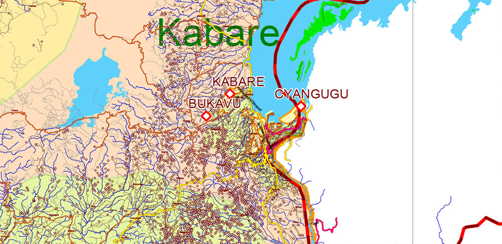
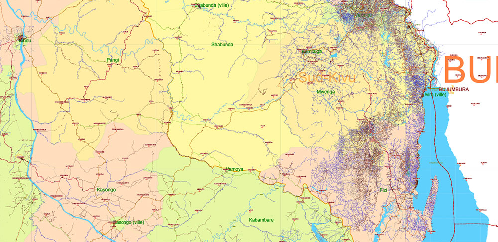
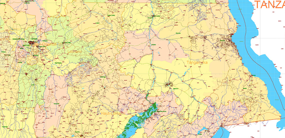
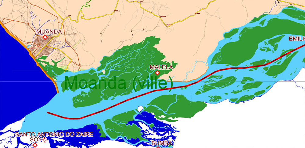
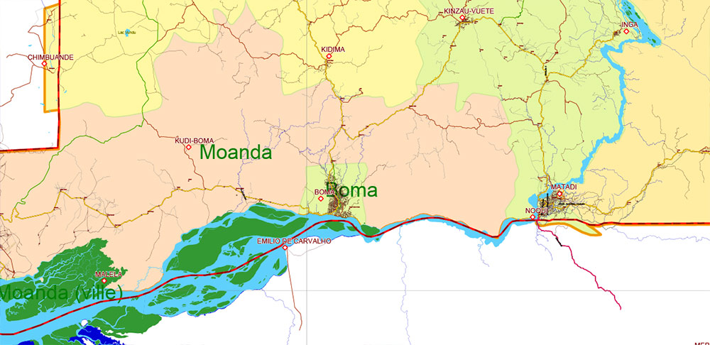
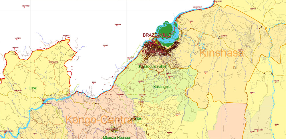
Congo Democratic Republic Vector Map high detailed road map + admin areas + cities and water objects editable Layered Adobe Illustrator
Separated layers:
- Legend
- Grids
- Names Geopoints 2 (main cities and towns) + halo
- Points Geo 2 (main cities and towns)
- Names Geopoints (all known places)
- Points Geo (all known places)
- Names principal roads (some)
- Names Water objects (areas)
- Names Countries
- Names Districts
- Names Provinces
- Urban areas
- Main roads and streets
- Civil streets and roads
- Railroads
- Country boundaries
- Waterways
- Water areas
- Districts areas
- Provinces areas
- Sea / Ocean
Congo Democratic Republic Vector Map high detailed road map + admin areas + cities and water objects editable Layered Adobe Illustrator
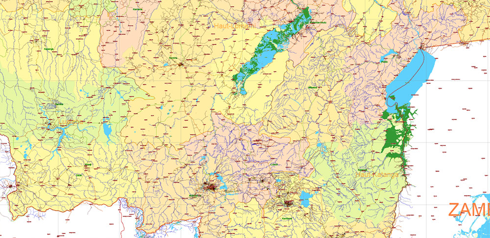
Congo Democratic Republic Vector Map high detailed road map + admin areas + cities and water objects editable Layered Adobe Illustrator
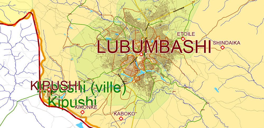
Congo Democratic Republic Vector Map high detailed road map + admin areas + cities and water objects editable Layered Adobe Illustrator
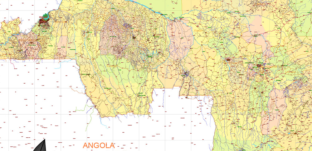
Congo Democratic Republic Vector Map high detailed road map + admin areas + cities and water objects editable Layered Adobe Illustrator
Congo Democratic Republic Vector Map high detailed road map + admin areas + cities and water objects editable Layered Adobe Illustrator
Congo Democratic Republic Vector Map high detailed road map + admin areas + cities and water objects editable Layered Adobe Illustrator
Congo Democratic Republic Vector Map high detailed road map + admin areas + cities and water objects editable Layered Adobe Illustrator
Congo Democratic Republic Vector Map high detailed road map + admin areas + cities and water objects editable Layered Adobe Illustrator
Congo Democratic Republic Vector Map high detailed road map + admin areas + cities and water objects editable Layered Adobe Illustrator
Congo Democratic Republic Vector Map high detailed road map + admin areas + cities and water objects editable Layered Adobe Illustrator
Congo Democratic Republic Vector Map high detailed road map + admin areas + cities and water objects editable Layered Adobe Illustrator
Congo Democratic Republic Vector Map high detailed road map + admin areas + cities and water objects editable Layered Adobe Illustrator
Congo Democratic Republic Vector Map high detailed road map + admin areas + cities and water objects editable Layered Adobe Illustrator
Congo Democratic Republic Vector Map high detailed road map + admin areas + cities and water objects editable Layered Adobe Illustrator
Congo Democratic Republic Vector Map high detailed road map + admin areas + cities and water objects editable Layered Adobe Illustrator
Congo Democratic Republic Vector Map high detailed road map + admin areas + cities and water objects editable Layered Adobe Illustrator
Congo Democratic Republic Vector Map high detailed road map + admin areas + cities and water objects editable Layered Adobe Illustrator
Congo Democratic Republic Vector Map high detailed road map + admin areas + cities and water objects editable Layered Adobe Illustrator
Congo Democratic Republic Vector Map high detailed road map + admin areas + cities and water objects editable Layered Adobe Illustrator
Congo Democratic Republic Vector Map high detailed road map + admin areas + cities and water objects editable Layered Adobe Illustrator

 Author: Kirill Shrayber, Ph.D. FRGS