Extended Description of the Vector Map
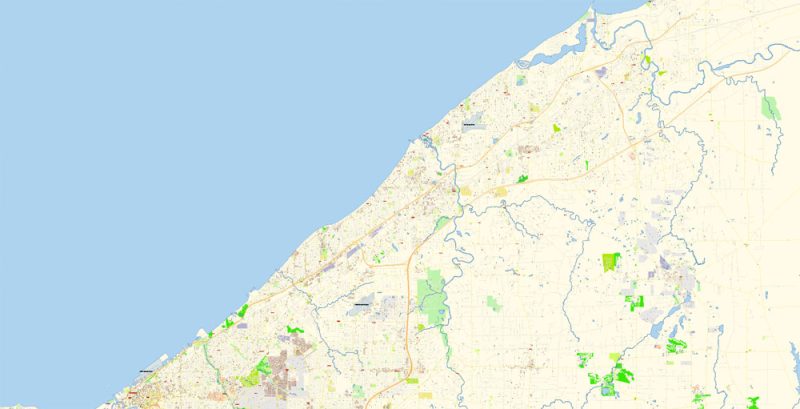
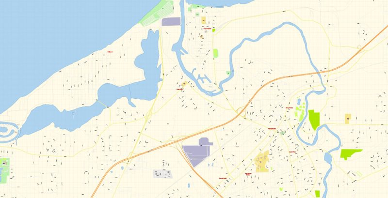
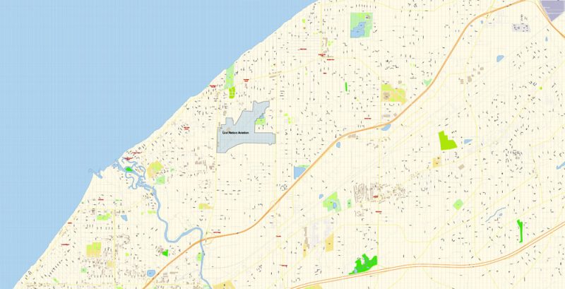
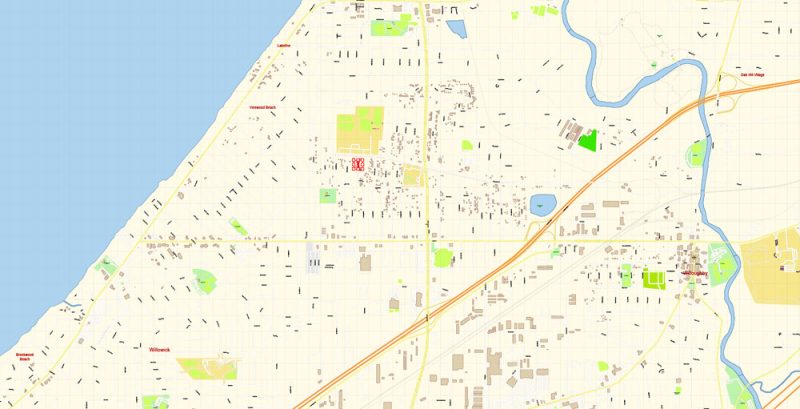
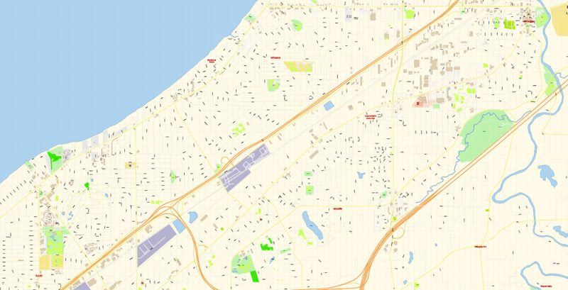
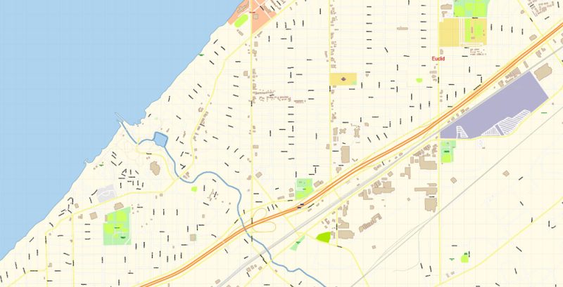
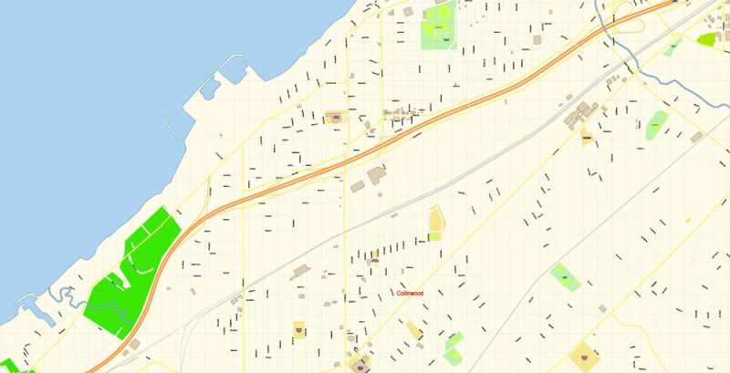
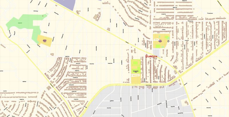
Printable Vector Map of Cleveland Ohio US detailed City Plan scale 100 m 1:3519 full editable Adobe Illustrator Street Map in layers, scalable, text format all names, 28 MB ZIP
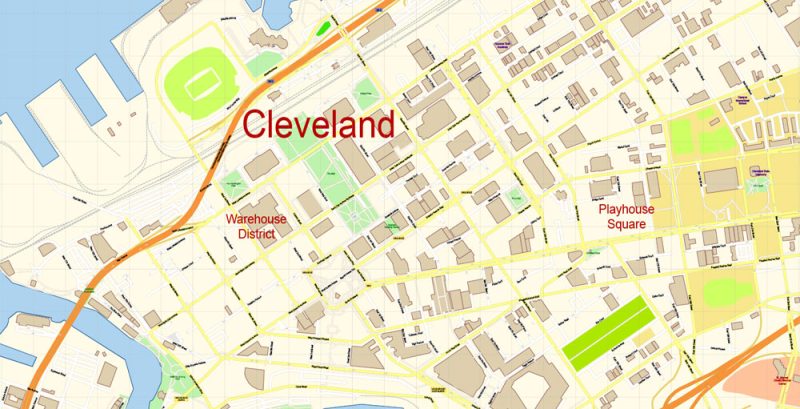
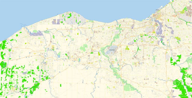
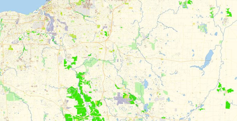
All street names, Main Objects, Buildings. Map for design, printing, arts, projects, presentations, for architects, designers, and builders, business, logistics.
Layers: color_fills, water, streets_roads, labels_roads, names_objects, names_streets, names_places, arrows_streets, buildings, legend, etc.
The most exact and detailed map of the city in scale.
IF YOU NEED: We can add the layer areas and numbers zip (postal) codes. Free for you.
For Editing and High-Quality Printing
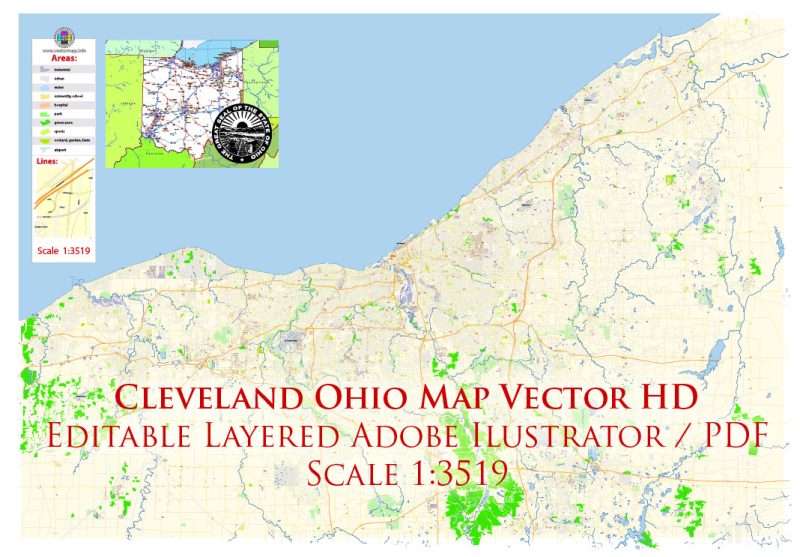
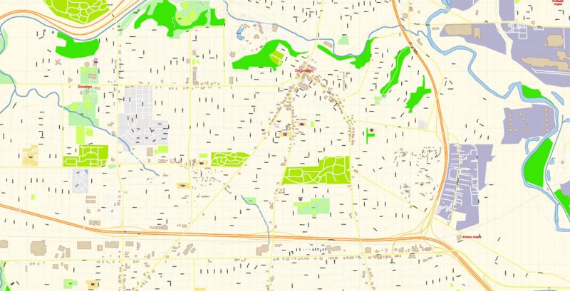
Cleveland Ohio US Map Vector Exact City Plan High Detailed Street Map editable Adobe Illustrator in layers
Cleveland
City in Ohio
Cleveland is a city in the U.S. state of Ohio, and the county seat of Cuyahoga County. The city proper has a population of 383,793, making it the 52nd-largest city in the United States and the second-largest city in Ohio.
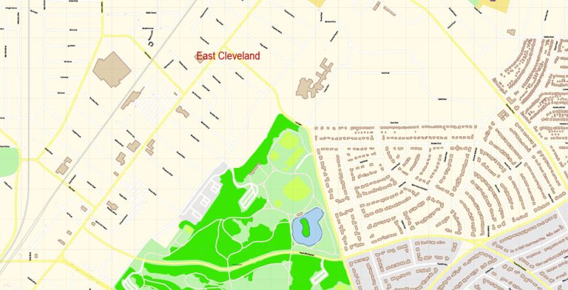
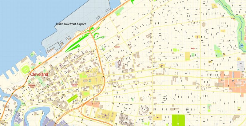
Cleveland Ohio US Map Vector Exact City Plan High Detailed Street Map editable Adobe Illustrator in layers
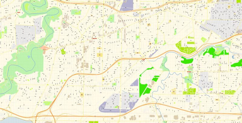
Cleveland Ohio US Map Vector Exact City Plan High Detailed Street Map editable Adobe Illustrator in layers
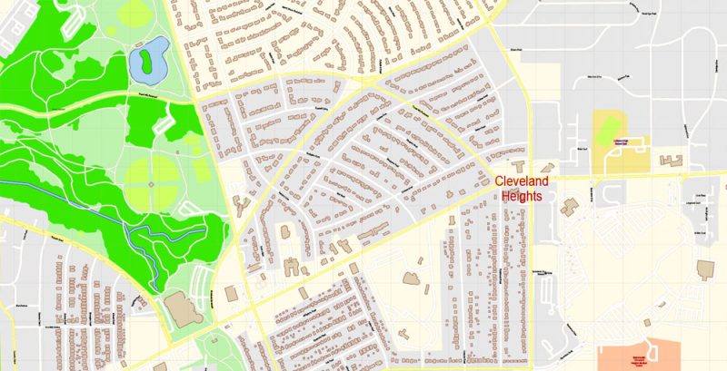
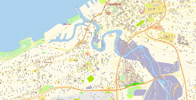
Cleveland Ohio US Map Vector Exact City Plan High Detailed Street Map editable Adobe Illustrator in layers
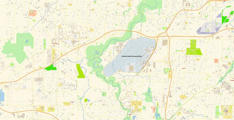
Cleveland Ohio US Map Vector Exact City Plan High Detailed Street Map editable Adobe Illustrator in layers
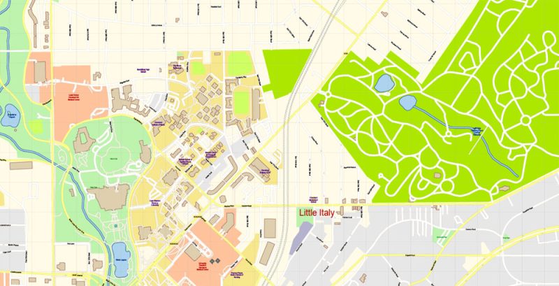
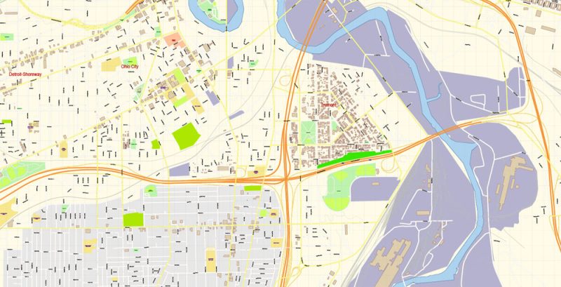
Cleveland Ohio US Map Vector Exact City Plan High Detailed Street Map editable Adobe Illustrator in layers
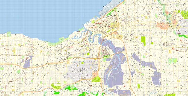
Cleveland Ohio US Map Vector Exact City Plan High Detailed Street Map editable Adobe Illustrator in layers
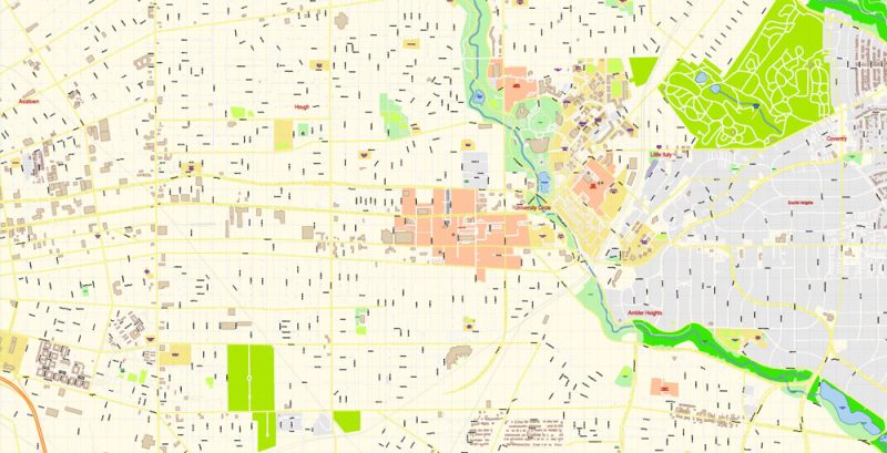
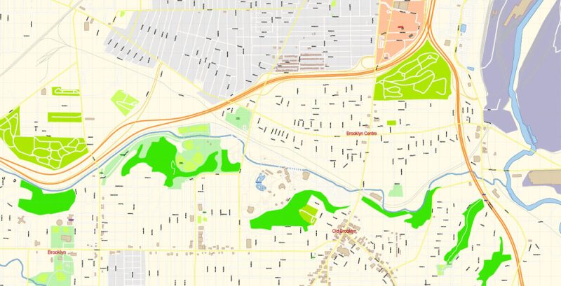
Cleveland Ohio US Map Vector Exact City Plan High Detailed Street Map editable Adobe Illustrator in layers
Cleveland Ohio US Map Vector Exact City Plan High Detailed Street Map editable Adobe Illustrator in layers
Cleveland Ohio US Map Vector Exact City Plan High Detailed Street Map editable Adobe Illustrator in layers
Cleveland Ohio US Map Vector Exact City Plan High Detailed Street Map editable Adobe Illustrator in layers
Cleveland Ohio US Map Vector Exact City Plan High Detailed Street Map editable Adobe Illustrator in layers
Cleveland Ohio US Map Vector Exact City Plan High Detailed Street Map editable Adobe Illustrator in layers
Cleveland Ohio US Map Vector Exact City Plan High Detailed Street Map editable Adobe Illustrator in layers
Cleveland Ohio US Map Vector Exact City Plan High Detailed Street Map editable Adobe Illustrator in layers
Cleveland Ohio US Map Vector Exact City Plan High Detailed Street Map editable Adobe Illustrator in layers
Cleveland Ohio US Map Vector Exact City Plan High Detailed Street Map editable Adobe Illustrator in layers
Cleveland Ohio US Map Vector Exact City Plan High Detailed Street Map editable Adobe Illustrator in layers
Cleveland Ohio US Map Vector Exact City Plan High Detailed Street Map editable Adobe Illustrator in layers
Cleveland Ohio US Map Vector Exact City Plan High Detailed Street Map editable Adobe Illustrator in layers
Cleveland Ohio US Map Vector Exact City Plan High Detailed Street Map editable Adobe Illustrator in layers
Cleveland Ohio US Map Vector Exact City Plan High Detailed Street Map editable Adobe Illustrator in layers
Cleveland Ohio US Map Vector Exact City Plan High Detailed Street Map editable Adobe Illustrator in layers
Cleveland Ohio US Map Vector Exact City Plan High Detailed Street Map editable Adobe Illustrator in layers


 Author: Kirill Shrayber, Ph.D. FRGS


