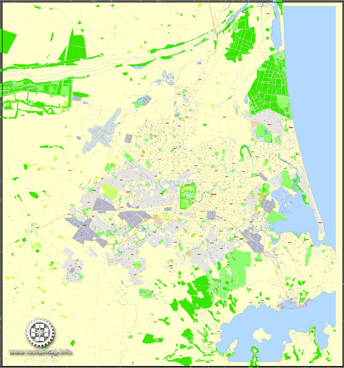
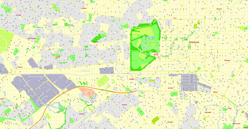
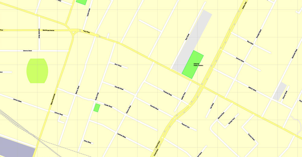
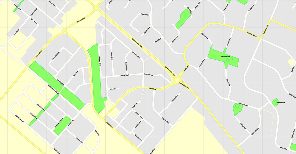
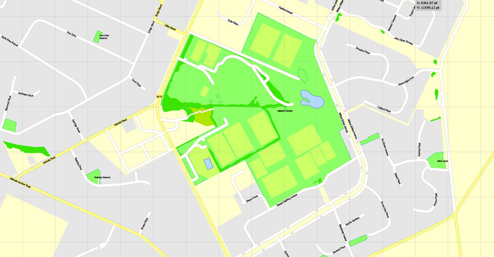
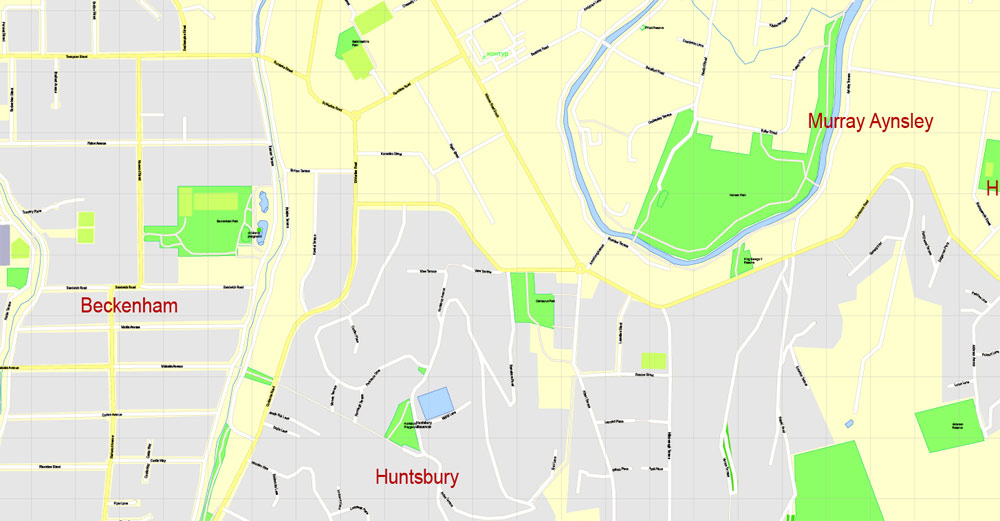
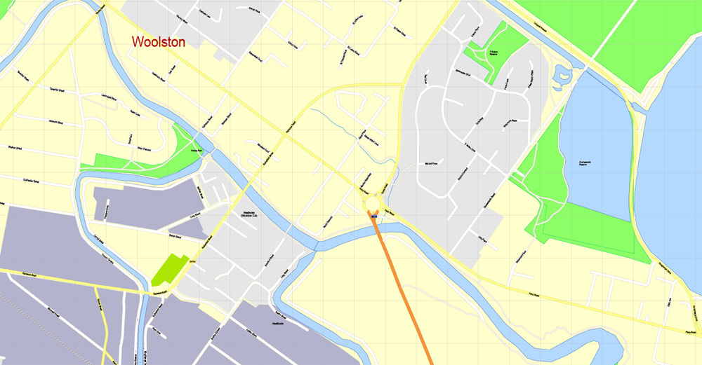
Christchurch, New Zealand, Printable Map, exact vector street map, fully editable Adobe Illustrator, V3.11, Scale 100 meters, scalable, editable, text format street names, 3 Mb ZIP.
All streets named, main objects. Map for publishing, design, printing, publications, arts, projects, presentations, for architects, designers and builders, business, logistics. The most exact and detailed map of the city.
Separated layers: streets and roads, color fills, road labels, street arrows, objects, names 1,2,3, scales. Royalty Free.
DWG, DXF, CDR and other formats – on request, same price, please, contact.
Christchurch, New Zealand.
This vector map of Christchurch is used as a basis for design, editing, and further printing.
This is the most detailed, exact map of Christchurch for high-quality printing and polygraphy. You can always clarify the map development date by contacting us.
For your convenience, all objects on Christchurch vector map are divided into layers. And the editing is very easy – colors, lines, etc.
You can easily add any objects needed (e.g. shops, salons, sale points, gas station or attraction) on any layer of Christchurch vector map.
Christchurch is the largest city in the South Island of New Zealand and the seat of the Canterbury Region. The Christchurch urban area lies on the South Island’s east coast, just north of Banks Peninsula. It is home to 404,500 residents, making it New Zealand’s third-most populous city behind Auckland and Wellington.
One of the advantages of Christchurch vector maps of our production is the relevance of cartographic data, we constantly update all our products.
This vector map of Christchurch is used by:
designers, layout designers, printers, advertisers and architects. Our product – vector maps – is designed for further editing and printing in large formats – from @Wall format (a few meters) to A-0 and A-1, A-2, A-3.
Christchurch map in vector format is used for design, urban planning, presentations and media visualizations.
Advertising and presentation map of Christchurch (usually the final designer marks the routes, and puts the client’s objects (shops, saloons, gas stations etc.)
The undoubted advantage is that people will NEVER throw out this advertising product – the map. In fact, as an advertising medium, a map is the most “long-playing” of the well-known polygraphic advertising media, with the longest lifespan, and the maximum number of interactions with the customer.
For travelers, maps are sold at the airports and gas stations around the world. Often the source is our vector maps.
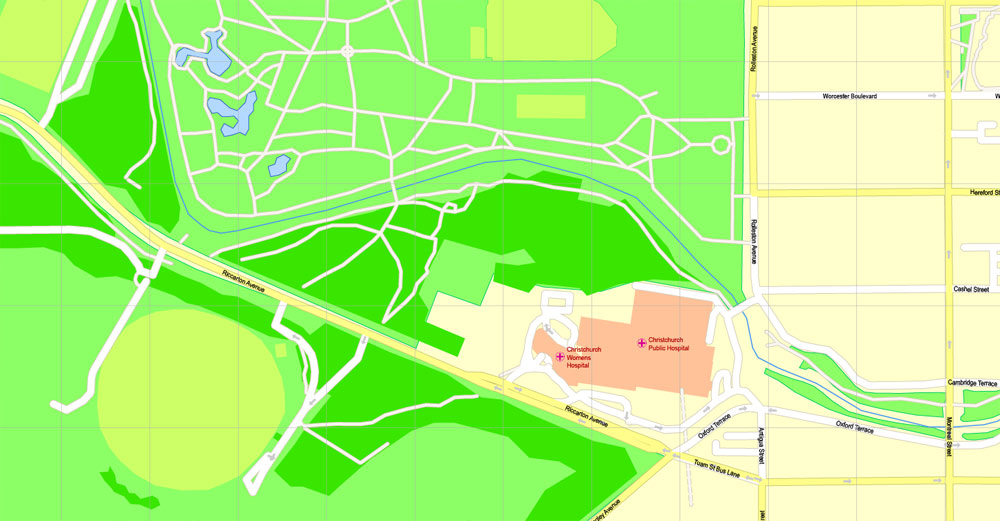
The Avon River flows through the centre of the city, with an urban park located along its banks. At the request of the Deans brothers—whose farm was the earliest settlement in the area—the river was named after the River Avon in Scotland, which rises in the Ayrshire hills near to where their grandfather’s farm was located.
Take a look, who purchases our vector maps of Christchurch in “Our Clients and Friends” page – these are large and small companies, from super-brands like Volvo and Starbucks, to small design studios and printing houses.
It’s very easy to work with vector maps of Christchurch, even for a not very experienced designer who can turn on and off the map layers, add new objects, change the colors of fill and lines according to customer requirements.
The undoubted advantage of Christchurch vector maps in printing is an excellent and detailed visualization, when customer can expand a large paper map and instantly define his location, find a landmark, an object or address on map, unlike using the popular electronic formats of Google and Yandex maps for example.
Printable vector maps of Christchurch are much more convenient and efficient than any electronic maps on your smartphone, because ALL DETAILS are displayed in the entire space of Christchurch map.
Useful tips on working with vector maps of cities and countries in Adobe Illustrator.
«V» – launches the Selection tool (cursor, black arrow), which makes active any vector line.
«А» – launches the Direct Selection tool (white cursor), allows you to select curve elements and drag them to the desired place.
«R» – activates the Rotate tool, which helps you rotating selected objects around the center point by 360 degrees.
«E» – gives you the opportunity to use the Eraser tool and erase unnecessary parts.
«X» – switches between Fill and Stroke in the Tools section. Try to get used to this hot key and
you will quickly understand that you can’t live and work without it.
Guides are not limited to vertical and horizontal in Adobe Illustrator. You can also create a diagonal guide for example. Moreover, you can turn any contours into guides. Select the outline and go to View > Guides > Make Guides (Create Guides), or simply press Cmd/Ctrl + 5. You can also turn the guides back into an editable object. Go to menu, View > Guides > Unlock Guides (Release Guides), select the guide you want to edit and select View > Guides > Release Guides (Reset Guides), or just press Cmd/Ctrl + Option / Alt + 5).
You will probably want to change the color scheme used on our Christchurch vector map.
To quickly and effectively play with colors.
Of course, you can do it manually, all objects in our Christchurch vector map are divided according to types and layers, and you can easily change the color gamma of vector objects in groups and layers.
But there is more effective way of working with the whole VECTOR MAP of Christchurch and all layers:
The overview dialog «Edit colors»/«Repaint Graphic Object» (this dialog box name can change depending on the context):
If you have selected a part or a layer of Christchurch vector map and open the dialog box by clicking the icon in the Control panel, on the Samples palette or the Color Catalog, or if you choose Edit > Edit Colors> Repaint Graphic Object, then the «Repaint Graphic Object» dialog box appears, and you get access to «Assign» and «Edit» tabs.
If a picture or a map fragment is not selected, and you open the dialog box by clicking the icon in the Control panel, on the Samples palette or in the Color Catalog, the «Edit Colors» dialog box appears and you can only access the «Edit» tab.
Regardless of the name at the top of the dialog box, the right-hand side always displays the color group of the current document, as well as two default color groups: Print Color and Grayscale. These color groups can be selected and used any time.
Create and edit color groups of Christchurch vector map, and also assign colors using the «Edit Colors»/ а «Repaint Graphic Object» dialog box.
A. Creating and editing of a color group on the «Edit» tab
B. Assigning colors on the «Assign» tab
C. Select a group of colors from the «Color groups» list
The option «Repaint a graphic object» in the lower part of the dialog box allows you to preview the colors on a selected layer of Vector map, or a group of elements, and specify whether its colors will be redefined when the dialog box is closed.
The main areas of the dialog box are:
«Edit»
The «Edit» tab is designed to create a new or edit the existing color groups.
The harmony rules Menu and the Color Wheel are used to conduct experiments with color harmonies. The color wheel shows how colors are related in color harmony, and the color bars allow you to view and manipulate an individual color values. In addition, you can adjust the brightness, add and remove colors, save color groups and view colors on the selected Vector Map of Christchurch or a separated layers.
«Assign»
The «Assign» tab is used to view and control on how the original colors are replaced with colors from the color group like your corporate colors in the Vector Map of Christchurch.
The assign color ability is provided only if the entire map, layer or fragment is selected in the document. You can specify which of new colors replace the current colors, whether the spot colors should be preserved and how colors are replaced (for example, you can replace colors completely or changing the color tone while maintaining the brightness). The «Assign» tab allows you to redefine colors in the Vector Map of Christchurch, or in separate layers and fragments using the current color group or reducing the number of colors in the current Vector Map.
Color groups
Is a list of all saved color groups for current document (the same groups appear in the «Samples» palette). You can edit and delete the existing color groups, as well as creating a new ones using the list of “Color Groups” in the dialog box. All changes appear in the «Samples» palette.
The highlighted color group shows, which color group is currently edited.
Any color group can be selected and edited, or used to redefine the colors in the selected vector map of Christchurch , its fragments or elements.
Saving a color group adds this group to the specified list.
Opening the «Edit Colors»/«Repaint Graphic Object» dialog box.
Open the «Edit Colors»/«Repaint Graphic Object» dialog box using one of the following methods:
«Edit»> «Edit Colors»> «Repaint Graphic object» or «Repaint With Style».
Use these commands if you need to edit the colors in the selected vector map of Christchurch city.
«Repaint Graphic object» button on the «Control» panel.
Use this button if you need to adjust colors of Christchurch vector map using the а «Repaint graphic object» dialog box.
The specified button is available if the selected vector map or its fragment contains two or more colors.
Note. This color editing method is convenient for global color adjustment in a vector map, if global colors were not used when creating a Map of Christchurch.
The «Edit colors» button or «Edit or apply colors» on the «Color Catalog» palette
Click this button if you need to edit colors on the «Color Catalog» palette or edit and then apply them to the selected Vector Map of Christchurch or its fragment.
The «Edit color group» button or «Edit or apply color group» on the «Samples» palette.
Click this button if you need to edit the colors in the specific color group or edit and apply them to the selected Vector Map of Christchurch or a group of its elements, for example, the whole layer “Streets and lines”. You can also double-click the color group in the Samples panel to open the dialog box.
If the map file is too large and your computer freezes or even can’t open it quickly:
1. Try to reduce the color resolution of the video card (display) to 256 colors while working with a large map.
2. Using Windows Task Manager, select all the application you don’t need, while working with map, just turn them off.
3. Launch Adobe Illustrator. (DO NOT OPEN the vector map file)
4. Start the Windows Task Manager using administrator rights > Find the “Illustrator” process > set the «real time» priority,
5. Open the file. When you see the LEGACY FONT popup window – click “OK” (do not update). You can restore the TEXT later.
6. Can also be useful: When file is opened – Edit > Settings > Basic Settings > disable smoothing. /// It looks scary, but works quickly)))
We recommend saving the file in Adobe Illustrator 10 version. It’s much more stable when working with VERY BIG size files.
Archaeological evidence has indicated that the Christchurch area was first settled by humans in about 1250. Christchurch became a city by Royal Charter on 31 July 1856, making it officially the oldest established city in New Zealand. The Canterbury Association, which settled the Canterbury Plains, named the city after Christ Church, Oxford. The new settlement was laid out in a grid pattern centred on Cathedral Square; during the 19th century there were few barriers to the rapid growth of the urban area, except for the Pacific to the east and the Port Hills to the south.
Agriculture is the historic mainstay of Christchurch’s economy. The early presence of the University of Canterbury and the heritage of the city’s academic institutions in association with local businesses has fostered a number of technology-based industries.
The city suffered a series of earthquakes between September 2010 and early 2012, with the most destructive of them occurring at 12.51 p.m. on Tuesday, 22 February 2011, in which 185 people were killed and thousands of buildings across the city collapsed or suffered severe damage. By late 2013, 1,500 buildings in the city had been demolished, leading to an ongoing recovery and rebuilding project.
Geography
Christchurch lies in Canterbury, near the centre of the east coast of the South Island, east of the Canterbury Plains. It is located near the southern end of Pegasus Bay, and is bounded to the east by the Pacific Ocean coast and the estuary of the Avon and Heathcote Rivers. To the south and south-east the urban portion of the city is limited by the volcanic slopes of the Port Hills separating it from Banks Peninsula. To the north the city is bounded by the braided Waimakariri River.
Christchurch is one of a group of only four cities in the world to have been carefully planned following the same layout of a central city square, four complementing city squares surrounding it and a parklands area that embrace the city centre. The first city built with this pattern was Philadelphia. Later came Savannah and Adelaide, before Christchurch.
Christchurch has one of the highest-quality water supplies in the world, with its water rated among the purest and cleanest in the world. Untreated, naturally filtered water is sourced, via more than 50 pumping stations surrounding the city, from aquifers emanating from the foothills of the Southern Alps.
Small guide: How to work with the vector map?
You can: Mass select objects by type and color – for example, the objects type “building” (they are usually dark gray) – and remove them from the map, if you do not need them in your print or design project. You can also easily change the thickness of lines (streets), just bulk selection the road by the line color.
The streets are separated by type, for example, type “residential road” are usually white with a gray stroke. Highway usually orange with a brown or dark gray stroke.
It is easy to change the font of inscriptions, all or each individually. Also, just can be make and any other manipulation of objects on the vector map in Adobe illustrator format.
Important: All the proportions on the map are true, that is, the relative sizes of the objects are true, because Map is based on an accurate GPS projection, and It transated into the (usual for all) the Mercator projection.
You can easily change the color, stroke and fill of any object on the map, zoom without loss of quality Image Verification.
Select object

Bulk selection the same objects on the vector map

See the bulk selected objects on the vector map

Bulk delete buildungs from the vector map

Select residencial road (small street) on the vector map

Bulk selection the same lines (streets, roads) on the full map

Create fat lines of the streets on the vector maps (bulk action) 1

Create fat lines of the streets on the vector maps (bulk action) 2

Create fat lines of the streets on the vector maps (bulk action) 3

You can easily change the color, stroke and fill of any object on the map, zoom without loss of quality Image Verification.
Christchurch, New Zealand
Christchurch is the largest city in the South Island of New Zealand and the seat of the Canterbury Region. The Christchurch urban area lies on the South Island’s east coast, just north of Banks Peninsula. It is home to 389,700 residents, making it New Zealand’s third most-populous urban area behind Auckland and Wellington.
The city was named by the Canterbury Association, which settled the surrounding province of Canterbury. The name of Christchurch was agreed on at the first meeting of the association on 27 March 1848. It was suggested by John Robert Godley, who had attended Christ Church, Oxford. Some early writers called the town Christ Church, but it was recorded as Christchurch in the minutes of the management committee of the association. Christchurch became a city by Royal Charter on 31 July 1856, making it officially the oldest established city in New Zealand.
The river that flows through the centre of the city (its banks now largely forming an urban park) was named Avon at the request of the pioneering Deans brothers after the Scottish River Avon, which rises in the Ayrshire hills near what was their grandfather’s farm and flows into the Clyde.
The usual Māori name for Christchurch is Ōtautahi (“the place of Tautahi”). This was originally the name of a specific site by the Avon River near present-day Kilmore Street and the Christchurch Central Fire Station. The site was a seasonal dwelling of Ngāi Tahu chief Te Potiki Tautahi, whose main home was Port Levy on Banks Peninsula. The Ōtautahi name was adopted in the 1930s. Prior to that the Ngāi Tahu generally referred to the Christchurch area as Karaitiana, a transliteration of the English word Christian. The city’s name is often abbreviated by New Zealanders to Chch. In New Zealand Sign Language, the city’s name is the fingerspelled letter C (made by forming the hand into a C shape) signed twice, with the second to the right of the first, while mouthing “Christchurch”.
Geography of Christchurch, New Zealand
Satellite image showing Christchurch and surrounding areas.
View of the Christchurch region from the International Space Station.
Christchurch lies in Canterbury, near the centre of the east coast of the South Island, east of the Canterbury Plains. It is located near the southern end of Pegasus Bay, and is bounded to the east by the Pacific Ocean coast and the estuary of the Avon and Heathcote Rivers. To the south and south-east the urban portion of the city is limited by the volcanic slopes of the Port Hills separating it from Banks Peninsula. In 2006, Banks Peninsula was incorporated into the city, in effect tripling the city’s land area while adding only about 8,000 people to the city’s population. To the north the city is bounded by the braided Waimakariri River.
Christchurch is one of only eight pairs of cities in the world that have near-exact antipodal cities. Half of these antipodal pairs are in New Zealand and Spain/Morocco–with A Coruña, Spain as Christchurch’s antipode.
Christchurch is one of a group of only four cities in the world to have been carefully planned following the same layout of a central city square, four complementing city squares surrounding it and a parklands area that embrace the city centre. The first city built with this pattern was Philadelphia. Later came Savannah and Adelaide, before Christchurch. As such, Christchurch holds an important legacy and a strong platform for future development.
Christchurch has one of the highest-quality water supplies in the world, with its water rated among the purest and cleanest in the world. Untreated, naturally filtered water is sourced, via more than 50 pumping stations surrounding the city, from aquifers emanating from the foothills of the Southern Alps.
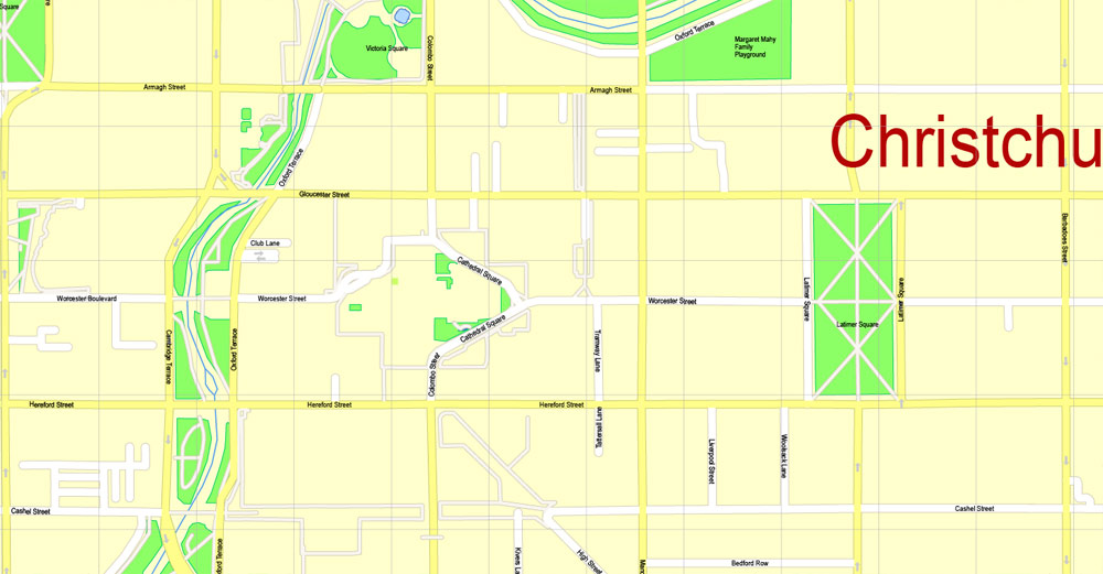
Central City of Christchurch, New Zealand
At the city’s centre is Cathedral Square, surrounding the now-earthquake-damaged – landmark Anglican cathedral, Christ Church. The area around this square and within the Four Avenues of Christchurch (Bealey Avenue, Fitzgerald Avenue, Moorhouse Avenue and Deans Avenue) is considered to be the central business district (CBD) of the city. The central city also has a number of residential areas, including Inner City East, Inner City West, Avon Loop, Moa Neighbourhood and Victoria, but many of the residential buildings in the CBD were demolished following the February 2011 Earthquakes. Cathedral Square is located at the crossing of two major central streets, Colombo Street and Worcester Street.
Cathedral Square, the heart of the city, hosted attractions such as (until the February 2011 Earthquake) the Wizard of New Zealand, Ian Brackenbury Channell, and evangelist Ray Comfort; regular market days; free standing food and coffee carts; an aquarium, pubs and restaurants and the city’s chief tourist information centre. it is expected that activities in Cathedral Square will increase as the rebuild progresses. The Wizard of New Zealand now operates from New Regent Street.
The central city also includes the pedestrianised sections of Cashel and High streets commonly known pre-earthquakes as ‘City Mall’. Refurbished in 2008/09 the mall featured especially designed seating, flower and garden boxes, more trees, paving, and an extension to the central city tram route. The tram route extension was nearly complete when the February 2011 Earthquake struck. Following the earthquakes, most buildings in Cashel Mall were demolished. A shopping area called Re:START opened on Cashel Street adjacent to Ballantyne’s Department Store in October 2011. The Re:START mall is made of colourful shipping containers that have been converted to house retail stores. The Bridge of Remembrance commemorating war dead stands at the western end of the mall, and is being repaired and earthquake strengthened, with hopes of repairs being partially completed to commemorate the 100th anniversary of World War I in August 2014 and being fully completed in time to commemorate ANZAC Day 2015.
The Cultural Precinct provided a backdrop to a vibrant scene of ever-changing arts, cultural, and heritage attractions within an area of less than one square kilometre. The Arts Centre, the Canterbury Museum and the Art Gallery are located in the Cultural Precinct. The majority of the activities were free and a printable map was provided. There areas are slowly being reopened follow earthquake repair and strengthening work.
In 2010, the Christchurch City Council released “A City For People Action Plan”, a programme of work through to 2022 to improve public spaces within the central city to entice more inner city residents and visitors. A primary action was to reduce the impact of motorised private vehicles and increase the comfort of pedestrians and cyclists. The plan was based on a report prepared for the council by renowned Danish design firm Gehl Architects. Since the February 2011 Christchurch earthquake Wellington architect Ian Athfield has been selected to re-plan, although many varied suggestions have been promoted for rebuilding the central city.
The Central City, which was fully closed off following 22 February Earthquake, opened in stages and was fully reopened in June 2013. There are still some streets closed off due to earthquake damage, infrastructure repair work, and damaged buildings.
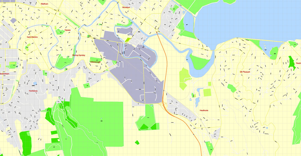
Inner suburbs
(clockwise, starting north of the city centre)
Mairehau
Shirley
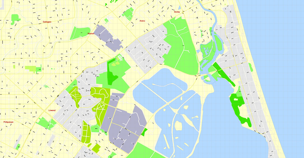
Dallington
Richmond
Avonside
Linwood
Phillipstown
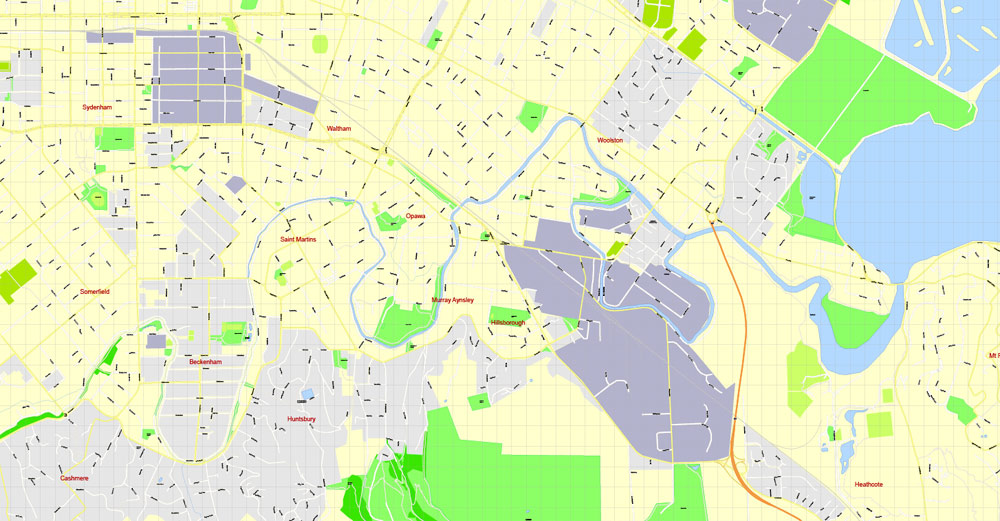
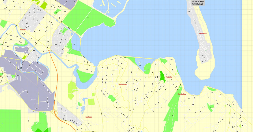
Woolston
Opawa
Waltham
St Martins
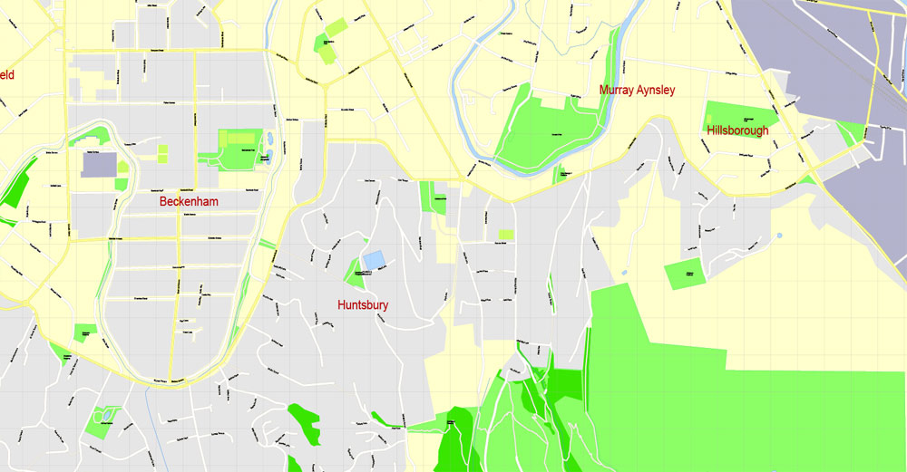
Beckenham
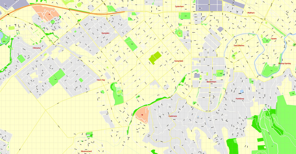
Sydenham
Somerfield
Spreydon
Addington
Riccarton
Ilam
Upper Riccarton
Burnside
Fendalton
Bryndwr
Strowan
Merivale
Papanui
St Albans
Edgeware
Outer suburbs
(clockwise, starting north of the city centre)
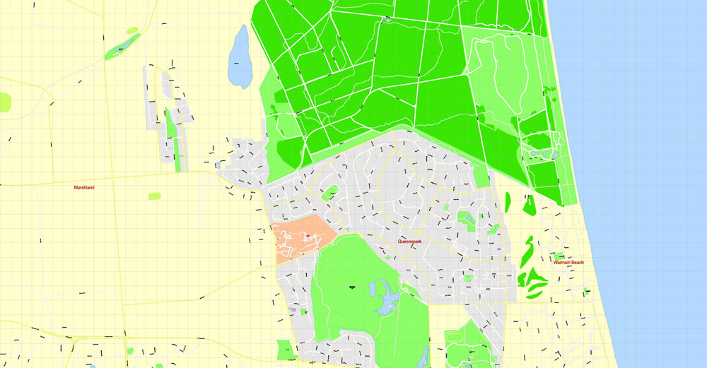
Marshland
Bottle Lake
Burwood
Parklands
Prestons
Highfield
Waimairi Beach
Queenspark
Avondale
North New Brighton
New Brighton
Bexley (now largely defunct)
Aranui
Wainoni
South Brighton
Southshore
Bromley
Mt Pleasant
Redcliffs
Moncks Bay
Clifton
Richmond Hill
Sumner
Scarborough Hill
Ferrymead
Heathcote Valley
Hillsborough
Murray Aynsley
Huntsbury
Bowenvale
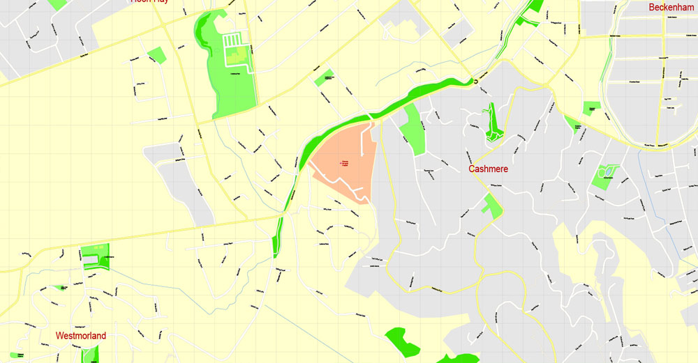
Cashmere
Westmorland
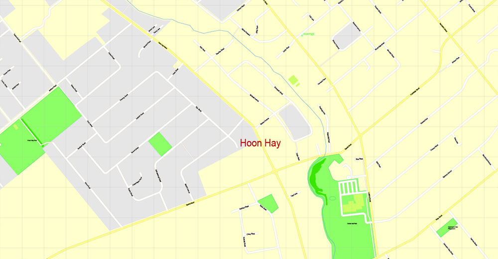
Hoon Hay
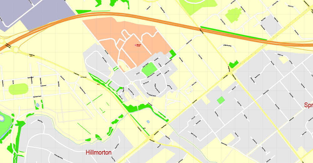
Hillmorton
Aidanfield
Halswell
Kennedys Bush
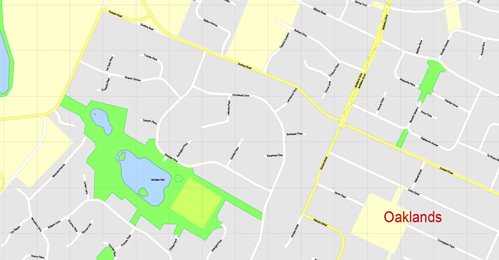
Oaklands
Westlake
Longhurst
Knight Stream Park
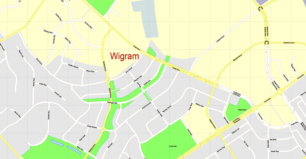
Wigram
Middleton
Sockburn
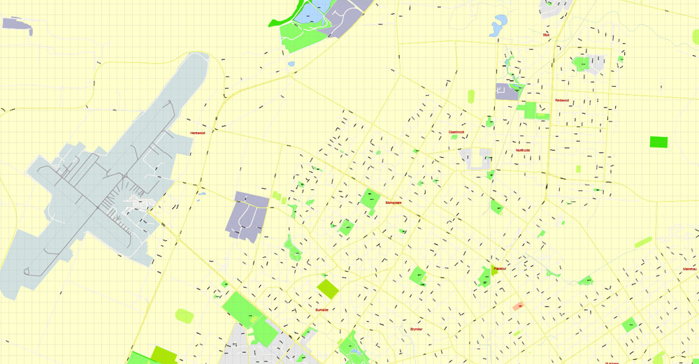
Hornby
Hei Hei
Broomfield
Islington
Yaldhurst
Russley
Hyde Park
Avonhead
Harewood
Bishopdale
Northcote
Casebrook
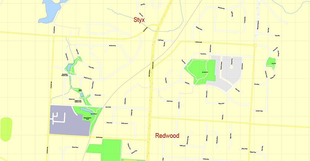
Redwood
Regents Park
Styx Mill
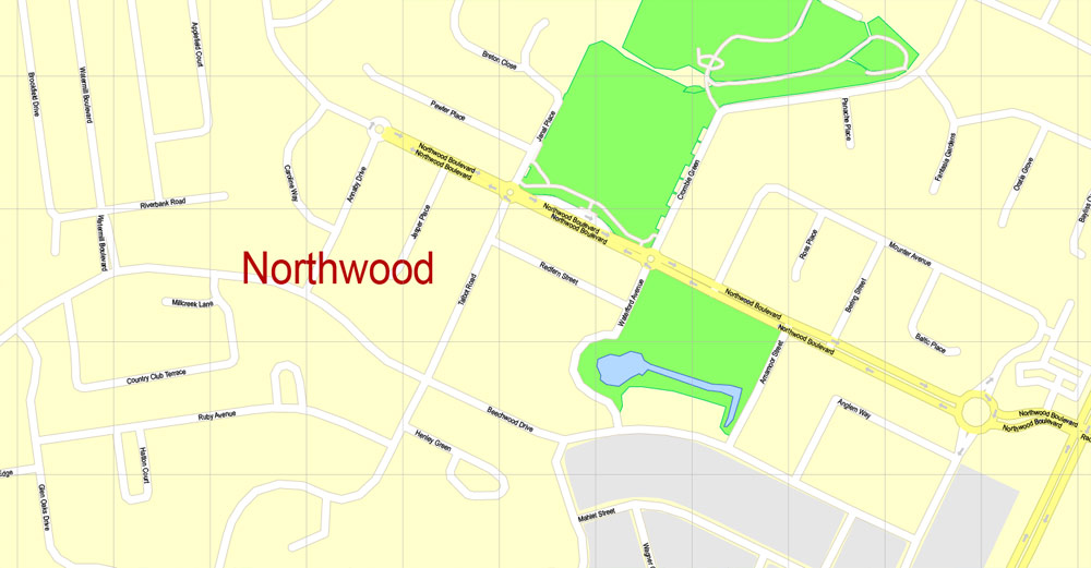
Northwood
Groynes Park
Belfast
Spencerville
Brooklands
https://en.wikipedia.org/wiki/Christchurch#Geography

 Author: Kirill Shrayber, Ph.D. FRGS
