Extended Description of the Vector Map
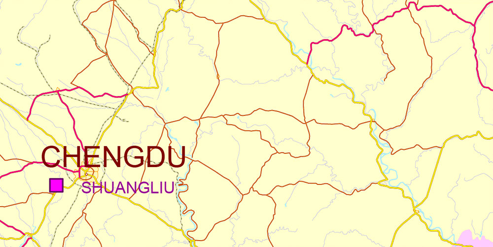
Printable Vector Map of Chengdu, Xi’An and Chonquing China (English names) detailed map + admin areas + cities, roads, railroads and water objects, editable Layered Adobe Illustrator, scalable, editable text/curves format of names, 2 Mb ZIP.
Fully editable map: Map for publishing, design, printing, publications, arts, projects, presentations, for architects, designers, and builders, business, logistics. The most exact and detailed map. GPS correct Mercator Projection.
For printing any format.
DWG, DXF, CDR, ESRI Shapes, and other formats – by request, the same price, please contact.
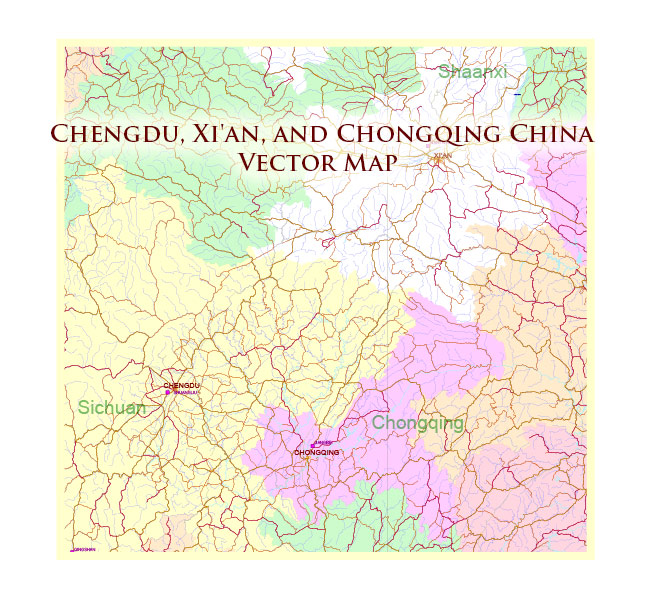
Chengdu, Xi’An and Chonquing China Vector Map Road and Railroad map + admin areas + Main cities, water objects editable Layered Adobe Illustrator (English)
AO BRIEF — Chengdu–Chongqing–Xi’an Triangle (China)
Overview
-
Area of focus: the development corridor linking Chengdu (Sichuan), Chongqing Municipality, and Xi’an (Shaanxi)—a major inland “west-of-China” macro-region with dense population, heavy industry + tech manufacturing, and top-tier rail/expressway connectivity.
-
Strategic shape: two basins (Sichuan Basin + the Chongqing river metropolis) connected northward through mountain “gates” toward the Guanzhong Plain (Xi’an). Control of the mountain passes and river/rail chokepoints defines mobility.
Terrain & Physical Geography
-
Chengdu / western basin edge: broad, low-relief alluvial plain (Chengdu Plain) at the western margin of the Sichuan Basin; rapid transition to foothills and highlands west/northwest (higher hazard + constrained corridors).
-
Chongqing: hilly, dissected terrain built around river confluences; steep slopes drive bridge/tunnel dependence and constrain large-footprint logistics sites to terraces/valleys.
-
Xi’an / Guanzhong Plain: flatter basin/valley setting north of the Qinling Mountains, forming a natural east–west movement shelf compared with the rugged south.
-
Primary water system: Chongqing is a key inland node on the Yangtze River system (river logistics + flood constraints).
Lines of Communication — Roads (Primary)
-
Basin mobility (Chengdu ↔ Chongqing): multiple parallel expressways + ring roads feeding dense satellite cities; redundancy is high but urban congestion can be decisive.
-
North–south spine (to Xi’an): expressways route through mountain/valley corridors (tunnels/bridges) — fewer truly equivalent alternatives than the map suggests; weather/landslides can localize single-route fragility.
-
Urban rings & radials: all three metros rely on multi-ring systems; last-mile throughput is usually limited by interchanges, river crossings (Chongqing), and urban construction churn.
Lines of Communication — Rail (Primary)
-
High-speed passenger backbone: strong HSR coverage linking the three cores; best for rapid personnel movement and time-sensitive light cargo.
-
Freight reality: heavy freight concentrates on legacy trunk lines + dedicated logistics parks on the flatter basin/river plain zones; mountain approaches create gradient, tunnel, and capacity pinchpoints.
Air, River, and Multimodal Transport
-
Air hubs (strategic reach):
-
Chengdu operates a dual-airport system; **Chengdu Tianfu International Airport opened June 27, 2021 and is one of the key western aviation nodes.
-
Chongqing’s main airport is a major inland gateway for central/west China flows.
-
Xi’an’s airport supports the Guanzhong corridor and northwest links.
-
River logistics (Chongqing advantage): as an inland “port metropolis” on the Yangtze system, Chongqing can shift bulk cargo between barge and rail/road; bridges, quays, and flood stages matter operationally.
Human Terrain — Demography & Settlement Pattern
Economy & Key Nodes
-
Chengdu: electronics/IT, aerospace, R&D and services; strong consumer economy and logistics distribution for the basin.
-
Chongqing: heavy industry + autos, river/rail logistics, manufacturing supply chains; acts as inland gateway for bulk flows.
-
Xi’an: aerospace/defense-adjacent industry, research universities, advanced manufacturing; major inland rail/air connector for northwest corridors.
Hazards & Operating Constraints
-
Seismic risk: western Sichuan basin edge is quake-prone; secondary risks include landslides and infrastructure disruption along mountain approaches.
-
Hydromet: Yangtze tributary flood cycles affect Chongqing riverfront logistics; fog/haze can degrade aviation regularity seasonally.
-
Terrain friction: Chongqing topography amplifies chokepoint sensitivity (bridge closures, tunnel incidents); north–south corridors toward Xi’an are more “few-good-routes” than “many-equal-routes.”
Command Takeaways
-
Mobility is easy inside basins, harder between them. The basin-to-plain linkage (toward Xi’an) is the strategic seam—passes, tunnels, and river crossings define tempo.
-
Chongqing is the multimodal pivot (river + rail + road), but it’s also the most chokepoint-sensitive at the urban scale.
-
Chengdu offers the cleanest logistics geometry (flat expansion space) and redundant access, while Xi’an anchors the northern shelf with strong rail-centric reach across the northwest.
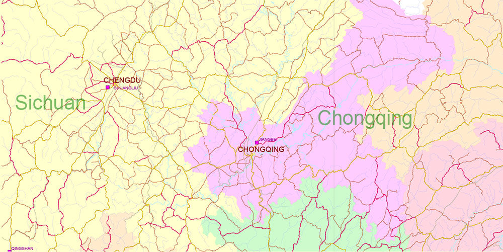
Chengdu, Xi’An and Chonquing China Vector Map Road and Railroad map + admin areas + Main cities, water objects editable Layered Adobe Illustrator (English)
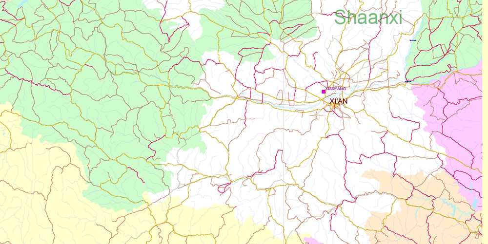
Chengdu, Xi’An and Chonquing China Vector Map Road and Railroad map + admin areas + Main cities, water objects editable Layered Adobe Illustrator (English)
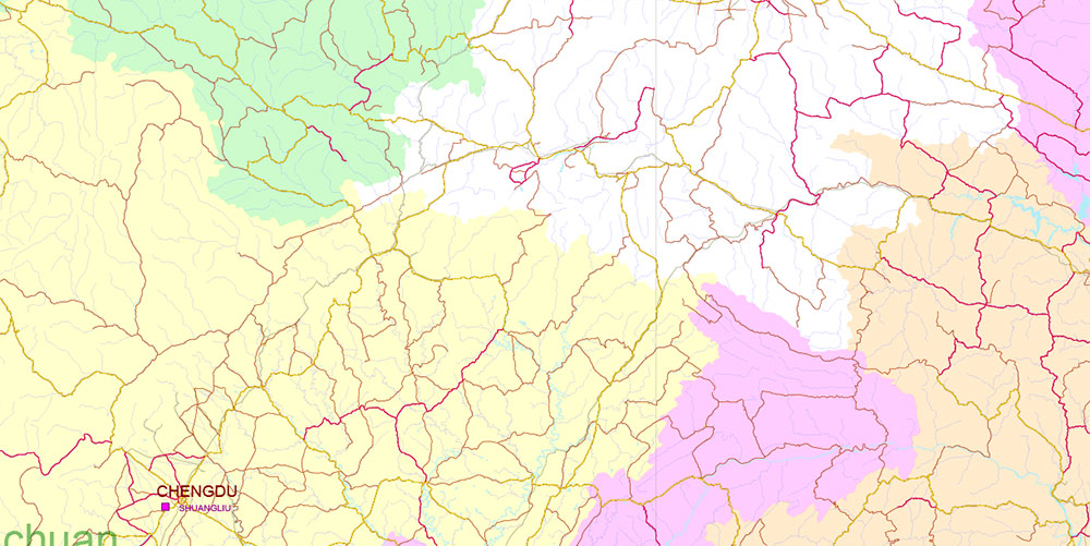
Chengdu, Xi’An and Chonquing China Vector Map Road and Railroad map + admin areas + Main cities, water objects editable Layered Adobe Illustrator (English)
Chengdu, Xi’An and Chonquing China Vector Map Road and Railroad map + admin areas + Main cities, water objects editable Layered Adobe Illustrator (English)

 Author: Kirill Shrayber, Ph.D. FRGS
")