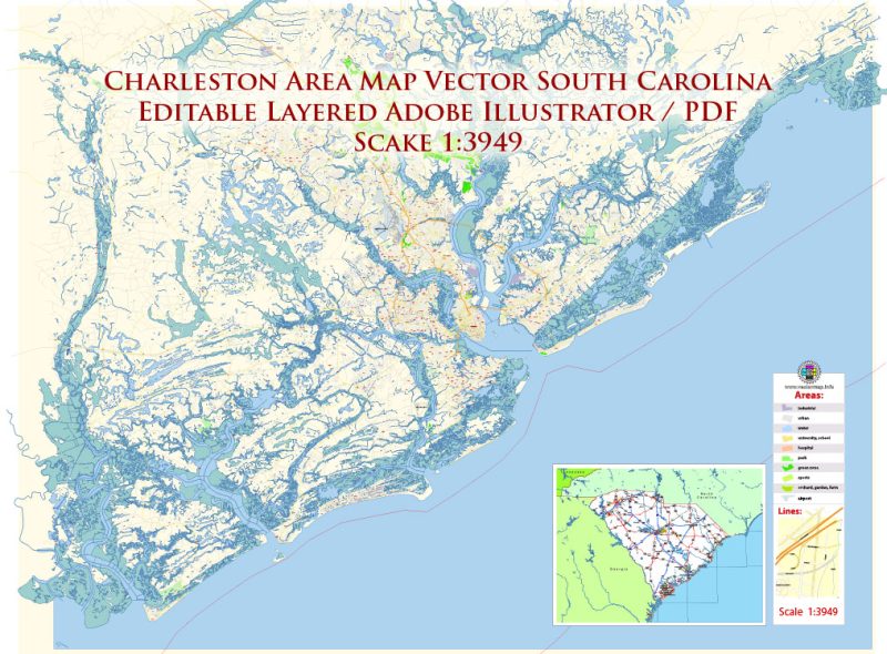
Printable PDF Vector Map of Charleston South Carolina US detailed City Plan scale 1:3949 full editable Adobe PDF Street Map in layers, scalable, text format all names, 114 MB ZIP
All street names, Main Objects, Buildings. Map for design, printing, arts, projects, presentations, for architects, designers, and builders, business, logistics.
Included: Simple Vector Map South Carolina
Map covered area:
Layers list:
- Legend
- Grids
- Labels of roads
- Names of places (city, hamlet, etc.)
- Names of objects (hospitals, schools, parks, water)
- Names of Main streets
- Names of Civil Streets
- Objects (icons)
- Arrows of streets
- Main Streets, roads, railroads, lines
- Civil streets
- Buildings
- Airports and heliports
- Water objects (rivers, lakes, ponds)
- Water 2 (swamps)
- Waterways
- Color fills (parks, hospital areas, school areas, etc.)
- Back and Sea
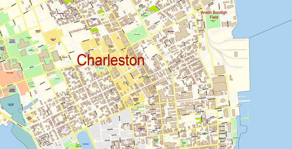
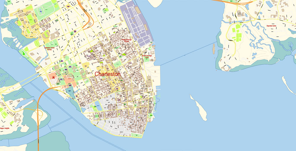
Charleston South Carolina US PDF Map Vector Exact City Plan High Detailed Street Map editable Adobe PDF in layers
The most exact and detailed map of the city in scale.
ALSO: If you need – we can add the ZIPcodes areas with numbers addon layer for this map. Free)))
ALSO: DWG, DXF, CDR and other formats: free convert for our customers.
For Editing and High-Quality Printing
Charleston is a typical city of the south of the USA; probably even the most typical: the way all southern cities were a century and a half ago. In the center it is a maze of streets, and almost every house is known when it was built and to whom it belonged — and it usually belonged to planters or shipowners, and in the courtyard of almost every house, there were rooms where slaves lived. Slavery was abolished a long time ago, blacks were formally equalized in rights with whites, black and white culture left a worthy mark in history, but Charleston tells us what history was here and how completely different things were combined in the same place — on the one hand, lively commercial and industrial development and outstanding cultural achievements, on the other — slave revolts and the complete defeat of blacks in rights. And monuments to the soldiers of the Civil War — on the part of the Southerners, of course — still stand in the center of Charleston, showing us that this page of history is not closed here. However, it is quite enough for a traveler to look around because it is much easier in Charleston than anywhere else to imagine how a rich American city lived two hundred years ago.

South Carolina, together with North Carolina, forms an area historically known as the “Carolinas”. Both were originally part of a single British colony called Carolina before they were divided into two separate states. Although having a smaller population than in North Carolina, South Carolina boasts a rich historical heritage. This is especially evident in Charleston, which was an important port in the colonial and post-colonial eras of the United States, as well as the site of the outbreak of the Civil War.
Although the famous “southern accent” here serves as proof of local affiliation, if you listen closely, you can hear a lot of regional variations in it – from the drawling pronunciation that came from coastal counties to the more chopped speech of the northern part of the state.
South Carolina can be quite hot and humid in summer, and therefore its coastal areas attract many tourists at this time. Winter is quite warm on the coast, although there is snow in the northern part of the state.
South Carolina is an integral part of the American “Bible Belt”, and religious zeal is much more noticeable than in other regions, such as California. In addition, South Carolina is a historically conservative state. For example, alcohol can only be purchased at ABC state stores, which are closed on Sundays. People here, as a rule, are kind and open.
Due to the popularity of South Carolina as a tourist and retirement destination, there are a large number of people who are seasonal residents or visitors from other parts of the country (especially from the northeast) and from Canada. This situation is more typical for coastal areas such as Myrtle Beach.
History
Founded in 1670, Charleston is the oldest city in South Carolina, and its age is quite decent in the USA. The original name of the city was Charlestown (Charles Town), after the English King Charles II, who authorized the construction, and was later simplified to Charleston. The city was the capital of the English province of Carolina, and it was from here that the colonization of the lands that now make up the south of the United States began. Since Charlestown was at sea, it was regularly attacked by the French, Spaniards and pirates, to which were added attacks by Indians from the mainland. So, in 1718, pirates under the command of Edward Teach aka Blackbeard besieged the city for a week, robbed the ships standing in the port and captured the crews and passengers, and then exchanged them for ransom and lifted the siege. Nevertheless, by the middle of the XVIII century, everything was back to normal, and Charlestown became the richest city and the most important port of the southern states. Its economy was mainly based on the cultivation of cotton and rice by black slaves on the plantations of South Carolina (which became a separate colony in 1712). In 1736, the first theater building in the English colonies of North America was built here, in 1773 – the first building of a public museum. In 1774, South Carolina declared its independence from Britain, for which Charlestown was attacked three times by the British army and navy. For the third time, in April 1780, the British under the command of Henry Clinton besieged the city and, after a month of siege, took it. They restored the city fortifications, but in 1782, after the final defeat in North America, they withdrew their troops. In 1783, the city was officially renamed Charleston. In 1788, the capital of the state of South Carolina was moved from Charleston to Columbia – the formal reason for this was a fire in a building built as the state capitol (later it housed the court), but the real reason was that during the two years of British occupation, South Carolinians lost confidence in the administration sitting in Charleston.
After the independence of the United States, there were more plantations, and, accordingly, the black population of Charleston increased. In 1822, a resident of Denmark Vesey was arrested and accused of preparing a slave uprising. After the trial, Vesey and several dozen of his followers were hanged, and the rights of blacks, both free and slaves, were significantly restricted. During the American Civil War, South Carolina sided with the Southerners, and quite important events took place here — for example, on December 24, 1860, South Carolina was the first among the southern states to declare its withdrawal from the United States, and on January 9, 1861, the fighting of the entire Civil War began in the port of Charleston, when the steamer “Star of the West” standing in the port and belonging to the Northerners was fired. On February 17, 1864, the first submarine attack in history took place here (the submarine of the Southerners “H. L. Hunley” sank the sloop of the Northerners “USS Housatonic”). Nevertheless, it is well known how the war ended, and in 1865 the troops of the Northerners occupied Charleston. From that moment, the slow decline of the city began. Reconstruction after the war was slow, freed slaves lived in the city, but were subjected to the same discrimination, and no one was going to integrate them into white society. In 1866 there was a strong earthquake. Charleston was at its epicenter and was severely destroyed, 2,000 homes were damaged. Nevertheless, Charleston was restored, and in the 1920s it became, and still remains, one of the centers of tourism in the United States. In the 1970s, the center was put in order, which is now a remarkable example of a preserved and restored rich American city of the XIX century.
Due to the mixed nature of the population, Charleston had a huge impact on the development of music in the United States, especially in the first half of the 20th century. Two of the most famous musical works associated with the city are the Charleston dance, which originated here and popularized on Broadway in the early 1920s, as well as the opera Porgy and Bess, which takes place in Charleston. The author of the libretto, Dubose Hayward, who had previously written a novel with this title, was a resident of the city, and the author of the music, George Gershwin, specially came here to work on the project.
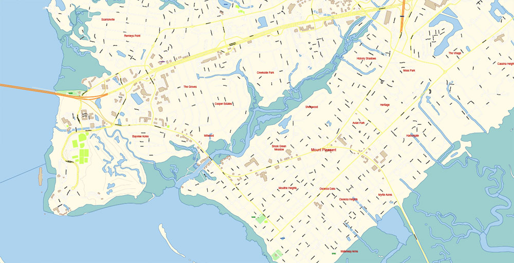
Gallery of Images “Urban plan Charleston South Carolina PDF”:
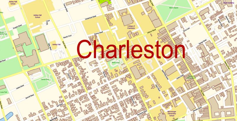
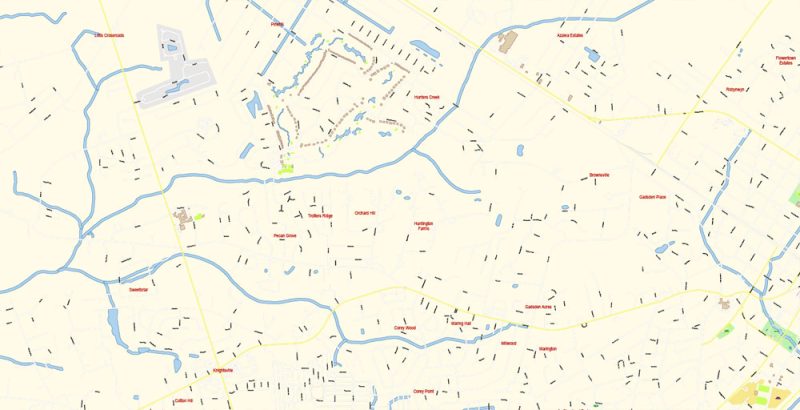
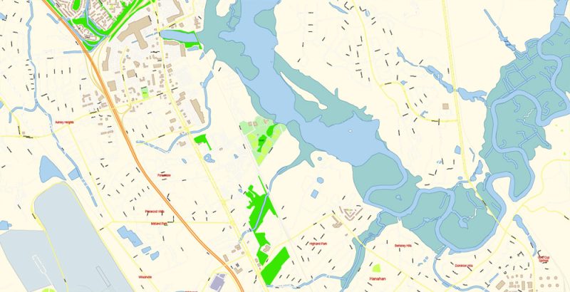
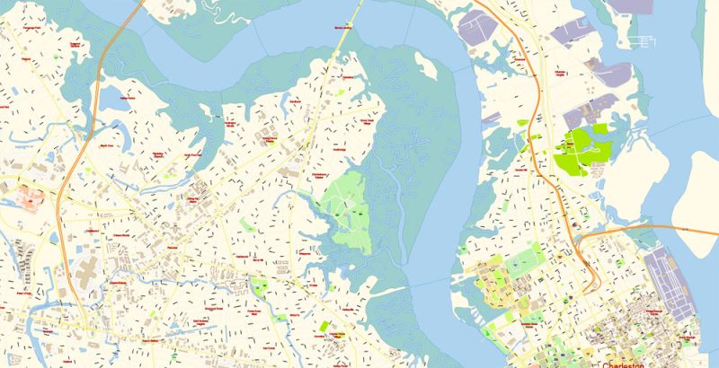
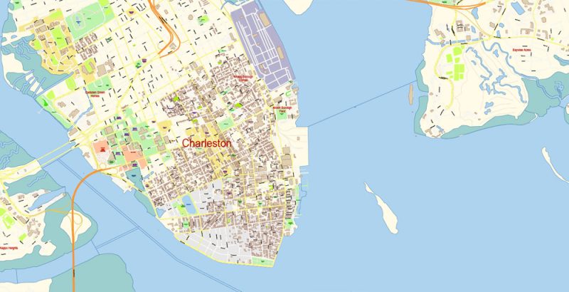
Charleston South Carolina US PDF Map Vector Exact City Plan High Detailed Street Map editable Adobe PDF in layers
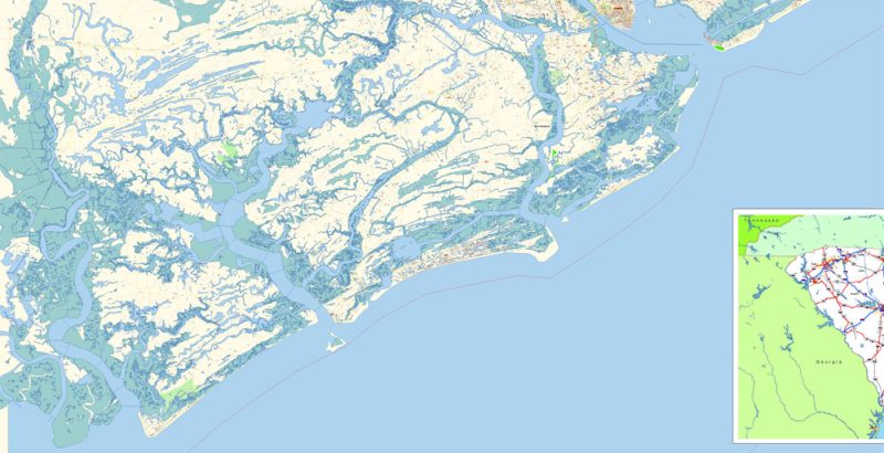
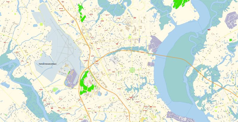
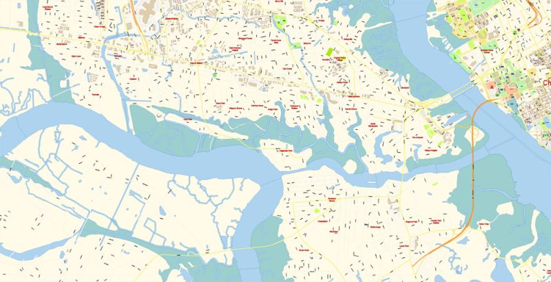
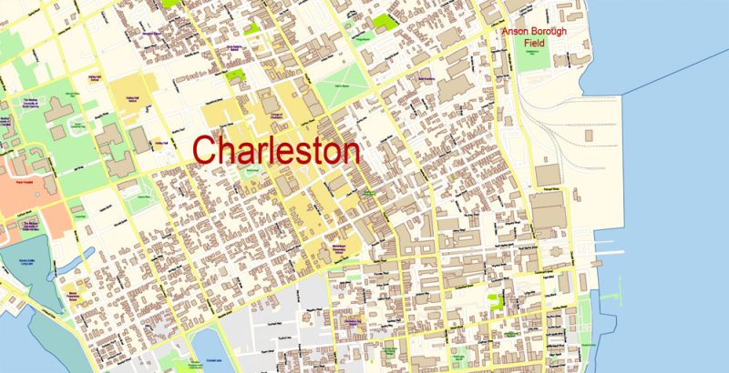
Charleston South Carolina US PDF Map Vector Exact City Plan High Detailed Street Map editable Adobe PDF in layers
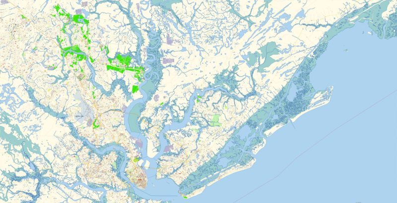
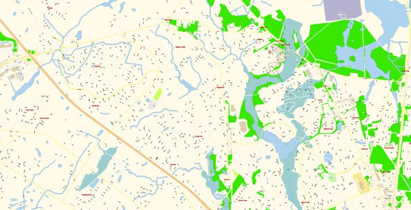
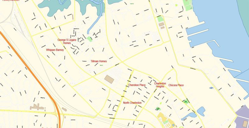
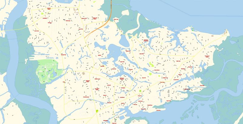
Charleston South Carolina US PDF Map Vector Exact City Plan High Detailed Street Map editable Adobe PDF in layers
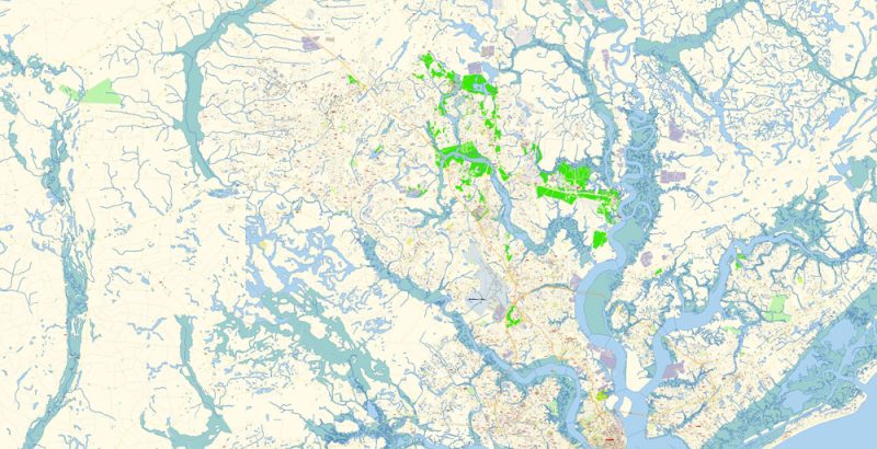
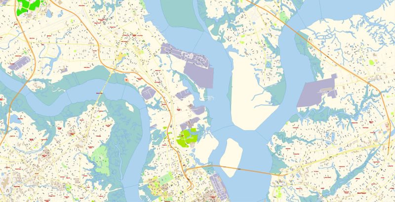
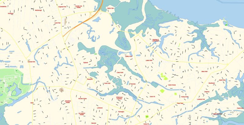
Charleston South Carolina US PDF Map Vector Exact City Plan High Detailed Street Map editable Adobe PDF in layers
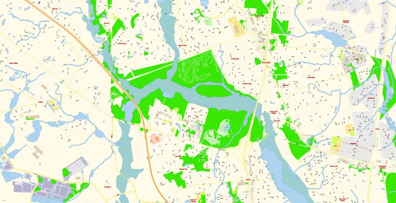
Charleston South Carolina US PDF Map Vector Exact City Plan High Detailed Street Map editable Adobe PDF in layers
Charleston South Carolina US PDF Map Vector Exact City Plan High Detailed Street Map editable Adobe PDF in layers
Charleston South Carolina US PDF Map Vector Exact City Plan High Detailed Street Map editable Adobe PDF in layers
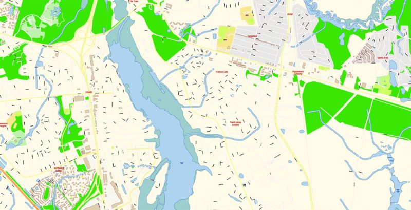
Charleston South Carolina US PDF Map Vector Exact City Plan High Detailed Street Map editable Adobe PDF in layers
Charleston South Carolina US PDF Map Vector Exact City Plan High Detailed Street Map editable Adobe PDF in layers
Charleston South Carolina US PDF Map Vector Exact City Plan High Detailed Street Map editable Adobe PDF in layers
Charleston South Carolina US PDF Map Vector Exact City Plan High Detailed Street Map editable Adobe PDF in layers
Charleston South Carolina US PDF Map Vector Exact City Plan High Detailed Street Map editable Adobe PDF in layers
Charleston South Carolina US PDF Map Vector Exact City Plan High Detailed Street Map editable Adobe PDF in layers
Charleston South Carolina US PDF Map Vector Exact City Plan High Detailed Street Map editable Adobe PDF in layers
Charleston South Carolina US PDF Map Vector Exact City Plan High Detailed Street Map editable Adobe PDF in layers
Charleston South Carolina US PDF Map Vector Exact City Plan High Detailed Street Map editable Adobe PDF in layers

Charleston South Carolina US PDF Map Vector Exact City Plan High Detailed Street Map editable Adobe PDF in layers
Charleston South Carolina US PDF Map Vector Exact City Plan High Detailed Street Map editable Adobe PDF in layers
Charleston South Carolina US PDF Map Vector Exact City Plan High Detailed Street Map editable Adobe PDF in layers


 Author: Kirill Shrayber, Ph.D. FRGS

