Extended Description of the Vector Map
Printable PDF Vector Map Central African Republic high detailed road map + admin areas + cities and water objects editable Layered Adobe PDF, scalable, editable text format of all names, 202 Mb ZIP.
Layered exact editable map: Map for publishing, design, printing, publications, arts, projects, presentations, for architects, designers, and builders, business, logistics. The most exact and detailed map. GPS correct Mercator Projection.
For printing any format.
Please note: This country map is compiled from multiple, unrelated geodata sources. The state border line (according to the UN data) DOES NOT COINCIDE with the boundaries of the administrative territories of the country (according to the national geo-statistical bureau).
Please note: in the preview, ALL LAYERS are enabled and visible. Of course, you can easily turn off the layers you don’t need and the map will become much simpler.
DWG, DXF, CDR, ESRI Shapes, and other formats – by request, the same price, please contact.
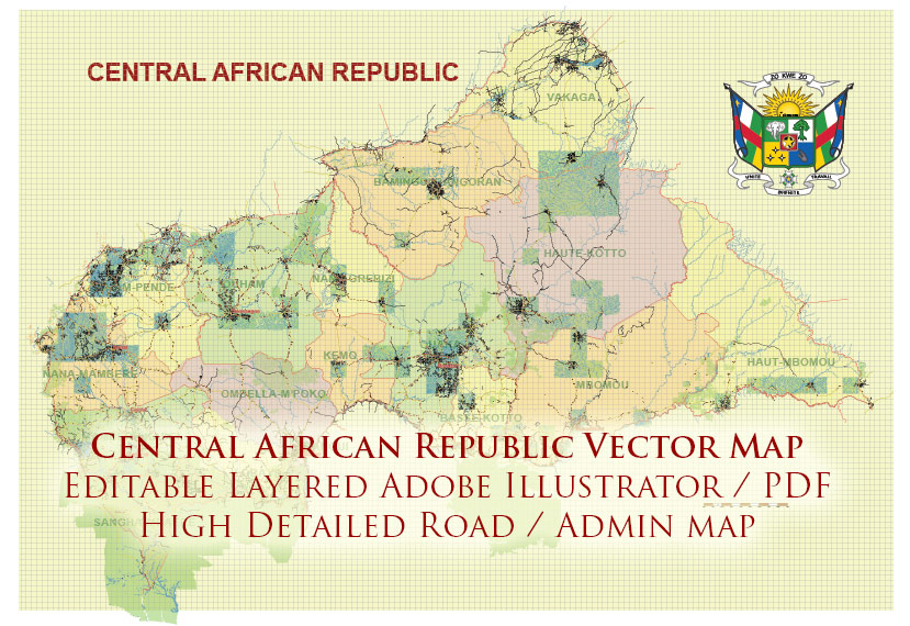
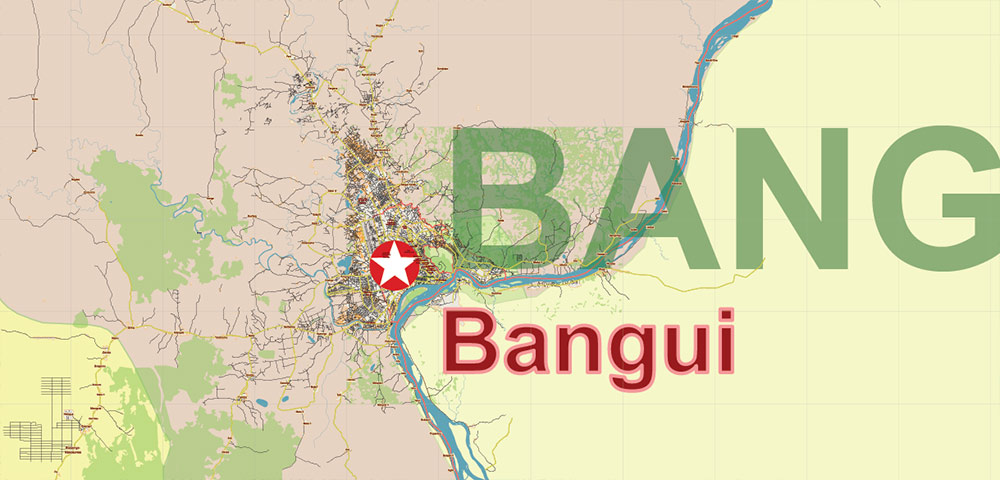
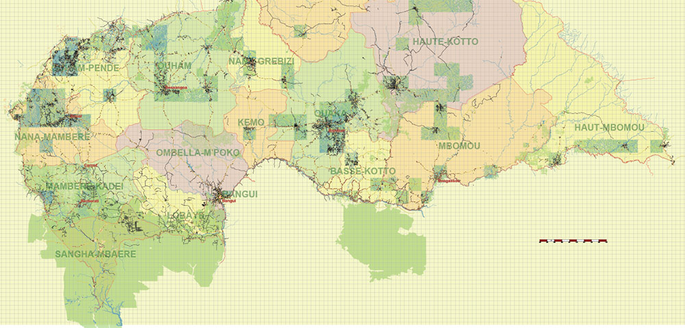
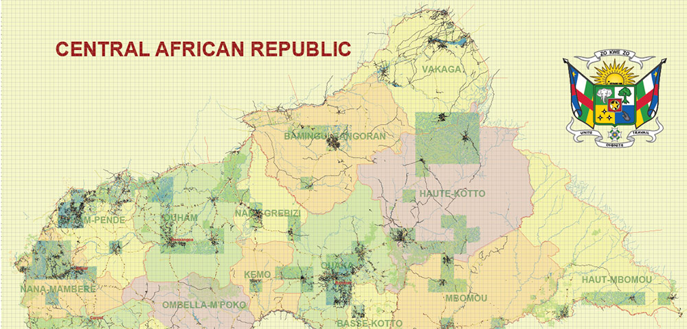
Central African Republic PDF Vector Map high detailed road map + admin areas + cities and water objects editable Layered Adobe PDF
Central African Republic: Geography Overview
The Central African Republic (CAR) is a landlocked country located in the heart of Africa. It shares borders with Chad to the north, Sudan to the northeast, South Sudan to the east, the Democratic Republic of the Congo and the Republic of the Congo to the south, and Cameroon to the west.
Area and Landscape
-
Total area: about 623,000 km² (240,000 sq mi).
-
The terrain is mostly savanna plains in the north and west, with dense tropical forests in the south.
-
The country also includes scattered plateaus and rolling hills, with the highest point being Mount Ngaoui (1,420 m / 4,659 ft) on the border with Cameroon.
Rivers and Water Systems
-
The Ubangi River and its tributaries form the main water system, flowing southward toward the Congo Basin.
-
To the north, rivers drain into the Chari River, part of the Lake Chad basin.
Climate
-
The climate is tropical, with a wet season (May–October) and a dry season (November–April).
-
Temperatures remain warm year-round, but rainfall is highest in the southern forested regions.
Natural Resources
The Central African Republic is rich in natural resources, including diamonds, gold, uranium, and timber, though much remains underdeveloped.
Separated layers:
- Legend / Scales
- Grids
- Names main cities
- Names Geopoints (all known places)
- Names Provinces
- Urban areas
- Main roads and streets
- Civil streets and roads
- Country / Provinces boundaries
- Waterways
- Water areas
- Provinces areas
- Land use areas
- Background
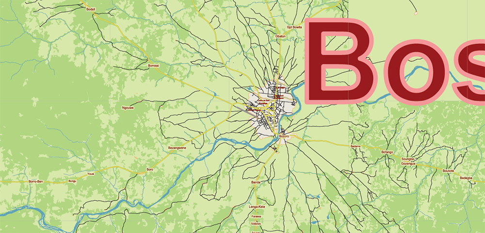
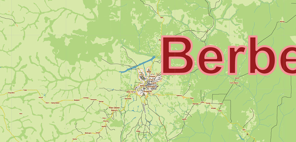
Central African Republic PDF Vector Map high detailed road map + admin areas + cities and water objects editable Layered Adobe PDF
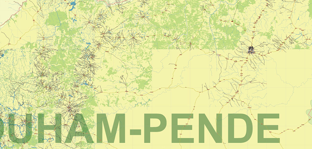
Central African Republic PDF Vector Map high detailed road map + admin areas + cities and water objects editable Layered Adobe PDF
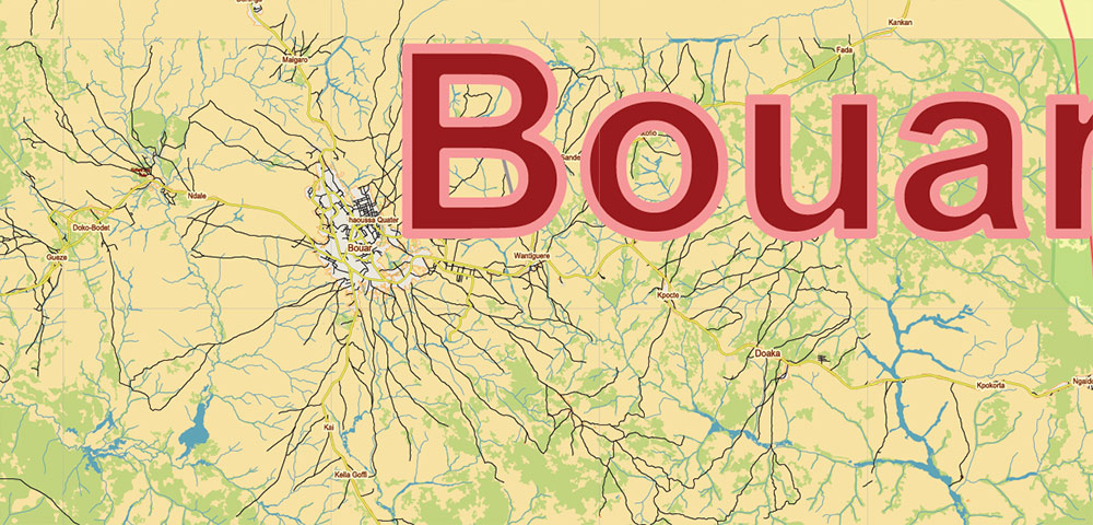
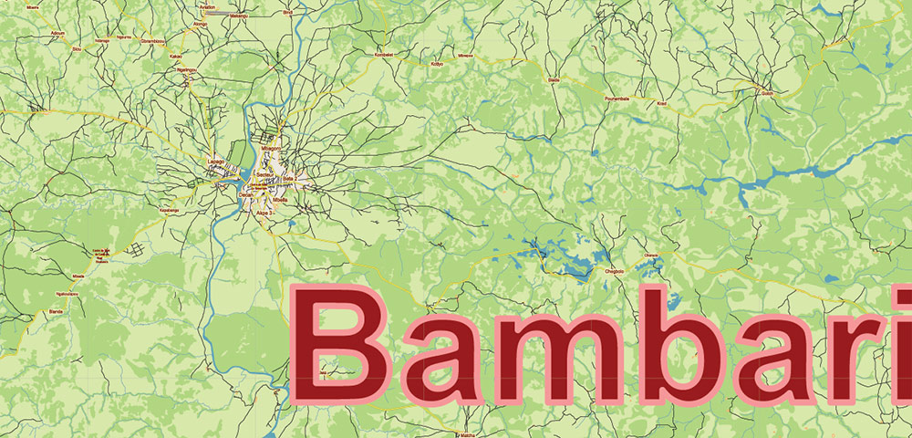
Central African Republic PDF Vector Map high detailed road map + admin areas + cities and water objects editable Layered Adobe PDF
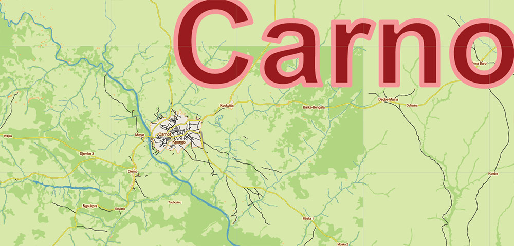
Central African Republic PDF Vector Map high detailed road map + admin areas + cities and water objects editable Layered Adobe PDF

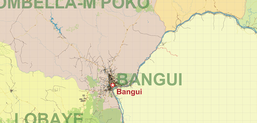
Central African Republic PDF Vector Map high detailed road map + admin areas + cities and water objects editable Layered Adobe PDF
Central African Republic PDF Vector Map high detailed road map + admin areas + cities and water objects editable Layered Adobe PDF
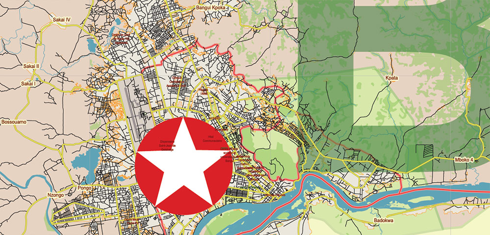
Central African Republic PDF Vector Map high detailed road map + admin areas + cities and water objects editable Layered Adobe PDF
Central African Republic PDF Vector Map high detailed road map + admin areas + cities and water objects editable Layered Adobe PDF
Central African Republic PDF Vector Map high detailed road map + admin areas + cities and water objects editable Layered Adobe PDF
Central African Republic PDF Vector Map high detailed road map + admin areas + cities and water objects editable Layered Adobe PDF
Central African Republic PDF Vector Map high detailed road map + admin areas + cities and water objects editable Layered Adobe PDF
Central African Republic PDF Vector Map high detailed road map + admin areas + cities and water objects editable Layered Adobe PDF

 Author: Kirill Shrayber, Ph.D. FRGS