Extended Description of the Vector Map
Printable Vector Map of Cape Coral + Fort Myers Florida US High Detailed City Plan scale 1:4200 fully editable Adobe Illustrator Street Map in layers, scalable, text/curves format all names, 54 MB ZIP
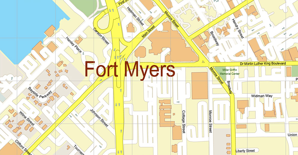
All street names, Main Objects, Buildings. Map for design, printing, arts, projects, presentations, for architects, designers, and builders, business, logistics.
Also: We can add (additional layer for this map), any other objects for you. It’s free for our customers.
If you need any OTHER format – DWG, DXF, Corel, or something else – please, email us
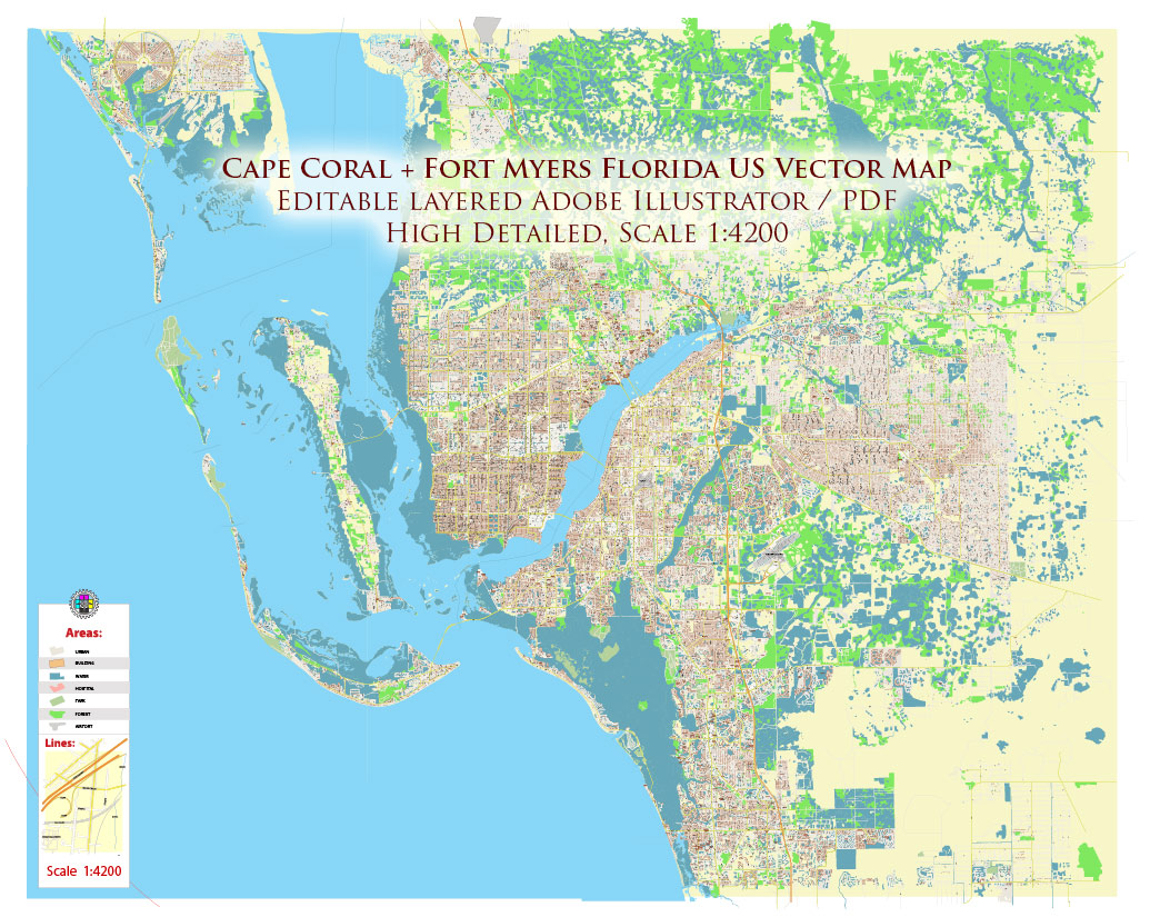
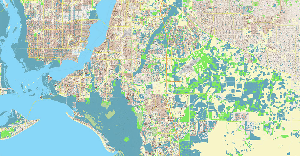
Cape Coral + Fort Myers Florida US Map Vector City Plan High Detailed Street Map editable Adobe Illustrator in layers
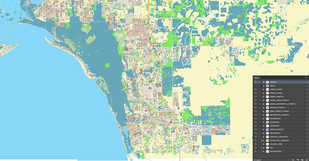
Layers list:
- Legend
- Grids
- Labels of roads
- Names of places (city, hamlet, etc.)
- Names of objects (hospitals, parks, water)
- Names of main streets
- Names of residential streets
- Arrows of street directions
- Main Streets, roads
- Residential streets
- Railroads
- Buildings
- Waterways
- Water objects (rivers, lakes, ponds, marshes)
- Airports, Heliports areas
- Color fills (parks, hospital areas, land use, etc.)
- Islands
- Background and sea
AO BRIEF — Fort Myers – Cape Coral corridor (Florida)
Overview
-
Twin-city urban area split by the Caloosahatchee River; core of SW Florida’s growth belt and a major retirement / second-home market.
-
Regional scale: Cape Coral–Fort Myers metro ~860,959 (2024 est.).
Geography & terrain
-
Setting: Low-elevation coastal plain with extensive wetlands, mangroves, and estuaries; flood-prone zones near river and tidal canals.
-
Hydro: Cape Coral’s canal grid + river/estuaries create strong “water adjacency” and boating access; salt/freshwater canal separation in parts of Cape Coral.
-
Coastal access: Barrier-island beach systems to the west, notably Sanibel Island and Captiva, plus the Estero Bay back-barrier environment.
-
Climate: Subtropical; pronounced wet season (summer) and hurricane exposure (late summer–fall). Heat/humidity drive seasonal population swings.
Key roads & lines of movement
Primary regional spines
-
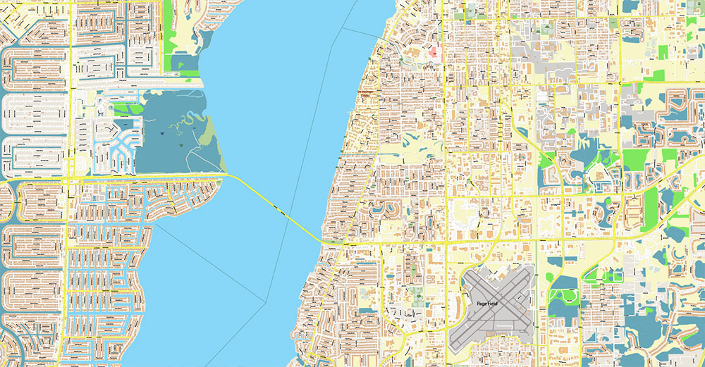
I-75 (N–S): Main strategic artery linking Tampa Bay ↔ Naples/Miami; key interchanges feed Fort Myers/airport and river crossings.
-
US-41 (Tamiami Trail): Parallel coastal spine; local commercial corridor and redundancy route.
East–west connectors (critical)
-
SR-82 (Daniels Pkwy / Dr. Martin Luther King Jr Blvd): Airport access + inland link toward Lehigh Acres and beyond.
-
SR-80 (Palm Beach Blvd): River corridor route connecting downtown Fort Myers ↔ eastern Lee County.
River crossings (high value chokepoints)
-
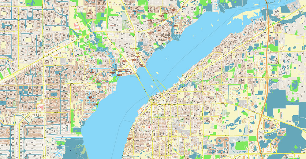
Midpoint Memorial Bridge (Colonial Blvd ↔ Veterans Pkwy): Major commuter bridge; ~1.25 miles shore-to-shore.
-
Cape Coral Bridge (College Pkwy / SR-884 corridor): South bridge; important for Fort Myers Beach/Sanibel approaches via local connectors.
-
Caloosahatchee Bridge (US-41): North crossing; ties historic Fort Myers core to North Fort Myers.
Districts & human terrain (practical map segmentation)
Fort Myers side
-
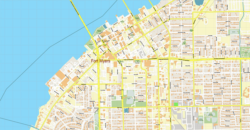
Downtown / River District: Civic core, events, waterfront, higher pedestrian density, congestion-prone at peaks.
-
Edison Park / McGregor Blvd corridor: Older residential + heritage/tourism nodes.
-
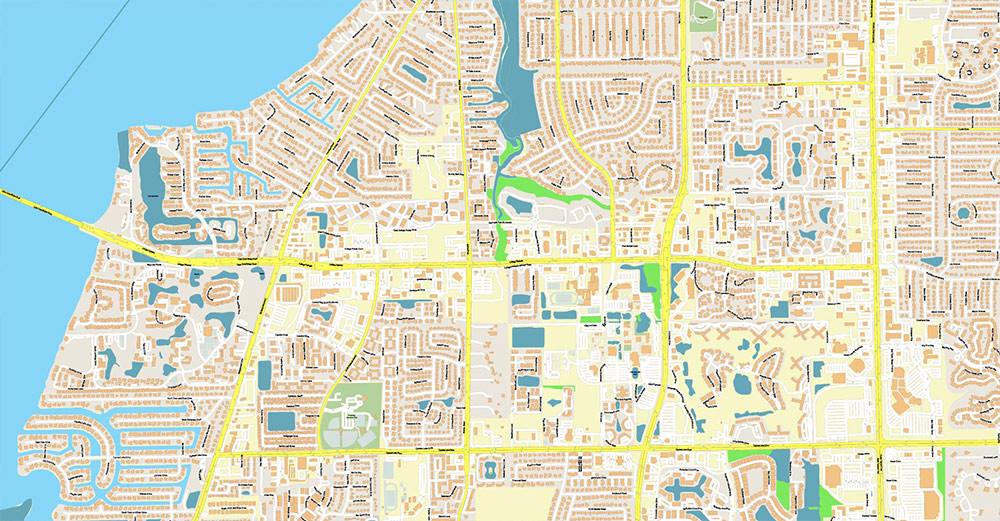
South Fort Myers / Gateway: Newer subdivisions, logistics/light industrial pockets, highway access.
-
Fort Myers Beach approach corridors: Seasonal traffic surges; evacuation sensitivity.
Cape Coral side
-
SE Cape (near bridges): Highest cross-river commuter integration; retail strips and arterials.
-
Southwest Cape / Gulf access canals: Higher-value waterfront residential; boating emphasis; limited arterial redundancy in places.
-
North Cape / Pine Island Rd axis: Growth front; big-box commercial and newer housing tracts.
-
Canal grid reality: Navigation is “arterials-to-neighborhood collectors” rather than continuous street mesh; route choice constrained by canal discontinuities.
Economy & key activity sectors
-
Tourism & coastal recreation: Beaches/islands, fishing/boating, winter-season visitor economy.
-
Real estate & construction: Strong driver (rapid in-migration + redevelopment cycles).
-
Healthcare: Major employment anchor (regional hospital networks and clinics).
-
Retail/services: Dispersed along US-41, Pine Island Rd, Del Prado Blvd, and bridge approaches.
-
Marine trades: Boat storage, marinas, repair yards—especially canal-adjacent zones.
Demography (operationally relevant)
-
Population scale (city-level):
-
Cape Coral ~233,025 (2024 est.).
-
Fort Myers ~99,918 (2024 est.).
-
Profile (typical): High share of retirees/seasonal residents + service workforce; strong intra-county commuting across bridges; multilingual pockets (Spanish/Haitian Creole present in SWFL generally).
-
Growth pattern: Subdivision expansion inland + infill/rebuild nearer the river/coast; infrastructure often lags peak-season demand.
Transport & access
-
Air: Southwest Florida International Airport (RSW) is the primary regional gateway; airport corridors strongly shape traffic (especially SR-82/Daniels Pkwy).
-
Transit: Limited coverage; car-dominant mobility; demand-responsive and senior-oriented services exist but don’t substitute for road capacity.
-
Ports/marinas: Numerous small facilities; the area is “many small access points” rather than one dominant seaport node.
Hazards & constraints (map + ops)
-
Hurricanes / storm surge: Bridge access, barrier islands, and low-lying canal neighborhoods become critical vulnerability zones; evacuation routing is a core planning layer.
-
Flooding & drainage: Intense rainfall events + tidal influence; watch underpasses/low crossings and canal-adjacent streets.
-
Seasonality: Winter peak population increases traffic, medical demand, and service load.
Command takeaways
-
Control/monitor I-75 nodes, SR-82 airport corridor, and the three river bridges—they define movement and response capacity.
-
Treat Cape Coral’s canal grid as compartmentalized neighborhoods with a few arterial “funnels.”
-
Build products/maps around bridge approaches + arterial hierarchies + evacuation layers (surge zones, shelters, contraflow concepts, critical facilities).
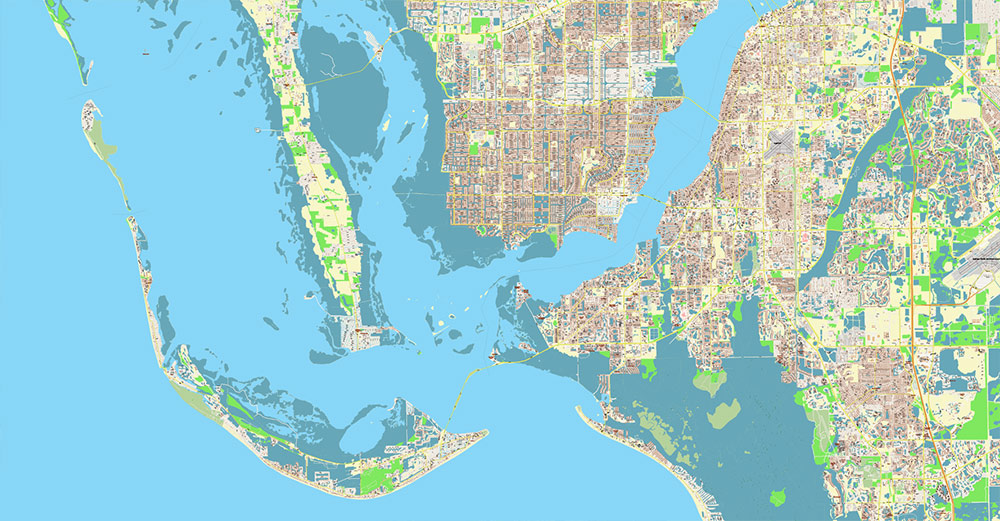
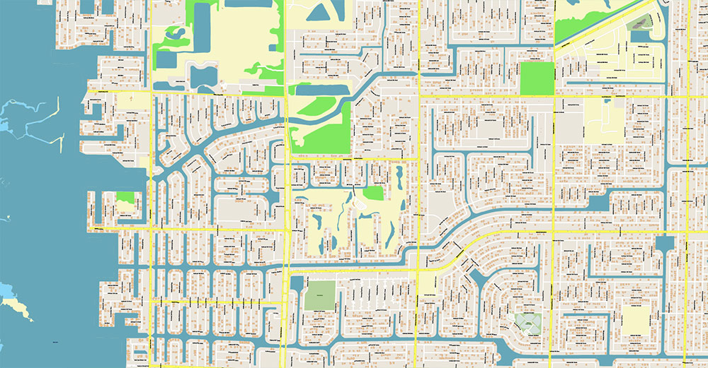
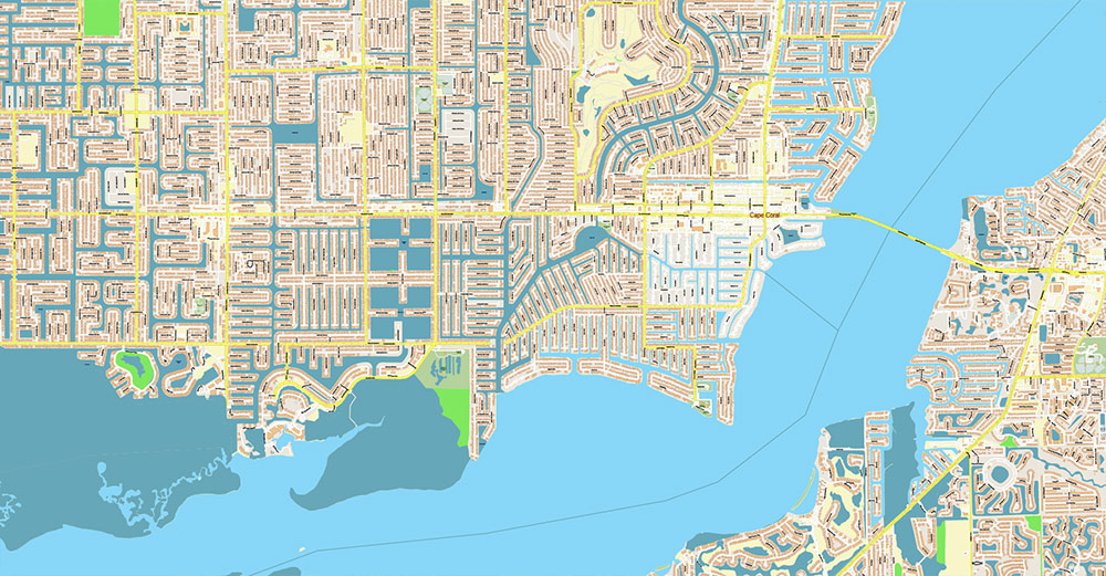
Cape Coral + Fort Myers Florida US Map Vector City Plan High Detailed Street Map editable Adobe Illustrator in layers
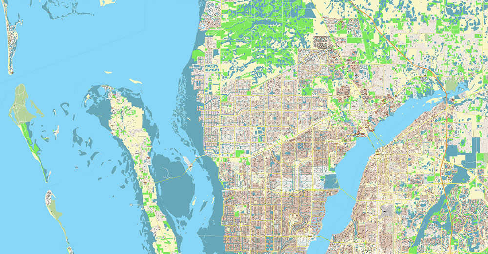
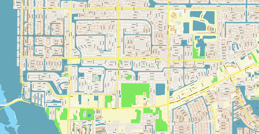
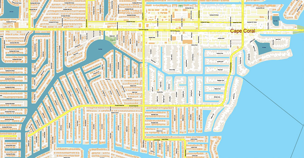
Cape Coral + Fort Myers Florida US Map Vector City Plan High Detailed Street Map editable Adobe Illustrator in layers
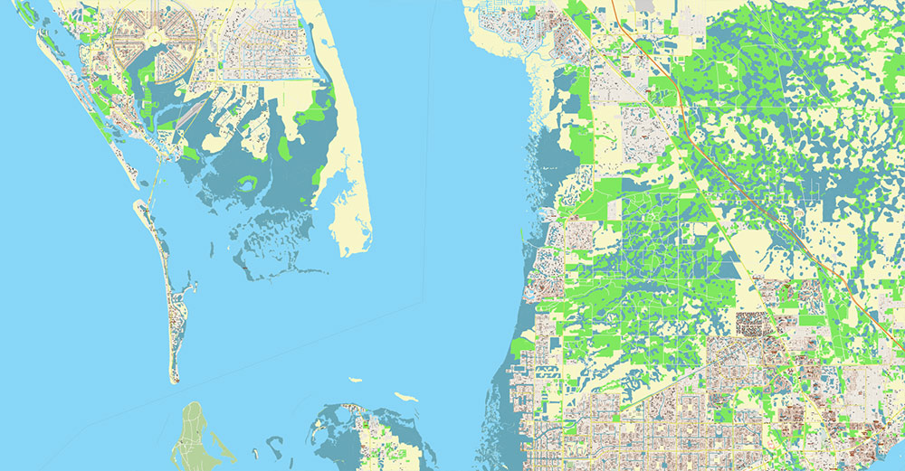
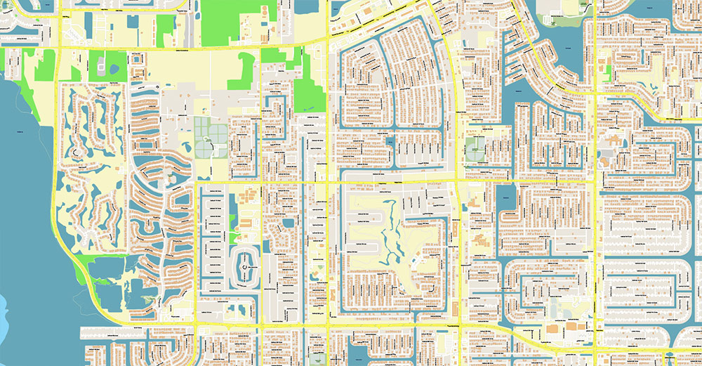
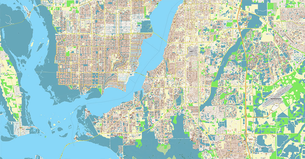
Cape Coral + Fort Myers Florida US Map Vector City Plan High Detailed Street Map editable Adobe Illustrator in layers
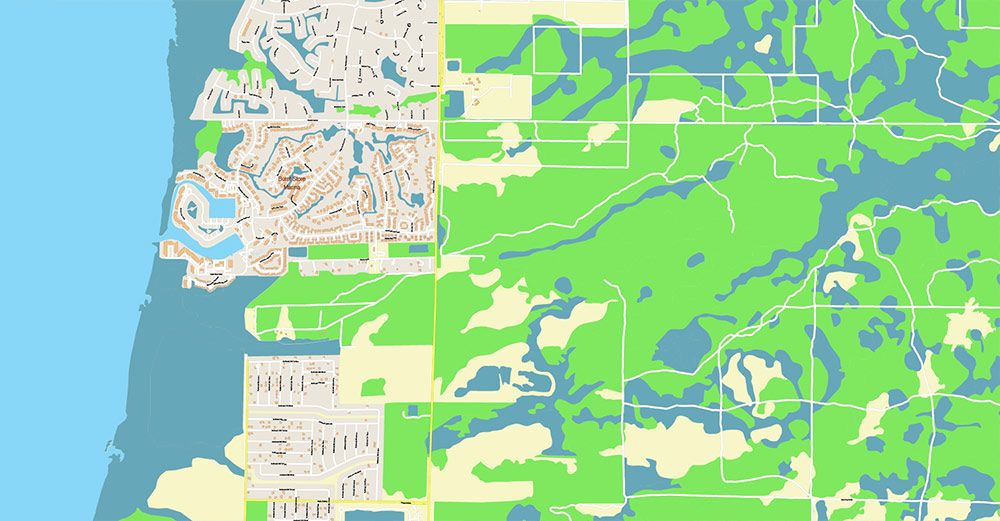
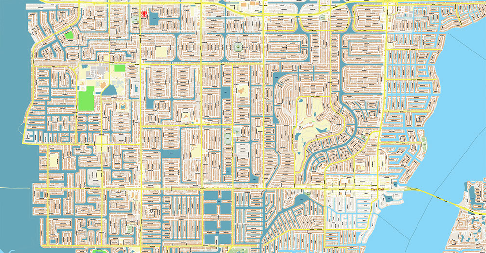
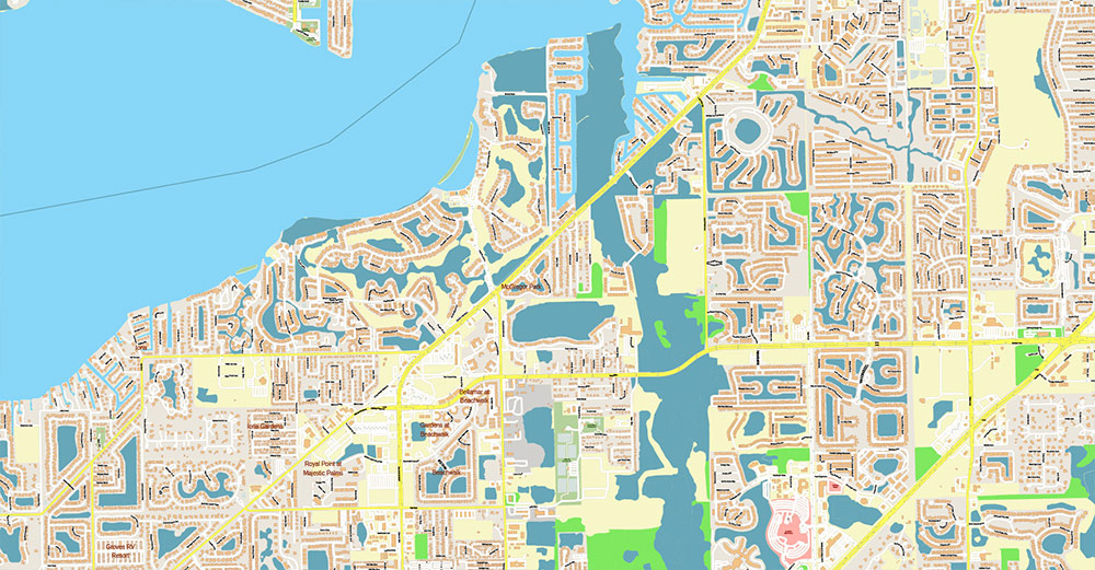
Cape Coral + Fort Myers Florida US Map Vector City Plan High Detailed Street Map editable Adobe Illustrator in layers
Cape Coral + Fort Myers Florida US Map Vector City Plan High Detailed Street Map editable Adobe Illustrator in layers
Cape Coral + Fort Myers Florida US Map Vector City Plan High Detailed Street Map editable Adobe Illustrator in layers
Cape Coral + Fort Myers Florida US Map Vector City Plan High Detailed Street Map editable Adobe Illustrator in layers
Cape Coral + Fort Myers Florida US Map Vector City Plan High Detailed Street Map editable Adobe Illustrator in layers
Cape Coral + Fort Myers Florida US Map Vector City Plan High Detailed Street Map editable Adobe Illustrator in layers
Cape Coral + Fort Myers Florida US Map Vector City Plan High Detailed Street Map editable Adobe Illustrator in layers
Cape Coral + Fort Myers Florida US Map Vector City Plan High Detailed Street Map editable Adobe Illustrator in layers
Cape Coral + Fort Myers Florida US Map Vector City Plan High Detailed Street Map editable Adobe Illustrator in layers
Cape Coral + Fort Myers Florida US Map Vector City Plan High Detailed Street Map editable Adobe Illustrator in layers
Cape Coral + Fort Myers Florida US Map Vector City Plan High Detailed Street Map editable Adobe Illustrator in layers
Cape Coral + Fort Myers Florida US Map Vector City Plan High Detailed Street Map editable Adobe Illustrator in layers
Cape Coral + Fort Myers Florida US Map Vector City Plan High Detailed Street Map editable Adobe Illustrator in layers
Cape Coral + Fort Myers Florida US Map Vector City Plan High Detailed Street Map editable Adobe Illustrator in layers
Cape Coral + Fort Myers Florida US Map Vector City Plan High Detailed Street Map editable Adobe Illustrator in layers
Cape Coral + Fort Myers Florida US Map Vector City Plan High Detailed Street Map editable Adobe Illustrator in layers

 Author: Kirill Shrayber, Ph.D. FRGS


