Extended Description of the Vector Map
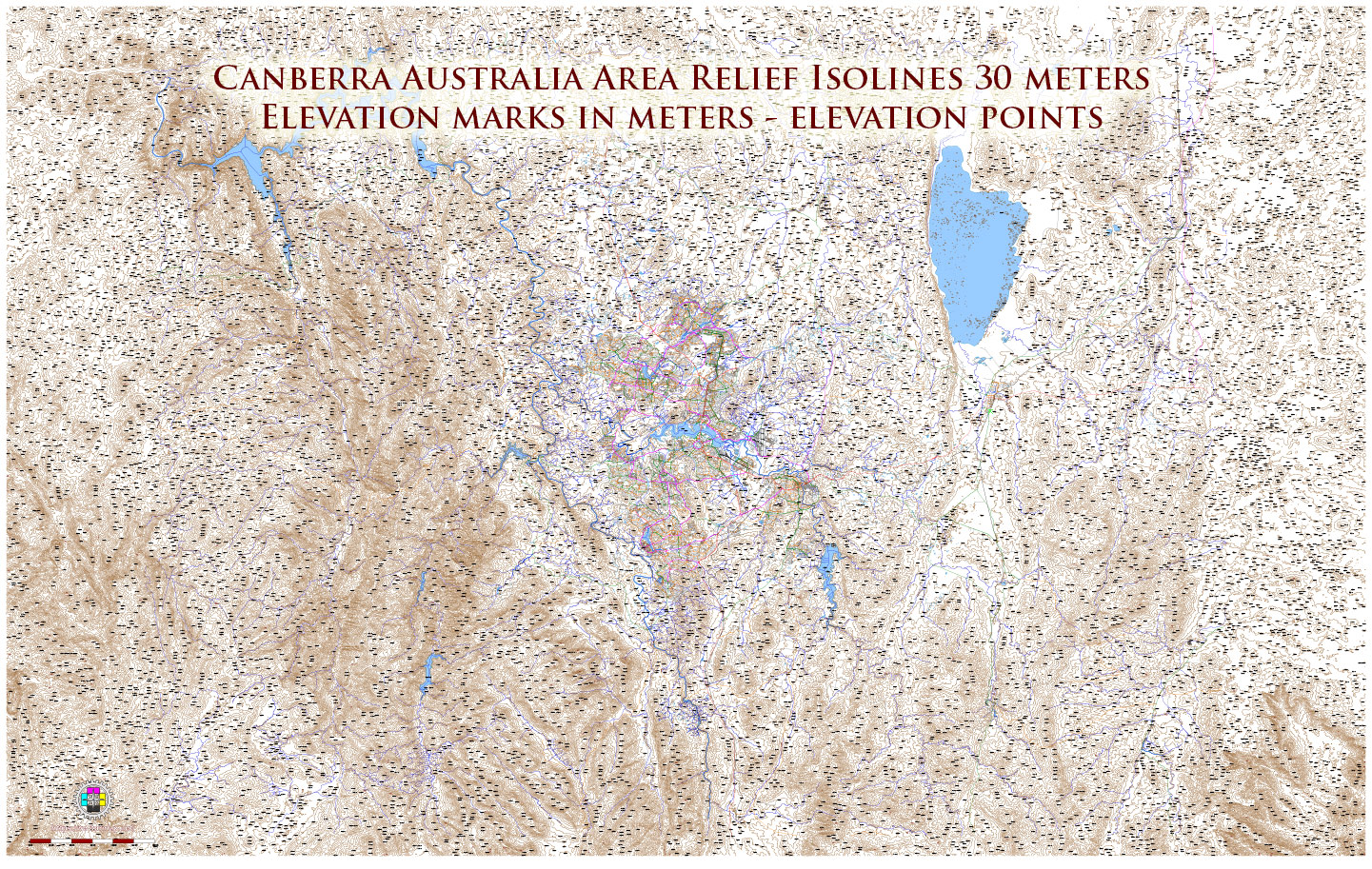
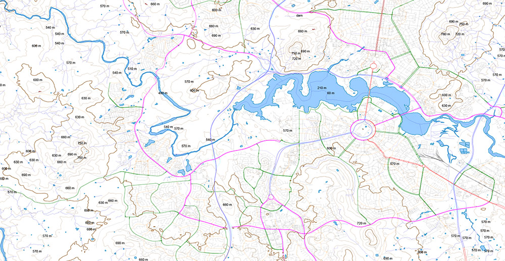
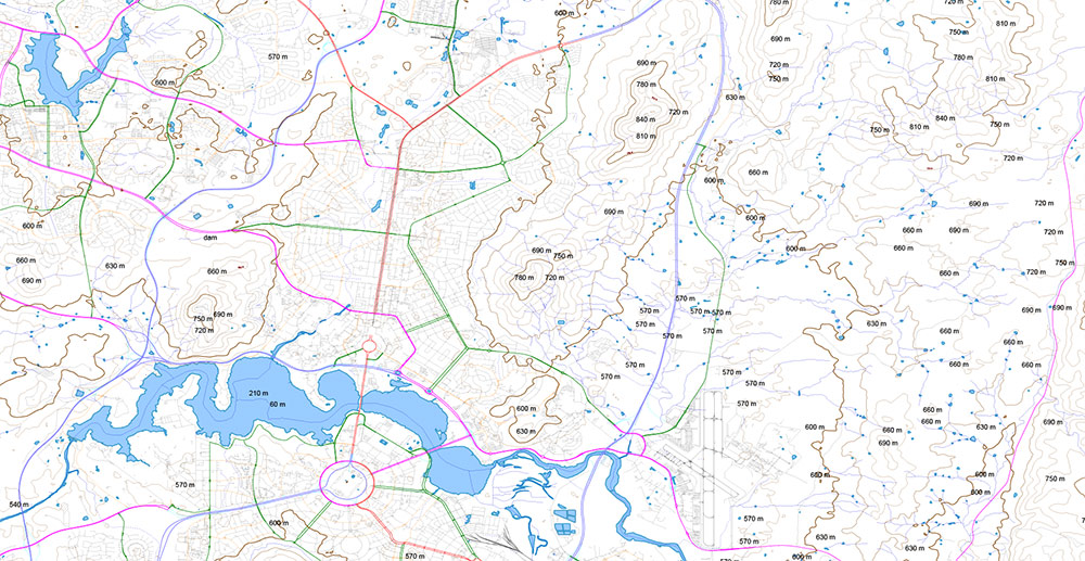
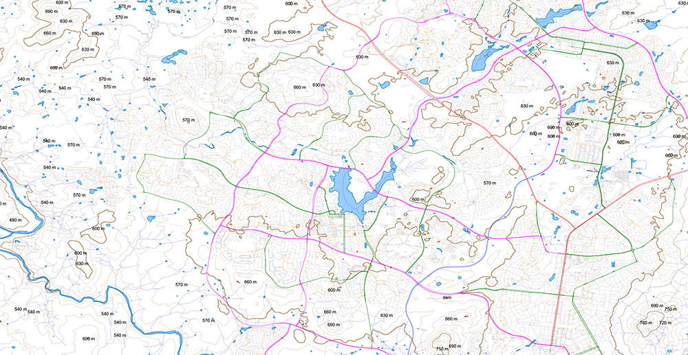
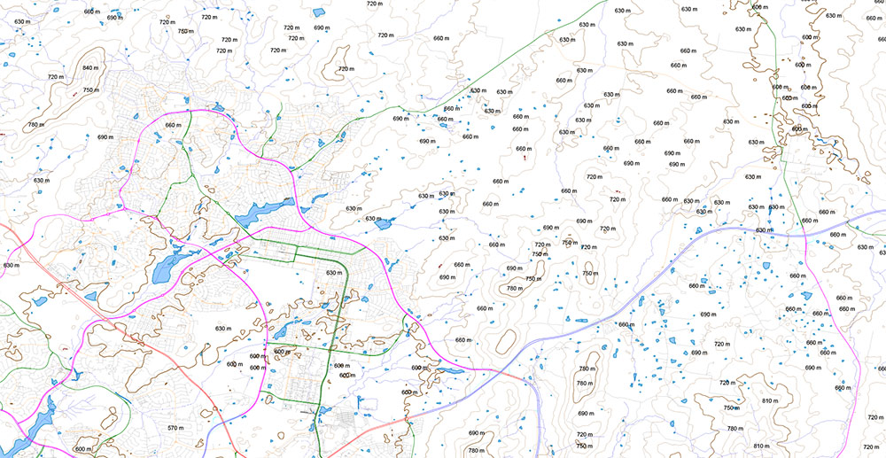
For Laser Cutting and 3-D modelling Vector Map of Canberra Region Australia Relief + Isolines 30 meters, detailed fully editable DWG + PDF + Adobe Illustrator in layers, scalable, text/curves format all names, 157 MB ZIP
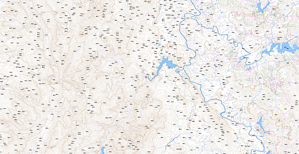
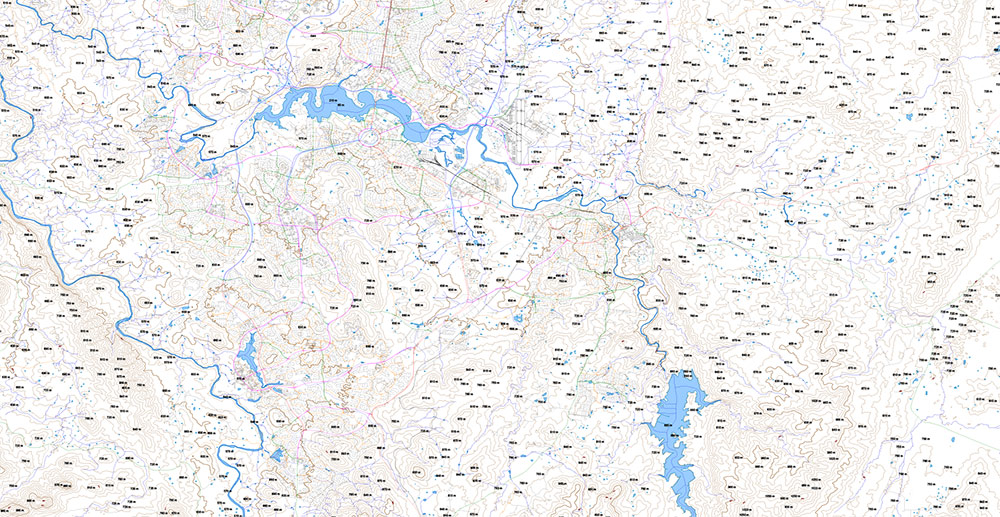
All streets and roads, Water objects, Height Relief Isolines 30 m, Elevation points in meters. Map for design, laser cutting, 3D printing, arts, projects, presentations, for architects, designers, and builders, business, logistics.
Also: We can add (additional layer for this map), any other objects for you. It’s free for our customers.
Canberra Region Australia Vector Relief Map for Laser Cutting editable DWG + PDF + Adobe Illustrator Street Map in layers in 1 archive
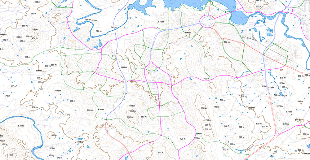
Layers list:
- Scale
- Main Streets, roads
- Residential streets
- Railroads
- Waterways
- Water objects areas (rivers, lakes, ponds)
- Airports and Heliports
- Relief Isolines 30 meters
- Elevation poins in meters – digits
- Background
Canberra Region Australia Vector Relief Map for Laser Cutting editable DWG + PDF + Adobe Illustrator Street Map in layers in 1 archive
Canberra Region Australia Vector Relief Map for Laser Cutting editable DWG + PDF + Adobe Illustrator Street Map in layers in 1 archive
Canberra Region Australia Vector Relief Map for Laser Cutting editable DWG + PDF + Adobe Illustrator Street Map in layers in 1 archive
Canberra Region Australia Vector Relief Map for Laser Cutting editable DWG + PDF + Adobe Illustrator Street Map in layers in 1 archive
Canberra Region Australia Vector Relief Map for Laser Cutting editable DWG + PDF + Adobe Illustrator Street Map in layers in 1 archive
Canberra Region Australia Vector Relief Map for Laser Cutting editable DWG + PDF + Adobe Illustrator Street Map in layers in 1 archive
Canberra Region Australia Vector Relief Map for Laser Cutting editable DWG + PDF + Adobe Illustrator Street Map in layers in 1 archive

 Author: Kirill Shrayber, Ph.D. FRGS
, full vector")
, full vector")