Extended Description of the Vector Map
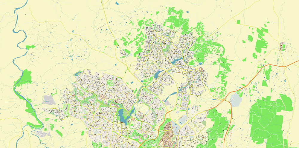
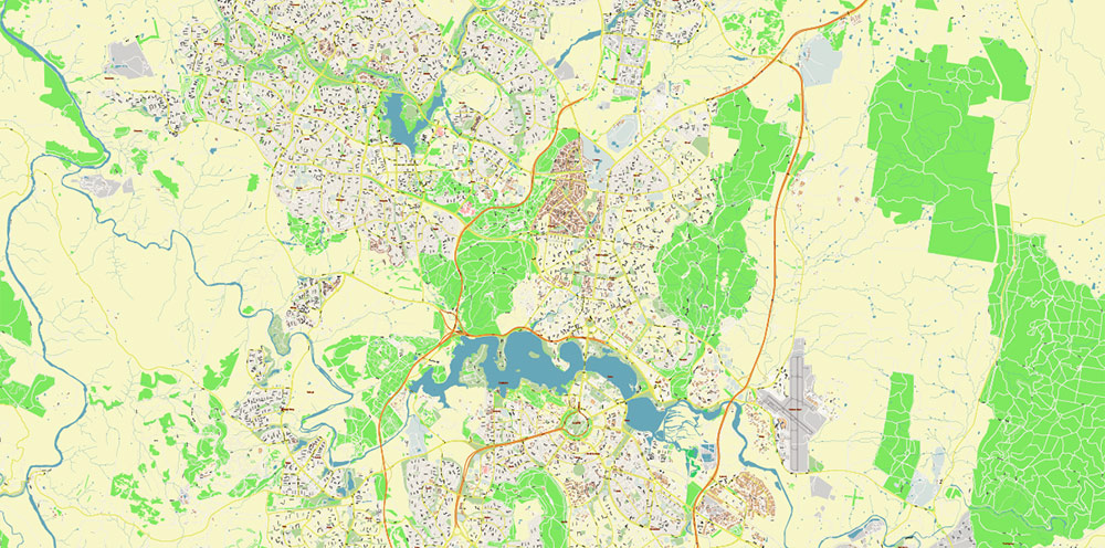
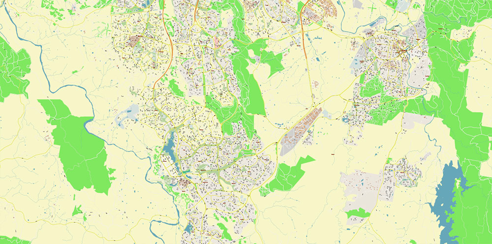
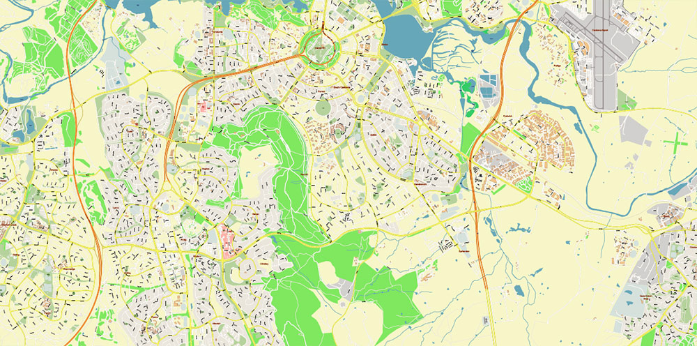
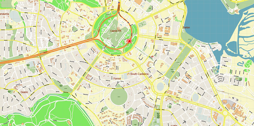
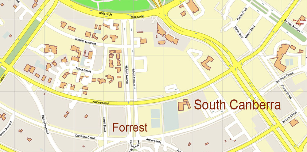
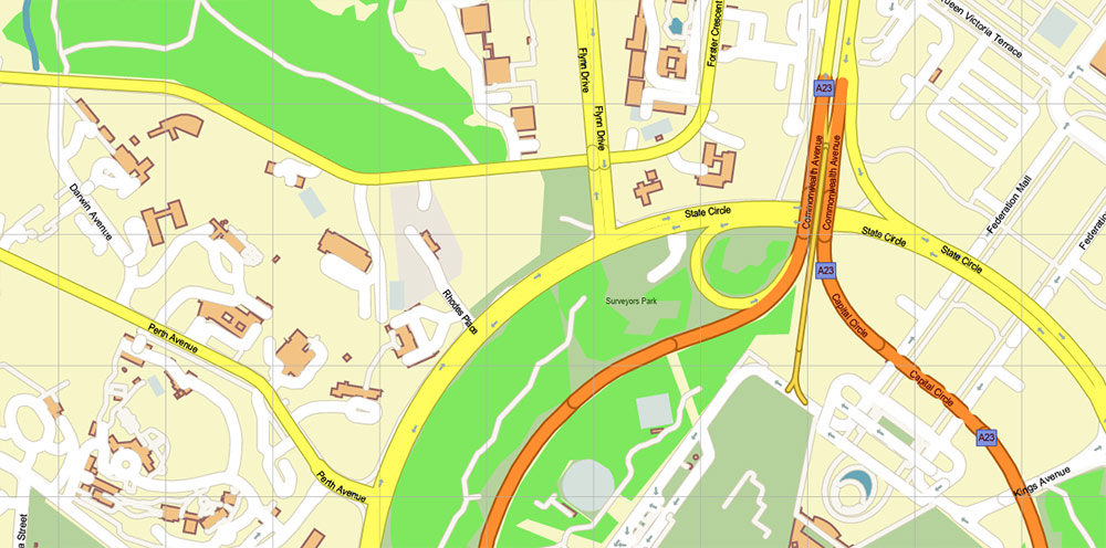
Printable PDF Vector Map of Canberra Region Australia, detailed Street Map scale 1:3834 fully editable Adobe PDF in layers, scalable, text/curves format all names, 95 MB ZIP
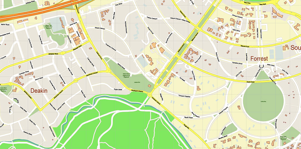
All street names, Main Objects, Buildings. Map for design, printing, arts, projects, presentations, for architects, designers, and builders, business, logistics.
Also: We can add (additional layer for this map), any other objects for you. It’s free for our customers.
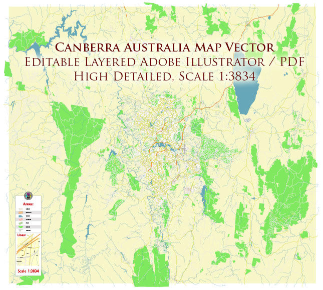
Canberra Region Australia PDF Map Vector Exact High Detailed City Plan editable Adobe PDF Street Map in layers fully editable
Layers list:
- Legend
- Grids
- Labels of roads
- Names of places (city, hamlet, etc.)
- Names of objects (hospitals, parks, water)
- Names of main streets
- Names of residential streets
- Arrows of the street directions
- Main Streets, roads
- Residential streets
- Railroads
- Buildings
- Waterways
- Water objects (rivers, lakes, ponds)
- Airports and Heliports
- Color fills (parks, hospital areas, land use, etc.)
- Background
Canberra Region Australia PDF Map Vector Exact High Detailed City Plan editable Adobe PDF Street Map in layers fully editable
AO BRIEF: Canberra, Australian Capital Territory (ACT)
Overview
-
National capital of Australia; planned city established post-World War I.
-
Seat of Australian Government, Parliament, and key national institutions.
-
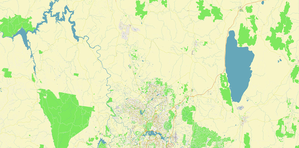
Inland basin between the Brindabella Ranges (west) and gentle tablelands (east).
-
Situated on the Molonglo River system, expanded artificially into Lake Burley Griffin.
Geography & Terrain
Key Transport Infrastructure
Air
-
Canberra Airport: International & domestic hub; direct services connecting major domestic cities and limited international flights.
-
Airfield supports military, charter, training, and medevac operations.
Road Network
-
Canberra road system is hierarchical: urban grid + radial connectors + highways.
-
Major Arterials / Highways:
-
Federal Highway: N-S high-capacity link toward Sydney; primary freight/passenger route.
-
Monaro Highway: SE direction to Monaro region; key trunk for goods/evacuation.
-
Majura Parkway: NE bypass linking Federal Highway to Canberra Airport and urban corridors.
-
Tuggeranong Parkway / Gungahlin Drive Extension: Major commuter axes linking suburbs to central city.
-
Urban roads are broad, multi-lane corridors with roundabouts, designed for high flow.
Rail
Public Transit
-
Bus network covering suburbs, intertown links; central transit interchanges.
-
Light rail line (stage expansions) along key urban corridor (north–south axis).
Key Urban & Strategic Nodes
-
Parliamentary Triangle: Government HQ, embassies, ceremonial axes.
-
City Centre: Commercial, cultural, administrative core.
-
Town Centres: Belconnen, Woden, Tuggeranong, Gungahlin — dispersed population hubs.
-
Defence Establishments: Military training, administrative units within region.
Demography & Human Terrain
-
Population: ~450,000+ in ACT; Canberra core ~400,000.
-
Density: Moderate density across suburbs; lower density green belts.
-
Composition:
-
High proportion of public sector professionals, academia, research, services.
-
Youth and families present; stable and growing population.
-
Urban Form:
-
Planned suburbs with distinct commercial/residential districts.
-
Strong green space integration — parks, reserves, corridors.
-
Civic Profile:
-
Multicultural; domestic migration from larger capitals.
-
High educational attainment and employment in government, tech, services.
Climate & Operating Conditions
Strategic Axes & Routes
-
North–South Corridor: Federal Highway → City → Tuggeranong; principal axis for civilian and logistical flow.
-
East–West Connectors: Links between major residential clusters and Canberra Airport / industrial estates.
-
Brindabella Ridge: Natural west flank; influences weather, line of sight, maneuver.
Key Takeaways
-
Canberra is a planned inland capital with strong transport arteries linking to Sydney and regional hubs.
-
Terrain combines valley lowlands with elevated ranges (west), shaping transport and weather.
-
Demographically stable, skilled, and government/service oriented population.
-
Urban layout supports predictable mobility with major arterial routes and structured town centres.
Canberra Region Australia PDF Map Vector Exact High Detailed City Plan editable Adobe PDF Street Map in layers fully editable
Canberra Region Australia PDF Map Vector Exact High Detailed City Plan editable Adobe PDF Street Map in layers fully editable
Canberra Region Australia PDF Map Vector Exact High Detailed City Plan editable Adobe PDF Street Map in layers fully editable
Canberra Region Australia PDF Map Vector Exact High Detailed City Plan editable Adobe PDF Street Map in layers fully editable
Canberra Region Australia PDF Map Vector Exact High Detailed City Plan editable Adobe PDF Street Map in layers fully editable
Canberra Region Australia PDF Map Vector Exact High Detailed City Plan editable Adobe PDF Street Map in layers fully editable
Canberra Region Australia PDF Map Vector Exact High Detailed City Plan editable Adobe PDF Street Map in layers fully editable
Canberra Region Australia PDF Map Vector Exact High Detailed City Plan editable Adobe PDF Street Map in layers fully editable
Canberra Region Australia PDF Map Vector Exact High Detailed City Plan editable Adobe PDF Street Map in layers fully editable

 Author: Kirill Shrayber, Ph.D. FRGS
, full vector")
, full vector")