Extended Description of the Vector Map
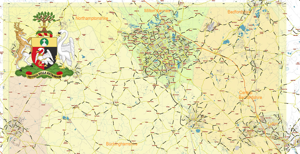
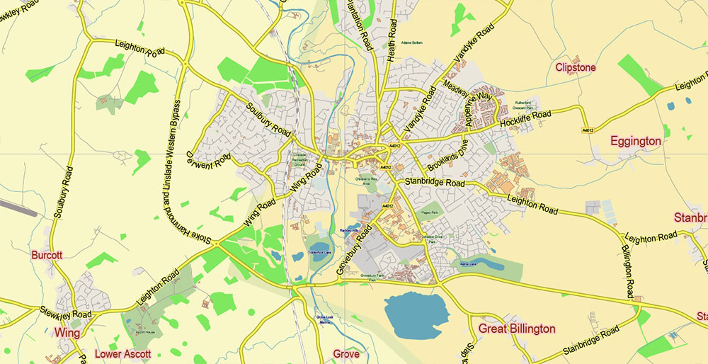
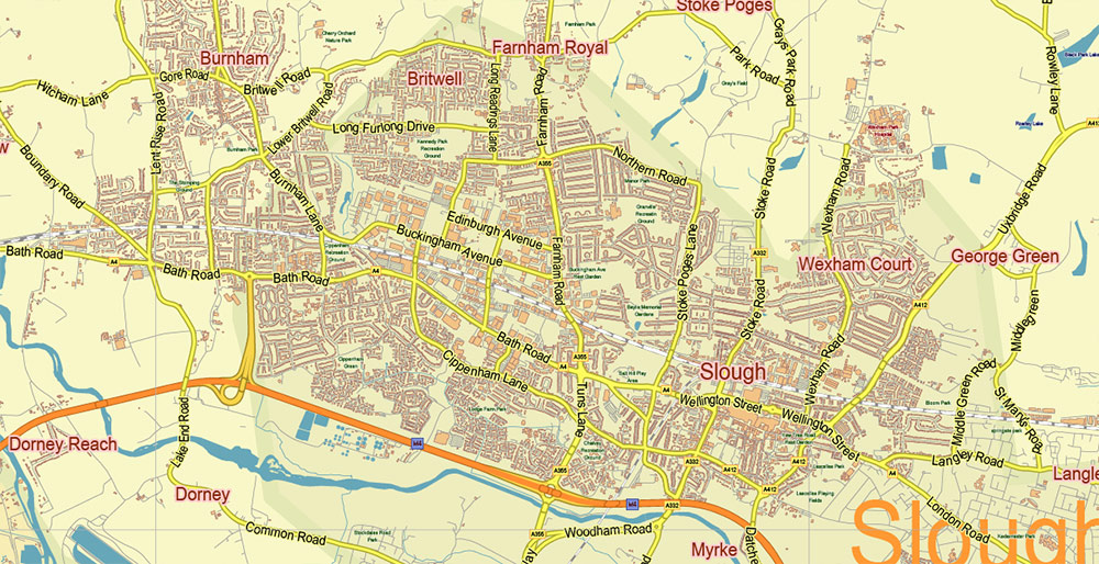
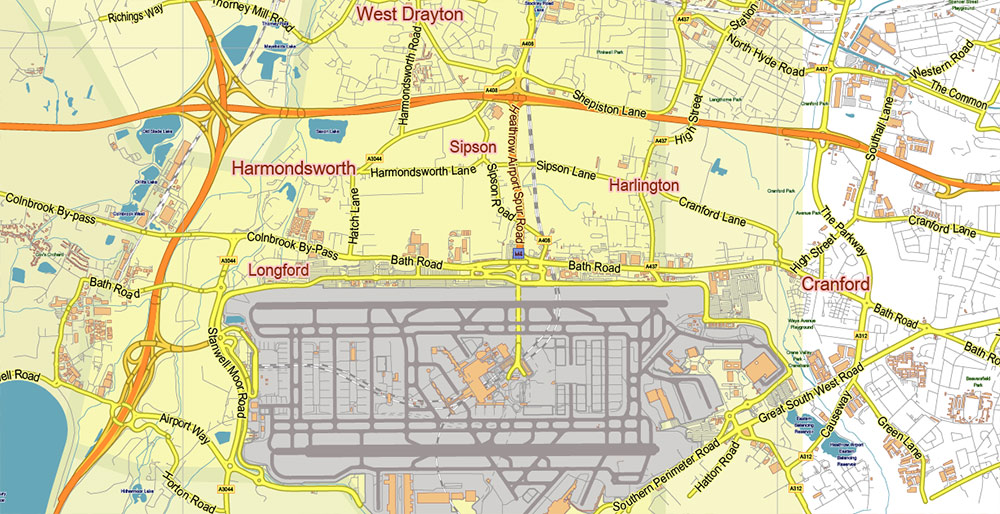
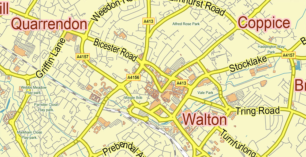
Printable Vector Map of Buckinghamshire UK LOW Detailed (for small print size) County Plan scale 1:46499 full editable Adobe Illustrator Street Map in layers, scalable, text format all names, 18 MB ZIP
Principal street names, Main Objects, Buildings. Map for design, printing, arts, projects, presentations, for architects, designers, and builders, business, logistics.
Included: Coat of Arms of Buckinghamshire.
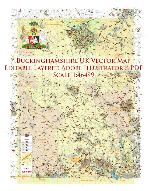
Buckinghamshire UK Map Vector Exact County Plan LOW Detailed (for small print size) Street Map + Admin editable Adobe Illustrator in layers
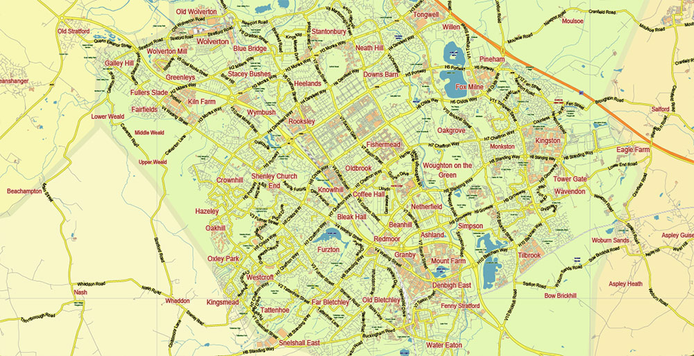
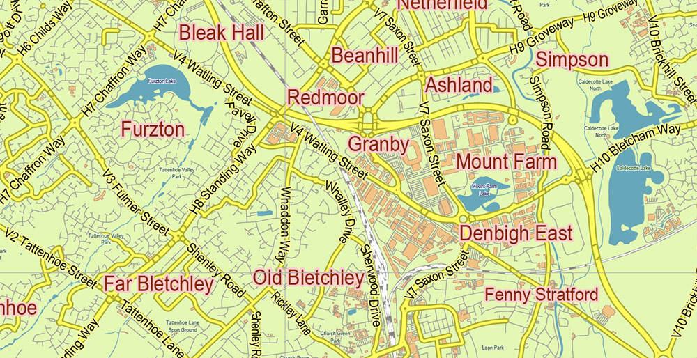
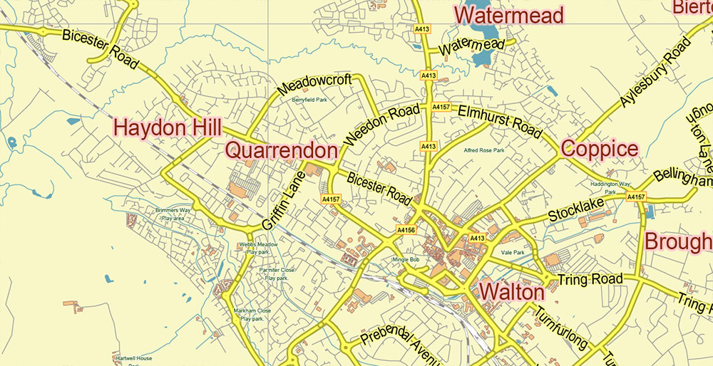
Layers list:
- Legend
- Grids
- Labels of roads
- Names of places (city, hamlet, etc.)
- Names of objects (hospitals, parks, water)
- Names of main streets
- Halo of names streets, objects, places
- Names of counties
- Main Streets, roads
- Civil streets
- Railroads
- Buildings
- Airports and heliports
- Water objects (rivers, lakes, ponds)
- Waterways
- Color fills (parks, hospital areas, land use, etc.)
- Counties areas
- Background
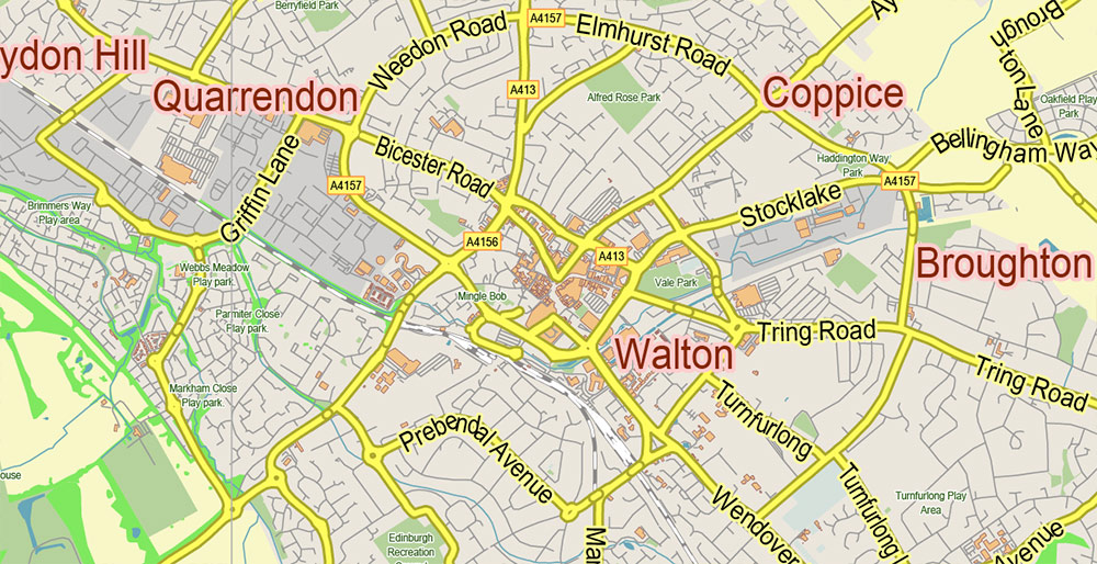
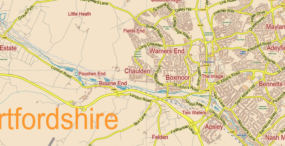
Buckinghamshire UK Map Vector Exact County Plan LOW Detailed (for small print size) Street Map + Admin editable Adobe Illustrator in layers
Buckinghamshire UK Map Vector Exact County Plan LOW Detailed (for small print size) Street Map + Admin editable Adobe Illustrator in layers
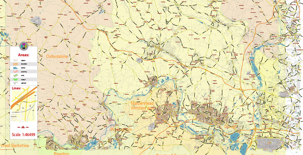
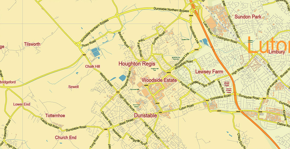
Buckinghamshire UK Map Vector Exact County Plan LOW Detailed (for small print size) Street Map + Admin editable Adobe Illustrator in layers
Buckinghamshire UK Map Vector Exact County Plan LOW Detailed (for small print size) Street Map + Admin editable Adobe Illustrator in layers
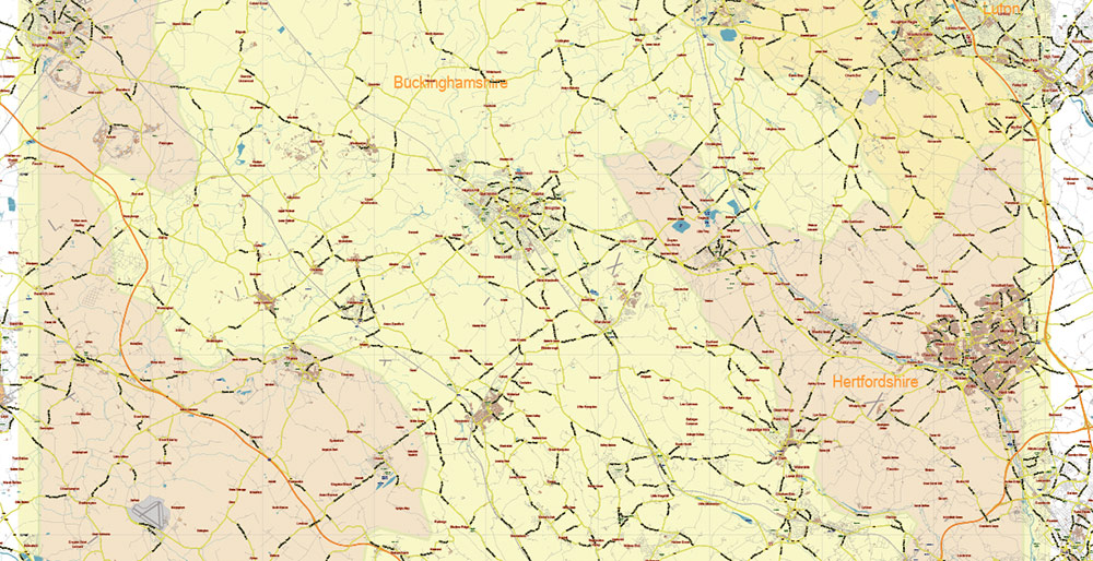
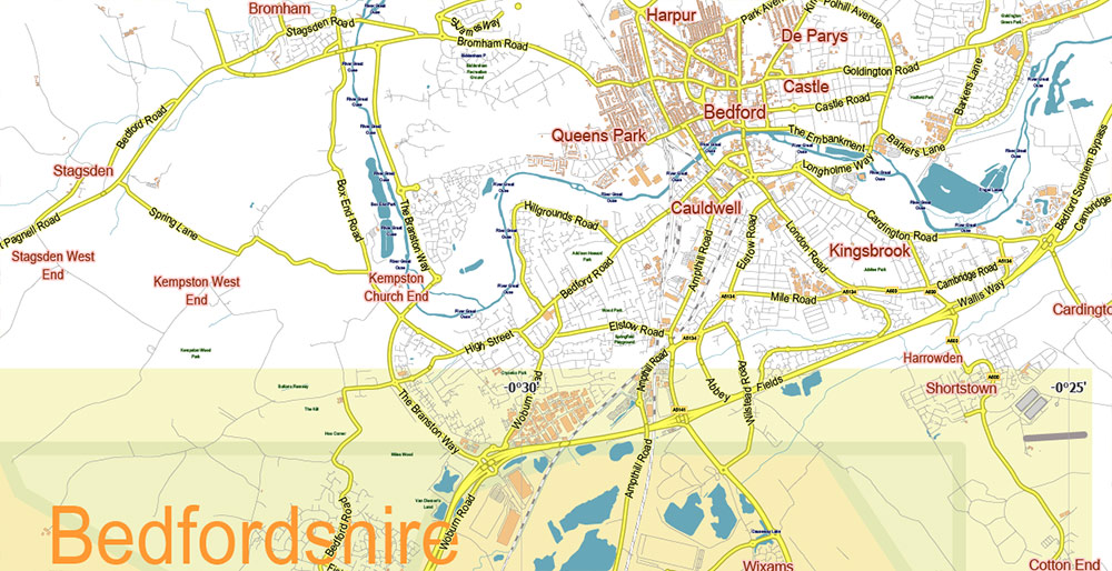
Buckinghamshire UK Map Vector Exact County Plan LOW Detailed (for small print size) Street Map + Admin editable Adobe Illustrator in layers
Buckinghamshire UK Map Vector Exact County Plan LOW Detailed (for small print size) Street Map + Admin editable Adobe Illustrator in layers
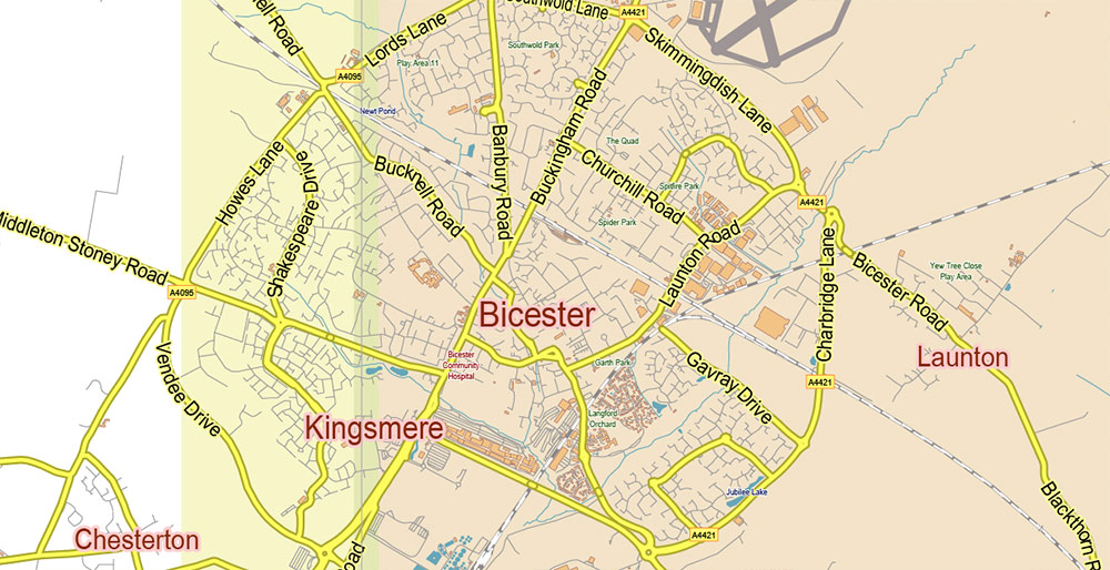
Buckinghamshire UK Map Vector Exact County Plan LOW Detailed (for small print size) Street Map + Admin editable Adobe Illustrator in layers
Buckinghamshire UK Map Vector Exact County Plan LOW Detailed (for small print size) Street Map + Admin editable Adobe Illustrator in layers
Buckinghamshire UK Map Vector Exact County Plan LOW Detailed (for small print size) Street Map + Admin editable Adobe Illustrator in layers
Buckinghamshire UK Map Vector Exact County Plan LOW Detailed (for small print size) Street Map + Admin editable Adobe Illustrator in layers
Buckinghamshire UK Map Vector Exact County Plan LOW Detailed (for small print size) Street Map + Admin editable Adobe Illustrator in layers
Buckinghamshire UK Map Vector Exact County Plan LOW Detailed (for small print size) Street Map + Admin editable Adobe Illustrator in layers
Buckinghamshire UK Map Vector Exact County Plan LOW Detailed (for small print size) Street Map + Admin editable Adobe Illustrator in layers
Buckinghamshire UK Map Vector Exact County Plan LOW Detailed (for small print size) Street Map + Admin editable Adobe Illustrator in layers
Buckinghamshire UK Map Vector Exact County Plan LOW Detailed (for small print size) Street Map + Admin editable Adobe Illustrator in layers

 Author: Kirill Shrayber, Ph.D. FRGS