Extended Description of the Vector Map
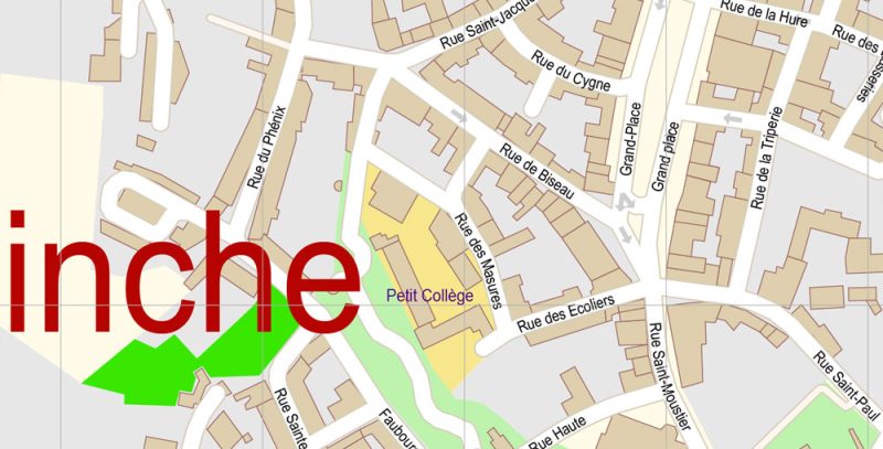
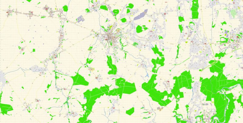
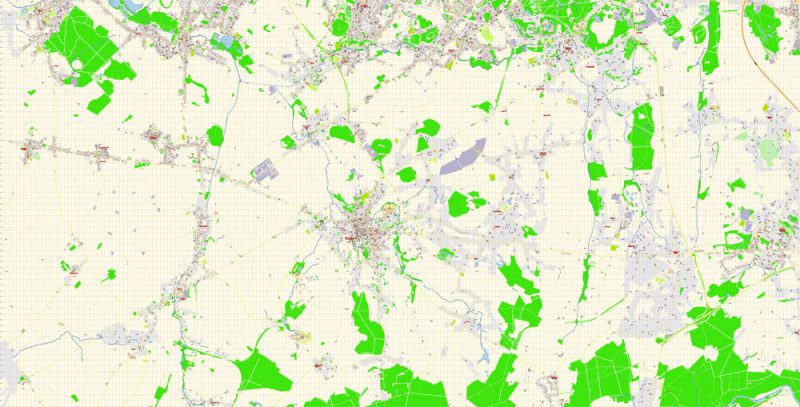
Printable Vector Map of Binche Belgium detailed City Plan scale 100 m 1:2994 full editable Adobe Illustrator Street Map in layers, scalable, text format all names, 7 MB ZIP
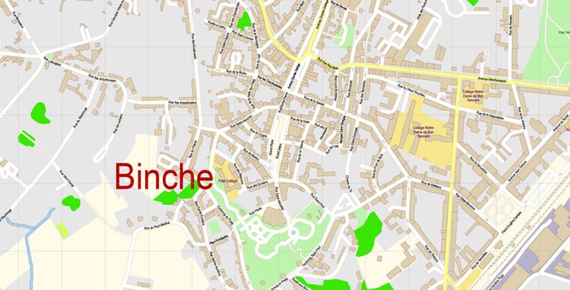
All street names, Main Objects, Buildings. Map for design, printing, arts, projects, presentations, for architects, designers, and builders, business, logistics.
Included: Admin map Belgium
Layers list:
- Legend
- Grids
- Labels of roads
- Names of places (city, hamlet, etc.)
- Names of objects (hospitals, schools, parks)
- Water objects (rivers, lakes)
- Names of streets
- Objects (icons)
- Arrows of streets
- Streets, roads, railroads, lines
- Buildings
- Color fills (parks, hospital areas, school areas, etc.)
- Back
The most exact and detailed map of the city in scale.
ALSO: DWG, DXF, CDR and other formats: free convert for our customers.
For Editing and High-Quality Printing
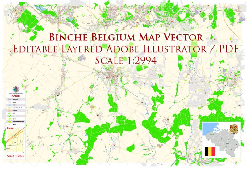
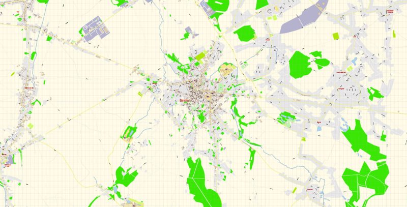
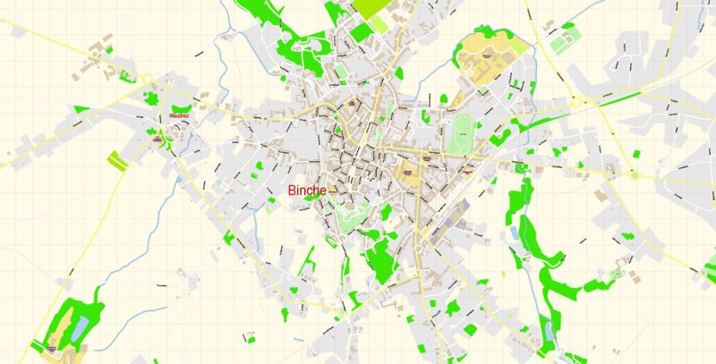
Binche Belgium Map Vector Exact City Plan High Detailed Street Map editable Adobe Illustrator in layers
Binche
City in Belgium
Binche is a Walloon city and municipality located in the Belgian province of Hainaut. On January 1, 2006, Binche had a total population of 32,409. The total area is 60.66 km² which gives a population density of 534 inhabitants per km².
Area: 60.66 km²
Province: Hainaut
Binche Belgium Map Vector Exact City Plan High Detailed Street Map editable Adobe Illustrator in layers
Binche Belgium Map Vector Exact City Plan High Detailed Street Map editable Adobe Illustrator in layers
Binche Belgium Map Vector Exact City Plan High Detailed Street Map editable Adobe Illustrator in layers
Binche Belgium Map Vector Exact City Plan High Detailed Street Map editable Adobe Illustrator in layers
Binche Belgium Map Vector Exact City Plan High Detailed Street Map editable Adobe Illustrator in layers
Binche Belgium Map Vector Exact City Plan High Detailed Street Map editable Adobe Illustrator in layers
Author Rating
Aggregate Rating
no rating based on 0 votes
@vectormapper
Product Name Binche Belgium Map Vector Exact City Plan High Detailed Street Map editable Adobe Illustrator in layers
Price
USD 29
Product Availability
Available in Stock


 Author: Kirill Shrayber, Ph.D. FRGS