Extended Description of the Vector Map
Printable PDF Vector Map Baillargues France, exact detailed City Plan, 100 meters scale map, editable Layered Adobe PDF Street Map, 9 Mb ZIP.
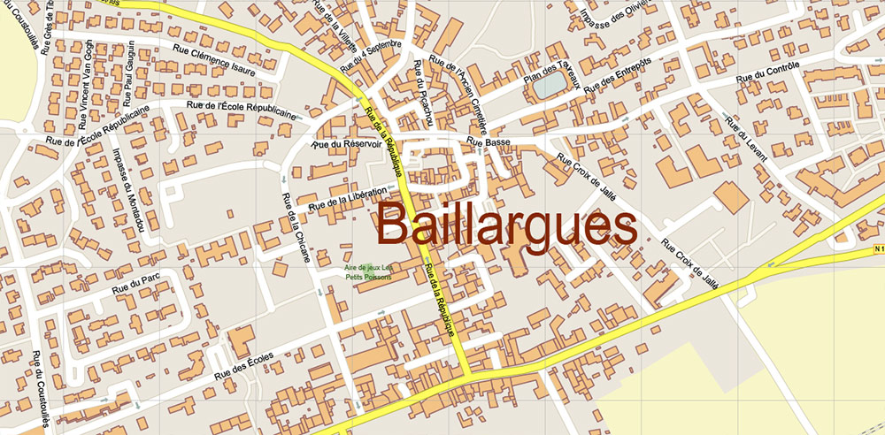
All streets named, main objects. Map for publishing, design, printing, publications, arts, projects, presentations, for architects, designers and builders, business, logistics. The most exact and detailed map of the city.
Layers: legend, grids, labels_roads, names_places, names_streets, names_objects, objects, arrows_streets, streets_roads, color_fills, etc.
Text format all names
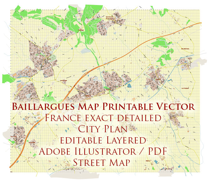
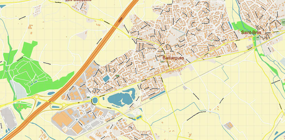
Baillargues PDF Map Printable Vector France, exact detailed City Plan editable Layered Adobe PDF Street Map
Geographic Overview: Baillargues and Surrounding Towns, Southern France
Location and Setting
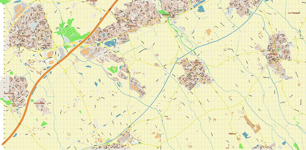
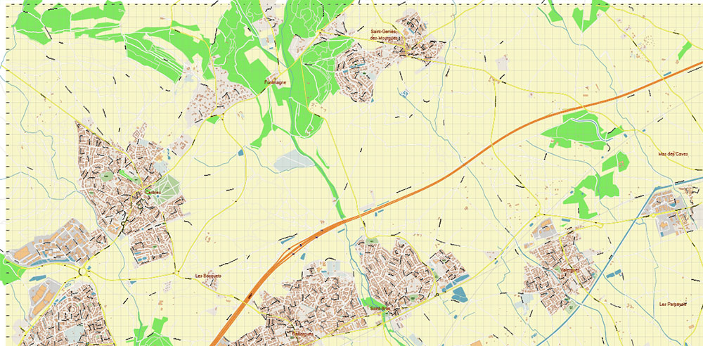
Baillargues is a small commune in the Hérault department, Occitanie region, in southern France. It lies about 15 km (9 miles) east of Montpellier, within the coastal plain that stretches between the Mediterranean Sea and the foothills of the Cévennes. The town sits at an elevation of ~50 m (160 ft) above sea level and covers roughly 7 km². Its position along the A9 motorway and the Montpellier–Nîmes railway line makes it an accessible satellite community of Montpellier.
The surrounding landscape is typical of Languedoc: vineyards, olive groves, and flat plains with a Mediterranean climate — hot, dry summers and mild, wetter winters.
Baillargues – Key Facts
-
Population: ~7,500 (2021 estimate).
-
Transport:
-
Railway station on the line Montpellier–Nîmes.
-
Direct access to A9 motorway (Autoroute La Languedocienne).
-
Local roads connect to Lunel, Mauguio, Castries.
-
Urban Layout: Compact residential town with schools, sports facilities, and suburban housing estates.
-
Notable Features: Golf de Montpellier Massane (a large golf and leisure complex), traditional Languedoc vineyards, and proximity to both Montpellier’s metropolitan amenities and Mediterranean beaches (~20 km).
Nearby Towns and Communes
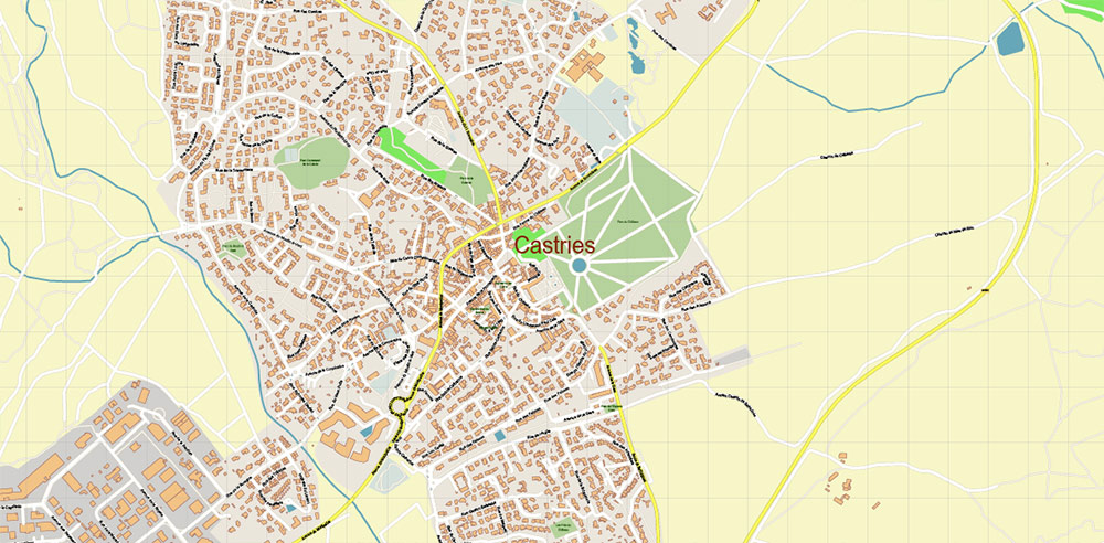
1. Castries
-
Located 4 km north of Baillargues.
-
Known for the Château de Castries and its aqueduct designed by Pierre-Paul Riquet, engineer of the Canal du Midi.
-
Residential town with a historic center and surrounding vineyards.
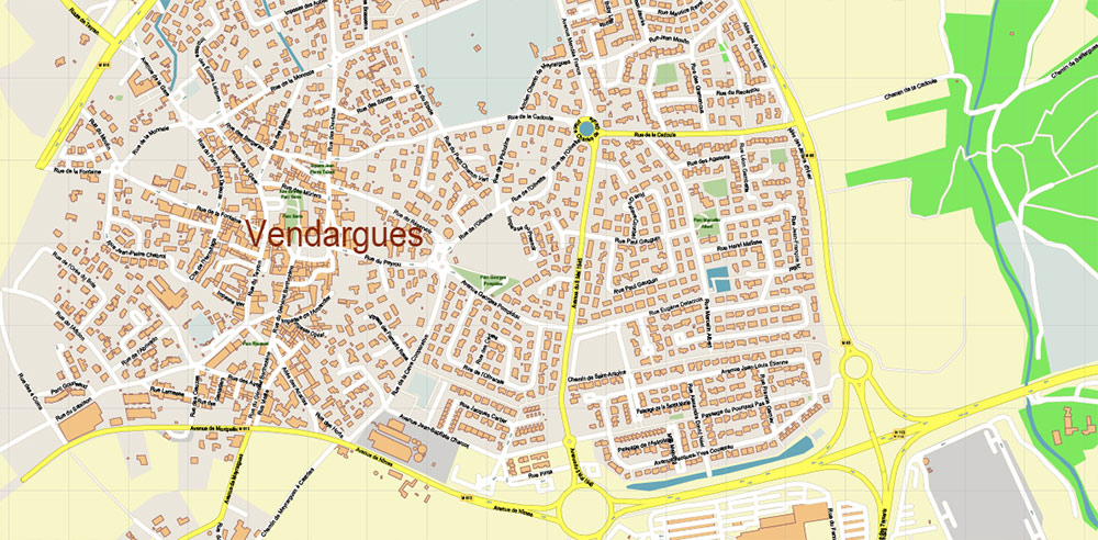
2. Vendargues
-
Just 3 km west.
-
Functions as a suburban extension of Montpellier.
-
Industrial and business parks, plus residential neighborhoods.
3. Mauguio
-
About 6 km south-west.
-
Larger town (~17,000 inhabitants).
-
Famous for Mauguio’s Étang de l’Or lagoon and its bullfighting traditions (Camargue-style events).
-
Contains Montpellier Méditerranée Airport on its territory (shared with Montpellier).
4. Lunel
-
~12 km east.
-
A mid-sized town (~26,000 people) with historical roots dating back to medieval times.
-
Known for wine production and its central square, the Place des Caladons.
-
Acts as a local hub between Montpellier and Nîmes.
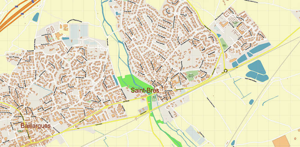
5. Saint-Brès
-
Immediate neighbor to the west of Baillargues.
-
Small commune (~3,000 people).
-
Primarily residential, with quick access to Montpellier via the A9.
6. Mudaison
-
About 2 km south-east.
-
Small village (~2,000 residents).
-
Surrounded by vineyards, typical rural Languedoc character.
Regional Context
Baillargues and its cluster of neighboring towns are part of the Montpellier metropolitan area, one of the fastest-growing urban zones in France. The entire area benefits from:
-
Transport links: A9 motorway, Montpellier–Nîmes rail corridor, proximity to Montpellier Airport and TGV station.
-
Climate: Mediterranean (Csa, Köppen), ~300 days of sunshine annually, summer highs often 30–34 °C (86–93 °F).
-
Economy: Vineyards, agriculture, light industry, and growing residential/commuter base linked to Montpellier.
-
Tourism and Culture: Proximity to Mediterranean beaches (La Grande-Motte, Palavas-les-Flots), the Camargue wetlands, and historic centers of Montpellier and Nîmes.
👉 This style gives you a clear, commander-level geographic brief: exact location, population, connections, nearby towns, and highlights.
Baillargues PDF Map Printable Vector France, exact detailed City Plan editable Layered Adobe PDF Street Map
Baillargues PDF Map Printable Vector France, exact detailed City Plan editable Layered Adobe PDF Street Map
Baillargues PDF Map Printable Vector France, exact detailed City Plan editable Layered Adobe PDF Street Map
Baillargues PDF Map Printable Vector France, exact detailed City Plan editable Layered Adobe PDF Street Map
Baillargues PDF Map Printable Vector France, exact detailed City Plan editable Layered Adobe PDF Street Map
Baillargues PDF Map Printable Vector France, exact detailed City Plan editable Layered Adobe PDF Street Map
Baillargues PDF Map Printable Vector France, exact detailed City Plan editable Layered Adobe PDF Street Map
Baillargues PDF Map Printable Vector France, exact detailed City Plan editable Layered Adobe PDF Street Map
Baillargues PDF Map Printable Vector France, exact detailed City Plan editable Layered Adobe PDF Street Map

 Author: Kirill Shrayber, Ph.D. FRGS