Extended Description of the Vector Map
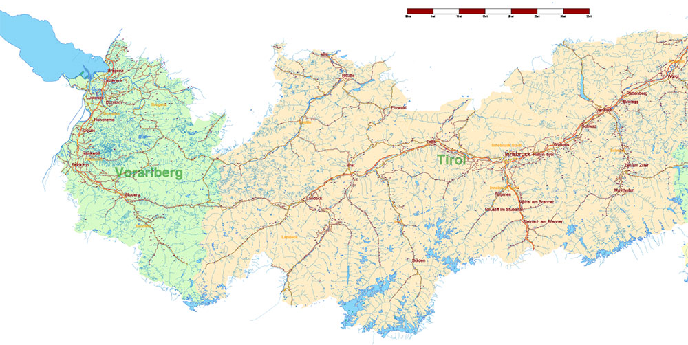
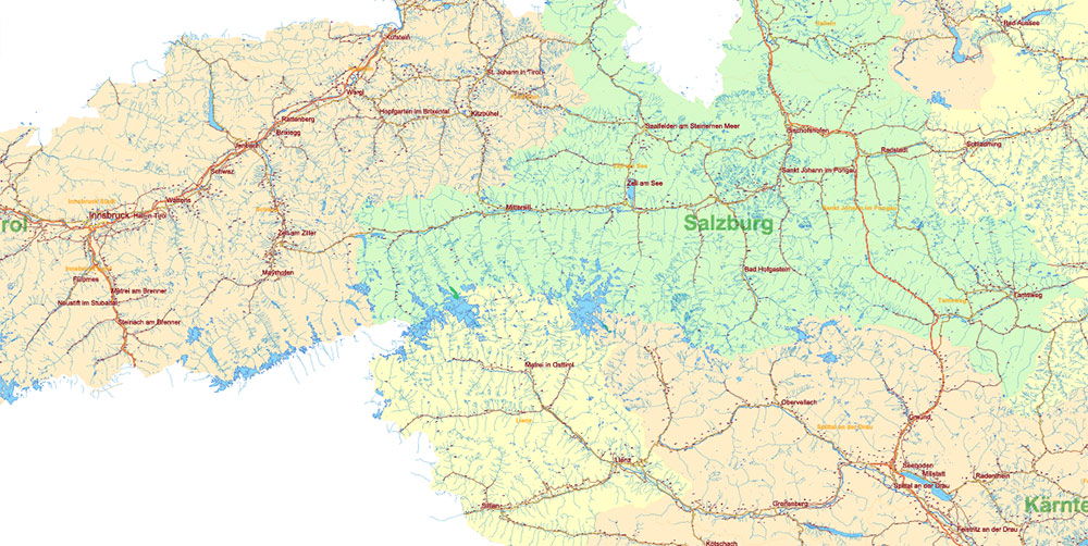
Printable Vector Map Austria Full high detailed road map + admin 1, 2 areas + cities and towns and villages + water objects editable Layered Adobe Illustrator, + separate file (same scale) all roads, scalable, editable text format of all names, 342 Mb ZIP.
Layered exact editable map: Map for publishing, design, printing, publications, arts, projects, presentations, for architects, designers, and builders, business, logistics. The most exact and detailed map. GPS correct Mercator Projection.
For printing any format.
Please note: This country map is compiled from multiple, unrelated geodata sources.
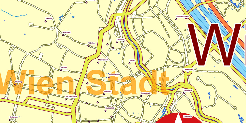
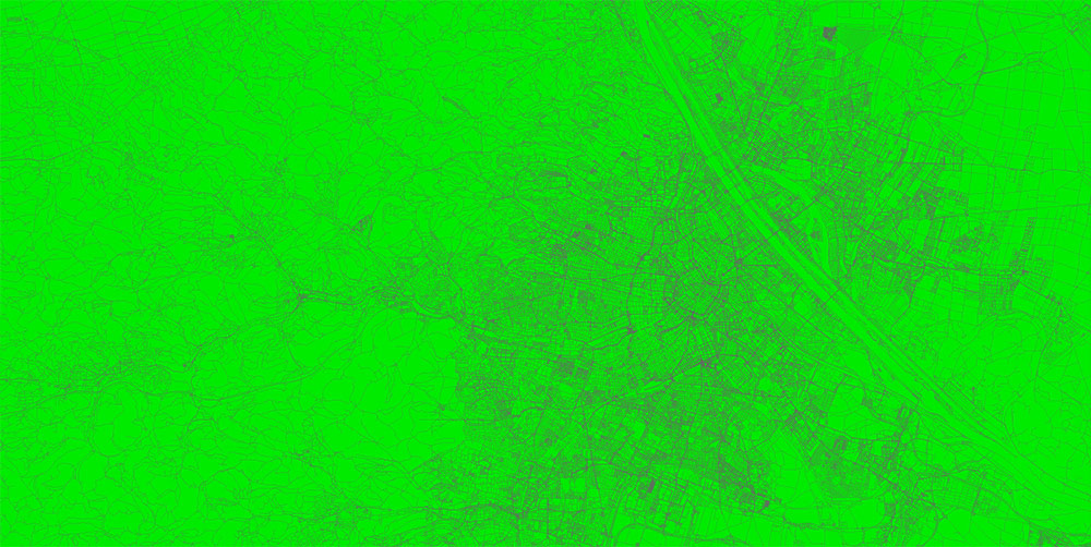
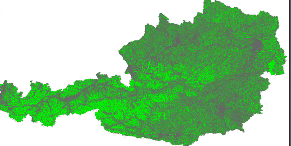
Please note: in the preview, ALL LAYERS are enabled and visible. Of course, you can easily turn off the layers you don’t need and the map will become much simpler.
DWG, DXF, CDR, ESRI Shapes, and other formats – by request, the same price, please contact.
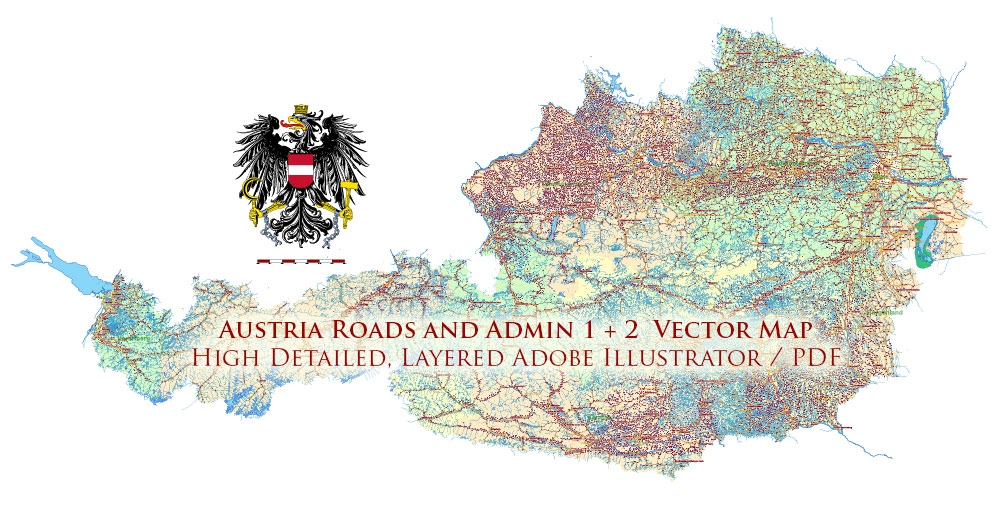
Austria Full Vector Map high detailed all road map + admin 1, 2 areas + cities, towns and water objects editable Layered Adobe Illustrator
Separated layers:
- Legend / Scale
- Names main cities and towns
- Names villages
- Geopoints 1, 2 – cities, towns, villages
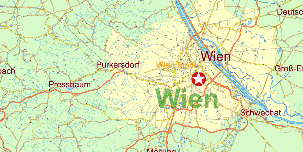
- Names admin areas 2 Politische Bezirke
- Names admin areas 1 Bundesländer
- Main roads and streets
- Railroads
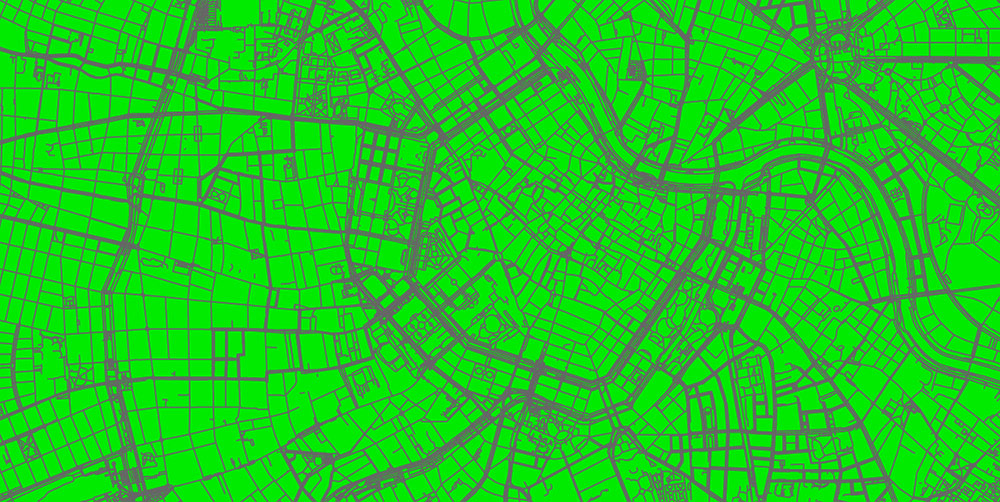
- All streets and roads (separated file, same scale)
- Waterways
- Water areas
- Admin areas 2 Politische Bezirke
- Admin areas 1 Bundesländer
- Background
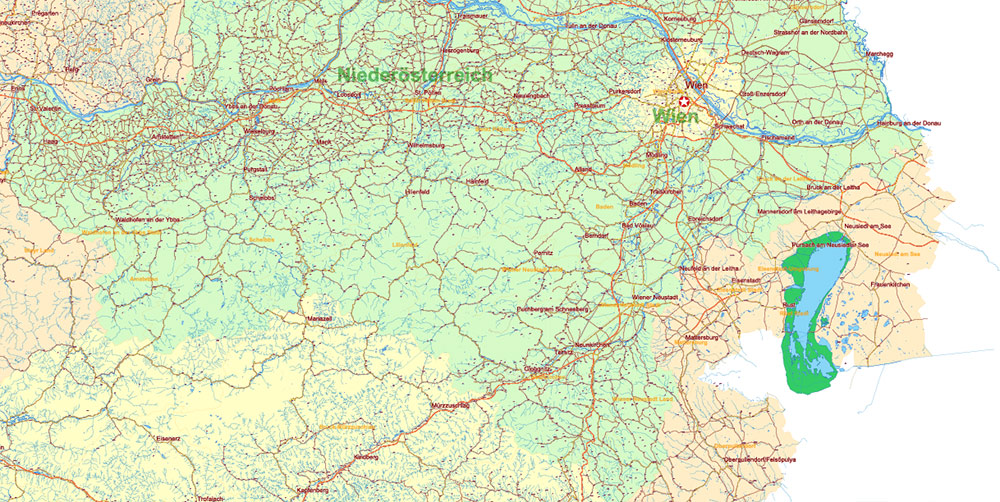
Austria Full Vector Map high detailed all road map + admin 1, 2 areas + cities, towns and water objects editable Layered Adobe Illustrator
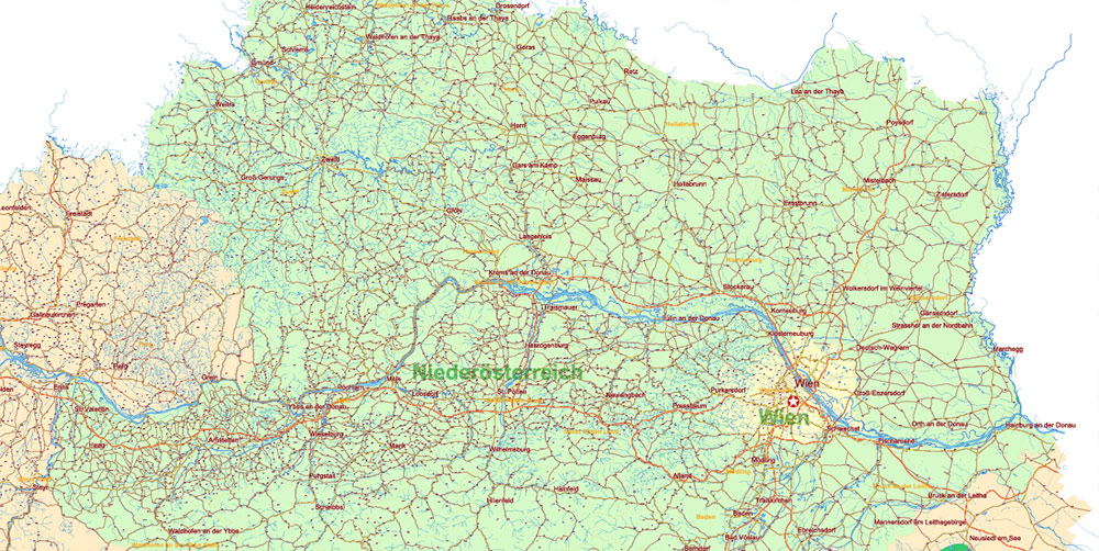
Austria Full Vector Map high detailed all road map + admin 1, 2 areas + cities, towns and water objects editable Layered Adobe Illustrator
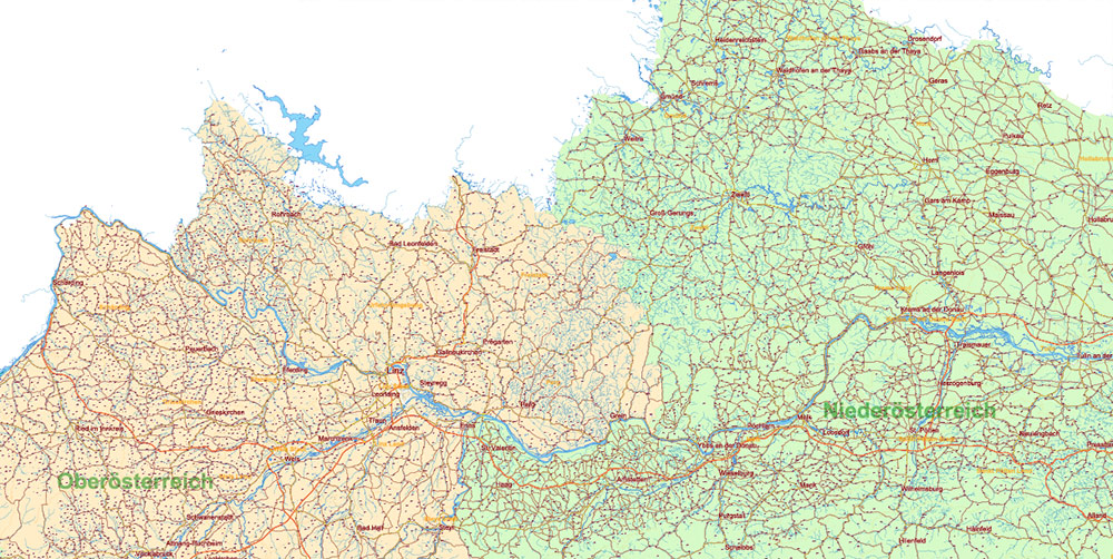
Austria Full Vector Map high detailed all road map + admin 1, 2 areas + cities, towns and water objects editable Layered Adobe Illustrator
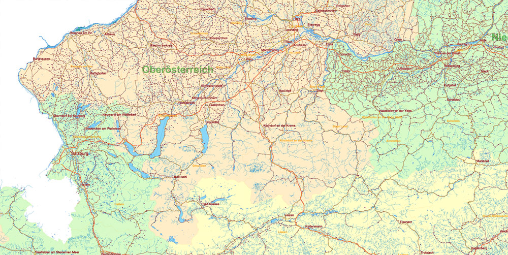
Austria Full Vector Map high detailed all road map + admin 1, 2 areas + cities, towns and water objects editable Layered Adobe Illustrator
Austria Full Vector Map high detailed all road map + admin 1, 2 areas + cities, towns and water objects editable Layered Adobe Illustrator
Austria Full Vector Map high detailed all road map + admin 1, 2 areas + cities, towns and water objects editable Layered Adobe Illustrator
Austria Full Vector Map high detailed all road map + admin 1, 2 areas + cities, towns and water objects editable Layered Adobe Illustrator
Austria Full Vector Map high detailed all road map + admin 1, 2 areas + cities, towns and water objects editable Layered Adobe Illustrator
Austria Full Vector Map high detailed all road map + admin 1, 2 areas + cities, towns and water objects editable Layered Adobe Illustrator
Austria Full Vector Map high detailed all road map + admin 1, 2 areas + cities, towns and water objects editable Layered Adobe Illustrator
Austria Full Vector Map high detailed all road map + admin 1, 2 areas + cities, towns and water objects editable Layered Adobe Illustrator


 Author: Kirill Shrayber, Ph.D. FRGS


