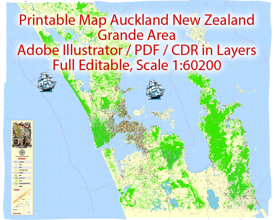
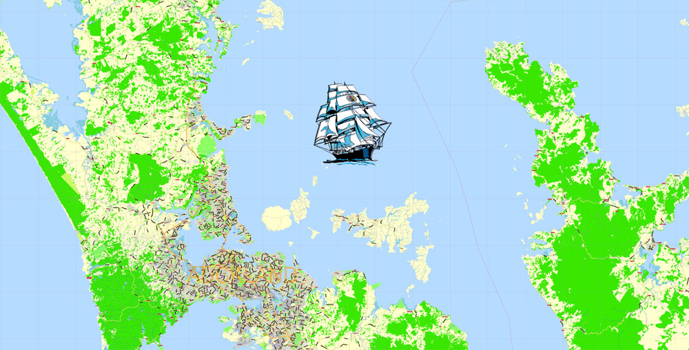
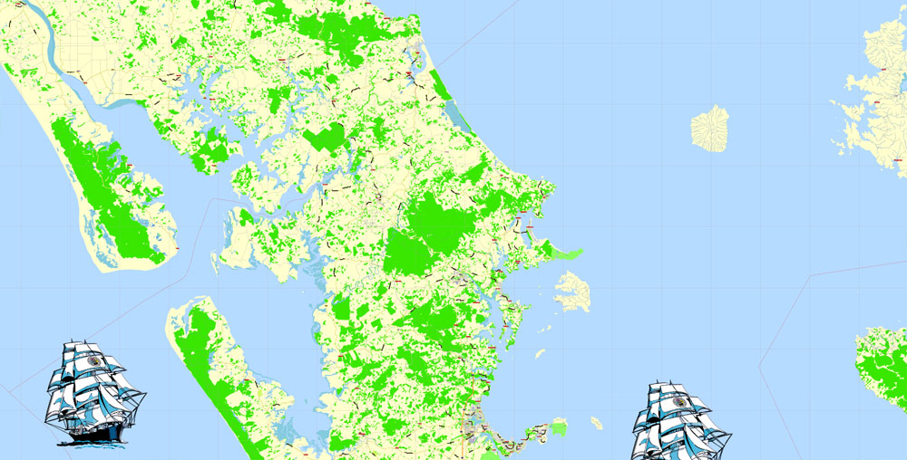
Printable Auckland PDF Map Grande Area New Zealand, exact vector City Plan scale 1:60200 full editable Printable Adobe PDF Street Map, full vector, scalable, editable text format all names, 48 mb ZIP
Main streets named, Main Objects. Map for design, printing, arts, projects, presentations, for architects, designers and builders, business, logistics.
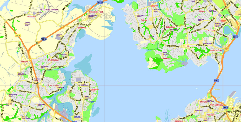
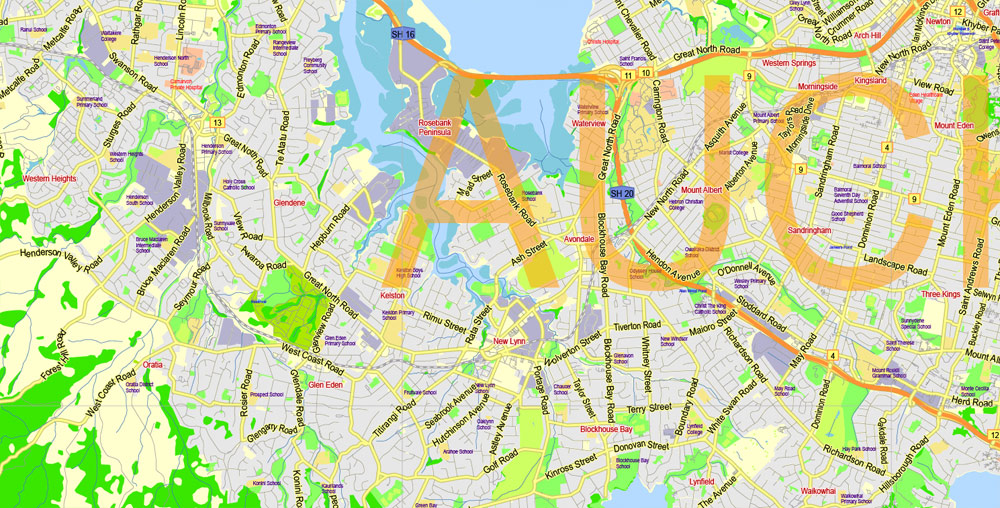
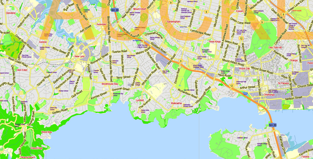
Layers: color fills, streets_roads, labels_roads, names_objects, names_streets, names_places, grids, legend.
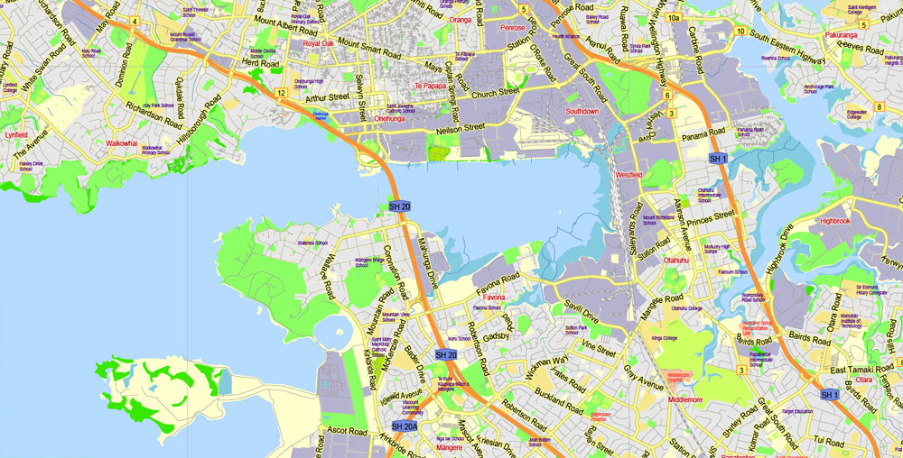
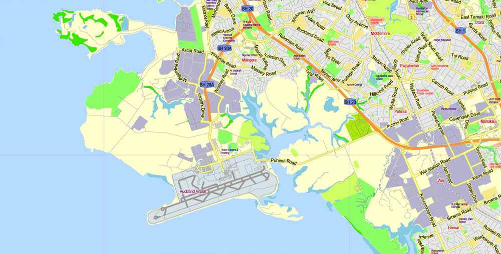
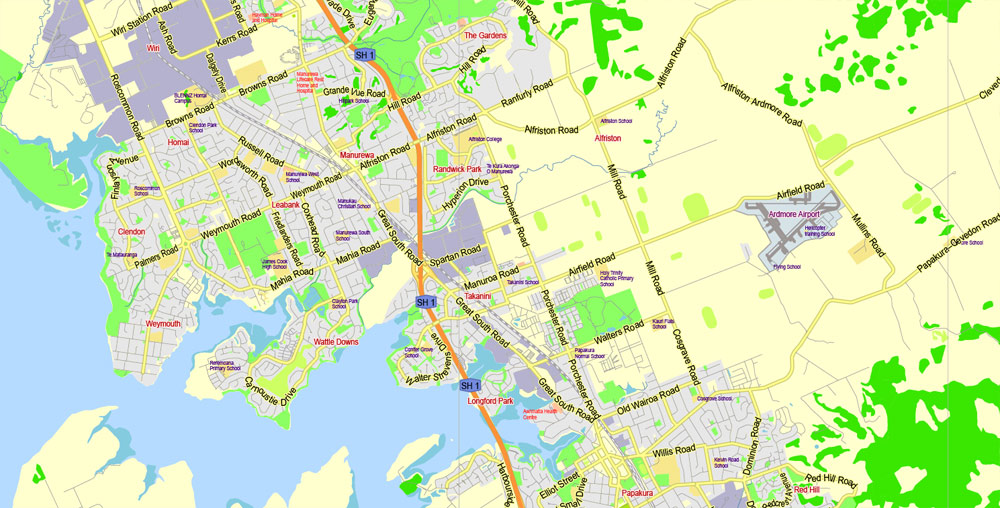
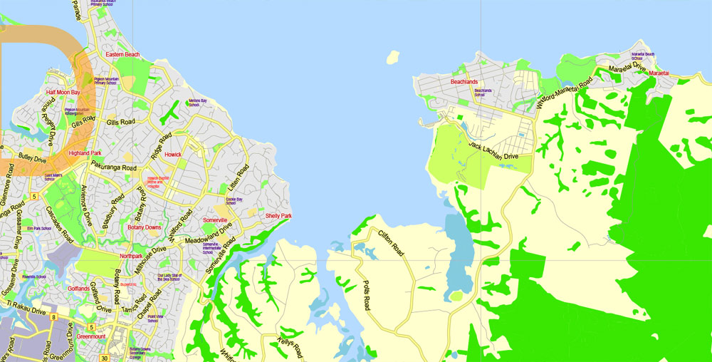
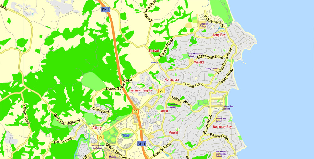
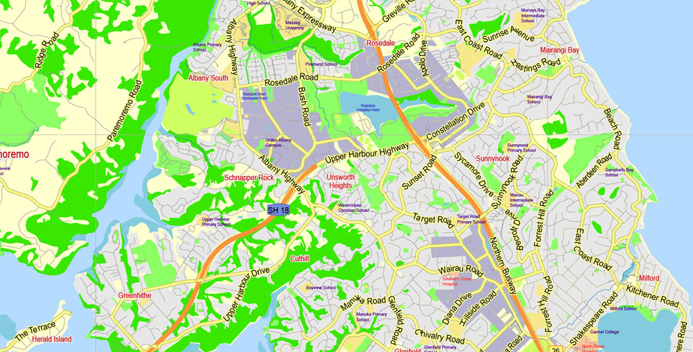
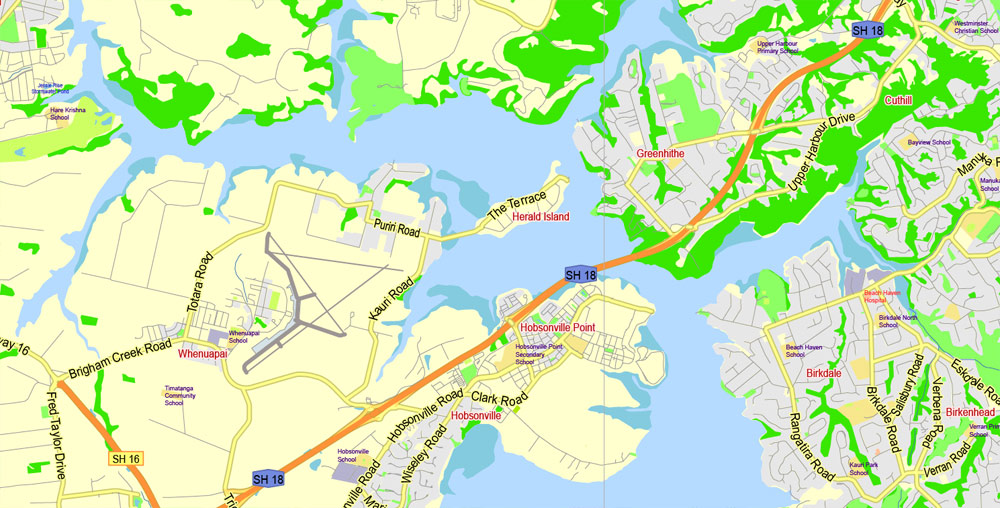
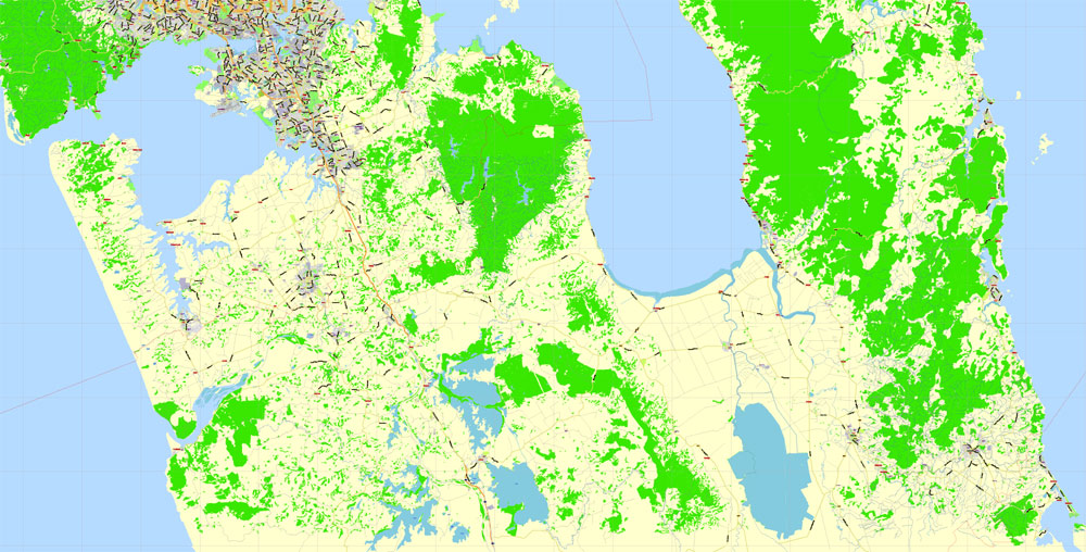
The most exact and detailed map of the city.
DWG, DXF and other formats – on request, same price, please, contact
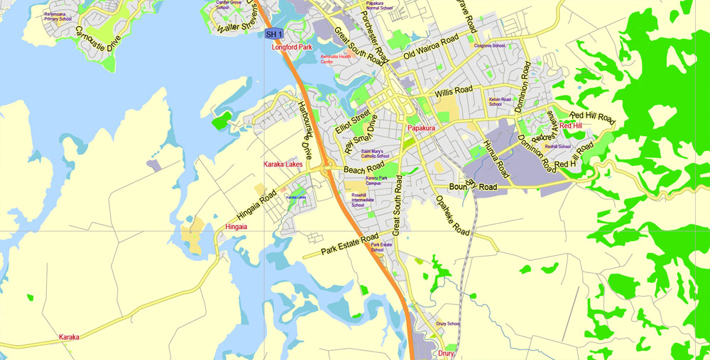
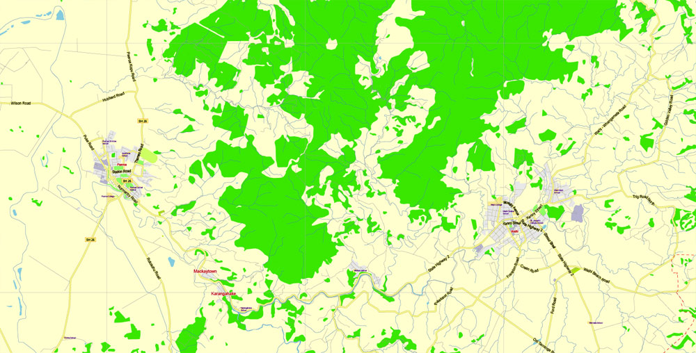
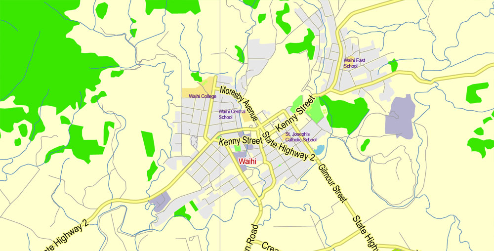
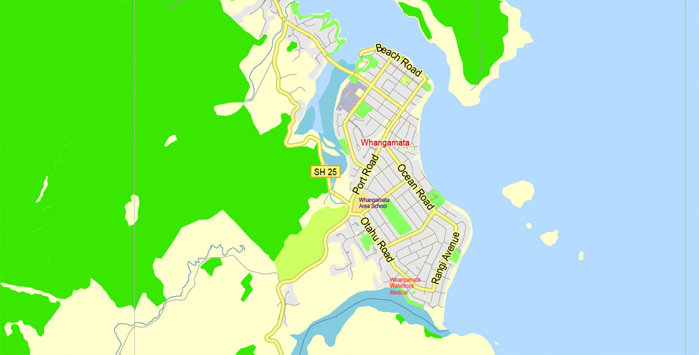
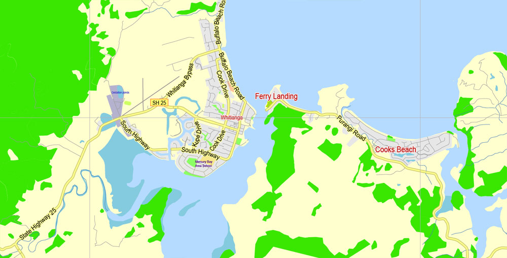
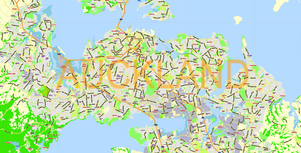
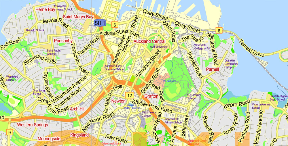
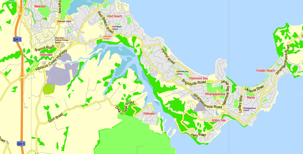
Auckland, New Zealand.
This vector map of Auckland city is used as a basis for design, editing, and further printing.
This is the most detailed, exact map of Auckland city for high-quality printing and polygraphy. You can always clarify the map development date by contacting us.
For your convenience, all objects on Auckland vector city map are divided into layers. And the editing is very easy – colors, lines, etc.
You can easily add any objects needed (e.g. shops, salons, sale points, gas station or attraction) on any layer of Auckland vector map.
Auckland is a city in the North Island of New Zealand. Auckland is the largest urban area in the country, with an urban population of around 1,628,900 (June 2018). It is located in the Auckland Region—the area governed by Auckland Council—which includes outlying rural areas and the islands of the Hauraki Gulf, resulting in a total population of 1,695,900.
One of the advantages of Auckland city vector maps of our production is the relevance of cartographic data, we constantly update all our products.
This vector map of Auckland city is used by:
designers, layout designers, printers, advertisers and architects. Our product – vector maps – is designed for further editing and printing in large formats – from @Wall format (a few meters) to A-0 and A-1, A-2, A-3.
The Auckland city map in vector format is used for design, urban planning, presentations and media visualizations.
The advertising and presentation map of Auckland city (usually the final designer marks the routes, and puts the client’s objects (shops, saloons, gas stations etc.)
The undoubted advantage is that people will NEVER throw out this advertising product – the map. In fact, as an advertising medium, a city map is the most “long-playing” of the well-known polygraphic advertising media, with the longest lifespan, and the maximum number of interactions with the customer.
For travelers, maps are sold at the airports and gas stations around the world. Often the source is our vector maps.
A diverse and multicultural city, Auckland is home to the largest Polynesian population in the world. The Māori-language name for Auckland is Tāmaki or Tāmaki-makau-rau, meaning “Tāmaki with a hundred lovers”, in reference to the desirability of its fertile land at the hub of waterways in all directions.
Take a look, who purchases our vector maps of Auckland city in “Our Clients and Friends” page – these are large and small companies, from super-brands like Volvo and Starbucks, to small design studios and printing houses.
It’s very easy to work with vector maps of Auckland city, even for a not very experienced designer who can turn on and off the map layers, add new objects, change the colors of fill and lines according to customer requirements.
The undoubted advantage of Auckland city vector maps in printing is an excellent and detailed visualization, when customer can expand a large paper map and instantly define his location, find a landmark, an object or address on map, unlike using the popular electronic formats of Google and Yandex maps for example.
Printable vector maps of Auckland city are much more convenient and efficient than any electronic maps on your smartphone, because ALL DETAILS are displayed in the entire space of Auckland city map.
The Auckland urban area (as defined by Statistics New Zealand) ranges to Waiwera in the north, Kumeu in the north-west, and Runciman in the south. Auckland lies between the Hauraki Gulf of the Pacific Ocean to the east, the low Hunua Ranges to the south-east, the Manukau Harbour to the south-west, and the Waitakere Ranges and smaller ranges to the west and north-west.

Useful tips on working with vector maps of cities and countries in Adobe Illustrator.
«V» – launches the Selection tool (cursor, black arrow), which makes active any vector line.
«А» – launches the Direct Selection tool (white cursor), allows you to select curve elements and drag them to the desired place.
«R» – activates the Rotate tool, which helps you rotating selected objects around the center point by 360 degrees.
«E» – gives you the opportunity to use the Eraser tool and erase unnecessary parts.
«X» – switches between Fill and Stroke in the Tools section. Try to get used to this hot key and
you will quickly understand that you can’t live and work without it.
Guides are not limited to vertical and horizontal in Adobe Illustrator. You can also create a diagonal guide for example. Moreover, you can turn any contours into guides. Select the outline and go to View > Guides > Make Guides (Create Guides), or simply press Cmd/Ctrl + 5. You can also turn the guides back into an editable object. Go to menu, View > Guides > Unlock Guides (Release Guides), select the guide you want to edit and select View > Guides > Release Guides (Reset Guides), or just press Cmd/Ctrl + Option / Alt + 5).
The surrounding hills are covered in rainforest and the landscape is dotted with dozens of dormant volcanic cones. The central part of the urban area occupies a narrow isthmus between the Manukau Harbour on the Tasman Sea and the Waitematā Harbour on the Pacific Ocean. Auckland is one of the few cities in the world to have a harbour on each of two separate major bodies of water.
You will probably want to change the color scheme used on our Auckland vector city map.
To quickly and effectively play with colors.
Of course, you can do it manually, all objects in our Auckland city vector map are divided according to types and layers, and you can easily change the color gamma of vector objects in groups and layers.
But there is more effective way of working with the whole VECTOR MAP of Auckland city and all layers:
The overview dialog «Edit colors»/«Repaint Graphic Object» (this dialog box name can change depending on the context):
If you have selected a part or a layer of Auckland city vector map and open the dialog box by clicking the icon in the Control panel, on the Samples palette or the Color Catalog, or if you choose Edit > Edit Colors> Repaint Graphic Object, then the «Repaint Graphic Object» dialog box appears, and you get access to «Assign» and «Edit» tabs.
The isthmus on which Auckland resides was first settled around 1350 and was valued for its rich and fertile land. The Māori population in the area is estimated to have peaked at 20,000 before the arrival of Europeans. After a British colony was established in 1840, William Hobson, then Lieutenant-Governor of New Zealand, chose the area as his new capital. He named the area for George Eden, Earl of Auckland, British First Lord of the Admiralty. It was replaced as the capital in 1865 by Wellington, but immigration to Auckland stayed strong, and it has remained the country’s most populous city. Today, Auckland’s central business district is the major financial centre of New Zealand.
If a picture or a map fragment is not selected, and you open the dialog box by clicking the icon in the Control panel, on the Samples palette or in the Color Catalog, the «Edit Colors» dialog box appears and you can only access the «Edit» tab.
Regardless of the name at the top of the dialog box, the right-hand side always displays the color group of the current document, as well as two default color groups: Print Color and Grayscale. These color groups can be selected and used any time.
Create and edit color groups of Auckland city vector map, and also assign colors using the «Edit Colors»/ а «Repaint Graphic Object» dialog box.
A. Creating and editing of a color group on the «Edit» tab
B. Assigning colors on the «Assign» tab
C. Select a group of colors from the «Color groups» list
The option «Repaint a graphic object» in the lower part of the dialog box allows you to preview the colors on a selected layer of Vector map, or a group of elements, and specify whether its colors will be redefined when the dialog box is closed.
The main areas of the dialog box are:
«Edit»
The «Edit» tab is designed to create a new or edit the existing color groups.
The harmony rules Menu and the Color Wheel are used to conduct experiments with color harmonies. The color wheel shows how colors are related in color harmony, and the color bars allow you to view and manipulate an individual color values. In addition, you can adjust the brightness, add and remove colors, save color groups and view colors on the selected Vector Map of Auckland city or a separated layers.
«Assign»
The «Assign» tab is used to view and control on how the original colors are replaced with colors from the color group like your corporate colors in the Vector Map of Auckland city.
Auckland is classified as a Beta + World City because of its importance in commerce, the arts, and education. The University of Auckland, established in 1883, is the largest university in New Zealand. Landmarks such as the Auckland Art Gallery Toi o Tāmaki, the Harbour Bridge, the Sky Tower, and many museums, parks, restaurants, and theatres are among the city’s significant tourist attractions. Auckland Airport handles around one million international passengers a month. Despite being one of the most expensive cities in the world, Auckland is ranked third on the 2016 Mercer Quality of Living Survey, making it one of the most liveable cities.
The assign color ability is provided only if the entire map, layer or fragment is selected in the document. You can specify which of new colors replace the current colors, whether the spot colors should be preserved and how colors are replaced (for example, you can replace colors completely or changing the color tone while maintaining the brightness). The «Assign» tab allows you to redefine colors in the Vector Map of Auckland city, or in separate layers and fragments using the current color group or reducing the number of colors in the current Vector Map.
Color groups
Is a list of all saved color groups for current document (the same groups appear in the «Samples» palette). You can edit and delete the existing color groups, as well as creating a new ones using the list of “Color Groups” in the dialog box. All changes appear in the «Samples» palette.
The highlighted color group shows, which color group is currently edited.
Any color group can be selected and edited, or used to redefine the colors in the selected vector map of Auckland city, its fragments or elements.
Saving a color group adds this group to the specified list.
Opening the «Edit Colors»/«Repaint Graphic Object» dialog box.
Open the «Edit Colors»/«Repaint Graphic Object» dialog box using one of the following methods:
«Edit»> «Edit Colors»> «Repaint Graphic object» or «Repaint With Style».
Use these commands if you need to edit the colors in the selected vector map of Auckland city.
«Repaint Graphic object» button on the «Control» panel.
Use this button if you need to adjust colors of Auckland city vector map using the а «Repaint graphic object» dialog box.
The specified button is available if the selected vector map or its fragment contains two or more colors.
Note. This color editing method is convenient for global color adjustment in a vector map, if global colors were not used when creating a City Map of Auckland.
The «Edit colors» button or «Edit or apply colors» on the «Color Catalog» palette
Click this button if you need to edit colors on the «Color Catalog» palette or edit and then apply them to the selected Vector Map of Auckland city or its fragment.
The «Edit color group» button or «Edit or apply color group» on the «Samples» palette.
Click this button if you need to edit the colors in the specific color group or edit and apply them to the selected Vector Map of Auckland city or a group of its elements, for example, the whole layer “Streets and lines”. You can also double-click the color group in the Samples panel to open the dialog box.
If the map file is too large and your computer freezes or even can’t open it quickly:
1. Try to reduce the color resolution of the video card (display) to 256 colors while working with a large map.
2. Using Windows Task Manager, select all the application you don’t need, while working with map, just turn them off.
3. Launch Adobe Illustrator. (DO NOT OPEN the vector map file)
4. Start the Windows Task Manager using administrator rights > Find the “Illustrator” process > set the «real time» priority,
5. Open the file. When you see the LEGACY FONT popup window – click “OK” (do not update). You can restore the TEXT later.
6. Can also be useful: When file is opened – Edit > Settings > Basic Settings > disable smoothing. /// It looks scary, but works quickly)))
We recommend saving the file in Adobe Illustrator 10 version. It’s much more stable when working with VERY BIG size files.
Geography
Harbours, gulf and rivers
Auckland lies on and around an isthmus, less than two kilometres wide at its narrowest point, between Mangere Inlet and the Tamaki River. There are two harbours in the Auckland urban area surrounding this isthmus: Waitematā Harbour to the north, which opens east to the Hauraki Gulf and thence to the Pacific Ocean, and Manukau Harbour to the south, which opens west to the Tasman Sea. The total coastline of Auckland is 3,702 kilometres (2,300 mi) long.
Bridges span parts of both harbours, notably the Auckland Harbour Bridge crossing the Waitematā Harbour west of the Auckland Central Business District (CBD). The Mangere Bridge and the Upper Harbour Bridge span the upper reaches of the Manukau and Waitematā Harbours, respectively. In earlier times, portage paths crossed the narrowest sections of the isthmus.
Several islands of the Hauraki Gulf are administered as part of Auckland, though they are not part of the Auckland metropolitan area. Parts of Waiheke Island effectively function as Auckland suburbs, while various smaller islands near Auckland are mostly zoned ‘recreational open space’ or are nature sanctuaries.
Auckland also has a total length of approximately 21,000 kilometres (13,000 mi) of rivers and streams, about 8 percent of these in urban areas.
Auckland
City in New Zealand
Auckland, based around 2 large harbours, is a major city in the north of New Zealand’s North Island. In the centre, the iconic Sky Tower has views of Viaduct Harbour, which is full of superyachts and lined with bars and cafes. Auckland Domain, the city’s oldest park, is based around an extinct volcano and home to the formal Wintergardens. Near Downtown, Mission Bay Beach has a seaside promenade.
Area
• Urban 1,102.9 km2 (425.8 sq mi)
Highest elevation 196 m (643 ft)
Lowest elevation 0 m (0 ft)
Population
• Urban 1,534,700
• Urban density 1,400/km2 (3,600/sq mi)
• Metro 1,657,200
Free vector map World, Adobe Illustrator, download now maps vector clipart
Map for design, projects, presentation free to use as you like.
See also: TERMS & CONDITIONS: SOFTWARE LICENSE AGREEMENT FOR DIGITAL CARTOGRAPHIC DATA.

 Author: Kirill Shrayber, Ph.D. FRGS


")