Extended Description of the Vector Map
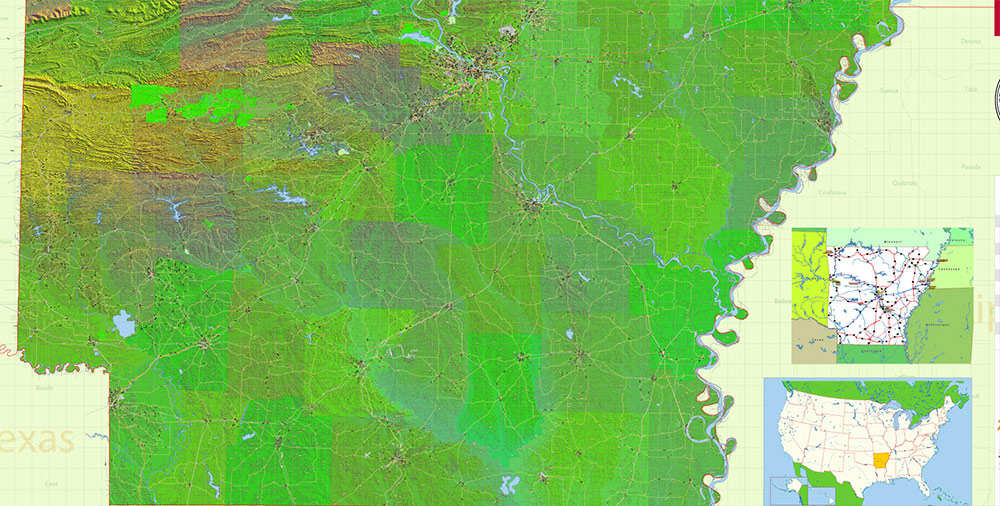
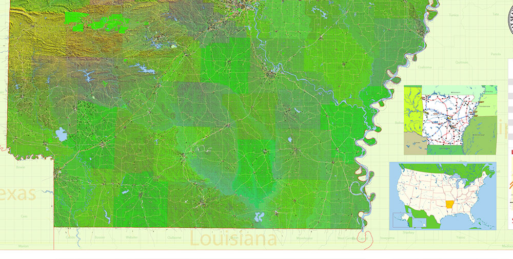
Printable Shaded Relief PDF Vector Map of Arkansas State, US High Detailed Plan full editable Adobe Illustrator PDF Road Admin Map in layers, scalable, text format all names, 1336 MB ZIP
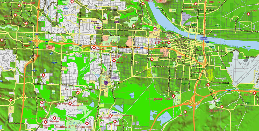
All streets and roads, Principal street names, All Cities and Towns, Airports and Heliports, Main Objects, Counties, raster Shaded Relief HD. Map for design, printing, arts, projects, presentations, for architects, designers, and builders, business, logistics.
The most exact and detailed map of the state in scale.
For Editing and High-Quality Printing, Royalty free
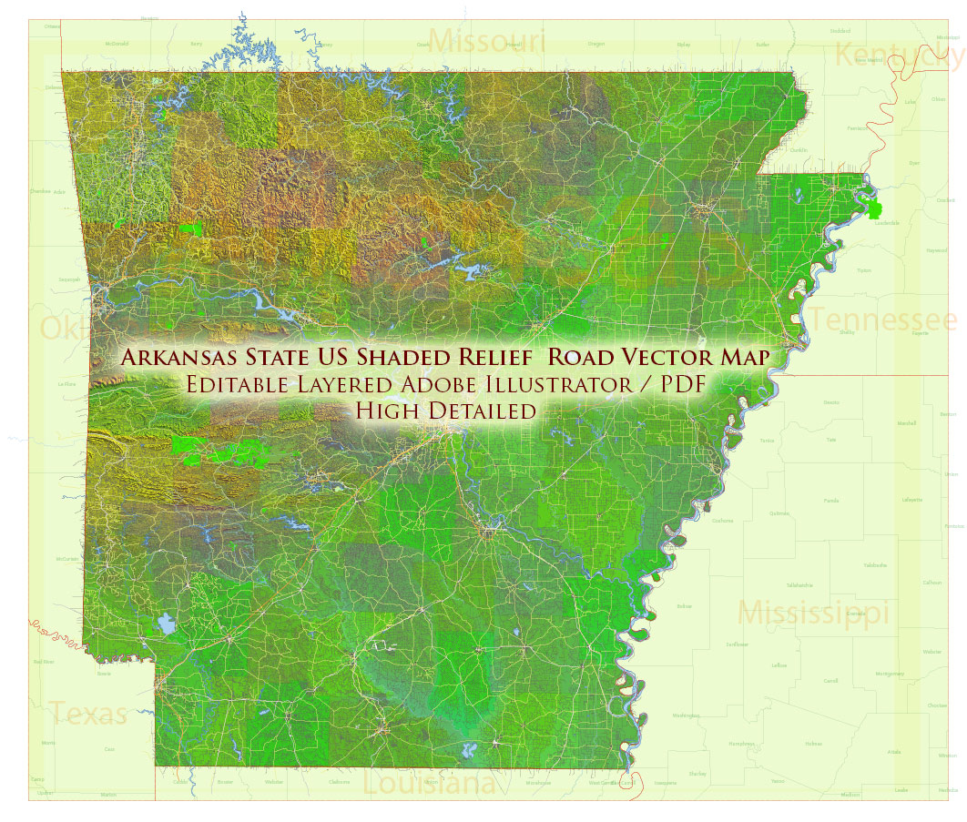
Arkansas State US PDF Map Vector Exact Shaded Relief and Roads High Detailed Map + Counties editable Adobe PDF in layers
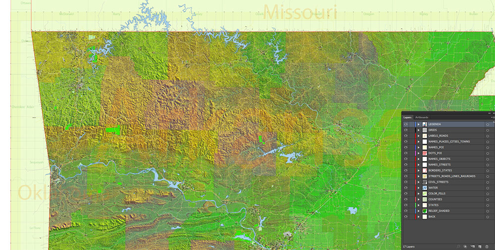
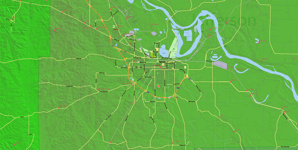
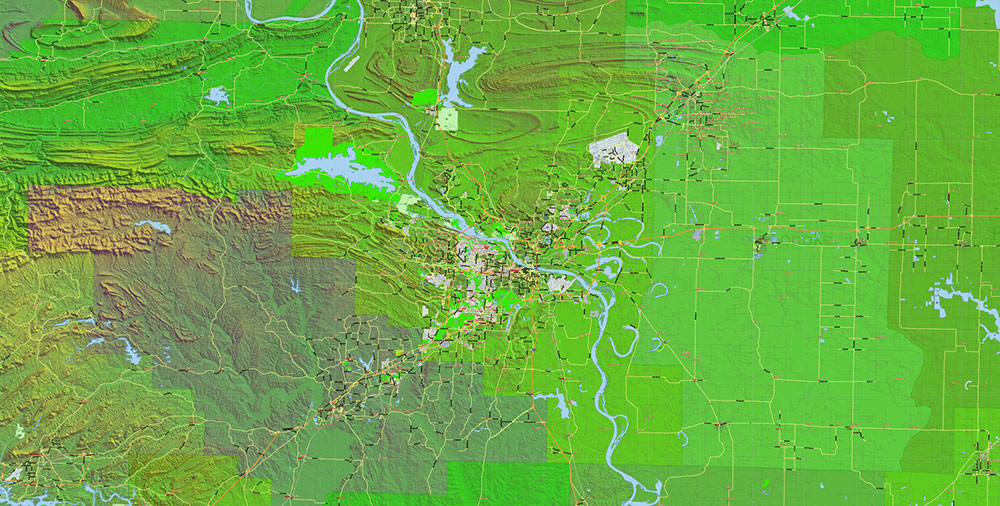
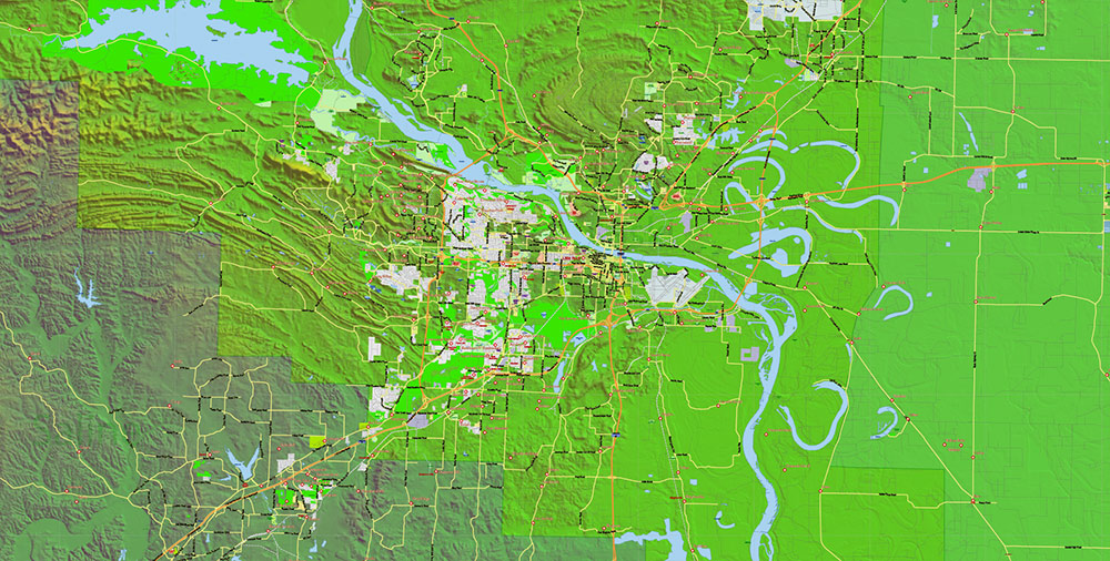
Layers list:
- Legend
- Grids
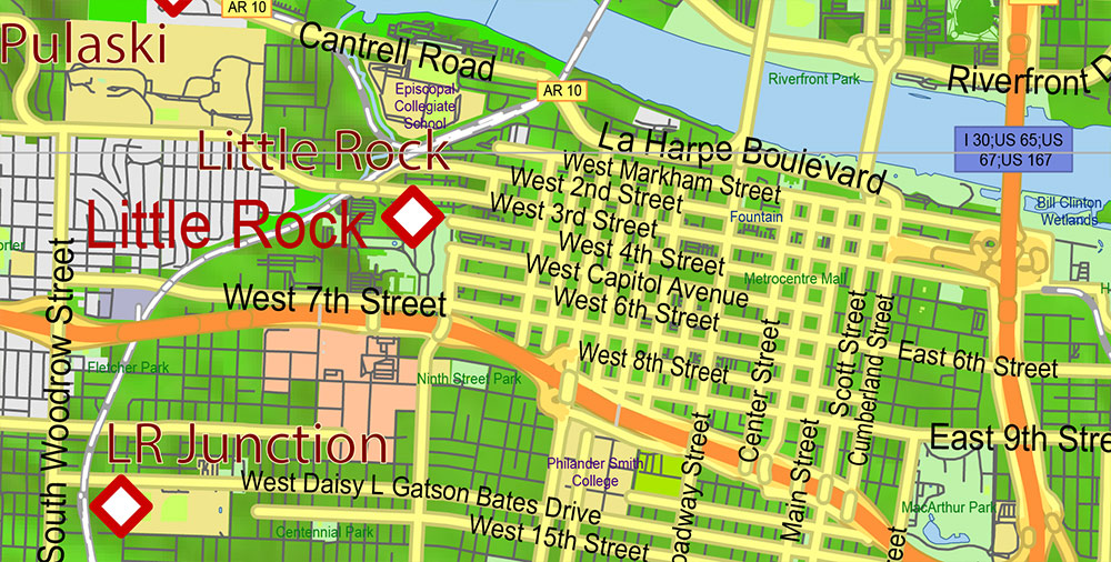
- Labels of roads
- Names of places (city, hamlet, etc.)
- Points of the Cities and Towns
- Airports and Heliports names
- Points of the Airports and Heliports
- Names of objects (hospitals, schools, parks, water)
- Names of main streets
- Names of Counties
- Principal Streets and Roads
- Residential streets
- Railroads
- Airports and Heliports areas
- Water objects (rivers, lakes, ponds)
- Waterways
- Color fills (parks, hospital areas, school areas, land use, etc.)
- Counties areas
- Shader Relief Raster JPG HD
- Background
Arkansas State US PDF Map Vector Exact Shaded Relief and Roads High Detailed Map + Counties editable Adobe PDF in layers
AO BRIEF — Arkansas, USA
Landlocked south-central U.S. state. Terrain-diverse, river-rich, low to mid population density. Strategic value lies in inland mobility corridors, major river systems, and dispersed urban nodes.
GEOGRAPHY & TERRAIN
-
Regions:
-
Ozark Plateau (NW): Rugged hills, forests, karst; restricted mobility off paved routes.
-
Ouachita Mountains (W–SW): East–west ridges; limited crossings.
-
Arkansas River Valley (Central): Broad corridor between Ozarks and Ouachitas.
-
Mississippi Alluvial Plain / Delta (E): Flat, fertile, flood-prone lowlands.
-
Elevation: ~55 m (Delta) to ~840 m (Ozarks).
-
Climate: Humid subtropical; hot summers, mild winters; severe storms/tornado risk in season.
LINES OF COMMUNICATION (ROADS & RAIL)
-
Interstates:
-
I-40: Primary east–west spine (Memphis ↔ Oklahoma City corridor).
-
I-30: Southwest axis (Little Rock ↔ Dallas).
-
I-49: North–south western axis (Kansas City region ↔ Fort Smith/Fayetteville).
-
I-55: Eastern edge along the Mississippi River.
-
U.S. Highways: US-67/167, US-65, US-71 provide secondary reach.
-
Rail: BNSF/UP corridors parallel major highways and river valleys.
MAJOR URBAN NODES
-
Little Rock: Capital, logistics hub, river crossing on Arkansas River.
-
Fort Smith: Border city; rail/road junction near Oklahoma.
-
Fayetteville: University, tech/services cluster (NW growth corridor).
-
Springdale: Poultry/food processing, logistics.
-
Jonesboro: Delta regional center.
-
Pine Bluff: River/industrial legacy.
WATER RESOURCES
-
Mississippi River: Eastern boundary; strategic inland waterway.
-
Arkansas River: Navigable; links to Mississippi via McClellan–Kerr system.
-
White River System: Major reservoirs (hydro, flood control).
-
Red River tributaries: Southwest drainage.
-
Lakes: Beaver Lake, Lake Ouachita, Bull Shoals—water supply, power, recreation.
-
Constraint: Seasonal flooding in Delta and river valleys.
ECONOMY / INFRASTRUCTURE
-
Primary sectors: Agriculture (rice, soy, poultry), food processing, logistics, light manufacturing.
-
Energy: Hydropower from reservoirs; grid stable but storm-vulnerable.
-
Rural logistics: Long distances between nodes; dependence on highways.
DEMOGRAPHY / HUMAN TERRAIN
-
Population: ~3 million.
-
Distribution: Concentrated in Central and NW corridors; sparse Delta/rural Ozarks.
-
Composition: Majority White; significant African American population in Delta; growing Hispanic communities in NW.
-
Social pattern: Urban-rural divide; generally cooperative civilian environment.
HAZARDS & CONSTRAINTS
-
Severe weather (tornadoes, thunderstorms).
-
Flooding along Mississippi and Arkansas rivers.
-
Forested, hilly terrain restricts off-road movement in Ozarks/Ouachitas.
-
Limited redundancy in some rural corridors.
COMMAND TAKEAWAYS
-
Control I-40 and Arkansas River crossings = statewide mobility dominance.
-
NW corridor (I-49) is the fastest-growing, most resilient AO.
-
Delta offers speed and visibility but high flood risk.
-
Terrain dictates corridor-based operations; air/river assets multiply reach.
-
Best suited for logistics, staging, and transit control rather than dense urban ops.
Arkansas State US PDF Map Vector Exact Shaded Relief and Roads High Detailed Map + Counties editable Adobe PDF in layers
Arkansas State US PDF Map Vector Exact Shaded Relief and Roads High Detailed Map + Counties editable Adobe PDF in layers
Arkansas State US PDF Map Vector Exact Shaded Relief and Roads High Detailed Map + Counties editable Adobe PDF in layers
Arkansas State US PDF Map Vector Exact Shaded Relief and Roads High Detailed Map + Counties editable Adobe PDF in layers
Arkansas State US PDF Map Vector Exact Shaded Relief and Roads High Detailed Map + Counties editable Adobe PDF in layers
Arkansas State US PDF Map Vector Exact Shaded Relief and Roads High Detailed Map + Counties editable Adobe PDF in layers
Arkansas State US PDF Map Vector Exact Shaded Relief and Roads High Detailed Map + Counties editable Adobe PDF in layers

 Author: Kirill Shrayber, Ph.D. FRGS


