Extended Description of the Vector Map
Printable Colored Relief PDF Vector Map of Arizona State, US High Detailed Plan full editable Adobe PDF Road Admin Map in layers, scalable, text format all names, 347 MB ZIP
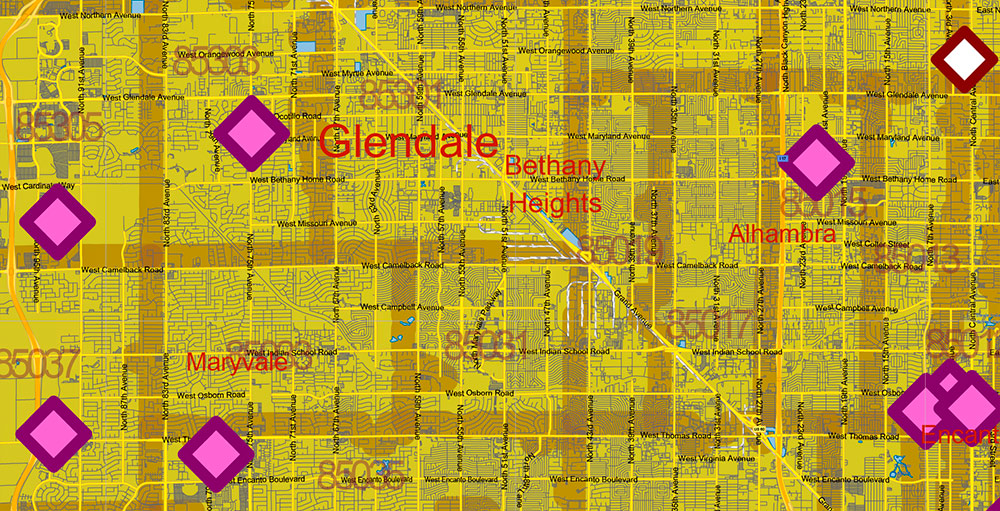
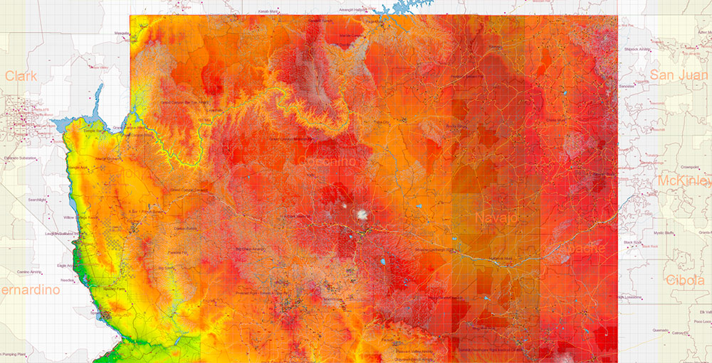
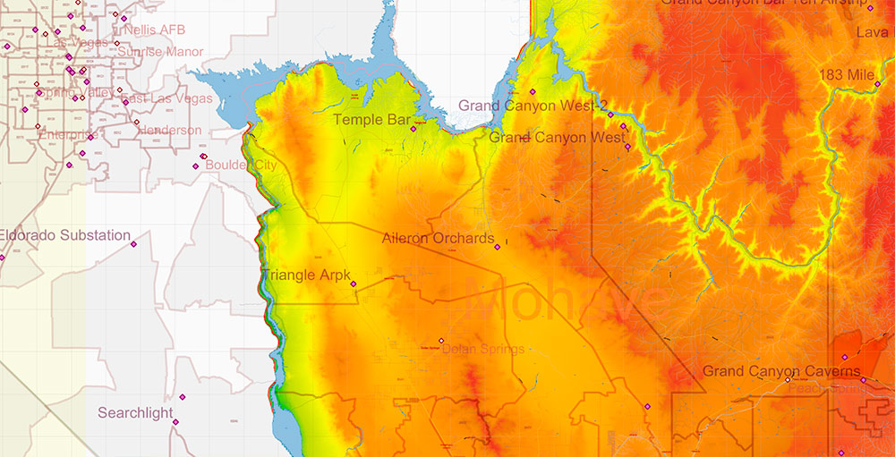
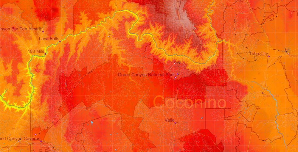
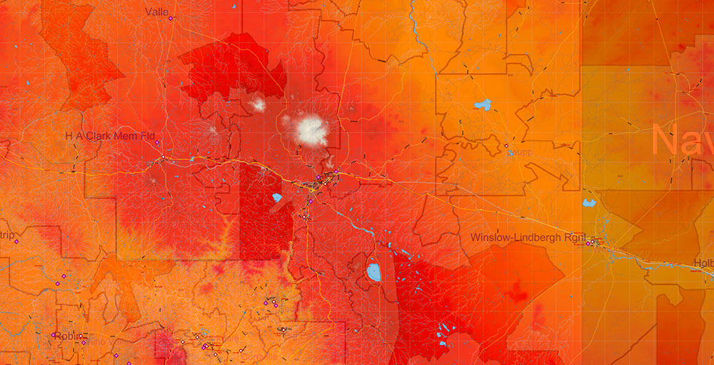
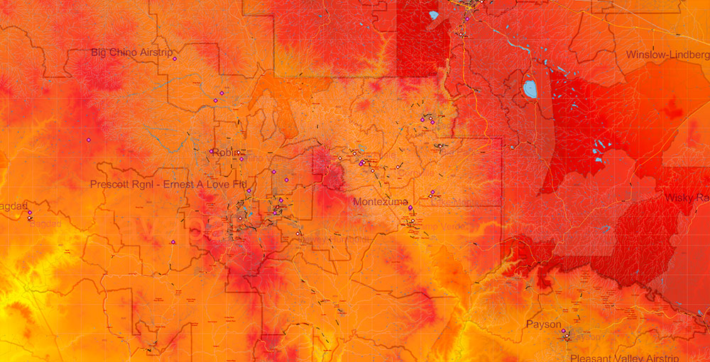
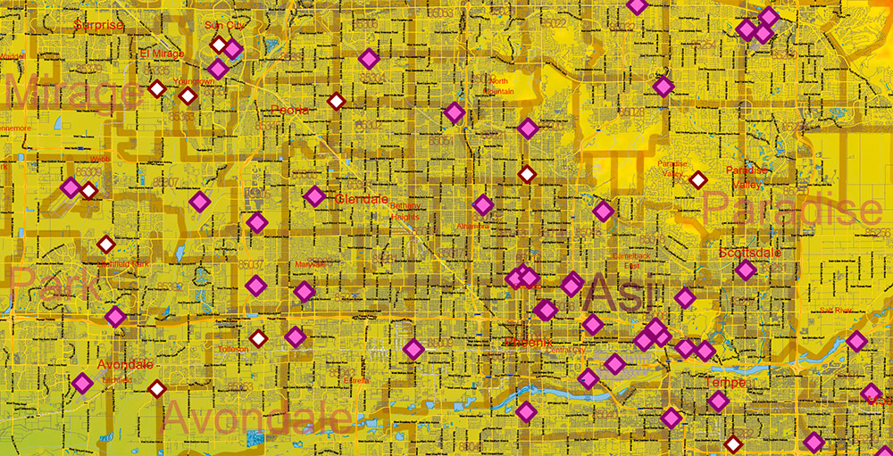
All streets and roads, Principal street names, All Cities and Towns, Zipcodes, Airports and Heliports, Main Objects, Counties, raster Colored Relief HD. Map for design, printing, arts, projects, presentations, for architects, designers, and builders, business, logistics.
The most exact and detailed map of the state in scale.
For Editing and High-Quality Printing, Royalty free
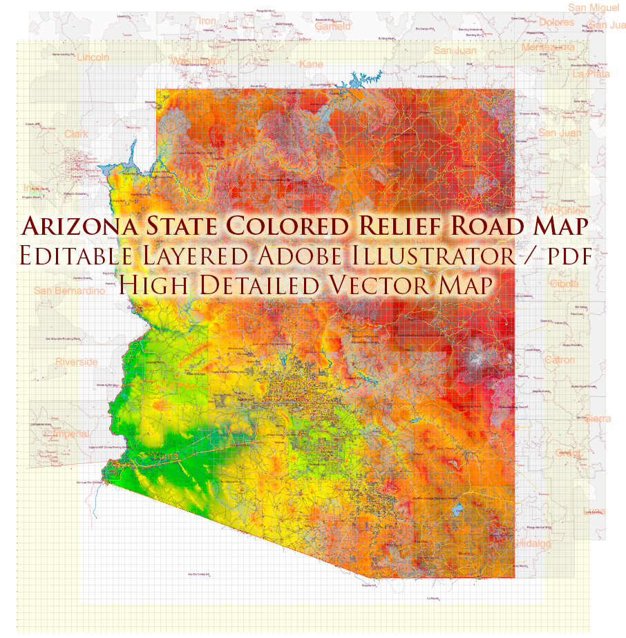
Arizona State US PDF Map Vector Exact Colored Reliaf and Roads High Detailed Map + Counties + Zipcodes editable Adobe PDF in layers
Layers list:
- Legend
- Grids
- Labels of roads
- Names of places (city, hamlet, etc.)
- Points of the Cities and Towns 2
- Airports and Heliports names
- Points of the Airports and Heliports
- Names of objects (hospitals, schools, parks, water)
- Names of main streets
- Names of Counties
- Principal Streets and Roads
- Residential streets
- Railroads
- ZIP Codes numbers
- ZIP Codes areas
- Airports and Heliports areas
- Water objects (rivers, lakes, ponds)
- Waterways
- Color fills (parks, hospital areas, school areas, land use, etc.)
- Islands
- Counties areas
- Colored Relief Raster JPG HD
- Background
AO Brief — Arizona (USA)
Geology & Biosphere–Focused Edition
1) Geological Overview (Why Arizona looks the way it does)
Arizona is a geologist’s cross-section of western North America: ancient continental crust in the north, uplifted plateaus in the middle, and stretched desert basins in the south and west. Three major provinces dominate.
-
Age: Mostly Paleozoic sedimentary rocks (sandstone, limestone, shale), laid down 250–550+ million years ago.
-
Structure: Broad, relatively undeformed layers; horizontal strata exposed by erosion.
-
Signature landforms: Mesas, buttes, slot canyons, sheer cliffs.
-
Iconic incision: The Grand Canyon, cut primarily by river erosion following regional uplift.
-
Operational implications: Stable bedrock, steep relief, long sightlines; limited crossings due to cliffs and canyon systems.
B) Mogollon Rim & Central Highlands
-
Nature: A major escarpment marking the southern edge of the Plateau.
-
Rock types: Basalts, limestones, sandstones; volcanic caps in places.
-
Role: Climatic and ecological boundary—cooler, wetter highlands above; arid basins below.
-
Operational implications: Natural barrier to north–south movement; weather shifts abruptly with elevation.
C) Basin and Range Province (South & West)
-
Process: Crustal stretching over the last ~20–30 million years.
-
Pattern: Alternating fault-block mountain ranges and sediment-filled basins.
-
Rock types: Metamorphic cores, granites, volcanic flows, thick alluvial fans.
-
Operational implications: Long valleys favor movement; rugged ranges channel routes into predictable corridors.
2) Volcanism & Tectonics (Still visible, mostly quiet)
-
Volcanic fields: Northern Arizona hosts extensive basaltic lava fields and cinder cones, especially near Flagstaff.
-
Highest terrain: The San Francisco Peaks—remnants of a large stratovolcano.
-
Seismicity: Generally low to moderate; faults are visible but mostly inactive.
-
Soils: Volcanic soils in the north are fertile and support dense forests; desert soils are thin, saline, or gravelly.
3) Mineral Resources (Why people came here)
-
Copper: Arizona is one of the world’s major copper regions; large porphyry copper systems dominate the south and central areas.
-
Other resources: Gold, silver, molybdenum, uranium (historic), and industrial minerals.
-
Landscape impact: Open-pit mines, tailings, altered drainage patterns—important for environmental and mobility considerations.
4) Biomes & Ecosystems (From cactus to alpine forest)
Arizona compresses multiple North American biomes into one state due to elevation change of over 3,000 m from lowest desert to highest peaks.
-
Climate: Hot desert with bimodal rainfall (winter storms + summer monsoon).
-
Vegetation: Saguaro cactus, palo verde, creosote bush, ocotillo.
-
Fauna: Reptiles, small mammals, desert birds; activity peaks at dawn/dusk.
-
Operational notes: Sparse cover, extreme heat stress, excellent visibility.
B) Chihuahuan Desert (Southeast margins)
C) Grasslands & Shrublands (Mid-elevations)
D) Ponderosa Pine Forests (Central Highlands & Rim)
-
One of the world’s largest continuous ponderosa pine forests.
-
Cooler temperatures, higher precipitation.
-
Fire ecology: Frequent low-intensity fires historically; modern suppression increases wildfire risk.
E) Subalpine & Alpine Zones (Highest Peaks)
5) Riparian Systems (Small area, huge importance)
-
Streams and rivers support a disproportionate share of biodiversity.
-
Cottonwood–willow corridors host birds, insects, and mammals.
-
Many rivers are ephemeral; flow appears only after storms.
-
Operational relevance: Natural movement corridors, shade, water—but also flash-flood hazards.
6) Climate–Biosphere Interaction
-
Elevation controls life: Every 300 m of elevation roughly mimics moving hundreds of kilometers north in climate.
-
Monsoon dynamics: Summer storms trigger rapid plant growth, insect booms, and animal activity—but also erosion and flooding.
-
Drought sensitivity: Long droughts stress forests, increase pest outbreaks, and elevate wildfire probability.
-
Climate change trend (broad): Hotter extremes, altered fire regimes, stressed water systems.
7) Protected Lands & Ecological Constraints
-
Large portions of Arizona are national parks, monuments, forests, wilderness areas, and tribal lands.
-
These areas preserve geology and ecosystems but restrict access and alteration.
-
Biodiversity “hot spots” often overlap with rugged or water-rich terrain.
8) Hazards Rooted in Geology & Ecology
-
Heat & dehydration (deserts).
-
Wildfire (forested highlands).
-
Flash floods (arroyos, slot canyons).
-
Rockfall & landslides (steep canyon walls, Rim country).
-
Dust storms (fine desert sediments + wind).
9) Geology–Biosphere Summary (One-Look Takeaway)
-
Arizona’s geology sets the stage: uplifted plateaus, faulted basins, and volcanic highlands.
-
Elevation drives ecosystems, creating sharp transitions from cactus desert to alpine tundra within short distances.
-
Water is the master variable—scarce, episodic, and tightly linked to terrain.
-
Any operation or planning effort must treat heat, fire, floods, and protected lands as primary environmental constraints.
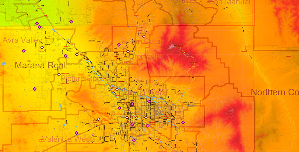
Arizona State US PDF Map Vector Exact Colored Reliaf and Roads High Detailed Map + Counties + Zipcodes editable Adobe PDF in layers
Arizona State US PDF Map Vector Exact Colored Reliaf and Roads High Detailed Map + Counties + Zipcodes editable Adobe PDF in layers
Arizona State US PDF Map Vector Exact Colored Reliaf and Roads High Detailed Map + Counties + Zipcodes editable Adobe PDF in layers
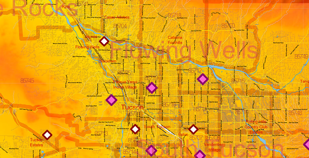
Arizona State US Map Vector Exact Colored Reliaf and Roads High Detailed Map + Counties + Zipcodes editable Adobe Illustrator in layerArizona State US PDF Map Vector Exact Colored Reliaf and Roads High Detailed Map + Counties + Zipcodes editable Adobe PDF in layers
Arizona State US PDF Map Vector Exact Colored Reliaf and Roads High Detailed Map + Counties + Zipcodes editable Adobe PDF in layers
Arizona State US PDF Map Vector Exact Colored Reliaf and Roads High Detailed Map + Counties + Zipcodes editable Adobe PDF in layers
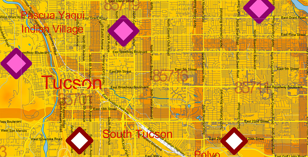
Arizona State US PDF Map Vector Exact Colored Reliaf and Roads High Detailed Map + Counties + Zipcodes editable Adobe PDF in layers
Arizona State US PDF Map Vector Exact Colored Reliaf and Roads High Detailed Map + Counties + Zipcodes editable Adobe PDF in layers
Arizona State US PDF Map Vector Exact Colored Reliaf and Roads High Detailed Map + Counties + Zipcodes editable Adobe PDF in layers
Arizona State US PDF Map Vector Exact Colored Reliaf and Roads High Detailed Map + Counties + Zipcodes editable Adobe PDF in layers
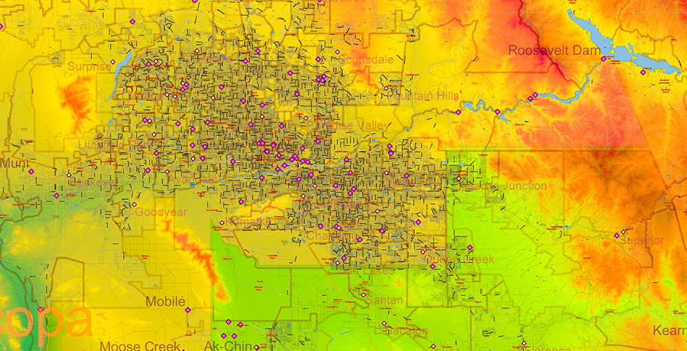
Arizona State US PDF Map Vector Exact Colored Reliaf and Roads High Detailed Map + Counties + Zipcodes editable Adobe PDF in layers
Arizona State US PDF Map Vector Exact Colored Reliaf and Roads High Detailed Map + Counties + Zipcodes editable Adobe PDF in layers

 Author: Kirill Shrayber, Ph.D. FRGS


