Antalya is a resort and port city in southern Turkey on the Mediterranean coast, the administrative center of Antalya Province. The permanent population of the city is just over 1 million people, while in the summer the number of people actually in the city can exceed 2 million due to the active tourist flow.
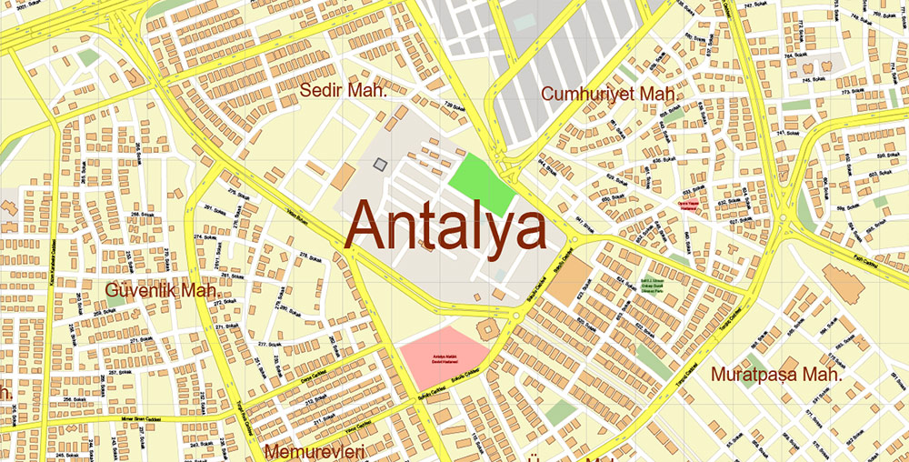
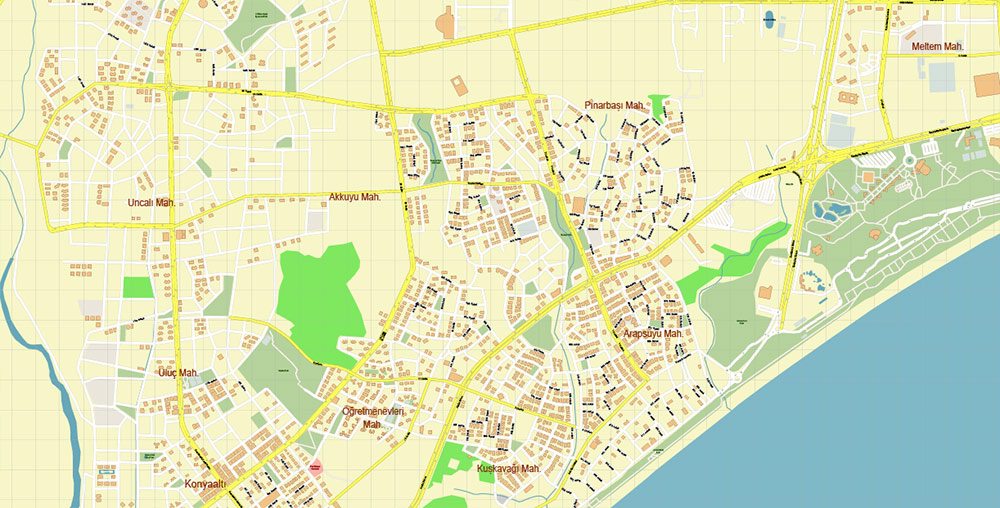
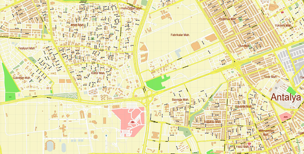
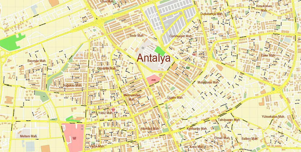
The territory of Antalya is divided into old and new cities. The official administrative division is divided into 5 districts: Aksu, Deshemealty, Kepez, Konyaaltı, Muratpaşa.
Antalya has a subtropical Mediterranean climate, with mild, very rainy winters and long, hot, dry summers. A very large amount of precipitation in winter in Antalya falls due to the Taurus Mountains, which prevent the penetration of cyclones further north, as if “filtering out” their contents. In summer, precipitation is rare, sometimes there was a summer with no precipitation at all. The relative humidity of the air almost all year round is from 55 to 65 percent.
From May to October, the dry season is dominated by clear, low-cloud weather, and from October to April, the wet season is dominated by cold winds and heavy rains. Negative air temperatures and snow are extremely rare and short-lived. The swimming season is conventionally considered from mid-May to early November.
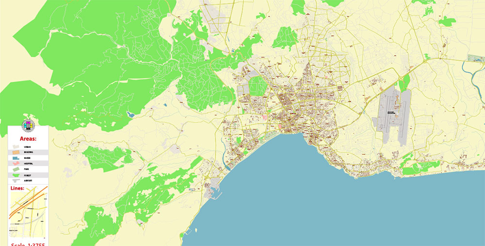
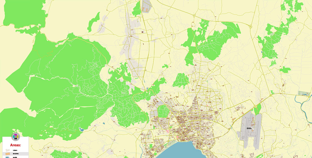
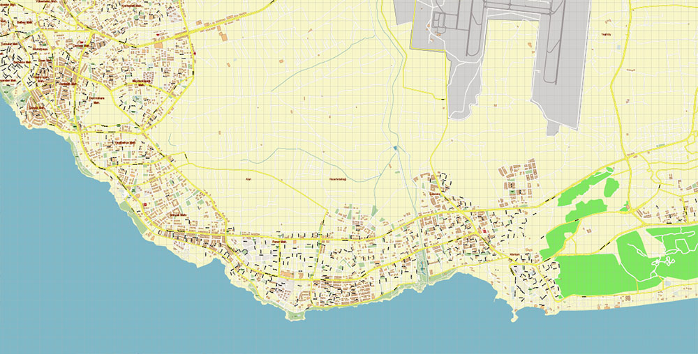
The terrain of the entire province of Antalya is mostly mountainous, and the territory of the city is no exception. The coastal area has steep multi-meter height differences (clearly visible in the old town), on one of them, there is a waterfall. Further from the shore in the area of new buildings, the differences are less.
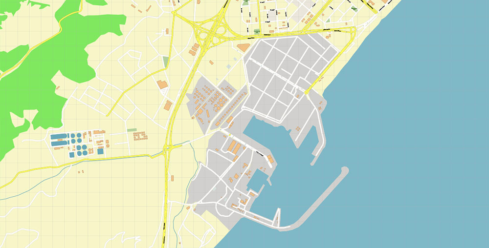
The main sectors of the economy are agriculture, tourism, trade, and the light industry. Among the relatively new aspects of the economic development of the city, it is worth noting the construction of pleasure yachts, which has been gaining momentum since the beginning of the 2010s (since the commissioning of the new seaport).
Agriculture is represented by crop production (citrus fruits, bananas, olives, apples, tomatoes, cucumbers, cotton), animal husbandry (sheep, poultry), and processing of agricultural products (production of olive oil, fruit juices, canned food). Despite access to the sea, fishing and seafood production in the region are practically not carried out.
Light industry is primarily represented by textiles (clothing, household items), with a small number of leather industries.
Trade and tourism form the basis of the economic well-being of the city and the region. Until the mid-2000s, the tourist flow consisted mainly of consumers of package tours from Russia, Ukraine, and Germany. Recently, the authorities have used a different concept-instead of isolated all-inclusive hotels, the emphasis is on the attractiveness of the entire city and the development of its recreational structures. Due to the active influx of tourists, trade is also flourishing, represented at all levels-from huge megamalls to small private shops.
Clock Tower (Saat kulesi) and mosque on Republic Square
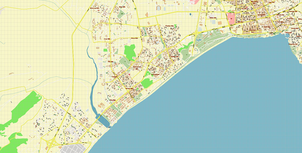
The historic center (old town) combines elements of Roman, Byzantine, and Ottoman architectural traditions. Most of the remaining buildings and structures date back to the Ottoman period. Apart from the architecture, the old town of Antalya is also famous for its ancient monuments and archaeological museum.
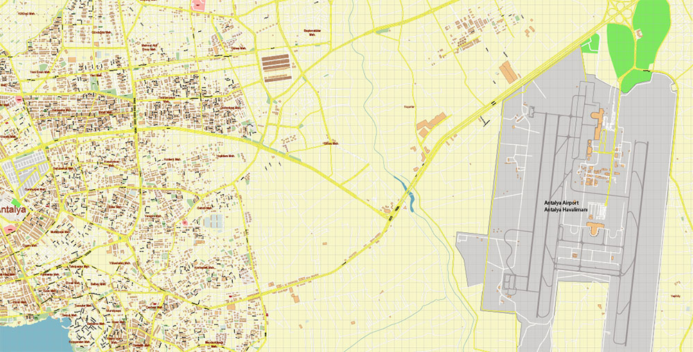
Antalya has a huge airport, its two international terminals are considered one of the best on the entire Mediterranean coast (in 2014, a record was set — 12.5 million people passed through the Antalya airport). The quality of the roads is at a high level. Throughout the city, there is a large number of catering organizations and entertainment establishments. The coastal area consists of beaches (many of which are awarded for their high level of comfort and cleanliness), children’s attractions, water activities, and small beach cafes and restaurants.
There are not many hotels and inns within the city, mostly they are located in suburban villages.
The city has 2 universities (Antalya Tourism Academy and Akdeniz), 3 sports complexes, a large number of schools, hospitals and preschool institutions.
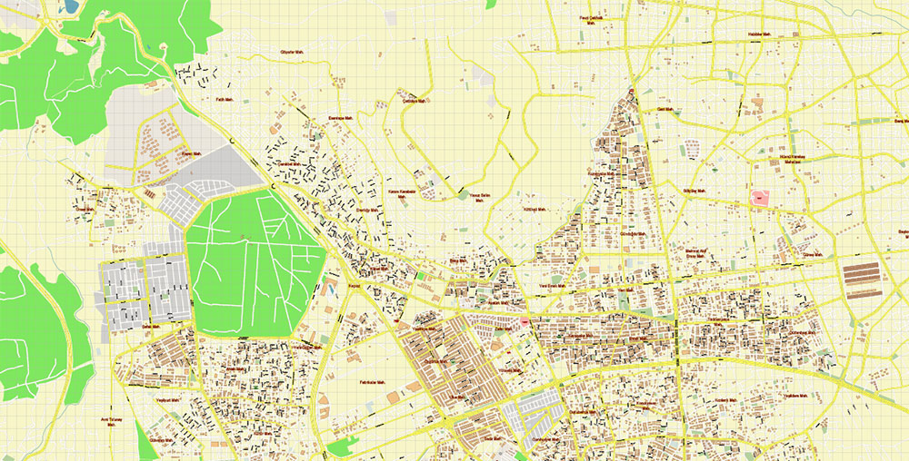
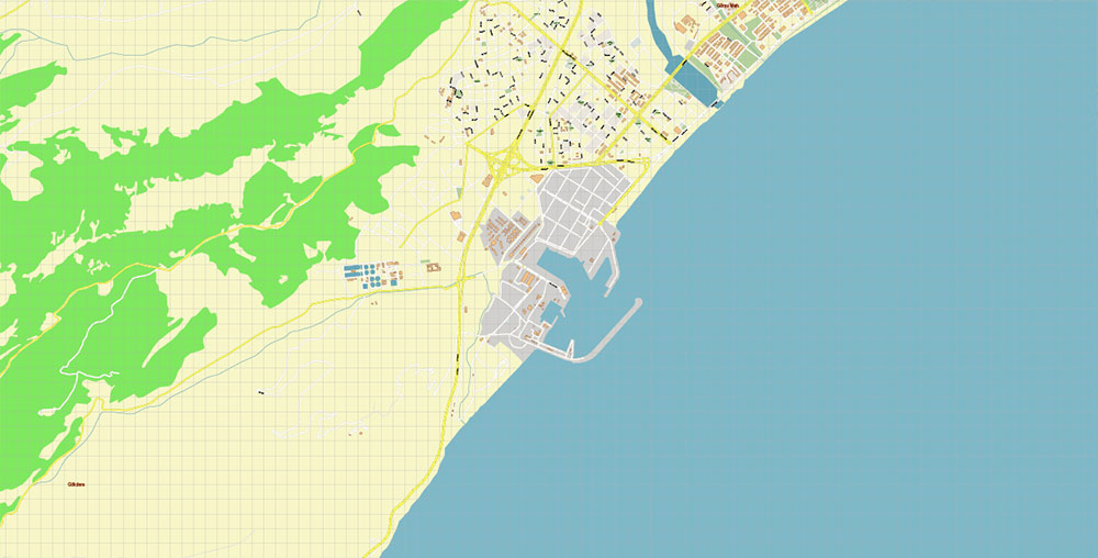
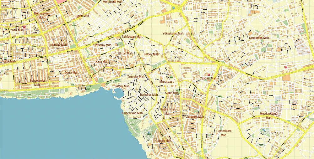
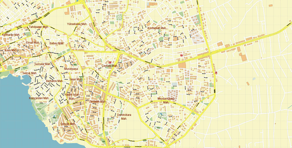
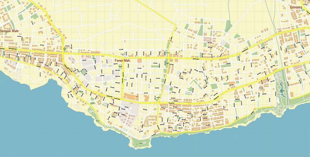
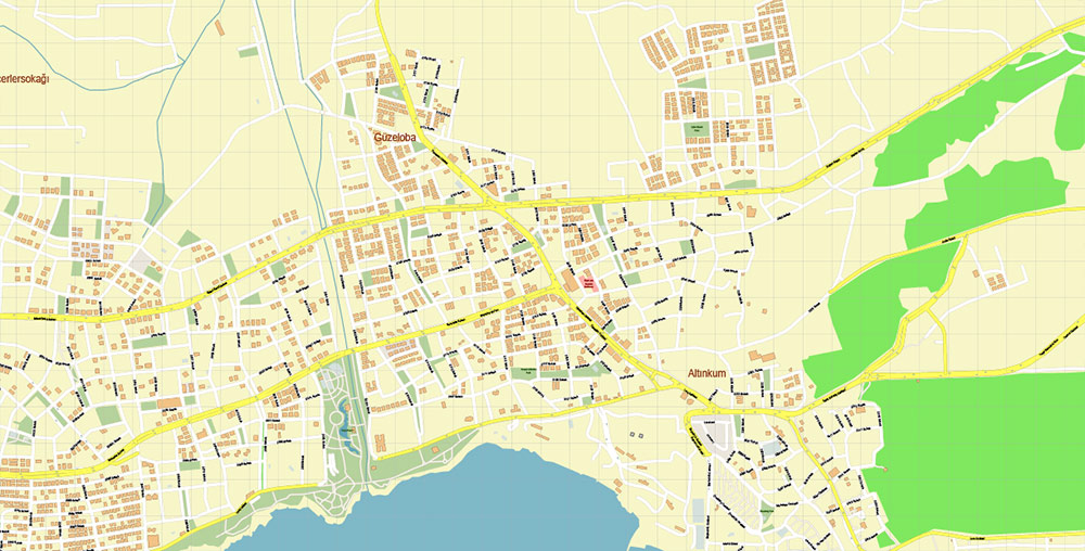
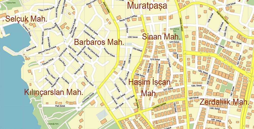
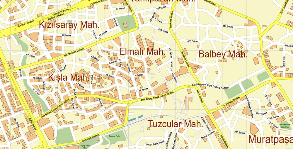
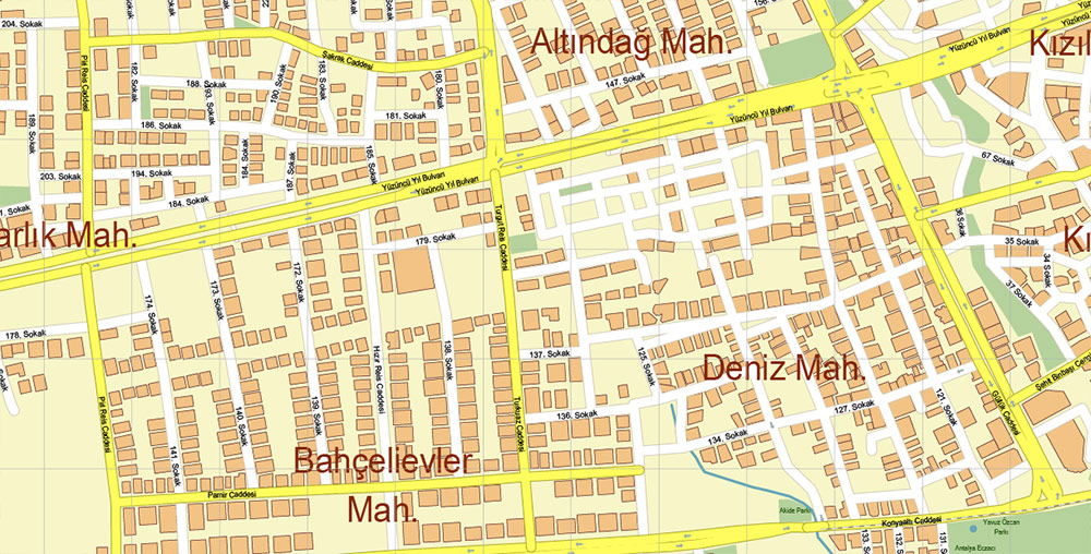
Printable Vector Map of Antalya Turkey detailed City Plan scale 1:3755 full editable Adobe Illustrator Street Map in layers, scalable, text / curves format all names, 7 MB ZIP
All street names, Main Objects, Buildings. Map for design, printing, arts, projects, presentations, for architects, designers, and builders, business, logistics.
Need AutoCAD DWG / DXF or any other format? Please, contact us!
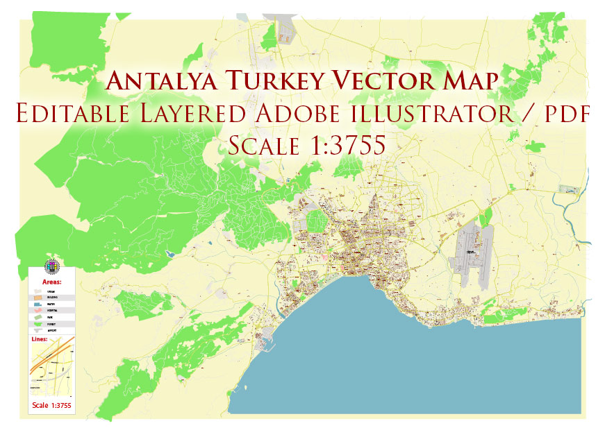
Antalya Turkey Map Vector Accurate High Detailed City Plan editable Adobe Illustrator Street Map in layers
Layers list:
- Legend
- Grids
- Names of places (city, hamlet, etc.)
- Names of objects (hospitals, parks, water)
- Names of main streets
- Names of civil streets
- Arrows of street drive direction
- Main Streets, roads
- Civil streets
- Railroads
- Buildings
- Airports and heliports
- Water objects (rivers, lakes, ponds)
- Waterways
- Color fills (parks, hospital areas, land use, etc.)
- Islands
- Background and Sea
Antalya Turkey Map Vector Accurate High Detailed City Plan editable Adobe Illustrator Street Map in layers
Antalya Turkey Map Vector Accurate High Detailed City Plan editable Adobe Illustrator Street Map in layers
Antalya Turkey Map Vector Accurate High Detailed City Plan editable Adobe Illustrator Street Map in layers
Antalya Turkey Map Vector Accurate High Detailed City Plan editable Adobe Illustrator Street Map in layers
Antalya Turkey Map Vector Accurate High Detailed City Plan editable Adobe Illustrator Street Map in layers
Antalya Turkey Map Vector Accurate High Detailed City Plan editable Adobe Illustrator Street Map in layers
Antalya Turkey Map Vector Accurate High Detailed City Plan editable Adobe Illustrator Street Map in layers
Antalya Turkey Map Vector Accurate High Detailed City Plan editable Adobe Illustrator Street Map in layers
Antalya Turkey Map Vector Accurate High Detailed City Plan editable Adobe Illustrator Street Map in layers

Antalya Turkey Map Vector Accurate High Detailed City Plan editable Adobe Illustrator Street Map in layers
Antalya Turkey Map Vector Accurate High Detailed City Plan editable Adobe Illustrator Street Map in layers
Antalya Turkey Map Vector Accurate High Detailed City Plan editable Adobe Illustrator Street Map in layers
Antalya Turkey Map Vector Accurate High Detailed City Plan editable Adobe Illustrator Street Map in layers
Antalya Turkey Map Vector Accurate High Detailed City Plan editable Adobe Illustrator Street Map in layers
Antalya Turkey Map Vector Accurate High Detailed City Plan editable Adobe Illustrator Street Map in layers
Antalya Turkey Map Vector Accurate High Detailed City Plan editable Adobe Illustrator Street Map in layers
Antalya Turkey Map Vector Accurate High Detailed City Plan editable Adobe Illustrator Street Map in layers
Antalya Turkey Map Vector Accurate High Detailed City Plan editable Adobe Illustrator Street Map in layers
Antalya Turkey Map Vector Accurate High Detailed City Plan editable Adobe Illustrator Street Map in layers
Antalya Turkey Map Vector Accurate High Detailed City Plan editable Adobe Illustrator Street Map in layers

 Author: Kirill Shrayber, Ph.D. FRGS
 Street Map editable Adobe Illustrator in layers")
