Extended Description of the Vector Map
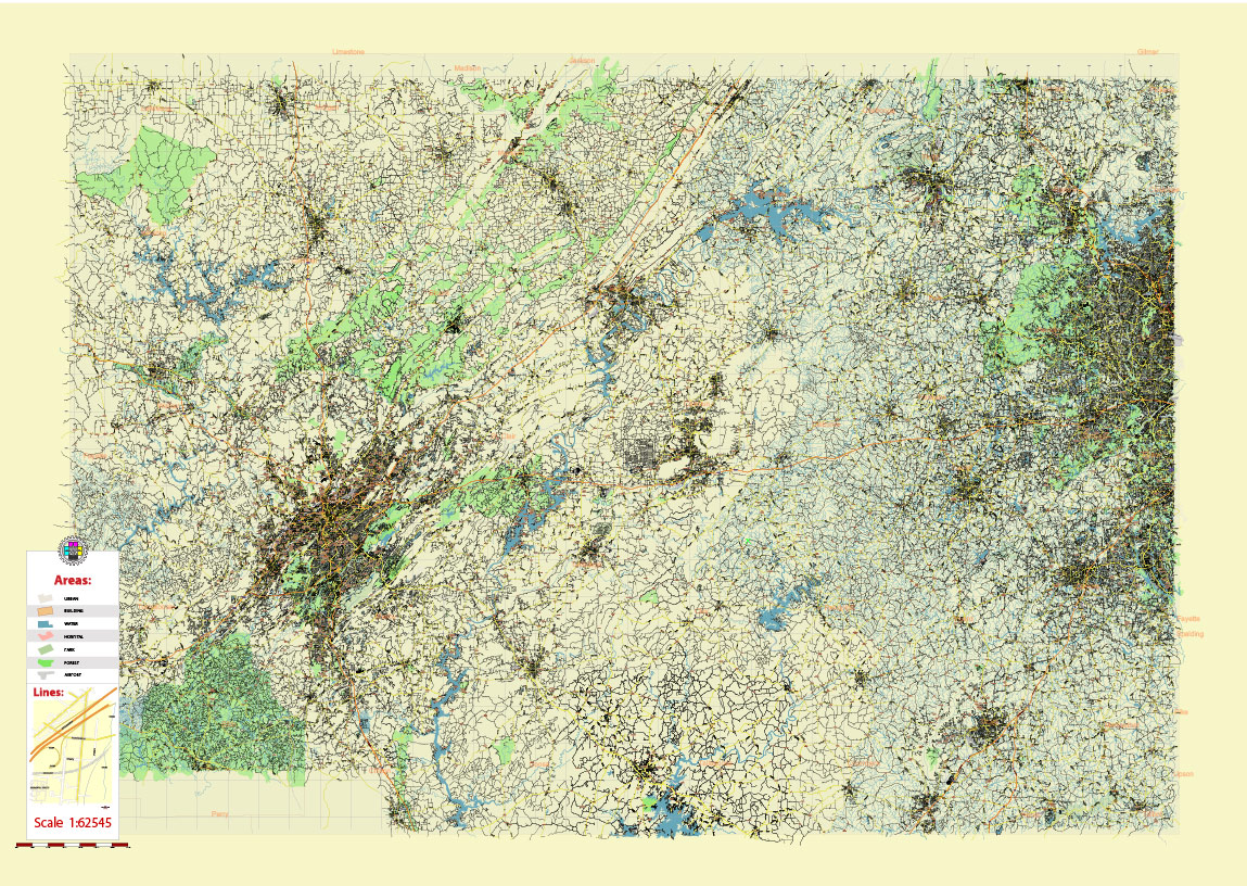
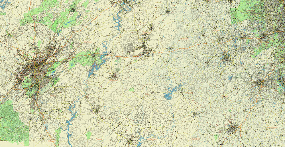
Printable Shaded Relief Vector Map of Alabama – Georgia USA Tornado Area High Detailed Road Map fully editable Adobe Illustrator Road and Counties Map in layers, scalable, text/curves format all names, 366 MB ZIP
All streets and roads, All Cities and Towns, Airports and Heliports, Main Objects, Counties, raster Shaded Relief HD. Map for design, printing, arts, projects, presentations, for architects, designers, and builders, business, logistics.
The most exact and detailed map of the state in scale.
For Editing and High-Quality Printing, Royalty free
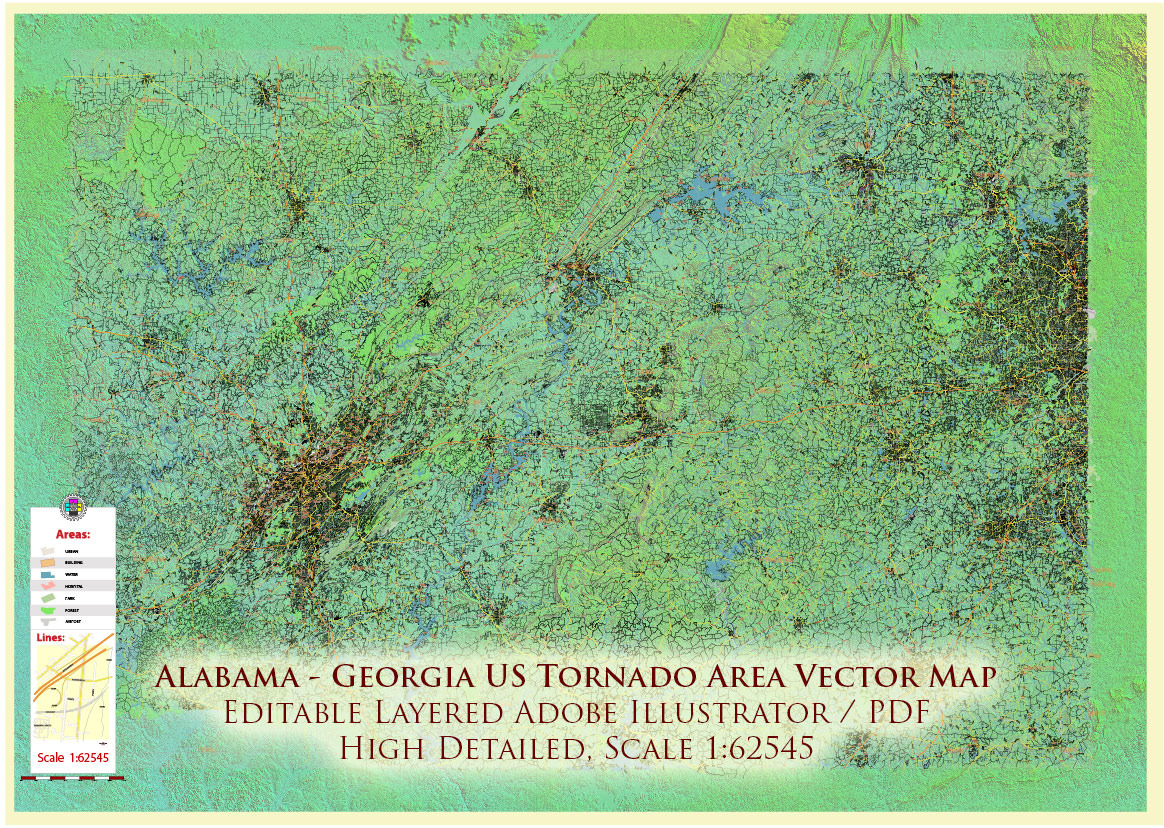
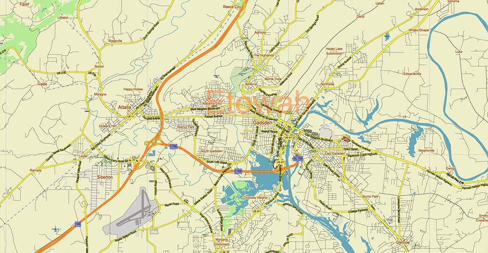
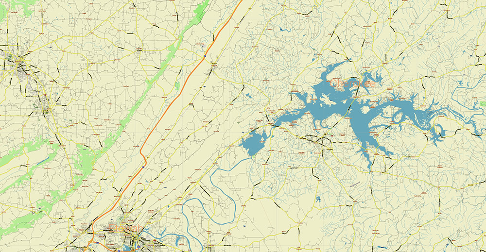
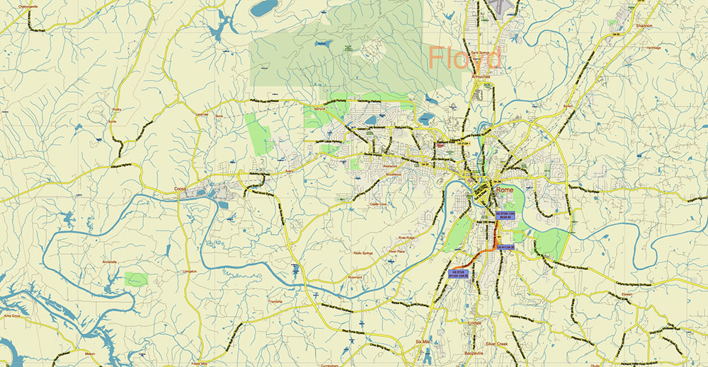
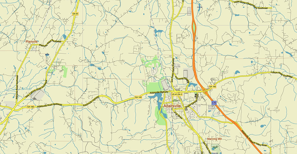
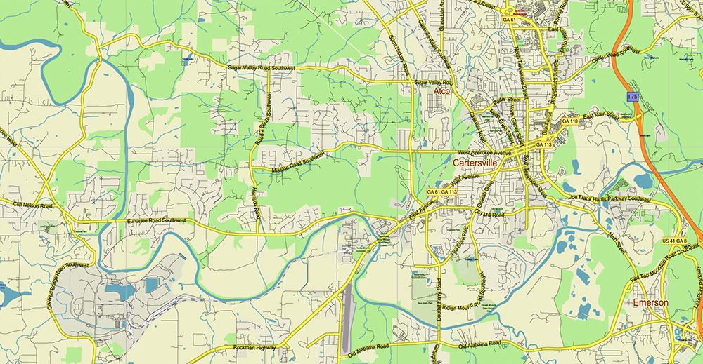
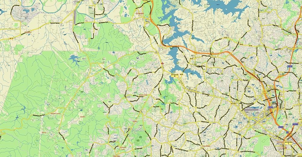
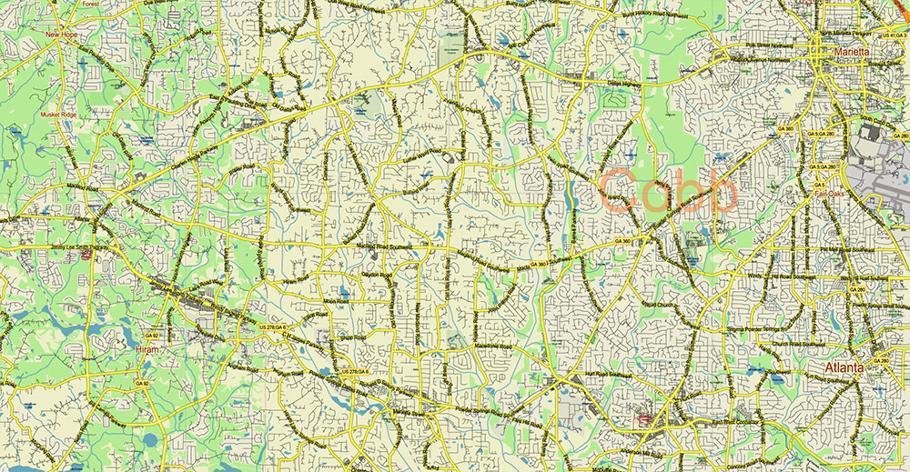
Alabama – Georgia USA Tornado Area Vector Map: high detailed road map + Shaded Relief editable Adobe Illustrator
Alabama – Georgia USA Tornado Area Vector Map: high detailed road map + Shaded Relief editable Adobe Illustrator
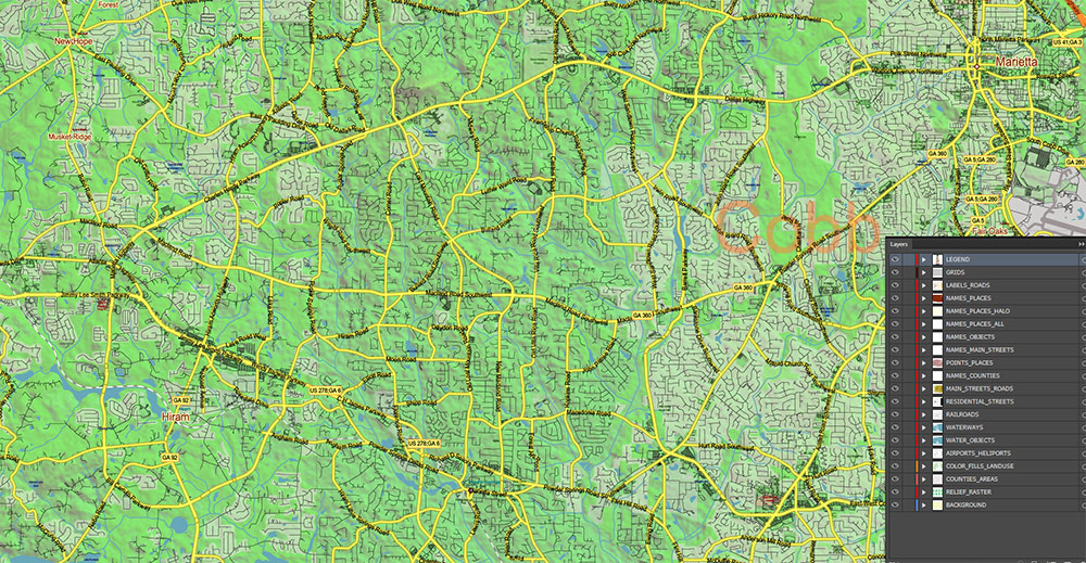
Layers list:
- Legend – Scale in miles
- Grids
- Names of places (city, hamlet, etc.) + Halo
- Names of Places 2
- Points of the Cities and Towns
- Names of objects
- Names of Counties
- Principal Streets and Roads
- Residential streets and roads
- Railroads
- Airports and Heliports runways
- Water objects (rivers, lakes, ponds)
- Waterways
- Land Use Areas transparent 50%
- Counties areas transparent 20%
- Shader Relief Raster transparent 50%
- Background
AO BRIEF — ALABAMA–GEORGIA TORNADO AREA (USA)
Overview
- Core sector of the Dixie Alley tornado belt in the southeastern United States
- Area of operations: central & northern Alabama and western–central Georgia
- Terrain: rolling hills, dissected plateaus, wide river valleys; lower relief than Great Plains but more vegetated
- High tornado frequency with year-round potential, peak in March–May and secondary peak in November–December
- Tornadoes often rain-wrapped, fast-moving, and occurring at night → high casualty risk
Key Roads / Lines of Communication
- Primary E–W corridors:
- I-20 (Birmingham – Atlanta axis; critical spine)
- US-78 (parallel regional route)
- Primary N–S corridors:
- I-65 (Mobile – Birmingham – Nashville axis; western boundary influence)
- I-75 (Atlanta – Macon; eastern operational spine)
- I-85 (Montgomery – Atlanta; key connector)
- Dense secondary highway grid; rural road network extensive but tree-lined, low visibility
- Rail corridors follow valleys; logistics hubs concentrated around Birmingham and Atlanta
Terrain / Geography
- Western AO: Black Belt (Alabama) — low rolling terrain, clay soils, open agricultural patches
- Central AO: Appalachian foothills — irregular ridges, forested slopes, elevation variation up to ~500–700 m
- Eastern AO: transition into Piedmont Plateau (Georgia) — smoother uplands, dense vegetation
- Major rivers:
- Tombigbee River (west flank)
- Alabama River
- Coosa River
- Chattahoochee River (GA–AL boundary)
- Forest cover high (mixed pine–hardwood) → limited line-of-sight, radar masking in valleys
Climate / Seasonality
- Humid subtropical climate
- Strong moisture inflow from the Gulf of Mexico
- Frequent collision of:
- Warm, moist Gulf air
- Cooler continental air from the north
- Severe storm ingredients often present:
- High CAPE + strong wind shear
- Tornado characteristics:
- More frequent long-track supercells
- High incidence of nighttime events
- Reduced visual detection vs Plains
Demography / Human Terrain
- Major urban nodes:
- Birmingham (industrial/logistics hub)
- Atlanta (major metro, dense infrastructure)
- Montgomery
- Columbus
- High proportion of rural population, dispersed settlements
- Significant number of manufactured homes (mobile homes) → elevated vulnerability
- Socioeconomic variability; some regions with limited access to shelters
Hazards / Threats
- Primary: EF2–EF5 tornadoes, often embedded in squall lines or supercells
- Secondary:
- Severe thunderstorms (hail, damaging winds)
- Flash flooding in river basins and lowlands
- Key operational hazards:
- Low visibility (rain-wrapped tornadoes)
- Night events (reduced warning response)
- Dense vegetation masking funnel approach
- Infrastructure vulnerability:
- Power grid disruptions widespread
- Road blockage from fallen trees
Logistics / Sustainment
- Strong interstate network enables rapid response between hubs
- Air support viable via:
- Birmingham–Shuttlesworth Intl.
- Hartsfield–Jackson Atlanta Intl. (major logistics node)
- Constraints:
- Rural road congestion post-event
- Debris fields in forested areas slow ground movement
- Staging areas best located near interstate junctions (I-20 / I-65 / I-75 corridors)
Command Takeaways
- Expect high-impact tornado events with low detectability
- Prioritize early warning dissemination, especially for nocturnal scenarios
- Route planning must account for tree cover and debris blockage
- Urban corridors (Birmingham–Atlanta axis) = critical infrastructure + high exposure
- Compared to Great Plains: lower visibility, higher vulnerability, more complex terrain
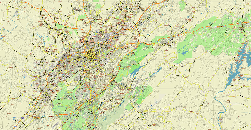
Alabama – Georgia USA Tornado Area Vector Map: high detailed road map + Shaded Relief editable Adobe Illustrator
Alabama – Georgia USA Tornado Area Vector Map: high detailed road map + Shaded Relief editable Adobe Illustrator
Alabama – Georgia USA Tornado Area Vector Map: high detailed road map + Shaded Relief editable Adobe Illustrator
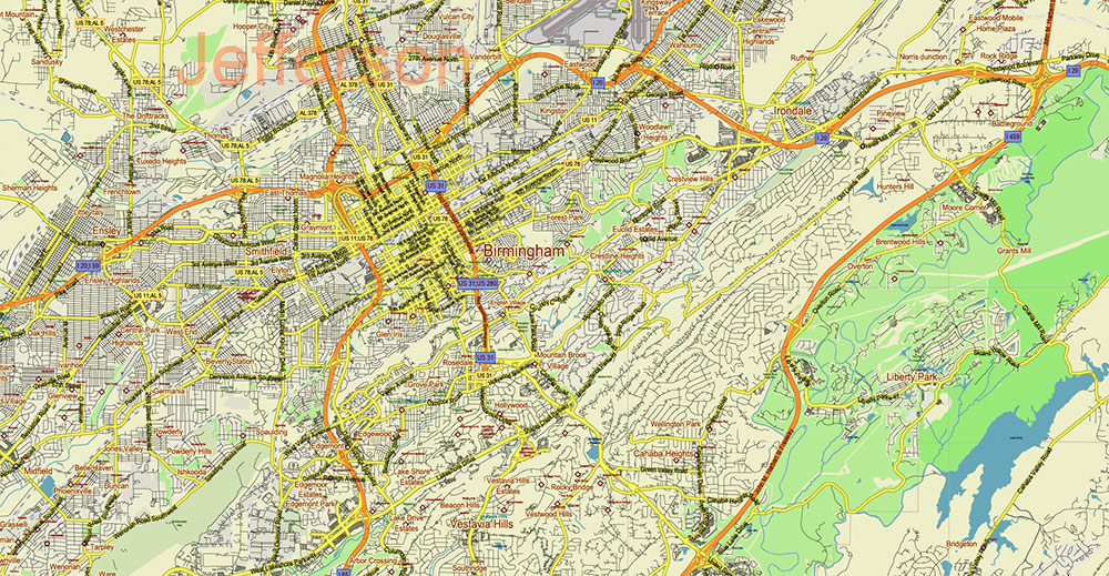
Alabama – Georgia USA Tornado Area Vector Map: high detailed road map + Shaded Relief editable Adobe Illustrator
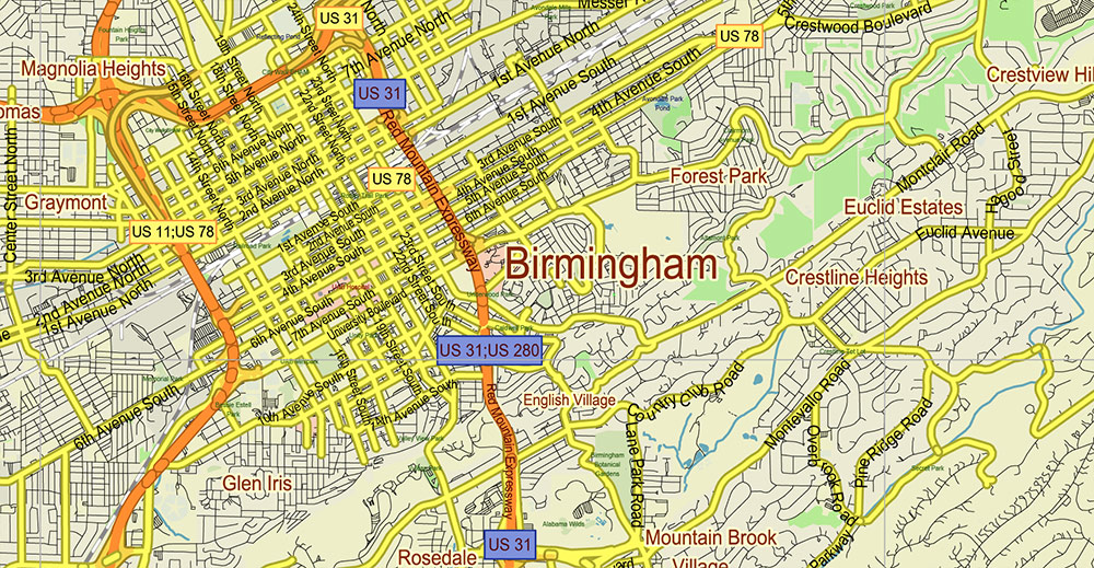
Alabama – Georgia USA Tornado Area Vector Map: high detailed road map + Shaded Relief editable Adobe Illustrator
Alabama – Georgia USA Tornado Area Vector Map: high detailed road map + Shaded Relief editable Adobe Illustrator
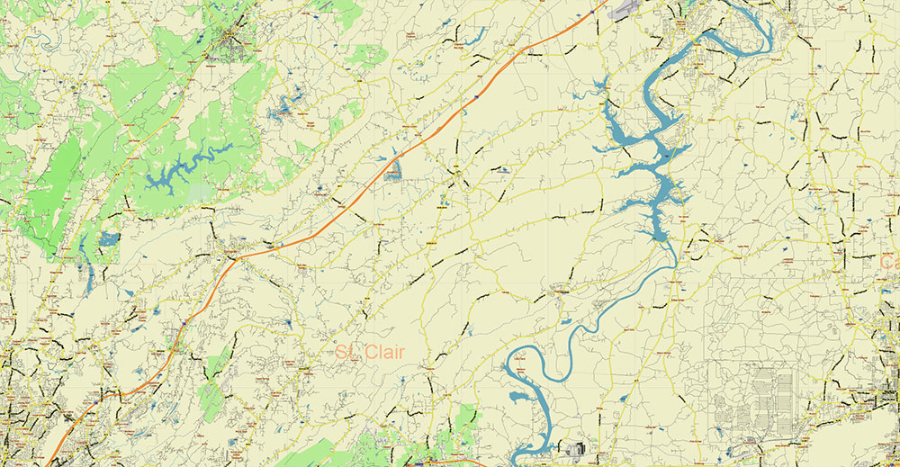
Alabama – Georgia USA Tornado Area Vector Map: high detailed road map + Shaded Relief editable Adobe Illustrator
Alabama – Georgia USA Tornado Area Vector Map: high detailed road map + Shaded Relief editable Adobe Illustrator
Alabama – Georgia USA Tornado Area Vector Map: high detailed road map + Shaded Relief editable Adobe Illustrator
Alabama – Georgia USA Tornado Area Vector Map: high detailed road map + Shaded Relief editable Adobe Illustrator
Alabama – Georgia USA Tornado Area Vector Map: high detailed road map + Shaded Relief editable Adobe Illustrator
Alabama – Georgia USA Tornado Area Vector Map: high detailed road map + Shaded Relief editable Adobe Illustrator
Alabama – Georgia USA Tornado Area Vector Map: high detailed road map + Shaded Relief editable Adobe Illustrator

 Author: Kirill Shrayber, Ph.D. FRGS


