Extended Description of the Vector Map
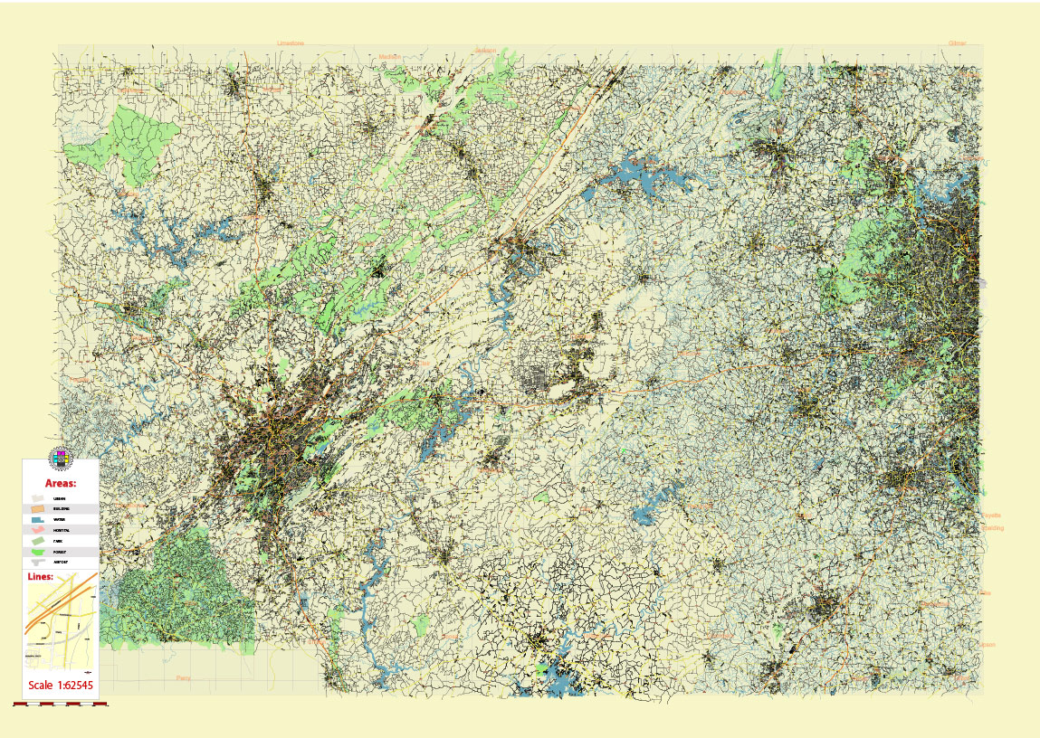
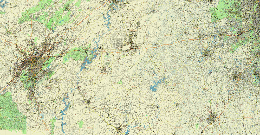
Printable Shaded Relief PDF Vector Map of Alabama – Georgia USA Tornado Area High Detailed Road Map fully editable Adobe PDF Road and Counties Map in layers, scalable, text/curves format all names, 792 MB ZIP
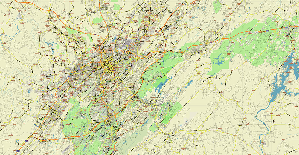
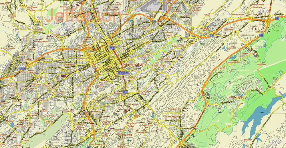
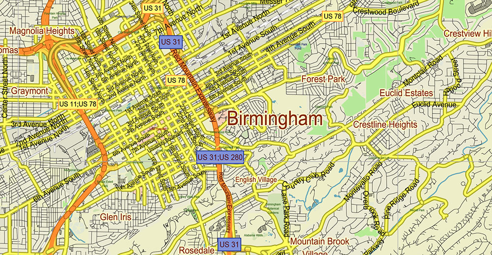
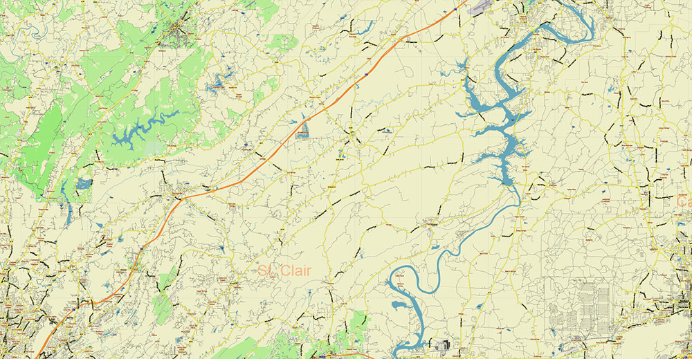
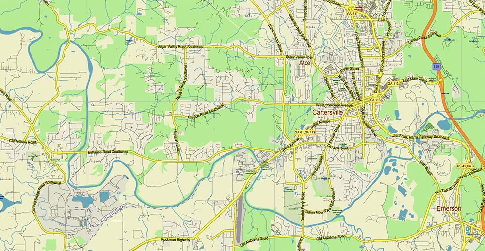
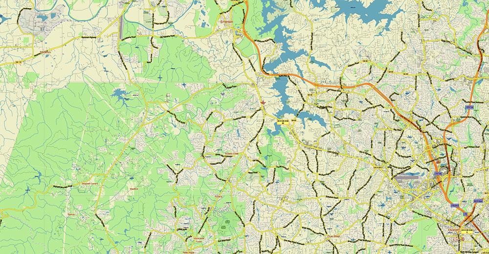
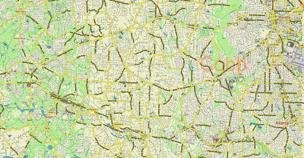
All streets and roads, All Cities and Towns, Airports and Heliports, Main Objects, Counties, raster Shaded Relief HD. Map for design, printing, arts, projects, presentations, for architects, designers, and builders, business, logistics.
The most exact and detailed map of the state in scale.
For Editing and High-Quality Printing, Royalty free
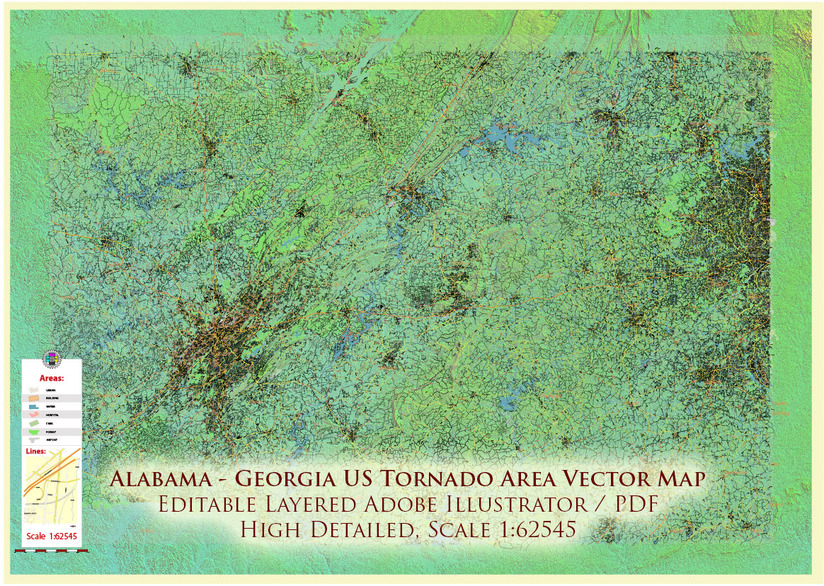
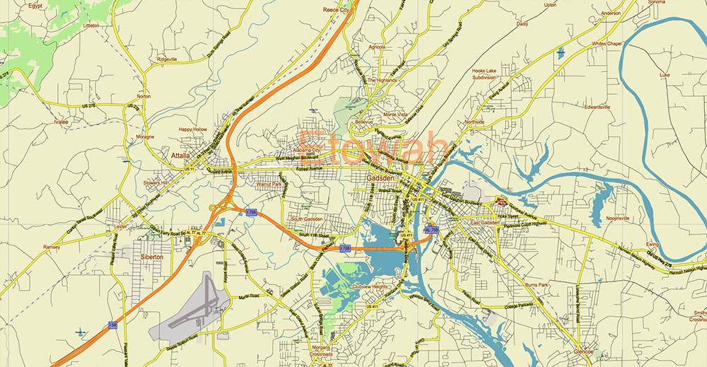
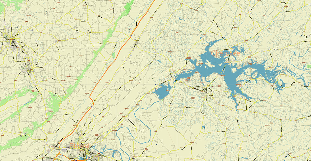
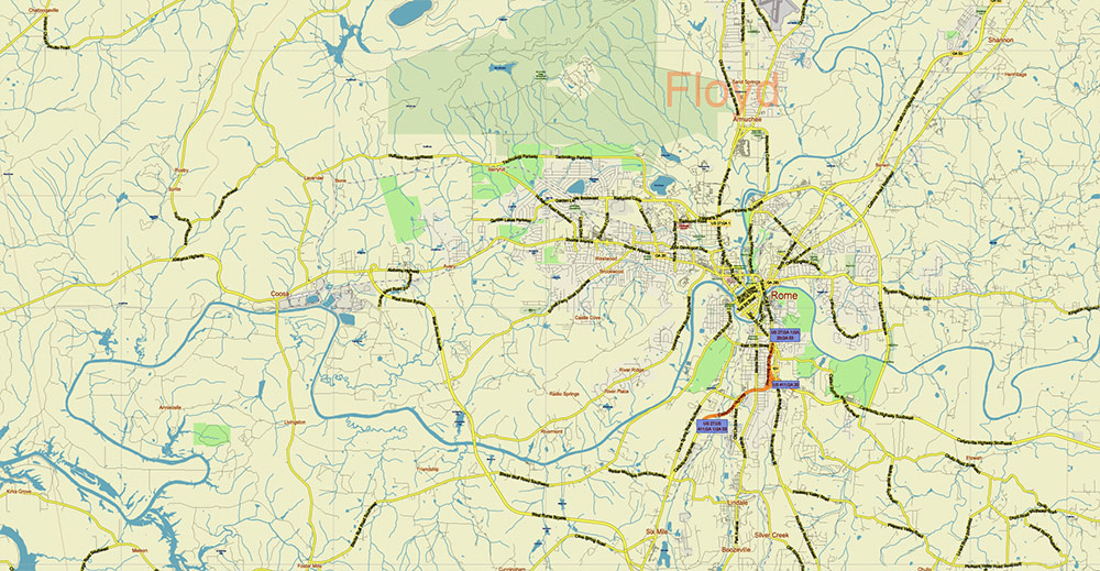
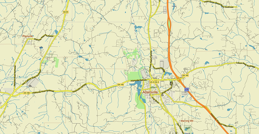
Alabama – Georgia USA Tornado Area PDF Vector Map: high detailed road map + Shaded Relief editable Layered Adobe PDF
Alabama – Georgia USA Tornado Area PDF Vector Map: high detailed road map + Shaded Relief editable Layered Adobe PDF
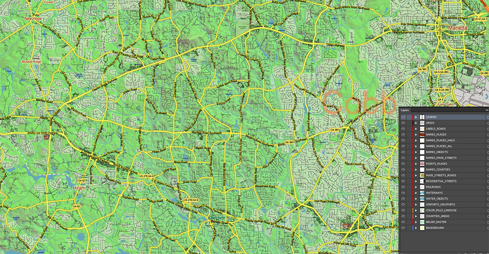
Layers list:
- Legend – Scale in miles
- Grids
- Names of places (city, hamlet, etc.) + Halo
- Names of Places 2
- Points of the Cities and Towns
- Names of objects
- Names of Counties
- Principal Streets and Roads
- Residential streets and roads
- Railroads
- Airports and Heliports runways
- Water objects (rivers, lakes, ponds)
- Waterways
- Land Use Areas transparent 50%
- Counties areas transparent 20%
- Shader Relief Raster transparent 50%
- Background
AO BRIEF — ALABAMA–GEORGIA TORNADO AREA
(Cartographic / Transport Network Focus)
Road Network Structure (Macro Grid)
- Integrated into the U.S. Interstate + U.S. Highway grid system (hierarchical, federally coordinated numbering)
- Even-numbered routes → E–W corridors; odd-numbered → N–S (general rule, not strict)
- Network density: high, but with strong contrast between:
- Urban freeway-grade interstates
- Rural 2-lane state routes (tree-lined, limited visibility)
Primary Interstate Framework (Operational Backbone)
E–W Axis (Critical Tornado Corridor Tracking)
- I-20 — dominant west–east spine
- Links: Mississippi → Birmingham → Atlanta
- High-priority mapping layer (storm propagation axis)
- I-59 / I-20 concurrency (AL)
- Parallel routing across central Alabama; split east of Birmingham
- I-59 takes northern Appalachian foothill alignment
- Secondary:
- US-78 (parallel to I-20, legacy corridor)
N–S Axis (Moisture / Logistics Flow)
- I-65 — Gulf → Birmingham → Tennessee
- Major north–south supply & evacuation corridor
- I-75 — Atlanta → Macon → Florida
- I-85 — Montgomery → Atlanta → Carolinas
- Diagonal SW–NE connector (key severe weather corridor)
- Direct AL–GA linkage (Montgomery–Atlanta axis)
Secondary Highways (Feeder & Redundancy Network)
- U.S. Routes:
- US-11 (parallel to I-59)
- US-29 (parallel to I-85 in GA)
- US-80 / US-280 (Montgomery–Columbus–central GA)
- State routes:
- Dense mesh, especially in Georgia Piedmont
- Example: GA SR-166 (AL border → Atlanta connector)
Urban Transport Nodes (Network Concentration)
- Birmingham
- I-20 / I-59 / I-65 convergence
- Beltway: I-459 (bypass routing)
- Atlanta
- Major SE U.S. transport hub
- I-75 + I-85 concurrency (“Downtown Connector”)
- Circumferential ring: I-285 (critical bypass)
- Secondary nodes:
- Montgomery (I-65 / I-85 junction)
- Columbus (I-185 spur from I-85)
Network Morphology (Cartographic Observations)
- Alabama:
- More linear, corridor-based structure
- Strong reliance on few primary interstates
- Parallel routing (I-20 / I-59) creates redundancy
- Georgia:
- More radial–hub system centered on Atlanta
- Higher density of connectors and bypasses
- Overall pattern:
- West → East compression toward Atlanta hub
- Increasing network complexity eastward
Terrain Interaction with Roads
- Appalachian foothills (N AL / N GA):
- Interstates follow valleys or cuts → curvilinear geometry
- Elevation-driven segmentation (not grid-like)
- Piedmont (central GA):
- Smoother alignment, more uniform spacing
- Black Belt (AL):
- Straighter segments, agricultural openness
Cartographic Constraints (Critical for Mapping)
- Vegetation cover:
- Roads often under canopy → hidden in aerial/satellite layers
- Relief shading:
- Moderate but enough to distort linear perception (esp. I-59 corridor)
- Hydrography crossings:
- Bridges concentrated at few nodes (important choke points)
- Urban distortion:
- Atlanta = multi-layer spaghetti interchange geometry
Traffic & Flow Characteristics
- Interstates carry dominant long-distance flow (freight + evacuation)
- Secondary roads:
- Critical for last-mile access, but fragile under storm damage
- Congestion hotspots:
- Birmingham interchange cluster
- Atlanta metro (I-75/I-85/I-285 system)
Operational Mapping Notes
- Highlight:
- I-20 corridor (primary tornado tracking axis)
- I-65 / I-85 (response and evacuation routes)
- Symbolization:
- Interstates — bold hierarchy (Level 1)
- US Routes — secondary (Level 2)
- State roads — thin mesh (Level 3)
- Consider:
- Overlay tornado tracks vs I-20 alignment
- Add urban interchange schematics (Atlanta, Birmingham)
- Avoid over-detail:
- Rural secondary roads = visually dense but low strategic value
Command Takeaways (Cartographic)
- The AO is defined by a single dominant E–W corridor (I-20) with diagonal feeder axes (I-65, I-85)
- Atlanta acts as a gravitational node for the entire eastern sector
- Terrain + vegetation reduce map readability → prioritize network hierarchy clarity
- For tornado mapping:
- Align symbology with storm movement vectors (SW→NE)
- Emphasize transport corridors intersecting that vector
Alabama – Georgia USA Tornado Area PDF Vector Map: high detailed road map + Shaded Relief editable Layered Adobe PDF
Alabama – Georgia USA Tornado Area PDF Vector Map: high detailed road map + Shaded Relief editable Layered Adobe PDF
Alabama – Georgia USA Tornado Area PDF Vector Map: high detailed road map + Shaded Relief editable Layered Adobe PDF
Alabama – Georgia USA Tornado Area PDF Vector Map: high detailed road map + Shaded Relief editable Layered Adobe PDF
Alabama – Georgia USA Tornado Area PDF Vector Map: high detailed road map + Shaded Relief editable Layered Adobe PDF
Alabama – Georgia USA Tornado Area PDF Vector Map: high detailed road map + Shaded Relief editable Layered Adobe PDF
Alabama – Georgia USA Tornado Area PDF Vector Map: high detailed road map + Shaded Relief editable Layered Adobe PDF
Alabama – Georgia USA Tornado Area PDF Vector Map: high detailed road map + Shaded Relief editable Layered Adobe PDF
Alabama – Georgia USA Tornado Area PDF Vector Map: high detailed road map + Shaded Relief editable Layered Adobe PDF
Alabama – Georgia USA Tornado Area PDF Vector Map: high detailed road map + Shaded Relief editable Layered Adobe PDF
Alabama – Georgia USA Tornado Area PDF Vector Map: high detailed road map + Shaded Relief editable Layered Adobe PDF
Alabama – Georgia USA Tornado Area PDF Vector Map: high detailed road map + Shaded Relief editable Layered Adobe PDF
Alabama – Georgia USA Tornado Area PDF Vector Map: high detailed road map + Shaded Relief editable Layered Adobe PDF

 Author: Kirill Shrayber, Ph.D. FRGS


