Extended Description of the Vector Map
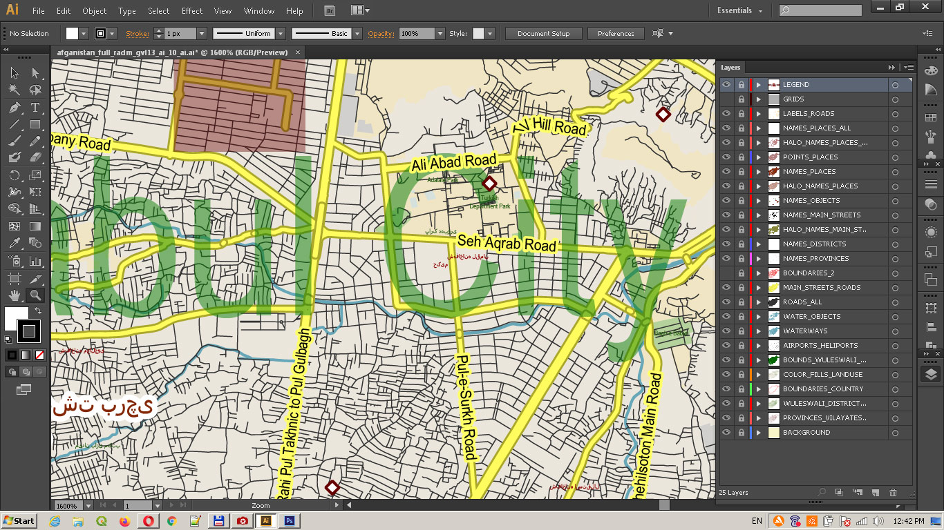
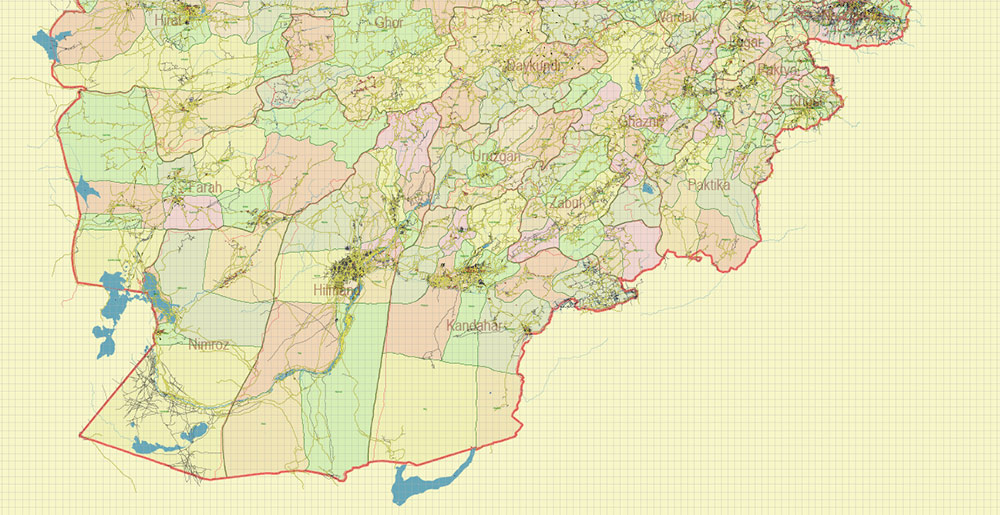
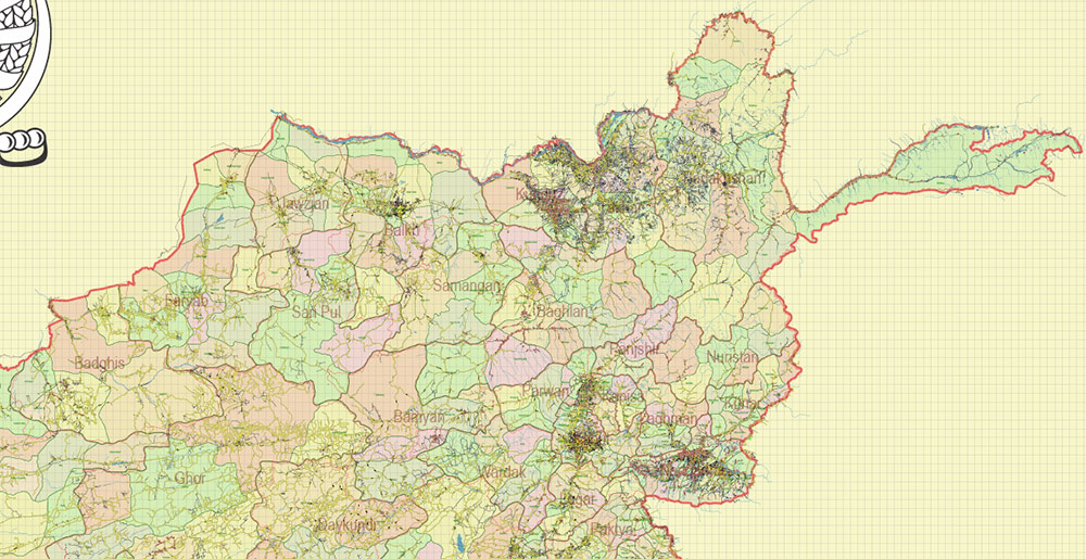
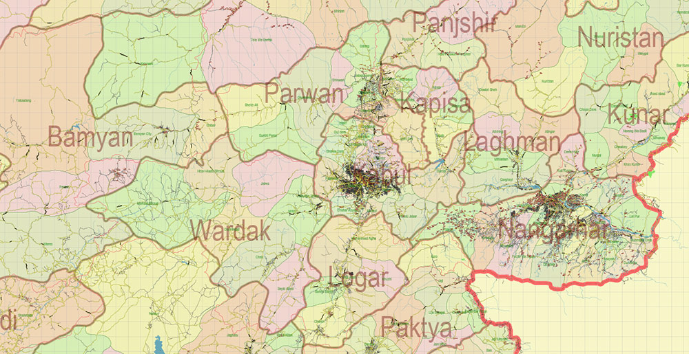
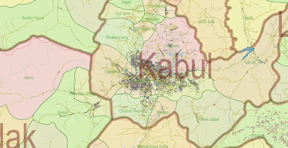
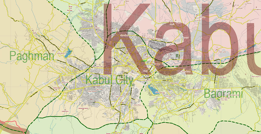
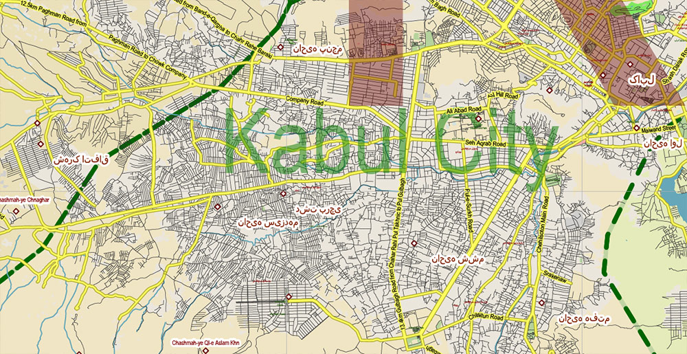
Printable Vector Map of Afghanistan high detailed fully editable Adobe Illustrator Road Map in layers, scalable, curves format all names, 103 MB ZIP
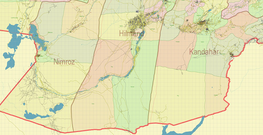
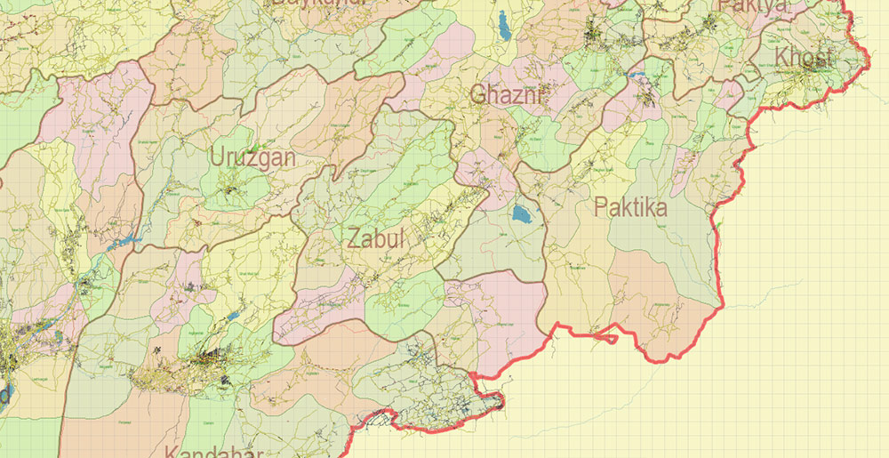
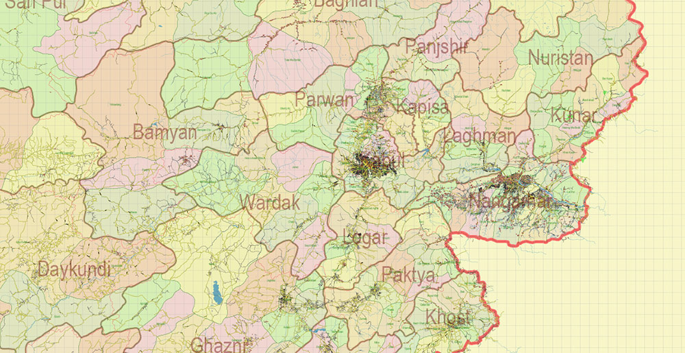
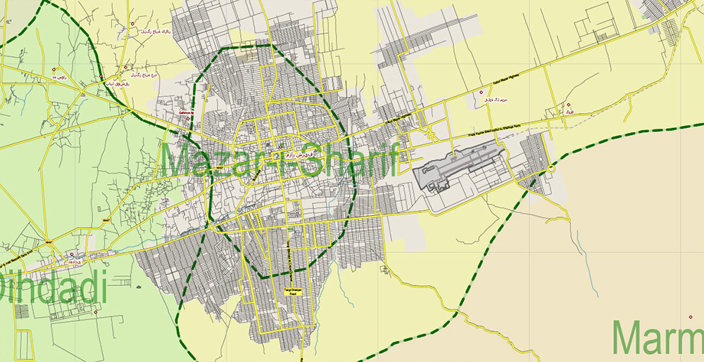
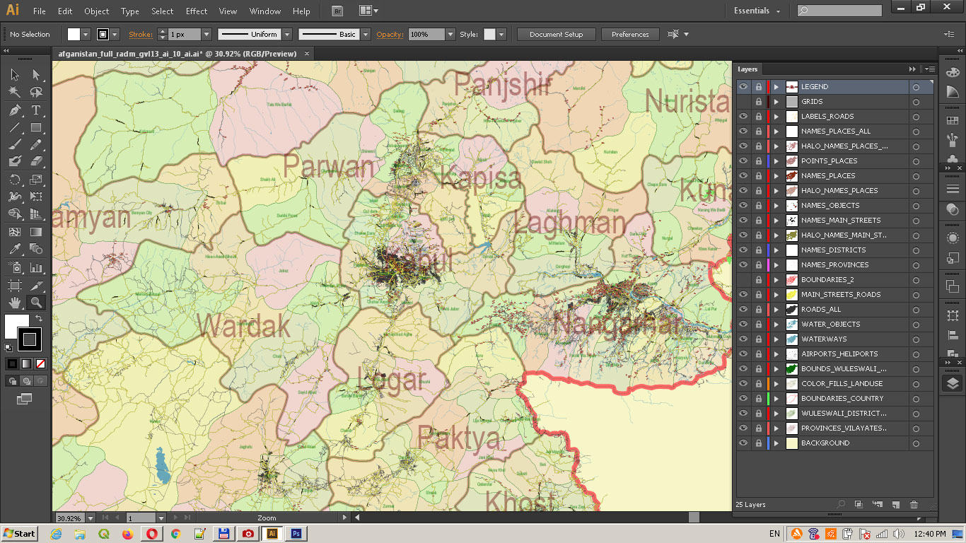
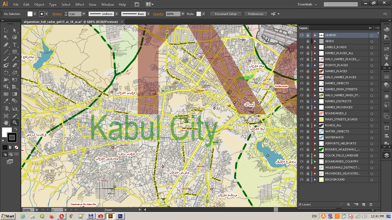
Principal street names (ENG, not all), All roads, All cities, towns, and villages + Provinces + Vilayates (districts). Map for design, printing, arts, projects, presentations, for architects, designers, and builders, business, logistics.
Also: We can add (additional layer for this map), any other objects for you. It’s free for our customers.
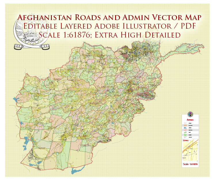
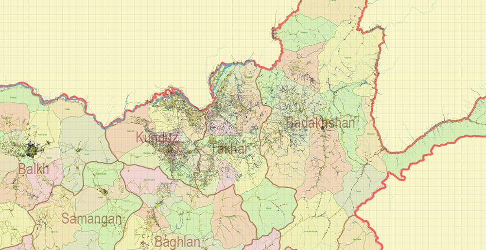
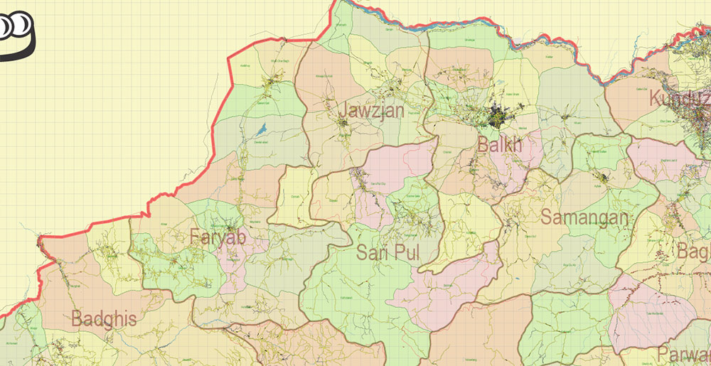
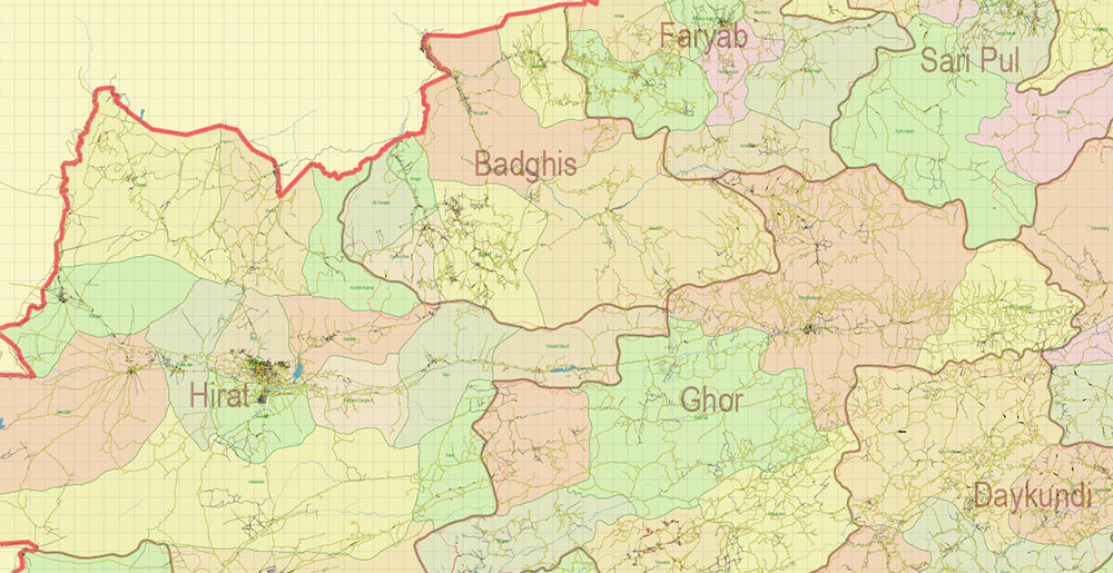
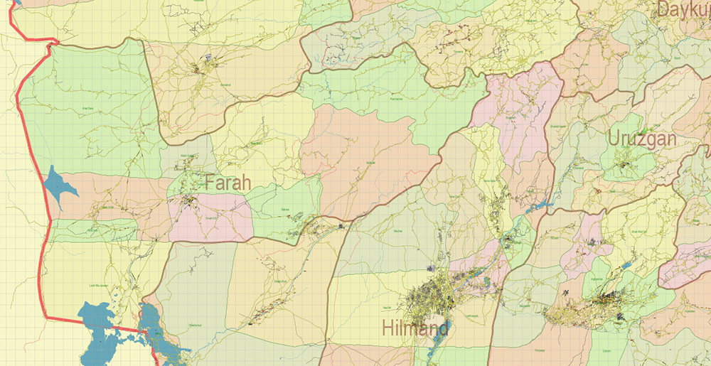
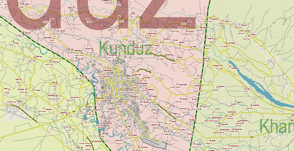
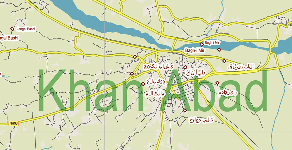
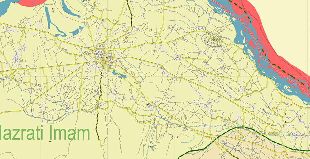
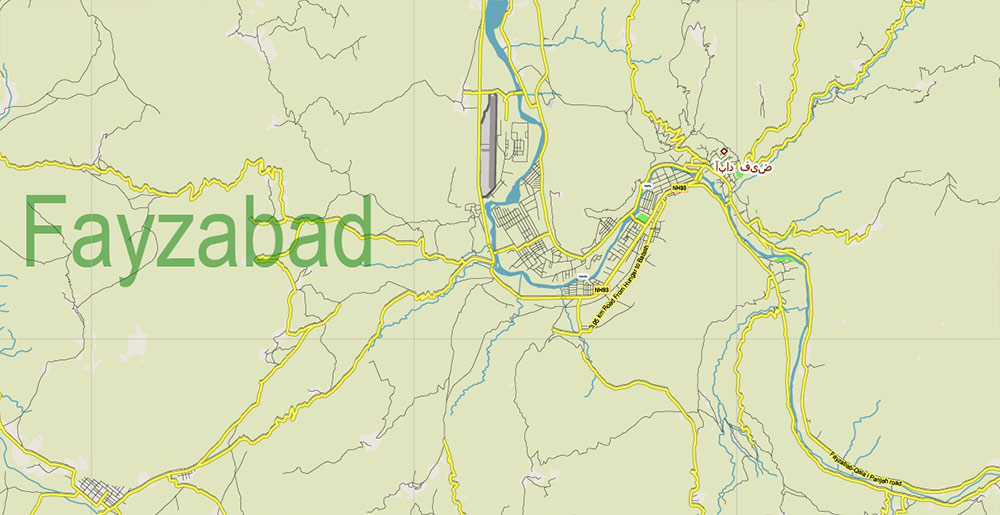
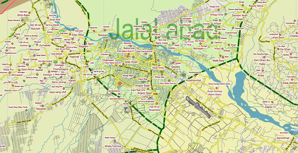
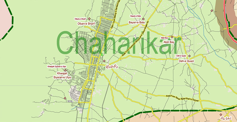
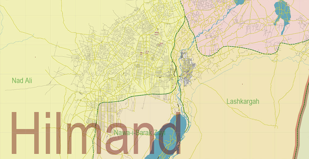
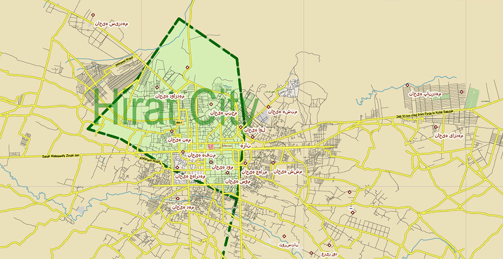
Afghanistan Full Map Vector Exact High Detailed: All Roads All Cities + Admin areas editable Adobe Illustrator Road Map in layers
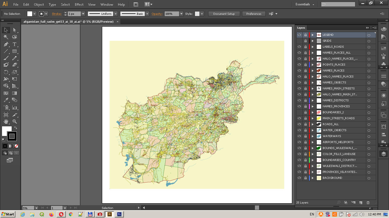
Layers list:
- Legend
- Grids
- Labels of roads
- Names of places (city, town, hamlet, etc.)
- Names of places 2 (city, town, hamlet, etc.)
- Points of Places
- Names of Provinces
- Names of Vilayates (Districts)
- Names of objects (hospitals, parks, water)
- Names of main streets
- Halo names 1,2,3,4
- Vilayates (district) boundaries
- Main Streets, roads and railroads
- Residential streets and small roads
- Waterways
- Water objects (rivers, lakes, ponds)
- Airports and Heliports
- Color fills (parks, hospital areas, land use, etc.)
- Vilayates (district) areas
- Provinces areas
- Country Boundaries 1,2 (Military and Civil)
- Background
Afghanistan Full Map Vector Exact High Detailed: All Roads All Cities + Admin areas editable Adobe Illustrator Road Map in layers
Afghanistan Full Map Vector Exact High Detailed: All Roads All Cities + Admin areas editable Adobe Illustrator Road Map in layers
Afghanistan Full Map Vector Exact High Detailed: All Roads All Cities + Admin areas editable Adobe Illustrator Road Map in layers
Afghanistan Full Map Vector Exact High Detailed: All Roads All Cities + Admin areas editable Adobe Illustrator Road Map in layers
Afghanistan Full Map Vector Exact High Detailed: All Roads All Cities + Admin areas editable Adobe Illustrator Road Map in layers
Afghanistan Full Map Vector Exact High Detailed: All Roads All Cities + Admin areas editable Adobe Illustrator Road Map in layers
Afghanistan Full Map Vector Exact High Detailed: All Roads All Cities + Admin areas editable Adobe Illustrator Road Map in layers
Afghanistan Full Map Vector Exact High Detailed: All Roads All Cities + Admin areas editable Adobe Illustrator Road Map in layers
Afghanistan Full Map Vector Exact High Detailed: All Roads All Cities + Admin areas editable Adobe Illustrator Road Map in layers
Afghanistan Full Map Vector Exact High Detailed: All Roads All Cities + Admin areas editable Adobe Illustrator Road Map in layers
Afghanistan Full Map Vector Exact High Detailed: All Roads All Cities + Admin areas editable Adobe Illustrator Road Map in layers
Afghanistan Full Map Vector Exact High Detailed: All Roads All Cities + Admin areas editable Adobe Illustrator Road Map in layers
Afghanistan Full Map Vector Exact High Detailed: All Roads All Cities + Admin areas editable Adobe Illustrator Road Map in layers
Afghanistan Full Map Vector Exact High Detailed: All Roads All Cities + Admin areas editable Adobe Illustrator Road Map in layers
Afghanistan Full Map Vector Exact High Detailed: All Roads All Cities + Admin areas editable Adobe Illustrator Road Map in layers
Afghanistan Full Map Vector Exact High Detailed: All Roads All Cities + Admin areas editable Adobe Illustrator Road Map in layers
Afghanistan Full Map Vector Exact High Detailed: All Roads All Cities + Admin areas editable Adobe Illustrator Road Map in layers
Afghanistan Full Map Vector Exact High Detailed: All Roads All Cities + Admin areas editable Adobe Illustrator Road Map in layers
Afghanistan Full Map Vector Exact High Detailed: All Roads All Cities + Admin areas editable Adobe Illustrator Road Map in layers
Afghanistan Full Map Vector Exact High Detailed: All Roads All Cities + Admin areas editable Adobe Illustrator Road Map in layers
Afghanistan Full Map Vector Exact High Detailed: All Roads All Cities + Admin areas editable Adobe Illustrator Road Map in layers
Afghanistan Full Map Vector Exact High Detailed: All Roads All Cities + Admin areas editable Adobe Illustrator Road Map in layers
Afghanistan Full Map Vector Exact High Detailed: All Roads All Cities + Admin areas editable Adobe Illustrator Road Map in layers
Afghanistan Full Map Vector Exact High Detailed: All Roads All Cities + Admin areas editable Adobe Illustrator Road Map in layers
Afghanistan Full Map Vector Exact High Detailed: All Roads All Cities + Admin areas editable Adobe Illustrator Road Map in layers
Afghanistan Full Map Vector Exact High Detailed: All Roads All Cities + Admin areas editable Adobe Illustrator Road Map in layers
Afghanistan Full Map Vector Exact High Detailed: All Roads All Cities + Admin areas editable Adobe Illustrator Road Map in layers

 Author: Kirill Shrayber, Ph.D. FRGS